Articles similaires à Antique Map of Sweden & Norway, 1903, with Intricate Topographical Detail


Vous voulez plus d'images ou de vidéos ?
Demander au vendeur plus d'images ou de vidéos
1 sur 10
Antique Map of Sweden & Norway, 1903, with Intricate Topographical Detail
À propos de cet article
Title: Antique Map of Sweden & Norway, 1903, with Intricate Topographical Detail
Description:
This antique map, titled "Sweden & Norway (Scandinavia)," was engraved and published in 1903 by W. & A.K. Johnston in Edinburgh and London. It beautifully captures the geographical and political landscape of Scandinavia at the turn of the 20th century, highlighting the natural grandeur and strategic location of these northern European countries.
The map is delicately colored in pastel shades to mark provincial and administrative boundaries, while fine linework depicts the rugged mountains, deep fjords, and expansive forests that define the Scandinavian Peninsula. Cities such as Stockholm, Oslo (then Christiania), Gothenburg, and Bergen are marked with precision, alongside key rivers, lakes, and coastal features.
One of the most captivating aspects of this map is its depiction of the remote northern reaches above the Arctic Circle, including the northern coastlines and the rugged archipelagos of the Lofoten Islands. The carefully engraved typography and shading bring to life the varied topography of the region, emphasizing both its harsh beauty and its cultural significance.
For collectors, historians, and lovers of Scandinavian heritage, this map is more than just a visual artifact. It represents a time when these nations were known for their maritime traditions and natural resources, poised on the brink of the modern era. Its refined composition and careful coloring make it a statement piece for any setting.
Condition report:
This map is in very good antique condition, with only slight foxing and minor toning along the edges consistent with its age. The colors remain vibrant and the paper stable and well-preserved.
Framing tips:
A classic wooden frame in walnut or cherry will add warmth and depth to this antique map. Use a cream or light beige matting to accentuate the delicate coloring and fine engraving, creating a timeless and elegant display that will be a focal point in any home, library, or office.
- Dimensions:Hauteur : 36,8 cm (14,49 po)Largeur : 47 cm (18,51 po)Profondeur : 0,2 mm (0,01 po)
- Matériaux et techniques:
- Période:
- Date de fabrication:1903
- État:The map is in very good antique condition, with minor foxing and gentle toning at the edges typical for its age. The colors remain vibrant and the paper well-preserved. Folding line as issued.
- Adresse du vendeur:Langweer, NL
- Numéro de référence:Vendeur : BG-13577-211stDibs : LU3054345243032
À propos du vendeur
5,0
Vendeur reconnu
Ces vendeurs prestigieux sont des leaders du secteur. Ils représentent le summum en matière de qualité et de design.
Vendeur Or
Vendeurs premium dont la note est supérieure à 4,3 et le délai de réponse de 24 heures maximum
Établi en 2009
Vendeur 1stDibs depuis 2017
2 462 ventes sur 1stDibs
Temps de réponse habituel : <1 heure
- ExpéditionRecherche du devis...Expédition depuis : Langweer, Pays-Bas
- Politique des retours
Certaines parties de cette page ont été traduites automatiquement. 1stDibs ne garantit pas l'exactitude des traductions. L'anglais est la langue par défaut de ce site web.
Garantie d'authenticité
Bien qu'il soit peu probable que la situation se présente, dans le cas où vous rencontreriez un problème d'authenticité d'un article, contactez-nous dans un délai d'un an pour obtenir un remboursement intégral. DétailsGarantie de remboursement
Si votre article n'est pas conforme à la description, est endommagé pendant le transport ou ne vous est pas livré, contactez-nous sous 7 jours pour obtenir un remboursement intégral. DétailsAnnulation sous 24 heures
Vous disposez d'un délai de 24 heures pour annuler votre achat sans motif.Des vendeurs professionnels agréés
Nos vendeurs de renommée mondiale doivent respecter des normes strictes en matière de service et de qualité, afin de préserver l'intégrité de nos fiches produit.Garantie d'alignement des prix
Si vous constatez qu'un autre vendeur a mis en vente le même article à un prix inférieur sur un autre site, nous nous alignerons sur ce prix.Livraison en toute confiance à l'international
Notre réseau de transporteurs de premier ordre propose des options d'expédition spécialisées dans le monde entier, y compris des livraisons personnalisées.Plus d'articles de ce vendeur
Tout afficherAntique Map of Ireland, 1903, with Intricate County Boundaries & Coastal Details
Title: Antique Map of Ireland, 1903, with Intricate County Boundaries and Coastal Detail
Description:
This antique map of Ireland, engraved and published in 1903 by the esteemed W. ...
Catégorie
Début du 20ème siècle, Cartes
Matériaux
Papier

Antique Map of Europe, 1903, with Intricate Political Boundaries and Rich Detail
Title: Antique Map of Europe, 1903, with Intricate Political Boundaries and Rich Detail
Description:
This antique map, titled "Europe," is a finely engraved and beautifully colored ...
Catégorie
Début du 20ème siècle, Cartes
Matériaux
Papier

Antique Map of Northern Scotland, 1903, with Intricate Coastal Features
Title: Antique Map of Northern Scotland and Islands, 1903, with Intricate Coastal Features
Description:
This striking antique map, titled "Scotland (Northern Sheet I)," was engraved...
Catégorie
Début du 20ème siècle, Cartes
Matériaux
Papier

Antique Map of Asia with Intricate Provincial Boundaries, Published in 1903
Title: Antique Map of Asia, 1903, with Intricate Provincial Boundaries and Coastal Features
Description:
This antique map, titled "Asia," was engraved and published in 1903 by the r...
Catégorie
Début du 20ème siècle, Cartes
Matériaux
Papier

Antique Map of the German Empire, 1903, with Intricate Provincial Boundaries
Title: Antique Map of the German Empire, 1903, with Intricate Provincial Boundaries
Description:
This antique map, titled "Empire of Germany (Southern Portion)," was engraved and pu...
Catégorie
Début du 20ème siècle, Cartes
Matériaux
Papier

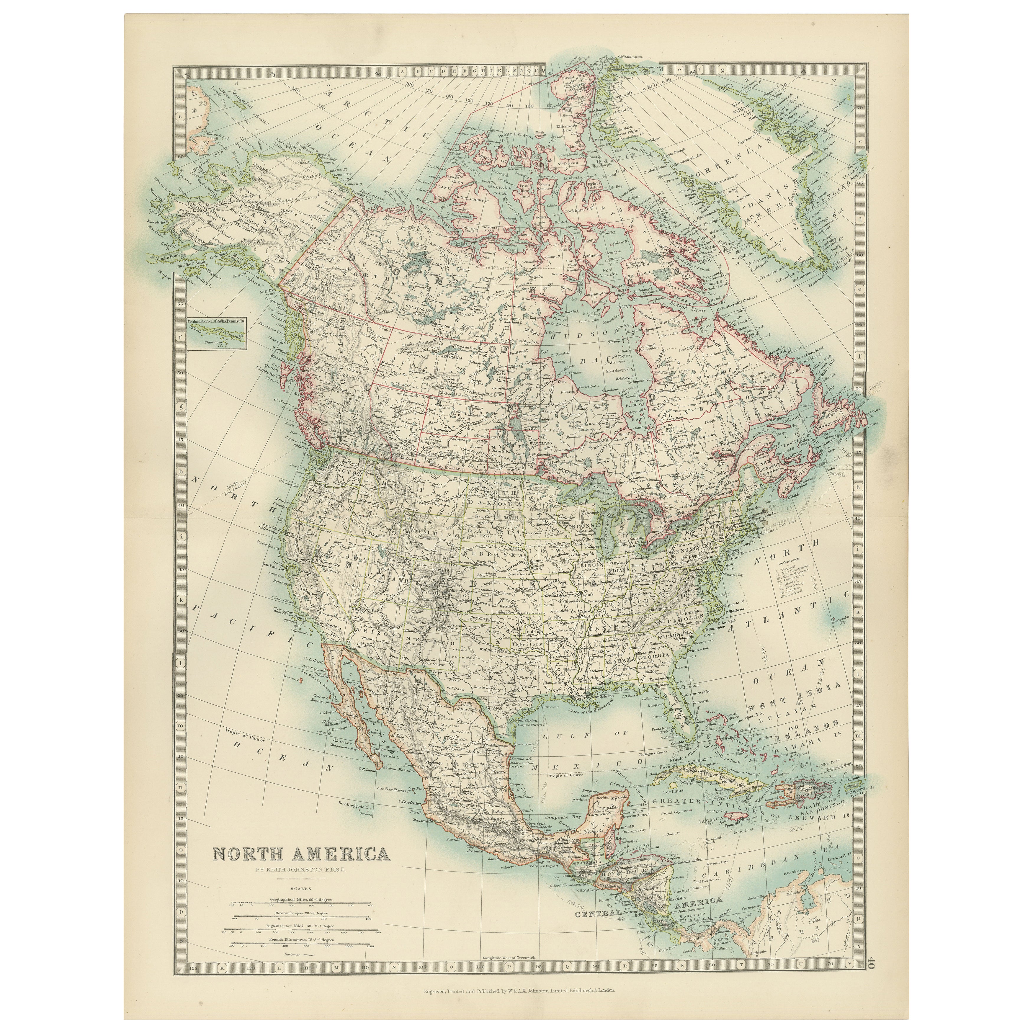
Explore North America in 1903 - Intricately Detailed Antique Map
North America, 1903 - A Colorful Historical Map with Detailed Borders
This attractive map of North America was engraved, printed, and published by W. & A.K. Johnston in 1903. A wond...
Catégorie
Début du 20ème siècle, Cartes
Matériaux
Papier

Suggestions
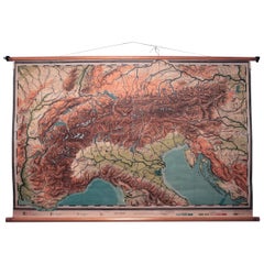
Carte de l'école topographique suédoise des Alpes européennes, fabriquée en Suède en 1922
Vieille carte scolaire topographique suédoise des Alpes européennes, Made in Sweden 1922
Cette carte scolaire suédoise d'époque est unique et illustre parfaitement la raison pour ...
Catégorie
Vintage, années 1920, Suédois, Cartes
Matériaux
Lin, Bois, Papier
Carte ancienne de l'État américain du Minnesota, 1903
Carte ancienne du Minnesota
Publié par A.I.C Black. 1903
Couleur originale
Bon état
Sans cadre.
Expédition gratuite
Catégorie
Antiquités, Début des années 1900, Anglais, Cartes
Matériaux
Papier

Carte ancienne de l'État américain de l'Alabama, 1903
Antique map of Alabama
Published By A & C Black. 1903
Original colour
Good condition
Unframed.
Free shipping
Catégorie
Antiquités, Début des années 1900, Anglais, Cartes
Matériaux
Papier

Carte ancienne de l'État américain de l'Alaska, 1903
Carte ancienne de l'Alaska
Publié par A.I.C Black. 1903
Couleur originale
Bon état
Sans cadre.
Expédition gratuite
Catégorie
Antiquités, Début des années 1900, Anglais, Cartes
Matériaux
Papier

Carte ancienne de l'État américain du Nebraska, 1903
Carte ancienne du Nebraska
Publié par A.I.C Black. 1903
Couleur originale
Bon état
Sans cadre.
Expédition gratuite
Catégorie
Antiquités, Début des années 1900, Anglais, Cartes
Matériaux
Papier

Carte ancienne d'origine de l'État américain de Washington, 1903
Carte ancienne de Washington
Publié par A.I.C Black. 1903
Couleur originale
Bon état
Sans cadre.
Expédition gratuite
Catégorie
Antiquités, Début des années 1900, Anglais, Cartes
Matériaux
Papier
