Articles similaires à Antique Map of the German Empire, 1903, Northern Portion with Coastal and Inland


Vous voulez plus d'images ou de vidéos ?
Demander au vendeur plus d'images ou de vidéos
1 sur 10
Antique Map of the German Empire, 1903, Northern Portion with Coastal and Inland
À propos de cet article
Title: Antique Map of the German Empire, 1903, Northern Portion with Coastal and Inland Detail
Description:
This antique map, titled "Empire of Germany (Northern Portion)," was engraved and published in 1903 by the respected W. & A.K. Johnston in Edinburgh and London. It offers a richly detailed and colored portrayal of the northern part of the German Empire at the dawn of the 20th century, capturing the historical geography and political divisions of this powerful and complex nation.
Hand-colored in soft pastel shades of pink, green, yellow, and blue, this map elegantly delineates provincial and administrative boundaries. From the bustling port cities along the North Sea and Baltic Sea to the inland heartlands of Prussia and Saxony, the map reveals the extensive railways, rivers, and road networks that defined the region’s industrial might and cultural vibrancy.
The map also highlights Germany’s coastal regions, including the Frisian Islands, Pomerania, and East Prussia, emphasizing the maritime and economic importance of these areas. Johnston’s precise linework and careful typography make this map not just a historical document but a work of art that reflects the meticulous skill and dedication of the era’s finest cartographers.
For collectors, historians, and those with an interest in German history and geography, this map is a captivating window into a time of growth and ambition within the German Empire. It captures the dynamic landscape of a region that would soon see tremendous changes in the early 20th century.
Condition report:
This map is in very good antique condition, with slight foxing and toning around the edges consistent with its age. The colors remain vibrant and the paper is well-preserved.
Framing tips:
A classic dark wooden frame, such as walnut or mahogany, will complement the map’s warm pastel tones. Use a cream or light tan matting to highlight the delicate coloring and detailed engraving, creating an elegant and timeless display for any home, study, or office.
- Dimensions:Hauteur : 36,8 cm (14,49 po)Largeur : 47 cm (18,51 po)Profondeur : 0,2 mm (0,01 po)
- Matériaux et techniques:
- Période:
- Date de fabrication:1903
- État:This map is in very good antique condition, showing only slight toning and minor foxing typical for its age. The colors remain vibrant and the paper stable and clear. Two folding lines as issued.
- Adresse du vendeur:Langweer, NL
- Numéro de référence:Vendeur : BG-13577-171stDibs : LU3054345242572
À propos du vendeur
5,0
Vendeur reconnu
Ces vendeurs prestigieux sont des leaders du secteur. Ils représentent le summum en matière de qualité et de design.
Vendeur Or
Vendeurs premium dont la note est supérieure à 4,3 et le délai de réponse de 24 heures maximum
Établi en 2009
Vendeur 1stDibs depuis 2017
2 463 ventes sur 1stDibs
Temps de réponse habituel : <1 heure
- ExpéditionRecherche du devis...Expédition depuis : Langweer, Pays-Bas
- Politique des retours
Certaines parties de cette page ont été traduites automatiquement. 1stDibs ne garantit pas l'exactitude des traductions. L'anglais est la langue par défaut de ce site web.
Garantie d'authenticité
Bien qu'il soit peu probable que la situation se présente, dans le cas où vous rencontreriez un problème d'authenticité d'un article, contactez-nous dans un délai d'un an pour obtenir un remboursement intégral. DétailsGarantie de remboursement
Si votre article n'est pas conforme à la description, est endommagé pendant le transport ou ne vous est pas livré, contactez-nous sous 7 jours pour obtenir un remboursement intégral. DétailsAnnulation sous 24 heures
Vous disposez d'un délai de 24 heures pour annuler votre achat sans motif.Des vendeurs professionnels agréés
Nos vendeurs de renommée mondiale doivent respecter des normes strictes en matière de service et de qualité, afin de préserver l'intégrité de nos fiches produit.Garantie d'alignement des prix
Si vous constatez qu'un autre vendeur a mis en vente le même article à un prix inférieur sur un autre site, nous nous alignerons sur ce prix.Livraison en toute confiance à l'international
Notre réseau de transporteurs de premier ordre propose des options d'expédition spécialisées dans le monde entier, y compris des livraisons personnalisées.Plus d'articles de ce vendeur
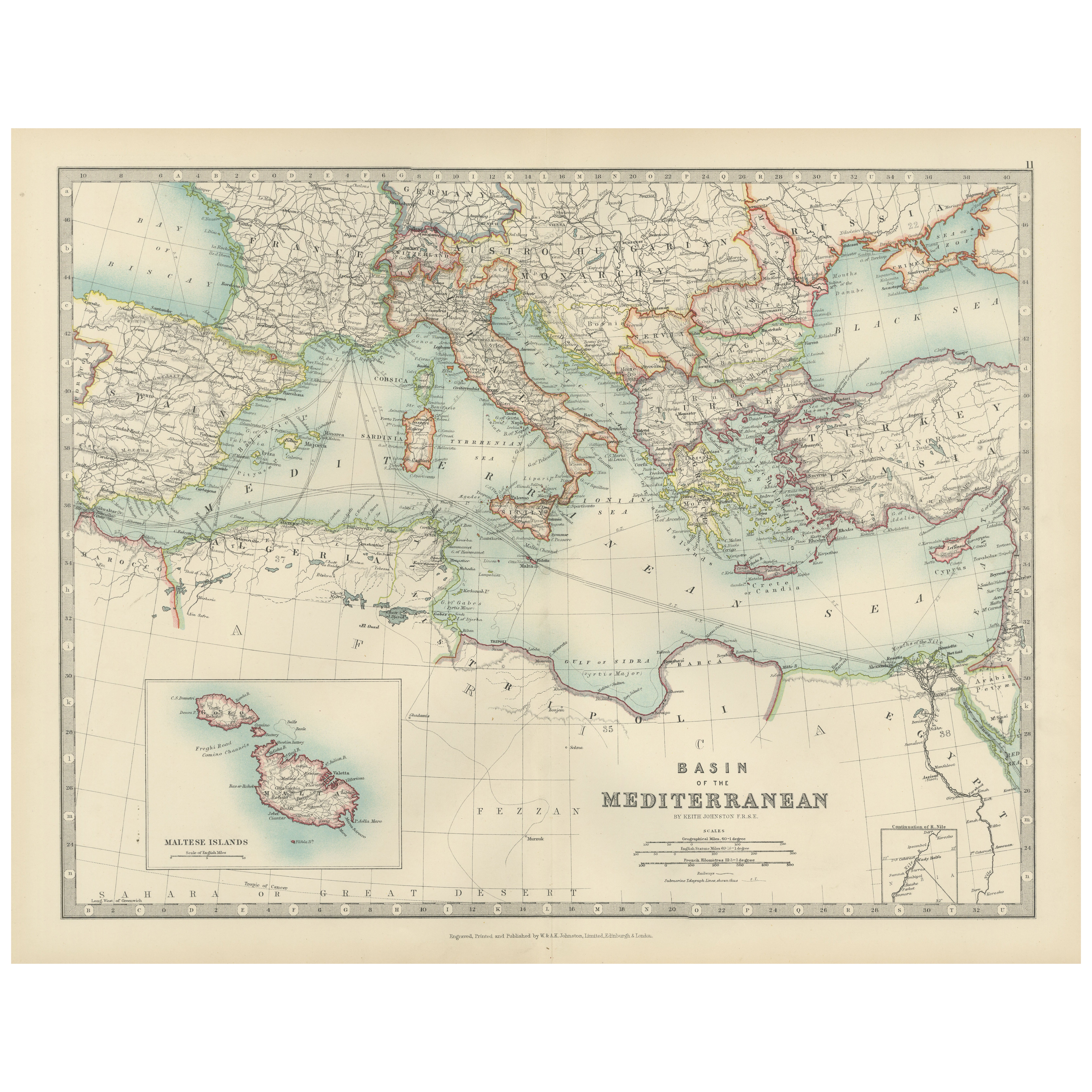
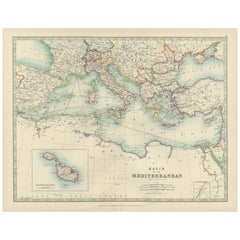
Tout afficherAntique Map of the Mediterranean Basin, 1903, with Detailed Coastal and Inland
Title: Antique Map of the Mediterranean Basin, 1903, with Detailed Coastal and Inland Geography
Description: This antique map, titled "Basin of the Mediterranean," was engraved and ...
Catégorie
Début du 20ème siècle, Cartes
Matériaux
Papier
Antique Map of Southern Scotland, 1903, with Coastal and Inland Details
Title: Antique Map of Southern Scotland, 1903, with Coastal and Inland Details
Description:
This exquisite antique map, titled "Scotland (Southern Sheet I)," was engraved and publis...
Catégorie
Début du 20ème siècle, Cartes
Matériaux
Papier

Antique Map of Northern Scotland, 1903, with Intricate Coastal Features
Title: Antique Map of Northern Scotland and Islands, 1903, with Intricate Coastal Features
Description:
This striking antique map, titled "Scotland (Northern Sheet I)," was engraved...
Catégorie
Début du 20ème siècle, Cartes
Matériaux
Papier

Antique Map of the German Empire, 1903, with Intricate Provincial Boundaries
Title: Antique Map of the German Empire, 1903, with Intricate Provincial Boundaries
Description:
This antique map, titled "Empire of Germany (Southern Portion)," was engraved and pu...
Catégorie
Début du 20ème siècle, Cartes
Matériaux
Papier

Carte ancienne de l'envergure nord des Philippines par J.N. Bellin, 1764
Carte détaillée de la partie nord des Philippines, s'étendant de Batanes et Babuyanes à Mindonoro et Masbate, et centrée sur Luzon. L'une des cartes les plus détaillées de l'époque. ...
Catégorie
Antiquités, Milieu du XVIIIe siècle, Cartes
Matériaux
Papier

255 $US Prix de vente
16 % de remise
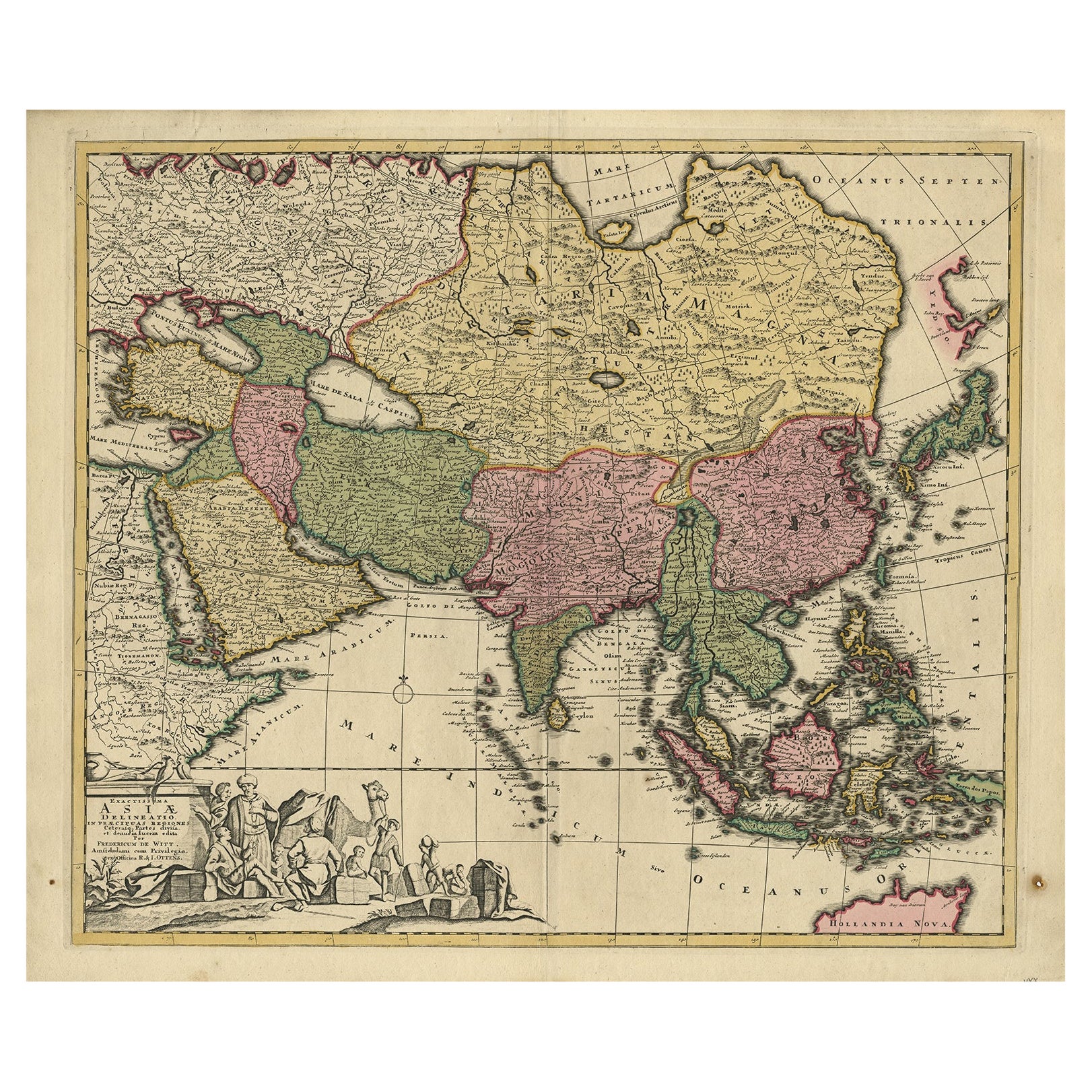
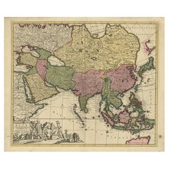
Carte ancienne d'Asie avec une portion nord de l'Australie Hollandia Nova", 1727
Carte ancienne intitulée "Exactissima Asiae Delineatio in praecipuas regiones Caeterasq Partes" Carte ancienne originale du continent asiatique avec une partie nord de l'Australie "H...
Catégorie
Antiquités, XVIIIe siècle, Cartes
Matériaux
Papier
1 534 $US Prix de vente
20 % de remise
Suggestions
Carte ancienne de l'État américain de l'Illinois (partie nord), 1903
Carte ancienne de l'Illinois (partie nord)
Publié par A.I.C Black. 1903
Couleur originale
Bon état
Sans cadre.
Expédition gratuite
Catégorie
Antiquités, Début des années 1900, Anglais, Cartes
Matériaux
Papier

Carte ancienne de l'État américain du Michigan (partie nord), 1903
Carte ancienne du Michigan (partie nord)
Publié par A.I.C Black. 1903
Couleur originale
Bon état
Sans cadre.
Expédition gratuite
Catégorie
Antiquités, Début des années 1900, Anglais, Cartes
Matériaux
Papier

Carte ancienne de l'État américain de l'Ohio (partie nord ), 1903
Carte ancienne de l'Ohio (partie nord)
Publié par A.I.C Black. 1903
Couleur originale
Bon état
Sans cadre.
Expédition gratuite
Catégorie
Antiquités, Début des années 1900, Anglais, Cartes
Matériaux
Papier

Carte ancienne de l'État américain de Californie (partie nord), 1903
Carte ancienne de la Californie (partie nord)
Publié par A.I.C Black. 1903
Couleur originale
Bon état
Sans cadre.
Expédition gratuite
Catégorie
Antiquités, Début des années 1900, Anglais, Cartes
Matériaux
Papier

Carte ancienne de l'État américain du Missouri (partie nord du Missouri), 1903
Carte ancienne du Missouri ( Partie Nord )
Publié par A.I.C Black. 1903
Couleur originale
Bon état
Sans cadre.
Expédition gratuite
Catégorie
Antiquités, Début des années 1900, Anglais, Cartes
Matériaux
Papier

49 $US
Livraison gratuite
Carte ancienne de l'État américain de New York (partie nord) 1903
Antique map of New York ( Northern Part )
Published By A & C Black. 1903
Original colour
Good condition
Unframed.
Free shipping
Catégorie
Antiquités, Début des années 1900, Anglais, Cartes
Matériaux
Papier
