Articles similaires à Antique Map of the Northeast USA - Vibrant 1903 Cartographic Detail
Vous voulez plus d'images ou de vidéos ?
Demander au vendeur plus d'images ou de vidéos
1 sur 10
Antique Map of the Northeast USA - Vibrant 1903 Cartographic Detail
À propos de cet article
Map of the Northeastern United States of North America, 1903
This striking antique map titled “United States of North America (North Eastern Sheet)” was created by the renowned Scottish cartographer Keith Johnston and published in 1903. It captures the northeastern portion of the United States, including states such as New York, Pennsylvania, New Jersey, New England, and parts of the Midwest like Ohio and Indiana. With its fine engraving and hand-colored boundaries, this map offers a vivid snapshot of America’s bustling northeastern corridor at the turn of the century.
Notable features include major cities such as New York, Boston, and Philadelphia, as well as detailed renderings of the Great Lakes region, showcasing Lake Michigan, Lake Erie, and Lake Ontario with exceptional precision. The map’s inset of Maine provides additional geographical context for the northernmost reaches of this region, along with a clear delineation of rivers, railways, and mountain ranges. The typography is both elegant and easy to read, displaying Johnston’s trademark clarity and meticulous attention to detail.
The map’s condition is very good to excellent, with a clean impression and minimal age-related toning, adding character without compromising legibility. It’s a wonderful example of the craftsmanship that defined early 20th-century cartography and a superb item for collectors and history enthusiasts.
For framing, consider using a classic wooden or dark frame to complement the antique colors and highlight the intricate details. A neutral matting will help draw the eye to the delicate engraved lines and fine coloration, making this piece an attractive addition to any study, library, or home gallery.
- Dimensions:Hauteur : 36,8 cm (14,49 po)Largeur : 47 cm (18,51 po)Profondeur : 0,2 mm (0,01 po)
- Matériaux et techniques:
- Période:
- Date de fabrication:1903
- État:The map’s condition is excellent, with a clean impression and minimal age-related toning, adding character without compromising legibility.
- Adresse du vendeur:Langweer, NL
- Numéro de référence:Vendeur : BG-13577-451stDibs : LU3054345291742
À propos du vendeur
5,0
Vendeur reconnu
Ces vendeurs prestigieux sont des leaders du secteur. Ils représentent le summum en matière de qualité et de design.
Vendeur Or
Vendeurs premium dont la note est supérieure à 4,3 et le délai de réponse de 24 heures maximum
Établi en 2009
Vendeur 1stDibs depuis 2017
2 463 ventes sur 1stDibs
Temps de réponse habituel : 1 heure
- ExpéditionRecherche du devis...Expédition depuis : Langweer, Pays-Bas
- Politique des retours
Certaines parties de cette page ont été traduites automatiquement. 1stDibs ne garantit pas l'exactitude des traductions. L'anglais est la langue par défaut de ce site web.
Garantie d'authenticité
Bien qu'il soit peu probable que la situation se présente, dans le cas où vous rencontreriez un problème d'authenticité d'un article, contactez-nous dans un délai d'un an pour obtenir un remboursement intégral. DétailsGarantie de remboursement
Si votre article n'est pas conforme à la description, est endommagé pendant le transport ou ne vous est pas livré, contactez-nous sous 7 jours pour obtenir un remboursement intégral. DétailsAnnulation sous 24 heures
Vous disposez d'un délai de 24 heures pour annuler votre achat sans motif.Des vendeurs professionnels agréés
Nos vendeurs de renommée mondiale doivent respecter des normes strictes en matière de service et de qualité, afin de préserver l'intégrité de nos fiches produit.Garantie d'alignement des prix
Si vous constatez qu'un autre vendeur a mis en vente le même article à un prix inférieur sur un autre site, nous nous alignerons sur ce prix.Livraison en toute confiance à l'international
Notre réseau de transporteurs de premier ordre propose des options d'expédition spécialisées dans le monde entier, y compris des livraisons personnalisées.Plus d'articles de ce vendeur
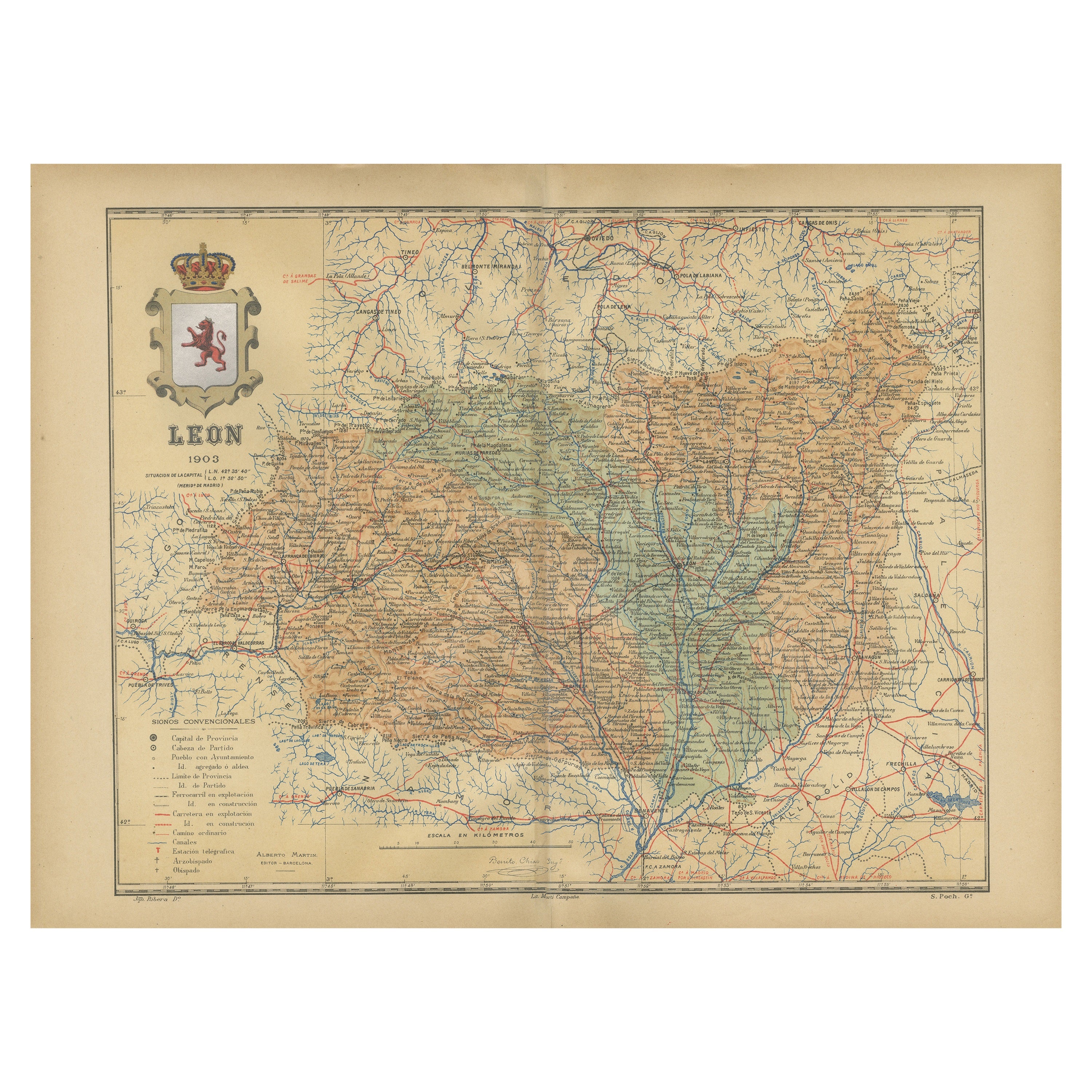
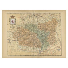
Tout afficherLeón 1903 : Un détail cartographique de la province montagneuse de Castilla y León
La carte représente la province de León, située au nord-ouest de l'Espagne et faisant partie de la communauté autonome de Castilla y León, à partir de 1903. Les caractéristiques nota...
Catégorie
Antiquités, Début des années 1900, Cartes
Matériaux
Papier
270 $US Prix de vente
20 % de remise
Livraison gratuite
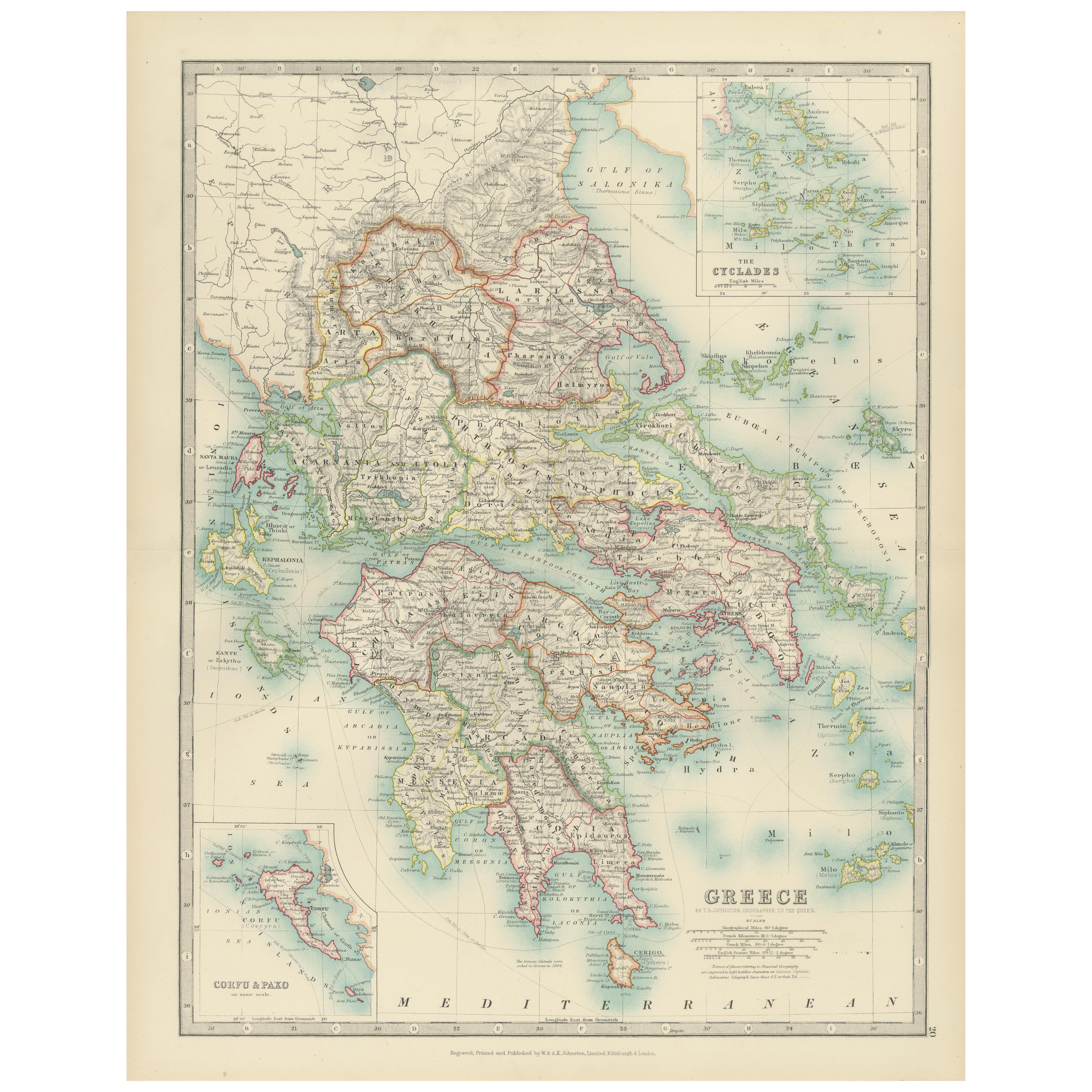
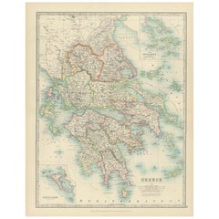
Antique Map of Greece and the Cyclades, 1903, with Many Details and Inset Maps
Title: Antique Map of Greece and the Cyclades, 1903, with Intricate Detail and Inset Maps
Description: This antique map, titled "Greece with Its Islands, Including the Cyclades," wa...
Catégorie
Début du 20ème siècle, Cartes
Matériaux
Papier
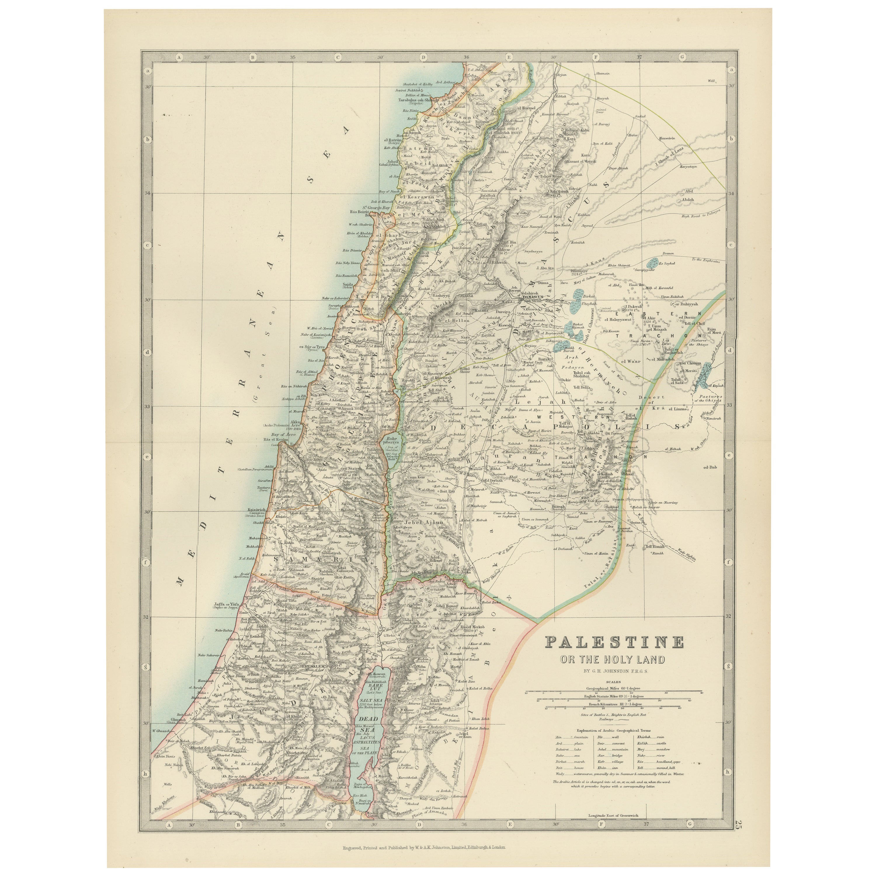
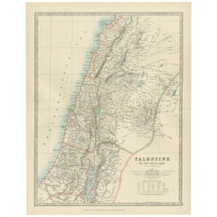
Antique Map of Palestine or The Holy Land, 1903, with Biblical Details
Title: Antique Map of Palestine or The Holy Land, 1903, with Biblical and Geographical Details
Description:
This antique map, titled "Palestine or The Holy Land," was engraved and p...
Catégorie
Début du 20ème siècle, Cartes
Matériaux
Papier
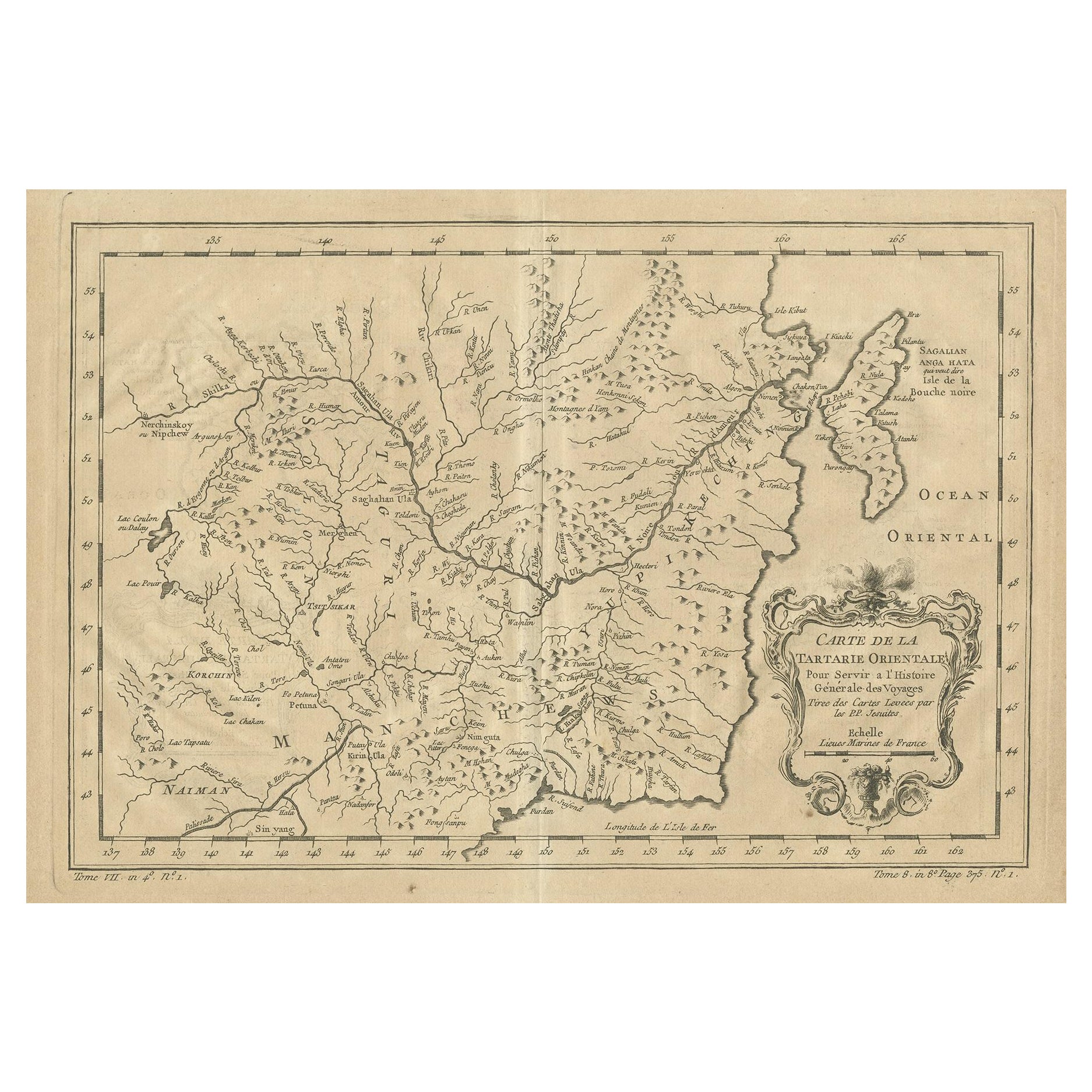
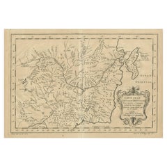
Carte ancienne de Manchuria et de la partie nord-est de la terre de Tartary
Carte ancienne intitulée "Carte de la Tartarie Orientale (...)". Carte détaillée de la Mandchourie et de la partie nord-est de la Tartarie, y compris Sagallan Anga Hata--Isle de la B...
Catégorie
Antiquités, Milieu du XVIIIe siècle, Cartes
Matériaux
Papier
270 $US Prix de vente
20 % de remise
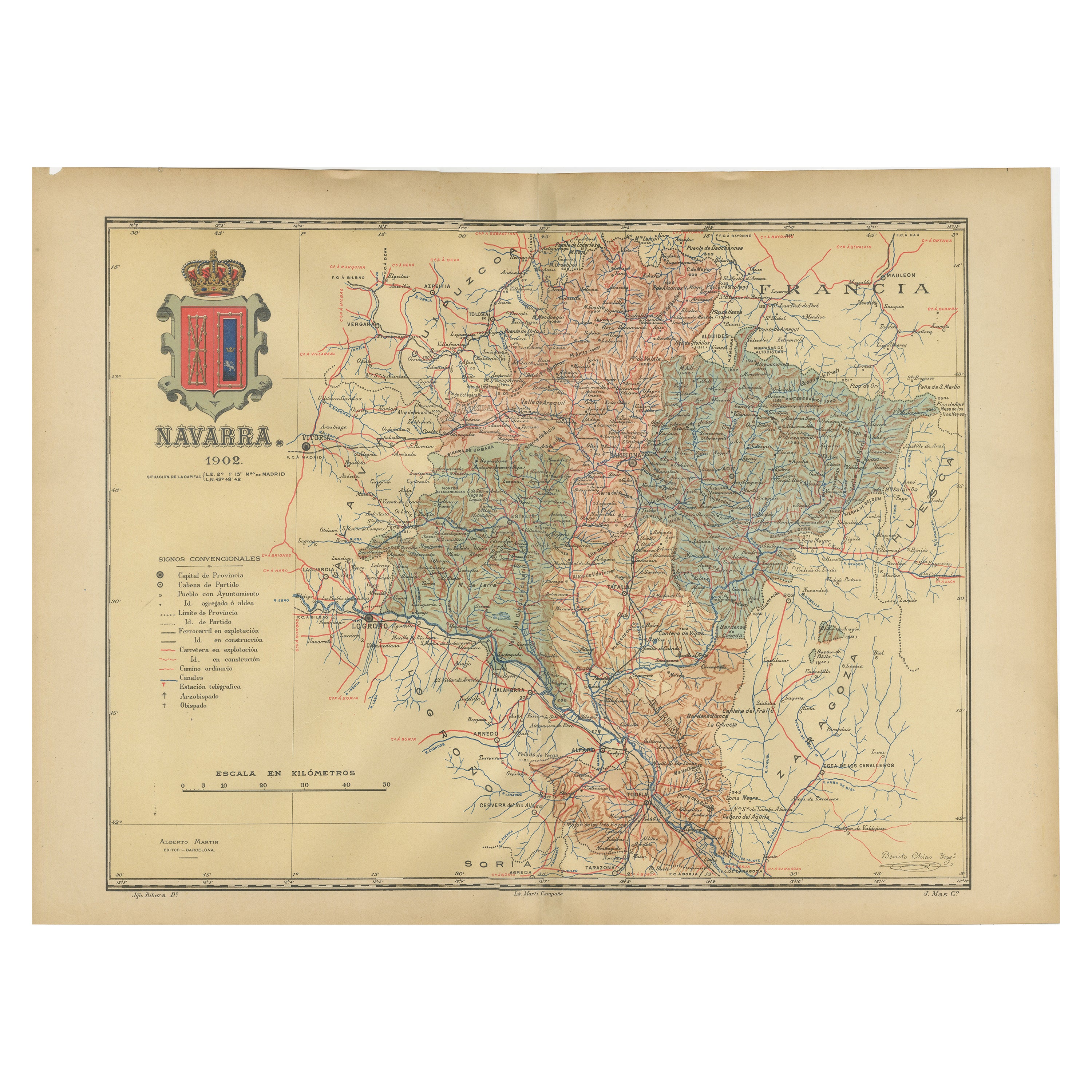
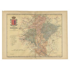
La Navarra en détails cartographiques : une carte des chemins de fer du nord de l'Espagne de 1902
La carte ancienne originale mise en vente montre la province espagnole de Navarre telle qu'elle était en 1902. Voici une brève description et un titre potentiel pour la carte :
Desc...
Catégorie
Antiquités, Début des années 1900, Cartes
Matériaux
Papier
316 $US Prix de vente
20 % de remise
Livraison gratuite
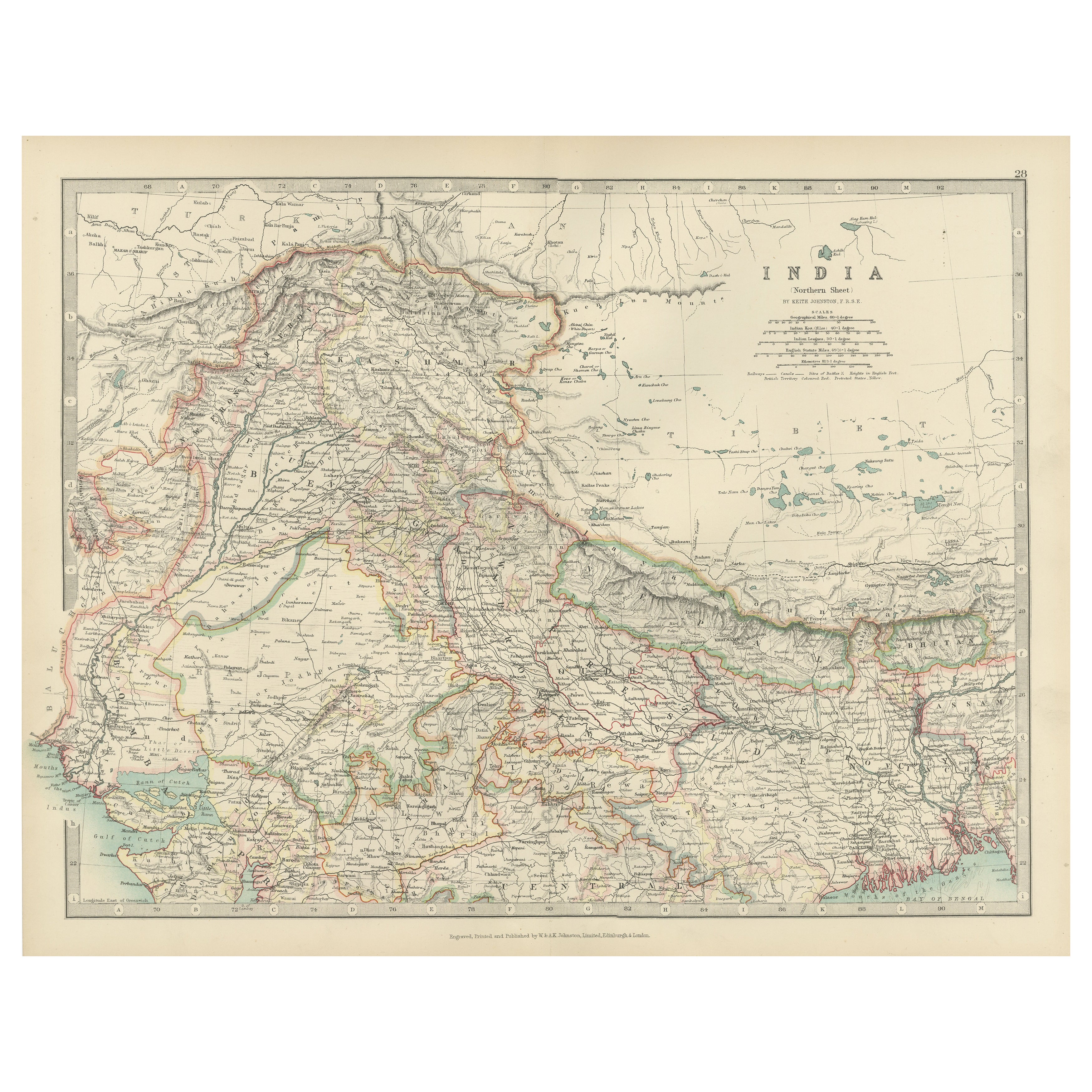
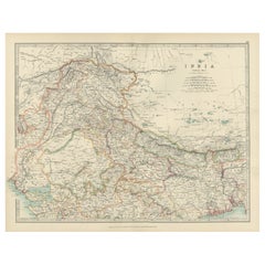
Antique Map of Northern India, Featuring Boundaries & Himalayan Detail, 1903
Antique Map of Northern India, 1903, Featuring Provincial Boundaries and Himalayan Detail
This antique map, titled "India (Northern Sheet)," was engraved and published in 1903 by W....
Catégorie
Début du 20ème siècle, Cartes
Matériaux
Papier
Suggestions
Carte ancienne d'Amérique du Nord, États-Unis, Canada, Mexique, cartographie, Colton, Victorien
Il s'agit d'une carte ancienne de l'Amérique du Nord. Gravure lithographique de l'atlas du continent par JH Colton, datant de la période victorienne et plus tard, circa 1860.
Fasci...
Catégorie
Antiquités, Milieu du XIXe siècle, Américain, Victorien, Cartes
Matériaux
Papier

Carte ancienne de l'État américain du Minnesota, 1903
Carte ancienne du Minnesota
Publié par A.I.C Black. 1903
Couleur originale
Bon état
Sans cadre.
Expédition gratuite
Catégorie
Antiquités, Début des années 1900, Anglais, Cartes
Matériaux
Papier

Carte ancienne de l'État américain de l'Alabama, 1903
Antique map of Alabama
Published By A & C Black. 1903
Original colour
Good condition
Unframed.
Free shipping
Catégorie
Antiquités, Début des années 1900, Anglais, Cartes
Matériaux
Papier

Carte ancienne de l'État américain de l'Alaska, 1903
Carte ancienne de l'Alaska
Publié par A.I.C Black. 1903
Couleur originale
Bon état
Sans cadre.
Expédition gratuite
Catégorie
Antiquités, Début des années 1900, Anglais, Cartes
Matériaux
Papier

Carte ancienne de l'État américain du Nebraska, 1903
Carte ancienne du Nebraska
Publié par A.I.C Black. 1903
Couleur originale
Bon état
Sans cadre.
Expédition gratuite
Catégorie
Antiquités, Début des années 1900, Anglais, Cartes
Matériaux
Papier

Carte ancienne d'origine de l'État américain de Washington, 1903
Carte ancienne de Washington
Publié par A.I.C Black. 1903
Couleur originale
Bon état
Sans cadre.
Expédition gratuite
Catégorie
Antiquités, Début des années 1900, Anglais, Cartes
Matériaux
Papier
