Articles similaires à Canada Map 1903 - East Central Dominion - Ontario, Quebec & More
Vous voulez plus d'images ou de vidéos ?
Demander au vendeur plus d'images ou de vidéos
1 sur 10
Canada Map 1903 - East Central Dominion - Ontario, Quebec & More
À propos de cet article
Canada Map 1903 - East Central Dominion - Ontario, Quebec & More
This captivating antique map, titled "Dominion of Canada (East Central Sheet)" and published in 1903 by Keith Johnston, offers a detailed depiction of the heart of Canada’s eastern territories. The map encompasses parts of Ontario and Quebec, extending to the northern Great Lakes and incorporating significant areas of the Atlantic coastline. It's a magnificent example of early 20th-century cartography and showcases the precision and artistry of the Johnston publishing firm.
The map details the complex geography of the region, including rivers, mountain ranges, roads, and railways, revealing the infrastructure and growth of Canada during this period. The meticulously engraved lines and delicate coloring of provincial borders bring an elegance to the presentation, while the naming of towns and cities speaks to the historical importance of the time.
This map not only captures geographical features but also hints at the political and economic development of Canada in the early 1900s, illustrating a period of growth and connection between regions. The inset of major urban areas and the care taken in denoting smaller settlements reflect a keen understanding of the land’s evolving identity.
Condition:
This original map is in excellent condition with slight toning along the edges, typical for its age. The color borders remain bright, and there are no significant tears or repairs.
Framing Tips:
To preserve and display this historical piece, consider framing it in a solid wood frame in a warm mahogany or walnut finish. A cream or off-white mat will enhance the subtle coloring of the map, while museum glass will help protect it from light and dust, ensuring its beauty endures.
- Dimensions:Hauteur : 36,8 cm (14,49 po)Largeur : 47 cm (18,51 po)Profondeur : 0,2 mm (0,01 po)
- Matériaux et techniques:
- Période:
- Date de fabrication:1903
- État:This original map is in excellent condition with slight toning along the edges, typical for its age. The color borders remain bright, and there are no significant tears or repairs.
- Adresse du vendeur:Langweer, NL
- Numéro de référence:Vendeur : BG-13577-421stDibs : LU3054345291472
À propos du vendeur
5,0
Vendeur reconnu
Ces vendeurs prestigieux sont des leaders du secteur. Ils représentent le summum en matière de qualité et de design.
Vendeur Or
Vendeurs premium dont la note est supérieure à 4,3 et le délai de réponse de 24 heures maximum
Établi en 2009
Vendeur 1stDibs depuis 2017
2 462 ventes sur 1stDibs
Temps de réponse habituel : <1 heure
- ExpéditionRecherche du devis...Expédition depuis : Langweer, Pays-Bas
- Politique des retours
Certaines parties de cette page ont été traduites automatiquement. 1stDibs ne garantit pas l'exactitude des traductions. L'anglais est la langue par défaut de ce site web.
Garantie d'authenticité
Bien qu'il soit peu probable que la situation se présente, dans le cas où vous rencontreriez un problème d'authenticité d'un article, contactez-nous dans un délai d'un an pour obtenir un remboursement intégral. DétailsGarantie de remboursement
Si votre article n'est pas conforme à la description, est endommagé pendant le transport ou ne vous est pas livré, contactez-nous sous 7 jours pour obtenir un remboursement intégral. DétailsAnnulation sous 24 heures
Vous disposez d'un délai de 24 heures pour annuler votre achat sans motif.Des vendeurs professionnels agréés
Nos vendeurs de renommée mondiale doivent respecter des normes strictes en matière de service et de qualité, afin de préserver l'intégrité de nos fiches produit.Garantie d'alignement des prix
Si vous constatez qu'un autre vendeur a mis en vente le même article à un prix inférieur sur un autre site, nous nous alignerons sur ce prix.Livraison en toute confiance à l'international
Notre réseau de transporteurs de premier ordre propose des options d'expédition spécialisées dans le monde entier, y compris des livraisons personnalisées.Plus d'articles de ce vendeur
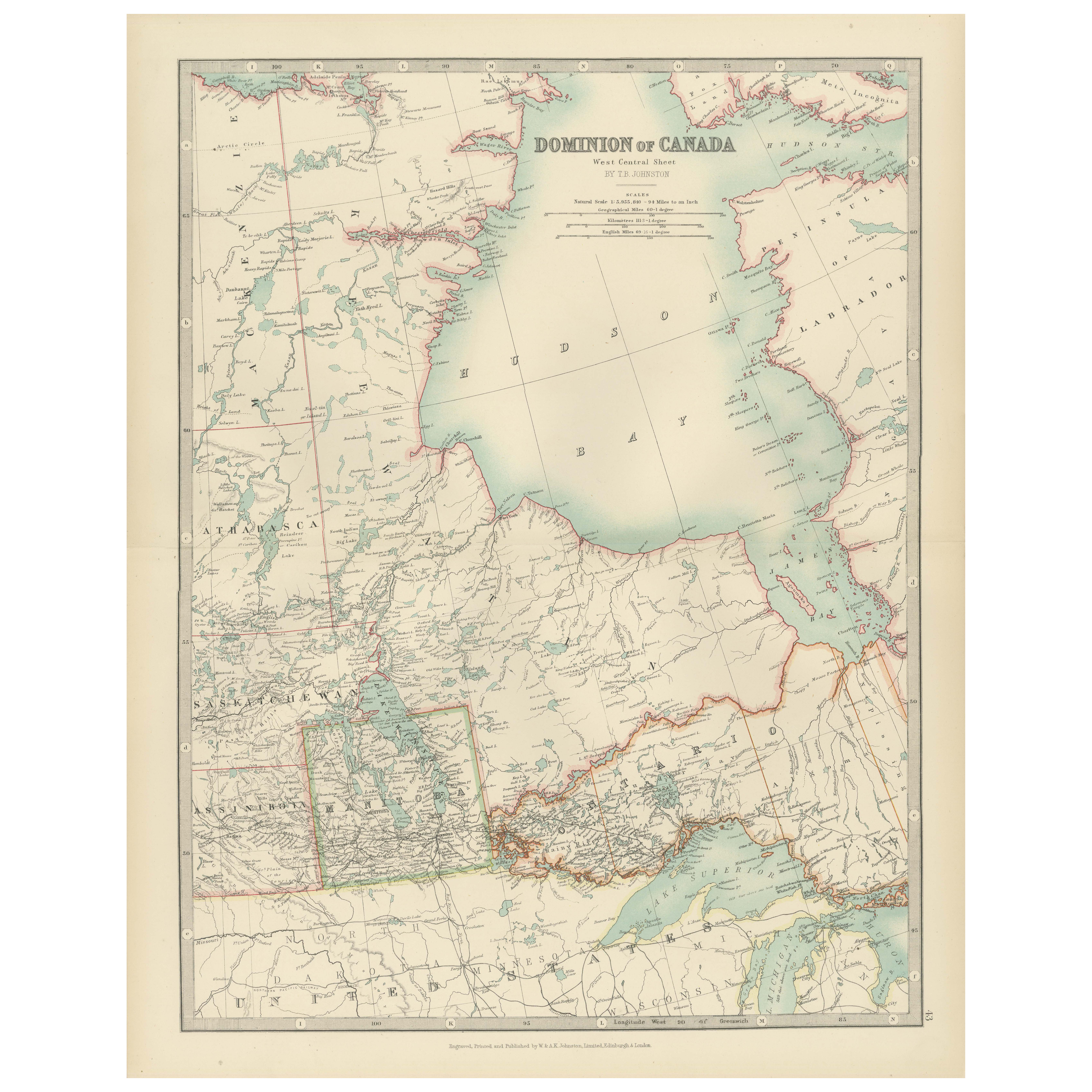
Tout afficherCanada Map 1903 - Dominion of Canada, West Central Sheet
Title: Canada Map 1903 - Dominion of Canada, West Central Sheet
Description:
This fascinating 1903 map of the Dominion of Canada’s West Central regions by T.R. Johnston offers a viv...
Catégorie
Début du 20ème siècle, Cartes
Matériaux
Papier
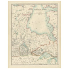
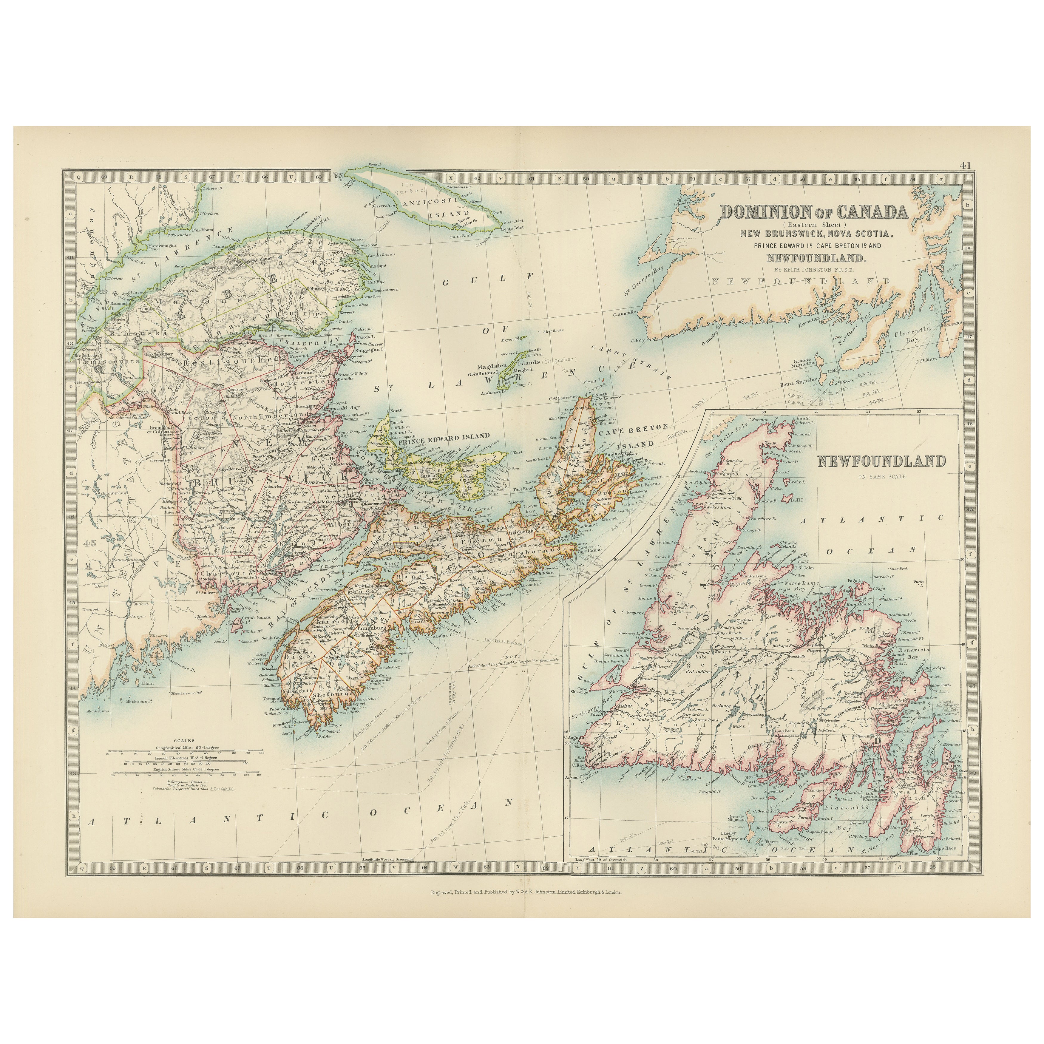
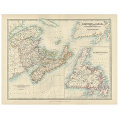
Canada Dominion Map 1903 - A Detailed View of Eastern Canada and Newfoundland
North America, 1903 - A Colorful Historical Map with Detailed Borders
This attractive map of North America was engraved, printed, and published by W. & A.K. Johnston in 1903. A wond...
Catégorie
Début du 20ème siècle, Cartes
Matériaux
Papier
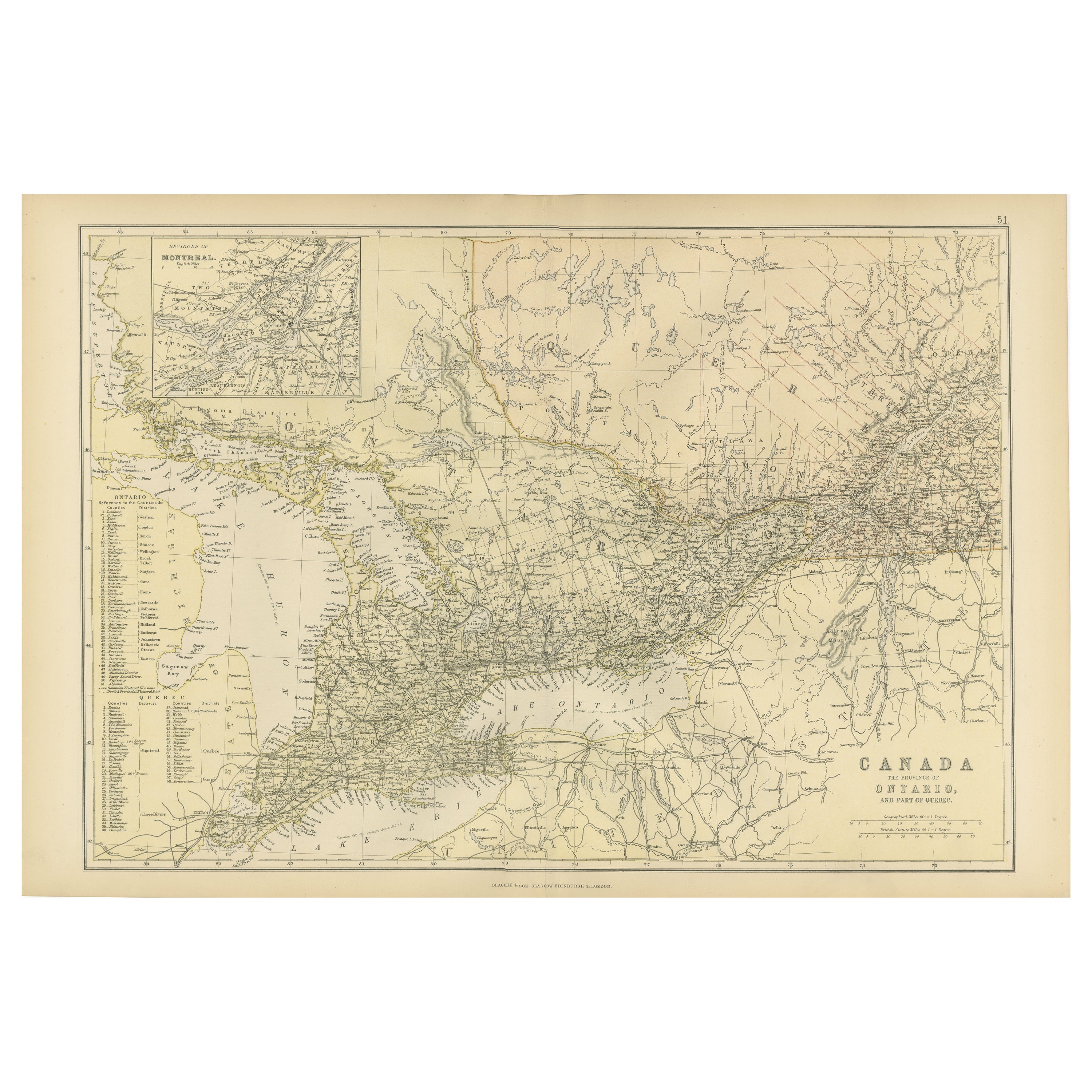
Carte ancienne du Canada, de la province d'Ontario et d'une partie du Québec, 1882
Il s'agit d'une carte historique tirée de l'Atlas Blackie de 1882, détaillant cette fois "la province de l'Ontario et une partie du Québec" au Canada. La carte présente une illustrat...
Catégorie
Antiquités, années 1880, Cartes
Matériaux
Papier

232 $US Prix de vente
20 % de remise
Livraison gratuite
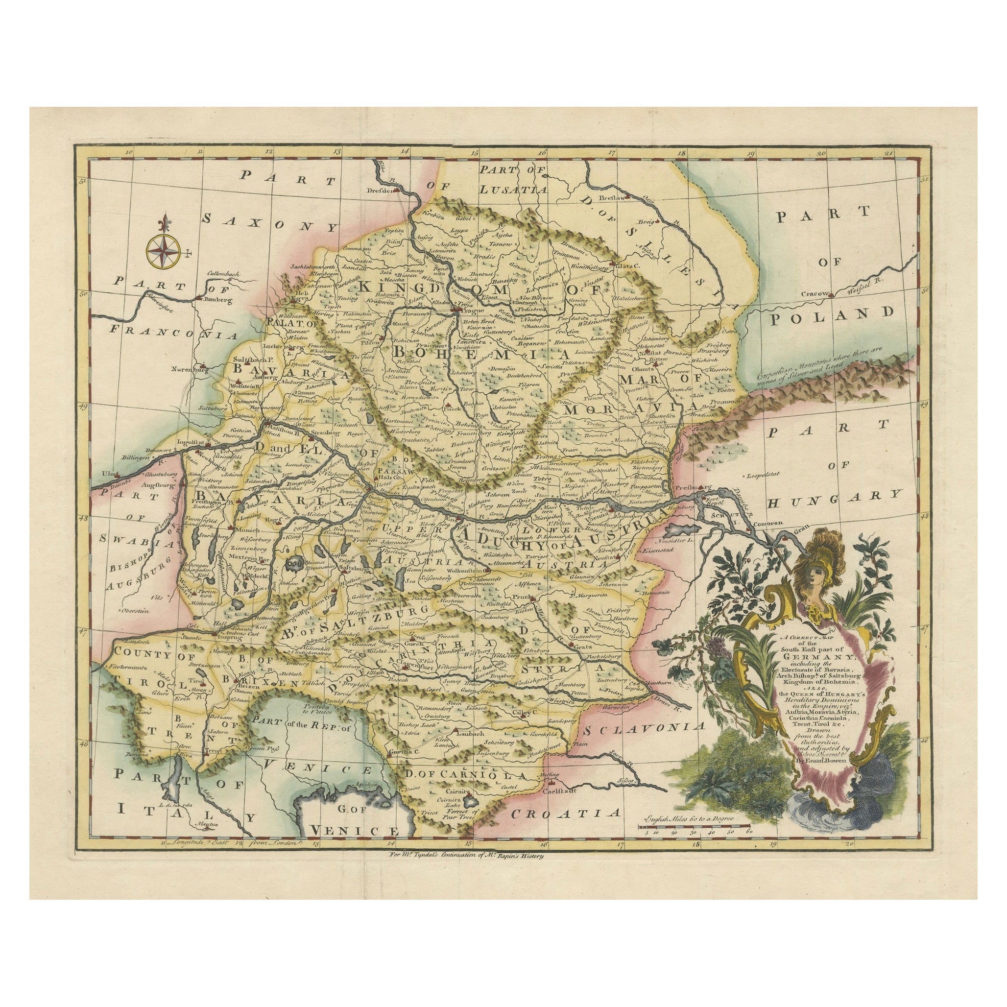
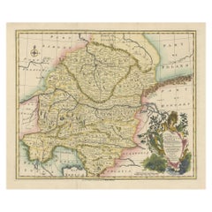
Une superbe carte de Bowen de 1744 : Allemagne du Sud-Est et Dominions de la Reine de Hongrie
Titre : Une carte nouvelle et correcte de la partie sud-est de l'Allemagne, 1744.
Cette carte d'Emanuel Bowen, datant d'environ 1744, représente magnifiquement la partie sud-est de ...
Catégorie
Antiquités, années 1740, Cartes
Matériaux
Papier
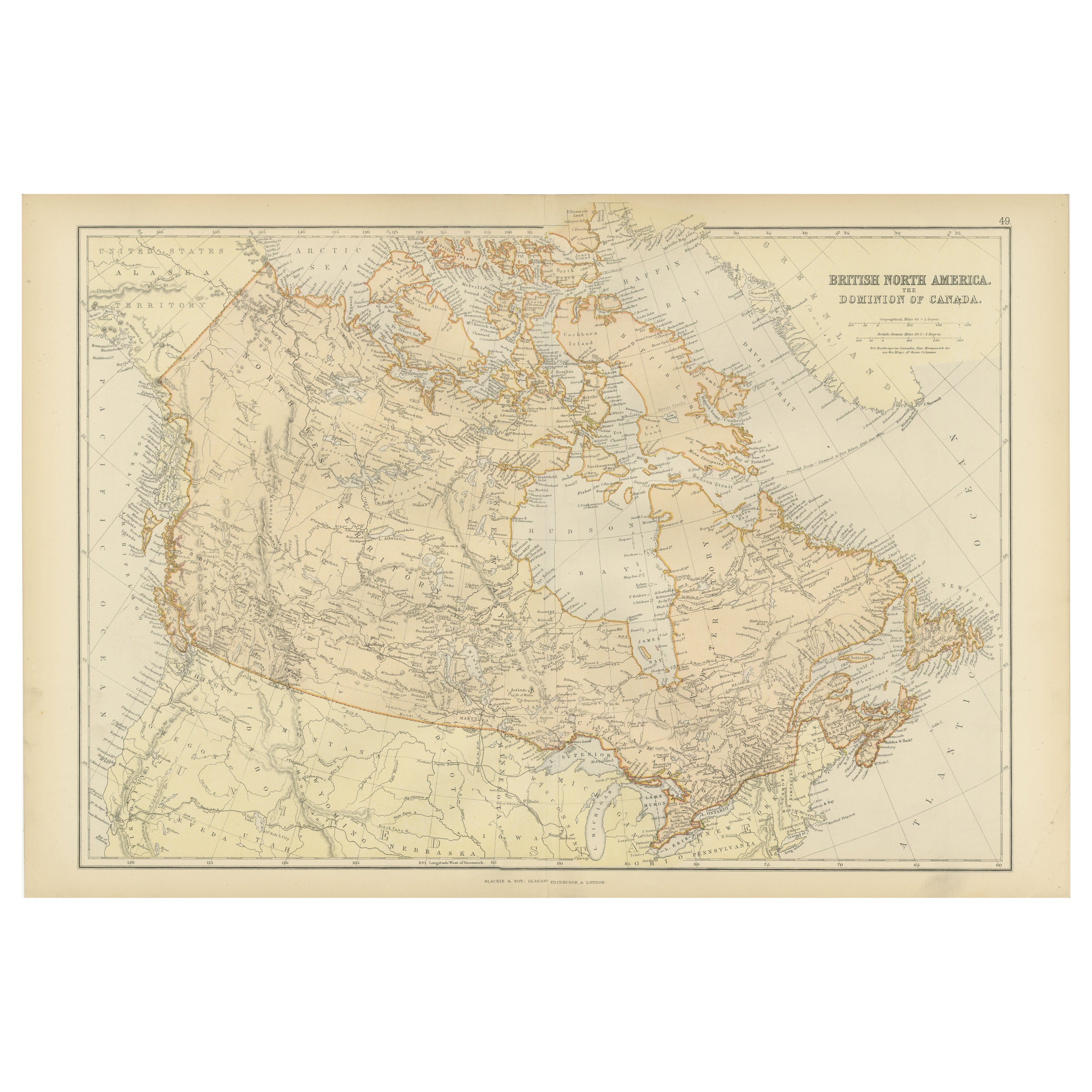
Carte ancienne d'Amérique du Nord britannique, le Dominion du Canada, 1882
Cette carte est intitulée "British North America, Dominion of Canada" et provient de l'Atlas Blackie de 1882. Elle représente l'espace géographique du Canada actuel, avec des élément...
Catégorie
Antiquités, années 1880, Cartes
Matériaux
Papier

232 $US Prix de vente
20 % de remise
Livraison gratuite
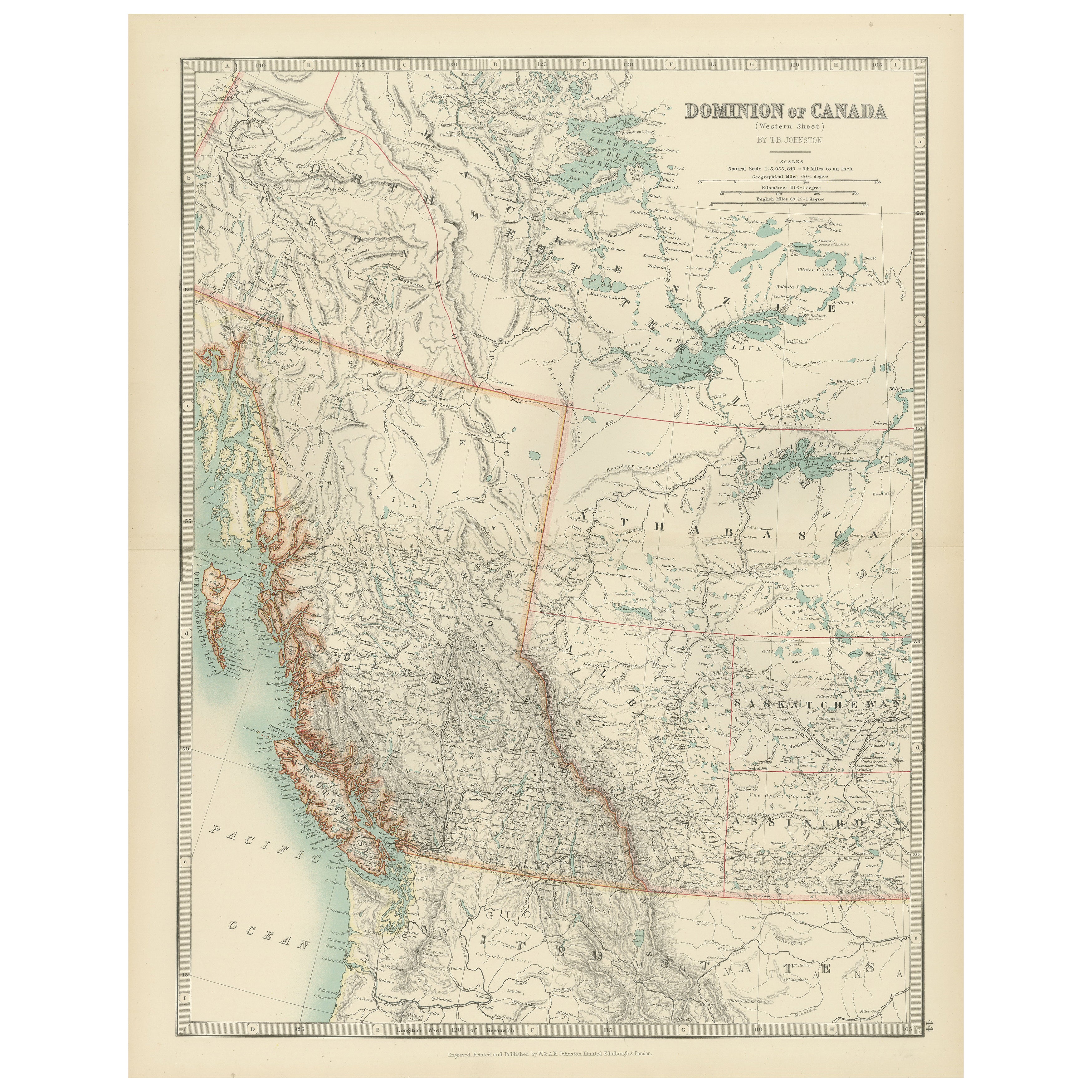
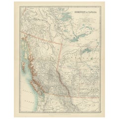
Canada’s West – 1903 Engraved Map by Johnston – Unique and Historic
This beautiful and detailed map, titled "Dominion of Canada (Western Sheet)," was created by Keith Johnston and published in 1903.
It presents a fascinating depiction of Canada's w...
Catégorie
Début du 20ème siècle, Cartes
Matériaux
Papier
Suggestions
Carte de l'Allemagne de l'Est des États-Unis
Par VEB Hermann Haack
Une carte brillamment colorée de la région de Leipzig, Karl Marx Stadt et Dresde dans l'ancienne République démocratique allemande par VEB Hermann Haack de Gotha.
Catégorie
Vintage, années 1970, Allemand, Cartes

295 $US Prix de vente
25 % de remise
Carte ancienne de l'État américain du Minnesota, 1903
Carte ancienne du Minnesota
Publié par A.I.C Black. 1903
Couleur originale
Bon état
Sans cadre.
Expédition gratuite
Catégorie
Antiquités, Début des années 1900, Anglais, Cartes
Matériaux
Papier

Carte ancienne de l'État américain de l'Alabama, 1903
Antique map of Alabama
Published By A & C Black. 1903
Original colour
Good condition
Unframed.
Free shipping
Catégorie
Antiquités, Début des années 1900, Anglais, Cartes
Matériaux
Papier

Carte ancienne de l'État américain de l'Alaska, 1903
Carte ancienne de l'Alaska
Publié par A.I.C Black. 1903
Couleur originale
Bon état
Sans cadre.
Expédition gratuite
Catégorie
Antiquités, Début des années 1900, Anglais, Cartes
Matériaux
Papier

Carte ancienne de l'État américain du Nebraska, 1903
Carte ancienne du Nebraska
Publié par A.I.C Black. 1903
Couleur originale
Bon état
Sans cadre.
Expédition gratuite
Catégorie
Antiquités, Début des années 1900, Anglais, Cartes
Matériaux
Papier

Carte ancienne d'origine de l'État américain de Washington, 1903
Carte ancienne de Washington
Publié par A.I.C Black. 1903
Couleur originale
Bon état
Sans cadre.
Expédition gratuite
Catégorie
Antiquités, Début des années 1900, Anglais, Cartes
Matériaux
Papier
