Articles similaires à Carte du sud du Portugal du 17e siècle par Sanson - coloriée à la main, 1679

Vous voulez plus d'images ou de vidéos ?
Demander au vendeur plus d'images ou de vidéos
1 sur 10
Carte du sud du Portugal du 17e siècle par Sanson - coloriée à la main, 1679
420 €TVA incluse
À propos de cet article
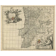
17th Century Map of Southern Portugal by Sanson – Hand-Colored, 1679
This stunning 1679 map of Portugal offers a captivating glimpse into the past, showcasing the country's geography as it was understood over three centuries ago. Spanning the entire western coast of the Iberian Peninsula, the map meticulously details regions such as Entre Douro e Minho, Beira, Estremadura, Alentejo, and the Algarve, each delineated with vibrant yellow and green borders. The Atlantic Ocean, labeled as "Oceano de Portugal" and "Tugal," frames the western edge, while the Gulf of Cadiz graces the southern boundary, adding a nautical allure to the composition. Intricate place names like Lisbon, Setubal, and Evora are scattered across the landscape, accompanied by a network of rivers, mountains, and towns, all rendered in delicate hand-colored lines and shading.
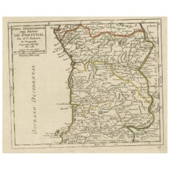
What makes this print particularly intriguing is its historical context and artistic execution. Created in an era when cartography was both a science and an art form, the map reflects the knowledge and exploration of the time, with some regions depicted with a charmingly approximate accuracy. The ornate cartouche in the upper right corner, adorned with a decorative drape and title "Parte Meridional do Reyno de Portugal," serves as a focal point, hinting at the map's royal patronage and its purpose as both a functional tool and a decorative piece. Red dots marking key locations add a touch of visual interest, drawing the eye across the terrain.
The map depicts the southern portion of Portugal, including:
Lisbon (Lisbonne) and the surrounding regions like Setúbal, Alentejo (ALEN), and the Ribatejo.
The Algarve region at the bottom, labeled "Reino do Algarve".
Border regions of Spain such as Andalusia and Extremadura.
Major rivers like the Tejo (Tagus) and Guadiana are prominently shown.
Cities such as Évora, Beja, Faro, Tavira, and Portalegre are labeled.
Coastal features like Cabo de São Vicente and Golfo de Cádiz are identified.
For a potential buyer, this map is a treasure trove of historical insight and aesthetic appeal. It offers a window into 18th-century Portugal, a period of maritime prowess and cultural richness, making it an ideal addition to a collection of antique maps or a study of European history. The aged parchment texture, combined with the hand-colored details, lends an authentic antique charm that modern reproductions struggle to replicate. Whether displayed in a study, library, or gallery, this map promises to spark conversations and admiration, blending educational value with timeless elegance.
Condition Summary
The print is in fair condition for its age, with some expected wear. There are no significant visible tears or losses, but a weaker area has been supported with archival tape on the reverse. The hand-colored elements remain vivid, and the text is legible, preserving the map's historical integrity.
Framing Tips
To preserve and showcase this print effectively, use acid-free matting and backing to protect the paper from further deterioration. A simple, elegant wooden frame in a neutral tone like walnut or oak will complement the map's antique style without overpowering it. Ensure the frame size allows for a generous border around the map to highlight its detailed edges and cartouche. Hang the print in a location away from direct sunlight and humidity to maintain its condition over time.
- Dimensions:Hauteur : 42,5 cm (16,74 po)Largeur : 57 cm (22,45 po)Profondeur : 0,2 mm (0,01 po)
- Matériaux et techniques:Papier,Gravé
- Lieu d'origine:
- Période:Fin du XVIIe siècle
- Date de fabrication:1679
- État:The print is in fair condition for its age, with some expected wear. There are no significant visible tears or losses, but a weaker area has been supported with archival tape on the reverse. The hand-colored elements remain vivid.
- Adresse du vendeur:Langweer, NL
- Numéro de référence:Vendeur : BG-14068-21stDibs : LU3054345401102
À propos du vendeur
5,0
Vendeur reconnu
Ces vendeurs prestigieux sont des leaders du secteur. Ils représentent le summum en matière de qualité et de design.
Vendeur Platine
Vendeurs premium dont la note est supérieure à 4,7 et le délai de réponse de 24 heures maximum
Établi en 2009
Vendeur 1stDibs depuis 2017
2 636 ventes sur 1stDibs
Temps de réponse habituel : <1 heure
- ExpéditionRecherche du devis...Expédition depuis : Langweer, Pays-Bas
- Politique des retours
Certaines parties de cette page ont été traduites automatiquement. 1stDibs ne garantit pas l'exactitude des traductions. L'anglais est la langue par défaut de ce site web.
Garantie d'authenticité
Bien qu'il soit peu probable que la situation se présente, dans le cas où vous rencontreriez un problème d'authenticité d'un article, contactez-nous dans un délai d'un an pour obtenir un remboursement intégral. DétailsGarantie de remboursement
Si votre article n'est pas conforme à la description, est endommagé pendant le transport ou ne vous est pas livré, contactez-nous sous 7 jours pour obtenir un remboursement intégral. DétailsAnnulation sous 24 heures
Vous disposez d'un délai de 24 heures pour annuler votre achat sans motif.Des vendeurs professionnels agréés
Nos vendeurs de renommée mondiale doivent respecter des normes strictes en matière de service et de qualité, afin de préserver l'intégrité de nos fiches produit.Garantie d'alignement des prix
Si vous constatez qu'un autre vendeur a mis en vente le même article à un prix inférieur sur un autre site, nous nous alignerons sur ce prix.Livraison en toute confiance à l'international
Notre réseau de transporteurs de premier ordre propose des options d'expédition spécialisées dans le monde entier, y compris des livraisons personnalisées.Plus d'articles de ce vendeur
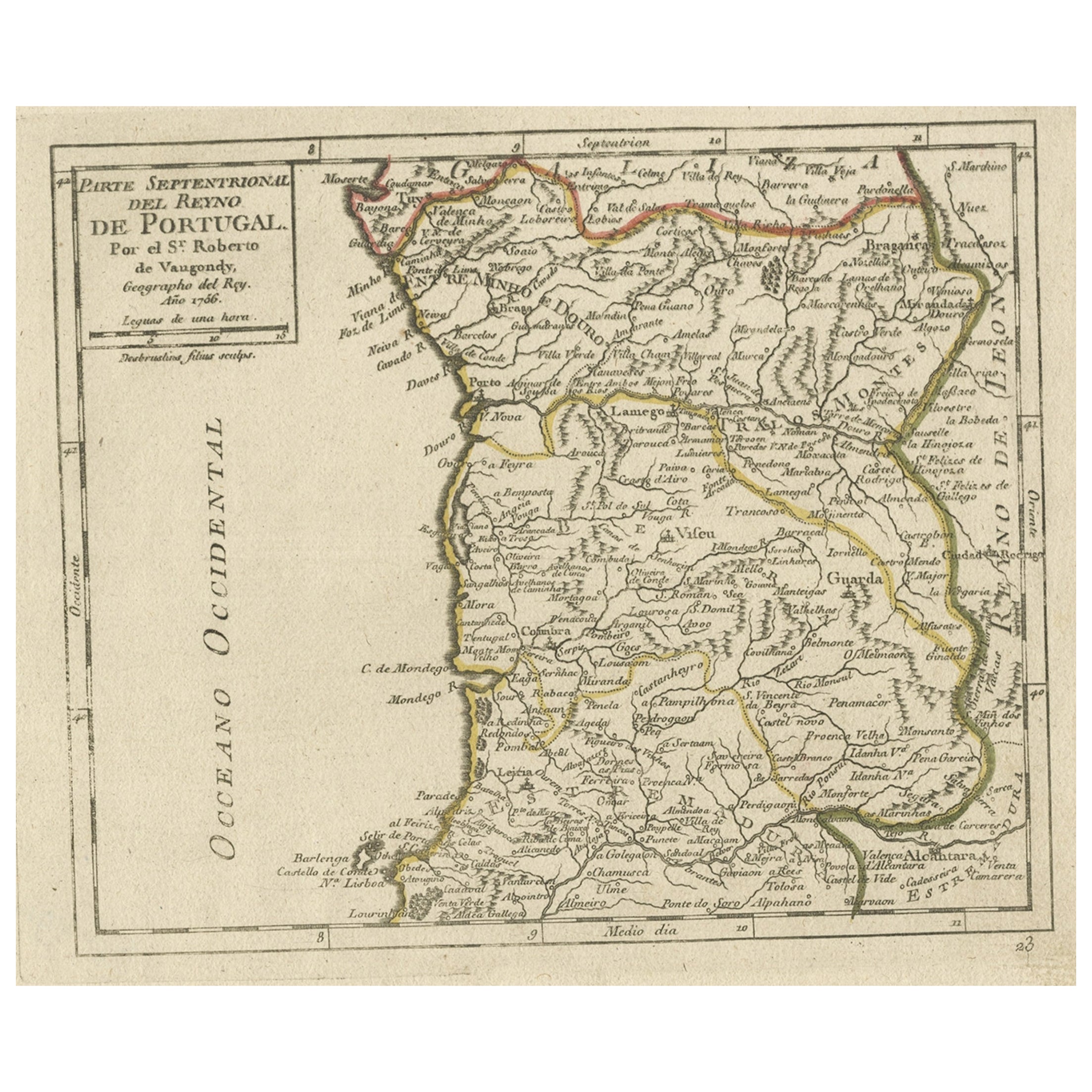
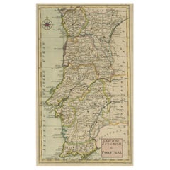
Tout afficherCarte ancienne colorée à la main du nord du Portugal, 1756
Carte ancienne du Portugal intitulée "Parte Sepentrional del Reyno de Portugal".
Carte ancienne du nord du Portugal. Cette carte provient de l'"Atlas Portatif".
Artistes et g...
Catégorie
Antiquités, années 1750, Cartes
Matériaux
Papier
144 € Prix de vente
20 % de remise
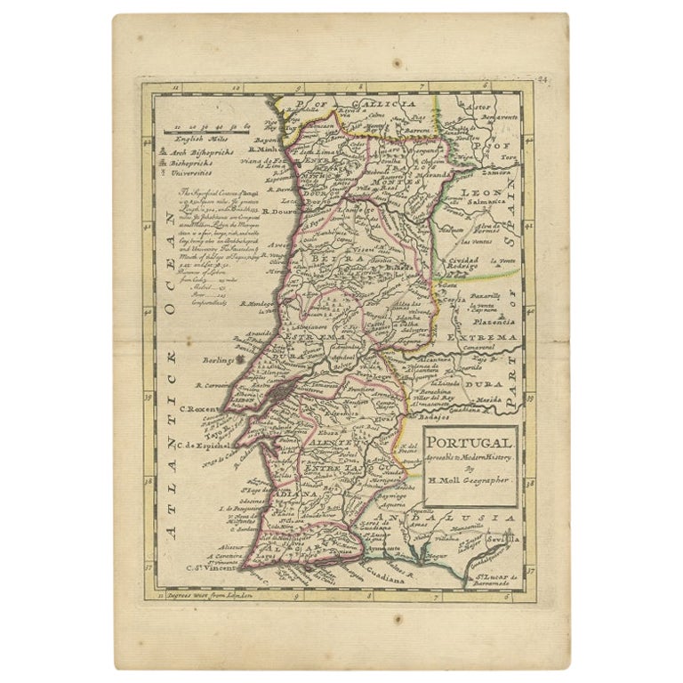
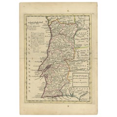
Carte ancienne du Portugal par Moll, 1727
Carte ancienne du Portugal intitulée "Portugal Agreeable to Modern History". Carte détaillée du Portugal indiquant les principales routes, les voies navigables, les archevêchés, les ...
Catégorie
Antiquités, XVIIIe siècle, Cartes
Matériaux
Papier
158 € Prix de vente
20 % de remise
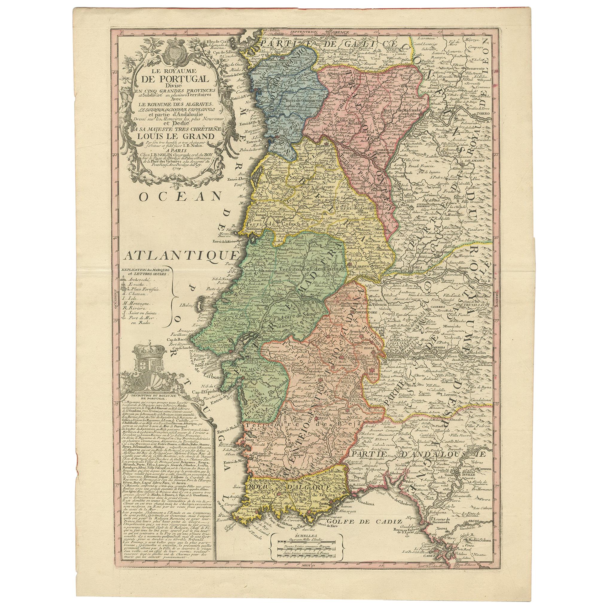
Carte ancienne du Portugal par Nolin (1704)
Carte ancienne intitulée 'Le Royaume de Porutgal divisé en cinq grandes Provinces (...)'. Carte du Portugal rare et très décorative. Elle montre le territoire du Royaume du Portugal ...
Catégorie
Antiquités, Début du XVIIIe siècle, Cartes
Matériaux
Papier

680 € Prix de vente
20 % de remise
Carte ancienne du Portugal par P. Schenk, datant d'environ 1700
Carte ancienne intitulée "Portugalliae et Algarbia". Bel exemplaire de la rare carte du Portugal de Schenk, avec les armoiries du Portugal, de l'Algérie et d'un voilier espagnol dans...
Catégorie
Antiquités, Début du XVIIIe siècle, Cartes
Matériaux
Papier

692 € Prix de vente
20 % de remise
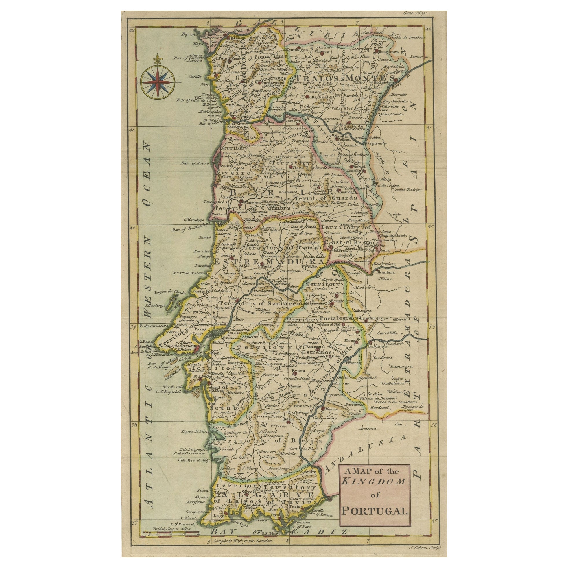
Carte ancienne détaillée du Portugal, publiée pour le « Genttleman's Magazine », 1758
Carte ancienne du Portugal intitulée "Carte du Royaume du Portugal".
Carte détaillée du Portugal, publiée pour le "Gentleman's Magazine".
Artistics and Engravers : Gravé par ...
Catégorie
Antiquités, années 1750, Cartes
Matériaux
Papier
384 € Prix de vente
20 % de remise
Carte ancienne du Portugal par J. De Ram, datant d'environ 1680
Une carte détaillée du Portugal. Orné d'un beau cartouche, de voiliers et de nombreux putti. Édition très rare de J. de Ram, vers 1680.
Catégorie
Antiquités, Fin du XVIIe siècle, Cartes
Matériaux
Papier
648 € Prix de vente
20 % de remise
Suggestions
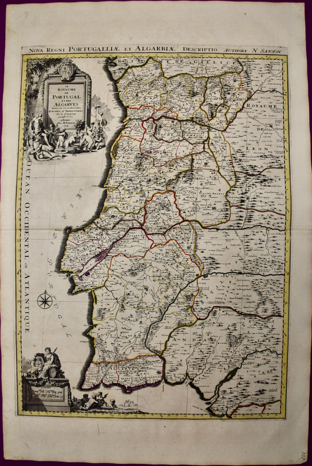
Portugal : Grande carte du 17ème siècle colorée à la main par Sanson et Jaillot
Par Nicholas Sanson d'Abbeville
Cette grande carte coloriée à la main intitulée "Le Royaume de Portugal et des Algarves Divisee en see Archeveches, Eveches et Territoires Par le Sr Sanson" a été créée à l'origine p...
Catégorie
1690, Estampes - Paysage
Matériaux
Gravure

Espagne et Portugal : Carte colorée à la main du XVIIe au XVIIIe siècle par Visscher
Par Nicolaus Visscher
Il s'agit d'une carte de l'Espagne et du Portugal du début du XVIIIe siècle, avec de belles couleurs originales à la main, intitulée "Hispaniae et Portugalliae Regna per Nicolaum Vis...
Catégorie
Fin du XVIIe siècle, Autres styles artistiques, Estampes - Paysage
Matériaux
Gravure

Carte ancienne originale d'Espagne et du Portugal, datant d'environ 1790
Super carte de l'Espagne et du Portugal
Gravure sur cuivre par A. Bell
Publié vers 1790.
Non encadré.
Catégorie
Antiquités, années 1790, Anglais, Autre, Cartes
Matériaux
Papier

Carte de l'Espagne et du Portugal - Gravure de Pierre François Tardieu - 1837
Carte de l'Espagne et du Portugal est une gravure réalisée par Pierre François Tardieu en 1837.
Bonnes conditions.
L'œuvre est réalisée dans une composition équilibrée. l'œuvre et ...
Catégorie
années 1830, Moderne, Estampes - Figuratif
Matériaux
Lithographie

Sud-est de l'Angleterre : Une carte du 17e siècle coloriée à la main par Mercator et Hondius
Par Gerard Mercator
Carte du XVIIe siècle coloriée à la main sur cuivre intitulée "The Sixt Table of England" par Gerard Mercator et Jodocus Hondius, publiée à Amsterdam en 1635 dans "Cosmographicall De...
Catégorie
années 1630, Estampes - Paysage
Matériaux
Gravure
La Grèce du Sud : une grande carte du 17e siècle colorée à la main par Sanson et Jaillot
Par Nicholas Sanson d'Abbeville
Cette grande carte originale gravée sur cuivre et colorée à la main du sud de la Grèce et de la péninsule du Péloponnèse, intitulée "La Moree Et Les Isles De Zante, Cefalonie, Ste. M...
Catégorie
1690, Estampes - Paysage
Matériaux
Gravure
