Articles similaires à Map of Ardèche France with Annonay and Vineyards by Vuillemin, 19th c


Vous voulez plus d'images ou de vidéos ?
Demander au vendeur plus d'images ou de vidéos
1 sur 11
Map of Ardèche France with Annonay and Vineyards by Vuillemin, 19th c
120 €TVA incluse
À propos de cet article
Map of Ardèche France with Annonay and Vineyards by Vuillemin, 19th c
This beautifully engraved 19th-century map of Ardèche, a department in southeastern France, comes from Alexandre Vuillemin’s *Nouvel Atlas Illustré*, published in Paris by Migeon. The map offers a detailed and artistic representation of the region, enhanced by vignettes, coats of arms, and historical references that highlight Ardèche’s cultural and natural richness.
The map presents the department’s full geographical scope with towns, rivers, and road networks, bordered by hand-applied yellow watercolor. Key locations such as Annonay, Privas, and Aubenas are clearly marked. The engraving also depicts the rugged terrain for which the Ardèche is well known, including the mountainous Massif Central and deep river gorges. In the upper left is a vignette of the town of Annonay, famous as the birthplace of the Montgolfier brothers, pioneers of balloon flight. Below that is a depiction of the natural stone arch of the Pont d’Arc, one of the most iconic landmarks in the region.
In the lower right corner, a striking scene depicts Joseph Marie Jacquard presenting his invention of the Jacquard loom, symbolizing Ardèche’s historical contributions to the textile industry. Jacquard’s automated loom was a key innovation in the development of modern weaving.
Ardèche is also a celebrated wine-producing region, especially in the southern part of the department near the Rhône Valley. The area is known for its rustic, characterful wines, including red blends made from Grenache, Syrah, and Merlot, as well as fresh white wines from Viognier and Chardonnay grapes. These wines are often labeled under the Côtes du Vivarais and Coteaux de l’Ardèche designations. The region’s climate and diverse terroirs make it an increasingly respected area within the Rhône wine landscape.
Alexandre Vuillemin, a skilled 19th-century French cartographer, was renowned for blending geography with artistic and cultural elements in his maps. His works were both decorative and informative, aimed at a growing educated public. The publisher, Migeon, was known for high-quality atlases that brought historical and geographic knowledge to a broad audience.
Condition summary:
Excellent impression with mild toning to the edges and a few small, scattered foxing marks. The hand-coloring remains vivid and the engraving is sharp and detailed.
Framing tips:
A classic dark wood or olive-toned frame will highlight the natural character of the Ardèche region. A warm off-white or light tan mat works well to emphasize the yellow hand-coloring. Use UV-protective glass for preservation.
- Dimensions:Hauteur : 26,1 cm (10,28 po)Largeur : 32,5 cm (12,8 po)Profondeur : 0,2 mm (0,01 po)
- Matériaux et techniques:Papier,Gravé
- Lieu d'origine:
- Période:
- Date de fabrication:circa 1850
- État:Excellent impression with mild toning to the edges and a few small, scattered foxing marks. The hand-coloring remains vivid and the engraving is sharp and detailed.
- Adresse du vendeur:Langweer, NL
- Numéro de référence:Vendeur : BG-13331-61stDibs : LU3054345359162
À propos du vendeur
5,0
Vendeur reconnu
Ces vendeurs prestigieux sont des leaders du secteur. Ils représentent le summum en matière de qualité et de design.
Vendeur Platine
Vendeurs premium dont la note est supérieure à 4,7 et le délai de réponse de 24 heures maximum
Établi en 2009
Vendeur 1stDibs depuis 2017
2 666 ventes sur 1stDibs
Temps de réponse habituel : <1 heure
- ExpéditionRecherche du devis...Expédition depuis : Langweer, Pays-Bas
- Politique des retours
Certaines parties de cette page ont été traduites automatiquement. 1stDibs ne garantit pas l'exactitude des traductions. L'anglais est la langue par défaut de ce site web.
Garantie d'authenticité
Bien qu'il soit peu probable que la situation se présente, dans le cas où vous rencontreriez un problème d'authenticité d'un article, contactez-nous dans un délai d'un an pour obtenir un remboursement intégral. DétailsGarantie de remboursement
Si votre article n'est pas conforme à la description, est endommagé pendant le transport ou ne vous est pas livré, contactez-nous sous 7 jours pour obtenir un remboursement intégral. DétailsAnnulation sous 24 heures
Vous disposez d'un délai de 24 heures pour annuler votre achat sans motif.Des vendeurs professionnels agréés
Nos vendeurs de renommée mondiale doivent respecter des normes strictes en matière de service et de qualité, afin de préserver l'intégrité de nos fiches produit.Garantie d'alignement des prix
Si vous constatez qu'un autre vendeur a mis en vente le même article à un prix inférieur sur un autre site, nous nous alignerons sur ce prix.Livraison en toute confiance à l'international
Notre réseau de transporteurs de premier ordre propose des options d'expédition spécialisées dans le monde entier, y compris des livraisons personnalisées.Plus d'articles de ce vendeur
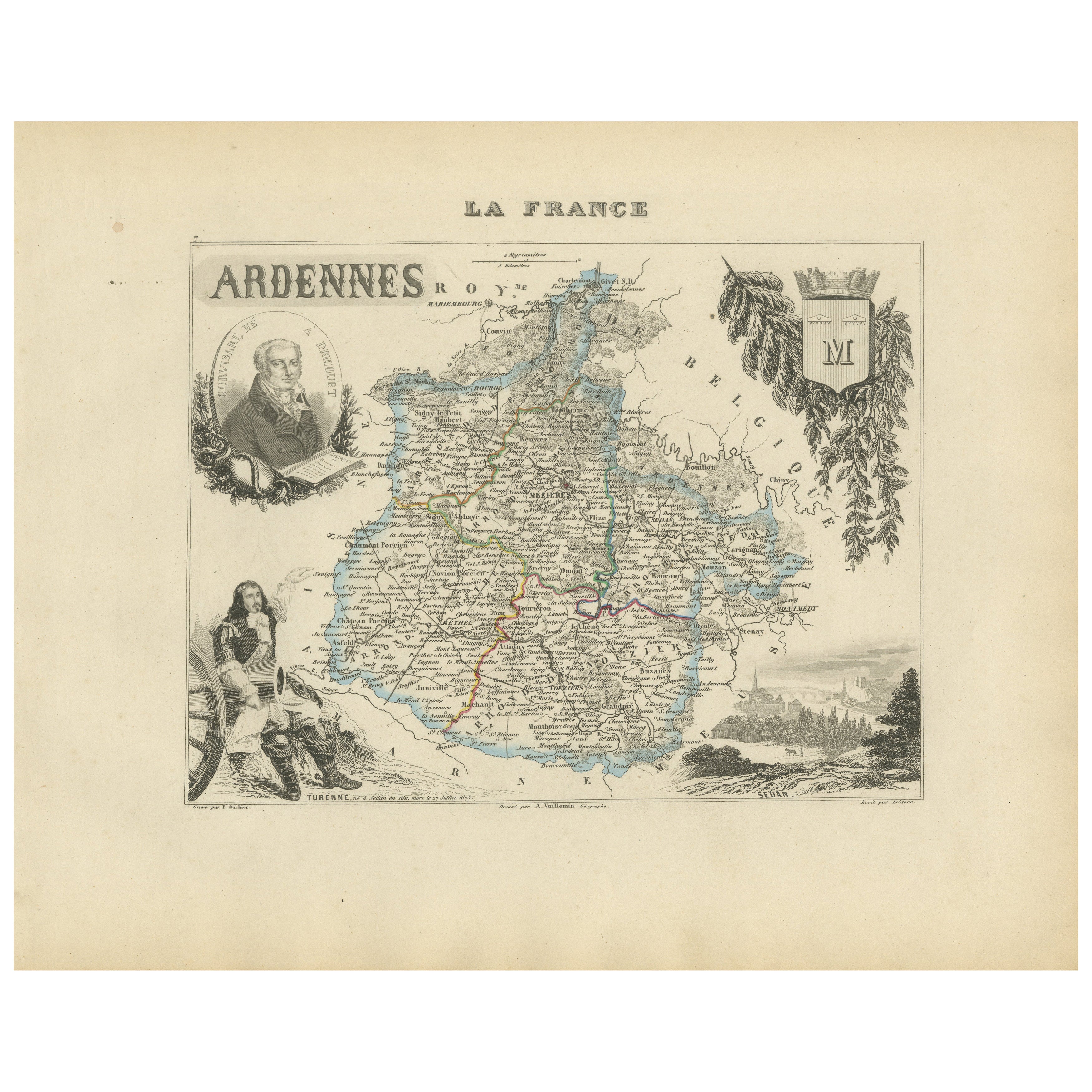
Tout afficherMap of Ardennes France with Sedan and Military History by Vuillemin, c.1850
Map of Ardennes France with Sedan and Military History by Vuillemin, 19th c
Description:
This detailed and decorative 19th-century map of the Ardennes department in northeastern Fra...
Catégorie
Antiquités, Milieu du XIXe siècle, Français, Cartes
Matériaux
Papier
Map of Aisne France with Soissons and Champagne Vineyards by Vuillemin, 19th c
Map of Aisne France with Soissons and Champagne Vineyards by Vuillemin, 19th c
Description:
This richly detailed 19th-century engraved and hand-colored map of the department of Aisn...
Catégorie
Antiquités, Milieu du XIXe siècle, Français, Cartes
Matériaux
Papier

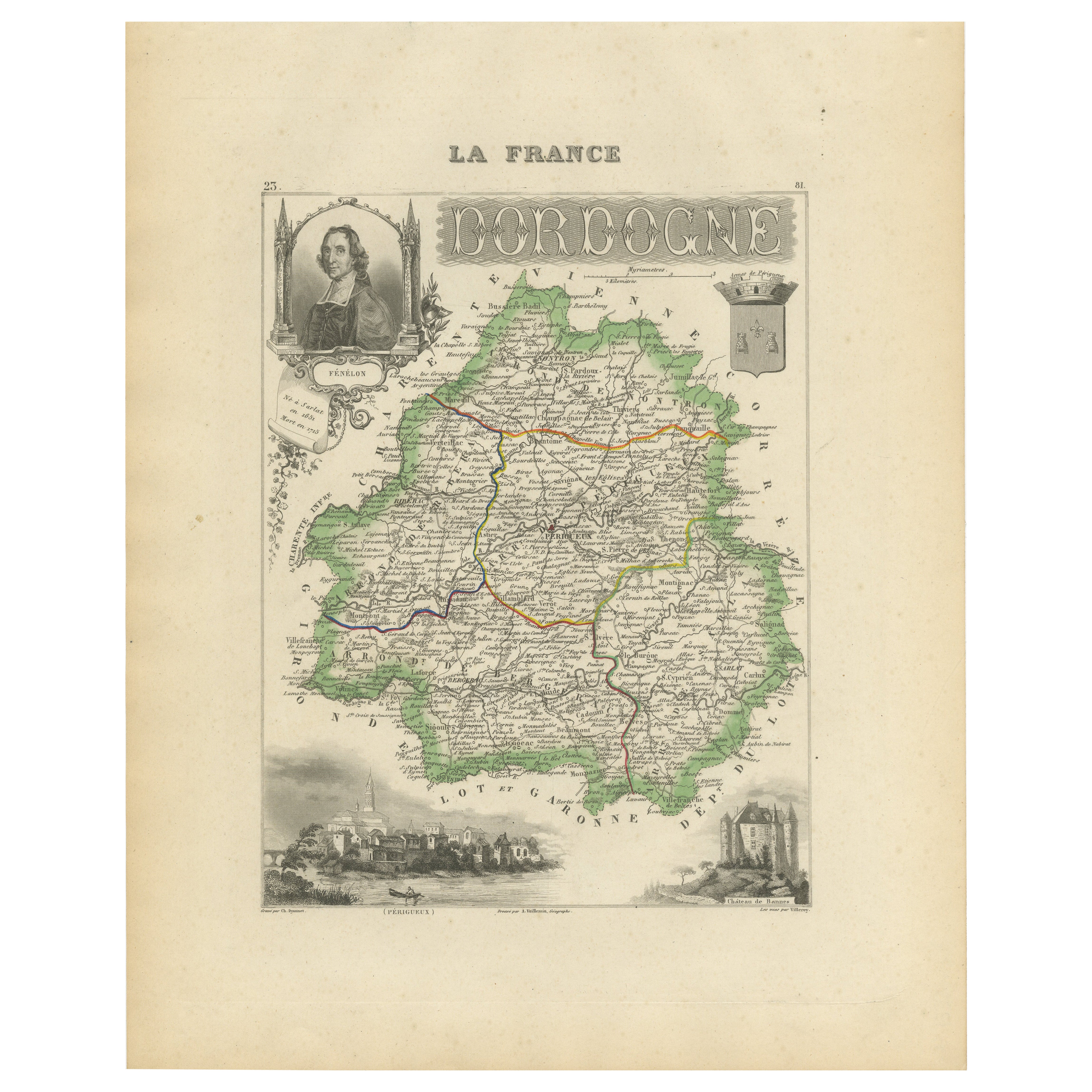
Map of Dordogne France with Périgueux and Château de Jumilhac, 19th Century
Map of Dordogne France with Périgueux and Château de Jumilhac, 19th Century
Description:
This richly detailed 19th-century map of the Dordogne department in southwestern France was ...
Catégorie
Antiquités, Milieu du XIXe siècle, Français, Cartes
Matériaux
Papier
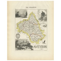
Map of Aveyron France with Rodez, Millau and Wine Routes, 19th Century
Map of Aveyron France with Rodez, Millau and Wine Routes, 19th Century
Description:
This detailed and decorative 19th-century map of Aveyron, a department in southern France, was dr...
Catégorie
Antiquités, Milieu du XIXe siècle, Français, Cartes
Matériaux
Papier
Map of Allier France with Saint-Pourçain Wine Region by Vuillemin, 19th c
Map of Allier France with Saint-Pourçain Wine Region by Vuillemin, 19th c
This decorative 19th-century map of Allier, a central department of France, comes from the celebrated Nouve...
Catégorie
Antiquités, Milieu du XIXe siècle, Français, Cartes
Matériaux
Papier

Carte du Gers en France avec A.I.C. et la région viticole de l'Armagnac par Vuillemin, 19e C.
Carte du Gers en France avec A.I.C. et la région viticole de l'Armagnac par Vuillemin, 19e C.
Cette carte gravée et coloriée à la main du département du Gers, dans le sud-ouest de l...
Catégorie
Antiquités, Milieu du XIXe siècle, Français, Cartes
Matériaux
Papier

Suggestions
Aude, France. Carte ancienne d'un département français, 1856
Par Victor Levasseur
département de l'Aude, gravure sur acier avec contour original coloré à la main, 1856, de l'Atlas national illustré de Levasseur.
Cette région de France est célèbre pour sa grande ...
Catégorie
XIXe siècle, Naturalisme, Estampes - Paysage
Matériaux
Gravure

Var, France. Carte ancienne d'un département français, 1856
Par Victor Levasseur
département du Var", gravure sur acier avec contour original coloré à la main, 1856, de l'Atlas National Illustre de Levasseur.
Le Var couvre le cœur de la Côte d'Azur et comprend ...
Catégorie
XIXe siècle, Naturalisme, Estampes - Paysage
Matériaux
Gravure

Lozere, France. Carte ancienne d'un département français, 1856
Par Victor Levasseur
département de la Lozère, gravure sur acier avec contour original coloré à la main, 1856, de l'Atlas national illustré de Levasseur.
Cette partie montagneuse isolée du Languedoc es...
Catégorie
XIXe siècle, Naturalisme, Estampes - Paysage
Matériaux
Gravure

L'Isere, France. Carte ancienne du département français de l'antiquité, 1856
Par Victor Levasseur
département de l'Isère, gravure sur acier avec contour original coloré à la main, 1856, de l'Atlas national illustré de Levasseur.
Cette région est connue pour sa production de Ble...
Catégorie
XIXe siècle, Naturalisme, Estampes - Paysage
Matériaux
Gravure

Aube, France. Carte ancienne d'un département français, 1856
Par Victor Levasseur
département de l'Aube, gravure sur acier avec contour original coloré à la main, 1856, de l'Atlas national illustré de Levasseur.
Cette région de France est connue pour sa producti...
Catégorie
XIXe siècle, Naturalisme, Estampes - Paysage
Matériaux
Gravure

L'Herault, France. Carte ancienne d'un département français, 1856
Par Victor Levasseur
département de Saône et Loire", gravure sur acier avec contour original coloré à la main, 1856, de l'Atlas national illustré de Levasseur.
Cette région abrite une grande variété de...
Catégorie
XIXe siècle, Naturalisme, Estampes - Paysage
Matériaux
Gravure
