Articles similaires à Map of Dordogne France with Périgueux and Château de Jumilhac, 19th Century


Vous voulez plus d'images ou de vidéos ?
Demander au vendeur plus d'images ou de vidéos
1 sur 10
Map of Dordogne France with Périgueux and Château de Jumilhac, 19th Century
140 €TVA incluse
À propos de cet article
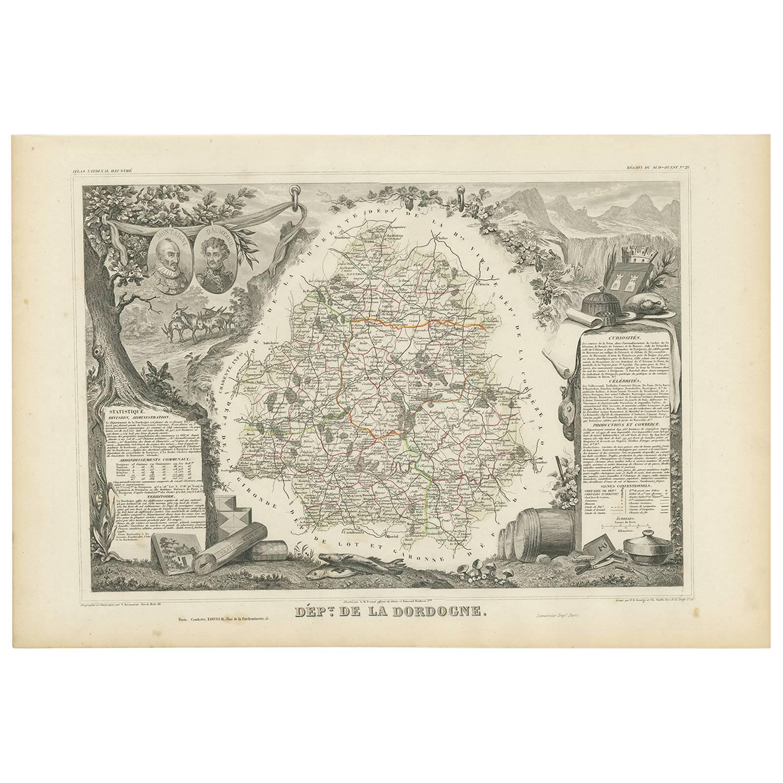
Map of Dordogne France with Périgueux and Château de Jumilhac, 19th Century
Description:
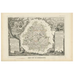
This richly detailed 19th-century map of the Dordogne department in southwestern France was drawn by Alexandre Vuillemin and published by Migeon in Paris for the *Nouvel Atlas Illustré*. The map masterfully combines cartographic precision with elegant engravings that highlight the historical and cultural significance of this beloved region of Aquitaine.
The map outlines Dordogne in soft green hand-coloring, with towns, rivers, and roadways finely engraved. The departmental capital, Périgueux, is centrally located and clearly labeled, along with other important towns such as Bergerac, Sarlat, Nontron, and Ribérac. The rolling hills, intersecting river valleys, and dense forests of the Périgord region are suggested through detailed topographical lines.
At the lower left is a charming vignette of Périgueux with its cathedral dome rising above a riverside village scene. To the lower right, the Château de Jumilhac appears perched on a slope, representing the region’s long architectural history and noble estates. The upper left features a portrait of François Fénelon, the theologian and writer born in Périgord in the 17th century. His inclusion reflects the department’s intellectual heritage. The heraldic crest of Dordogne also appears in the upper right.
Dordogne is famous for its culinary and cultural wealth, particularly its foie gras, truffles, walnuts, and wines. Bergerac, located in the southwestern part of the department, is a key wine-producing area within the Bergerac AOC, known for its red, white, and rosé wines. The vineyards here produce wines from Bordeaux varietals such as Merlot, Cabernet Sauvignon, and Sauvignon Blanc, with increasingly refined expressions gaining international recognition. The region is also steeped in prehistoric significance, home to the Lascaux caves and numerous archaeological sites.
This map is a decorative and historical homage to Dordogne’s blend of gastronomy, viticulture, literature, and rural charm. It is a superb piece for collectors with interests in French culture, food, wine, and history.
Condition summary:
Very good condition with light toning and a few small foxing marks, mainly around the margins. The engraving remains crisp and the hand coloring is well preserved.
Framing tips:
Pair this map with a warm walnut or golden oak frame to reflect the earthy tones of Dordogne. A cream or soft green mat will complement the coloring and highlight the detailed vignettes. Use UV-protective glass for long-term display and preservation.
- Dimensions:Hauteur : 32,5 cm (12,8 po)Largeur : 26,1 cm (10,28 po)Profondeur : 0,2 mm (0,01 po)
- Matériaux et techniques:Papier,Gravé
- Lieu d'origine:
- Période:
- Date de fabrication:circa 1850
- État:Very good condition with light toning and a few small foxing marks, mainly around the margins. The engraving remains crisp and the hand coloring is well preserved.
- Adresse du vendeur:Langweer, NL
- Numéro de référence:Vendeur : BG-13331-231stDibs : LU3054345363672
À propos du vendeur
5,0
Vendeur reconnu
Ces vendeurs prestigieux sont des leaders du secteur. Ils représentent le summum en matière de qualité et de design.
Vendeur Platine
Vendeurs premium dont la note est supérieure à 4,7 et le délai de réponse de 24 heures maximum
Établi en 2009
Vendeur 1stDibs depuis 2017
2 662 ventes sur 1stDibs
Temps de réponse habituel : <1 heure
- ExpéditionRecherche du devis...Expédition depuis : Langweer, Pays-Bas
- Politique des retours
Certaines parties de cette page ont été traduites automatiquement. 1stDibs ne garantit pas l'exactitude des traductions. L'anglais est la langue par défaut de ce site web.
Garantie d'authenticité
Bien qu'il soit peu probable que la situation se présente, dans le cas où vous rencontreriez un problème d'authenticité d'un article, contactez-nous dans un délai d'un an pour obtenir un remboursement intégral. DétailsGarantie de remboursement
Si votre article n'est pas conforme à la description, est endommagé pendant le transport ou ne vous est pas livré, contactez-nous sous 7 jours pour obtenir un remboursement intégral. DétailsAnnulation sous 24 heures
Vous disposez d'un délai de 24 heures pour annuler votre achat sans motif.Des vendeurs professionnels agréés
Nos vendeurs de renommée mondiale doivent respecter des normes strictes en matière de service et de qualité, afin de préserver l'intégrité de nos fiches produit.Garantie d'alignement des prix
Si vous constatez qu'un autre vendeur a mis en vente le même article à un prix inférieur sur un autre site, nous nous alignerons sur ce prix.Livraison en toute confiance à l'international
Notre réseau de transporteurs de premier ordre propose des options d'expédition spécialisées dans le monde entier, y compris des livraisons personnalisées.Plus d'articles de ce vendeur
Tout afficherMap of Côte-d'Or France with Dijon and Burgundy Wine Region, 19th Century
Map of Côte-d'Or France with Dijon and Burgundy Wine Region, 19th Century
Description:
This beautifully engraved 19th-century map of Côte-d'Or, located in the historic region of Bur...
Catégorie
Antiquités, Milieu du XIXe siècle, Français, Cartes
Matériaux
Papier

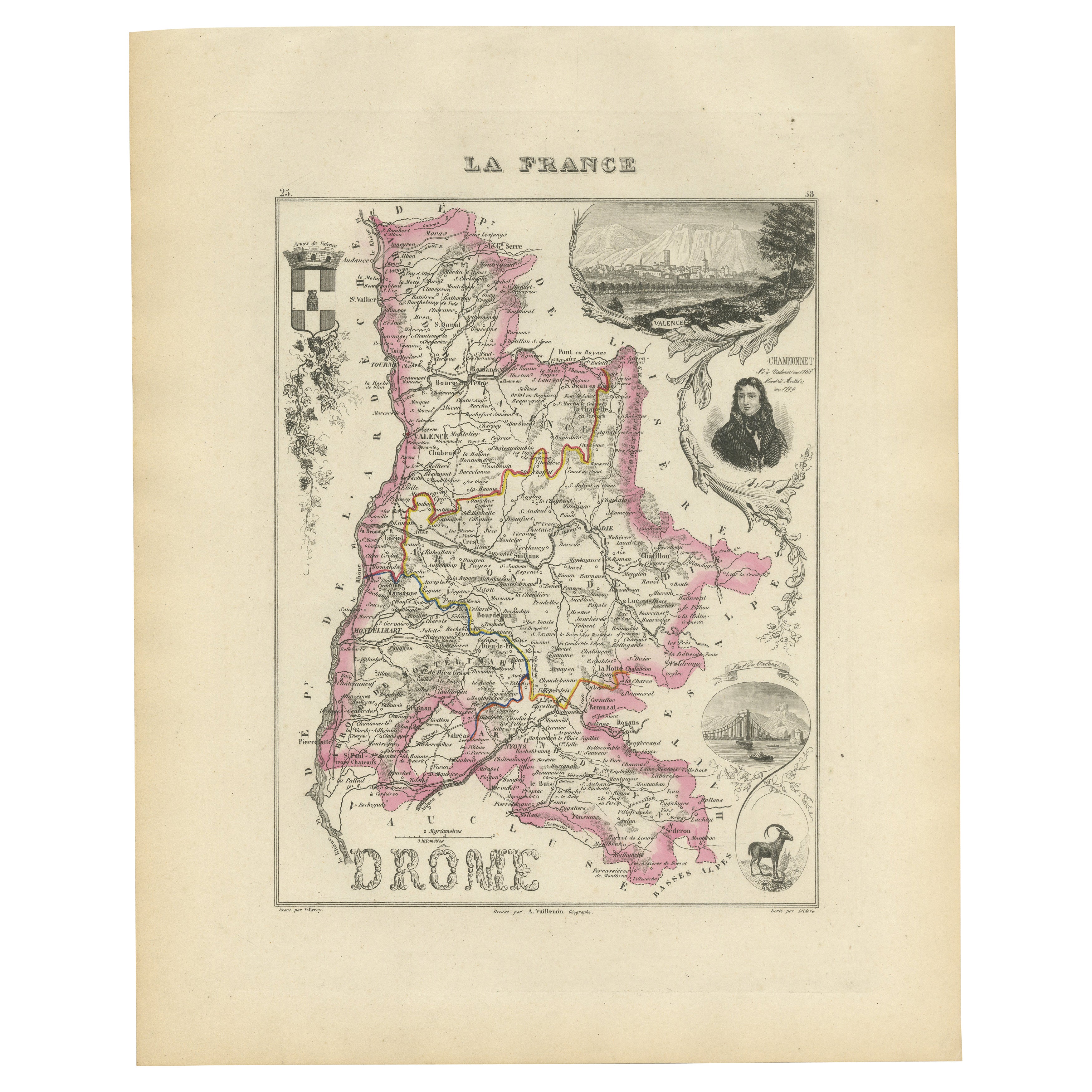
Map of Drôme France with Valence and Rhône Valley Wine Region, 19th Century
Map of Drôme France with Valence and Rhône Valley Wine Region, 19th Century
Description:
This beautifully engraved 19th-century map of the Drôme department in southeastern France wa...
Catégorie
Antiquités, Milieu du XIXe siècle, Français, Cartes
Matériaux
Papier
Map of Côtes-du-Nord France with Saint-Brieuc and Brittany Coastline, c.1850
Map of Côtes-du-Nord France with Saint-Brieuc and Brittany Coastline, 19th c
Description:
This elegant 19th-century map of Côtes-du-Nord, the historic name for what is now known as ...
Catégorie
Antiquités, Milieu du XIXe siècle, Français, Cartes
Matériaux
Papier

Map of Ardèche France with Annonay and Vineyards by Vuillemin, 19th c
Map of Ardèche France with Annonay and Vineyards by Vuillemin, 19th c
This beautifully engraved 19th-century map of Ardèche, a department in southeastern France, comes from Alexandr...
Catégorie
Antiquités, Milieu du XIXe siècle, Français, Cartes
Matériaux
Papier

Carte ancienne du Dordogne « France » de V. Levasseur, 1854
Carte ancienne intitulée "Dépt. de la Dordogne". Carte du département français de la Dordogne, France. Cette région est surtout connue pour sa production de Monbazillac, un vin blanc...
Catégorie
Antiquités, Milieu du XIXe siècle, Cartes
Matériaux
Papier
160 € Prix de vente
20 % de remise
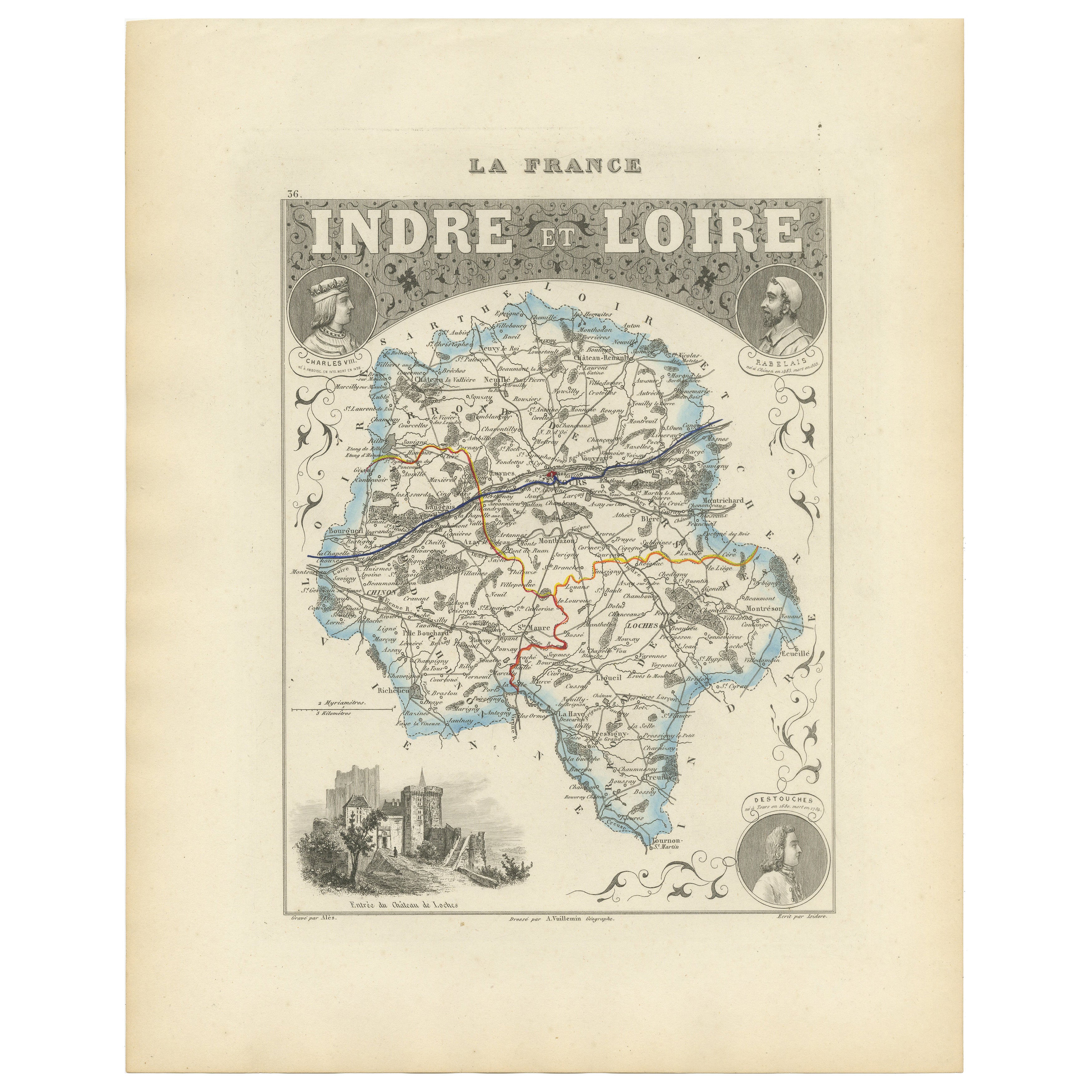
Antique French Map of Indre-et-Loire with Tours, Amboise, Chinon, 1800s
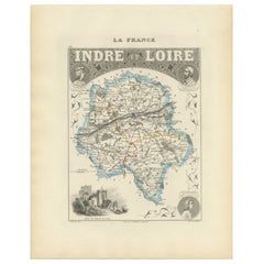
Carte ancienne de l'Indre-et-Loire, France par Vuillemin, 19ème siècle
Cette carte magnifiquement gravée illustre le département d'Indre-et-Loire, situé dans la région Centre-Val de...
Catégorie
Antiquités, Milieu du XIXe siècle, Français, Cartes
Matériaux
Papier
Suggestions
Carte Bonne de Poitou, Touraine et Anjou, France, Ric.a015, 1771
1771 Bonne carte du Poitou,
Touraine et Anjou, France
Ric.a015
1771 Carte de Potiou, Touraine et Anjou intitulée "Carte des Gouvernements D'Anjou et du Saumurois, de la Tour...
Catégorie
Antiquités, 17ème siècle, Inconnu, Cartes
Matériaux
Papier

Grande carte de France du 19ème siècle
Grande carte de France du 19e siècle.
Remarquable état de conservation, avec une patine d'usage agréable.
Récemment encadré.
France Circa 1874.
Catégorie
Antiquités, Fin du XIXe siècle, Français, Cartes
Matériaux
Lin, Papier

Saone et Loire, France. Carte ancienne d'un département français, 1856
Par Victor Levasseur
département de Saône et Loire", gravure sur acier avec contour original coloré à la main, 1856, de l'Atlas national illustré de Levasseur.
Le département français de la Saône et Lo...
Catégorie
XIXe siècle, Naturalisme, Estampes - Paysage
Matériaux
Gravure

Aube, France. Carte ancienne d'un département français, 1856
Par Victor Levasseur
département de l'Aube, gravure sur acier avec contour original coloré à la main, 1856, de l'Atlas national illustré de Levasseur.
Cette région de France est connue pour sa producti...
Catégorie
XIXe siècle, Naturalisme, Estampes - Paysage
Matériaux
Gravure

Lozere, France. Carte ancienne d'un département français, 1856
Par Victor Levasseur
département de la Lozère, gravure sur acier avec contour original coloré à la main, 1856, de l'Atlas national illustré de Levasseur.
Cette partie montagneuse isolée du Languedoc es...
Catégorie
XIXe siècle, Naturalisme, Estampes - Paysage
Matériaux
Gravure

L'Isere, France. Carte ancienne du département français de l'antiquité, 1856
Par Victor Levasseur
département de l'Isère, gravure sur acier avec contour original coloré à la main, 1856, de l'Atlas national illustré de Levasseur.
Cette région est connue pour sa production de Ble...
Catégorie
XIXe siècle, Naturalisme, Estampes - Paysage
Matériaux
Gravure
