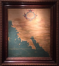
The 1564 Medici Danti Map of California
View Similar Items


Want more images or videos?
Request additional images or videos from the seller
1 of 5
The 1564 Medici Danti Map of California
$135,000List Price
About the Item
- Dimensions:Height: 44.625 in (113.35 cm)Width: 38.625 in (98.11 cm)
- Medium:
- Movement & Style:
- After:Fra Egnazio Danti (1536 - 1586)
- Period:
- Condition:
- Gallery Location:New York, NY
- Reference Number:1stDibs: LU1029066332
About the Seller
5.0
Recognized Seller
These prestigious sellers are industry leaders and represent the highest echelon for item quality and design.
Established in 1997
1stDibs seller since 2012
22 sales on 1stDibs
Typical response time: 5 hours
Authenticity Guarantee
In the unlikely event there’s an issue with an item’s authenticity, contact us within 1 year for a full refund. DetailsMoney-Back Guarantee
If your item is not as described, is damaged in transit, or does not arrive, contact us within 7 days for a full refund. Details24-Hour Cancellation
You have a 24-hour grace period in which to reconsider your purchase, with no questions asked.Vetted Professional Sellers
Our world-class sellers must adhere to strict standards for service and quality, maintaining the integrity of our listings.Price-Match Guarantee
If you find that a seller listed the same item for a lower price elsewhere, we’ll match it.Trusted Global Delivery
Our best-in-class carrier network provides specialized shipping options worldwide, including custom delivery.More From This Seller
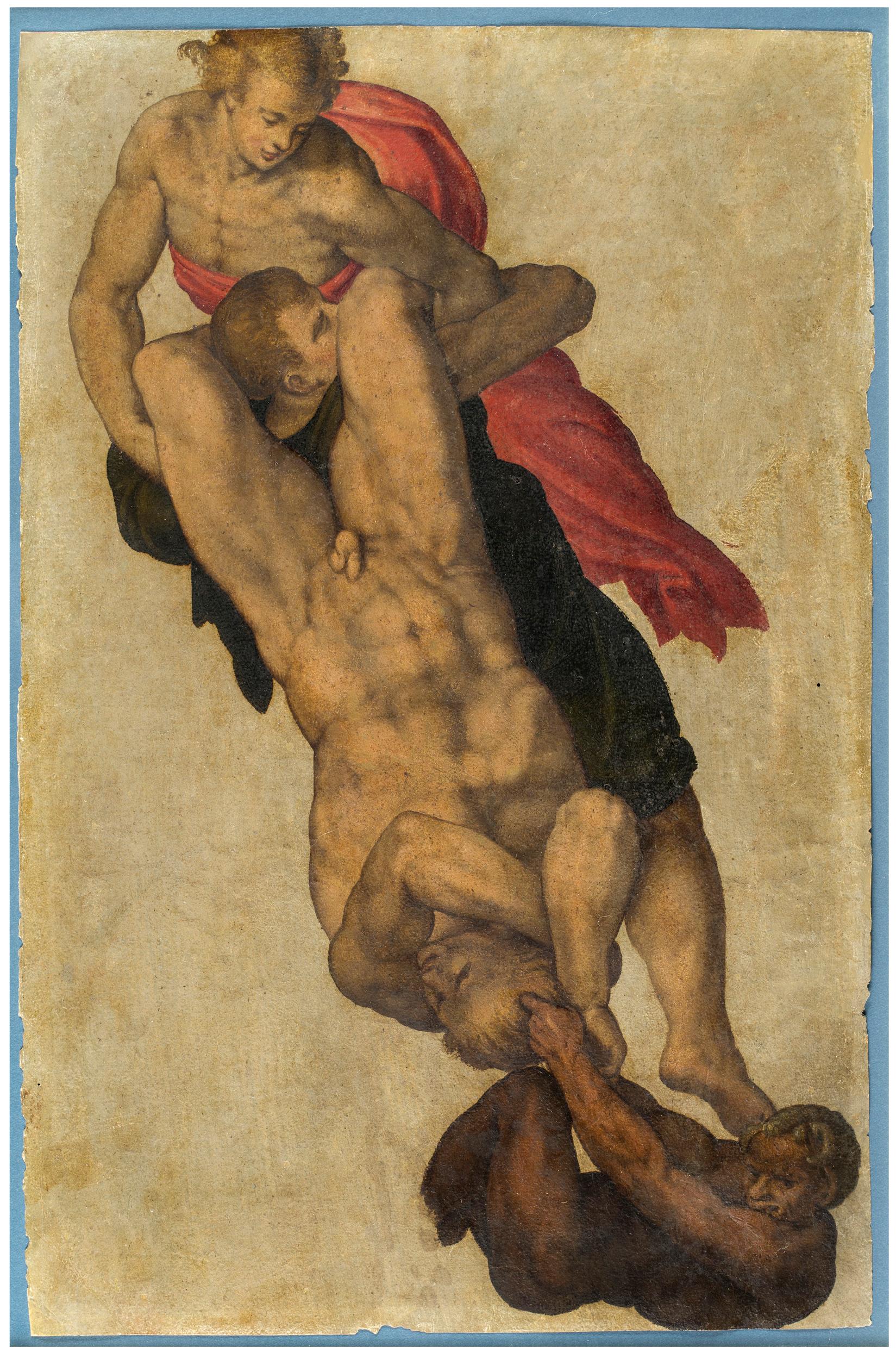
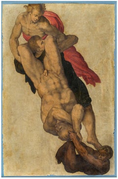
View AllStudy after Michelangelo’s “The Last Judgment”
By Michelangelo Buonarroti
Located in New York, NY
Italian School, 16th Century
Provenance:
Private Collection, New York
This intriguing drawing is a study by an anonymous 16th-century Italian artist after a vignette in Michelangelo’s fresco of The Last Judgement in the Sistine Chapel. The altar wall of the Sistine Chapel was already richly decorated when Pope Clement VII commissioned Michelangelo to paint his Last Judgment...
Category
16th Century Old Masters Figurative Drawings and Watercolors
Materials
Paper, Gouache
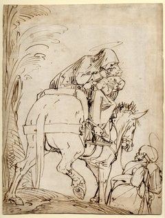
The Flight into Egypt
Located in New York, NY
Inscribed: 3. una Madonna che va in Egitto, verso, and Madonna che va in Egitto, recto
Provenance:
Private Collection, UK, since 1999
This expressive and boldly executed drawing is the work of Luca...
Category
16th Century Old Masters Figurative Drawings and Watercolors
Materials
Chalk, Ink, Pen, Paper
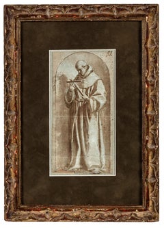
Study of a Franciscan Saint, probably San Diego de Alcalá
Located in New York, NY
Provenance: Ivan E. Phillips, Montreal and New York, until 2023.
The brothers Bartolomé Carducho and Vicente Carducho, both born and trained in Florence, settled in Spain where they made their careers. Vicente worked on numerous commissions for both the church and the Spanish court...
Category
17th Century Old Masters Drawings and Watercolor Paintings
Materials
Paper, Chalk, Ink, Pen
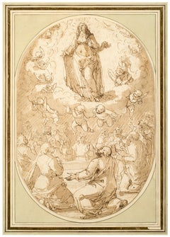
The Assumption of the Virgin
Located in New York, NY
Provenance:
Unidentified collector’s mark “D.G.R,” lower right (Lugt 757b)
Wilhelm Suida (1877–1959), New York; by descent to:
Robert L. and Bertina Suida Manning, New York, until 1996
Private Collection, USA
This impressive drawing of the Assumption of the Virgin is the work of the Genoese artist Giovanni Battista Paggi. The son of a nobleman, Paggi received a humanist education and was a self-taught artist. According to Paggi’s first biographer, Raffaele Soprani, it was only after encountering Luca...
Category
16th Century Old Masters Figurative Drawings and Watercolors
Materials
Paper, Ink, Pen
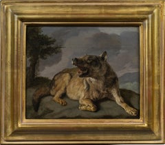
A Wolf
Located in New York, NY
Provenance:
The Marchesi Strozzi, Palazzo Strozzi, Florence
Sale, Christie’s, London, May 20, 1993, lot 315, as by Carl Borromaus Andreas Ruthart...
Category
17th Century Old Masters Animal Paintings
Materials
Canvas, Paper, Oil
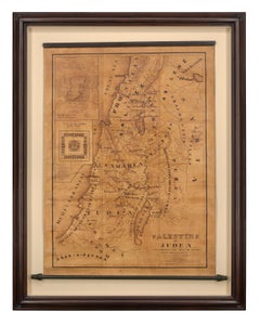
Map of Palestine or Judea, Illustrating the History of the New Testament
By Rev. Nathan B. Rogers
Located in New York, NY
Pen and ink on paper, laid down on canvas, mounted to wooden scroll bars
Signed and dated lower right: “Drawn by N. B. Rogers August. 1843”
Inscribed with an ownership inscription on the verso: Rev. E. D. Daniels, Palmer, Mass.
Provenance:
Rev. Eugene Davidson Daniels, Palmer, Massachusetts, 1871
This extraordinary manuscript map is a rare survivor of the devotional and educational culture of New England in the first half of the nineteenth century. Although at first glance resembling a large-scale engraving or printed publication, this precisely rendered wall map was entirely drawn by hand, the product of meticulous research by a minister working in isolation in rural Maine. The map shows New Testament era cities, towns, tribal areas, and political borders as well as physical features such as rivers, lakes, mountains, and hills (indicated by half-tone cross-hatching). On to this geographically accurate rendering of the Holy Land, Rogers has located and inscribed significant locales mentioned in the Gospels and has annotated these places with relevant citations from the Bible. He further records these by plotting the travels of Jesus on what resemble a series of trails across the Holy Land. Each is distinguished by a different pattern of dots and dashes – correlated to an explanatory table at the lower right. From this we know that these lines document the “Flight into Egypt and return,” “Travels of Christ from Nazareth to Jerusalem and return,” “Travels from the commencement of his Ministry to the first Passover,” “Travels from the first and the second Passover,” “Travels from Jerusalem to Galilee after the 2nd Passover,” and “Travels from the third Passover to the Crucifixion.”
An inset map of “Jerusalem...
Category
19th Century More Art
Materials
Canvas, Paper, Ink, Pen
You May Also Like
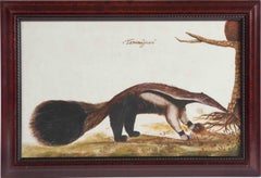
Animal painting of a 'Tamanuâguacû (Ant-eater)' late 17th/18th century, Brazil
Located in Amsterdam, NL
Follower of Zacharias Wagener (1614-1688)
Tamanuâguasû (Giant Anteater)
On Italian 17th or 18th-century paper, H. 28 x W. 43.5 cm
The present painting is a copy after Wagener’s painting of the anteater, Tamanduá-bandeira, which is illustrated in his “Thier Buch”, with 109 drawings of Brazilian fish, birds and mammals, published in Amsterdam c. 1641, in German.
Zacharias Wagener, or Wagenaer in Dutch, (Dresden 1614 – Amsterdam 1668) was a real adventurer who became Opperhoofd on Deshima and Governor of the Cape of Good Hope in the service of the VOC. During the Thirty-Year War in Germany Wagener tried his luck in Amsterdam where he worked for the map-maker Willem Blaeu. In 1634 he joined the WIC and left for Dutch Brazil where he worked as writer and painter, together with Frans Post...
Category
Early 18th Century Old Masters Animal Drawings and Watercolors
Materials
Paper, India Ink, Gouache
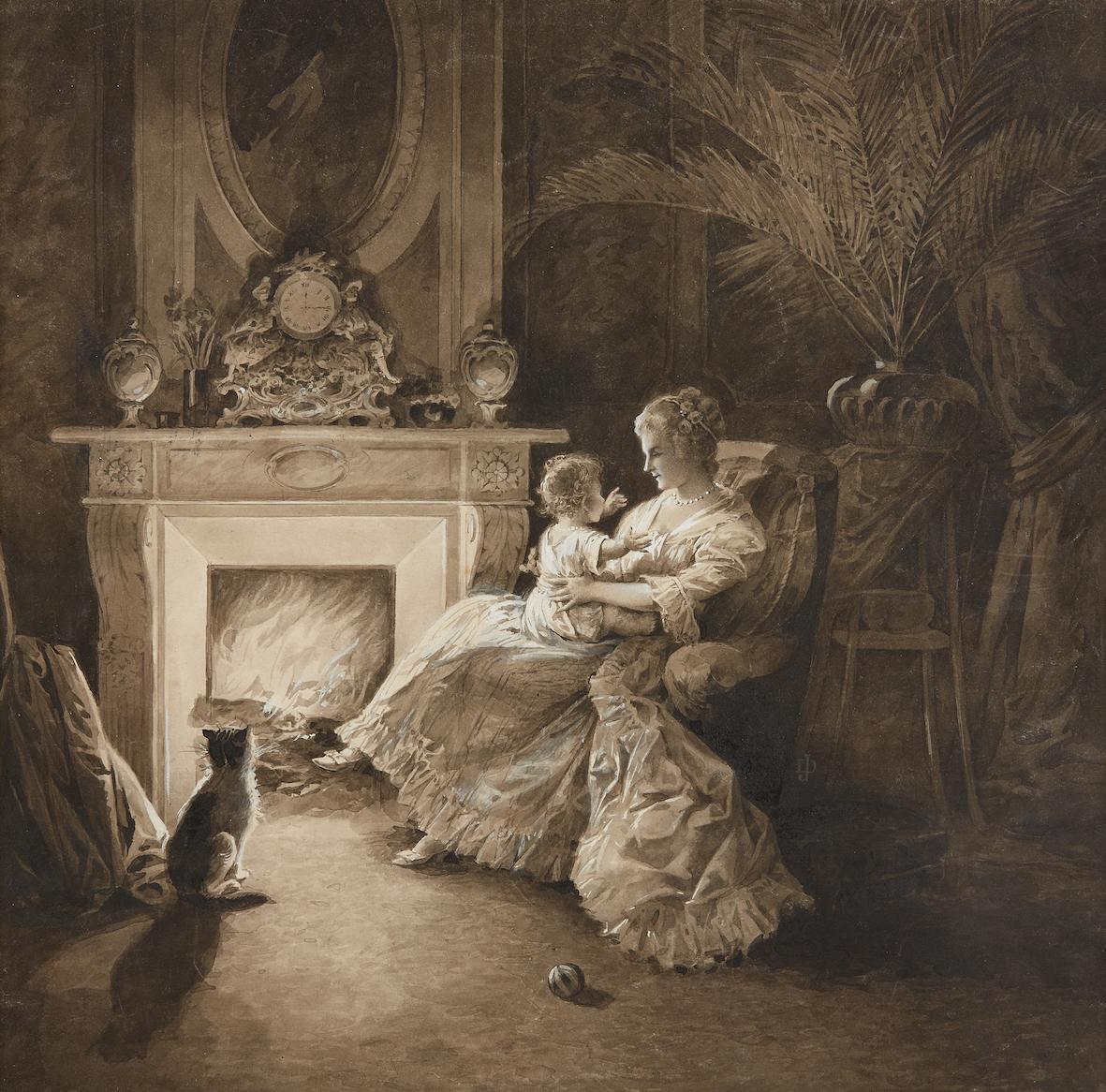
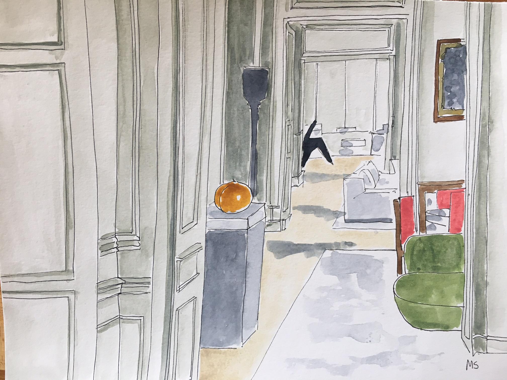
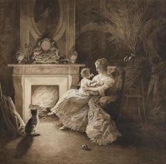
By the Fireside
Located in Paris, Île-de-France
Edouard Bernard DEBAT-PONSAN
(Toulouse 1847 – 1913 Paris)
By the Fireside
Ink, wash, and gouache on paper
15 3/8 x 15 3/4 in
39 x 40 cm
Monogrammed lower right “DP”
Provenance
Private collection, France
This work is a preparatory study related to the artist’s painting Before the Ball...
Category
Late 19th Century Old Masters Interior Drawings and Watercolors
Materials
Ink, Gouache
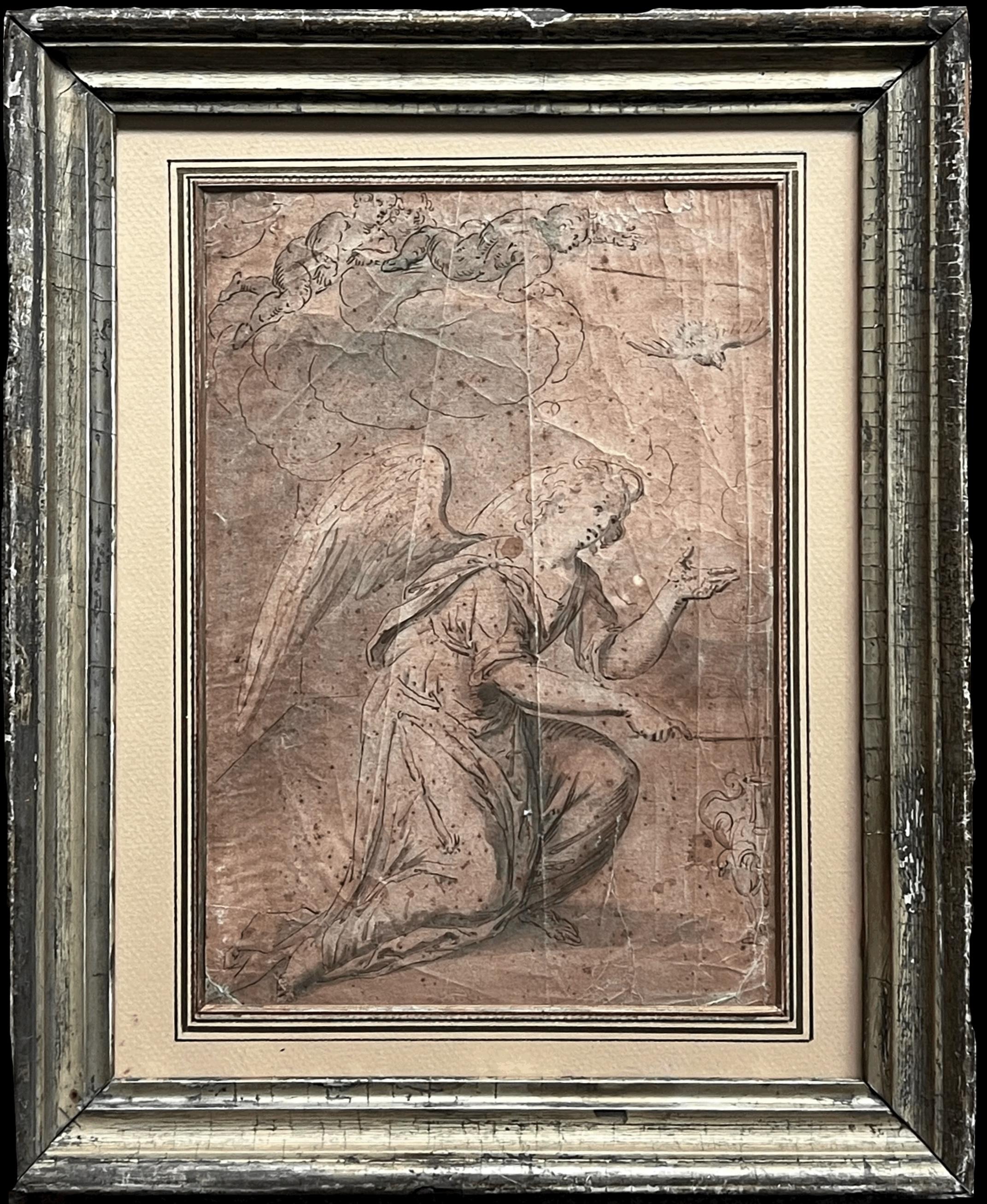
Fine 17th Century Dutch Old Master Ink Drawing & Wash Visiting Angel
Located in Cirencester, Gloucestershire
The Angel
Dutch Old Master, 17th century
wash with pencil drawing on artist paper, framed
Glass covering
framed: 14 x 12.5 inches
board: 12.5 x 9.5 inches
condition: age related crea...
Category
17th Century Old Masters Figurative Paintings
Materials
Gouache, Ink

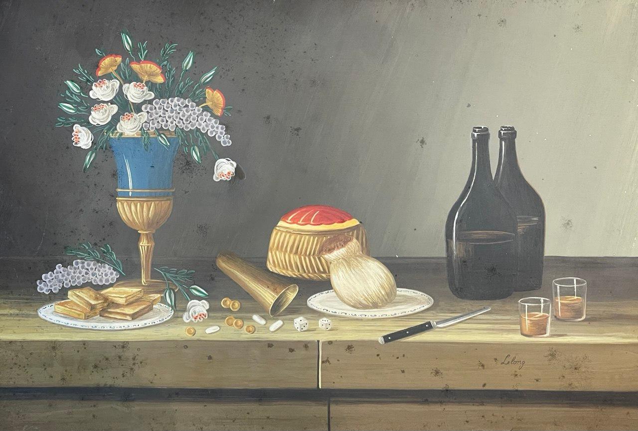
Still Life
Located in Edinburgh, GB
This drawing by Johann Rudolf Feyerabend, known as Lelong, is a finely executed still life that captures a rustic yet elegant composition. The detailed rendering of objects—such as t...
Category
Late 18th Century Old Masters Still-life Drawings and Watercolors
Materials
Paper, Gouache

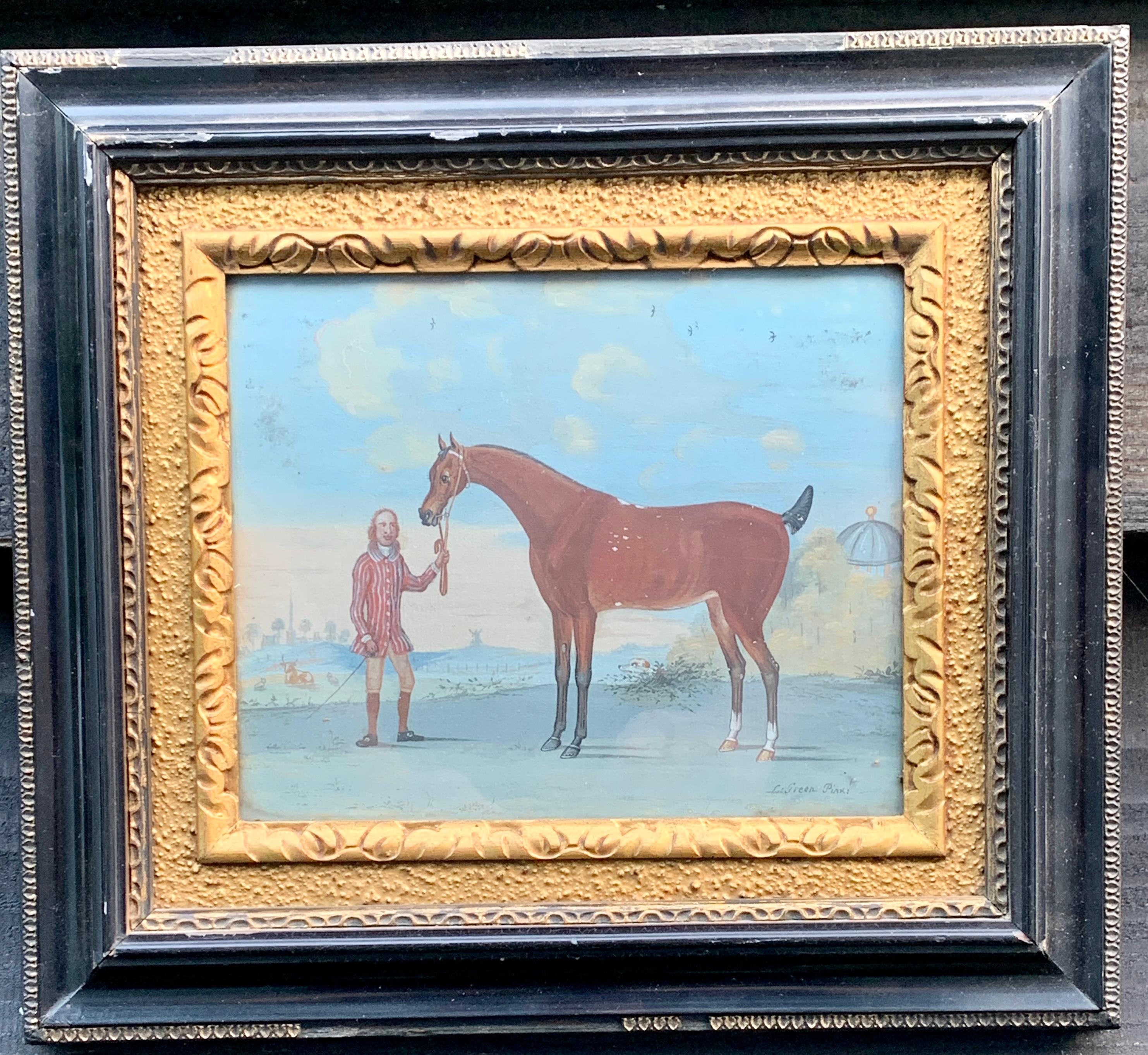
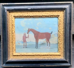
18th century English scene of a groom with a horse in a landscape
Located in Woodbury, CT
Wonderful 18th century English gouache on paper of a 18th century English scene of a groom with a horse in a landscape.
One of a set of five all framed in Hogarth frames.
L.Green ...
Category
1780s Old Masters Figurative Paintings
Materials
Paper, Gouache
$2,360 Sale Price
20% Off
Free Shipping
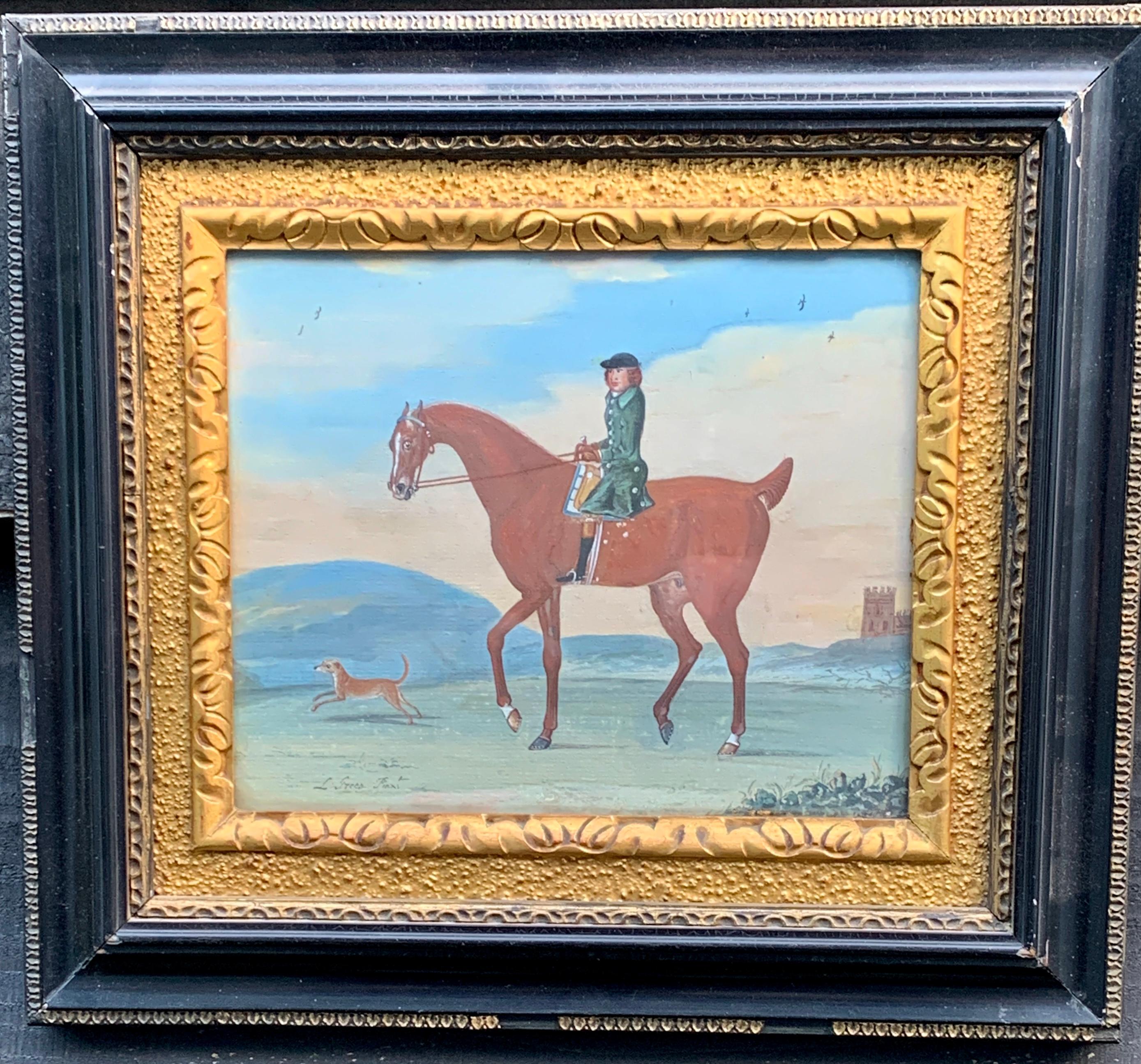
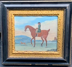
18th century English scene of a man on his horse with his dog in a landscape
Located in Woodbury, CT
Wonderful 18th century English gouache on paper of a 18th century English scene of a man on his horse with his dog in a landscape
One of a set of five all framed in Hogarth frames. ...
Category
1780s Old Masters Figurative Paintings
Materials
Paper, Gouache
$2,360 Sale Price
20% Off
Free Shipping
Recently Viewed
View AllMore Ways To Browse
Mid Century Pen And Ink
Costume Design Watercolor
Francis Bacon Signed
Watercolor Soldier
Woman Charcoal Drawing
Antique Technical Drawings
Pen And Ink Drawings With Color
Watercolor Car
Vintage Pencil Drawing
Male Nude Watercolor
California Mid Century Watercolor
Montmartre Drawing
1930 Architectural Drawings
Ancient Chinese Paper
Sex Drawings
Bust Drawing
Antique Pen And Ink Drawings
Ireland Watercolor