Charles Magnus Maps
to
1
1
1
1
1
1
1
1
1
1
104
63
28
24
Creator: Charles Magnus
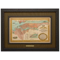
1855 "New-York City & County Map" by Charles Magnus
By Charles Magnus
Located in Colorado Springs, CO
This is a beautiful hand-colored map titled “New York City & County Map with Vicinity entire Brooklyn, Williamsburgh, Jersey City &c.” The work was published in 1855 by Charles Magnu...
Category
1850s American Antique Charles Magnus Maps
Materials
Paper
Related Items
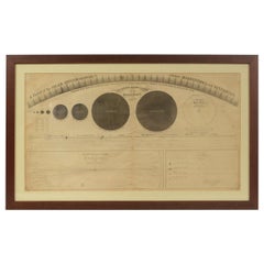
1855 Astronomical Plate of Distance of the Planets by FJ Huntington New York
Located in Milan, IT
Plate of the distance of the planets “Entered according to Act of Congress in the year 1855 by F.J. Huntington in the Clerk's Office of the District Court of the United States for th...
Category
1850s American Antique Charles Magnus Maps
Materials
Glass, Wood, Paper
$1,441
H 19.61 in W 32.21 in D 0.6 in
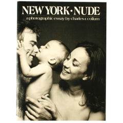
New York Nude, a Photographic Essay by Charles R. Collum
By Charles R. Collum
Located in valatie, NY
New York Nude, a photographic essay by Charles R. Collum. NY: Watson-Guptill publications. First edition hardcover with dust jacket, 1981. 128 pp. A collection of nude portraits capt...
Category
20th Century American Charles Magnus Maps
Materials
Paper
Vintage Oversized New York City Lower Manhattan 1840s Map Print
Located in Dayton, OH
Vintage late 20th century reproduction print of New York City featuring lower Manhattan in 1840.
Category
Late 20th Century Victorian Charles Magnus Maps
Materials
Paper
$800 Sale Price
20% Off
H 61 in W 49 in D 1 in
Rare Original Map of New Amsterdam (New York) – “Restitutio”, ca. 1674 –
Located in Dronten, NL
An exceptionally rare and original 17th-century engraving of New Amsterdam, now New York City, published by the renowned Amsterdam cartographer Carel (Carolus) Allard around 1674. Kn...
Category
17th Century Dutch Antique Charles Magnus Maps
Materials
Paper
$24,950
H 20.16 in W 23.35 in D 0.4 in
Vintage Wall Chart New York City Urban Map, USA 1950s
Located in Stockholm, SE
A classical wall chart showing a map of the city of New York. published by Westermann and with English text. Used as teaching material in Swedish schools. colorful print on paper rei...
Category
1950s German Vintage Charles Magnus Maps
Materials
Metal
Five Original New York City Subway Straphangers on Pole
Located in Stamford, CT
Five original New York City subway straphangers mounted on the original pole. The cast iron and porcelain 'straphanger' or pivoting grab handle was made by the Rico manufacturing com...
Category
Early 20th Century American Charles Magnus Maps
Materials
Iron
Antique Map of Preble County 'Ohio' by Titus, 1871
Located in Langweer, NL
Antique map titled 'Outline Plan of Prble County, Ohio'. Original antique map of Preble County, Ohio. This map originates from 'Atlas of Preble County Ohio' by C.O. Titus. Published ...
Category
Late 19th Century Antique Charles Magnus Maps
Materials
Paper
$288 Sale Price
20% Off
H 14.97 in W 12.41 in D 0.02 in
The Timeline History of New York City Book
Located in North Hollywood, CA
The Timeline History of New York City Book
Playne Books Ltd;
Worth Press Ltd;
Hardcover book.
A hands-on presentation of New York's history feat...
Category
21st Century and Contemporary American Expressionist Charles Magnus Maps
Materials
Paper
1864 Johnson's Map of New York State with City Insets
Located in Langweer, NL
Title: 1864 Johnson's Map of New York State with City Insets
Description: This 1864 map, titled "Johnson's New York," was published by Johnson and Ward and features a detailed depic...
Category
1860s Antique Charles Magnus Maps
Materials
Paper
$269 Sale Price
20% Off
H 17.13 in W 26.78 in D 0 in
Large Antique Map of New York State with Inset Maps
Located in Langweer, NL
Antique map titled 'Johnson's New York' Large map of New York State. With insets of Albany, Oswego, Buffalo, Rochester, Syracuse, Troy and NYC. Published by Johnson and Browning, 186...
Category
Mid-19th Century Antique Charles Magnus Maps
Materials
Paper
$470 Sale Price
20% Off
H 18.04 in W 26.58 in D 0.02 in
Large Antique Map of England Hand Colored by Counties
Located in Langweer, NL
Antique map titled 'A New Map of England from the latest Authorities'. Large map of England, hand colored by counties. Published by John Cary, 1821.
John Cary (1755-1835) was a B...
Category
Early 19th Century Antique Charles Magnus Maps
Materials
Paper
$518 Sale Price
20% Off
H 21.46 in W 25.67 in D 0.02 in
Antique Map of Monroe County 'Ohio' by Titus '1871'
Located in Langweer, NL
Antique map titled 'Monroe'. Original antique map of Monroe, Ohio. This map originates from 'Atlas of Preble County Ohio' by C.O. Titus. Published 1871.
Category
Late 19th Century Antique Charles Magnus Maps
Materials
Paper
$240 Sale Price
20% Off
H 14.97 in W 12.41 in D 0.02 in
Charles Magnus maps for sale on 1stDibs.
Charles Magnus maps are available for sale on 1stDibs. These distinctive items are frequently made of paper and are designed with extraordinary care. There are many options to choose from in our collection of Charles Magnus maps, although black editions of this piece are particularly popular. If you’re looking for additional options, many customers also consider maps by and Rand McNally & Co.. Prices for Charles Magnus maps can differ depending upon size, time period and other attributes — on 1stDibs, these items begin at $9,500 and can go as high as $9,500, while a piece like these, on average, fetch $9,500.


