Maison Delamarche Maps
to
1
1
1
1
1
1
1
1
1
1
104
63
28
24
Creator: Maison Delamarche
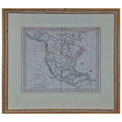
America "Amérique Septentrionale": A 19th Century French Map by Delamarche
By Maison Delamarche 1
Located in Alamo, CA
This framed mid 19th century map of North America entitled "Amérique Septentrionale" by Felix Delamarche was published in Paris in 1854 by Quay de l'Horloge du Palais, avec les Carte...
Category
Mid-19th Century American Other Antique Maison Delamarche Maps
Materials
Paper
Related Items
Antique Map of Africa by Delamarche, 1806
Located in Langweer, NL
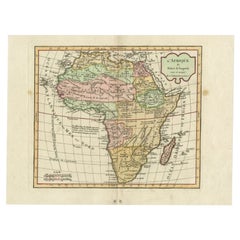
Antique map titled 'L'Afrique'.
Decorative map of Africa by Robert de Vaugondy, revised and published by Delamarche. Source unknown, to be determined.
Artists and Engravers: Charl...
Category
19th Century Antique Maison Delamarche Maps
Materials
Paper
Antique Map of South America by Johnston '1909'
Located in Langweer, NL
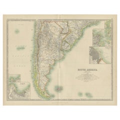
Antique map titled 'South America, Southern Sheet'. Depicting Chile, Argentina, Brazil, Patagonia, the Falkland Island and more. With inset maps of Valparaiso, Rio de Janeiro and Bue...
Category
Early 20th Century Maison Delamarche Maps
Materials
Paper
$239 Sale Price
20% Off
H 19.49 in W 24.41 in D 0.02 in
Antique Map of North America by Lapie '1842'
Located in Langweer, NL
Antique map titled 'Carte de l'Amérique septentrionale'. Map of North America, with an inset map of the Aleutian Islands. This map originates from 'Atlas universel de géographie anci...
Category
Mid-19th Century Antique Maison Delamarche Maps
Materials
Paper
Antique Map of North America by Levasseur '1875'
Located in Langweer, NL
Antique map titled 'Carte générale de l'Amérique Septentrionale'. Large map of North America. This map originates from 'Atlas de Géographie Modern...
Category
Late 19th Century Antique Maison Delamarche Maps
Materials
Paper
$479 Sale Price
20% Off
H 18.71 in W 24.02 in D 0.02 in
1847 Amerique Septentrionale Framed Map
Located in Stamford, CT
1847 Amerique Septentrionale Framed Map Illustrated by Raimond Bonheur. As found framed condition.
Category
1840s American American Classical Antique Maison Delamarche Maps
Materials
Glass, Wood, Paper
Antique Map of North America by Johnson, '1872'
Located in Langweer, NL
Antique map titled 'Johnson's North America'. Original map of North America, with an inset map of the Hawaiian group or Sandwich Islands. This map originates from 'Johnson's New Illu...
Category
Late 19th Century Antique Maison Delamarche Maps
Materials
Paper
$383 Sale Price
20% Off
H 26.58 in W 18.12 in D 0.02 in
Antique Map of South America by J. Cook, 1775
Located in Langweer, NL
Antique map titled 'Kaart van het Zuidlyk Eind van Amerika'. Map of the sourthern part of South America, focusing on Cook's tracks around the Cape Horn and T...
Category
Mid-18th Century Antique Maison Delamarche Maps
Materials
Paper
Antique Map of North America by A & C. Black, 1870
Located in Langweer, NL
Antique map titled 'North America'. Original antique map of North America. This map originates from ‘Black's General Atlas of The World’. Published by A & C. Black, 1870.
Category
Late 19th Century Antique Maison Delamarche Maps
Materials
Paper
$263 Sale Price
20% Off
H 23.63 in W 17.52 in D 0.02 in
Antique Map of North America by Lowry '1852'
Located in Langweer, NL
Antique map titled 'North America'. Original map of North America. This map originates from 'Lowry's Table Atlas constructed and engraved from the...
Category
Mid-19th Century Antique Maison Delamarche Maps
Materials
Paper
19th Century French Émile Deyrolle Anatomical Lithograph Poster
Located in London, GB
Émile Deyrolle Anatomical poster
A wonderfully rare and decorative curio medical French (Paris) original lithograph on board anatomical poster in ...
Category
1880s French Early Victorian Antique Maison Delamarche Maps
Materials
Paper
Antique Map of South America by W. G. Blackie, 1859
Located in Langweer, NL
Antique map titled 'South America'. Original antique map of South America. This map originates from ‘The Imperial Atlas of Modern Geography’. Published by W. G. Blackie, 1859.
Category
Mid-19th Century Antique Maison Delamarche Maps
Materials
Paper
$239 Sale Price
20% Off
H 21.26 in W 14.57 in D 0.02 in
Mid-19th Century American Stationary with Manuscript Letter, Signed 1854
Located in Langweer, NL
American stationery with in the top the following text printed:
E pluribus unum – Latin for "Out of many, one" (also translated as "One out of many" or "One from many") – is a traditional motto of the United States, appearing on the Great Seal along with Annuit cœptis (Latin for "he approves the undertaking [lit. 'things undertaken']") and Novus ordo seclorum (Latin for "New order of the ages"); its inclusion on the seal was approved by an Act of Congress in 1782. While its status as national motto was for many years unofficial, E pluribus unum was still considered the de facto motto of the United States from its early history. Eventually, the United States Congress passed an act (H. J. Resolution 396), adopting "In God We Trust" as the official motto in 1956.
The thirteen letters of E PLURIBUS UNUM makes its use symbolic of the thirteen original states like the thirteen stripes on the US flag. The meaning of the phrase originates from the concept that out of the union of the original Thirteen Colonies emerged a new single nation. It is emblazoned across the scroll and clenched in the eagle's beak on the Great Seal of the United States. (Source: wikipedia)
Text below the portraits: "The Presidents of our Great Republic."
Letter paper with hand-colored engraving showing the portraits of the 14 presidents of the USA from George Washington up to Franklin Pierce...
Category
1850s Antique Maison Delamarche Maps
Materials
Paper
$431 Sale Price
20% Off
H 11.03 in W 8.86 in D 0 in
Maison Delamarche maps for sale on 1stDibs.
Maison Delamarche maps are available for sale on 1stDibs. These distinctive items are frequently made of paper and are designed with extraordinary care. There are many options to choose from in our collection of Maison Delamarche maps, although gray editions of this piece are particularly popular. Prices for Maison Delamarche maps can differ depending upon size, time period and other attributes — on 1stDibs, these items begin at $975 and can go as high as $975, while a piece like these, on average, fetch $975.


