Michel Etienne Turgot Maps
to
1
1
1
1
1
1
1
1
1
1
1
1
104
59
28
21
Creator: Michel Etienne Turgot
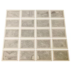
French 18th Century Map of Paris by Turgot
By Michel Etienne Turgot
Located in Los Angeles, CA
Complete Paris map set of etchings by Turgot. This printing is from the 1960s and have warm natural color to the paper. Frame each individually to your liking. The overall dimension ...
Category
1960s French French Provincial Vintage Michel Etienne Turgot Maps
Materials
Paper
$4,500 / set
Related Items
Plan of Paris, France, by A. Vuillemin, Antique Map, 1845
Located in Colorado Springs, CO
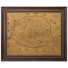
This large and detailed plan of Paris was published by Alexandre Vuillemin in 1845. The map conveys a wonderful amount of information and is decorated throughout with pictorial vigne...
Category
1840s American Antique Michel Etienne Turgot Maps
Materials
Paper
Four 18th Century Engraved and Hand-Colored Maps by Weigel
By Christoph Weigel
Located in Copenhagen, K
Small collection of four engraved maps of Italy, Balkan and of Central Asia.
Two are of Italy, one Corsica and Northern Italy and the other of the Southern Italian boot...
Category
18th Century German Antique Michel Etienne Turgot Maps
Materials
Paper
$450 / item
H 15.75 in W 18.12 in D 0.79 in
French Furniture of the 18th Century
By Pierre Verlet
Located in valatie, NY
French Furniture of the 18th century by Pierre Verlet and Penelope Hunter-Stiebel (Translator). University Press of Virginia, Charlottesville, VA, 1991. First edition thus hardcover ...
Category
1990s American Michel Etienne Turgot Maps
Materials
Paper
Saint-Domingue (French Section): 18th Century Map from France Militaire Series
Located in Langweer, NL
This map is titled "St. Domingue (Partie Française)" and is part of the France Militaire series. It focuses on the French portion of Saint-Domingue, which corresponds to modern-day H...
Category
1790s Antique Michel Etienne Turgot Maps
Materials
Paper
$114 Sale Price
20% Off
H 7.17 in W 10.83 in D 0 in
18th Century French Miniature Chest of Chestnut
Located in High Point, NC
18th century rare French carpenter's sample made of chestnut wood. It has three drawers with each a kings wood inlay central design. Lovely pegged construction, supported on a lovely...
Category
18th Century French Louis XV Antique Michel Etienne Turgot Maps
Materials
Chestnut
Beautiful 17th Century Map of Paris and Isle de France by Templeux, c.1650
Located in Langweer, NL
Map of Isle de France by D. de Templeux, ca. 1650, Hand-Colored and Decorative
This richly detailed antique map titled *Le Gouvernement de L'Isle de France* was engraved by Daniel d...
Category
1650s Antique Michel Etienne Turgot Maps
Materials
Paper
$761
H 18.9 in W 22.45 in D 0.01 in
18th Century French Reliquaries
Located in Dallas, TX
Set of three 18th century French Reliquaries.
Carved wood with metal repousse over the wood
Each piece contains the original Latin pages framed in o...
Category
Early 18th Century French French Provincial Antique Michel Etienne Turgot Maps
Materials
Metal
French 18th Century Glove
Located in Round Top, TX
A very intriguing 18th century glove in wood and leather with iron protrusions. One's hand is inserted into the glove with positions for all fingers - like a baseball glove. The orig...
Category
Mid-18th Century French Antique Michel Etienne Turgot Maps
Materials
Iron
18th Century Map of French Pyrenees Region of France
Located in Haddonfield, NJ
An antique map titled "Principatus Benearnia, La Principaute De Bearn" created by the renowned Dutch cartographer Willem Janszoon Blaeu.
It depicts the Principality of Bearn, a histo...
Category
1880s Danish Baroque Antique Michel Etienne Turgot Maps
Materials
Wood, Paper
Map of Saint Helena Island: Early 18th-Century Copper Engraving by F. Bernard
Located in Langweer, NL
Map of Saint Helena Island: Early 18th-Century Copper Engraving by F. Bernard
This rare and beautifully detailed copper engraving of Saint Helena Island dates from around 1722 and...
Category
1720s Antique Michel Etienne Turgot Maps
Materials
Paper
$142 Sale Price
20% Off
H 6.23 in W 5.12 in D 0.01 in
Antique 18th Century Map of the Province of Pensilvania 'Pennsylvania State'
Located in Philadelphia, PA
A fine antique of the colony of Pennsylvania.
Noted at the top of the sheet as a 'Map of the province of Pensilvania'.
This undated and anonymous map is thought to be from the Gentleman's Magazine, London, circa 1775, although the general appearance could date it to the 1760's.
The southern boundary reflects the Mason-Dixon survey (1768), the western boundary is placed just west of Pittsburgh, and the northern boundary is not marked.
The map has a number of reference points that likely refer to companion text and appear to be connected to boundaries. The western and southern boundaries are marked Q, R, S, for example. A diagonal line runs from the Susquehanna R to the Lake Erie P. A broken line marked by many letters A, B, N, O, etc., appears in the east.
There are no latitude or longitude markings, blank verso.
Framed in a shaped contemporary gilt wooden frame and matted under a cream colored matte.
Bearing an old Graham Arader Gallery...
Category
18th Century British American Colonial Antique Michel Etienne Turgot Maps
Materials
Paper
$1,250
H 10.25 in W 13.25 in D 0.5 in
18th Century Map of the Southern Balkans by Giovanni Maria Cassini
By Giovanni Maria Cassini
Located in Hamilton, Ontario
18th century map by Italian engraver Giovanni Maria Cassini (Italy 1745-1824).
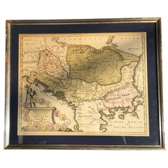
Map of the Southern Balkans: Rome. Hand colored and copper engraved print done in the year 1788. It in...
Category
18th Century Italian Antique Michel Etienne Turgot Maps
Materials
Paper
$795 Sale Price
36% Off
H 20.75 in W 25.5 in D 0.1 in
Previously Available Items
Turgot's 1739 "Plan de Paris"
By Michel Etienne Turgot
Located in Stamford, CT
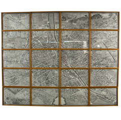
A stunning 1950's copy ( 117/1000 ) of Turgot's 1739 "Plan de Paris". This remarkable map shows the whole of 18th century Paris and offers a wonderful pe...
Category
18th Century and Earlier French Antique Michel Etienne Turgot Maps
Materials
Oak, Paper
Michel Etienne Turgot maps for sale on 1stDibs.
Michel Etienne Turgot maps are available for sale on 1stDibs. If you’re looking for additional options, many customers also consider maps by Willem Blaeu, J. Migeon, and F. Valentijn.


