Bartele Gallery Furniture
to
13,186
16,671
16,670
1
1
6,074
9,337
1,259
1
691
111
5
141
9
59
56
2
4
16,642
18
14
8
3
1,456
453
449
237
217
16,671
16,671
16,671
104
95
80
75
59
Item Ships From: Europe
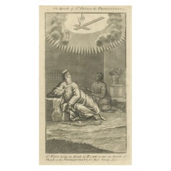
St. Paul to Philippians Engraving – Paul in Bonds Writing Epistle c.1735
Located in Langweer, NL
St. Paul to Philippians Engraving – Paul in Bonds Writing Epistle c.1735
Description:
This evocative antique engraving titled “The Epistle of St. Paul to the Philippians” depicts th...
Category
Antique 1730s English Prints
Materials
Paper
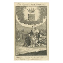
Paul to Timothy Engraving – St. Paul Foretells Death & Martyrdom c.1735
Located in Langweer, NL
Paul to Timothy Engraving – St. Paul Foretells Death & Martyrdom c.1735
Description:
This powerful antique engraving titled “The II Epistle of St. Paul to Timothy” depicts the Apost...
Category
Antique 1730s English Prints
Materials
Paper
Epistle to the Hebrews Engraving – Paul, Law & Gospel Allegory c.1735
Located in Langweer, NL
Epistle to the Hebrews Engraving – Paul, Law & Gospel Allegory c.1735
Description:
This fascinating antique engraving titled “The Epistle of Paul the Apostle to the Hebrews – The La...
Category
Antique 1730s English Prints
Materials
Paper
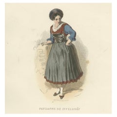
Bavarian Peasant Woman Print Iffeldorf Germany 1853 by Compte-Calix – Lithograph
Located in Langweer, NL
Bavarian Peasant Woman Print Iffeldorf Germany 1853 by Compte-Calix – Hand-Colored Lithograph
This charming antique print depicts a peasant woman (Paysanne) from Iffeldorf in Bavari...
Category
Antique Mid-19th Century French Prints
Materials
Paper
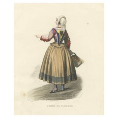
Sardinian Woman – Ploaghe Italy, Compte-Calix Hand-Colored Print 1853
Located in Langweer, NL
Sardinian Woman Print Ploaghe Italy 1853 by Compte-Calix – Hand-Colored Lithograph
This elegant antique print depicts a woman from Ploaghe in Sardinia, Italy (Femme de Ploaghe), in ...
Category
Antique Mid-19th Century French Prints
Materials
Paper
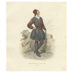
Sardinian Butcher Print Cagliari Italy 1853 by Compte-Calix – Hand-Colored Litho
Located in Langweer, NL
Sardinian Butcher Print Cagliari Italy 1853 by Compte-Calix – Hand-Colored Lithograph
This impressive antique print depicts a butcher (Boucher) from Cagliari in Sardinia, Italy, in ...
Category
Antique Mid-19th Century French Prints
Materials
Paper
Sardinian Man – Bosa Italy, Compte-Calix Hand-Colored Print 1853
Located in Langweer, NL
Sardinian Man Costume Print Bosa Italy 1853 by Compte-Calix – Hand-Colored Lithograph
This characterful antique print depicts a man from Bosa in Sardinia, Italy, wearing traditional...
Category
Antique Mid-19th Century French Prints
Materials
Paper
Arab Knife Grinder – Cairo Egypt, Compte-Calix Hand-Colored Print 1853
Located in Langweer, NL
Arab Knife Grinder Print Cairo Egypt 1853 by Compte-Calix – Hand-Colored Lithograph
This fascinating antique print depicts an Arab knife grinder (Rémouleur Arabe) in Cairo, Egypt. C...
Category
Antique Mid-19th Century French Prints
Materials
Paper
Bavarian Woman Print Passau Germany 1853 by Compte-Calix – Hand-Colored Litho
Located in Langweer, NL
Bavarian Woman Print Passau Germany 1853 by Compte-Calix – Hand-Colored Lithograph
This refined antique print depicts a woman from Passau in Bavaria, Germany (Femme de Passau). Created by François Claudius Compte-Calix, it was published in Paris in 1853 by Chez Aubert et C-ie as part of the prestigious Le Keepsake de Costumes series, which presented traditional costumes from Europe and beyond in elegant artistic detail.
François Claudius Compte-Calix (1813-1880) was a respected French painter and lithographer known for his romantic and historical subjects, as well as his detailed costume studies that combine ethnographic authenticity with artistic grace.
This hand-colored lithograph, from the Musée Cosmopolite collection, shows the Bavarian woman kneeling in prayer, hands clasped on a wooden prayer stand...
Category
Antique Mid-19th Century French Prints
Materials
Paper
Tyrolean Shepherdess – Jenbach Austria, Compte-Calix Hand-Colored 1853
Located in Langweer, NL
Tyrolean Shepherdess Print Jenbach Austria 1853 by Compte-Calix – Hand-Colored Lithograph
This delicate antique print depicts a shepherdess (Bergère) from Jenbach in Tyrol, Austria....
Category
Antique Mid-19th Century French Prints
Materials
Paper
Tyrolean Carpet Seller – Zell Austria, Compte-Calix Hand-Colored 1853
Located in Langweer, NL
Tyrolean Carpet Seller Print Zell Austria 1853 by Compte-Calix – Hand-Colored Lithograph
This striking antique print depicts a carpet seller (Marchand de Tapis) from Zell in Tyrol, ...
Category
Antique Mid-19th Century French Prints
Materials
Paper
Jewish Girl Print Algiers Algeria 1853 by Compte-Calix – Hand-Colored Lithograph
Located in Langweer, NL
Jewish Girl Print Algiers Algeria 1853 by Compte-Calix – Hand-Colored Lithograph
This graceful antique print depicts a young Jewish girl (Jeune Fille Juive d'Alger) from Algiers, Al...
Category
Antique Mid-19th Century French Prints
Materials
Paper
Jewish Bride Print Algeria 1853 by Compte-Calix – Hand-Colored Lithograph
Located in Langweer, NL
Jewish Bride Print Algeria 1853 by Compte-Calix – Hand-Colored Lithograph
This exquisite antique print depicts a Jewish bride (Juive Mariée) from Algeria, created by François Claudi...
Category
Antique Mid-19th Century French Prints
Materials
Paper
Jewish Merchant – Algeria, Compte-Calix Hand-Colored Print, 1853
Located in Langweer, NL
Jewish Merchant Print Algeria 1853 by Compte-Calix – Hand-Colored Lithograph
This distinguished antique print depicts a Jewish merchant (Marchand Juif) in Algeria, created by Franço...
Category
Antique Mid-19th Century French Prints
Materials
Paper
Swiss Girl – Brienz Canton Bern, Compte-Calix Hand-Colored Print 1853
Located in Langweer, NL
Swiss Girl Print Brienz Canton of Bern 1853 by Compte-Calix – Hand-Colored Lithograph
This beautiful antique print depicts a young girl from Brienz in the Canton of Bern, Switzerlan...
Category
Antique Mid-19th Century French Prints
Materials
Paper
French Woman Print Nîmes Region 1853 by Compte-Calix – Hand-Colored Lithograph
Located in Langweer, NL
French Woman Print Nîmes Region 1853 by Compte-Calix – Hand-Colored Lithograph
This elegant antique print depicts a woman from the environs of Nîmes in southern France. Created by F...
Category
Antique Mid-19th Century French Prints
Materials
Paper
French Peasant Woman – La Rochelle, Compte-Calix, Hand-Colored 1853
Located in Langweer, NL
French Peasant Woman Print La Rochelle 1853 by Compte-Calix – Hand-Colored Lithograph
This elegant antique print depicts a peasant woman (Paysanne) from the surroundings of La Roche...
Category
Antique Mid-19th Century French Prints
Materials
Paper
Sardinian Man Costume Print Tresnuraghes 1853 by Compte-Calix – Hand-Colored
Located in Langweer, NL
Sardinian Man Costume Print Tresnuraghes 1853 by Compte-Calix – Hand-Colored Lithograph
This striking antique print depicts a man from Tresnuraghes in Sardinia, Italy, wearing tradi...
Category
Antique Mid-19th Century French Prints
Materials
Paper
Sardinian Shepherdess Print Gallura Italy 1853 by Compte-Calix – Hand-Colored
Located in Langweer, NL
Sardinian Shepherdess Print Gallura Italy 1853 by Compte-Calix – Hand-Colored Lithograph
This graceful antique print depicts a Sardinian shepherdess (Pastora della Gallura) from the...
Category
Antique Mid-19th Century French Prints
Materials
Paper
Bavarian Innkeeper Print Miesbach 1853 by Compte-Calix – Hand-Colored Lithograph
Located in Langweer, NL
Bavarian Innkeeper Print Miesbach 1853 by Compte-Calix – Hand-Colored Lithograph
This charming antique print depicts an innkeeper from Miesbach in Bavaria, Germany (Aubergiste de Mi...
Category
Antique Mid-19th Century French Prints
Materials
Paper
French Peasant Woman – Neuviller Bar Rhin, Compte-Calix, 1853 Print
Located in Langweer, NL
French Peasant Woman Print Neuviller Bar Rhin 1853 by Compte-Calix – Hand-Colored Lithograph
This beautiful antique print depicts a peasant woman (Paysanne) from the surroundings of...
Category
Antique Mid-19th Century French Prints
Materials
Paper
lgeria Moorish Woman – Hand-Colored Costume Lithograph, 1853
Located in Langweer, NL
Moorish Woman Costume Print Algeria 1853 by Compte-Calix – Hand-Colored Lithograph
This elegant antique print depicts a Moorish woman (Femme Mauresque) from Algeria, part of the cel...
Category
Antique Mid-19th Century French Prints
Materials
Paper
Arab Chief Costume Print Algeria 1853 by Compte-Calix – Hand-Colored Lithograph
Located in Langweer, NL
Arab Chief Costume Print Algeria 1853 by Compte-Calix – Hand-Colored Lithograph
This fine antique print depicts a dignified Arab Chief (Chef Arabe) from Algeria, captured in detaile...
Category
Antique Mid-19th Century French Prints
Materials
Paper
Map of Virgin Islands and Lesser Antilles by Rigobert Bonne, c. 1780
Located in Langweer, NL
Map of Virgin Islands and Lesser Antilles by Rigobert Bonne, c. 1780
This fine antique map is titled 'Supplément pour les Isles Antilles, extrait des cartes angloises' and was engraved by Rigobert Bonne, Ingénieur-Hydrographe de la Marine, around 1780. It depicts:
Upper half:
* The Virgin Islands (*Les Isles Vierges*), including:
* St. Thomas
* St. John
* Tortola
* Virgin Gorda
* Jost Van Dyke
* Surrounding smaller islands and passages.
* Parts of Puerto Rico visible left.
Lower half:
Nine inset maps of individual Caribbean islands with coastal details:
1. I. de la Barboude (Barbuda)
2. I. St. Christophe (St. Kitts)
3. I. Antigoa (Antigua)
4. I. de la Dominique (Dominica)
5. I. de Sainte Lucie (St. Lucia)
6. I. de la Barbade (Barbados)
7. I. de St. Vincent
8. I. de la Grenade (Grenada)
9. I. de Tabago (Tobago)
Features:
* Coastal names, bays, capes, and harbours noted.
* Fine clear engraving typical of Bonne’s atlases for maritime use.
* Scale bar with French lieues marines.
Engraver: Rigobert Bonne
Date: circa 1780
Published in: Atlas Encyclopédique
Condition:
Good dark impression on laid paper with wide margins. Some slight toning along centre fold and faint edge wear consistent with age. Original platemark visible.
Framing suggestions:
Display with other Bonne Caribbean or West Indies maps in a travel, history, or colonial themed wall. Ideal floated in a black or walnut wood frame with archival matting to preserve the crisp engraving.
Keywords:
Rigobert Bonne Caribbean maps...
Category
Antique 1780s French Maps
Materials
Paper
1758 Map of Saint Kitts – St. Christophe, Antique French Engraving
Located in Langweer, NL
Map of Saint Kitts (St. Christophe), circa 1758
This is an antique French map titled *Carte de l'Isle St. Christophe*, engraved by Jacques-Nicolas Bellin and published around 1758 f...
Category
Antique Mid-18th Century French Maps
Materials
Paper
Map of Guyane (French Guiana) with Cayenne, circa 1826
Located in Langweer, NL
Map of Guyane (French Guiana) with Cayenne, circa 1826
This is an antique French map titled “Guyane” from *Petit Atlas National (Colonies françaises)* published by Blaisot around 18...
Category
Antique Early 19th Century French Maps
Materials
Paper
Martinique Map by Rigobert Bonne – French Antique Map, c.1768
Located in Langweer, NL
Map of Martinique by Rigobert Bonne, circa 1768
This is a detailed antique map of Martinique titled “Isle de la Martinique,” engraved by Rigobert Bonne around 1768 for the Atlas Encyclopédique. Bonne, a renowned French hydrographer and successor to Bellin, is celebrated for his scientifically precise and elegantly engraved maps.
The map shows Martinique with its mountainous interior, rivers, and settlements labelled, including Fort Royal, Fort St. Pierre, Le Marin, and Le Prêcheur. Coastal features, bays, and capes are marked, along with anchorages important for maritime navigation in the 18th century. The depiction includes relief shown pictorially, characteristic of Bonne’s cartographic style, enhancing both geographic understanding and aesthetic appeal.
This copperplate engraving retains original hand colouring outlining the coastlines in delicate blue and brown tones, typical for the period. It served as a key reference for scholars, navigators, and colonial administrators during France’s colonial presence in the Caribbean.
Condition:
Good condition overall. A strong impression with bright, original hand-colour outlines. General age toning, faint offsetting, and a vertical fold as issued in the atlas. Margins ample all around for framing.
Framing suggestions:
This historic Caribbean map...
Category
Antique 1760s French Maps
Materials
Paper
Map of Martinique, Guadeloupe, Marie-Galante, Désirade & Saintes by Bonne, 1788
Located in Langweer, NL
Map of Martinique, Guadeloupe, Marie-Galante, Désirade & Saintes by Bonne, 1788
This fine antique map, titled *Isle de la Martinique, Isles de la Guadeloupe, de Marie Galante, de la...
Category
Antique Late 18th Century French Maps
Materials
Paper
1758 Bellin Map of Guadeloupe and Marie-Galante – Caribbean Islands
Located in Langweer, NL
Thank you for noting the correct date on the map. Here is your **updated plain text catalog listing**:
---
**Title (under 80 characters):**
1758 Bellin Map of Guadeloupe and Marie-Galante – Caribbean Islands
**Description:**
Original antique map titled *Carte de l’Isle de la Guadeloupe* by Jacques Nicolas Bellin, engraved for the *Histoire Générale des Voyages*, published in Paris in 1758.
This finely engraved copperplate map depicts the French Caribbean island of Guadeloupe, showing its distinctive butterfly-shaped division into Basse-Terre and Grande-Terre. The surrounding smaller islands include Marie-Galante (bottom right) and Les Saintes. The map details numerous place names, parishes, rivers, bays, mountains, and anchorages. A decorative rococo title cartouche graces the upper right corner, complemented by a scale bar cartouche in the upper left.
Jacques Nicolas Bellin (1703-1772) served as Hydrographer to the King and was one of the most prominent French cartographers of the 18th century, producing maps noted for their accuracy, elegance, and clarity. This map was created for the influential *Histoire Générale des Voyages* by Abbé Prévost.
Condition report:
Excellent condition. Strong and clean impression on fine laid paper with wide margins. Original hand coloring in outline and wash, highlighting coastlines and cartouches. Minor age toning at edges; verso blank.
Framing suggestion:
Frame with a classic gold or dark wood moulding and a neutral cream archival mat to emphasize the fine engraving and delicate color washes. Museum glass is recommended to preserve this 18th-century Caribbean map...
Category
Antique Mid-18th Century French Maps
Materials
Paper
Optica View The Hague Hofvijver & Binnenhof, Basset c.1770 Hand-Colored Print
Located in Langweer, NL
Optica View The Hague Hofvijver & Binnenhof, Basset c.1770 Hand-Colored Print
This is a fine hand-colored optical print titled *Le fameux Vivier de la Haye*, also captioned in Latin...
Category
Antique 1770s French Prints
Materials
Paper
Optica Print – The Hague Prinsegracht, Basset c.1770, Hand-Colored
Located in Langweer, NL
Optica View The Hague Prinsegracht, Basset c.1770 Hand-Colored Engraving
This is a beautifully engraved and hand-colored optical print titled *Vue perspective du Chateau du Prince G...
Category
Antique 1770s French Prints
Materials
Paper
Optica Print – The Hague Canal and Cannon Foundry by Basset, c.1770
Located in Langweer, NL
Optica View The Hague Canal & Cannon Foundry, Basset c.1770
This is a finely engraved and hand-colored optical print titled *Vue du Canal et de l’Hotel de Fonderie de Canon a la Hay...
Category
Antique 1770s French Prints
Materials
Paper
Optical View of The Hague Petit Voorhout Promenade – Basset c.1770
Located in Langweer, NL
Optica View The Hague Petit Voorhout Promenade, Basset c.1770
This is a finely engraved and hand-colored optical print titled *Vue du petit Voorhout une des promenades de la Haye pr...
Category
Antique 1770s French Prints
Materials
Paper
Optica View The Hague Scheveningsebrug & Noordeinde, c.1770
Located in Langweer, NL
Optica View The Hague Scheveningsebrug & Noordeinde, c.1770
This is a finely engraved and hand-colored optical print titled '’t Gesight van de Schevelingse Brug komende uyt het Noor...
Category
Antique 1770s Dutch Prints
Materials
Paper
Optica View The Hague Nieuwe Voorhout from the Bos, c.1770
Located in Langweer, NL
Optica View The Hague Nieuwe Voorhout from the Bos, c.1770
This is a finely engraved and hand-colored optical print titled 'Gesicht van het Nieuwe Voorhout komende uyt het Bosch. Vu...
Category
Antique 1770s European Prints
Materials
Paper
Petites Voitures Divers – Antique Carriage Types Print, Paris c.1820
Located in Langweer, NL
Petites Voitures Divers – Antique Carriage Types Print, Paris c.1820
This is a finely detailed engraved plate titled Petites Voitures Divers. 20, published in Paris circa 1820. The ...
Category
Antique Early 19th Century French Prints
Materials
Paper
Map of Iran, Arabia, Asia Minor & Caucasus by Perthes, 1858
Located in Langweer, NL
Map of Iran, Arabia, Asia Minor & Caucasus by Perthes, 1858
This is a detailed engraved map titled Vorder-Asien oder Iran, Turan, Arabien, Kleinasien und die Kaukasus Länder, publis...
Category
Antique Mid-19th Century German Maps
Materials
Paper
Optica View Amsterdam Kloveniersburgwal & St. Anthoniesluis, c.1770
Located in Langweer, NL
Optica View Amsterdam Kloveniersburgwal & St. Anthoniesluis, c.1770
This is a finely engraved and hand-colored optical print titled Canalis quae vocatur Kleveniers prospiciens versu...
Category
Antique 1770s Italian Prints
Materials
Paper
Optica View Amsterdam Halvemaansbrug & St. Anthoniesluis, c.1770
Located in Langweer, NL
Optica View Amsterdam Halvemaansbrug & St. Anthoniesluis, Leizelt c.1770
This is a finely engraved and hand-colored optical print titled Le Pont de Halvemansbrugg vue vers le Colven...
Category
Antique 1770s German Prints
Materials
Paper
Optica View Amsterdam Spiegelgracht to Leidsegracht, Probst c.1750
Located in Langweer, NL
Optica View Amsterdam Spiegelgracht to Leidsegracht, Probst c.1750
This is a finely engraved and hand-colored optical print titled Dominorum fossa de Speculorum via vergens ad fossa...
Category
Antique Mid-18th Century German Prints
Materials
Paper
Optica View Amsterdam Amstel River by Rondel, Winckler c.1770
Located in Langweer, NL
Optica View Amsterdam Amstel River by Rondel, Winckler c.1770
This is a finely engraved and hand-colored optical print titled La Riviere d’Amstel à Amsterdam pres le Logement t’Rond...
Category
Antique 1770s German Prints
Materials
Paper
Optica View Amsterdam Hogesluis & Amstel Locks, Basset Paris c.1770
Located in Langweer, NL
Optica View Amsterdam Hogesluis & Amstel Locks, Basset Paris c.1770
This is a finely engraved and hand-colored optica view titled Vue de l’ecluse d’Amstel regardant par le dehors d’...
Category
Antique 1770s French Prints
Materials
Paper
Plan of Cincinnati Map, USA c.1870 – Hand-Colored Street Plan with Wards
Located in Langweer, NL
Plan of Cincinnati Map, USA c.1870 – Hand-Colored Street Plan with Wards
This is a finely engraved and hand-colored street plan titled Plan of Cincinnati and Vicinity, published in ...
Category
Antique Mid-19th Century American Maps
Materials
Paper
Brazil Coastline Map – Broenner Carte du Bresil, 1772 Captaincies
Located in Langweer, NL
Carte du Bresil Map, Broenner Krefeld 1772 – Brazil Coastline Captaincies
This is an engraved map titled Carte du Bresil Prem. Partie, published in Krefeld (Germany) by J.J. Broenne...
Category
Antique Late 18th Century French Maps
Materials
Paper
Johnson’s Illinois Map, USA c.1864 – Hand-Colored with Chicago Courthouse View
Located in Langweer, NL
Johnson’s Illinois Map, USA c.1864 – Hand-Colored with Chicago Courthouse View
This is a finely engraved and hand-colored map titled Johnson’s Illinois, published by Johnson and War...
Category
Antique Mid-19th Century American Maps
Materials
Paper
Johnson’s New Brunswick Nova Scotia Newfoundland Map, USA c.1864
Located in Langweer, NL
Johnson’s New Brunswick Nova Scotia Newfoundland Map, USA c.1864
This is a finely engraved and hand-colored map titled Johnson’s New Brunswick, Nova Scotia, Newfoundland, and Prince...
Category
Antique Mid-19th Century American Maps
Materials
Paper
Plan of Baltimore City Map, USA c.1870 – Hand-Colored Street Plan
Located in Langweer, NL
Plan of Baltimore City Map, USA c.1870 – Hand-Colored Street Plan
This is a finely engraved and hand-colored street plan titled Plan of Baltimore, published in the United States cir...
Category
Antique Mid-19th Century American Maps
Materials
Paper
Central America Map – Johnson, Hand-Colored with Insets, c.1864
Located in Langweer, NL
Johnson’s Central America Map, USA c.1864 – Hand-Colored with Insets
This is a finely engraved and hand-colored map titled Johnson’s Central America, published by Johnson and Ward i...
Category
Antique Mid-19th Century American Maps
Materials
Paper
Washington Oregon Idaho Map – Johnson, Hand-Colored, c.1864
Located in Langweer, NL
Johnson’s Washington Oregon Idaho Map, USA c.1864 – Hand-Colored
This is a finely engraved and hand-colored map titled Johnson’s Washington, Oregon, and Idaho, published by Johnson ...
Category
Antique Mid-19th Century American Maps
Materials
Paper
Minnesota and Dakota Map – Johnson, Hand-Colored, USA c.1864
Located in Langweer, NL
Johnson’s Minnesota and Dakota Map, USA c.1864 – Hand-Colored Territorial Map
Description:
This is a finely engraved and hand-colored map titled Johnson’s Minnesota and Dakota, pub...
Category
Antique Mid-19th Century American Maps
Materials
Paper
Maine County Map – Johnson, Hand-Colored, USA c.1864
Located in Langweer, NL
Johnson’s Maine Map, USA Published c.1864 – Hand-Colored County Map
This is a finely engraved and hand-colored map titled Johnson’s Maine, published by Johnson and Ward in New York ...
Category
Antique Mid-19th Century American Maps
Materials
Paper
Delaware and Maryland Map – Johnson, Hand-Colored with Insets, 1864
Located in Langweer, NL
Johnson’s Delaware and Maryland Map, USA c.1864 – Hand-Colored with Insets
This is a finely engraved and hand-colored map titled Johnson’s Delaware and Maryland, published by Johnso...
Category
Antique Mid-19th Century American Maps
Materials
Paper
Arkansas Map by Colton, USA Published c.1864 – Hand-Colored County Map
Located in Langweer, NL
Arkansas Map by Colton, USA Published c.1864 – Hand-Colored County Map
This is a finely engraved and hand-colored map titled Arkansas, published by G.W. & C.B. Colton & Co. in New Y...
Category
Antique Mid-19th Century American Maps
Materials
Paper
Hindostan or British India Map – Johnson, Hand-Colored USA c.1864
Located in Langweer, NL
Johnson’s Hindostan or British India Map, USA c.1864 – Hand-Colored
This is a finely engraved and hand-colored map titled Johnson’s Hindostan or British India, published by Johnson ...
Category
Antique Mid-19th Century American Maps
Materials
Paper
Johnson’s Mexico Map with Tehuantepec Inset, USA c.1864 – Hand-Colored
Located in Langweer, NL
Johnson’s Mexico Map with Tehuantepec Inset, USA c.1864 – Hand-Colored
This is a finely engraved and hand-colored map titled Johnson’s Mexico, published by Johnson and Ward in New Y...
Category
Antique Mid-19th Century American Maps
Materials
Paper
Johnson’s China Map with Canton Inset, USA Published c.1864 – Hand-Colored
Located in Langweer, NL
Johnson’s China Map with Canton Inset, USA Published c.1864 – Hand-Colored
This is a finely engraved and hand-colored map titled Johnson’s China, publis...
Category
Antique Mid-19th Century American Maps
Materials
Paper
Johnson’s Australia Map, USA Published c.1864 – Decorative Hand-Colored Map
Located in Langweer, NL
Johnson’s Australia Map, USA Published c.1864 – Decorative Hand-Colored Map
This is a finely engraved and hand-colored map titled Johnson’s Australia published by Johnson and Ward i...
Category
Antique Mid-19th Century American Maps
Materials
Paper
Attack Plan of Douay Fortress, France, 1710 Siege – Brussels c.1720 Map
Located in Langweer, NL
Attack Plan of Douay Fortress, France, 1710 Siege – Brussels c.1720 Map
This engraved military map shows the detailed plan of attacks on the fortress city of Douay (Douai) in northe...
Category
Antique Early 18th Century French Maps
Materials
Paper
Detailed 1720s Map – Siege of Douay and Lines of Circumvallation, France
Located in Langweer, NL
Detailed 1720s Map – Siege of Douay and Lines of Circumvallation, France
This engraved map shows the detailed fortifications and surrounding region of Douay (Douai) in northern Fran...
Category
Antique Early 18th Century French Maps
Materials
Paper
Detailed 1729 Battle Map – Allied Army Camp at Denain France, 1712 Siege
Located in Langweer, NL
Map of Allied Camp at Denain, France, 1712 Attack – Published 1729
This engraved map depicts the army camp of the Allied forces at Denain, attacked by the French on July 24, 1712 du...
Category
Antique Early 18th Century Dutch Maps
Materials
Paper
