Bartele Gallery Furniture
to
13,186
16,671
16,670
1
1
6,074
9,337
1,259
1
691
111
5
141
9
59
56
2
4
16,642
18
14
8
3
1,456
453
449
237
217
16,671
16,671
16,671
104
95
80
75
59
Item Ships From: Europe
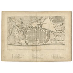
Plan of Pondicherry Fortifications and Attacks, France, c.1750
Located in Langweer, NL
Plan of Pondicherry Fortifications and Attacks, France, c.1750
This finely engraved map depicts the fortified city of Pondicherry, titled "Plan de Pondichéry et de ses attaques." It...
Category
Antique Mid-18th Century French Maps
Materials
Paper
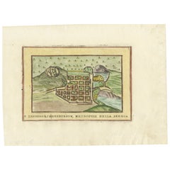
Edinburgh City Plan, Italy c.1700 – “Edenburgo Metropoli della Scozia”
Located in Langweer, NL
Edinburgh City Plan, Italy c.1700 – “Edenburgo Metropoli della Scozia”
This is a charming hand-colored engraved plan of Edinburgh, titled in Italian Edenburgo, Metropoli della Scozi...
Category
Antique Early 18th Century Italian Prints
Materials
Paper
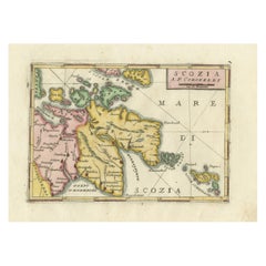
Scozia – Antique Map of Scotland by Coronelli, circa 1690
Located in Langweer, NL
Map of Scotland by Coronelli, c.1690 – “Scozia A.P. Coronelli”
This finely engraved and hand-colored map depicts Scotland, titled Scozia A.P. Coronelli, produced by the renowned Ven...
Category
Antique Late 17th Century Italian Prints
Materials
Paper
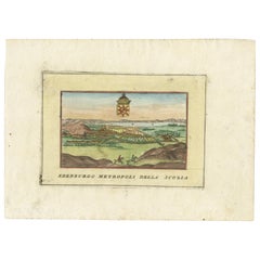
Hand-Colored View of Edinburgh, Italy, c.1700 – “Edenburgo Metropoli”
Located in Langweer, NL
Hand-Colored View of Edinburgh, Italy, c.1700 – “Edenburgo Metropoli”
This finely hand-colored engraving shows a panoramic view of Edinburgh, titled in Italian “Edenburgo Metropoli ...
Category
Antique Early 18th Century Italian Prints
Materials
Paper
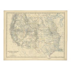
1874 Map of Western United States – Detailed Atlas by Keith Johnston
Located in Langweer, NL
1874 Map of Western United States by Keith Johnston – Detailed Atlas
This is an original antique map titled “United States of North America (Western States)” by Alexander Keith John...
Category
Antique 1870s Scottish Maps
Materials
Paper
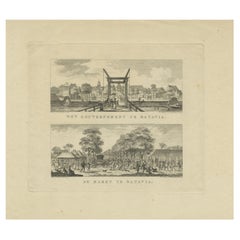
Batavia Market Scenes & Government House – Antique Prints VOC Period, c.1780
Located in Langweer, NL
Batavia Views – Government House and Market Scenes, circa 1780
This is an original late 18th-century engraving featuring two detailed views of Batavia (now Jakarta, Indonesia) under...
Category
Antique Late 18th Century Dutch Maps
Materials
Paper
1728 Map of Batavia Castle & City, Java – Van der Aa after 1669
Located in Langweer, NL
1728 Map of Batavia Castle & City, Java – Van der Aa after 1669
This is an original antique copperplate engraving titled “Plan de la Ville et du Château de Batavia en l’Isle de Iava...
Category
Antique Early 18th Century Dutch Maps
Materials
Paper
1740 Batavia Chinese Massacre Engraving – Dutch Colonial Indonesia
Located in Langweer, NL
1740 Batavia Chinese Massacre Engraving – Dutch Colonial Indonesia
This is an original 18th-century engraving depicting the Batavia Chinese Massacre of October 9, 1740. Titled in Fr...
Category
Antique Mid-18th Century Dutch Prints
Materials
Paper
Batavia Castle Church Courtyard – Vue d’Optique, Indonesia c.1770
Located in Langweer, NL
Optica View of Batavia Castle Church Courtyard, Indonesia, c.1770
This is an original 18th-century hand-coloured optical print depicting the inner courtyard of Batavia Castle (Kaste...
Category
Antique 18th Century German Prints
Materials
Paper
Batavia, a View of the Portuguese Church – Antique Optical Print, Indonesia 1770
Located in Langweer, NL
Optica View of Batavia Bastion Gelderland, Indonesia, circa 1770
This is an original 18th-century hand-coloured optical print depicting a view from the Bastion Gelderland outside th...
Category
Antique 18th Century German Prints
Materials
Paper
Batavia Bastion Perl – Antique Optical Print of Indonesia, c.1770
Located in Langweer, NL
Optica View of Batavia Castle Bastion Perl, Indonesia, circa 1770
This is an original 18th-century hand-coloured optical print depicting a view of the Bastion Perl along the curtain...
Category
Antique 18th Century German Prints
Materials
Paper
1726 Map of Bengal by Van der Aa after Valentijn – Dutch East Indies
Located in Langweer, NL
1726 Map of Bengal by Van der Aa after Valentijn – Dutch East Indies
This is an original antique map titled “Nieuwe Kaart van ’t Koninryk van Bengale,” published by Pieter van der Aa in Leiden in 1726. The map depicts the Kingdom of Bengal and surrounding regions, based on earlier work by François Valentijn, a Dutch East India Company (VOC) official and historian whose extensive writings on Asia were among the most important early European sources.
The engraving covers the Bengal region (modern-day Bangladesh and West Bengal, India), showing detailed river systems including the Ganges and its distributaries flowing into the Gulf of Bengal. Major towns, cities, and kingdoms are labelled in Dutch, such as Orixa (Orissa), Arracan, Tipera (Tripura), and Cos Assam (Assam). Mountain ranges are represented pictorially with stylised hachured peaks, while fertile plains are indicated with field patterns, adding visual texture to the map.
In the upper right is an elegant title cartouche with dedication to VOC officials, referencing Mathijs van den Broecke, a director in Bengal, and Johannes Lennep. A compass rose is positioned at the bottom, enhancing its decorative maritime appeal, with north oriented to the right as typical for Dutch maps of Asian regions in this period.
Pieter van der Aa (1659–1733) was a prolific publisher known for compiling maps from earlier explorers and engravers into elegant and collectible volumes. His works remain valued for their historical significance, decorative artistry, and connection to VOC trade networks and colonial history.
Condition:
Good condition. Strong impression with later hand colouring. Light age toning, faint foxing mainly in margins, and some creasing along original fold lines as issued. Fully suitable for framing.
Framing tips:
Frame this map in a slim gilt or dark wood frame to highlight its decorative hand colouring. Use an off-white archival mat to accentuate the engraving and protect the edges. UV-protective glazing is recommended to maintain colour vibrancy and paper integrity.
Keywords block for your listing:
bengal map...
Category
Antique Early 18th Century Dutch Maps
Materials
Paper
Original Antique Blaeu Map of Karst, Carniola, Istria, and Trieste, circa 1640
Located in Langweer, NL
Blaeu Map of Karst, Carniola, Istria, and Trieste, circa 1640
This is an original antique map titled “Karstia, Carniola, Histria et Windorum Marchia,” published by Willem Blaeu in Amsterdam circa 1640. The map depicts the historical regions of Karst (Karstia), Carniola (modern-day Slovenia), Istria (the peninsula shared by Croatia, Slovenia, and Italy), and the Windic March, a medieval border territory.
The engraving shows detailed place names, rivers, mountains, and settlements across present-day Slovenia, northeastern Italy, and northwestern Croatia. The Gulf of Trieste is prominently illustrated at the lower left, with Trieste labelled and coastal settlements clearly indicated. The Adriatic Sea is elegantly engraved with stippled waters, a compass rose, rhumb lines, and a sailing ship, enhancing its decorative maritime appeal.
In the upper left corner is a beautifully designed cartouche bearing the title within a scrollwork frame with foliage and drapery motifs. The lower left includes a mileage scale in Italian miles and a dedication to Guiljelmus Blaeu excudit, confirming its publication from the Blaeu workshop.
Willem Janszoon Blaeu (1571–1638) was one of the leading Dutch cartographers of the early 17th century, succeeded by his son Joan Blaeu. Their maps were known for their precision, aesthetic engraving, and clarity, making the Blaeu atlases the most prestigious publications of the Dutch Golden Age.
Condition:
Good condition. Strong, clean impression on laid paper with wide margins. Light age toning and faint foxing in blank margins, minor creasing along the original centre fold as issued. No tears or repairs noted. Fully suitable for framing.
Framing tips:
Frame this map in a thin black, walnut, or gilt frame to enhance its historic character. Use an off-white or cream archival mat to highlight the detailed engraving and preserve the sheet edges. UV-protective glazing is recommended to protect the paper and ensure its clarity and integrity over time.
Keywords: Here are short keyword blocks formatted for direct copy-pasting into your website SEO or 1stdibs tags:
karst map, carniola map, istria map, trieste map, blaeu map, willem blaeu,
17th century map, dutch cartography, antique balkan map, slovenia antique map,
croatia antique...
Category
Antique 17th Century Dutch Maps
Materials
Paper
Antique Map of Slavonia, Croatia, Bosnia and Dalmatia by Janssonius, circa 1640
Located in Langweer, NL
Antique Map of Slavonia, Croatia, Bosnia and Dalmatia by Janssonius, circa 1640
This elegant and detailed map titled Sclavonia, Croatia, Bosnia cum Dalmatiae Parte was published by ...
Category
Antique 17th Century Dutch Maps
Materials
Paper
Blaeu Map of Ottoman Balkans – Walachia Bulgaria Romania, circa 1665
Located in Langweer, NL
Blaeu Map of Ottoman Balkans – Walachia Bulgaria Romania, circa 1665
This is an original hand-coloured antique map titled “Walachia, Servia, Bulgaria, Romania,” published by Joan Bl...
Category
Antique 17th Century Dutch Maps
Materials
Paper
17th Century Blaeu Map – Ottoman Balkans: Walachia, Bulgaria, Romania, ca. 1650
Located in Langweer, NL
Blaeu Map of Walachia, Servia, Bulgaria, Romania, circa 1640
This is an original antique map titled “Walachia, Servia, Bulgaria, Romania,” published by Joan Blaeu in Amsterdam betwe...
Category
Antique 17th Century Dutch Maps
Materials
Paper
Battle of Turnhout 1597 – Dutch and English Victory over Spanish, Published 1700
Located in Langweer, NL
Battle of Turnhout 1597 – Dutch and English Victory over Spanish
This original antique engraving depicts the Battle of Turnhout, fought on January 24, 1597, during the Eighty Years’...
Category
Antique Early 18th Century Dutch Prints
Materials
Paper
Antique 1743 Map – Travels of Jesus Christ & Apostles by Seutter
Located in Langweer, NL
Antique 1743 Map – Travels of Jesus Christ & Apostles by Seutter
This is an original antique map titled “Carte des Voyages de Notre Seigneur Jesus-Christ et des Actes des Apotres St...
Category
Antique Mid-18th Century German Maps
Materials
Paper
Japanese Isles Map by Mallet, 1683 – Decorative Miniature Map
Located in Langweer, NL
1683 Map of Japan Isles by Mallet – Decorative Miniature Map
This is an original antique map titled “Isles du Japon,” created by Alain Manesson Mallet and published in Paris in 1683...
Category
Antique 1680s French Maps
Materials
Paper
Saint Domingue Map 1793 – Colonial Haiti and Dominican Republic Plan
Located in Langweer, NL
1793 Map of Saint Domingue (Haiti and DR) – Colonial Island Plan
This antique map is titled “A Map of the Island of St. Domingo” and dates from circa 1793. It depicts the entire isl...
Category
Antique Late 18th Century English Maps
Materials
Paper
1794 Map of Jamaica by Bryan Edwards – Parishes, Plantations, Settlements
Located in Langweer, NL
1794 Bryan Edwards Map of Jamaica – Parishes, Plantations, Settlements
This is an important antique map titled “A Map of the Island of Jamaica, Divided into Counties and Parishes,” created by Bryan Edwards in 1794. It was published in the second edition of his influential work *The History of the British West Indies*, which provided detailed insights into the geography, society, and economy of the Caribbean at the height of British colonial influence.
The map meticulously depicts Jamaica divided into its traditional counties and parishes, each shaded to aid visual differentiation. Major settlements are clearly labelled, including Kingston, Montego Bay, Spanish Town, and Falmouth. The island’s intricate network of rivers, mountains, and coastal features are rendered with careful hachure and stipple shading to indicate elevation and terrain. Edwards uses small circular symbols to denote the locations of numerous sugar plantations that formed the backbone of Jamaica’s economy during this period, each plantation representing not only agricultural wealth but also the grim history of enslaved African labour central to the island’s prosperity.
Further notations identify churches, barracks, forts, and ports, demonstrating the comprehensive utility of this map for historical research into colonial infrastructure. The map even marks Bryan...
Category
Antique Late 18th Century English Maps
Materials
Paper
Jerusalem and Temple Imaginary Map by Blome, Published London 1689
Located in Langweer, NL
Imaginary Plan of Jerusalem by Blome after Villalpando, 1689
This impressive antique engraving presents an imaginary plan of Jerusalem by Richard Blome, published in 1689. The engra...
Category
Antique Late 17th Century English Maps
Materials
Paper
Ottoman Empire in Europe – Antique Map by Reilly, Vienna, 1796
Located in Langweer, NL
Map of the Ottoman Empire in Europe – Reilly, Vienna circa 1794-1796
This large original antique map, titled “Karte von dem Oschmanischen Reiche in Europa,” was published between 17...
Category
Antique Late 18th Century Austrian Maps
Materials
Paper
Large Antique Dog Poster – Shepherd and Mastiff by Briedwiser c.1880
Located in Langweer, NL
Large Antique Dog Poster – Shepherd and Mastiff by Briedwiser c.1880
Description:
This impressive original chromolithograph poster dates to circa 1880 and was published by Carl Gero...
Category
Antique Late 19th Century Austrian Prints
Materials
Paper
Poodle and Hound – Large Antique Dog Poster by Briedwiser, c.1880
Located in Langweer, NL
Large Antique Dog Poster – Poodle and Hound by Briedwiser c.1880
Description:
This large original zoological teaching poster was published circa 1880 by Carl Gerold’s Sohn in Vienna...
Category
Antique Late 19th Century Austrian Prints
Materials
Paper
Large Antique Zoology Poster – Crayfish, Leeches, Snails, Insects c.1880
Located in Langweer, NL
Large Antique Zoology Poster – Crayfish, Leeches, Snails, Insects c.1880
Description:
This large antique zoological teaching poster was published circa 1880 by Carl Gerold’s Sohn in...
Category
Antique Late 19th Century Austrian Prints
Materials
Paper
Large Antique Zoology Poster – Stoat, Weasel, Polecat c.1880
Located in Langweer, NL
Large Antique Zoology Poster – Stoat, Weasel, Polecat c.1880
Description:
This impressive large antique zoological teaching poster was published circa 1880 by Carl Gerold’s Sohn in ...
Category
Antique Late 19th Century Austrian Prints
Materials
Paper
Large Antique Educational Poster of European Beetles and Larvae, c.1880
Located in Langweer, NL
Large Antique Educational Poster of European Beetles and Larvae, c.1900
Description:
This large antique educational entomology poster depi...
Category
Antique Late 19th Century Austrian Prints
Materials
Paper
Large Antique Entomology Poster – Dragonflies, Crickets & Flies, ca.1880
Located in Langweer, NL
Large Antique Entomology Poster – Dragonflies, Crickets, Flies & Mole Crickets, 65x84 cm
This impressive large-format antique entomology poster depicts a wide range of insects in fi...
Category
Antique Late 19th Century Austrian Prints
Materials
Paper
Antique Map of North America – Physical Relief Map by Hachette c.1883
Located in Langweer, NL
Antique Map of North America – Physical Relief Map by Hachette c.1883
Description:
This antique map titled “Amérique du Nord” was published around 1883 by E. Hachette in Paris as pa...
Category
Antique Late 19th Century French Maps
Materials
Paper
Antique Map of Australia and Oceania – Physical Relief Map by Hachette, c.1883
Located in Langweer, NL
Antique Map of Australia and Oceania – Physical Relief Map by Hachette, c.1883
Description:
This antique map titled “Australie” was published circa 1883 by Hachette in Paris as part...
Category
Antique Late 19th Century French Maps
Materials
Paper
Relief Atlas Map of South America by Hachette – Antique French Map c.1883
Located in Langweer, NL
Antique Map of South America – Physical Relief Map by Hachette, c.1883
Description:
This antique map titled “Amérique du Sud” was published circa 1883 by Hachette in Paris as part o...
Category
Antique Late 19th Century French Maps
Materials
Paper
Relief Atlas Map of Europe by Hachette – Antique French Map c.1883
Located in Langweer, NL
Antique Map of Europe – Physical Relief Map by Hachette, circa 1883
Description:
This antique map titled “Europe Physique” was published by Hachette in Paris around 1883 and origina...
Category
Antique Late 19th Century French Maps
Materials
Paper
Relief Atlas Map of Asia by Hachette – Antique French Map, circa 1883
Located in Langweer, NL
Antique Map of Asia – Relief Atlas Map by Hachette, circa 1883
Description:
This antique map titled “Asie” was published by Hachette in Paris around 1883 and originates from their e...
Category
Antique Late 19th Century French Maps
Materials
Paper
Relief Atlas Map of Africa by Hachette – Antique c.1883 French Map
Located in Langweer, NL
Antique Map of Africa – Relief Atlas Map by Hachette, circa 1880
Description:
This is an attractive antique map titled “Afrique,” published by Hachette...
Category
Antique Late 19th Century Maps
Materials
Paper
His Majesty’s Arrival at Honselaarsdijk – Grand Procession Engraving c.1690
Located in Langweer, NL
Title: Arrival of His Majesty in Honselaarsdijk – Grand Procession Engraving, circa 1690
Description:
This impressive large-format antique engraving depicts the grand arrival proces...
Category
Antique Late 17th Century Dutch Prints
Materials
Paper
Grand Pond at Biljoen – Antique c.1790 Print Dedicated to Princess Wilhelmina
Located in Langweer, NL
View of the Grand Pond at Biljoen – Dedicated to Princess Frederica Louise Wilhelmina, circa 1790
This elegant antique engraving depicts a tranquil view of the grand pond (étang) at...
Category
Antique Late 18th Century Dutch Prints
Materials
Paper
Royal Pavilion of the Prince of Orange at Tervuren – Antique Print c.1820s
Located in Langweer, NL
Title: Lusthuis of HRH the Prince of Orange at Tervuren, circa 1820s
Description:
This fine antique engraving depicts the Lusthuis (Pleasure House or Country Retreat) of His Royal H...
Category
Antique Early 19th Century Dutch Prints
Materials
Paper
Deathbed of the Prince of Orange, circa 1647 – Historic Dutch Engraving, ca.1647
Located in Langweer, NL
Deathbed of Frederik Hendrik, Prince of Orange, circa 1647–1650 – Historic Dutch Engraving
This remarkable and moving antique engraving depicts the final moments of Frederik Hendrik...
Category
Antique Mid-17th Century Dutch Prints
Materials
Paper
Meeting of the VOC Directors with Prince William V, Amsterdam 1768
Located in Langweer, NL
Meeting of the VOC Directors with Prince William V, Amsterdam 1768
Description:
This impressive 18th-century engraving depicts a historical meeting of the directors of the Dutch Eas...
Category
Antique Mid-18th Century Dutch Prints
Materials
Paper
Tomb of William the Silent – Nieuwe Kerk Delft – Dutch Engraving circa 1750
Located in Langweer, NL
Tomb of William the Silent – Nieuwe Kerk Delft – Dutch Architectural Engraving c.1750
This finely detailed antique engraving depicts the elaborate tomb monument of William the Silen...
Category
Antique Mid-18th Century Dutch Prints
Materials
Paper
Sir William Jones – Judge of the Supreme Court of Bengal – European Mag. c.1795
Located in Langweer, NL
Sir William Jones – Judge of the Supreme Court of Bengal – European Mag. c.1795
This finely executed antique engraving depicts Sir William Jones (1746-1794), renowned British philol...
Category
Antique Late 18th Century Dutch Prints
Materials
Paper
Willem IV and Princess Carolina – Antique Dutch Engraving c.1730
Located in Langweer, NL
Willem IV and Princess Carolina – Antique Dutch Engraving c.1730
Description:
This elegant antique engraving portrays Willem (William IV, Prince of Orange) and his sister Carolina o...
Category
Antique Early 18th Century Dutch Prints
Materials
Paper
Atahualpa – Last Inca Emperor of Peru – Baroque Engraving c.1700
Located in Langweer, NL
Atahualpa – Last Inca Emperor of Peru – Baroque Engraving c.1700
Description:
This striking antique engraving depicts Atahualpa, the last sovereign emperor of the Inca Empire, here ...
Category
Antique Early 18th Century European Prints
Materials
Paper
Engraved Portrait of King William I of the Netherlands after J.W. Pieneman, 1835
Located in Langweer, NL
Engraved Portrait of King William I of the Netherlands after J.W. Pieneman, by B. Taurel
Description:
This is a highly detailed 19th-century engraved portrait of King William I of t...
Category
Antique Early 19th Century European Prints
Materials
Paper
Gerard van Honthorst – Striking 17th Century Portrait Engraving after Van Dyck
Located in Langweer, NL
Title: Gerard van Honthorst – Antique Portrait Engraving by Paulus Pontius after Van Dyck, circa 1630-1641
Description:
This is an impressive and finely executed 17th-century engrav...
Category
Antique Mid-17th Century European Prints
Materials
Paper
Portrait of an African Man, after Rubens – Engraving by Joseph Lange, 1801
Located in Langweer, NL
Portrait of an African Man, after Rubens – Engraving by Joseph Lange, 1801
Description:
This captivating portrait engraving depicts an African man tu...
Category
Antique Early 19th Century European Prints
Materials
Paper
Portrait of Justus Sustermans, Flemish Painter to the Grand Duke of Florence
Located in Langweer, NL
Title: Portrait of Justus Sustermans, Flemish Painter to the Grand Duke of Florence
Description:
This is an antique engraving of Justus Sustermans (1597-1681), a renowned Flemish Baroque portrait painter born in Antwerp and active primarily at the Medici court in Florence. The engraving shows Sustermans half-length, wearing a richly detailed buttoned robe with a lace collar, with his hair in loose curls, and his right hand resting elegantly. Below the portrait is inscribed:
IVSTVS SVTTERMANS ANTVERPIENSIS PICTOR MAGNI DVCIS FLORENTINI
This Latin inscription identifies him as Justus Sustermans of Antwerp, painter to the Grand Duke of Florence. The engraving is after Anthony van Dyck, noted by the line at bottom left "Ant: van Dyck fecit aqua forti," indicating that van Dyck created the etching in the early to mid-17th century as part of his famous 'Iconography' series, portraying fellow artists and prominent individuals.
This engraving is after Anthony van Dyck’s etched portrait of Justus Sustermans from his Iconography series, originally etched by van Dyck circa 1630–1641.
However, this specific print is not an original van Dyck etching...
Category
Antique Early 18th Century European Prints
Materials
Paper
Prophet Muhammad (Mahomet) – 18th Century Paris Engraving by Daumont, c.1770
Located in Langweer, NL
18th Century Engraving of Mahomet (Prophet Muhammad), Published by Daumont Paris
Description:
This antique French engraving depicts Mahomet (Muhammad), described here as the founder...
Category
Antique Mid-17th Century French Prints
Materials
Paper
King Nader Shah of Persia – Thamas Koulikan, 18th Century Engraving
Located in Langweer, NL
Title: 18th Century Engraving of Thamas Koulikan (Nader Shah), King of Persia
Description:
This antique engraving depicts Thamas Koulikan, known in European sources as Nader Shah (r...
Category
Antique Mid-17th Century French Prints
Materials
Paper
Saint Arno, Bishop of Metz – French Religious Engraving, circa 1670
Located in Langweer, NL
Saint Arno, Bishop of Metz – 17th Century French Engraving
This original 17th-century engraving depicts Saint Arno (Arnulf) of Metz, a prominent 7th-century Frankish bishop and sain...
Category
Antique Late 17th Century French Prints
Materials
Paper
Mehmed Ali Pasha of Egypt – Early 19th Century Portrait Engraving, circa 1830
Located in Langweer, NL
Portrait of Mehmed Ali Pasha of Egypt – Early 19th Century Engraving
Description:
This finely detailed antique engraving portrays Mehmed Ali Pasha (c.1769–1849), the Ottoman Albania...
Category
Antique Early 19th Century European Prints
Materials
Paper
William the Silent Tomb – Antique Delft Nieuwe Kerk Engraving c.1840
Located in Langweer, NL
Tomb of William the Silent in Delft Nieuwe Kerk – c.1840 Engraving
Description:
This elegant antique engraving depicts the monumental tomb of William the Silent, also known as Willi...
Category
Antique Mid-19th Century Dutch Prints
Materials
Paper
Asian Wildlife and Hunting Scene – Antique German Engraving, c.1840
Located in Langweer, NL
Asian Wildlife and Hunting Scene – Antique German Engraving, c.1840
Description:
This captivating antique engraving titled “Asien” depicts Asian wildlife alongside traditional hunting scenes in a decorative tripartite composition. At the top are three finely engraved and partially hand-colored antelopes: a blackbuck (Antilope cervicapra) with its distinctive spiral horns, an Indian gazelle or chinkara (Gazella bennettii), and a greater kudu (Tragelaphus strepsiceros) or similar large antelope species with lyre-shaped horns. Their detailed anatomical rendering and warm coloration highlight the European natural history fascination of the early 19th century.
The middle register portrays an elaborate hunting expedition with an elephant bearing a howdah and rider, accompanied by horsemen and handlers. Surrounding them are multiple cheetahs (Acinonyx jubatus...
Category
Antique Mid-19th Century German Prints
Materials
Paper
African Wildlife and Hunting Scene – Antique German Engraving, c.1840
Located in Langweer, NL
African Wildlife and Hunting Scene – Antique German Engraving, c.1840
Description:
This striking antique engraving titled “Afrika” depicts a vivid tripartite composition portraying African wildlife and traditional hunting scenes. At the top are three finely engraved and partially hand-colored animals: a red river hog (Potamochoerus porcus) on the left, a zebra in the centre, and an African wild dog...
Category
Antique Mid-19th Century German Prints
Materials
Paper
Badger and Otter Hunt – Antique German Engraving, circa 1840
Located in Langweer, NL
Badger and Otter Hunt – Antique German Engraving, circa 1840
Description:
This highly detailed antique engraving titled "Dachs- und Fischotterjagd" (Badger and Otter Hunt) depicts a...
Category
Antique Mid-19th Century German Prints
Materials
Paper
American Hunters and Wild Cats – Antique Mayer Engraving c.1840
Located in Langweer, NL
American Wild Cats and Hunters – Antique Engraving by Mayer c.1840
This is an impressive 19th-century steel engraving titled 'America', published by Carl Mayer’s Kunst-Anstalt in Nu...
Category
Antique Mid-19th Century German Prints
Materials
Paper
Pyrenean Peasant Couple with Dog – Romantic 19th C. Engraving c.1840
Located in Langweer, NL
Romantic 19th Century Engraving – Pyrenean Peasants Couple with Dog, c.1840
Description:
This is a beautifully detailed 19th-century steel engraving titled Pyrenean Peasants (Landvo...
Category
Antique Mid-19th Century Prints
Materials
Paper
Antique Scientific Plates of Leeches, Worms, Spiders & Microscopic Anatomy, 1887
Located in Langweer, NL
Antique Scientific Plates of Leeches, Worms, Spiders, and Microscopic Anatomy – Sumatra c.1887
Description:
This set of four fascinating 19th-century lithographs originates from the...
Category
Antique Late 19th Century Dutch Prints
Materials
Paper
Antique Shell Print of Sumatran Snails – Helicarion, Pupina, Melania c.1887
Located in Langweer, NL
Antique Shell Print of Sumatran Snails – Helicarion, Pupina, Melania c.1887
Description:
This elegant 19th-century lithograph depicts various Sumatran molluscs and was published cir...
Category
Antique Late 19th Century Dutch Prints
Materials
Paper
