Items Similar to Aphrodite; Moeurs Antiques by Pierre Louÿs, illustr. by Antoine Calbet -


Want more images or videos?
Request additional images or videos from the seller
1 of 7
Aphrodite; Moeurs Antiques by Pierre Louÿs, illustr. by Antoine Calbet -
$400
£302.35
€347.45
CA$557
A$619.64
CHF 324.82
MX$7,571.81
NOK 4,136.20
SEK 3,893.66
DKK 2,593.62
Shipping
Retrieving quote...The 1stDibs Promise:
Authenticity Guarantee,
Money-Back Guarantee,
24-Hour Cancellation
About the Item
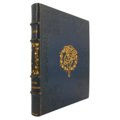
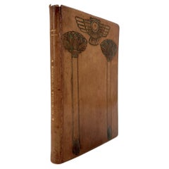
Paris: Rombaldi Éditeur, 1937.
Limited Edition.
8vo, 7 5/8 x 5 3/4 (194 x 156 mm). pp: 4, vii, 242. Five color lithographs including the frontispiece. Copies printed on Voiron laid paper are numbered. Previous owner's name in ink on first free flypaper, dated Paris 1937. Half-bound in red morocco with four raised bands and gilt titling; marbled boards and end papers; original wrappers printed in black and red bound in; t.e.g. Spine lightly sunned and with minor abrasions but binding is tight and square, pages bright. This work is part of the publisher's series "Les Contemporains."
[BNF32396591].
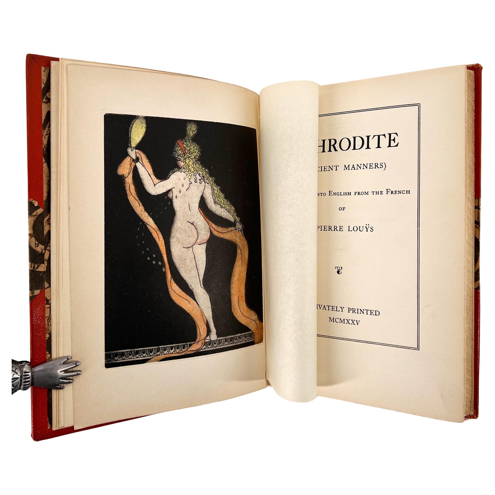
"Aphrodite: Ancient Manners" is a description of courtesan life in Alexandria by French poet and writer Pierre Louÿs (1870 – 1925) who is best known for the classical and lesbian themes in some of his writings. The book became an instant success when in was published in 1896 and became the subject of several editions, including this limited edition accompanied by the five lovely and "piquant" illustrations by Antoine Calbet. Calbet was known for his colorful, youthful, somewhat risqué pictures of women, had won medals at several of the Paris Salons (1863, 1880, 1891, 1892, 1893) and the Paris World Exhibition in 1900. He was a prolific illustrator of books (Zola, Barres) and magazines and his best know commission is probably the luxurious Train Bleu restaurant at Paris’s Gare de Lyon, where he painted delightful panels depicting the cities of Nice, Evian, Nîmes and Grenoble.
Condition: Near fine
- Dimensions:Height: 7.64 in (19.4 cm)Width: 6.15 in (15.6 cm)Depth: 0.99 in (2.5 cm)
- Materials and Techniques:
- Place of Origin:
- Period:
- Date of Manufacture:1937
- Condition:Wear consistent with age and use.
- Seller Location:Middletown, NY
- Reference Number:Seller: BH4631stDibs: LU8340240576732
About the Seller
5.0
Vetted Professional Seller
Every seller passes strict standards for authenticity and reliability
1stDibs seller since 2023
15 sales on 1stDibs
Typical response time: 9 hours
- ShippingRetrieving quote...Shipping from: Middletown, NY
- Return Policy
Authenticity Guarantee
In the unlikely event there’s an issue with an item’s authenticity, contact us within 1 year for a full refund. DetailsMoney-Back Guarantee
If your item is not as described, is damaged in transit, or does not arrive, contact us within 7 days for a full refund. Details24-Hour Cancellation
You have a 24-hour grace period in which to reconsider your purchase, with no questions asked.Vetted Professional Sellers
Our world-class sellers must adhere to strict standards for service and quality, maintaining the integrity of our listings.Price-Match Guarantee
If you find that a seller listed the same item for a lower price elsewhere, we’ll match it.Trusted Global Delivery
Our best-in-class carrier network provides specialized shipping options worldwide, including custom delivery.More From This Seller
View AllAphrodite; Ancient Manners by Pierre Louÿs, illustrated by Clara Tice
Located in Middletown, NY
Aphrodite; (Ancient Manners) Translated into ENGLISH - LIMITED EDITION - ILLUSTRATED by CLARA TICE
Privately Printed, 1925
8vo; 7 5/8 x 5 3/8 inches (193 x 132 mm); xiii, 252, (1) p...
Category
Early 20th Century American Books
Materials
Leather, Wood, Paper

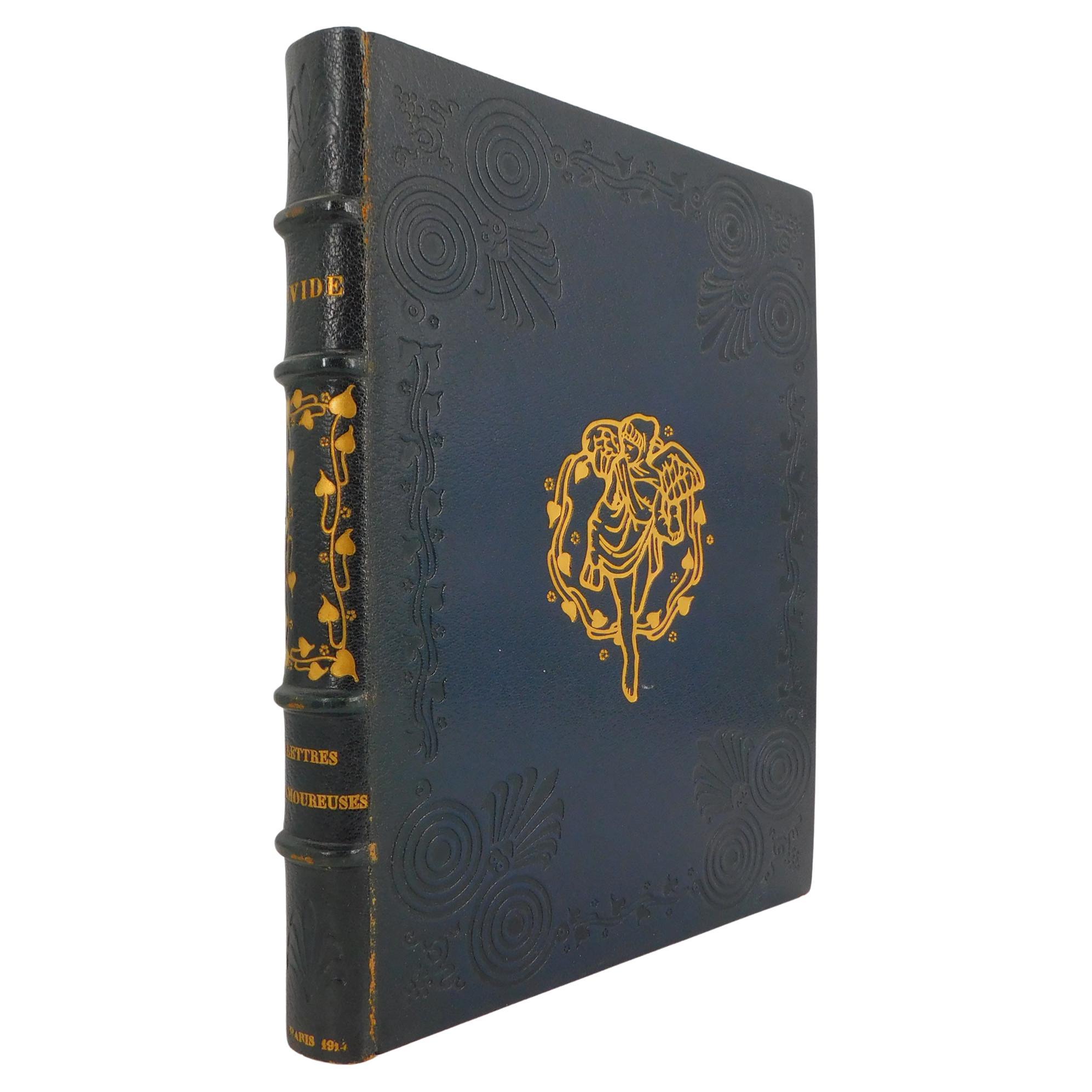
Ovid, Lettres Des Amoureuses, Art Nouveau Illustrations, Binding by R. Kieffer
Located in Middletown, NY
One of the forever-classics of world literature interpreted in a highly decorative Art Nouveau style, with color printing, gold frames on every page, and orientalist sepia wood engravings to illustrate the stories.
Ovid / Ovide. Lettres d...
Category
Early 20th Century French Books
Materials
Gold Leaf
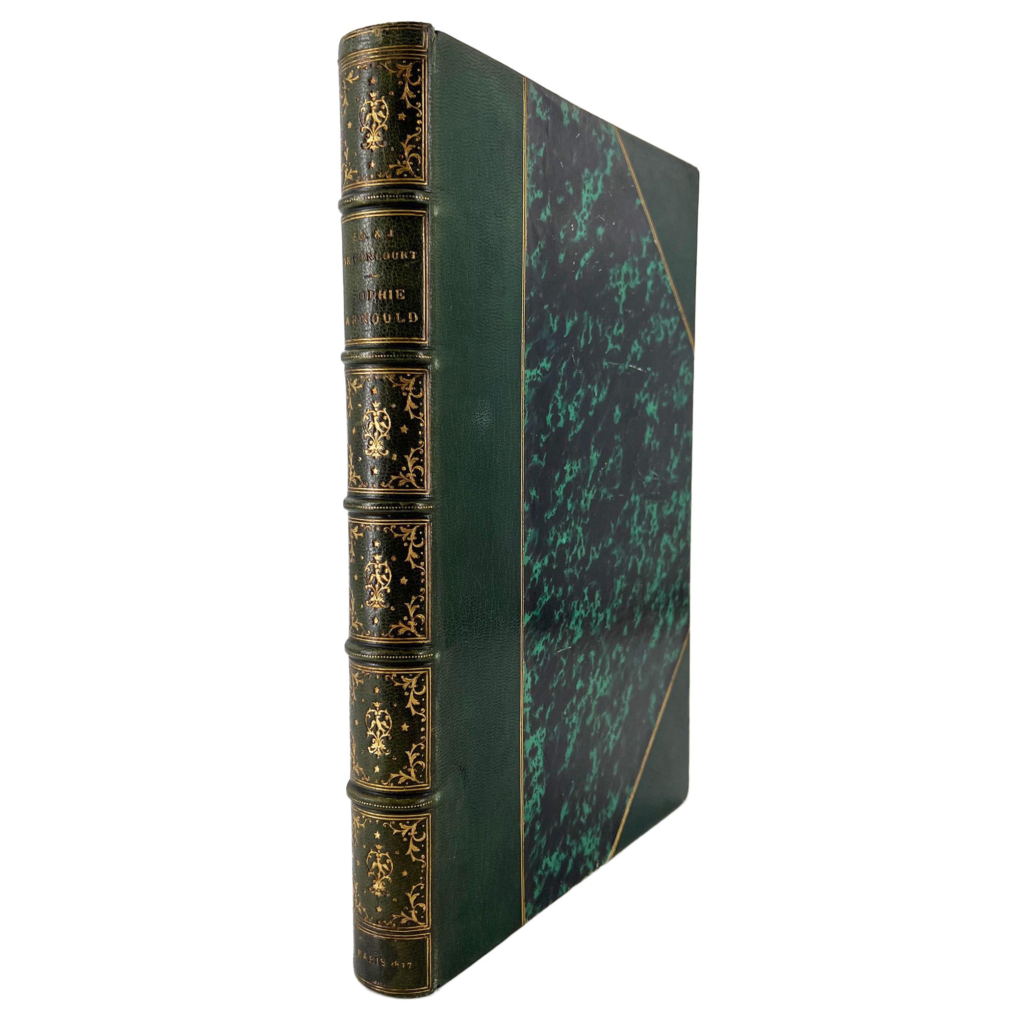
Sophie Arnould d'après sa correspondance... GONCOURT bros., deluxe, illustrated
Located in Middletown, NY
SIGNED, Second edition on LARGE PAPER
One of the first personal biographies (biographies intimes) written by the Goncourt brothers and composed in 1857. This special edition with el...
Category
Antique Late 19th Century French Books
Materials
Gold Leaf
La Comtesse d'Escarbagnas by Molière – Limited Edition, Illustrated
Located in Middletown, NY
Molière (Jean-Baptiste Poquelin), ed. Georges Monval
La Comtesse d'Escarbagnas
Paris: Librairie des Bibliophiles, 1895. L. Leloir / Champollion. Limited Edition.
16mo., 7 x4 5/8 (...
Category
Antique Late 19th Century French Books
Materials
Gold Leaf
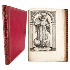
Bibliothecæ Alexandrinæ icones symbolicæ / elogiis illustratæ, by C. Giarda
Located in Middletown, NY
DISTINGUISHED PEDIGREE: from the libraries of Robert Hoe and John Barrymore.
Elegantly illustrated and bound copy with a famed pedigree that spans from Robert Hoe—the businessman, collector, and founding member of the Grolier Club in 1884— to "The Lamberts" (probably purchased in the epic Hoe library auction of 1911-1912), who gifted it to the colorful and famous actor John Barrymore. Their bookplates adorn the inside covers, will your bookplate be next?
Giarda, Cristoforo
Bibliothecæ Alexandrinæ icones symbolicæ … elogiis illustratæ
Milan: Giovanni Battista Bidelli, 1628.
4to, 9 5/8 x 7 inches (244 x 178 mm); (xii) + 140 pp, not including plates and inscriptions. Engraved architectural title with Saints Peter and Alexander by Cesare Bassano, 16 copperplates of female figures; woodcut dropcaps and tailpieces throughout.
Later (circa 1890) red levant morocco binding by R. Petit (signed in gilt on front turn-in) with triple gilt frames on boards, raised bands, gilt title and decorative motifs in compartments; inner dentelles, marbled endpapers, professionally rebacked preserving original richly gilt backstrip in compartments; title and preliminaries stained, occasional spotting or light soiling and a few small light ink stains to covers.
[Praz p.349]
Provenance: Robert Hoe (blue morocco book label...
Category
Antique 17th Century French Books
Materials
Gold Leaf
Au Souffle du Kasmin by Jeanne H. Chabal - illustrated poems
Located in Middletown, NY
This elegantly-printed and bound small volume is enhanced by an affectionate inscription by the author to her friend Mathilde Koehn, and a holograph poem of 4 stanzas, initialed and ...
Category
Early 20th Century French Books
Materials
Leather, Paper
You May Also Like
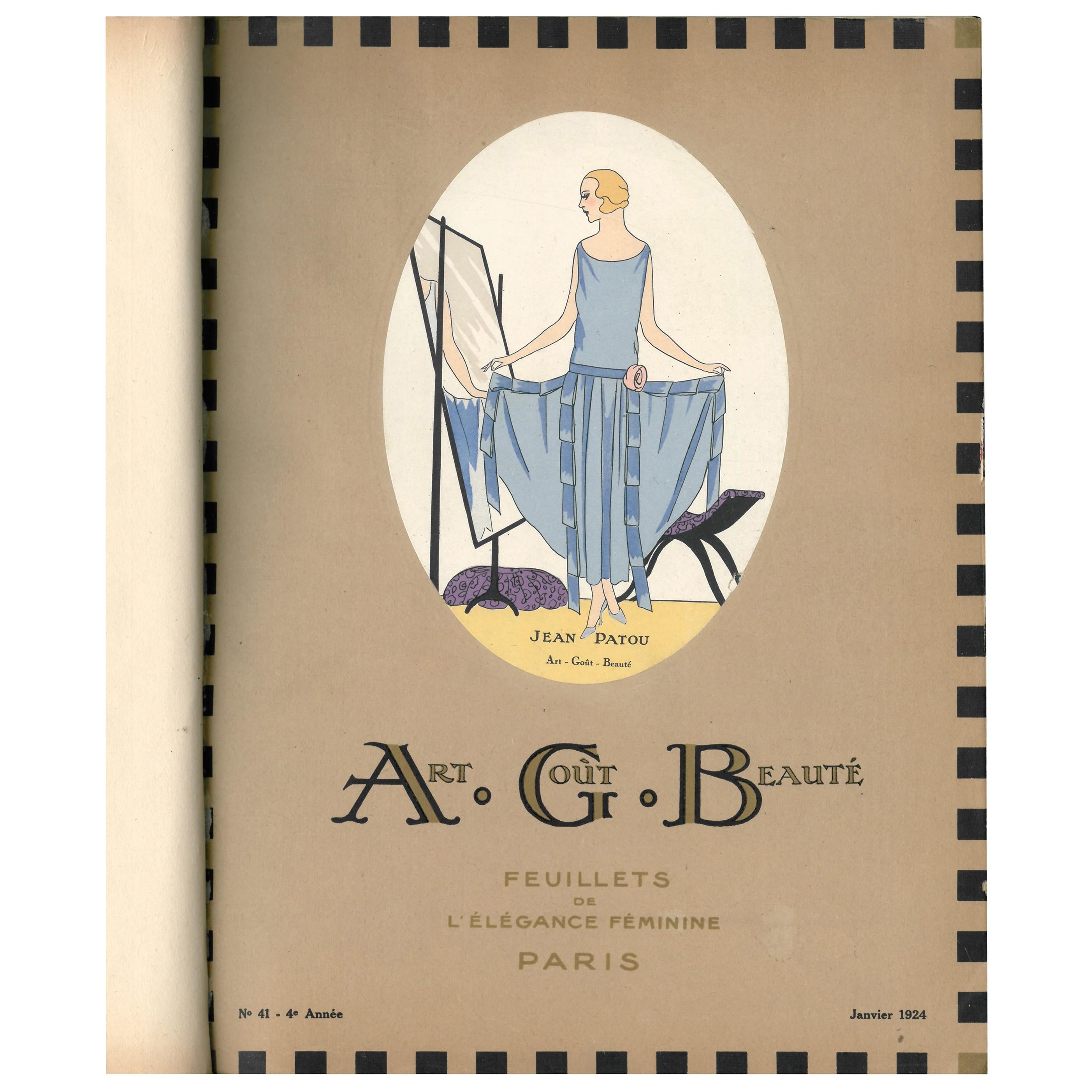
Art, Gout, Beaute: Feuillets de L'Elegance Feminine (Book)
Located in North Yorkshire, GB
This is an extremely rare bound set of the 12 ART, GOUT, BEAUTE monthly fashion magazines from 1924. It was noted or its superb art deco pochoir illustrations, some of which were dou...
Category
20th Century Books
Materials
Paper

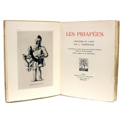
A. T'Serstvens, Georges Gorvel, M. Bousquet, Les Priapees, 1929
Located in Hillsborough, NJ
AUTHOR: A. T'Serstvens - Georges Gorvel - M. Bousquet.
TITLE: Les Priapees. Traduites du Latin par A. t Serstevens. Cinq planches sur cuivre gravees par Georges Gorviel d apres l...
Category
Vintage 1920s French Books
Materials
Paper
Antique Book by J. Girardin - "Le Locataire des Demoiselles Rocher", 2Y120
Located in Bordeaux, FR
Explore a classic piece of literature with this antique book by J. Girardin, titled "Le Locataire des Demoiselles Rocher." Published by Hachette, this novel offers a glimpse into historical storytelling and is a notable addition to any vintage book collection...
Category
Antique 1880s French Empire Antiquities
Materials
Paper
$140 Sale Price
70% Off
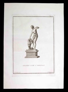
Aphrodite, Ancient Roman Statue - Original Etching by F. Morghen - 18th century
By Filippo Morghen
Located in Roma, IT
Aphrodite, Ancient Roman Statue, from the series "Antiquities of Herculaneum", is an original etching on paper realized by F. Morghen in the 18th century.
Signed on the plate, on th...
Category
18th Century Contemporary Figurative Prints
Materials
Etching
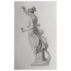
Original Antique Print of The Greek Goddess, Hebe. Dated 1833
Located in St Annes, Lancashire
Wonderful image of Hebe
Fine steel engraving.
Published by Fisher. Dated 1833
Unframed.
Category
Antique 1830s English Neoclassical Prints
Materials
Paper
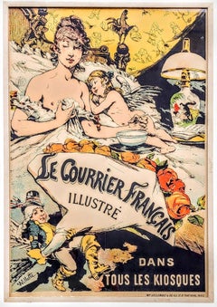
Le Courrier Français Illustré / Dans Tous Les Kiosques, Art Nouveau Lithograph
By Adolphe Willette
Located in Grand Rapids, MI
Adolphe Leon Willette (French, 1857-1926)
"Le Courrier Français Illustré / Dans Tous Les Kiosques"
English translation: "The Illustrated French Courier / In All Newsstands"
Le Cou...
Category
Late 19th Century Art Nouveau More Prints
Materials
Lithograph
More Ways To Browse
Antique Wood T Square
Antique Painted Leather Panels
Windows At Tiffanys The Art Of Gene Moore
1st Edition Picasso Ceramics Book
16th Century Edition Of Thomas Aquinas Book
Antique French Cast Iron Book Press
Boulanger Art Deco Coffe Set
Brian Lanker
Celo 1
Chesty Puller
Claudette Johnson
Collection Claude Dray
Deanna Petherbridge
Decoration Tradition Et Renouveau
French And Heald
Hr Giger Art
Hr Giger
Ibiza Bohemia