Items Similar to De Zeden der Wilden van Amerika by La Fiteau, 1731
Want more images or videos?
Request additional images or videos from the seller
1 of 7
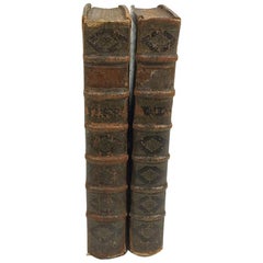
De Zeden der Wilden van Amerika by La Fiteau, 1731
$2,358.62
$2,948.2720% Off
£1,765.48
£2,206.8520% Off
€2,000
€2,50020% Off
CA$3,246.13
CA$4,057.6620% Off
A$3,618.15
A$4,522.6820% Off
CHF 1,898.32
CHF 2,372.9020% Off
MX$44,183.48
MX$55,229.3520% Off
NOK 24,036.83
NOK 30,046.0420% Off
SEK 22,718.46
SEK 28,398.0820% Off
DKK 15,225.41
DKK 19,031.7620% Off
About the Item
'De Zeden der Wilden van Amerika. Zynde een nieuwe uitvoerige en zeer kurieuse Beschryving van derzelver Oorsprong, Godsdienst, manier van Oorlogen, Huwelyken, Opvoeding, Oeffeningen, Feesten, Danzeryen, Begravenissen, en andere zeldzame gewoonten' by J.F. la Fiteau. The Hague, G. van der Poel, 1731, 2 parts in 1 vol., (4),36,(18),1-300; (4),301-555p., engr. frontisp., 2 ident. title-vignettes, 1 map and 41 plates, contemp. calf, folio.
- Dimensions:Height: 12.8 in (32.5 cm)Width: 8.27 in (21 cm)Depth: 2.17 in (5.5 cm)
- Materials and Techniques:
- Period:
- Date of Manufacture:1731
- Condition:First 4 lvs. loose(ning); upper pastedown dam.; a few leaves torn/ lacking marginal part; some lvs. unobtrusively waterst. Calf dried/ partly cracked; corners showing; spine-ends worn; calf splitting along upper joint.
- Seller Location:Langweer, NL
- Reference Number:Seller: BG-128021stDibs: LU3054321945812
About the Seller
5.0
Recognized Seller
These prestigious sellers are industry leaders and represent the highest echelon for item quality and design.
Platinum Seller
Premium sellers with a 4.7+ rating and 24-hour response times
Established in 2009
1stDibs seller since 2017
2,517 sales on 1stDibs
Typical response time: <1 hour
- ShippingRetrieving quote...Shipping from: Langweer, Netherlands
- Return Policy
Authenticity Guarantee
In the unlikely event there’s an issue with an item’s authenticity, contact us within 1 year for a full refund. DetailsMoney-Back Guarantee
If your item is not as described, is damaged in transit, or does not arrive, contact us within 7 days for a full refund. Details24-Hour Cancellation
You have a 24-hour grace period in which to reconsider your purchase, with no questions asked.Vetted Professional Sellers
Our world-class sellers must adhere to strict standards for service and quality, maintaining the integrity of our listings.Price-Match Guarantee
If you find that a seller listed the same item for a lower price elsewhere, we’ll match it.Trusted Global Delivery
Our best-in-class carrier network provides specialized shipping options worldwide, including custom delivery.More From This Seller
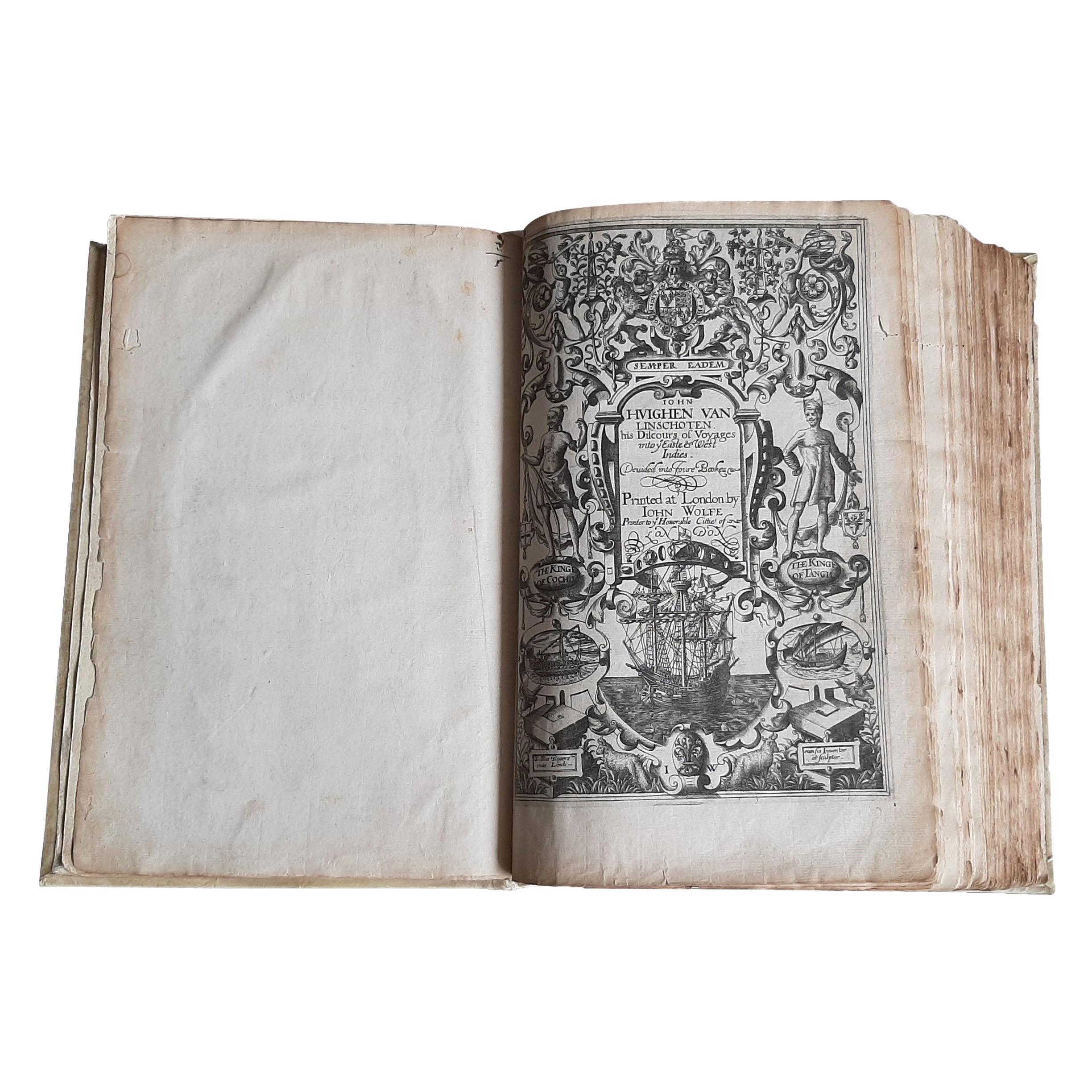
View AllJan Huygen van Linschoten’s ‘Itinerario’, ‘The Key to the East’
By Jan Huygen van Linschoten
Located in Langweer, NL
Rare and complete English edition of Van Linschoten's 'Itinerario'. The Itinerario is one of the most important early travel books, apparently used by ships sailing to India from Holland. It includes accurate sailing directions to the East Indies and many translations of Spanish and Portuguese documents on geography. Part III comprises an interesting account of America.
Title: his Discours of Voyages into ye Easte & West Indies. Devided into Foure Bookes Printed at London by JOHN WOLFE Printer to ye Honourable Cittie of LONDON. Published in London in 1598.
Contains illustrated copper title and 3 engr. title vignettes (small maps) as well as 10 folding copper maps...
Category
Antique 16th Century Books
Materials
Paper
Price Upon Request
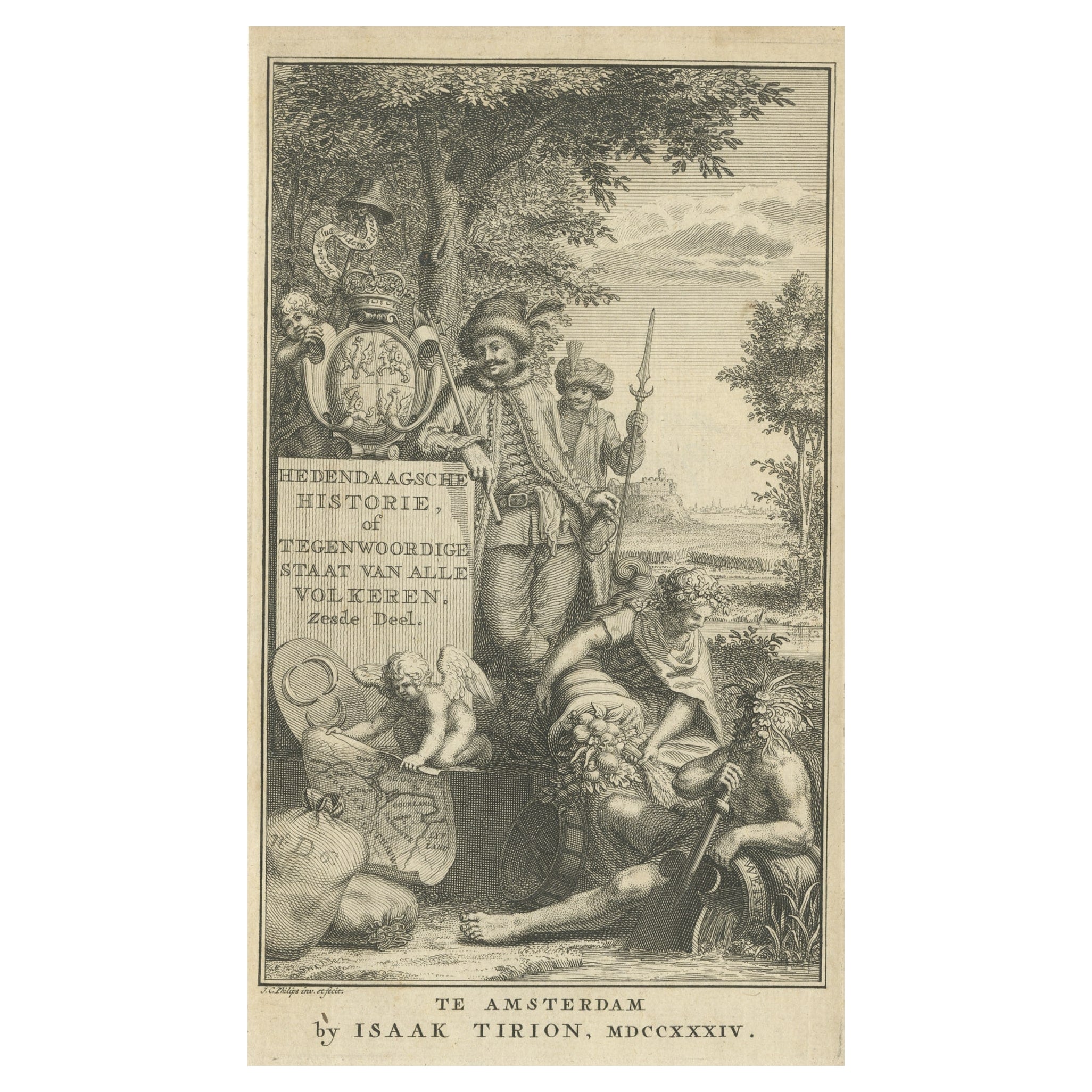
Antique Frontispiece of a Book about Europe by Tirion, 1734
Located in Langweer, NL
Antique frontispiece of the 6th volume of 'Hedendaagsche historie of tegenwoordige staat van allen volkeren (..)' by Thomas Salmon. This volume describes par...
Category
Antique 18th Century Prints
Materials
Paper
$113 Sale Price
20% Off
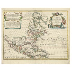
Scarce Latin Edition of Guillaume Delisle's 1700 Map of North America
Located in Langweer, NL
Scarce German Edition of Guillaume Delisle's 1700 Map of North America
This beautifully colored and highly detailed map is a rare Latin edition of Guillaume Delisle's influential 17...
Category
Antique Early 1700s Maps
Materials
Paper
$1,839 Sale Price
20% Off
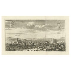
Westras: A Jan van Aveelen Engraving from 'Suecia Antiqua et Hodierna', 1701
Located in Langweer, NL
Original antique engraving of 'Westras' or Västerås in Sweden
The location referred to in the print is likely "Westras," which seems to be a historic name or variant spelling relate...
Category
Antique Early 1700s Prints
Materials
Paper
$424 Sale Price
20% Off
Free Shipping
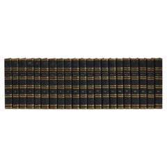
Large Set of Old Dutch Books about the Rise of the Dutch Republic, 1782
Located in Langweer, NL
Title: Vaderlandsche historie, vervattende de geschiedenissen der nu Vereenigde Nederlanden, inzonderheid die van Holland, van de vroegste tyden af [...].
21 vol., 8vo (1 sm. tear in map in vol. II; normal minor browning or spotting). - Reissue of the 2nd Tirion ed. (1770, 1st 1749-1759) of the account of the rise of the Dutch Republic with historical notes and references by the Dutch historian J. Wagenaar (1709-1773), until the year 1751. Engr. ill. by J. Folkema, P. Tanjé, J.C. Philips, J. Houbraken, S. Fokke, etc.: front. by J. Punt, 5 large folding maps (e.g. "Naaukeurige kaart van het Oude Nederland en eenige aangrenzende gewesten", "Oude kaart der nu Vereenigde Nederlanden", "Nieuwe kaart van het oostelijkste deel der weereld diendende tot aanwijzing van de scheepstogten der Nederlanderen naar Oostindië"), 1 city-plan of Leiden, 105 full-page portraits (e.g. of Erasmus, Philips of Marnix of St Aldegonde, Prince Maurice, Albert & Isabella, Kenau, Hugo De Groot, Piet Hein, Michiel de Ruyter...
Category
Antique Late 18th Century European Books
Materials
Paper
$1,368 Sale Price / set
20% Off
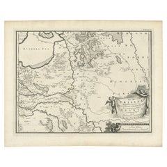
Antique Map of the Dutch Province of Gelderland, 1725
Located in Langweer, NL
Antique map titled 'Frisiae Haereditariae seu Trajectini Episcopatus Gelria?. Map of the province of Gelderland, the Netherlands. This map originates from 'Atlas Descriptio, secundum...
Category
Antique 18th Century Maps
Materials
Paper
$120 Sale Price
20% Off
You May Also Like
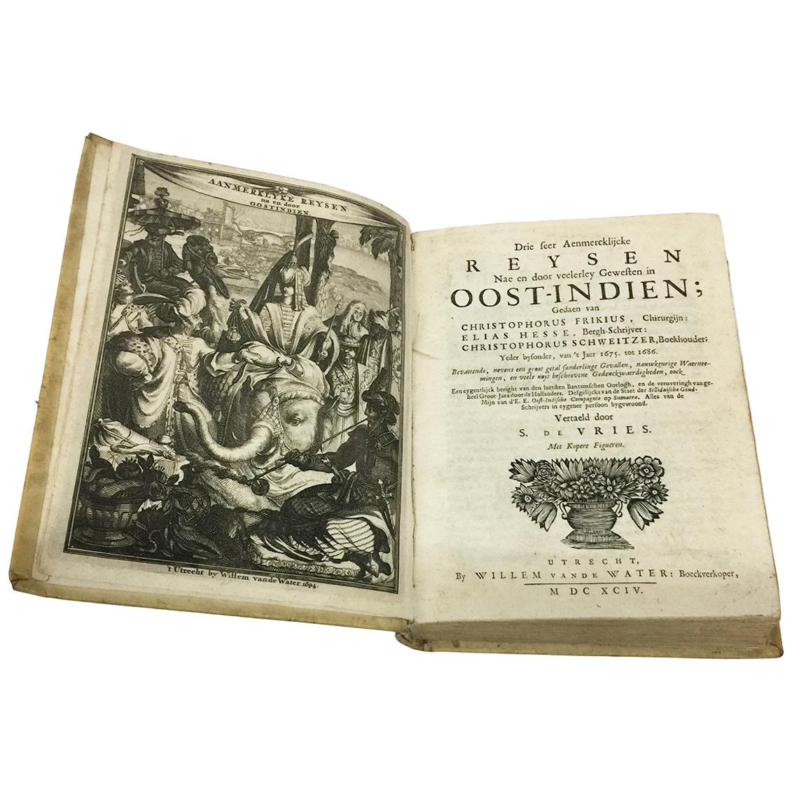
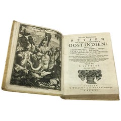
17th Century Dutch Book, Oost-Indien, 1694
Located in Delft, NL
17th Century Dutch Book, Oost-Indien, 1694 by Frikius, Hesse and Schweitzer, Simon de Vries
Dutch translation by Simon de Vries of the accounts of three Ge...
Category
Antique Late 17th Century Dutch Books
Materials
Paper
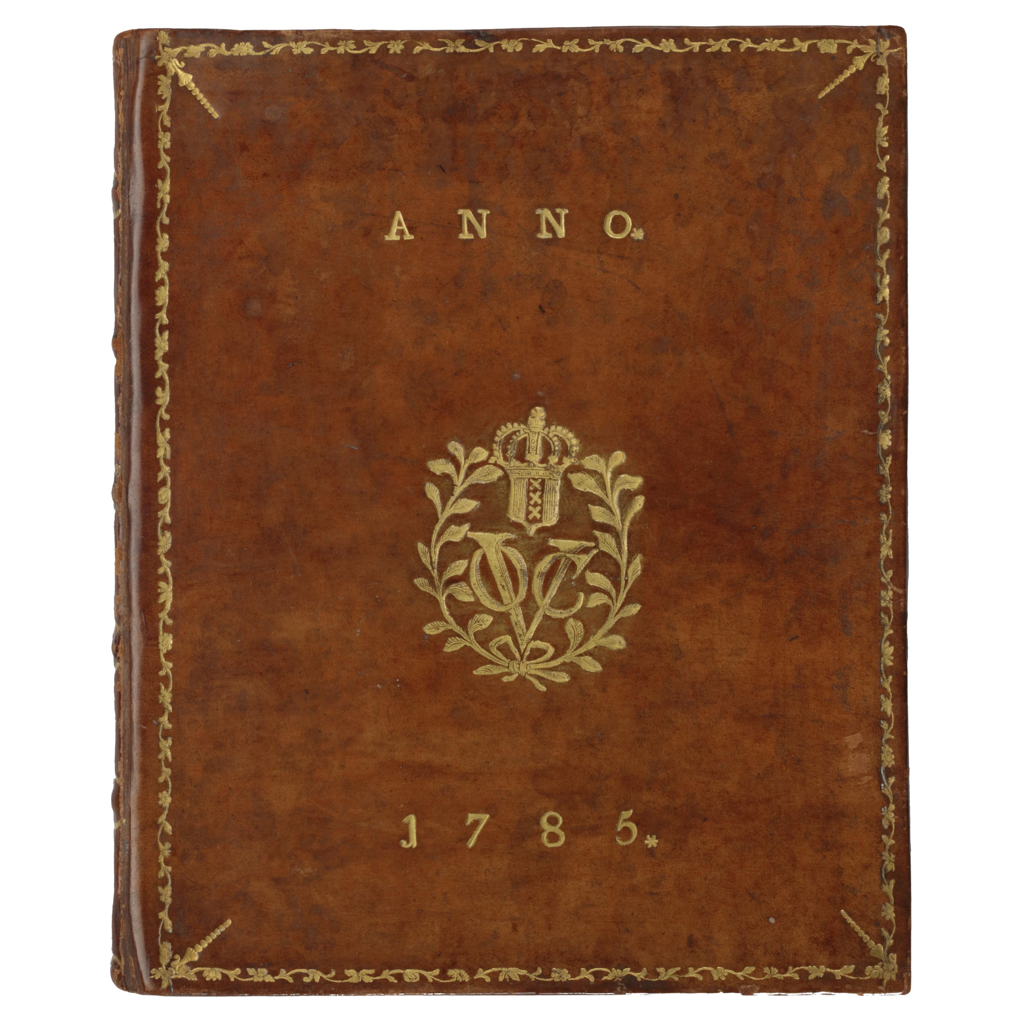
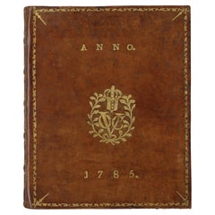
A Dutch East India Company VOC almanack for the year 1785
Located in Amsterdam, NL
"D’Erven Stichter’s Comptoir Almanach, Op ’t Jaar onzes Heeren Jesu Christi, 1785. Voorzien met alle de Jaar-, Paarden-, Beesten-, en Leermarkten, alsmede de Vacantien, het Varen der...
Category
Antique 18th Century Dutch Books
Materials
Leather, Paper
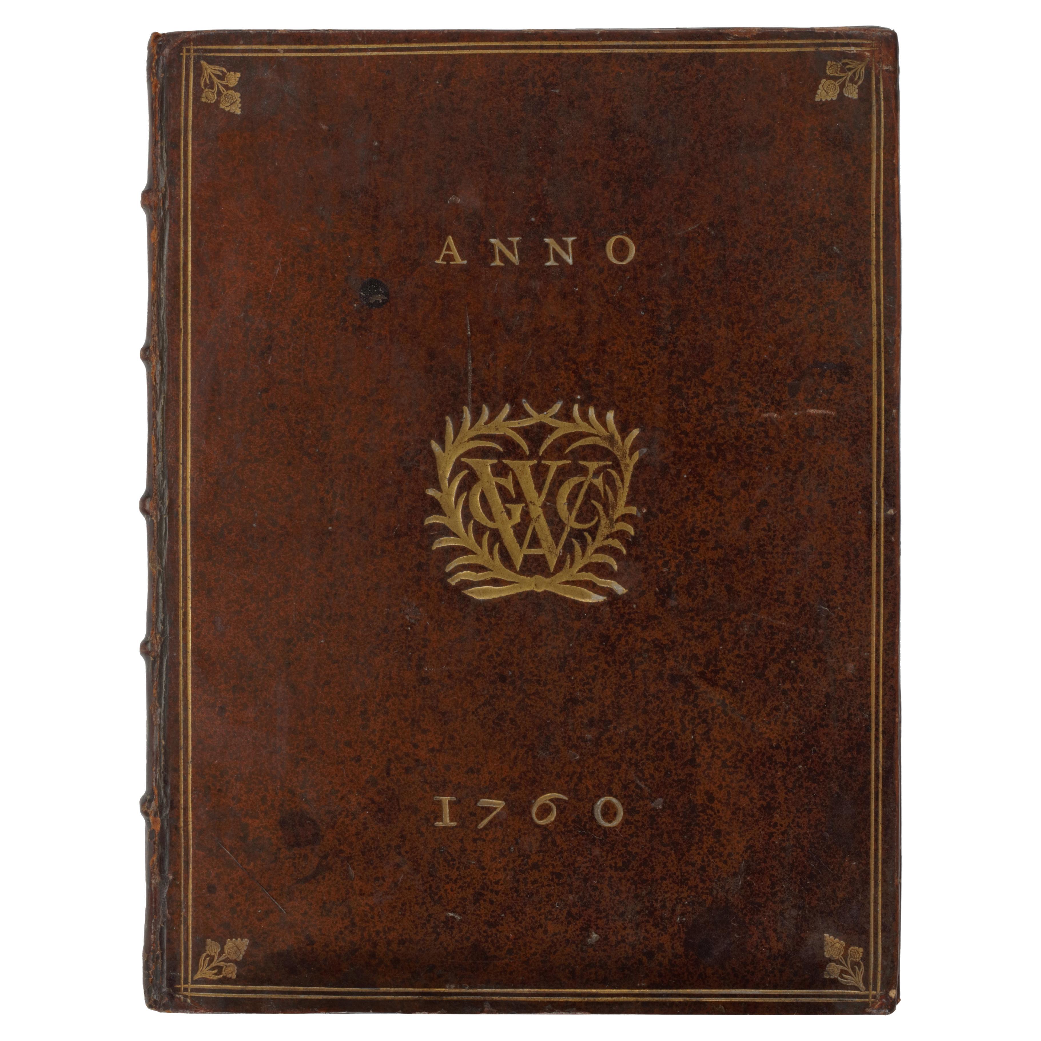
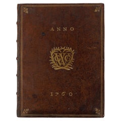
A Dutch West India Company GWC almanack for the year 1760
Located in Amsterdam, NL
"D'Erven Stichter’s Comptoir Almanach, Op ’t Schrikkel-Jaar onzes Heeren Jesu Christi, 1760, voorzien met alle de Jaar-, Paarden-, Beesten-, en Leermarkten Alsmede de Vacantien, het ...
Category
Antique 18th Century Dutch Books
Materials
Leather, Paper
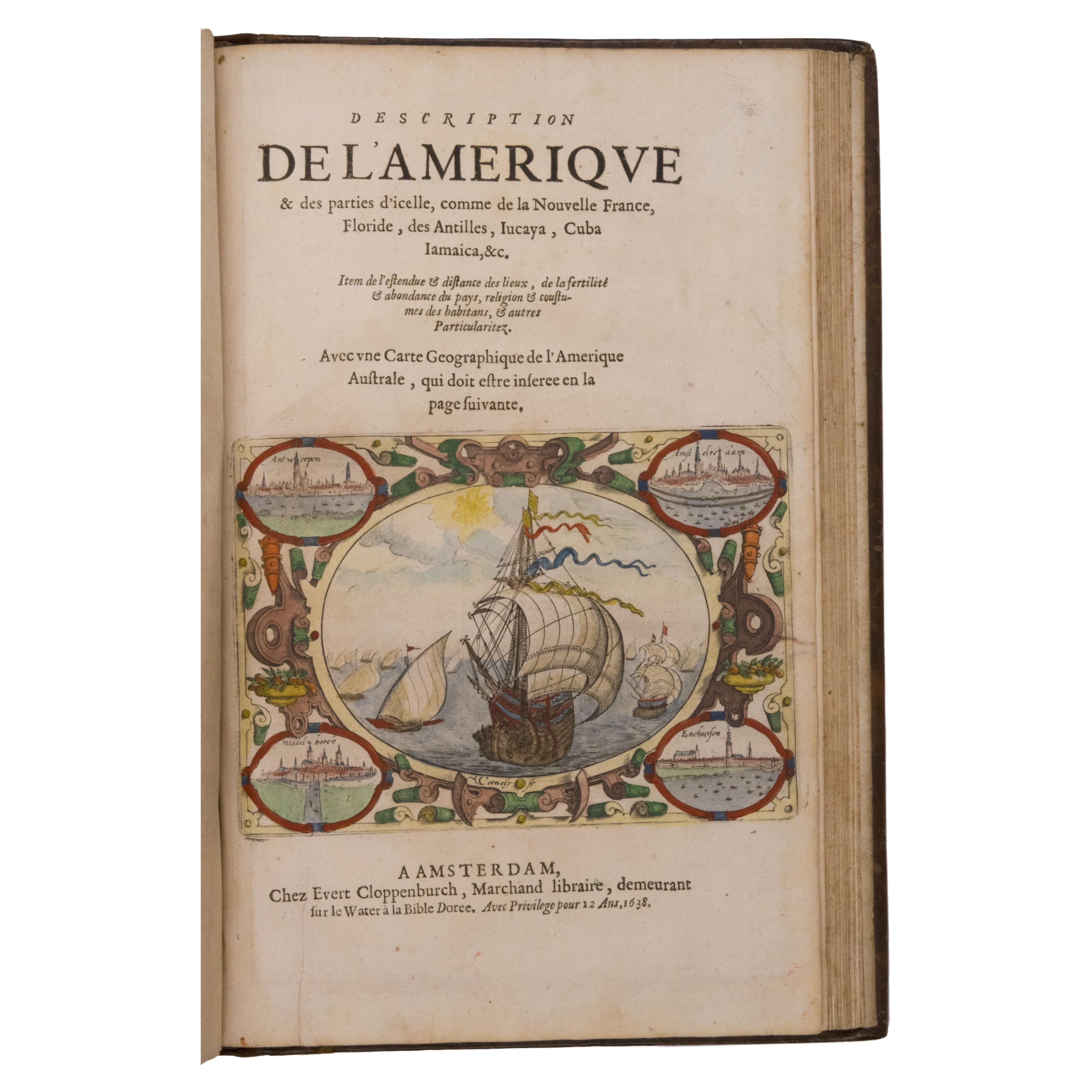
Seminal guide to the East and West Indies, with 42 coloured maps and plates
By Jan Huygen van Linschoten
Located in ZWIJNDRECHT, NL
Seminal guide to the East and West Indies, with 42 double-page and folding plates, including 6 maps, all engravings beautifully coloured by a contemporary hand
LINSCHOTEN, Jan Huygh...
Category
Antique Early 17th Century Dutch Dutch Colonial Books
Materials
Paper

$265,344 Sale Price
25% Off
Free Shipping
A New System of Modern Geography by William Guthrie - 1782
Located in Middletown, NY
A New System of Modern Geography; or, a Geographical, Historical, and Commercial Grammar; and Present State of the Kingdoms of the World. Maps engraved by Mr. Kitchin, C. Dilly and G...
Category
Antique Late 18th Century English Books
Materials
Gold Leaf
Bible, Biblia Sacra, Utrecht, Cornelius Guillielmus Le Febvre, 1732
Located in Delft, NL
Bible,, Biblia Sacra, dat is, de H. Schriftuer van het Oude, en het Nieuwe Testament, Naar de laetste Roomsche Keure der gemeine Latijnsche Overzettinge, in nederduitsch Vertaeld, me...
Category
Antique 18th Century Dutch Books
Materials
Leather, Paper
More Ways To Browse
Daniel Defoe
First Edition Churchill
John Leech
Vellum Covered Books
Antique Gutters
Colin Page
Flying Tigers
Sex Book
Washington Irving
Winston Leathers
Antique Leather Bible
Michael S Smith
Rock N Roll Collectibles
Silver Book Binding
The Works Of William Shakespeare
David Hicks In Color
Antique Miniature Books
Disney Books