Items Similar to Large Set of Old Dutch Books about the Rise of the Dutch Republic, 1782


Want more images or videos?
Request additional images or videos from the seller
1 of 10
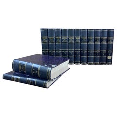
Large Set of Old Dutch Books about the Rise of the Dutch Republic, 1782
$1,391.05per set
$1,738.81per set20% Off
£1,034.80per set
£1,293.50per set20% Off
€1,160per set
€1,450per set20% Off
CA$1,904.82per set
CA$2,381.02per set20% Off
A$2,117.90per set
A$2,647.38per set20% Off
CHF 1,105.85per set
CHF 1,382.31per set20% Off
MX$25,780.01per set
MX$32,225.01per set20% Off
NOK 14,110.17per set
NOK 17,637.72per set20% Off
SEK 13,220.56per set
SEK 16,525.70per set20% Off
DKK 8,830.44per set
DKK 11,038.05per set20% Off
Shipping
Retrieving quote...The 1stDibs Promise:
Authenticity Guarantee,
Money-Back Guarantee,
24-Hour Cancellation
About the Item
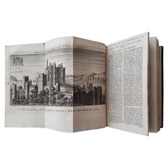
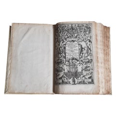
Title: Vaderlandsche historie, vervattende de geschiedenissen der nu Vereenigde Nederlanden, inzonderheid die van Holland, van de vroegste tyden af [...].
21 vol., 8vo (1 sm. tear in map in vol. II; normal minor browning or spotting). - Reissue of the 2nd Tirion ed. (1770, 1st 1749-1759) of the account of the rise of the Dutch Republic with historical notes and references by the Dutch historian J. Wagenaar (1709-1773), until the year 1751. Engr. ill. by J. Folkema, P. Tanjé, J.C. Philips, J. Houbraken, S. Fokke, etc.: front. by J. Punt, 5 large folding maps (e.g. "Naaukeurige kaart van het Oude Nederland en eenige aangrenzende gewesten", "Oude kaart der nu Vereenigde Nederlanden", "Nieuwe kaart van het oostelijkste deel der weereld diendende tot aanwijzing van de scheepstogten der Nederlanderen naar Oostindië"), 1 city-plan of Leiden, 105 full-page portraits (e.g. of Erasmus, Philips of Marnix of St Aldegonde, Prince Maurice, Albert & Isabella, Kenau, Hugo De Groot, Piet Hein, Michiel de Ruyter, Johan & Cornelis de Witt) and 41 folding plates ("Aankomst der Batavieren", "De Raad van Staate, te Brussel, in hegtenis genomen, in 't jaar 1576", "Oostende na de overgave", etc.). Last vol. contains a register. Titles in red and black. - Ref. Haitsma Mulier/VdLem 507. - STCN. - The last vol. bound with: Wagenaar, J. - Vaderlandsche historie verkort en by vraagen en antwoorden voorgesteld. Amsterdam, I. Tirion, 1770. [12]-162-[1] pp. Ill. with engr. mark on title, 3 engr. headpieces and 12 engr. pl. (each one containing 2 ill.).
Artist or Maker
Wagenaar, Jan
Date
1782
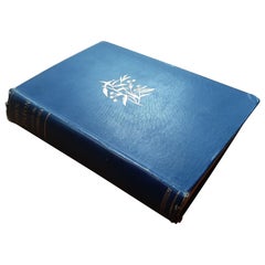
19th-c. blue quarter shagreen (lightly rubbed), gilt spines, marbled endpapers. Very good set.
- Dimensions:Height: 9 in (22.86 cm)Width: 6 in (15.24 cm)Depth: 25 in (63.5 cm)
- Sold As:Set of 21
- Materials and Techniques:
- Place of Origin:
- Period:
- Date of Manufacture:1782
- Condition:
- Seller Location:Langweer, NL
- Reference Number:Seller: BG-100971stDibs: LU3054325896962
About the Seller
5.0
Recognized Seller
These prestigious sellers are industry leaders and represent the highest echelon for item quality and design.
Platinum Seller
Premium sellers with a 4.7+ rating and 24-hour response times
Established in 2009
1stDibs seller since 2017
2,510 sales on 1stDibs
Typical response time: <1 hour
- ShippingRetrieving quote...Shipping from: Langweer, Netherlands
- Return Policy
Authenticity Guarantee
In the unlikely event there’s an issue with an item’s authenticity, contact us within 1 year for a full refund. DetailsMoney-Back Guarantee
If your item is not as described, is damaged in transit, or does not arrive, contact us within 7 days for a full refund. Details24-Hour Cancellation
You have a 24-hour grace period in which to reconsider your purchase, with no questions asked.Vetted Professional Sellers
Our world-class sellers must adhere to strict standards for service and quality, maintaining the integrity of our listings.Price-Match Guarantee
If you find that a seller listed the same item for a lower price elsewhere, we’ll match it.Trusted Global Delivery
Our best-in-class carrier network provides specialized shipping options worldwide, including custom delivery.More From This Seller
View AllVol 15 of 'The Universal Magazine of Knowledge and Pleasure' by Hinton '1754'
Located in Langweer, NL
Vol XV 'The Universal Magazine of Knowledge and Pleasure' by John Hinton, published 1754. The Universal Magazine of Knowledge and Pleasure was a per...
Category
Antique Mid-18th Century Books
Materials
Paper
$767 Sale Price
20% Off
Jan Huygen van Linschoten’s ‘Itinerario’, ‘The Key to the East’
By Jan Huygen van Linschoten
Located in Langweer, NL
Rare and complete English edition of Van Linschoten's 'Itinerario'. The Itinerario is one of the most important early travel books, apparently used by ships sailing to India from Holland. It includes accurate sailing directions to the East Indies and many translations of Spanish and Portuguese documents on geography. Part III comprises an interesting account of America.
Title: his Discours of Voyages into ye Easte & West Indies. Devided into Foure Bookes Printed at London by JOHN WOLFE Printer to ye Honourable Cittie of LONDON. Published in London in 1598.
Contains illustrated copper title and 3 engr. title vignettes (small maps) as well as 10 folding copper maps...
Category
Antique 16th Century Books
Materials
Paper
Price Upon Request
Missionary to the New Hebrides, an Autobiography by John G. Paton, '1889'
Located in Langweer, NL
'Missionary to the New Hebrides, an Autobiography' by John G. Paton. Edited by his brother. ibid., 1889, frontisp. portrait, map, orig. cl.
Category
Antique Late 19th Century Books
Materials
Paper
15 Volumes of 'Flora van Deutschland' by J. Sturm, 1906-1907
Located in Langweer, NL
15 volumes of 'Flora von Deutschand' by J. Sturm. Published 1906-1907. 2nd rev. ed., 15 vols., 888 (chromo)lithogr. plates, num. ills., orig. unif. hcl.
Category
20th Century Books
Materials
Paper
$719 Sale Price / set
20% Off
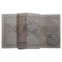
First Edition Guthrie's Geographical Grammmar in Miniature, 1807
Located in Langweer, NL
First edition of 'Guthrie's Geographical Grammar in Miniature'. 358 p. 13 fold. engr. maps, contemp. calf. Gilt spine. sm. 8vo. Upper hinge showing but strong; old bookplate "Ex Bibl...
Category
Antique Early 19th Century Books
Materials
Paper
$719 Sale Price
20% Off
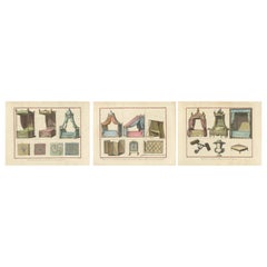
Crafts of Comfort and Style: Upholstery and Furniture Design in the 1760s
Located in Langweer, NL
The collage of original antique engravings a compilation of three prints from the "Encyclopédie" by Diderot and d'Alembert. Each print showcases various furnishings and decorative elements relating to beds and upholstery from the 18th century. The collection presents a visual guide to the design and craftsmanship of the period.
In the first print, we see two types of beds with canopies, known as "Lit à colonnes" and "Lit à la Duchesse," accompanied by different fabric patterns that might be used for the bed drapery or other upholstery within a room.
The second print continues with illustrations of beds, including "Lit à double tombeau" and "Lit à tombeau simple," a camp bed or "Lit de camp à l'Angloise," as well as a folding screen ("Paravent"), a fire screen ("Ecran"), and a type of swing door ("Porte-Batante").
The third print features a more elaborate "Lit à la Polonaise...
Category
Antique 1760s Prints
Materials
Paper
$613 Sale Price / set
20% Off
You May Also Like
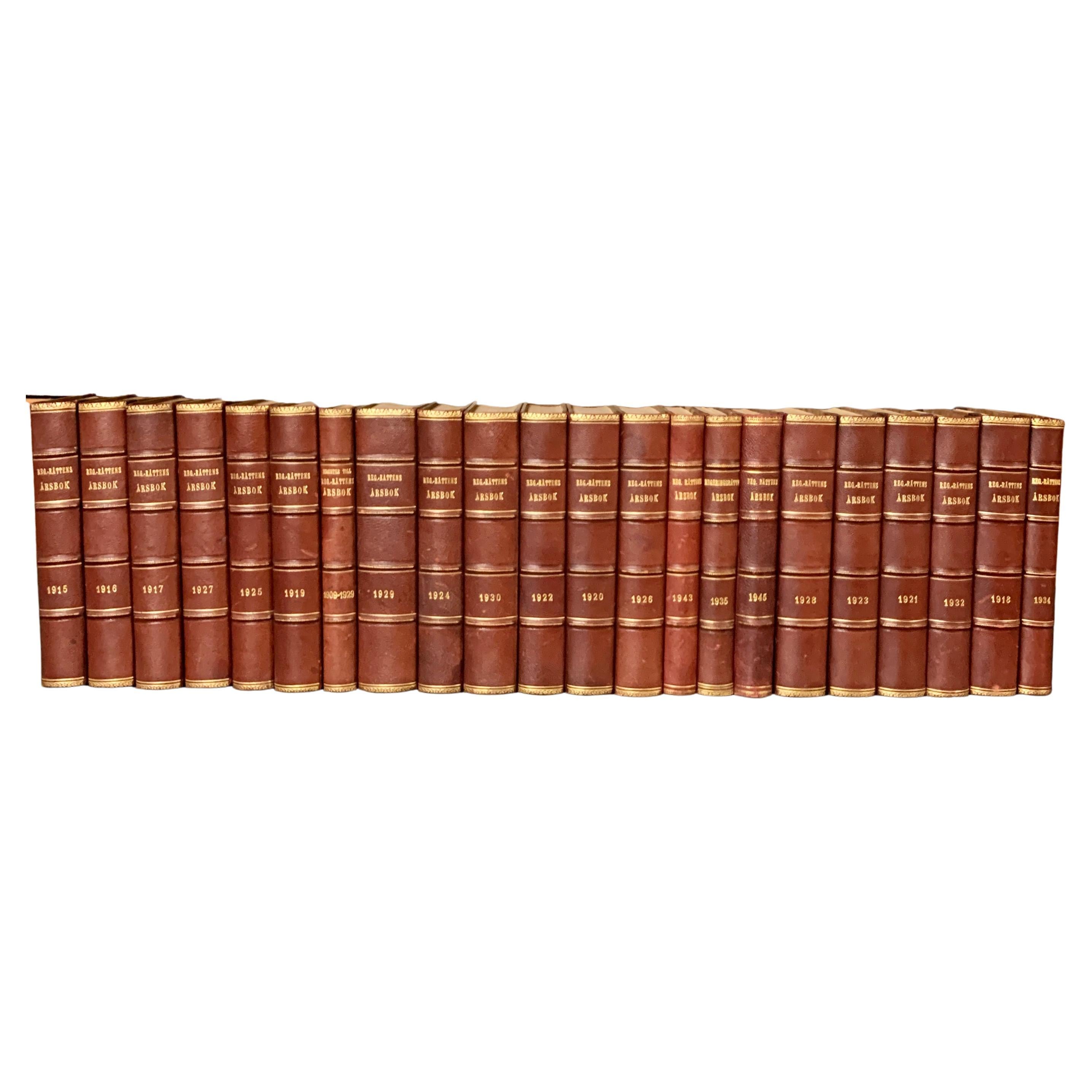
Collection of 22 Swedish 20th Century Leather-Bound Books
Located in Haddonfield, NJ
A collection of 22 Swedish decorative antique leather-bound library books.
The books are wrapped in leather-bound covers, comprised of a selection of warm tones and gold leaf print embossing.
The book collection measure horizontally is 80 cm, approximate 31,49 inches wide. This collection of books...
Category
Early 20th Century Swedish British Colonial Books
Materials
Leather, Paper
Set of Old Bound Books Dating from the 19th Century
Located in Beuzevillette, FR
Set of old religious books dating from the 19th century. From an old protestant library near Le Havre in France. These books are called for example « The poetry in Paris». These bea...
Category
Antique Late 19th Century French Books
Materials
Paper
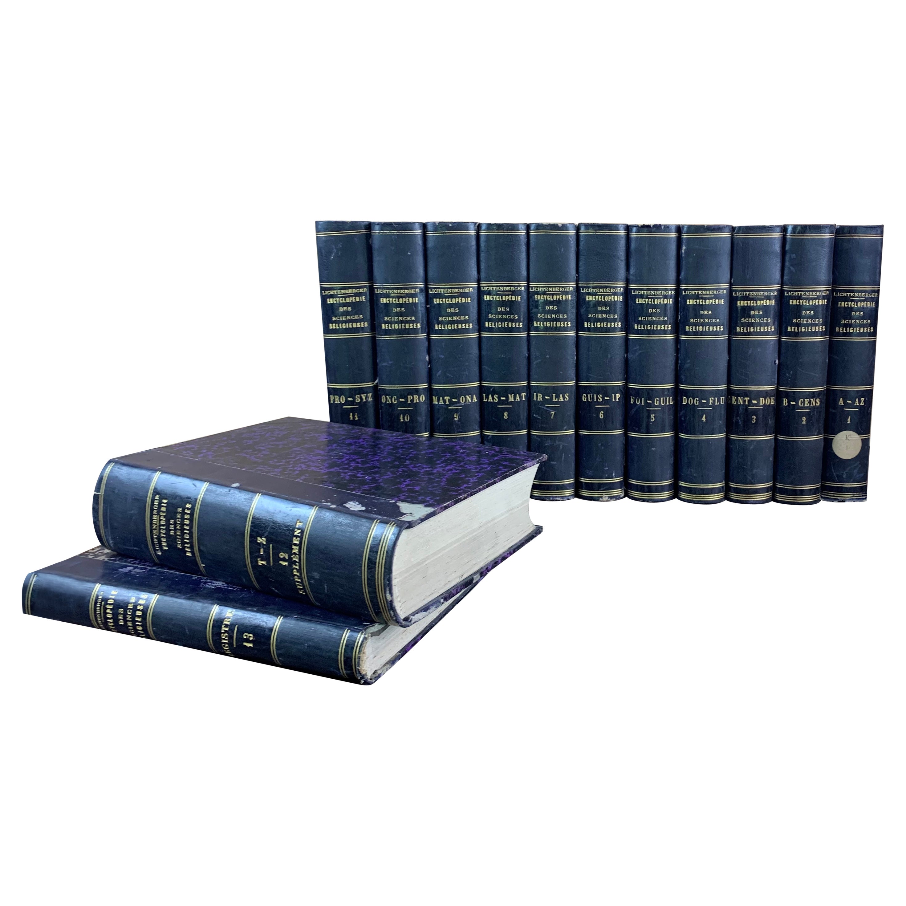
Set of Antique Books Dating From the 19th Century France
Located in Beuzevillette, FR
Set of antique books dating from the 19th century. From an old protestant library near Le Havre in France. These books are "encyclopedias of relig...
Category
Antique Late 19th Century French Books
Materials
Paper
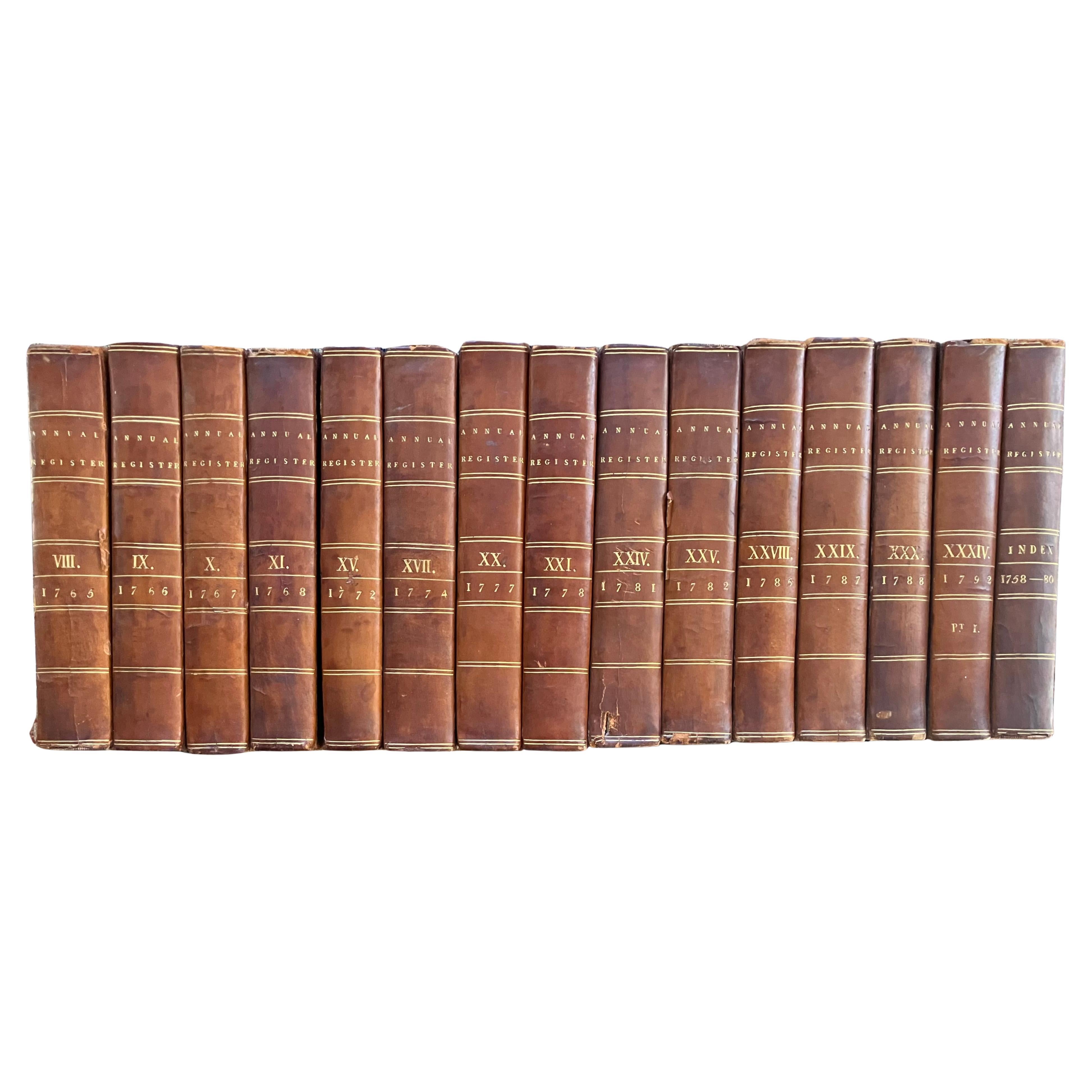
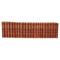
Inverary Set of Fifteen Leather Bound Books
Located in New York, NY
Inverary set of fifteen leather bound books. The Annual Register or A View of the History, Politics, and Literature for the year comprising the years 1765-1792: volume 8, 9, 10, 11,...
Category
Antique 18th Century English Books
Materials
Leather, Paper
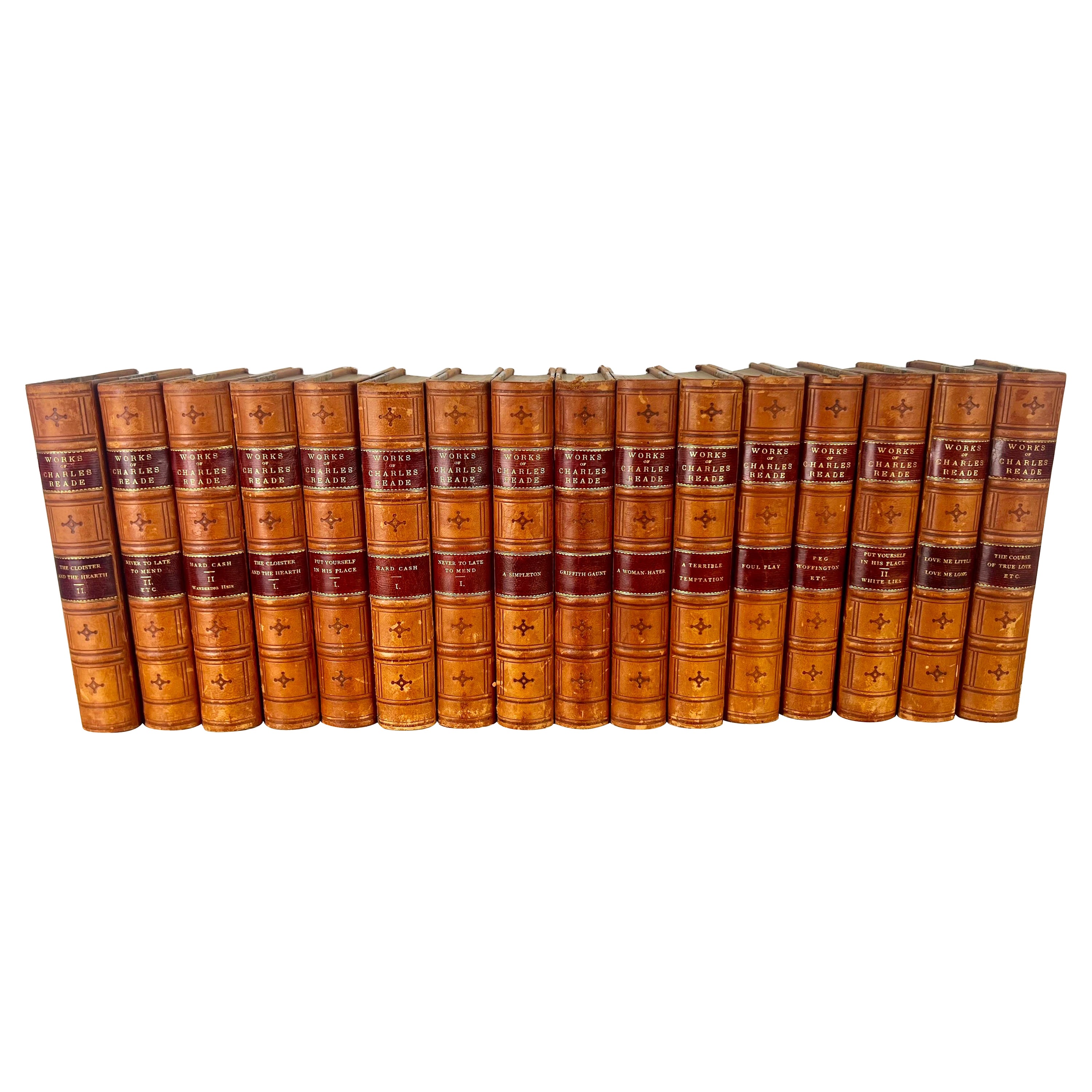
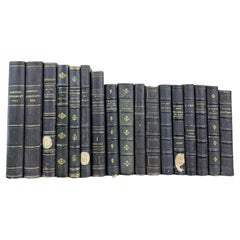
Set of Sixteen Leather Bound Book by Charles Reade
Located in Los Angeles, CA
Set of sixteen leather bound books by Charles Reade. Charles Reade was known for his novels that often combined elements of romance, social injustice, and moral earnestness. His wo...
Category
Antique 19th Century American Other Books
Materials
Leather, Paper

$2,320 Sale Price / set
20% Off
16 Volumes. William Hazlitt, The Life of Napoleon.
Located in New York, NY
16 Volumes. William Hazlitt, The Life of Napoleon. Edition de Deux Mondes. Bound by Blanchetiere in full green morocco with red and brown morocco borders. Gilt-tooling on the covers ...
Category
Antique Late 19th Century British Books
Materials
Leather
$18,500 / set
More Ways To Browse
Mark Dutcher
Dutch Antiques
Antique Books Amsterdam
Charlotte Bronte
J R R Tolkien
Sumo Book Stand
Viking Plate
Faberge Easter Egg
Holt Antique Furniture
Ian Fleming Books
Lewis And Clark
Pablo Picasso Coffee Table Book
Steven Holl
Verner Panton Book
Winnie The Pooh Collectibles
Antique Tools Glasgow
Antique Winchester Collectibles
Bible With Clasps