Items Similar to Navy Five-Star Admirals Signatures, United States World War II
Video Loading
Want more images or videos?
Request additional images or videos from the seller
1 of 7
Navy Five-Star Admirals Signatures, United States World War II
$6,950
£5,313.65
€6,120.25
CA$9,739.08
A$10,872.77
CHF 5,697.17
MX$133,093.35
NOK 72,354.08
SEK 68,220.71
DKK 45,676.02
Shipping
Retrieving quote...The 1stDibs Promise:
Authenticity Guarantee,
Money-Back Guarantee,
24-Hour Cancellation
About the Item
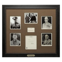
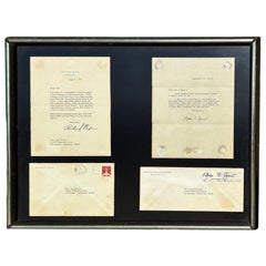
This amazing piece of U.S. Naval history features signed items from all four World War II Navy Admirals to ever wear the five-star rank. All are considered some of the finest admirals in the history of the Navy. Especially Chester Nimitz and William Halsey, both were instrumental in turning around the fortunes of the United States after the Japanese surprise attack on Pearl Harbor.
Chester Nimitz (1885-1966) was an American admiral, Commander in Chief of the U.S. Pacific Fleet during World War II, and largely responsible for the successful "island-hopping" campaign against the Japanese. The collage includes a Nimitz signed slip of paper with rank as well as, a war dated (July 16, 1942) letter from the Admiral's Flag Secretary, regarding the autograph.
William F Halsey (1882-1959) was an American admiral who led the task force attack on the Marshall and Gilbert islands and became commander of Allied naval forces in South Pacific commanding at the Solomon Islands and Leyte Gulf. Featured in the collage is a signed "W. F. Halsey" card.
Ernest J. King (1878-1956) was Commander in Chief, United States Fleet and Chief of Naval Operations. During World War II he directed the United States Navy's operations, planning, and administration and was a member of the Joint Chiefs of Staff. Included in the collage is a war dated (December 19, 1943) letter signed with rank by Admiral King.
William D. Leahy (1875-1959) was an American naval officer who served as the senior-most United States military officer on active duty during World War II. He held multiple titles and was at the center of all the major military decisions the United States made during the war. Featured in the collage is the admiral's business card as Ambassador of the United States -- signed in full.
Also included in this amazing U.S. Navy collage is photographs of each admiral as well as the five-star rank that each would have worn.
CONDITION:
Overall very good condition. All signatures are in dark ink and clearly legible. The letter signed by Nimitz has fold lines, one light stain, and the edges have been cut but no text is affected. The letter signed by King has fold lines and the paper is healthy. Halsey's signature card is clean and bright. Leahy's card is lightly soiled and has "1946" written in another ink. The collage is presented using the finest archival materials and procedures.
- Dimensions:Height: 37.5 in (95.25 cm)Width: 41 in (104.14 cm)Depth: 2 in (5.08 cm)
- Materials and Techniques:
- Place of Origin:
- Period:
- Date of Manufacture:Mid-20th Century
- Condition:Wear consistent with age and use.
- Seller Location:Colorado Springs, CO
- Reference Number:Seller: AS661stDibs: LU909713110581
About the Seller
4.9
Platinum Seller
Premium sellers with a 4.7+ rating and 24-hour response times
Established in 2010
1stDibs seller since 2011
461 sales on 1stDibs
- ShippingRetrieving quote...Shipping from: Colorado Springs, CO
- Return Policy
Authenticity Guarantee
In the unlikely event there’s an issue with an item’s authenticity, contact us within 1 year for a full refund. DetailsMoney-Back Guarantee
If your item is not as described, is damaged in transit, or does not arrive, contact us within 7 days for a full refund. Details24-Hour Cancellation
You have a 24-hour grace period in which to reconsider your purchase, with no questions asked.Vetted Professional Sellers
Our world-class sellers must adhere to strict standards for service and quality, maintaining the integrity of our listings.Price-Match Guarantee
If you find that a seller listed the same item for a lower price elsewhere, we’ll match it.Trusted Global Delivery
Our best-in-class carrier network provides specialized shipping options worldwide, including custom delivery.More From This Seller
View AllWWI and WWII Air Force Captains, Original Signatures
Located in Colorado Springs, CO
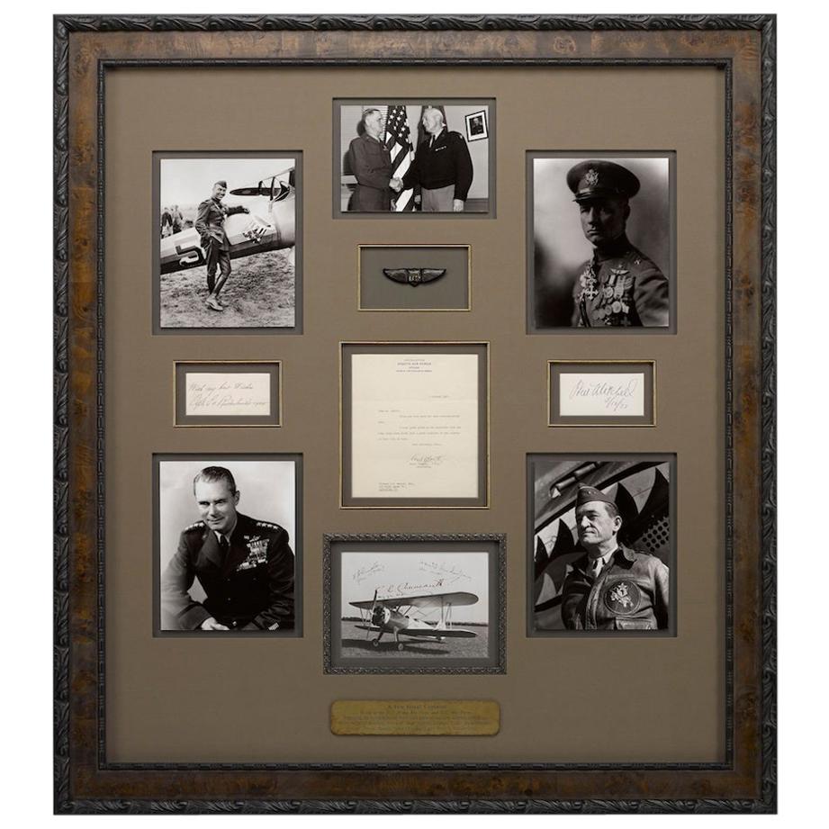
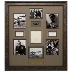
Offered is a unique collage featuring signatures from some of the greatest captains in history: Claire Chennault, Henry “Hap” Arnold, Hoyt Vandenberg, Carl “Tooey” Spaatz, William “Billy” Mitchell and Edward “Eddie” Rickenbacker. These men are some of the most influential figures in U.S. Air Force history. Each captain was involved in WWI and/or WWII, some were aces who proved the usability and effectiveness of airpower, and others were brilliant leaders who paved the way for U.S. victories and the development of the U.S. Air Force.
This framed collage includes original signatures on cards, a letter, and a photo. A photo of a biplane is featured at bottom and includes signatures from Claire Chennault, Hap Arnold, and Hoyt Vandenberg. There is also a letter, dated 1942 and featured prominently in the center of the collage, that is written to Elwood Maurer and signed by Carl Spaatz. Two cards appear on either side of the letter, with signatures from Eddie Rickenbacker and William Mitchell. Complimentary black and white photographs accompany the signatures elements as well as a decorative pair of WWI pilot wings...
Category
20th Century American Aviation Objects
Materials
Paper
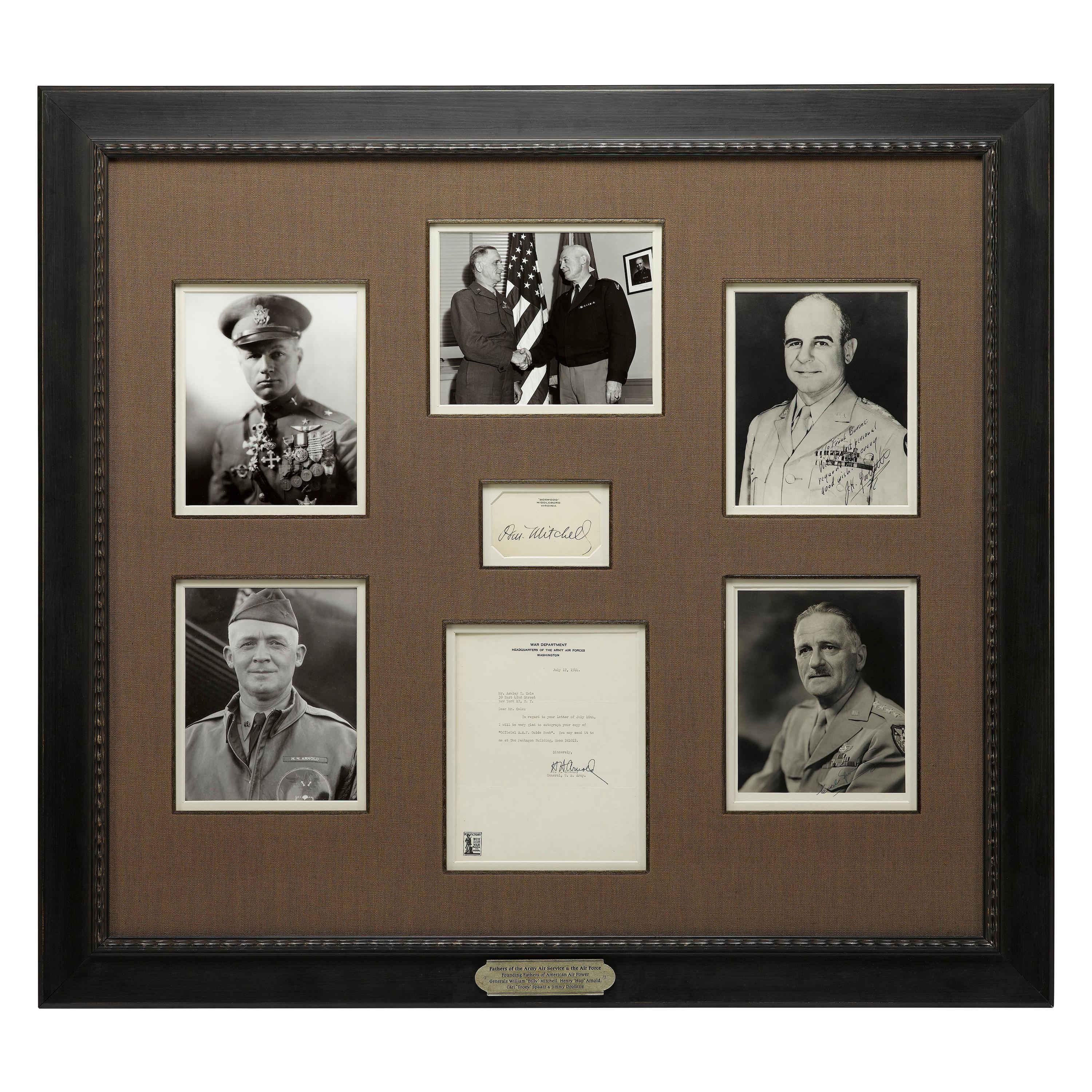
Fathers of the Air Service Authentic Signature Collage, circa 1926-1993
Located in Colorado Springs, CO
Presented is a collage celebrating the men who made an early impact on the formation of America’s Air Service. Complete with signatures by Jimmy Doolittle, Tooey Spaatz, Hap Arnold, ...
Category
Late 20th Century American Historical Memorabilia
Materials
Paper
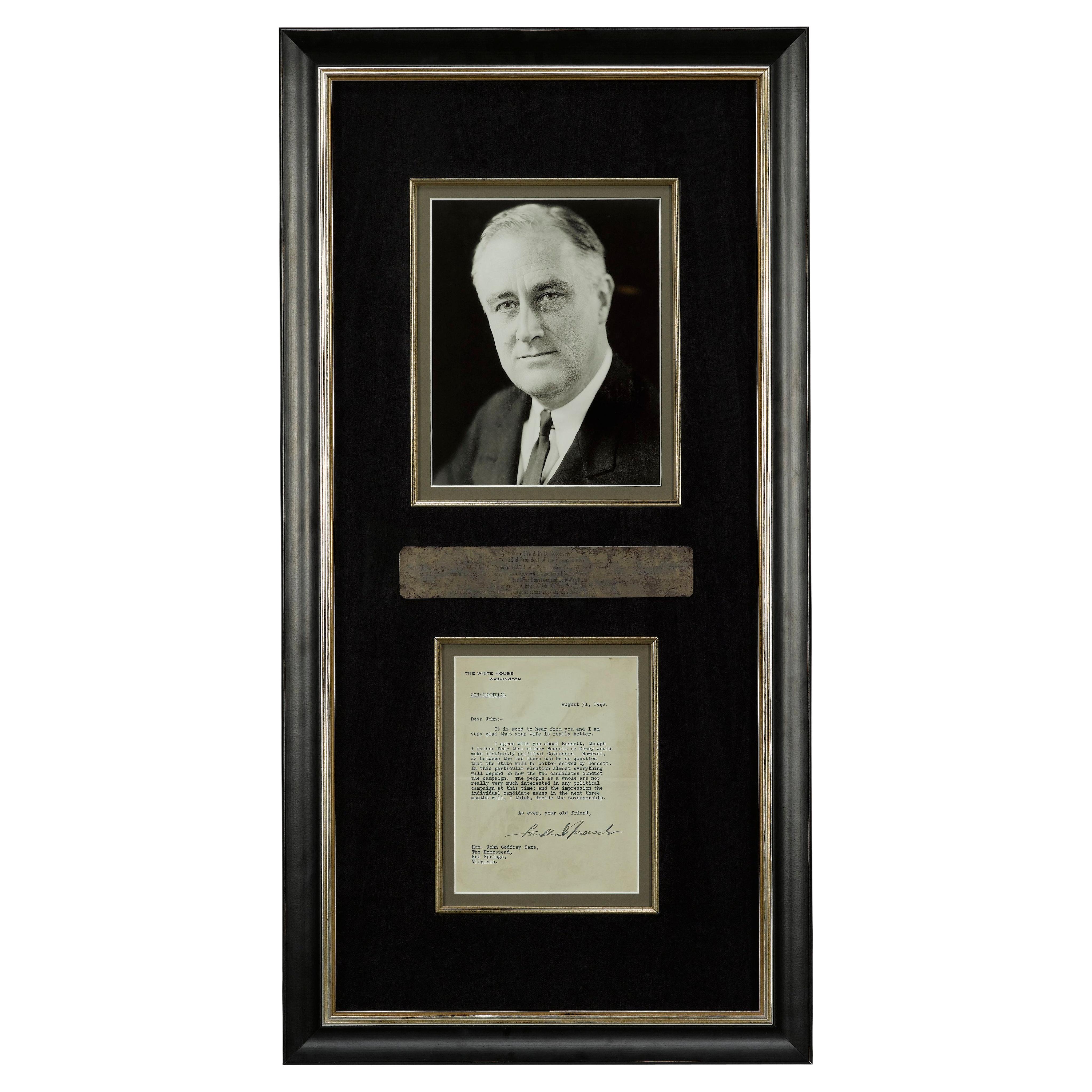
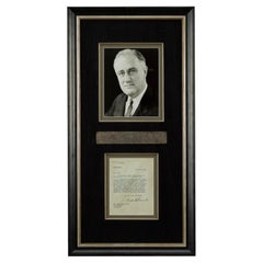
Franklin D. Roosevelt Signed Letter, 1942
Located in Colorado Springs, CO
Presented is an original signed letter from President Franklin D. Roosevelt to the Honorable John Godfrey Saxe, a NY lawyer and State Senator. The one-page typed letter is written on...
Category
Vintage 1940s American Historical Memorabilia
Materials
Paper
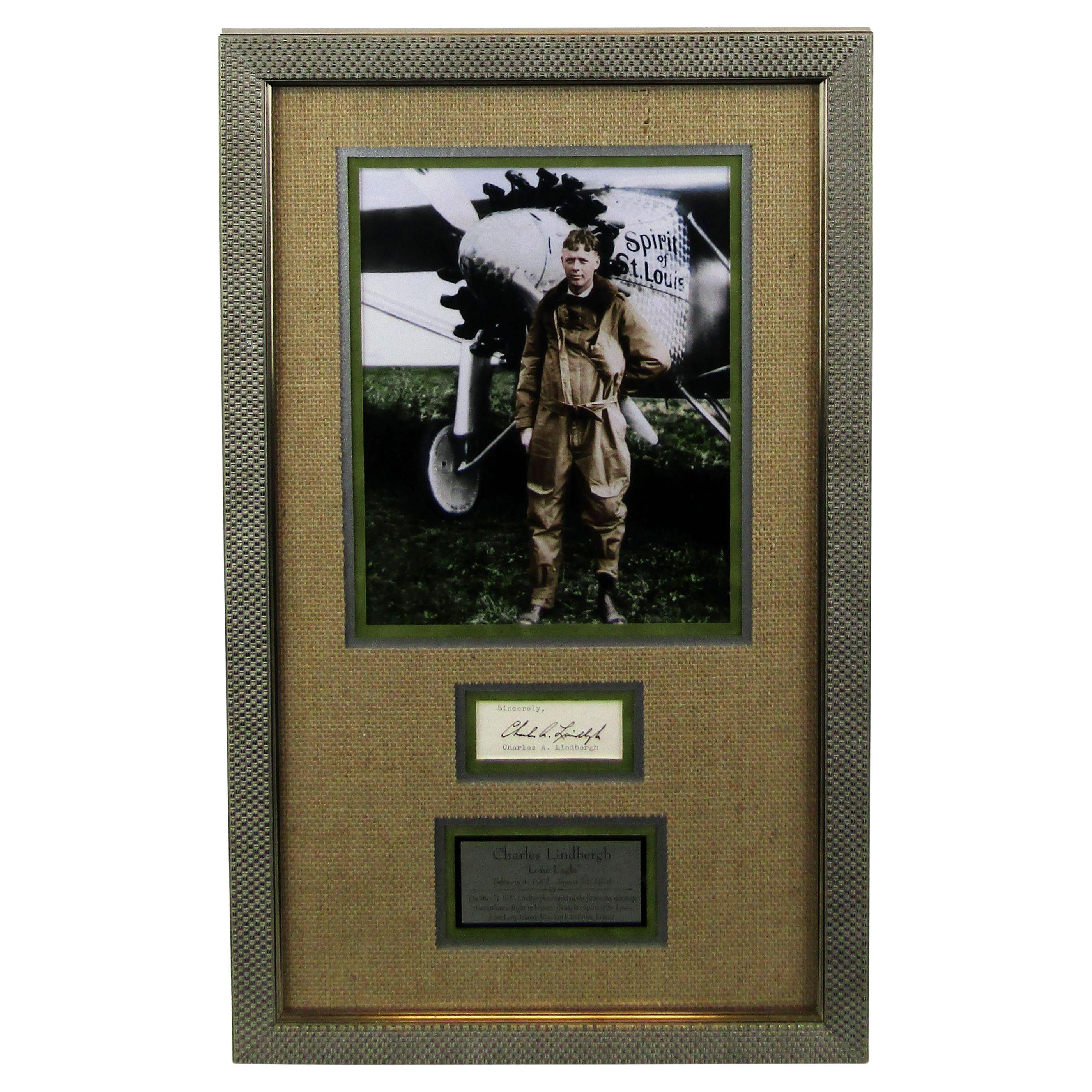
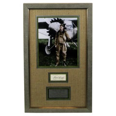
Charles A. Lindbergh Signature
Located in Colorado Springs, CO
This is a handsome display featuring the signature of celebrated American aviator Charles A. Lindbergh (1902-1974). Lindbergh signed the page, now cut, in black ink as "Charles A. Li...
Category
Antique Mid-19th Century American Aviation Objects
Materials
Paper
$2,600 Sale Price
20% Off
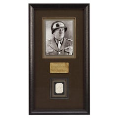
General George S. Patton Jr. Signature Collage
Located in Colorado Springs, CO
Offered is a collage celebrating General George S. Patton Jr. This collage features Patton's original signature on a section of cream paper. Patton's neat signature and rank appears ...
Category
Vintage 1940s Historical Memorabilia
Materials
Paper
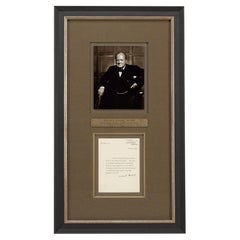
Winston Churchill Signed Typed Letter, to the English-Speaking Union, Feb. 1957
By Winston Churchill
Located in Colorado Springs, CO
Presented is a February 1957 signed letter by Winston Churchill to the English-Speaking Union, emphasizing the importance of good relations between the United States and Great Britai...
Category
Vintage 1950s French Mid-Century Modern Historical Memorabilia
Materials
Paper
You May Also Like
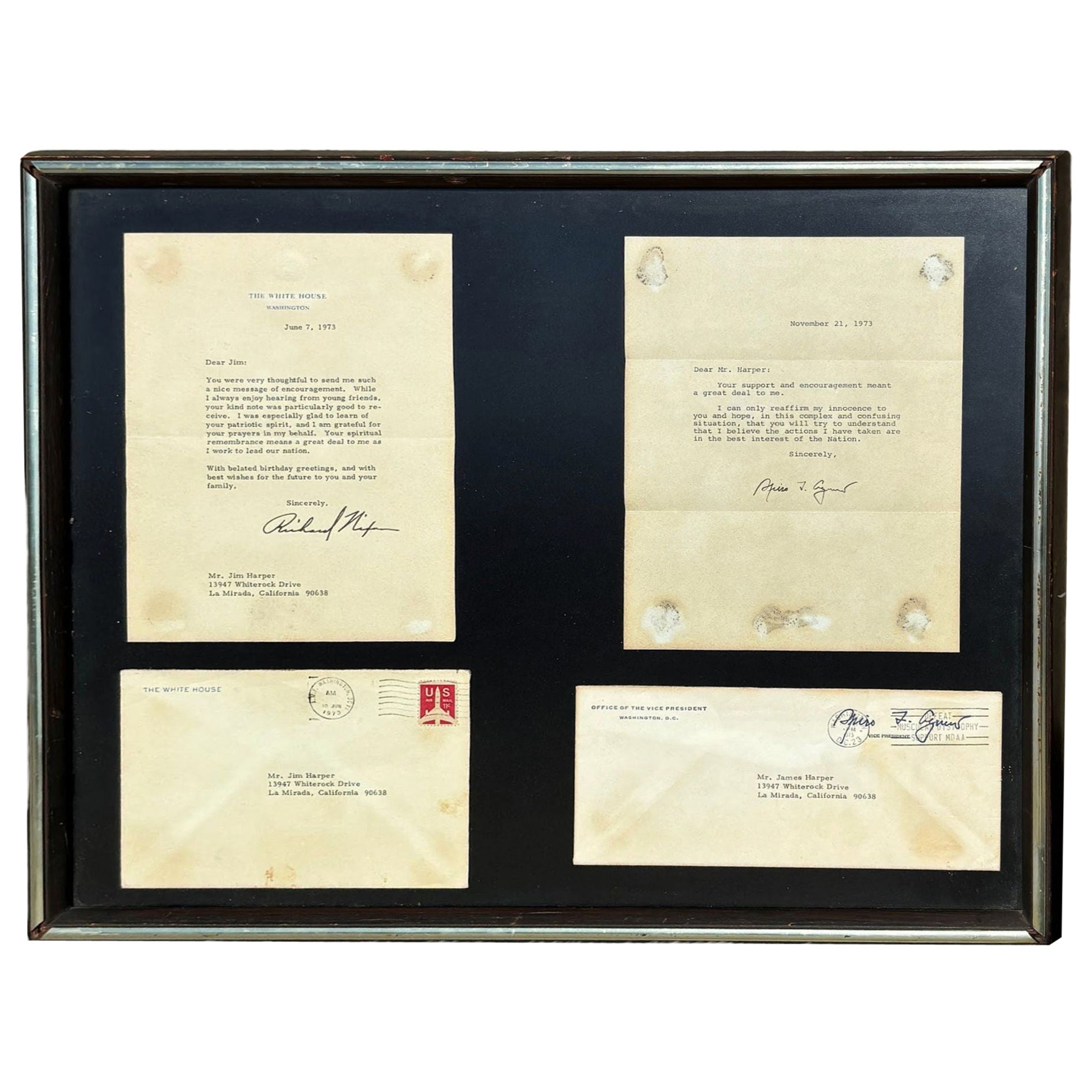
Framed Richard Nixon & Spiro Agnew Watergate Letters 1973
Located in Van Nuys, CA
Hand-typed letters between "Jim Harper" of California and the 37th president of the United States, Richard Nixon, and Vice President Spiro Agnew. It featur...
Category
Vintage 1970s American Historical Memorabilia
Materials
Glass, Wood
$302 Sale Price
44% Off
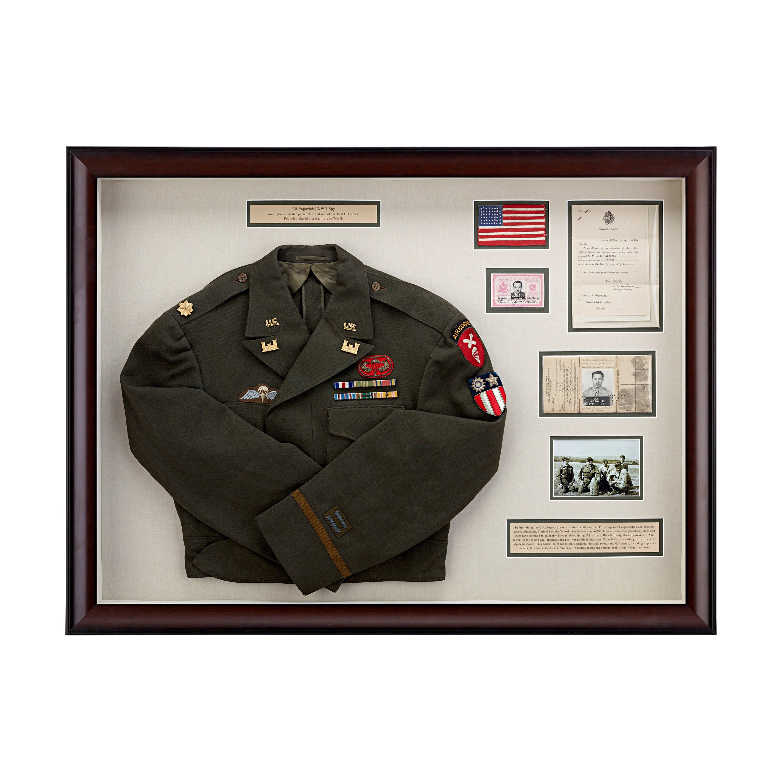
OSS Agent Personal Collection
Located in New Orleans, LA
This rare collection offers an unprecedented glimpse into the secretive life of Eli Popovich, an engineer, master parachutist and friend and collaborator to one of the most influential underground leaders during WWII, Josip Broz...
Category
20th Century American Historical Memorabilia
Materials
Glass, Wood
Highly Important Theodore Roosevelt Collection of 6 Items
By Theodore Roosevelt
Located in Dallas, TX
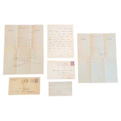
PRESENTING A HUGELY IMPORTANT, EXCEPTIONALLY RARE and FULLY AUTHENTIC COLLECTION of 6 Items pertaining to President Theodore Roosevelt, that have never been outside family ownership, namely:
(1) Original Theodore Roosevelt Letter 14th August 1918 to Eliza Calvert Hall,
(2) Original Envelope – Aug 1918, with postage stamps, marks, etc.
(3) Original Theodore Roosevelt Letter 8th November 1918 to Mrs Obenchain
(4) Original Envelope – Nov 1918, with postage stamps, marks, etc.
(5) HUGELY IMPORTANT handwritten ‘Poem’ on an Index Card by Eliza Calvert Hall which was sent by her to Theodore, after the death of Quentin in July 1918 and is referenced to by him, in the letter of August 1918, and
(6) Original letter dated 12 September 2018 to Maj LC Obenchain, which completes provenance/background.
(1) & (2) – PRESENTING AN EXCEPTIONALLY RARE and FULLY AUTHENTIC Theodore Roosevelt Letter from August 1918 with original envelope.
On ‘Sagamore Hill’ letterhead. Fully handwritten and personally signed by President...
Category
Early 20th Century American American Empire Historical Memorabilia
Materials
Paper
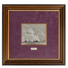
Charles Dixon R.A. for King George V, Royal Yacht Britannia
Located in Lymington, Hampshire
This ‘en grisaille’ watercolour on paper is Charles Dixon’s preparatory sketch for a proposed but apparently uncompleted painting of the royal racing yacht Britannia...
Category
Vintage 1930s English Nautical Objects
Materials
Paper
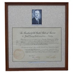
Presidential Seal with Calvin Coolidge Signed Document
Located in Houston, TX
Signed document signed by Calvin Coolidge with an attached president seal. There is a photo of Calvin Coolidge on top of the document. The second signature is by Frank Kellogg. The w...
Category
Vintage 1920s American Modern Historical Memorabilia
Materials
Paper
Original Typewritten Document Signed by F.D. Roosevelt, 1920
Located in Roma, IT
Historical Document by Roosevelt is a precious T.D.S. (Typewritten Document Signed) by the President of the United States of America Franklin Delano Roosevelt (1882 - 1945) to Charle...
Category
Vintage 1920s American Historical Memorabilia
Materials
Paper
More Ways To Browse
World War Ii Furniture
Used American Signature Furniture
Pacific Furniture Mid Century
Navy Flags
Japanese Flag
Japanese Secretary
Japanese World War Flag
Marshall Plan
Royal Memorabilia
Antique Camp Furniture
Naval Antiques
Shell Casing
Cleveland Antique Furniture
Antique Post Office Collectibles
Antique Feather Tree
Great Seal Of The United States
Glass Christmas Tree
Antique Cowboy Collectibles