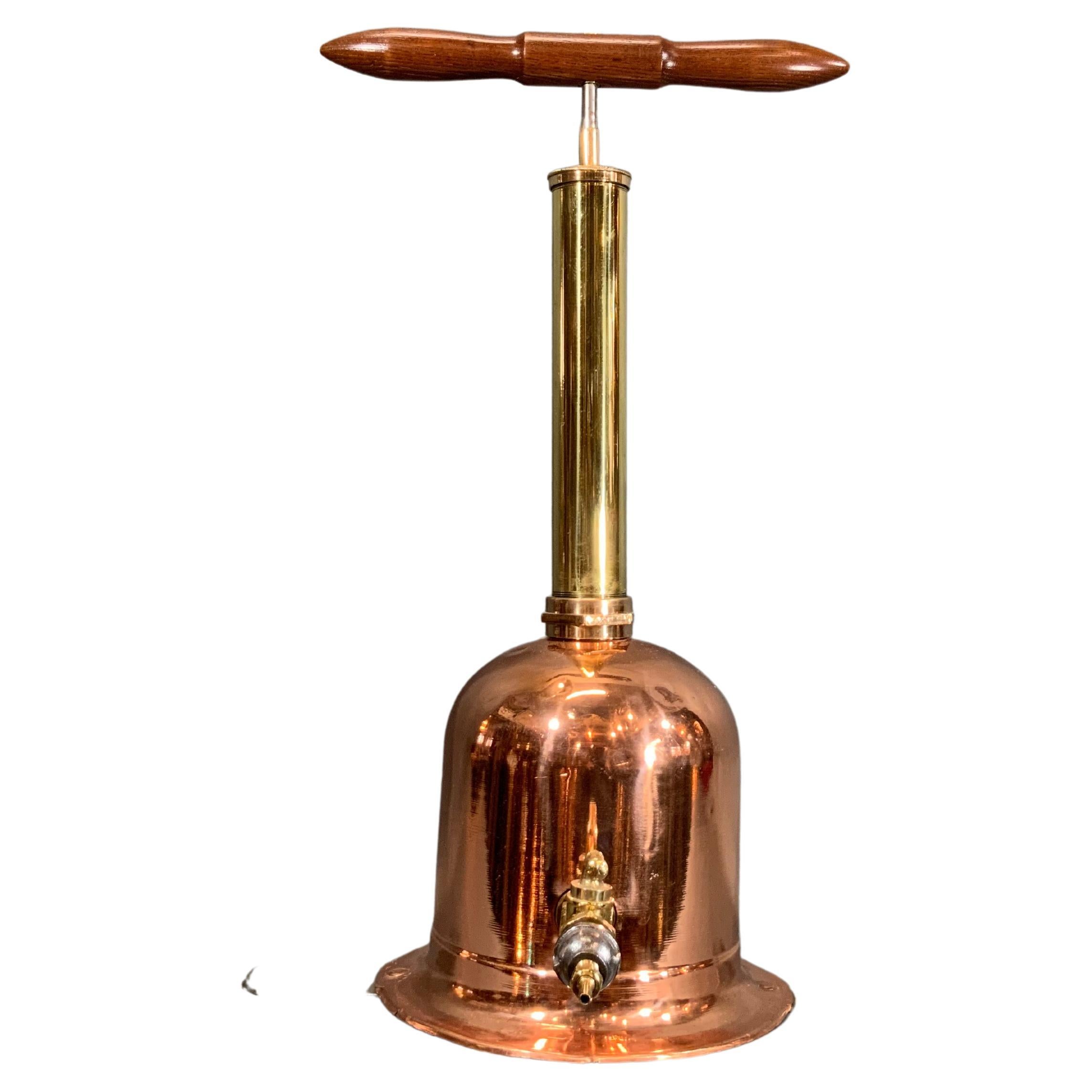
Items Similar to Gallon chekpump for Northamptonshire County Council
Want more images or videos?
Request additional images or videos from the seller
1 of 13
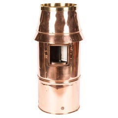
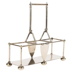
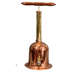
Gallon chekpump for Northamptonshire County Council
$1,027.82
£750
€875
CA$1,407.85
A$1,565.84
CHF 817.63
MX$19,054.57
NOK 10,442.40
SEK 9,793.13
DKK 6,530.44
Shipping
Retrieving quote...The 1stDibs Promise:
Authenticity Guarantee,
Money-Back Guarantee,
24-Hour Cancellation
About the Item
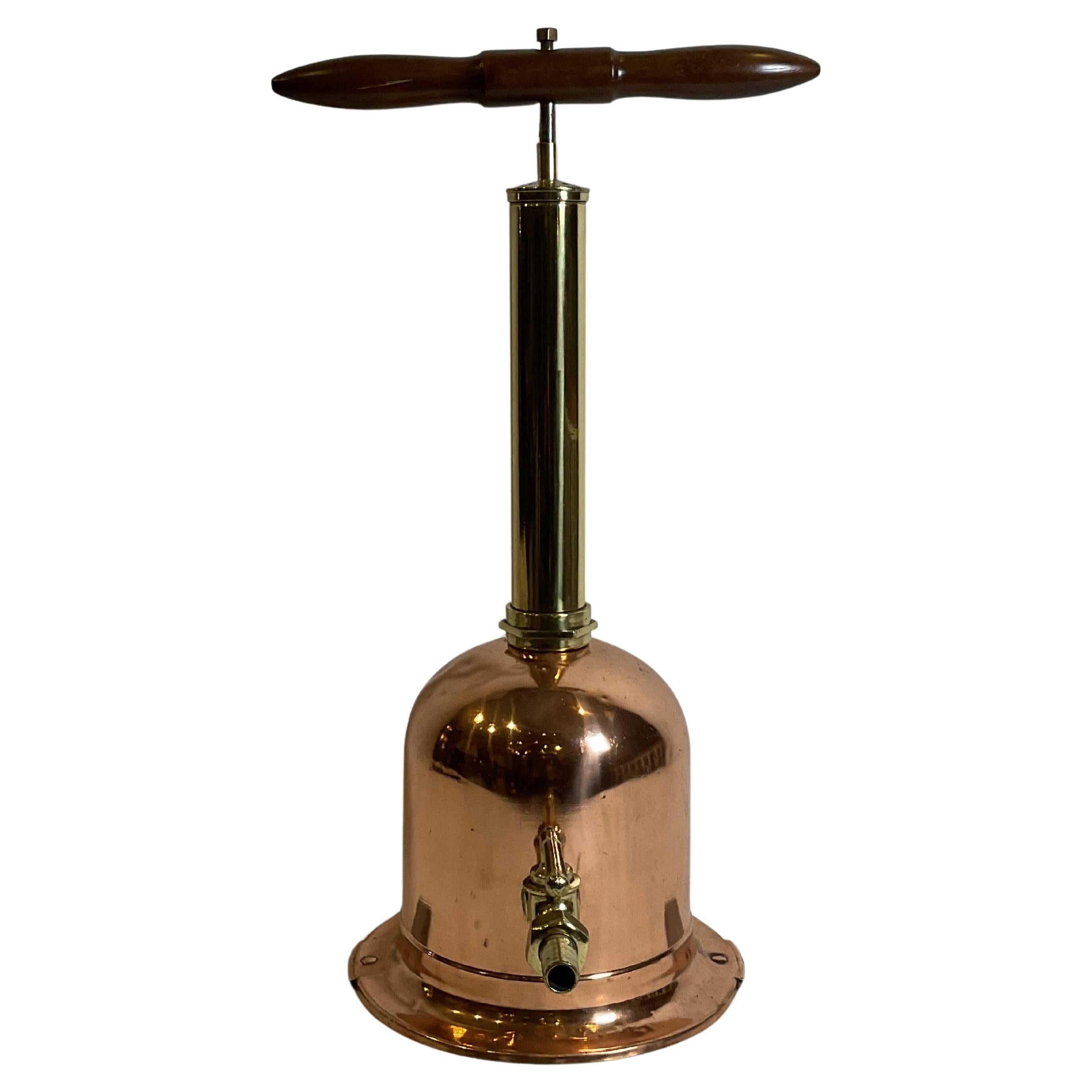
A copper and brass one gallon "chekpump" standard fuel measure for Northamptonshire County Council. Circa 1915.
- Dimensions:Height: 15.5 in (39.37 cm)Width: 12.5 in (31.75 cm)Depth: 9 in (22.86 cm)
- Style:Industrial (Of the Period)
- Materials and Techniques:
- Place of Origin:
- Period:
- Date of Manufacture:Circa 1925
- Condition:Wear consistent with age and use. Minor fading. Cleaned and polished.
- Seller Location:London, GB
- Reference Number:1stDibs: LU1190243744112
About the Seller
5.0
Gold Seller
Premium sellers maintaining a 4.3+ rating and 24-hour response times
Established in 1961
1stDibs seller since 2015
236 sales on 1stDibs
Typical response time: 6 hours
- ShippingRetrieving quote...Shipping from: London, United Kingdom
- Return Policy
Authenticity Guarantee
In the unlikely event there’s an issue with an item’s authenticity, contact us within 1 year for a full refund. DetailsMoney-Back Guarantee
If your item is not as described, is damaged in transit, or does not arrive, contact us within 7 days for a full refund. Details24-Hour Cancellation
You have a 24-hour grace period in which to reconsider your purchase, with no questions asked.Vetted Professional Sellers
Our world-class sellers must adhere to strict standards for service and quality, maintaining the integrity of our listings.Price-Match Guarantee
If you find that a seller listed the same item for a lower price elsewhere, we’ll match it.Trusted Global Delivery
Our best-in-class carrier network provides specialized shipping options worldwide, including custom delivery.More From This Seller
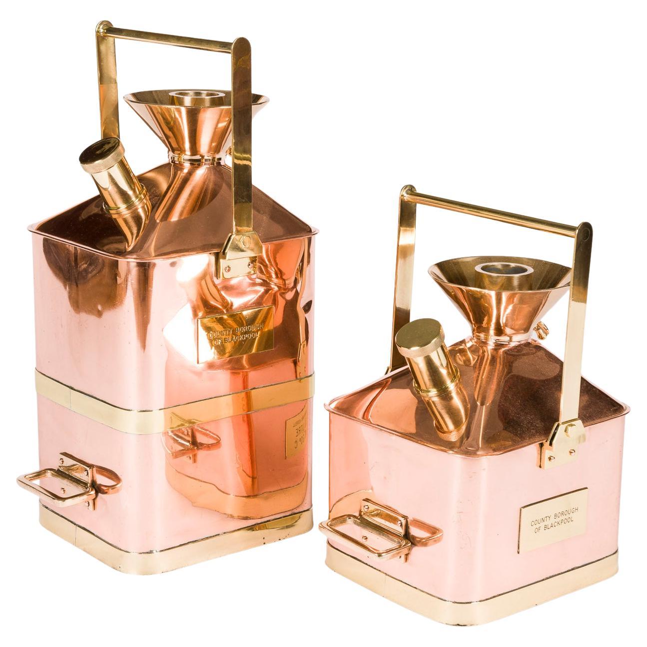
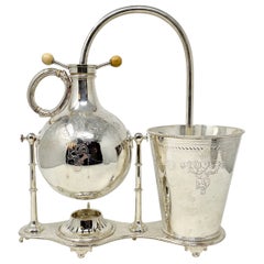
View AllCopper & brass fuel measures by Sutherland Astell
Located in London, GB
Two copper and brass metric "Checkpump" fuel measures by Sutherland Astell, circa 1950.
Made for the County Borough of Blackpool.
Marked: 10 and 20 litres, at 20°.
20L, Height: 23...
Category
Mid-20th Century English Scientific Instruments
Materials
Brass, Copper

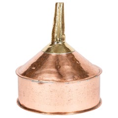
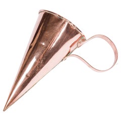
Large copper & brass funnel
Located in London, GB
A large late 19th century copper and brass funnel.
From Wiltshire County, England.
Category
Antique Late 19th Century English Industrial Scientific Instruments
Materials
Brass, Copper
$602 Sale Price
20% Off
Recording Copper Rain Gauge by Casella & Co of London
By Casella
Located in London, GB
An 8" diameter recording copper rain gauge by C F Casella & Co of London.
With an internal 24 hour "Gluck" barometer recorder.
Height:63 cm.
Diameter: 28 ...
Category
Mid-20th Century English Scientific Instruments
Materials
Copper
$1,973 Sale Price
20% Off
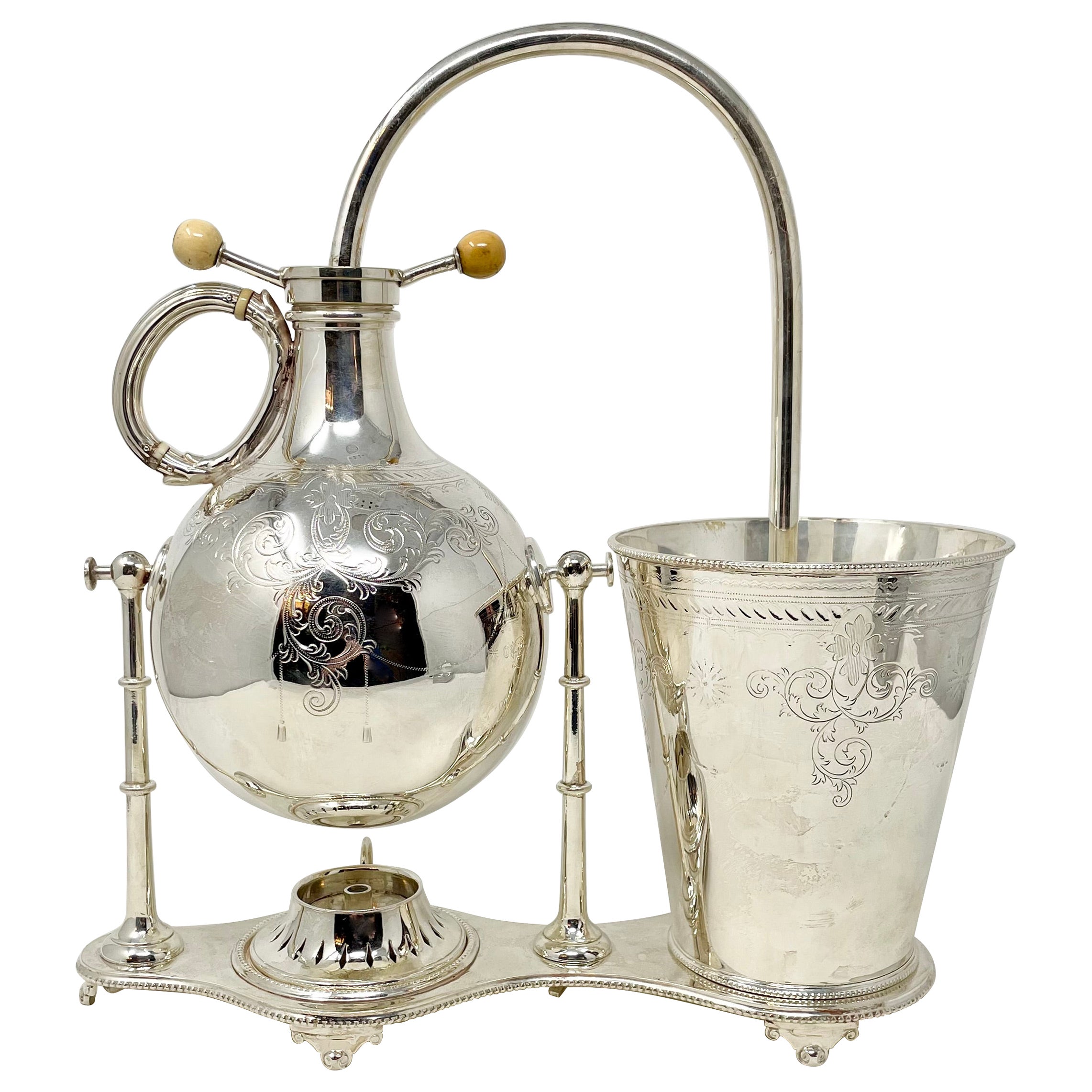
Silver Plated Decanter and Bottle Holder
Located in London, GB
An early 20th century silver plated decanter and bottle holder, with central shield, folding handle, and bun feet.
Category
Early 20th Century Barware
Materials
Silver Plate
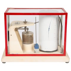
Open Scale Barograph by C F Casella & Co of London
By Casella
Located in London, GB
An open scale barograph by C F Casella & Co of London, circa 1960.
7 day clockwork "Gluck" barometer recorder.
Measures: Width: 32 cm.
Depth:18 cm.
Height: 23.5 cm.
C. F. Casella and Co:
Established in 1810 as Tagliabue and Casella.
Incorporated as a limited liability company, C. F. Casella and Co, in 1910.
AS advertised in 1930: C. F. Casella and Co Ltd., of Regent House, Britannia Walk, London, N1 7ND - Makers of anemometers, anemographs, barometers, barographs, hygrometers, hygrographs, radiation instruments, rain gauges...
Category
Mid-20th Century English Industrial Scientific Instruments
Materials
Metal
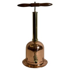
Large mid 19th century copper ale muller
Located in London, GB
A large mid 19th century copper ale muller.
Rolled copper with seam, riveted loop handle, side spout, and tinned interior.
Used to heat beer, ale, cider a...
Category
Antique Mid-19th Century English Barware
Materials
Copper
You May Also Like
Diving Pump With Copper Tank
Located in Norwell, MA
Copper and brass ocean divers auxiliary fresh air pump. With wood T handle, brass spigot with lever handle. Steel pad feet. Highly polished and lacquered. 27"Hx18"Wx11"Dia 14lbs.
Category
Vintage 1940s North American Nautical Objects
Materials
Brass
Copper and Brass Fresh Air Diver's Pump with Wood Handle
Located in Norwell, MA
Diver's pump for shallow water use which feeds air to the diver's helmet. Highly polished and lacquered, with wood handled plunger. Handles have been sanded and varnished. Great divi...
Category
Vintage 1940s American Nautical Objects
Materials
Copper
Antique English Silver-Plated Siphon Coffee Maker, Circa 1870.
Located in New Orleans, LA
Antique English Silver-Plated Siphon Coffee Maker, Circa 1870.
Category
Antique Late 19th Century English Sheffield and Silverplate
Materials
Silver Plate
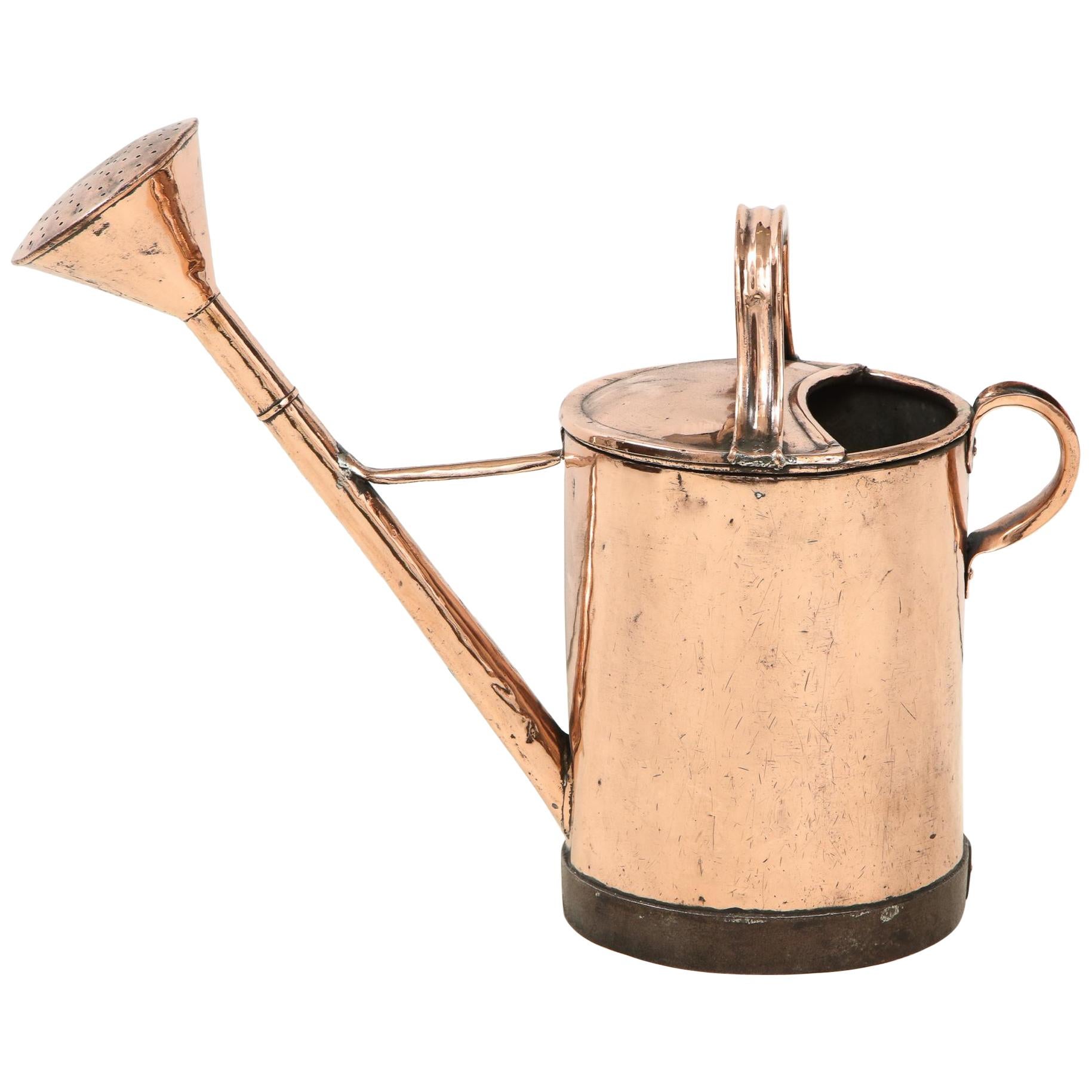
19th Century Copper Watering Can
Located in Greenwich, CT
Good 19th century copper watering can of cylindrical form, having both a carrying and pouring handle, extended flower head and wrought iron reinfor...
Category
Antique 19th Century French Edwardian Garden Ornaments
Materials
Copper

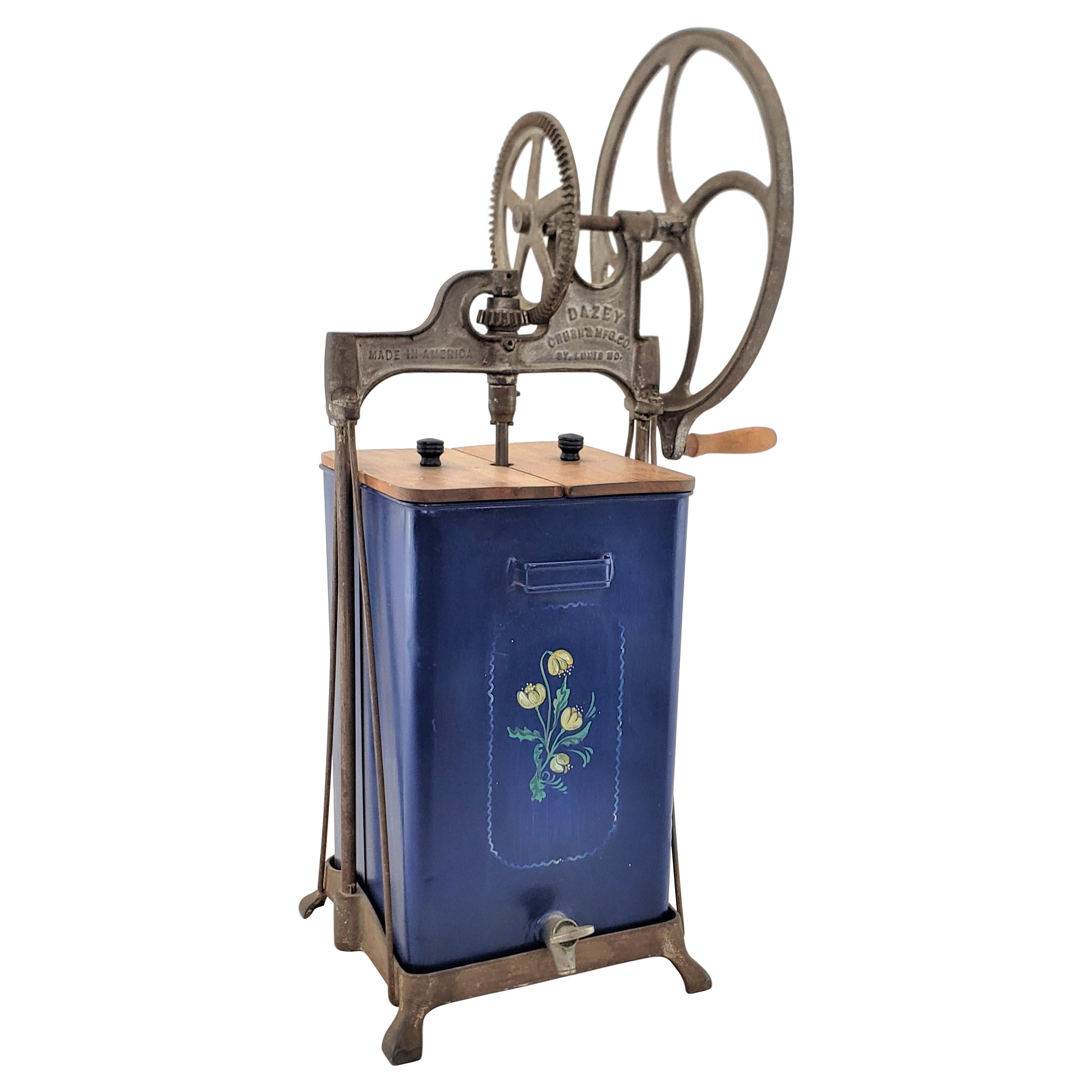
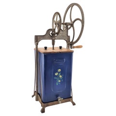
Antique Dazey Commercial Industrial Churn or Mixer with Toleware Decoration USA
Located in Hamilton, Ontario
This antique commercial churn or mixer was made by the Dazey Manufacturing Company of St. Louis in approximately 1920 in a period Art Deco style. The frame and gear mechanism of the ...
Category
Early 20th Century American Art Deco Scientific Instruments
Materials
Metal
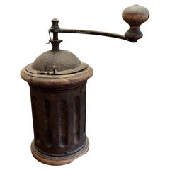
Old Coffee Grinder, France, 1930s
Located in Palermo, IT
Old coffee grinder, France, 1930s
Found in my cellar, it was presumably purchased by my great-great-grandparents. Fair condition, shows signs of age. I deliberately did not remove th...
Category
Vintage 1930s Italian Barware
Materials
Metal
$316 Sale Price
20% Off
More Ways To Browse
Jewelers Scale
Antique Brass Scoop
Antique Survey Instruments
Antique Surveying Instruments
Brain Model
Brass Telescope On Tripod
Compass Sundial
German Binoculars
Lorgnette Opera Glasses
Opera Glasses Lorgnette
Pressure Gauge
Wheel Barometer
Antique Brass Microscope Scientific Instruments
Antique Field Camera
Antique Lorgnette Folding Glasses
Antique Pomanders
Apothecary Balance
Barograph And Barometer