Items Similar to Late 20th Century Educational Geographic Map - Earths Lithosphere

Want more images or videos?
Request additional images or videos from the seller
1 of 8
Late 20th Century Educational Geographic Map - Earths Lithosphere
$130.19
£95
€110.83
CA$178.33
A$198.34
CHF 103.57
MX$2,413.58
NOK 1,322.70
SEK 1,240.46
DKK 827.19
Shipping
Retrieving quote...The 1stDibs Promise:
Authenticity Guarantee,
Money-Back Guarantee,
24-Hour Cancellation
About the Item
Late 20th Century Educational Geographic Map – Earths Lithosphere
Late 20th Century Educational Geographic Map – Earths Lithosphere. Good quality roll up school educational geographic map from the Czech republic. The map is printed on a cotton canvas that has been sealed with a clear lacquer.
WORKSHOP REPORT
Our workshop team inspect every product and carry out any needed repairs to ensure that everything leaves us serviced and maintained ready for many more years of life. All of our vintage products show the rich beauty and history of their life with the knocks and bumps of many years of use and we try to minimise restoration to keep every piece as original as possible.
Date: Late 20th Century
Maker: Industrial Production - Czech
Dimensions: L 1 x W 170 x H 112 cm
- Dimensions:Height: 44.1 in (112 cm)Width: 66.93 in (170 cm)Depth: 0.4 in (1 cm)
- Materials and Techniques:
- Place of Origin:
- Period:
- Date of Manufacture:Late 20th Century
- Condition:Refinished. Wear consistent with age and use.
- Seller Location:Hook, GB
- Reference Number:Seller: 1728.131stDibs: LU4494237881082
About the Seller
4.7
Vetted Professional Seller
Every seller passes strict standards for authenticity and reliability
Established in 2017
1stDibs seller since 2019
488 sales on 1stDibs
Typical response time: 16 hours
- ShippingRetrieving quote...Shipping from: Hook, United Kingdom
- Return Policy
Authenticity Guarantee
In the unlikely event there’s an issue with an item’s authenticity, contact us within 1 year for a full refund. DetailsMoney-Back Guarantee
If your item is not as described, is damaged in transit, or does not arrive, contact us within 7 days for a full refund. Details24-Hour Cancellation
You have a 24-hour grace period in which to reconsider your purchase, with no questions asked.Vetted Professional Sellers
Our world-class sellers must adhere to strict standards for service and quality, maintaining the integrity of our listings.Price-Match Guarantee
If you find that a seller listed the same item for a lower price elsewhere, we’ll match it.Trusted Global Delivery
Our best-in-class carrier network provides specialized shipping options worldwide, including custom delivery.More From This Seller
View AllLate 20th Century Educational Geographic Map - South African Topography (1728.5)
Located in Hook, Hampshire
Late 20th Century Educational Geographic Map – South African Topography (1728.5)
Late 20th Century Educational Geographic Map – South African Topograp...
Category
Late 20th Century Czech Posters
Materials
Cotton
Late 20th Century Educational Geographic Map - Atlantic Currents
Located in Hook, Hampshire
Late 20th Century Educational Geographic Map – Atlantic Currents
Late 20th Century Educational Geographic Map – Atlantic Currents. Good quality roll up school educational geographic ...
Category
Late 20th Century Czech Posters
Materials
Cotton
Late 20th Century Educational Geographic Map - South African Topography (1728.4)
Located in Hook, Hampshire
Late 20th Century Educational Geographic Map – South African Topography (1728.4)
Late 20th Century Educational Geographic Map – South African Topograp...
Category
Late 20th Century Czech Posters
Materials
Cotton
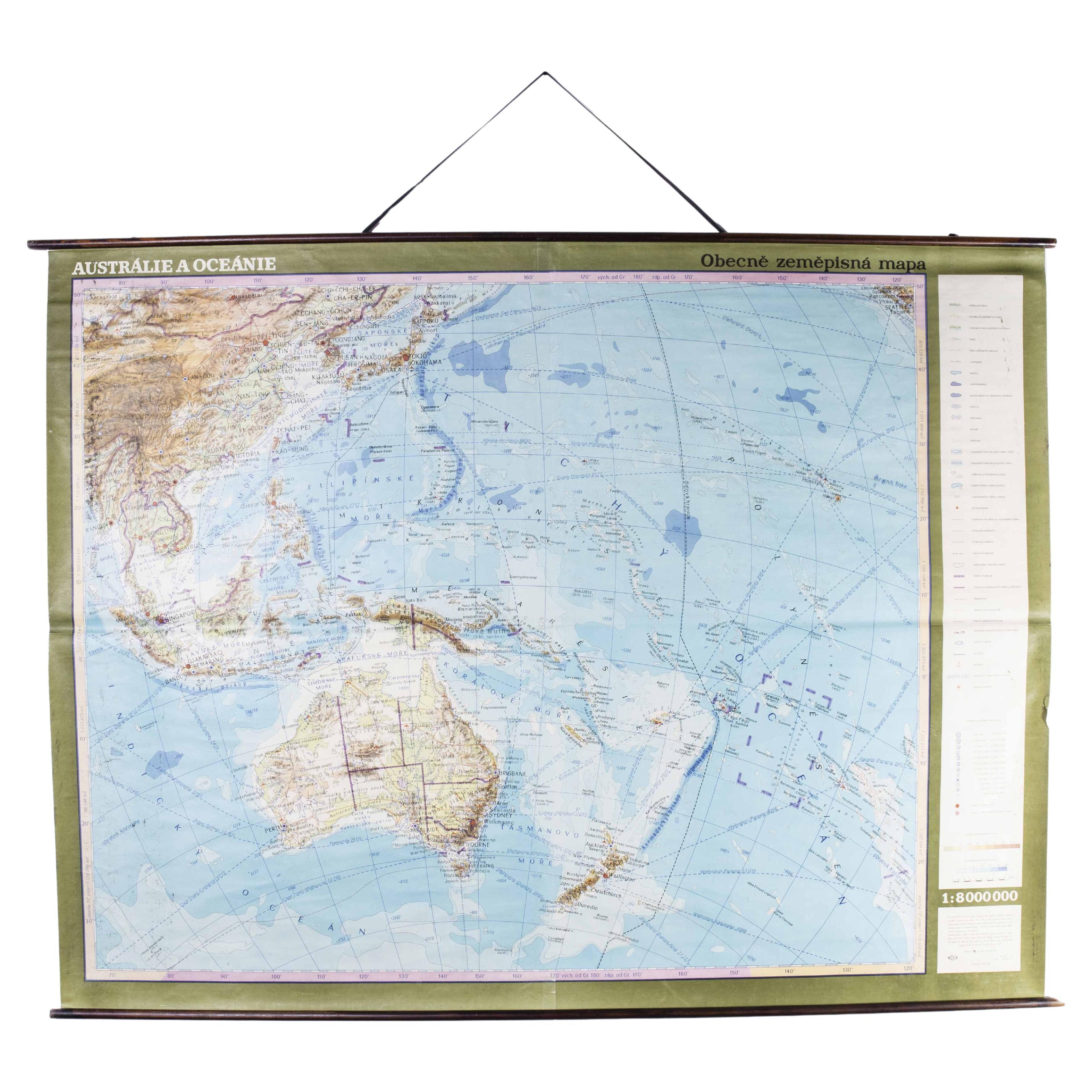
Late 20th Century Educational Geographic Map - Australasia
Located in Hook, Hampshire
Late 20th Century Educational Geographic Map – Australasia
Late 20th Century Educational Geographic Map – Australasia. Good quality roll up school educational geographic map from the...
Category
Late 20th Century Czech Posters
Materials
Cotton

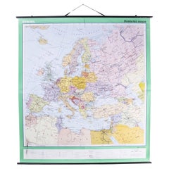
Late 20th Century Educational Geographic Map - European Countries
Located in Hook, Hampshire
Late 20th Century Educational Geographic Map – European Countries
Late 20th Century Educational Geographic Map – European Countries. Good quality roll up s...
Category
Late 20th Century Czech Posters
Materials
Cotton
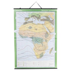
Late 20th Century Educational Geographic Map - African Climate
Located in Hook, Hampshire
Late 20th Century Educational Geographic Map – African Climate
Late 20th Century Educational Geographic Map – African Climate. Good quality roll up school educational geographic map ...
Category
Late 20th Century Czech Posters
Materials
Cotton
You May Also Like
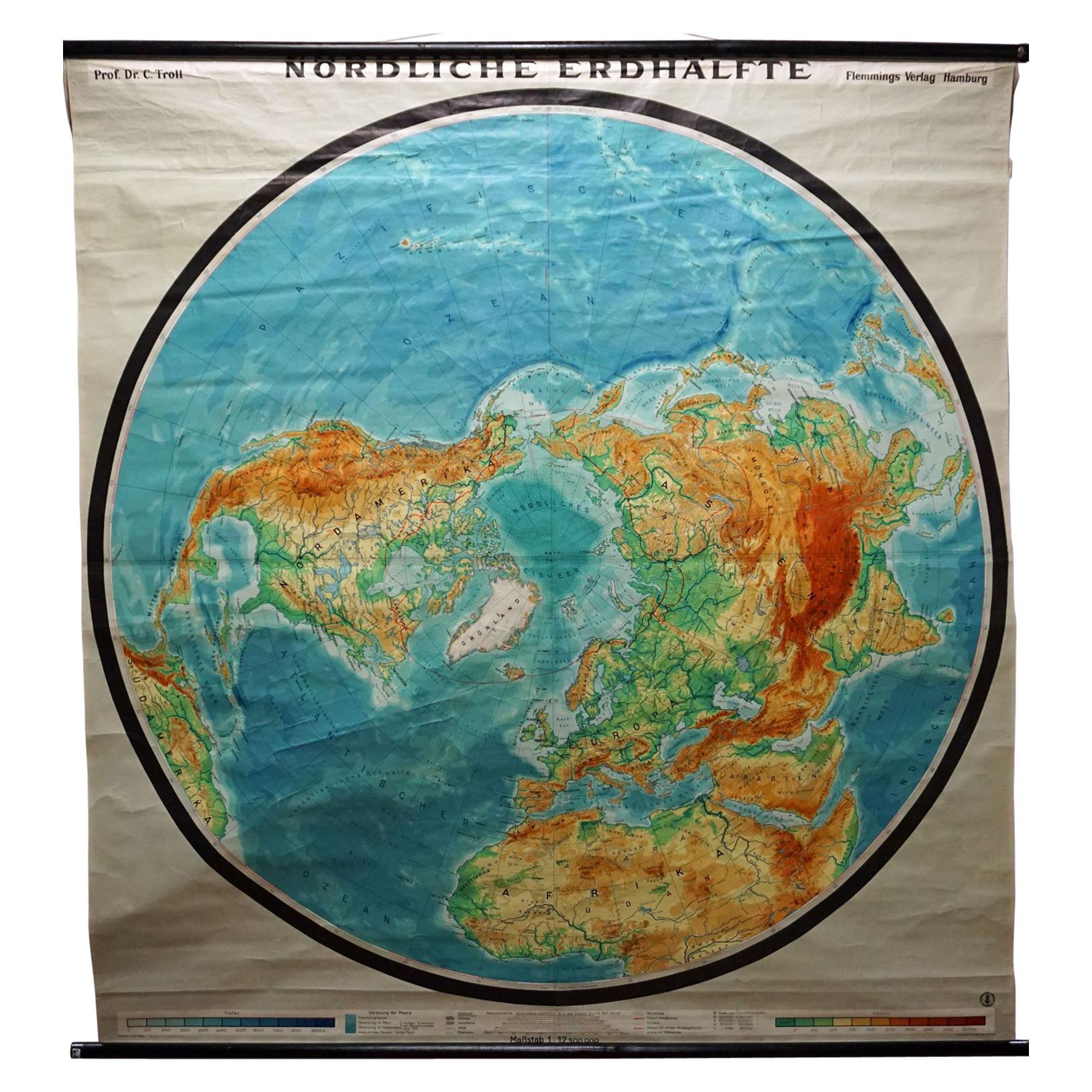
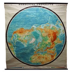
Northern Hemisphere of the Earth Rollable Map Vintage Wall Chart World Mural
Located in Berghuelen, DE
A great pull-down map or vintage wall chart illustrating the northern hemisphere of the earth. Published by Prof. Dr. C. Troll, Flemmings Verlag Ha...
Category
Mid-20th Century German Country Prints
Materials
Canvas, Wood, Paper
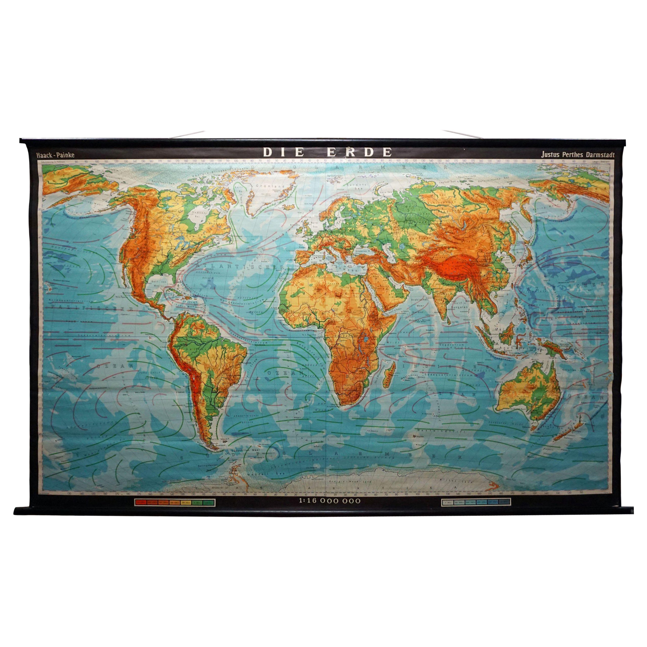
Vintage Mural World Map Earth Poster Pull-Down Wall Chart Poster Print
Located in Berghuelen, DE
A large decorative world map – named our earth, impressive wall chart decoration, published by Justus Perthes. Colorful print on paper reinforced with canvas.
Measurements:
Width 210 cm (82.68 inch)
Height 126,50cm (49.80 inch)
The measurements shown refer just to the canvas and do not include the poles.
Background information on the history of school wall charts:
The idea to upgrade every day school life by using pictures was supported in the late 18th century by Johann Bernhard Basedow. In 1774 he published a four-volume book "Elementarwerk" which combined pictures, text and information with merely hundred copperplates. Modern printing methods enabled the spread from rich private schools to rural grade schools. From 1820-1836 the oldest mentioned series of wall charts were published with the range of six booklets including 63 large sized charts...
Category
Vintage 1970s German Country Prints
Materials
Canvas, Wood, Paper
World Relief Map
Located in Antwerp, BE
Large world relief map.
Measures: Width 232 cm.
Height 158 cm.
Category
Mid-20th Century German Mid-Century Modern Maps
Materials
Acrylic

$2,156
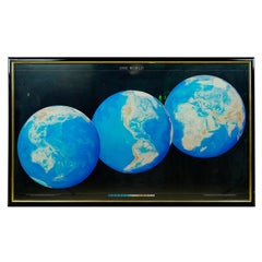
1990 Triple Perspective Planet Earth Map Framed Poster
Located in New York, NY
This decorative poster features a map of the Earth with a unique triple perspective view. It is enclosed in a black plastic frame, and the glass covering the poster is still intact. ...
Category
1990s American Posters
Materials
Glass, Plastic, Paper
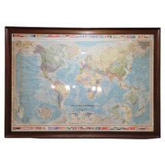
Map of France, globe / Planisphere “Le Monde Politique”, National Geographic Ins
By French House & Garden
Located in Valladolid, ES
Outstanding 19th-century French map designed and published by the French National Geographic Institute following the Aïtoff Wagner cartographic projection, a type of projection used...
Category
Vintage 1960s French Mid-Century Modern Prints
Materials
Crystal
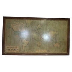
8 Foot Framed World Map by Philips
Located in Norwell, MA
1951 map of the world by George Philip and Son. Large beautiful map as it was in 1951. Nice patina mounted to a sturdy wood frame. Overall good condition. Very large in size. 90" W x...
Category
Vintage 1950s North American Maps
Materials
Paper
More Ways To Browse
Vertigo Film Poster
Vertigo Poster
Vintage Anatomical Posters
Vintage Bmw Poster
Vintage Breakfast At Tiffanys Movie Poster
Vintage Easy Rider Poster 1969
Vintage Japanese Godzilla
Vintage Peugeot Poster
Vintage Red Cross Uniform
Vintage Roller Skates
Vintage Semaphore
Vintage Ski Poster Sweden
Vintage Tarzan Posters
Vintage Zermatt Poster
Wwii Chinese Poster
101 Dalmatians
A Bout De Souffle
Alfie Caine