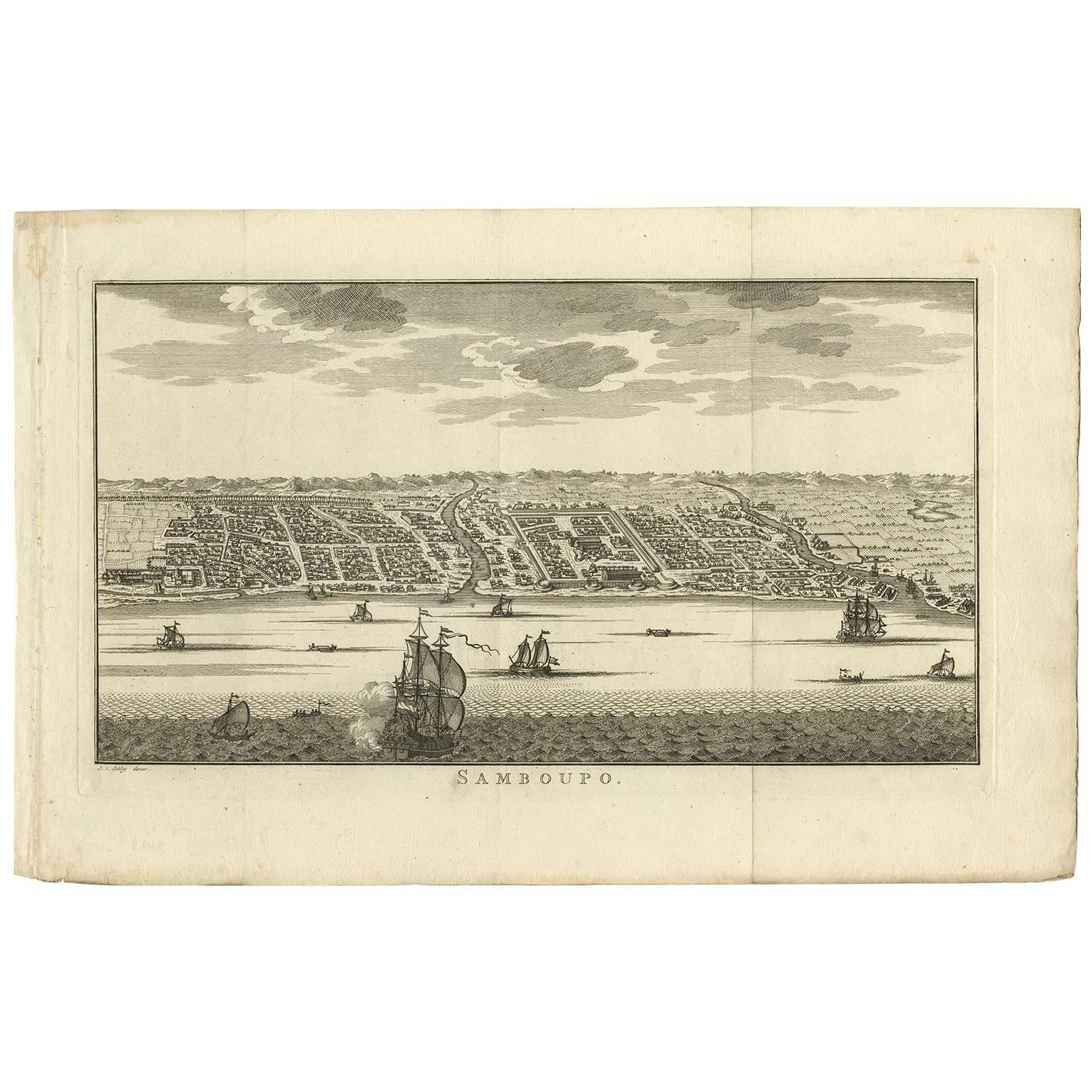
Items Similar to Antique Map of Samboepo by Valentijn, 1726


Want more images or videos?
Request additional images or videos from the seller
1 of 5
Antique Map of Samboepo by Valentijn, 1726
$372.70
$465.8820% Off
£282.33
£352.9120% Off
€320
€40020% Off
CA$516.33
CA$645.4120% Off
A$579.10
A$723.8720% Off
CHF 303.26
CHF 379.0820% Off
MX$7,036.58
MX$8,795.7220% Off
NOK 3,850.94
NOK 4,813.6720% Off
SEK 3,650.96
SEK 4,563.7020% Off
DKK 2,436.41
DKK 3,045.5120% Off
About the Item
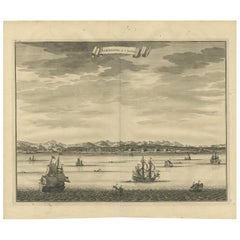
Antique map titled 'Samboepo in 't Verschiet'. Decorative panoramic view of the town of Samboupo on the island of Celebes (Sulawesi) in today's Indonesia. Dutch (V.O.C.) sailing ships and various local craft fill the foreground. The city with great detail including the fort and hundreds of individual houses and buildings. Below the print is an extensive key in Dutch that locates and describes 16 places and buildings. This print originates from 'Oud en Nieuw Oost-Indiën' by F. Valentijn.
- Creator:F. Valentijn (Artist)
- Dimensions:Height: 13.39 in (34 cm)Width: 15.75 in (40 cm)Depth: 0.02 in (0.5 mm)
- Materials and Techniques:
- Place of Origin:
- Period:
- Date of Manufacture:1726
- Condition:Wear consistent with age and use. General age-related toning and minor foxing. Tiny worm holes lower part of folding line. Please study images carefully.
- Seller Location:Langweer, NL
- Reference Number:Seller: BGRN-0911stDibs: LU3054313626442
About the Seller
5.0
Recognized Seller
These prestigious sellers are industry leaders and represent the highest echelon for item quality and design.
Platinum Seller
Premium sellers with a 4.7+ rating and 24-hour response times
Established in 2009
1stDibs seller since 2017
2,517 sales on 1stDibs
Typical response time: <1 hour
- ShippingRetrieving quote...Shipping from: Langweer, Netherlands
- Return Policy
Authenticity Guarantee
In the unlikely event there’s an issue with an item’s authenticity, contact us within 1 year for a full refund. DetailsMoney-Back Guarantee
If your item is not as described, is damaged in transit, or does not arrive, contact us within 7 days for a full refund. Details24-Hour Cancellation
You have a 24-hour grace period in which to reconsider your purchase, with no questions asked.Vetted Professional Sellers
Our world-class sellers must adhere to strict standards for service and quality, maintaining the integrity of our listings.Price-Match Guarantee
If you find that a seller listed the same item for a lower price elsewhere, we’ll match it.Trusted Global Delivery
Our best-in-class carrier network provides specialized shipping options worldwide, including custom delivery.More From This Seller
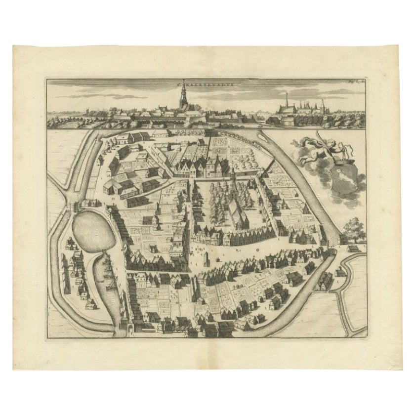
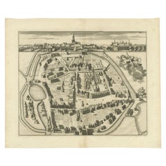
View AllAntique Map of the City of Sint-Maartensdijk by Smallegange, c.1696
Located in Langweer, NL
Antique map titled 'St. Maertensdyk'. Original antique map of the city of Sint-Maartensdijk, the Netherlands. Source unknown, to be determined.
Artists and Engravers: Published b...
Category
Antique 17th Century Maps
Materials
Paper
$153 Sale Price
20% Off
Antique Map of the City of Batavia by Van der Aa 'c.1730'
Located in Langweer, NL
Antique map titled 'Plan de la Ville et du Chateau de Batavia en l'Isle de Iava - Ware affbeeldinge wegens het Casteel ende Stadt Batavia gelegen op groot Eylant Java'. Detailed plan...
Category
Antique Mid-18th Century Maps
Materials
Paper

$1,118 Sale Price
20% Off
Antique Print of Samboepo by Valentijn, 1726
By F. Valentijn
Located in Langweer, NL
Antique print titled 'Samboepo in 't Verschiet'. Engraved view of the city of Samboepo (Makassar or Ujung Pandang) in Sulawesi with ships in the foreground. This print originates fro...
Category
Antique Early 18th Century Dutch Prints
Materials
Paper
$372 Sale Price
20% Off
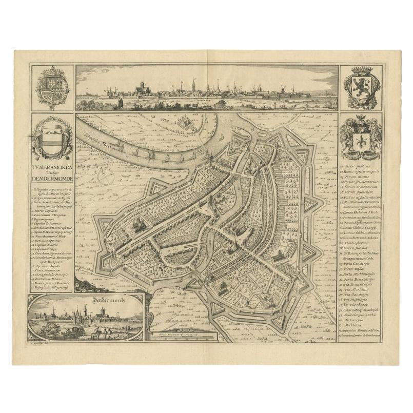
Beautiful Antique Map with Views of Dendermonde, Belgium, 1735
Located in Langweer, NL
Antique map titled 'Teneramonda vulgo Dendermonde'. Beautiful map with views of Dendermonde, Belgium. This map originates from 'Flandria illustrata, sive provinciae ac comitatus huju...
Category
Antique 18th Century Prints
Materials
Paper
$605 Sale Price
20% Off
Antique Print of Samboupo ‘Sulawesi, Indonesia’, 1750
By Jakob van der Schley
Located in Langweer, NL
Attractive detailed view of Samboupo on the island of Celebes (Sulawesi) Indonesia. This copper engraved print is a so called bird’s-eye perspective with gre...
Category
Antique Mid-18th Century Prints
Materials
Paper
$158 Sale Price
20% Off
Antique Map of the City of Groningen Made After Harrewijn, C.1750
Located in Langweer, NL
Antique map titled 'Groeningue'. Old map of the city of Groningen, the Netherlands. Source unknown, to be determined.
Artists and Engravers: Most likely made after J. Harrewijn.
...
Category
Antique 18th Century Maps
Materials
Paper
$102 Sale Price
20% Off
You May Also Like
Framed 1731 Color Engraving, Map of Rotterdam by Matthaus Seutter, "Roterodami"
Located in Bridgeport, CT
"Roterodami". Seutter (1678-1757) was an important German 18th century map maker. Bird's eye view of the city above with full details, neoclassi...
Category
Antique 18th Century European Renaissance Maps
Materials
Glass, Wood, Paper

18th Century Map Engraving - Newport, a Strong Sea-Port Town in Flanders
Located in Corsham, GB
A map of Nieuwpoort, anglicised to 'Newport', in northern Belgium. There is a panorama in the upper quarter depicting major landmarks. Below is a plan of the town, including its strong defences and ships at the port in the lower register. Inscribed with the title in plate to the lower edge, 'Newport a Strong Sea-Port Town...
Category
18th Century More Prints
Materials
Engraving

$269 Sale Price
20% Off
Utrecht, Antique Map from "Civitates Orbis Terrarum"
By Franz Hogenberg
Located in Roma, IT
Braun G., Hogenberg F., Traiectum or Utrecht, from the collection Civitates Orbis Terrarum, Cologne, T. Graminaeus, 1572-1617.
Very fine B/W aquatint showing a view of Utrecht, with...
Category
16th Century Landscape Prints
Materials
Etching

Rare Original Map of New Amsterdam (New York) – “Restitutio”, ca. 1674 –
Located in Dronten, NL
An exceptionally rare and original 17th-century engraving of New Amsterdam, now New York City, published by the renowned Amsterdam cartographer Carel (Carolus) Allard around 1674. Kn...
Category
Antique 17th Century Dutch Maps
Materials
Paper

Map of Kampen, Netherlands - by G. Braun and F. Hogenberg - Late 16th Century
By Franz Hogenberg
Located in Roma, IT
This map of Kampen (the ancient Campensis) is an original etching realized by George Braun and Franz Hogenberg as part of the famous Series "Civitates Orbis Terrarum".
The “Civita...
Category
16th Century Figurative Prints
Materials
Etching

17th Century Toulouse, Savve, Sommieres Topographical Map by Iohan Peeters
Located in New York, NY
Fine topographical 17th century map of Toulouse, Savve and Sommieres by Iohan Peeters
Beautiful engraving of the capital of France's Occitanie Region, Toulouse, called La Ville Rose- the Pink City, for the terracotta bricks used in its many buildings, giving the city a distinct apricot-rose hue. An important cultural and educational center, the city's residents included Nobel Prize winners and world renown artists- Henri de Toulouse-Lautrec, Henri Martin, Jean-Auguste-Dominique Ingres, Antonin Mercie, Alexandre Falguiere and more recently Cyril Kongo...
Category
Antique 17th Century Dutch Maps
Materials
Paper

More Ways To Browse
1920s Calendar
Andy Warhol Signature
Church Choir
Fern Lithograph
L Afrique Antique
Marc Henri
Sampson Paintings
Used Furniture Canberra
Antique Military Jackets
Antique Parrot Print
Antique Reindeer
Equestrian Engraving
Jacob 18 Century Furniture
La Perouse
Les Lalanne
Antique Bird Prints Heron
Botanical Chart
Ottoman Turkish Dress