Items Similar to Antique Optical View of The Coronation Ceremony of The Emperor of China, ca.1770
Video Loading
Want more images or videos?
Request additional images or videos from the seller
1 of 6
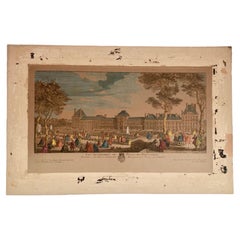
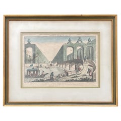
Antique Optical View of The Coronation Ceremony of The Emperor of China, ca.1770
$648.53
$810.6720% Off
£477.64
£597.0520% Off
€540
€67520% Off
CA$882.28
CA$1,102.8520% Off
A$980.41
A$1,225.5120% Off
CHF 513.74
CHF 642.1820% Off
MX$12,022.93
MX$15,028.6620% Off
NOK 6,552.49
NOK 8,190.6120% Off
SEK 6,164.34
SEK 7,705.4320% Off
DKK 4,110.94
DKK 5,138.6720% Off
Shipping
Retrieving quote...The 1stDibs Promise:
Authenticity Guarantee,
Money-Back Guarantee,
24-Hour Cancellation
About the Item
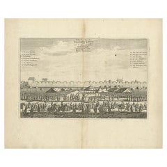
Antique print China titled 'Vue perspective de la grande Ceremonie du couronnement de l'Empereur de la Chine'.
Optical view of the coronation ceremony of the Emperor of China.
Artists and Engravers: Published by L.J. Mondhare, Paris.
Condition: Good, few small imperfections. Some creasing of the margins. General age-related toning, please study image carefully.
- Dimensions:Height: 13 in (33 cm)Width: 18.51 in (47 cm)Depth: 0 in (0.02 mm)
- Materials and Techniques:
- Period:1770-1779
- Date of Manufacture:circa 1770
- Condition:Wear consistent with age and use.
- Seller Location:Langweer, NL
- Reference Number:Seller: BG-114001stDibs: LU3054326448152
About the Seller
5.0
Recognized Seller
These prestigious sellers are industry leaders and represent the highest echelon for item quality and design.
Platinum Seller
Premium sellers with a 4.7+ rating and 24-hour response times
Established in 2009
1stDibs seller since 2017
2,494 sales on 1stDibs
Typical response time: 1 hour
- ShippingRetrieving quote...Shipping from: Langweer, Netherlands
- Return Policy
Authenticity Guarantee
In the unlikely event there’s an issue with an item’s authenticity, contact us within 1 year for a full refund. DetailsMoney-Back Guarantee
If your item is not as described, is damaged in transit, or does not arrive, contact us within 7 days for a full refund. Details24-Hour Cancellation
You have a 24-hour grace period in which to reconsider your purchase, with no questions asked.Vetted Professional Sellers
Our world-class sellers must adhere to strict standards for service and quality, maintaining the integrity of our listings.Price-Match Guarantee
If you find that a seller listed the same item for a lower price elsewhere, we’ll match it.Trusted Global Delivery
Our best-in-class carrier network provides specialized shipping options worldwide, including custom delivery.More From This Seller
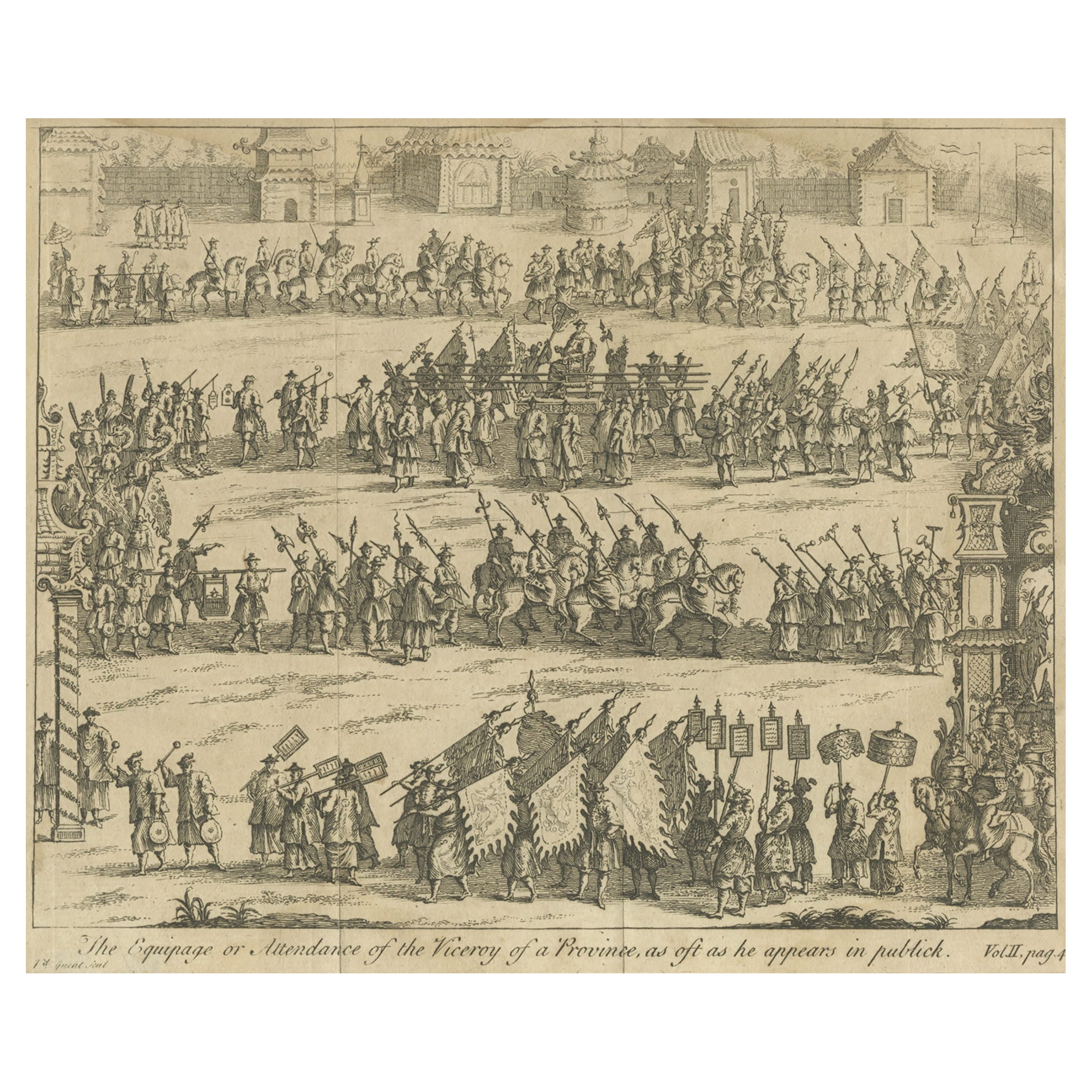
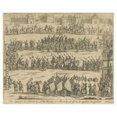
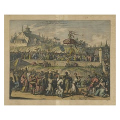
View AllAntique Print of a Viceroy Procession in China, C.1740
Located in Langweer, NL
Antique print titled 'The Equipage or Attendance of the Viceroy of a Province, as oft as he appears in publick'. Copper engraving of a Chinese procession...
Category
Antique 18th Century Prints
Materials
Paper
$229 Sale Price
20% Off
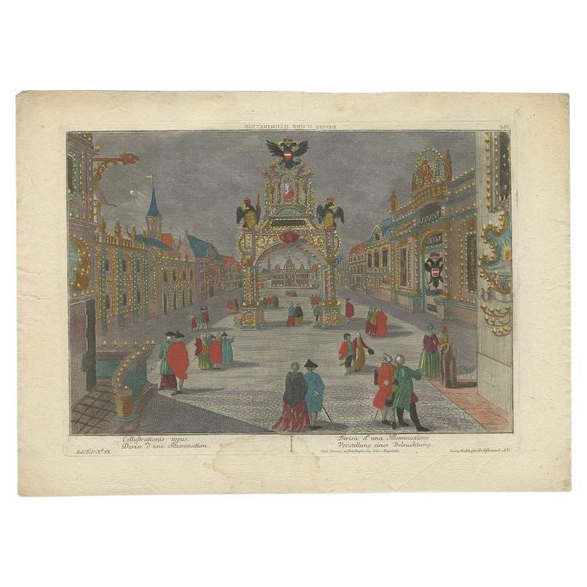
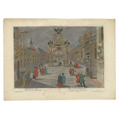
Rare Antique Optica Print of a Ceremony in Germany, c.1765
By Georg Balthasar Probst
Located in Langweer, NL
Antique print titled 'Collustrationis typus'. Optical view depicting an illuminated square of an unidentified town (probably in Germany) on the occasion of the coronation of the Germ...
Category
Antique 18th Century Prints
Materials
Paper
$422 Sale Price
20% Off
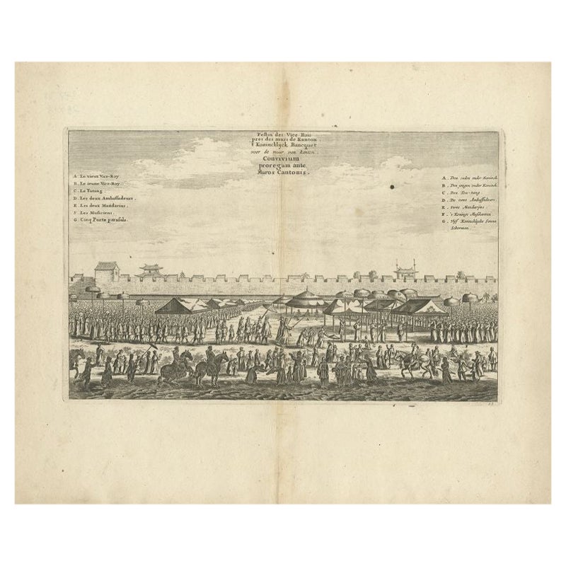
Antique Print of a Chinese Royal Banquet in Canton, 1668
By Johannes Nieuhof
Located in Langweer, NL
Antique print China titled 'Convivium proregum ante Muos Cantonis'. Old print depicting the Royal Banquet just outside the wall of the Chinese city of Canton with (A) the old Viceroy...
Category
Antique 17th Century Prints
Materials
Paper
$278 Sale Price
20% Off
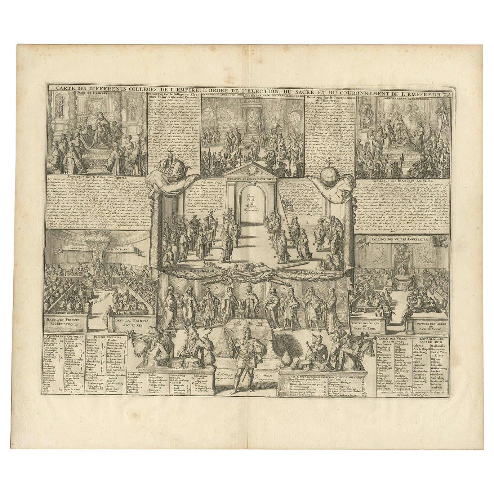
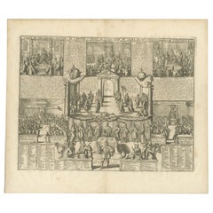
Antique Print of the Coronation of the Emperor by Chatelain, 1732
Located in Langweer, NL
Antique print titled 'Carte des differents Colleges de l'Empire Old print with small vignettes depicting the coronation of the Emperor, as well as two views showing the Imperial Univ...
Category
Antique 18th Century Prints
Materials
Paper
$470 Sale Price
20% Off
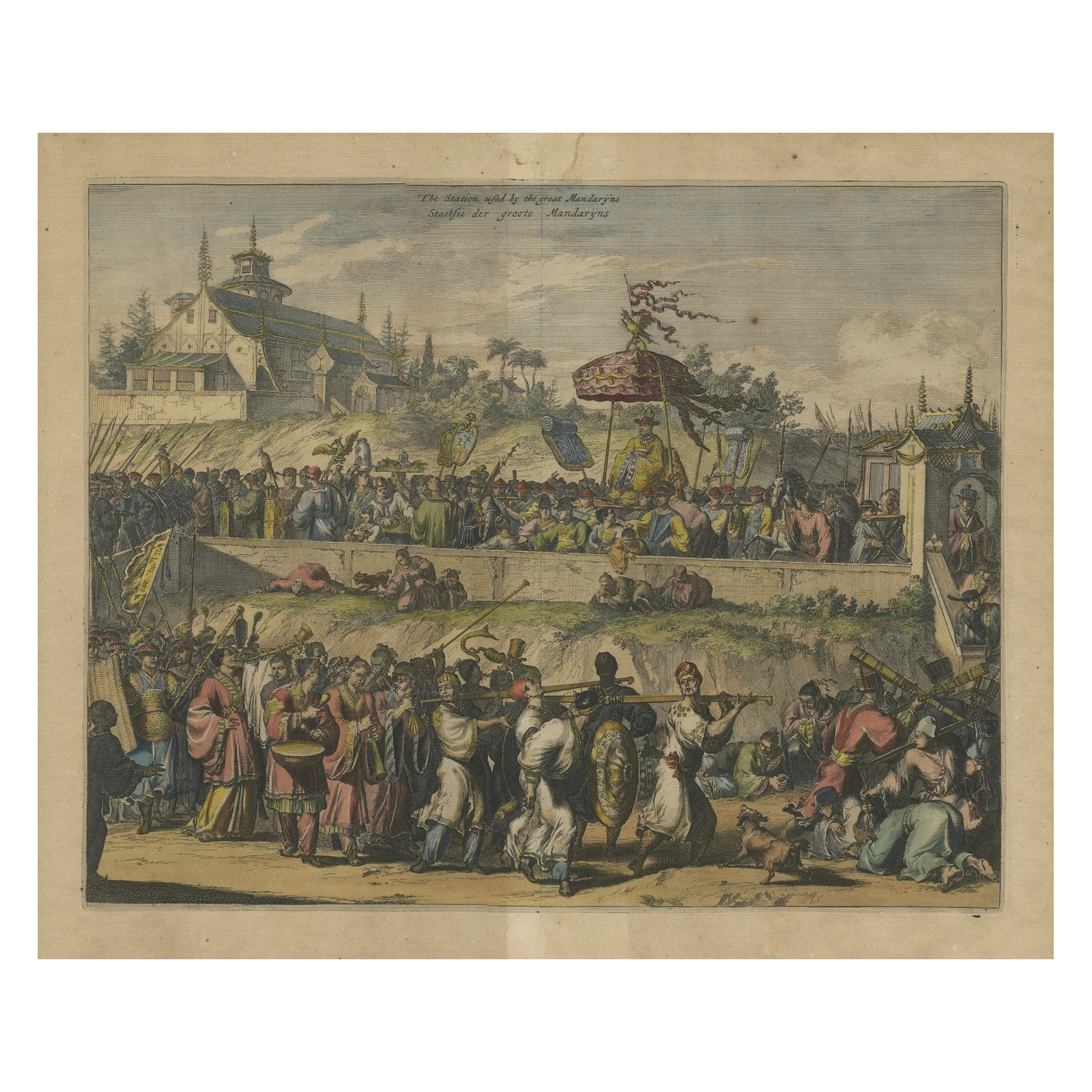
Original Copper Engraving with View of the Palace and Chinese Emperor, ca.1700
Located in Langweer, NL
Title: "The Station used by the great Mandaryns Staetsie der groote Mandarijns / The Station used by the great Mandaryns Staetsie der groote Mandarijns. 1665.
The richly illustrat...
Category
Antique Early 1700s Prints
Materials
Paper
$230 Sale Price
20% Off
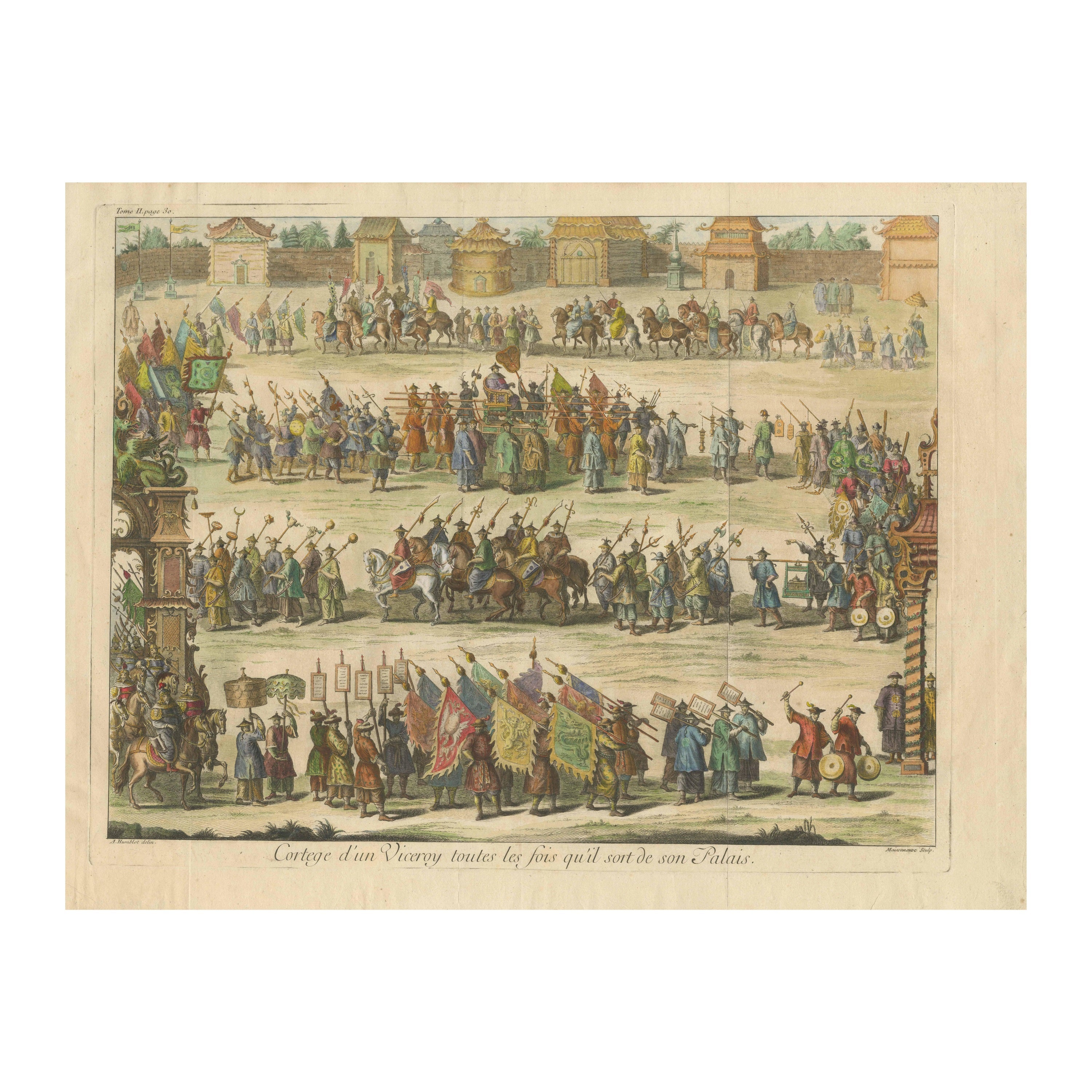
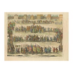
Old Original Copper Engraving Depicting a Viceroy with Entourage in China, 1735
Located in Langweer, NL
Original handtinted copper engraving with title: 'Cortege d'un Viceroy tout les fois qu'il sort de son palais'.
Translate in English: 'Procession of a Viceroy whenever he leaves h...
Category
Antique 1730s Prints
Materials
Paper
$345 Sale Price
20% Off
You May Also Like
Jacques Rigaud Engraving Palais Des Thuilleries
Located in Los Angeles, CA
French 18th Century Jacques Rigaud engraving of Palais Des Thuilleries. The dimension is the sight of the image. This item is ready to be framed to your...
Category
Antique 18th Century French Other Prints
Materials
Paper
Vue d’Optique of the King’s Cavalry and Saint Paul’s Basilica, 18th Century
Located in Savannah, GA
A pair of vue d’optiques of the Revue du Roy Cavalerie and St. Paul’s a Rome in eglomise glass frames, late 18th century.
frame: 22 by 17 inches; other slighly smaller
Category
Antique 18th Century Prints
Materials
Glass, Wood, Paper
Ancient View of Daulet - Original Lithograph - Mid-19th Century
Located in Roma, IT
Daulet is an original modern artwork realized in Italy in the mid of the 19th Century.
Original Colored Lithograph on Ivory Paper.
Inscripted on the lower margin.
Sheet dimension...
Category
Mid-19th Century Modern Figurative Prints
Materials
Lithograph
French 18th Century Louis XVI Style Print
Located in West Palm Beach, FL
A fine French 18th century Louis XVI st. print titled: Un des Tableaux de la grande Gallerie du Palais Royal (one of the paintings of the grand Gallery of the Royal Palace). The prin...
Category
Antique 18th Century French Louis XVI Decorative Art
Materials
Wood
French 18th Century Park Scene Lithograph
Located in Los Angeles, CA
Classic French 18th century lithograph of a daily French life scene in a park. This item is in its original frame. Great addition to your Class...
Category
Antique Late 18th Century French French Provincial Prints
Materials
Glass, Paper
18 Century Engraving of the Royal Menagerie at Versailles by Antoine Aveline
By Antoine Aveline
Located in Vancouver, British Columbia
A rare 18 century perspective view engraving of the Salon de la Menagerie at Versailles, attributed to Antoine Aveline retailed in Paris by Nicolas Langlois and executed with the per...
Category
Antique Early 18th Century French Louis XV Drawings
Materials
Paper
$440 Sale Price
20% Off
More Ways To Browse
Chinese Emperor Print
Antique Teak Door
Antique Textile Tools
Arabic Mirror
Art Deco Travel Clock
Arts And Crafts Corner Cabinet
Black Boulle Cabinet
Blenko Glass 1960s
Bone Inlay Door
Bookends Female
Brass Lion Claw
Brass Teapot
Bronze Barometer
Bronze Beetle
Burgundy Bowl
Burmese Buddha Head
Butterscotch Bakelite
Ceramic Persian Tile