Items Similar to Antique Original Engraving of Chinese Vessels in the 18th Century, 1765

Want more images or videos?
Request additional images or videos from the seller
1 of 5
Antique Original Engraving of Chinese Vessels in the 18th Century, 1765
$264.65
$330.8120% Off
£198.37
£247.9620% Off
€224
€28020% Off
CA$363.58
CA$454.4720% Off
A$405.90
A$507.3820% Off
CHF 212.69
CHF 265.8620% Off
MX$4,968.62
MX$6,210.7720% Off
NOK 2,701.11
NOK 3,376.3920% Off
SEK 2,546.80
SEK 3,183.5120% Off
DKK 1,705.17
DKK 2,131.4620% Off
Shipping
Retrieving quote...The 1stDibs Promise:
Authenticity Guarantee,
Money-Back Guarantee,
24-Hour Cancellation
About the Item
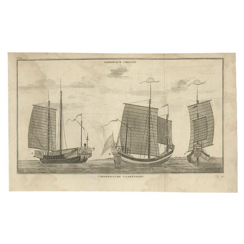
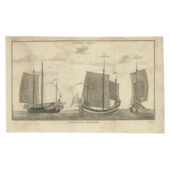
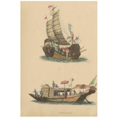
Description: Plate no.34: 'Vaisseaux chinois.' (Chinese vessels.) This original auhentic plate originates from: 'Reize rondom de werreld, Gedaan in de jaaren 1740 tot 1744, door den Heere George Anson …', 3rd. Ed., published in Leiden and Amsterdam in 1765, translated into Dutch from the 1748 first English ed. by Richard Walter. (A voyage round the world ... by George Anson ...)
Great Britain was at war with Spain in 1740. Admiral of the Fleet George Anson, 1st Baron Anson PC, FRS, RN (1697 -1762) was a British admiral and a wealthy aristocrat, noted for his circumnavigation of the globe and his role overseeing the Royal Navy during the Seven Years' War. Anson commanded the small British squadron sent at the beginning of the war with Spain to harass the Spaniards on the west coast of South America and cut off their supplies of wealth from the Pacific. Disasters and hardships plagued the expedition; most of the ships were lost around Cape Horn, and on the Chilean coast, and of a crew of 960, less than 350 survived.
Eventually the Centurion alone was left, but Anson persevered and succeeded in capturing a gold-laden Spanish galleon near Manila. The prize he earned as a result settled his fortune for life. This is the official account of his voyage of circumnavigation, compiled from Anson's journals by Richard Walter, chaplain on board the Centurion, and revised by Benjamin Robins.
Artists and Engravers: No engraver or cartographer indicated on this plate. Engravers in the originating work include Jacob Folkema (Dutch 1692-1767), Jakob van der Schley (Dutch 1715-1779) and Frans de Bakker (Dutch 1720-?, fl 1736-1767).
Condition: General age related toning and ocassional light soiling. Original fold lines as issued. Ocassional very small tears in paper edges. Light ghosting from text pages of originating work. Blank verso. Please study image carefully.
- Dimensions:Height: 10.04 in (25.5 cm)Width: 16.07 in (40.8 cm)Depth: 0 in (0.02 mm)
- Materials and Techniques:
- Period:1760-1769
- Date of Manufacture:1765
- Condition:Condition: General age related toning and ocassional light soiling. Original fold lines as issued. Ocassional very small tears in paper edges. Light ghosting from text pages of originating work. Blank verso. Please study image carefully.
- Seller Location:Langweer, NL
- Reference Number:Seller: PCT-43830 1stDibs: LU3054326678452
About the Seller
5.0
Recognized Seller
These prestigious sellers are industry leaders and represent the highest echelon for item quality and design.
Platinum Seller
Premium sellers with a 4.7+ rating and 24-hour response times
Established in 2009
1stDibs seller since 2017
2,511 sales on 1stDibs
Typical response time: <1 hour
- ShippingRetrieving quote...Shipping from: Langweer, Netherlands
- Return Policy
Authenticity Guarantee
In the unlikely event there’s an issue with an item’s authenticity, contact us within 1 year for a full refund. DetailsMoney-Back Guarantee
If your item is not as described, is damaged in transit, or does not arrive, contact us within 7 days for a full refund. Details24-Hour Cancellation
You have a 24-hour grace period in which to reconsider your purchase, with no questions asked.Vetted Professional Sellers
Our world-class sellers must adhere to strict standards for service and quality, maintaining the integrity of our listings.Price-Match Guarantee
If you find that a seller listed the same item for a lower price elsewhere, we’ll match it.Trusted Global Delivery
Our best-in-class carrier network provides specialized shipping options worldwide, including custom delivery.More From This Seller
View AllAntique Print of Chinese Vessels by Anson, '1749'
Located in Langweer, NL
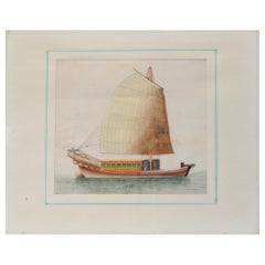
Antique print titled 'Vaisseaux chinois - Chineessche vaartuigen'. Original antique print of Chinese vessels. This print originates from 'Reize rondsom...
Category
Antique 18th Century Prints
Materials
Paper
$170 Sale Price
20% Off
Antique Print of Chinese Vessels, 1748
Located in Langweer, NL
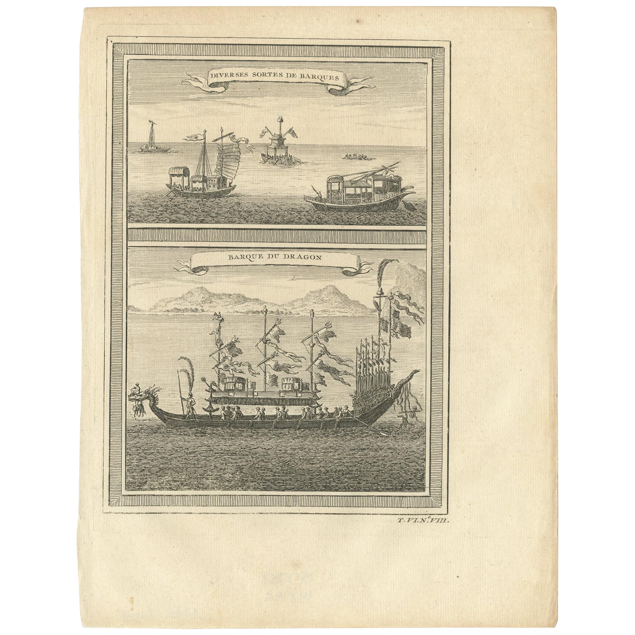
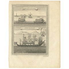
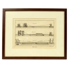
Antique print titled 'Diverses Sortes de Barques - Barque du Dragon'. View of Chinese vessels. The top view depicts various types of Chinese barque, including a small vessel at centre that is topped with a high canopy with a shrine on its roof and a pair of large flags...
Category
Antique Mid-18th Century Prints
Materials
Paper
$94 Sale Price
20% Off
Antique Print of Chinese Junks or Merchant Ships, 1827
Located in Langweer, NL
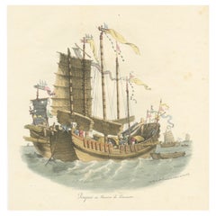
Antique print titled 'Jonques ou Navires de Commerce'. Original old print of Chinese junks or merchant ships. This print originates from 'La Chine, moeurs, usages, costumes, arts et ...
Category
Antique Mid-19th Century Prints
Materials
Paper
$189 Sale Price
20% Off
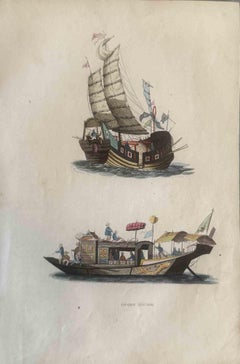
Antique Print of Chinese Junks by Wahlen '1843'
Located in Langweer, NL
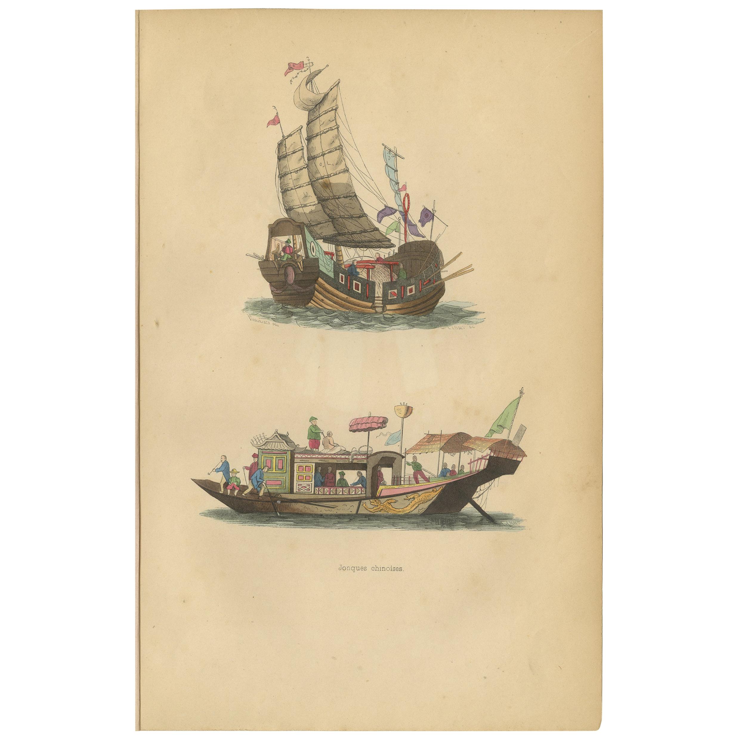
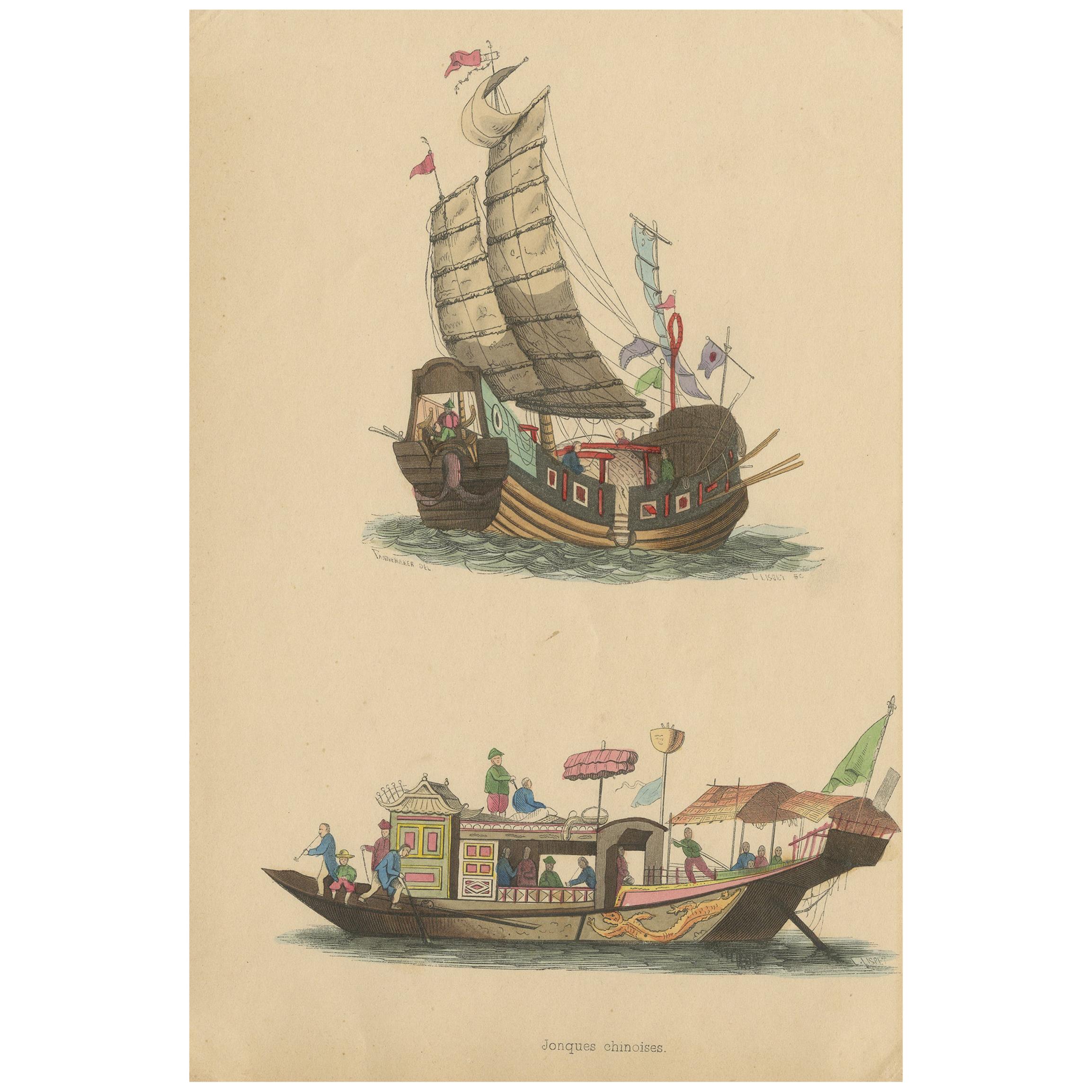
Antique print titled 'Jonques Chinoises'. Original antique print of Chinese junks (ships). This print originates from 'Moeurs, usages et costumes de to...
Category
Antique Mid-19th Century Prints
Materials
Paper

$94 Sale Price
20% Off
Antique Costume Print of Chinese Junks by Wahlen, ‘1843’
Located in Langweer, NL
Antique costume print titled 'Jonques Chinoises'. Original antique print of Chinese junks, a type of sailing ship. This print originates from 'Moeurs, usages et costumes de tous les ...
Category
Antique Mid-19th Century Prints
Materials
Paper
$141 Sale Price
20% Off
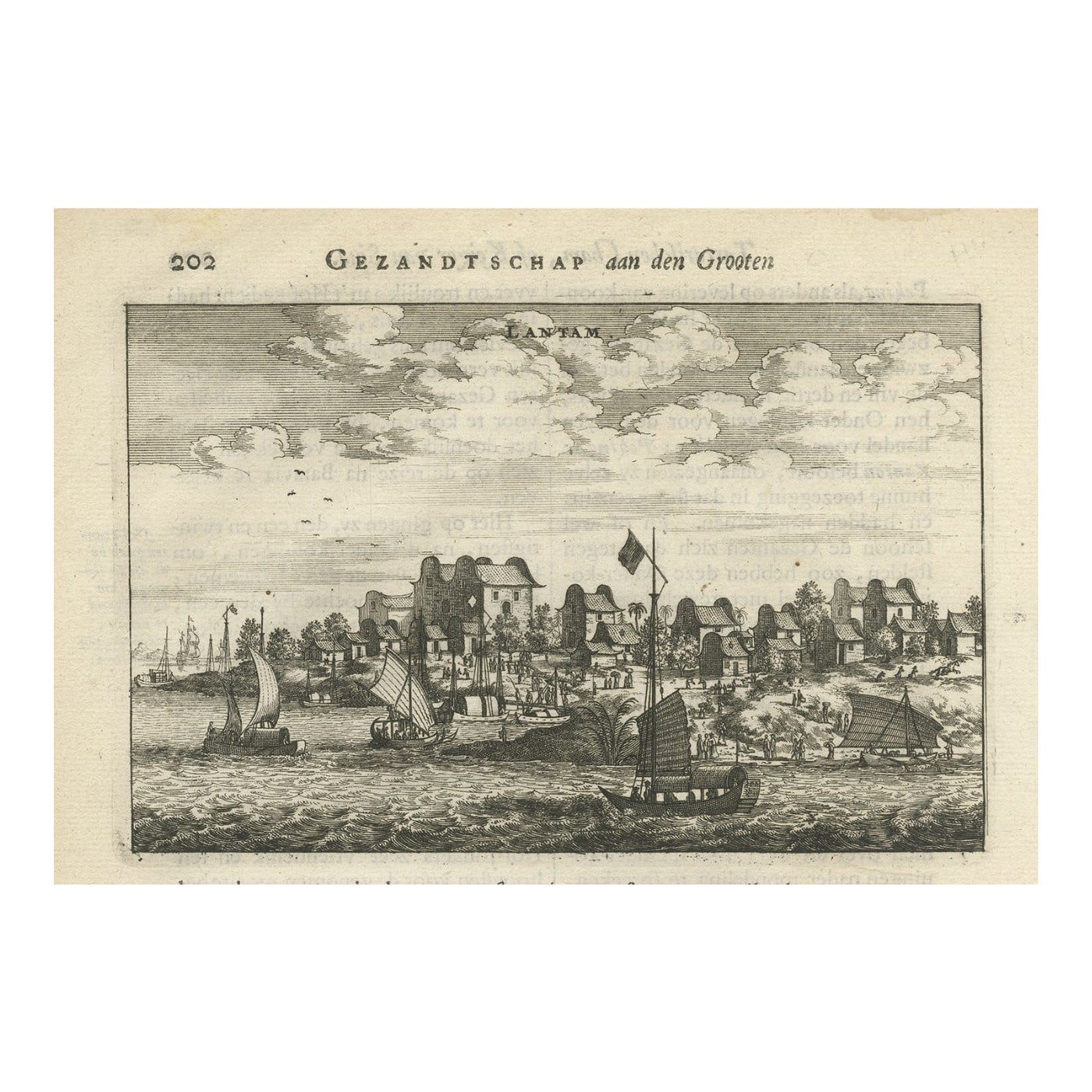
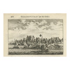
Antique Print of Chinese Vessels Near Lantam, China, 1665
Located in Langweer, NL
Antique print titled 'Lantam'. Old print depicting Chinese ships on the coast of Lantam. Also depicted are Chinese village houses. This print originates f...
Category
Antique 17th Century Prints
Materials
Paper
You May Also Like
Uses and Customs - Chinese Boats - Lithograph - 1862
Located in Roma, IT
Uses and Customs - Chinese Boats is a lithograph on paper realized in 1862.
The artwork belongs to the Suite Uses and customs of all the peoples of the universe: " History of the go...
Category
1860s Modern Figurative Prints
Materials
Lithograph
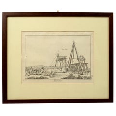
Engraving Print from the Panckoucke Encyclopédie Nautical Subject 1782-1832
Located in Milan, IT
Print by engraving on copper plate from the Panckoucke Encyclopédie méthodique, end of the 18th century,volume Marine Planches (more than 1,500 figures dealing with all subjects on the marina: planes, construction, carpentry, tree trunks, armaments of maneuvers, ropes, sails, artillery, ship maneuvers and combat tactics). This is the plate no. n. 24, pag. 69 fig. 341 ; with frame cm 38.3 x 31.5. Ship ropes are depicted. The Print has the "Benard direxit...
Category
Antique 1790s French Nautical Objects
Materials
Paper
Antique Chinese Rice Pit painting of a Boat Top Quality Canton, 19th Century
Located in Amsterdam, Noord Holland
Antique Chinese Rice Pit painting of a Boat Top Quality Canton, 19th Century.
Fabulous painting.
Additional information:
Material: Porcelain & Pottery
Type:...
Category
Antique 19th Century Chinese Paintings
Materials
Porcelain
$659 Sale Price
20% Off
Engraving Print from the Panckoucke Encyclopédie Nautical Subject, 1782-1832
Located in Milan, IT
Print by engraving on copper plate from the Panckoucke Encyclopédie méthodique, end of the 18th century, volume Marine Planches (more than 1,500 figures dealing with all subjects on the marina: planes, construction, carpentry, tree trunks, armaments of maneuvers, ropes, sails, artillery, ship maneuvers and combat tactics). This is the plate no. n. 26, pag. 70 fig. 350-353; with frame cm 38.3 x 31.5. Ship ropes are depicted. The Print has the "Benard direxit...
Category
Antique 1790s French Nautical Objects
Materials
Paper
18th Century Balthasar Frederich Lazelt Colored Engraving Print
Located in Kingston, NY
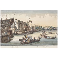
18th-century view of Lower Manhattan Harbor New York Entrance by Balthasar Frederic Lazelt colored engraving of New York's original harbor landings filled with ships and commerce, 17...
Category
Antique 18th Century Prints
Materials
Paper
Ancient View of Hong Kong - Original Lithograph - Early 19th Century
Located in Roma, IT
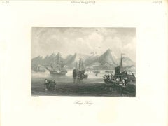
Ancient View of Hong Kong is an original modern artwork realized in Italy in the first half of the 19th Century.
Original B/W Lithograph on Ivory Paper.
Inscripted on the lower ma...
Category
Early 20th Century Modern Figurative Prints
Materials
Lithograph
More Ways To Browse
Antique Furniture Centurion
Robins Antiques
Painted Indian Cabinets
Polychrome Chest Of Drawers
Samurai Armor
Sas Airlines
Scalloped Bed
Secretary Desk Burl
Silver Teapot Wooden Handle
Starburst Sculpture
Talavera De La Reina
Teak Secretary Desk
Terracotta Elephant
Thomas Germany Porcelain Vintage
Tibet Statue
Trunk Desk
Used Cross Stitch Patterns
Victorian Blue Sofa