Items Similar to Antique Plan of Underground Area of Baths of Emperor Titus, Rome, Italy, 1786
Want more images or videos?
Request additional images or videos from the seller
1 of 5
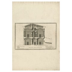
Antique Plan of Underground Area of Baths of Emperor Titus, Rome, Italy, 1786
$226.84
$283.5520% Off
£170.03
£212.5420% Off
€192
€24020% Off
CA$311.64
CA$389.5520% Off
A$347.91
A$434.8920% Off
CHF 182.30
CHF 227.8820% Off
MX$4,258.82
MX$5,323.5220% Off
NOK 2,315.24
NOK 2,894.0520% Off
SEK 2,182.98
SEK 2,728.7220% Off
DKK 1,461.57
DKK 1,826.9720% Off
About the Item
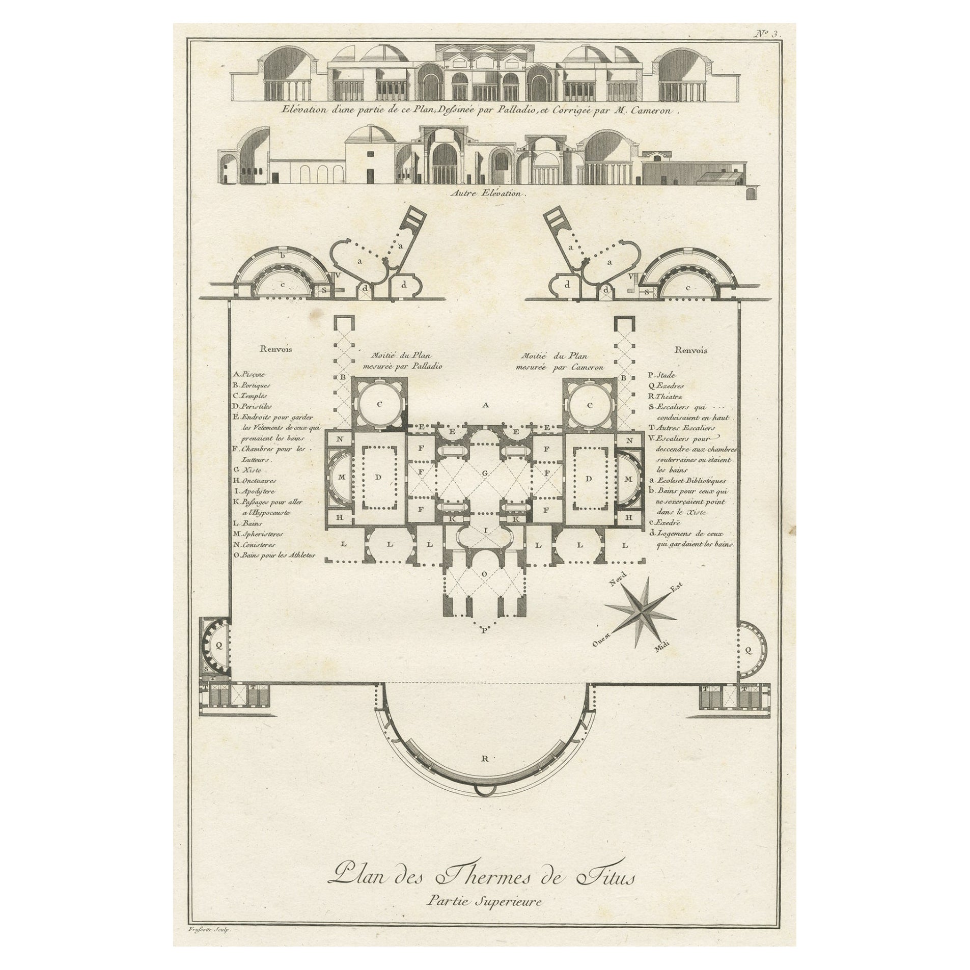
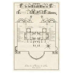
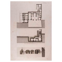
Antique print titled 'Plan des Thermes de Titus Partie Superieure'.
Plan of the underground areas of the Baths of Titus. The Baths of Titus or Thermae Titi were public baths (Thermae) built in 81 AD at Rome, by Roman emperor Titus. This print originates from 'Description des bains de Titus (..)' by N. Ponce. Arists and Engravers: Nicolas Ponce: engraver, print publisher of various series of plates, and author of various learned treatises on classical art.
Artist: Nicolas Ponce: engraver, print publisher of various series of plates, and author of various learned treatises on classical art.
Condition: Good, general age-related toning. Minor wear and soiling. Blank verso, please study image carefully.
Date: 1786
Overall size: 41 x 27.5 cm.
Image size: 33 x 22 cm.
Antique prints have long been appreciated for both their aesthetic and investment value. They were the product of engraved, etched or lithographed plates. These plates were handmade out of wood or metal, which required an incredible level of skill, patience and craftsmanship. Whether you have a house with Victorian furniture or more contemporary decor an old engraving can enhance your living space. We offer a wide range of authentic antique prints for any budget.
- Dimensions:Height: 10.83 in (27.5 cm)Width: 16.15 in (41 cm)Depth: 0 in (0.01 mm)
- Materials and Techniques:
- Period:
- Date of Manufacture:1786
- Condition:Wear consistent with age and use. Condition: Good, general age-related toning. Minor wear and soiling. Blank verso, please study image carefully.
- Seller Location:Langweer, NL
- Reference Number:Seller: BG-026391stDibs: LU3054327004452
About the Seller
5.0
Recognized Seller
These prestigious sellers are industry leaders and represent the highest echelon for item quality and design.
Platinum Seller
Premium sellers with a 4.7+ rating and 24-hour response times
Established in 2009
1stDibs seller since 2017
2,513 sales on 1stDibs
Typical response time: <1 hour
- ShippingRetrieving quote...Shipping from: Langweer, Netherlands
- Return Policy
Authenticity Guarantee
In the unlikely event there’s an issue with an item’s authenticity, contact us within 1 year for a full refund. DetailsMoney-Back Guarantee
If your item is not as described, is damaged in transit, or does not arrive, contact us within 7 days for a full refund. Details24-Hour Cancellation
You have a 24-hour grace period in which to reconsider your purchase, with no questions asked.Vetted Professional Sellers
Our world-class sellers must adhere to strict standards for service and quality, maintaining the integrity of our listings.Price-Match Guarantee
If you find that a seller listed the same item for a lower price elsewhere, we’ll match it.Trusted Global Delivery
Our best-in-class carrier network provides specialized shipping options worldwide, including custom delivery.More From This Seller
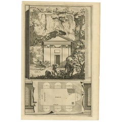
View AllAntique Plan of the Overground Area of Baths of Emperor Titus, Rome, Italy, 1786
Located in Langweer, NL
Antique print titled 'Plan des Thermes de Titus Partie Superieure'.
Plan of the overground area of the Baths of Titus. The Baths of Titus or Thermae Titi were public baths (Thermae) built in 81 AD at Rome, by Roman emperor Titus...
Category
Antique 18th Century Prints
Materials
Paper
$264 Sale Price
20% Off
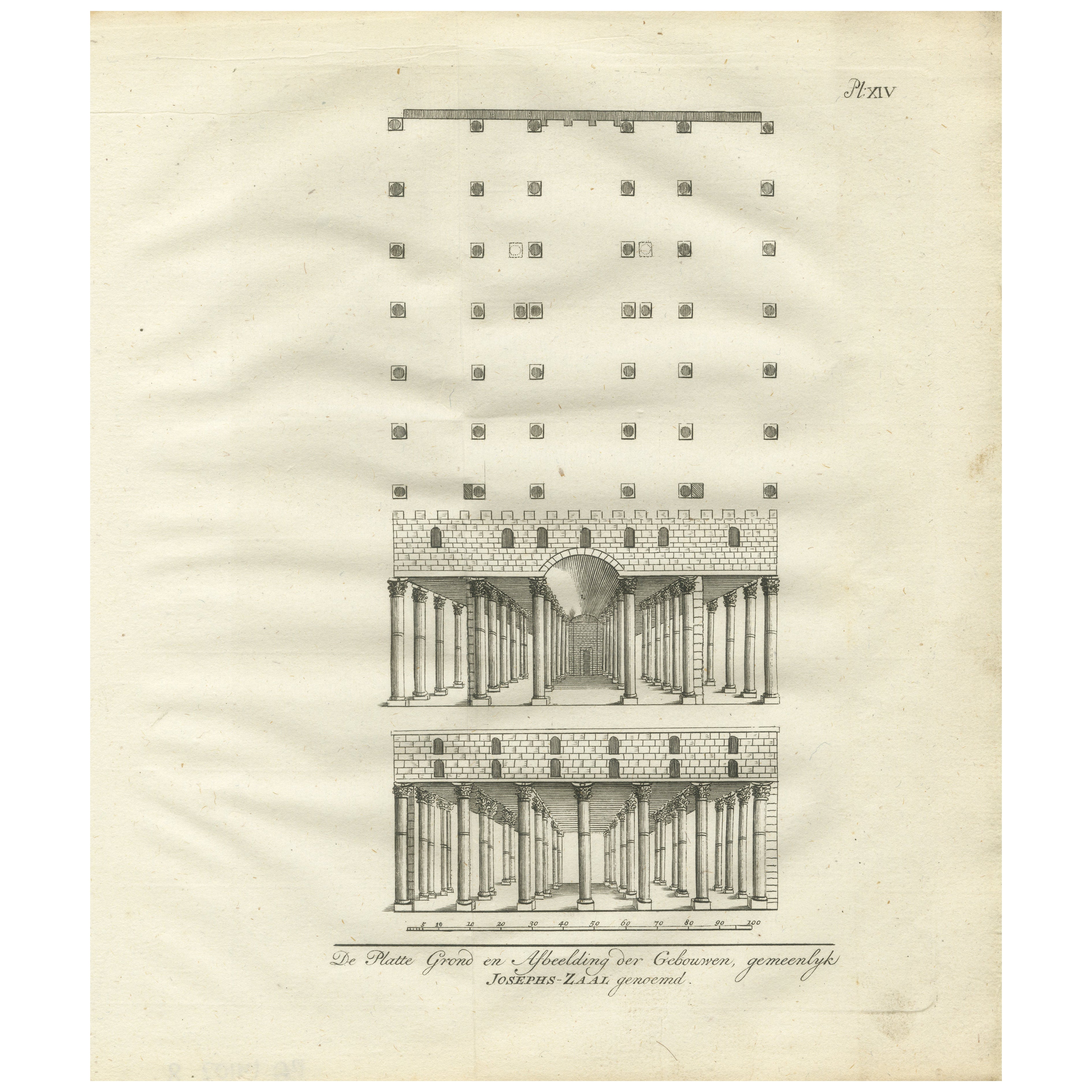
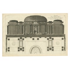
Hall of Joseph’s Granaries in Egypt – Floor Plan and Elevation Engraving, 1776
Located in Langweer, NL
Hall of Joseph’s Granaries in Egypt – Floor Plan and Elevation Engraving, 1776
Description:
This antique architectural engraving from 1776 shows the floor plan and structural elevat...
Category
Antique Late 18th Century Dutch Prints
Materials
Paper
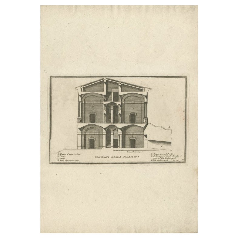
Antique Print of a Cross-Section of a Building in Rome by De Rossi, C.1710
Located in Langweer, NL
Antique print titled 'Spaccato della Palazzina'. Old print showing a cross-section of a building in Rome. This print originates from 'Studio d'architettura civile sopra gli ornamenti...
Category
Antique 18th Century Prints
Materials
Paper
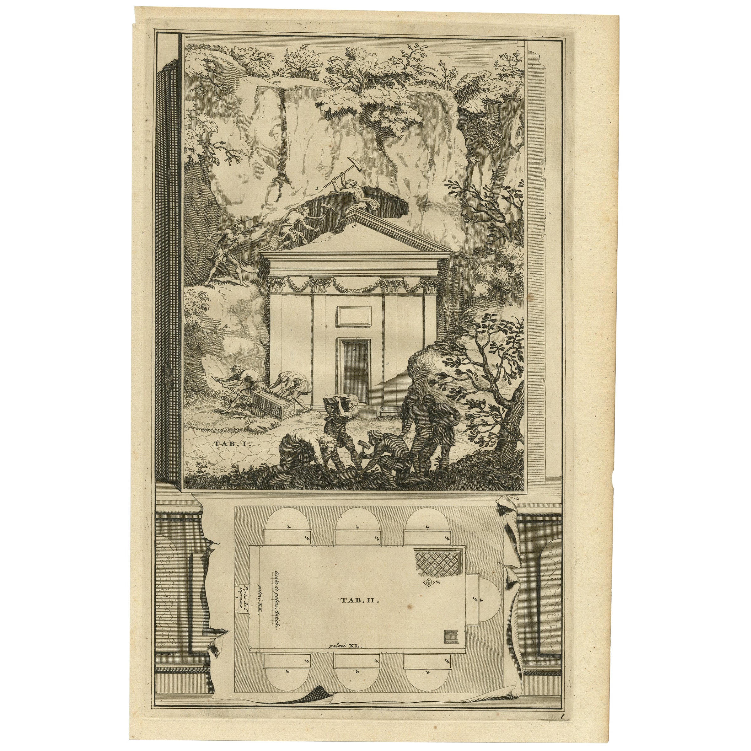
Antique Print of An Ancient Roman Tomb and a Floor Plan in Rome, Italy, 1704
Located in Langweer, NL
Description: Antique print, untitled. This original old antique print shows an ancient Roman tomb and a floor plan in Rome, Italy.
This original old ant...
Category
Antique Early 1700s Prints
Materials
Paper
$207 Sale Price / set
20% Off
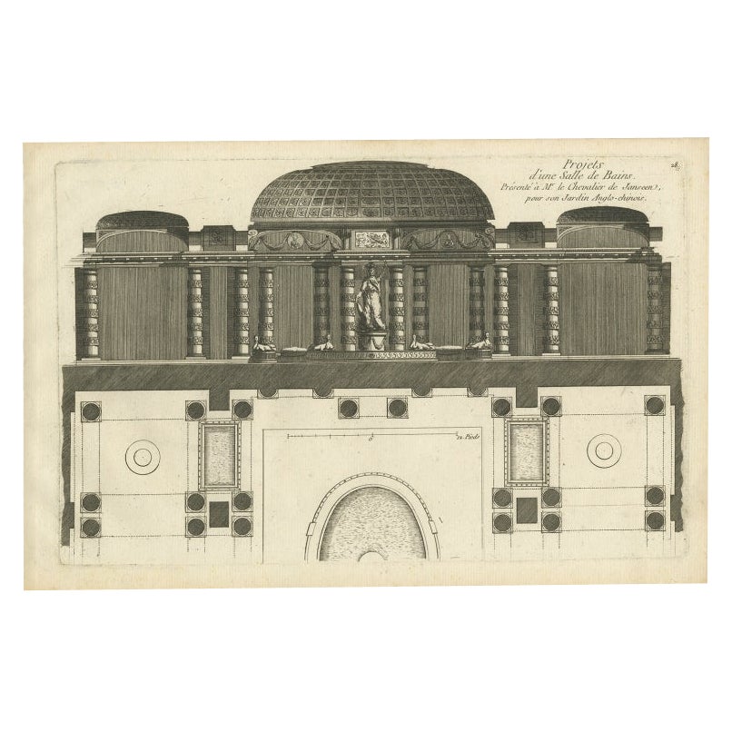
Antique Print of a Bathroom Design for Hotel De Jansen in Paris, France, c.1785
Located in Langweer, NL
Antique print titled 'Projets d'une Salle de Bains'. Copper engraving showing the design of a bathroom. This print originates from 'Jardins Anglo-Chinois à la Mode' by Georg Louis le...
Category
Antique 18th Century Prints
Materials
Paper
$340 Sale Price
20% Off
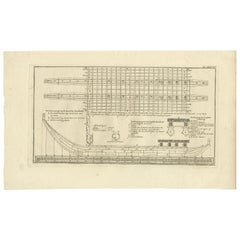
Antique Plan of Britannia 'Cross Section' by Cook, 1803
Located in Langweer, NL
Antique print titled 'Tekening, Plan en Doorsnede van de Britannia (..)'. This print depicts the the Tahiti war Canoe, double connected with beams and bonded with coconut ropes. Orig...
Category
Antique Early 19th Century Dutch Prints
Materials
Paper
$264 Sale Price
20% Off
You May Also Like
Architectural Roman Map - Etching by Vincenzo Scarpati - 18th Century
Located in Roma, IT
Architectural Roman Map from "Antiquities of Herculaneum" is an etching on paper realized by Vincenzo Scarpati in the 18th Century.
Signed on the plate.
Go...
Category
18th Century Old Masters Figurative Prints
Materials
Etching

Map of Forum Romanum - Original Etching by Pietro Ruga - 19th Century
Located in Roma, IT
Map of Forum Romanum is an original etching realized by Pietro Ruga 1849 ca.
Good Conditions except fr being aged with some small cutaways.
The artwork r...
Category
19th Century Modern More Prints
Materials
Etching

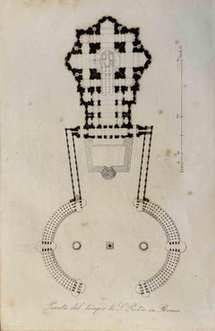
Uses and Customs - Map of St. Peter's Basilica - Lithograph - 1862
Located in Roma, IT
Uses and Customs - Map of St. Peter's Basilica is a lithograph on paper realized in 1862.
The artwork belongs to the Suite Uses and customs of all the peoples of the universe: " Hi...
Category
1860s Modern Figurative Prints
Materials
Lithograph
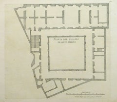
Antique Architectural Engraving - Santo Spirito Palace
By Giovanni Giacomo de Rossi
Located in Houston, TX
Antique Architectural engraving of the floor plan of the Santo Spirito Palace located in Florence, Italy by Italian, Giacomo Rossi, 16...
Category
18th Century and Earlier Interior Prints
Materials
Ink, Paper
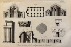
Uses and Customs -Map of St. Giulia Church, Bergamo - Lithograph - 1862
Located in Roma, IT
Uses and Customs - Architecture is a lithograph on paper realized in 1862.
The artwork belongs to the Suite Uses and customs of all the peoples of the universe: " History of the gov...
Category
1860s Modern Figurative Prints
Materials
Lithograph
Interior Plan - Original Etching by François Mazoit - 19th century
Located in Roma, IT
Interior Plan is an original etching realized by François Mazoit in the 19th century.
Plate-signed on the lower right.
Good conditions with diffused foxing spots.
Category
19th Century Modern Interior Prints
Materials
Etching
More Ways To Browse
Antique Cathedral Cabinet
Antique Chinese Black Lacquer Screen
Antique Chinese Watercolor Paintings
Antique Cloche
Antique Clock With Lion Heads
Antique Door Spindle
Antique Door Studs
Antique Double Secretary
Antique Drinking Bird
Antique Furniture Northumberland
Antique Haberdashery
Antique Heart Pine
Antique Horse Bit
Antique Japanese Kimono Kimonos And Textiles
Antique Korean Cabinet
Antique Macabre
Antique Secretary Side By Side
Antique Spice Set