Items Similar to Antique Portrait of a Dutch Officer Named Jan Van Swieten 1874
Want more images or videos?
Request additional images or videos from the seller
1 of 6
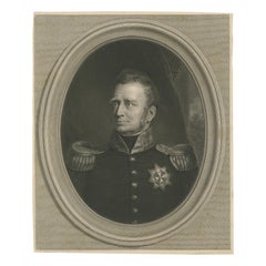
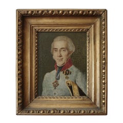
Antique Portrait of a Dutch Officer Named Jan Van Swieten 1874
$153.36
$191.7020% Off
£114.15
£142.6820% Off
€128
€16020% Off
CA$210.07
CA$262.5920% Off
A$233.64
A$292.0520% Off
CHF 122
CHF 152.5020% Off
MX$2,843.17
MX$3,553.9620% Off
NOK 1,558.13
NOK 1,947.6620% Off
SEK 1,461.25
SEK 1,826.5720% Off
DKK 974.42
DKK 1,218.0220% Off
Shipping
Retrieving quote...The 1stDibs Promise:
Authenticity Guarantee,
Money-Back Guarantee,
24-Hour Cancellation
About the Item
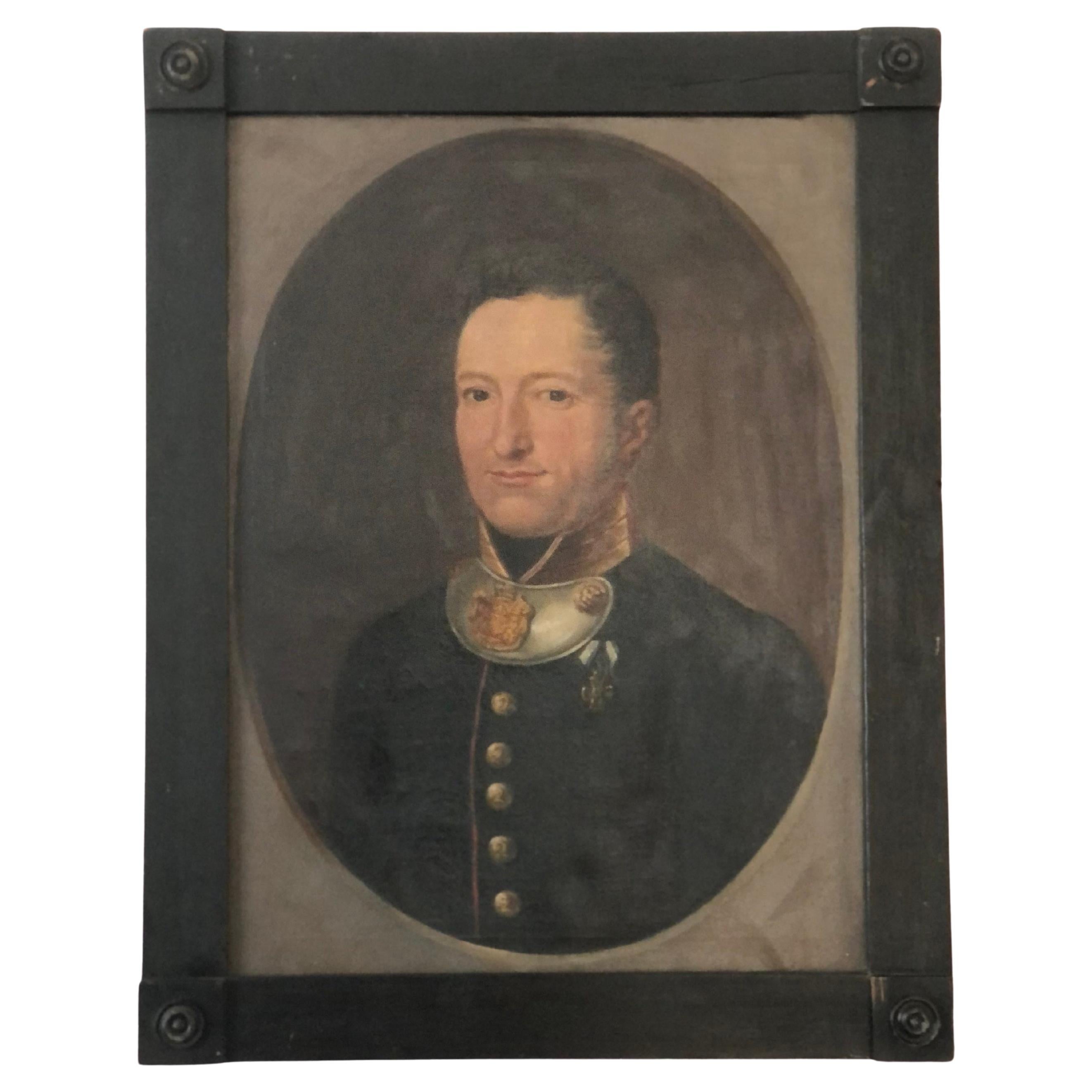
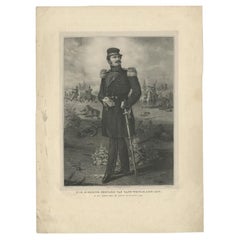
Antique portrait titled 'Luitenant Generaal J. van Swieten. Civiel regeerings commissaris en opperbevelhebber der Militaire Operatien tegen Atchin'. Antique portrait of Jan van Swieten. Van Swieten started his career in 1821 as an volunteer and started as a cadet in 1822, in 1824 became a second Lieutenant. Jan van Swieten played an important role as an officer in the Dutch East Indies and led expeditions in Java. Returned to the Netherlands in 1862, and was politically active for some time. In 1873 he was appointed commander of an expedition to Java. He recaptured The Kraton. In 1874 he received the Grand Cross of the Military Order of William. Originates from 'De Oorlog tusschen Nederland en Atchin' by G.L. Klepper.
Artists and Engravers: Published by 's Hage Wed. E. Spanier & Zn.
Condition: Good, general age-related toning. Some foxing, please study image carefully.
Date: 1874
Overall size: 23 x 31 cm.
Image size: 18 x 22 cm.
We sell original antique maps to collectors, historians, educators and interior decorators all over the world. Our collection includes a wide range of authentic antique maps from the 16th to the 20th centuries. Buying and collecting antique maps is a tradition that goes back hundreds of years. Antique maps have proved a richly rewarding investment over the past decade, thanks to a growing appreciation of their unique historical appeal. Today the decorative qualities of antique maps are widely recognized by interior designers who appreciate their beauty and design flexibility. Depending on the individual map, presentation, and context, a rare or antique map can be modern, traditional, abstract, figurative, serious or whimsical. We offer a wide range of authentic antique maps for any budget.
- Dimensions:Height: 12.21 in (31 cm)Width: 9.06 in (23 cm)Depth: 0 in (0.01 mm)
- Materials and Techniques:
- Period:
- Date of Manufacture:1874
- Condition:Condition: Good, general age-related toning. Some foxing, please study image carefully.
- Seller Location:Langweer, NL
- Reference Number:Seller: BG-11410'1stDibs: LU3054329259042
About the Seller
5.0
Recognized Seller
These prestigious sellers are industry leaders and represent the highest echelon for item quality and design.
Platinum Seller
Premium sellers with a 4.7+ rating and 24-hour response times
Established in 2009
1stDibs seller since 2017
2,508 sales on 1stDibs
Typical response time: <1 hour
- ShippingRetrieving quote...Shipping from: Langweer, Netherlands
- Return Policy
Authenticity Guarantee
In the unlikely event there’s an issue with an item’s authenticity, contact us within 1 year for a full refund. DetailsMoney-Back Guarantee
If your item is not as described, is damaged in transit, or does not arrive, contact us within 7 days for a full refund. Details24-Hour Cancellation
You have a 24-hour grace period in which to reconsider your purchase, with no questions asked.Vetted Professional Sellers
Our world-class sellers must adhere to strict standards for service and quality, maintaining the integrity of our listings.Price-Match Guarantee
If you find that a seller listed the same item for a lower price elsewhere, we’ll match it.Trusted Global Delivery
Our best-in-class carrier network provides specialized shipping options worldwide, including custom delivery.More From This Seller
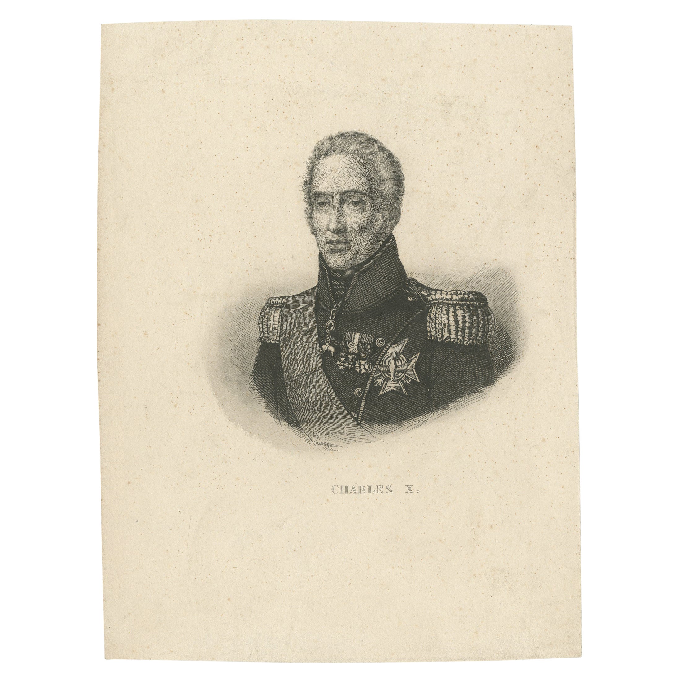
View AllAntique Portrait of Charles X, King of France, c.1860
Located in Langweer, NL
Antique print titled 'Charles X'. Portrait of Charles X, King of France. Source unknown, to be determined.
Artists and Engravers: Anonymous.
Condition: Good, general age-related to...
Category
Antique 19th Century Prints
Materials
Paper
$115 Sale Price
20% Off
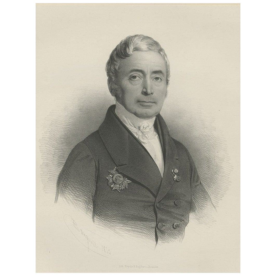
Rare Portrait of an Important Dutch or Belgium Figure, c.1850
Located in Langweer, NL
Untitled portait of a series depicting important figures of Belgium/France. Lithographed by Pierre-Joseph Degobert after C.L. Baugniet.
Artists and Engravers: Pierre-Joseph Degobe...
Category
Antique 19th Century Prints
Materials
Paper

$377 Sale Price
25% Off
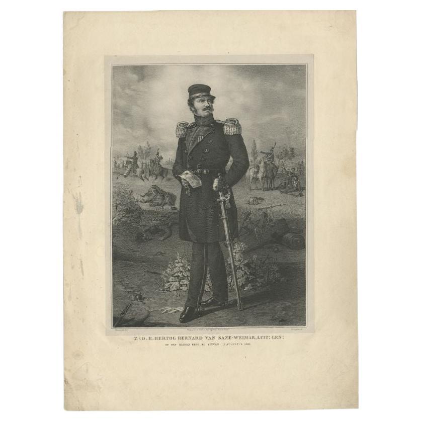
Antique Portrait of Prince Bernhard of Saxe-Weimar-Eisenach by Desguerrois
Located in Langweer, NL
Antique print titled 'Z.D.H. Hertog Bernard van Saze-Weimar (..) op den ijzeren berg bij Leuven, 10 augustus 1831'. Portrait of Prince Bernhard of Saxe-Weimar-Eisenach. Source unknow...
Category
Antique 19th Century Prints
Materials
Paper
$277 Sale Price
20% Off
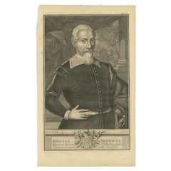
Antique Portrait of Hendrik Brouwer, Governor of the Dutch East Indies
Located in Langweer, NL
"Antique portrait titled 'Henrik Brouwer, Gouverneur Generaal van Nederlands Indiën'. Old portrait of Hendrik Brouwer, Dutch explorer and governor of the Dutch East Indies. This prin...
Category
Antique 18th Century Prints
Materials
Paper
$316 Sale Price
20% Off
Engraved Portrait of King William I of the Netherlands after J.W. Pieneman, 1835
Located in Langweer, NL
Engraved Portrait of King William I of the Netherlands after J.W. Pieneman, by B. Taurel
Description:
This is a highly detailed 19th-century engraved portrait of King William I of t...
Category
Antique Early 19th Century European Prints
Materials
Paper
Antique Portrait of Gebhard Leberecht von Blücher by Wagstaff 'c.1840'
Located in Langweer, NL
Original antique portrait of Gebhard Leberecht von Blücher by Charles Edward Wagstaff. Published by Hodgson & Graves, after Sir Thomas Lawrence, circa 1840. Gebhard Leberecht von Blü...
Category
Antique Mid-19th Century Prints
Materials
Paper
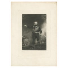
$479 Sale Price
20% Off
You May Also Like
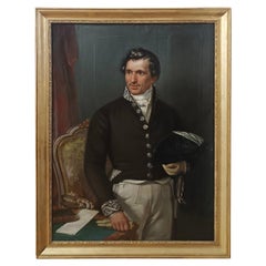
19th Century Antique Portrait Painting of a German Baron in Military Uniform
Located in Sakskøbing, DK
This elegant 19th‑century oil portrait painting presents the aristocrat Adam Franz Bernhard, Baron von Hirschberg, Lord of the condominium at Ebnath and Schwarzenreuth and Royal Bava...
Category
Antique 19th Century German Biedermeier Paintings
Materials
Canvas, Paint, Hardwood

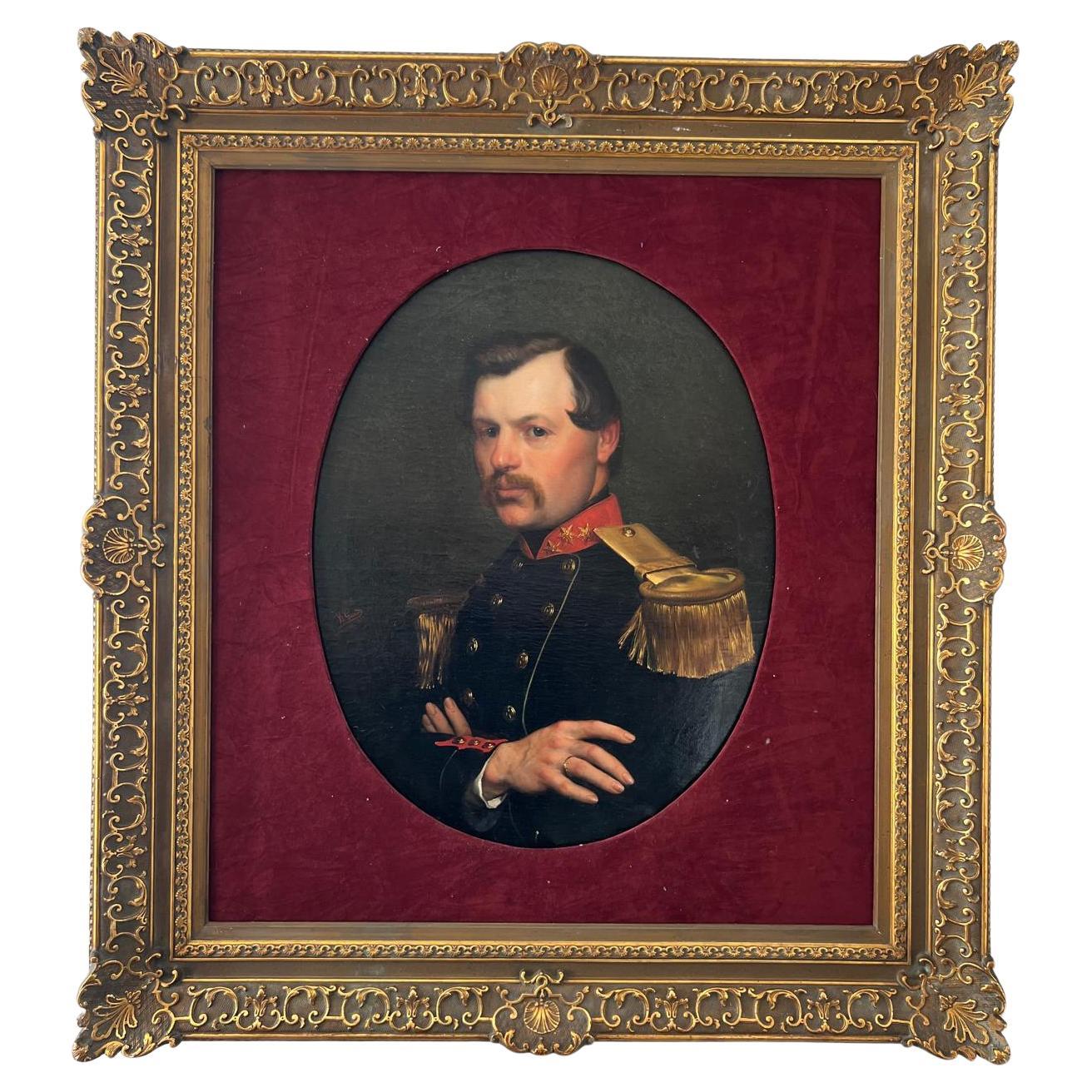
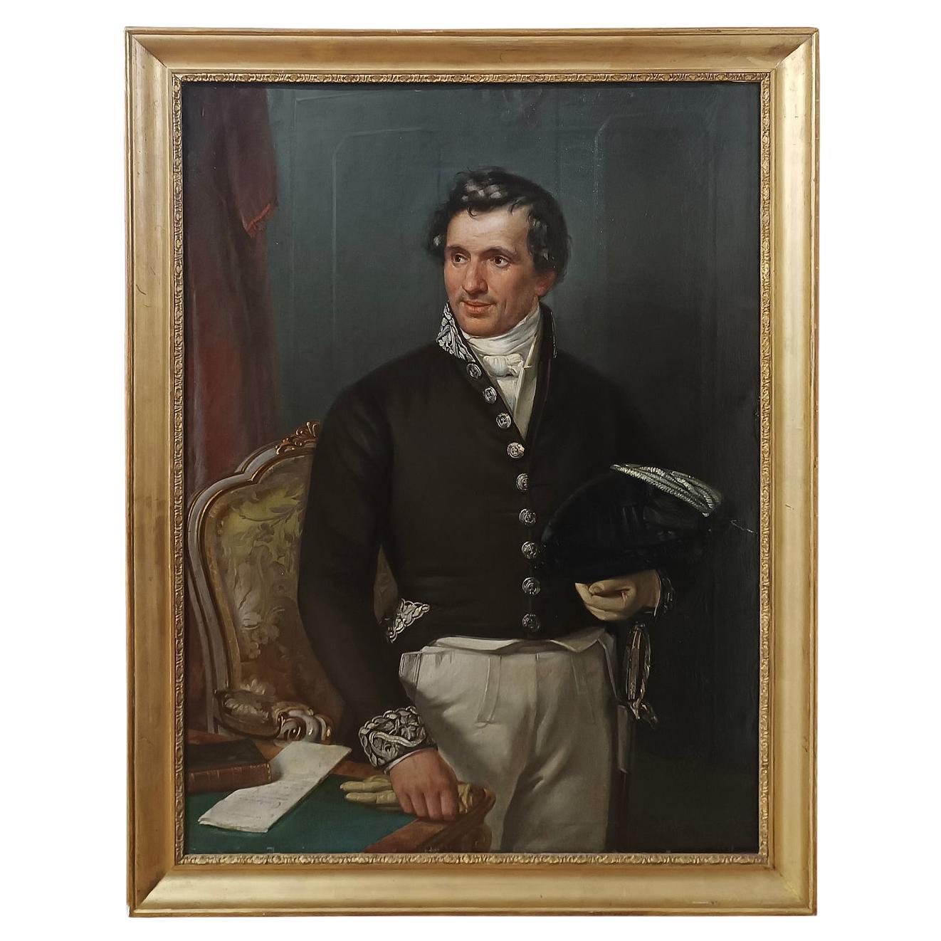
Portrait of an officer, signed Willem Geets, oil on canvas, 1867, 19th century
Located in NICE, FR
Portrait of a high-ranking officer with arms crossed over his chest and three-quarter view in detailed military garb: fringed silk epaulets, gold buttons, red cuffs. The attention to...
Category
Antique 1860s Dutch Napoleon III Paintings
Materials
Canvas

EARLY 19th CENTURY PORTRAIT OF A GENTLEMAN IN UNIFORM
Located in Firenze, FI
Splendid oil portrait on canvas of a gentleman in uniform, identified as Professor Moses Bosisio, mayor of Monza, who died in 1846, as reported on a plaque on the back of the paintin...
Category
Antique Early 19th Century Italian Empire Paintings
Materials
Canvas, Wood, Paint
19th Century Portrait of a French Officer
Located in Buchanan, MI
19th century portrait of a French officer in a giltwood frame.
Category
Antique 19th Century French Paintings
Materials
Canvas
Antique Photograph of Man in Military Uniform, Framed, C1860
Located in Big Flats, NY
Antique Photograph of Man In Military Uniform, Framed, C1860
Measures - 21"H x 19"W x 1"D
A vintage photograph depicting a man in a military uniform, dating to approximately 1860. ...
Category
Antique 19th Century Photography
Materials
Paper
$360 Sale Price
20% Off
Portrait Of General Goethals Attributed to Gustaaf Wappers (1803-1874)
Located in NICE, FR
This artwork is a portrait of General Goethals, who served as the commanding officer of the Province of Antwerp during the Bourbon Restoration era. It was painted in 1826 by the reno...
Category
Antique Early 19th Century French Louis Philippe Paintings
Materials
Canvas
More Ways To Browse
American 4 Drawer Chest
Antique 6 Drawer Chest
Antique Camel Table
Antique Chest Federal
Antique Farm Cabinet
Antique French Bulldog
Antique Furniture Cheshire
Antique Kangaroo
Antique Mahogany 4 Drawer Chest
Antique Oak Bow Front Cabinet
Antique Pine China Cabinet
Antique Primitive Chest
Antique Rosewood Dresser
Antique Salvage Windows
Antique Seahorse
Antique Shell Bottles
Antique Silver New Orleans
Antique Spice Cabinet