Items Similar to Antique Print of Gibraltar Showing the Spanish and English Fleet, 1782
Want more images or videos?
Request additional images or videos from the seller
1 of 6
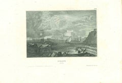
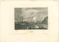
Antique Print of Gibraltar Showing the Spanish and English Fleet, 1782
$413.14
$516.4220% Off
£304.28
£380.3520% Off
€344
€43020% Off
CA$562.04
CA$702.5520% Off
A$624.55
A$780.6920% Off
CHF 327.27
CHF 409.0920% Off
MX$7,659.05
MX$9,573.8120% Off
NOK 4,174.18
NOK 5,217.7220% Off
SEK 3,926.91
SEK 4,908.6420% Off
DKK 2,618.82
DKK 3,273.5220% Off
Shipping
Retrieving quote...The 1stDibs Promise:
Authenticity Guarantee,
Money-Back Guarantee,
24-Hour Cancellation
About the Item
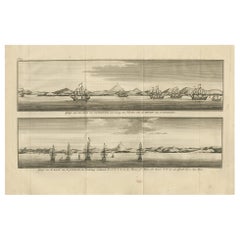
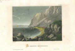
Antique print titled 'Perspective View of Gibraltar. With the the Disposition of the Spanish Attack, and Relief of the Garrison by the English Fleet under the command of Admiral Darby, 12 April 1781'. View of the island clearly showing the fortifications, during a bombardment, with the Spanish encampments on the left wing of the bay and a few Spanish ships disposed in front, under attack from the British fleet which sails into the bay from the right. This print originates from the 'European Magazine'.
Artists and Engravers: Engraved by Lodge. Published by J. Fielding, J. Sewell and J. Debrett.
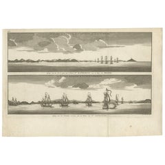
Condition: Good, general age-related toning. Minor wear, blank verso. Please study image carefully.
Date: 1782
Overall size: 26.5 x 20.5 cm.
Image size: 23 x 17 cm.
We sell original antique maps to collectors, historians, educators and interior decorators all over the world. Our collection includes a wide range of authentic antique maps from the 16th to the 20th centuries. Buying and collecting antique maps is a tradition that goes back hundreds of years. Antique maps have proved a richly rewarding investment over the past decade, thanks to a growing appreciation of their unique historical appeal. Today the decorative qualities of antique maps are widely recognized by interior designers who appreciate their beauty and design flexibility. Depending on the individual map, presentation, and context, a rare or antique map can be modern, traditional, abstract, figurative, serious or whimsical. We offer a wide range of authentic antique maps for any budget.
- Dimensions:Height: 8.08 in (20.5 cm)Width: 10.44 in (26.5 cm)Depth: 0 in (0.01 mm)
- Materials and Techniques:
- Period:
- Date of Manufacture:1782
- Condition:Condition: Good, general age-related toning. Minor wear, blank verso. Please study image carefully.
- Seller Location:Langweer, NL
- Reference Number:Seller: BG-103721stDibs: LU3054329584642
About the Seller
5.0
Recognized Seller
These prestigious sellers are industry leaders and represent the highest echelon for item quality and design.
Platinum Seller
Premium sellers with a 4.7+ rating and 24-hour response times
Established in 2009
1stDibs seller since 2017
2,494 sales on 1stDibs
Typical response time: 1 hour
- ShippingRetrieving quote...Shipping from: Langweer, Netherlands
- Return Policy
Authenticity Guarantee
In the unlikely event there’s an issue with an item’s authenticity, contact us within 1 year for a full refund. DetailsMoney-Back Guarantee
If your item is not as described, is damaged in transit, or does not arrive, contact us within 7 days for a full refund. Details24-Hour Cancellation
You have a 24-hour grace period in which to reconsider your purchase, with no questions asked.Vetted Professional Sellers
Our world-class sellers must adhere to strict standards for service and quality, maintaining the integrity of our listings.Price-Match Guarantee
If you find that a seller listed the same item for a lower price elsewhere, we’ll match it.Trusted Global Delivery
Our best-in-class carrier network provides specialized shipping options worldwide, including custom delivery.More From This Seller
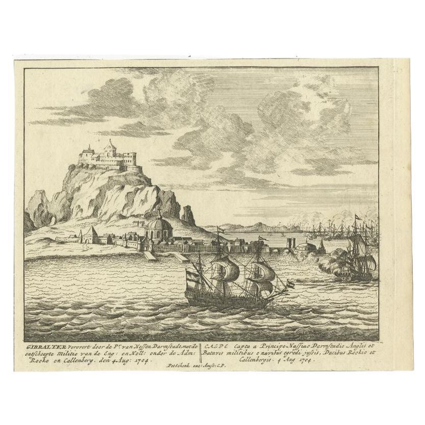
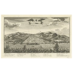
View AllAntique Print of Gibraltar, c.1720
Located in Langweer, NL
Antique print titled 'Gibraltar verovert door de Pr. van Hessen Darmstadt (..)'. Copper engraving of the capture of the fortified town of Gibraltar in 1704 during the War of the Span...
Category
Antique 18th Century Prints
Materials
Paper
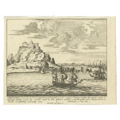
$422 Sale Price
20% Off
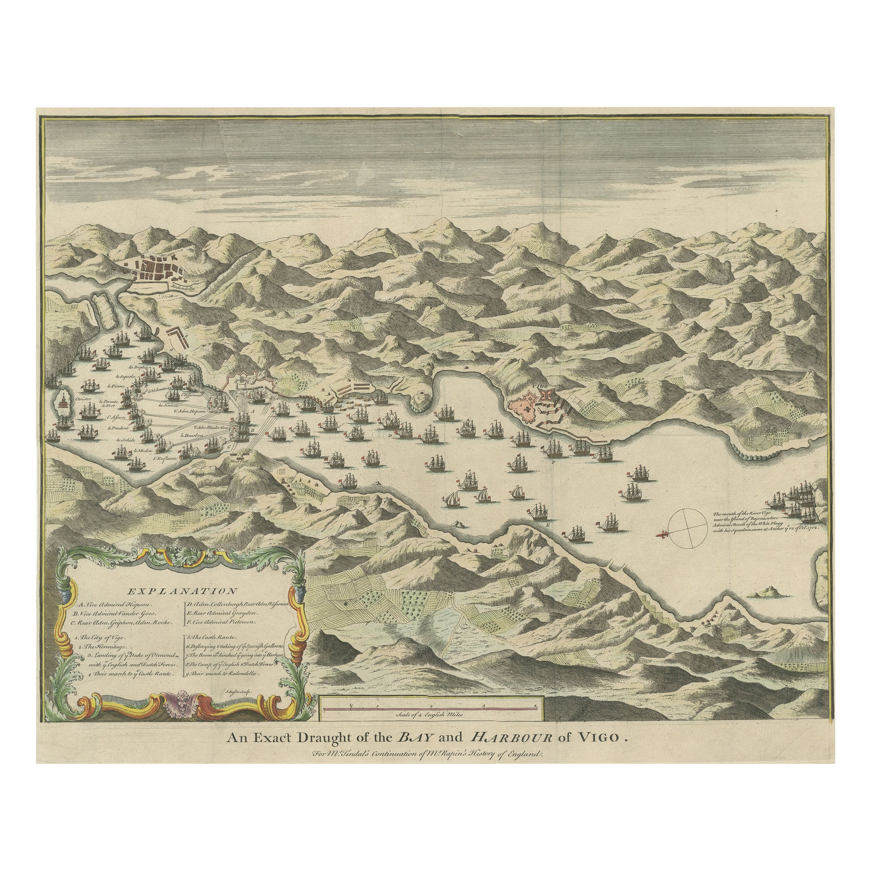
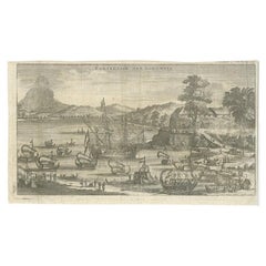
Antique Print of the Battle in 1702 of Vigo Bay or Rande, Galicia, Spain
Located in Langweer, NL
Antique print titled 'An Exact Draught of the Bay and Harbour of Vigo'. The Battle of Vigo Bay was an engagement that saw a combined Dutch/English naval force successfully capture on...
Category
Antique Mid-18th Century Prints
Materials
Paper
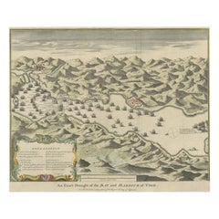
$845 Sale Price
20% Off
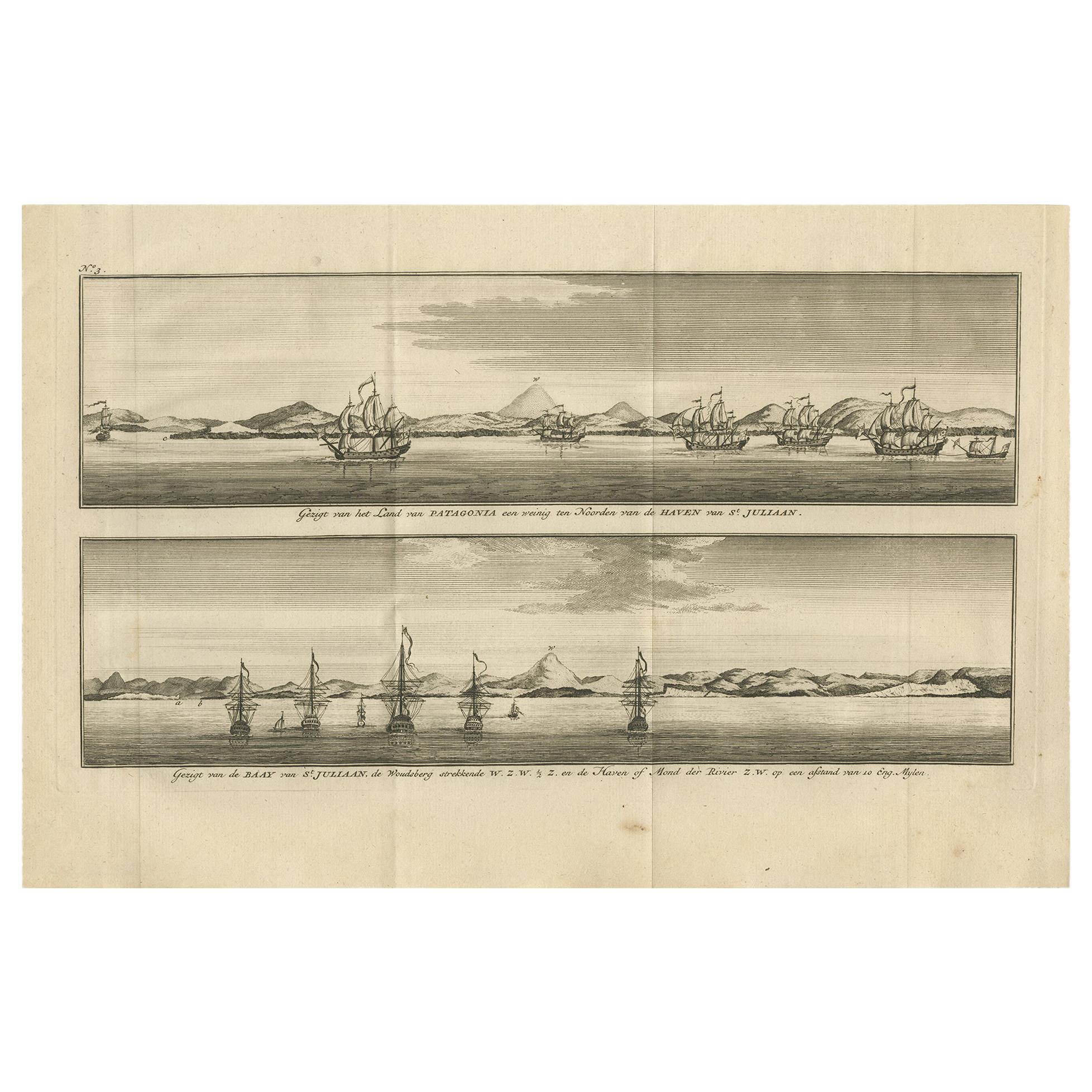
Antique Print with Views of St. Julian, Patagonia, 1749
Located in Langweer, NL
Antique print titled 'Gezigt van het land van Patagonia een weining ten noorden van de Haven van St. Juliaan.' and 'Gezigt van de Baay van St. Juliaan, de Woudsberg strekkende W.Z.W....
Category
Antique Mid-18th Century Prints
Materials
Paper
$240 Sale Price
20% Off
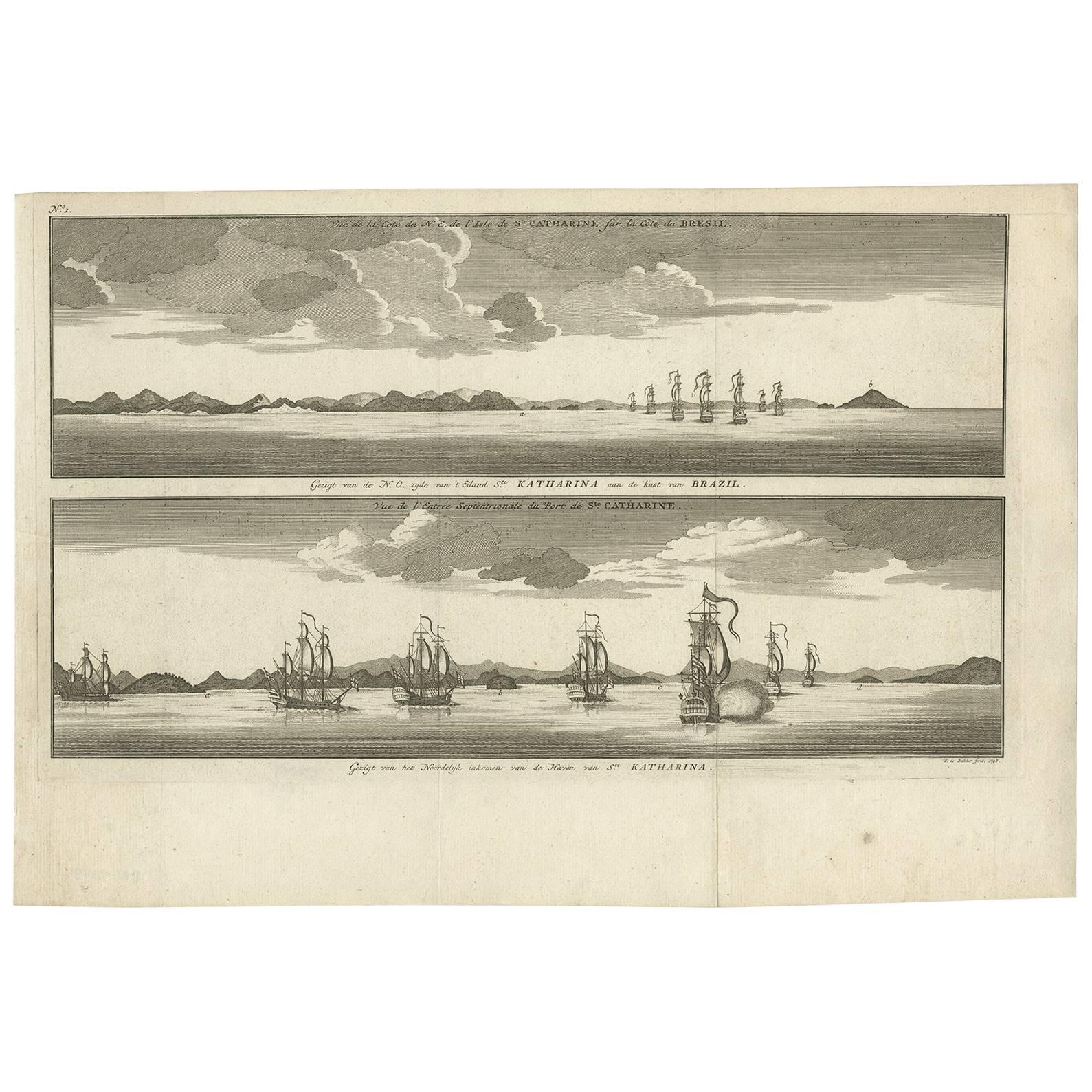
Antique Print with views of Santa Catarina Island by Anson (c.1760)
Located in Langweer, NL
Plate no.1: 'Vue de la cote de N.E. de l'Isle de Ste. Catharine sur la cote du Bresil.' - 'Vue de l'entree septentrionale du port de Ste. Catharine.' (View of the coast of the N.E. o...
Category
Antique Mid-18th Century Prints
Materials
Paper
$201 Sale Price
20% Off
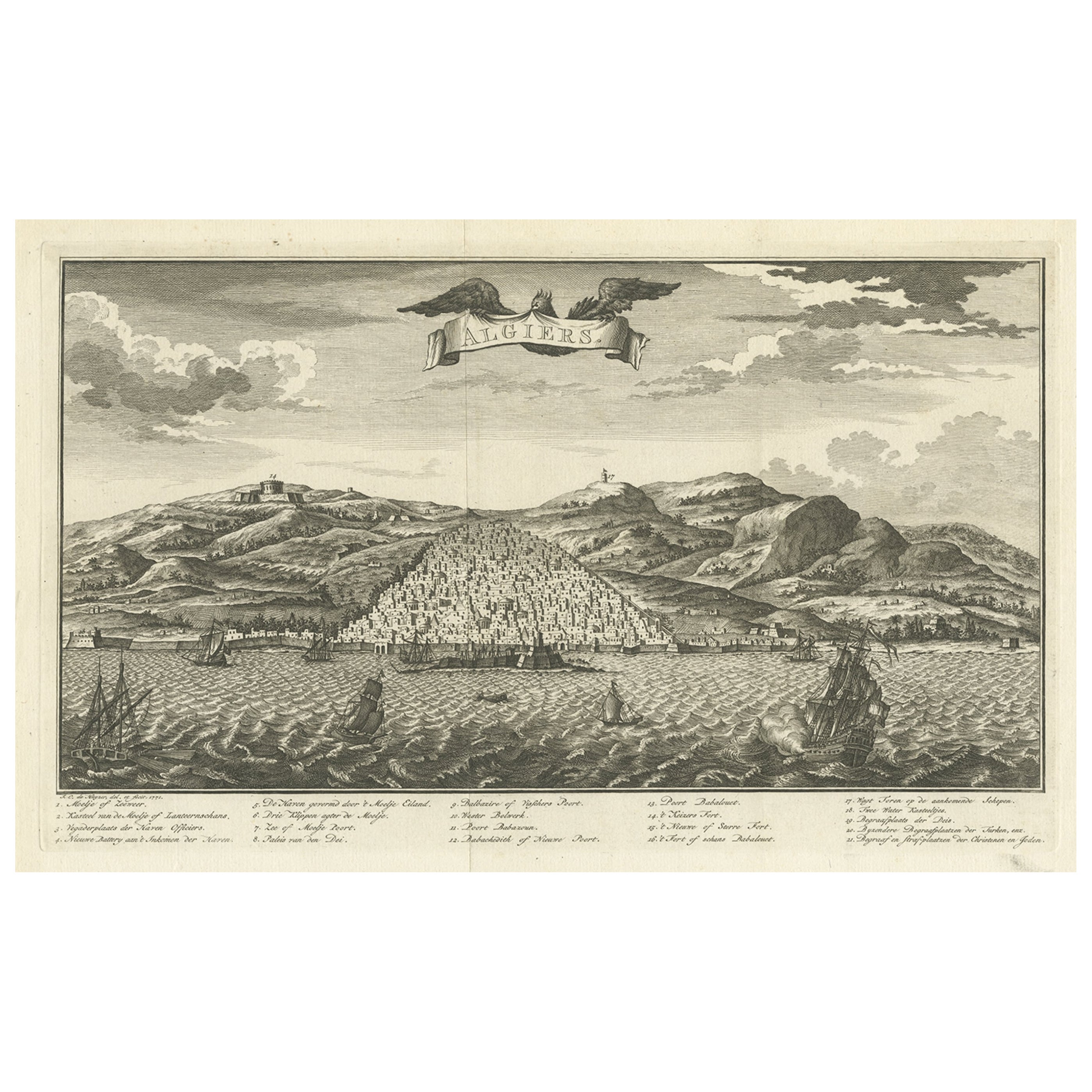
Original Antique Engraving of Algiers in Algeria, 1773
Located in Langweer, NL
Antique print titled 'Algiers'. Old print with a view of Algiers, Algeria. With Dutch legend. Originates from the first Dutch editon of an interesting travel account of Northern Afri...
Category
Antique 18th Century Prints
Materials
Paper
$470 Sale Price
20% Off
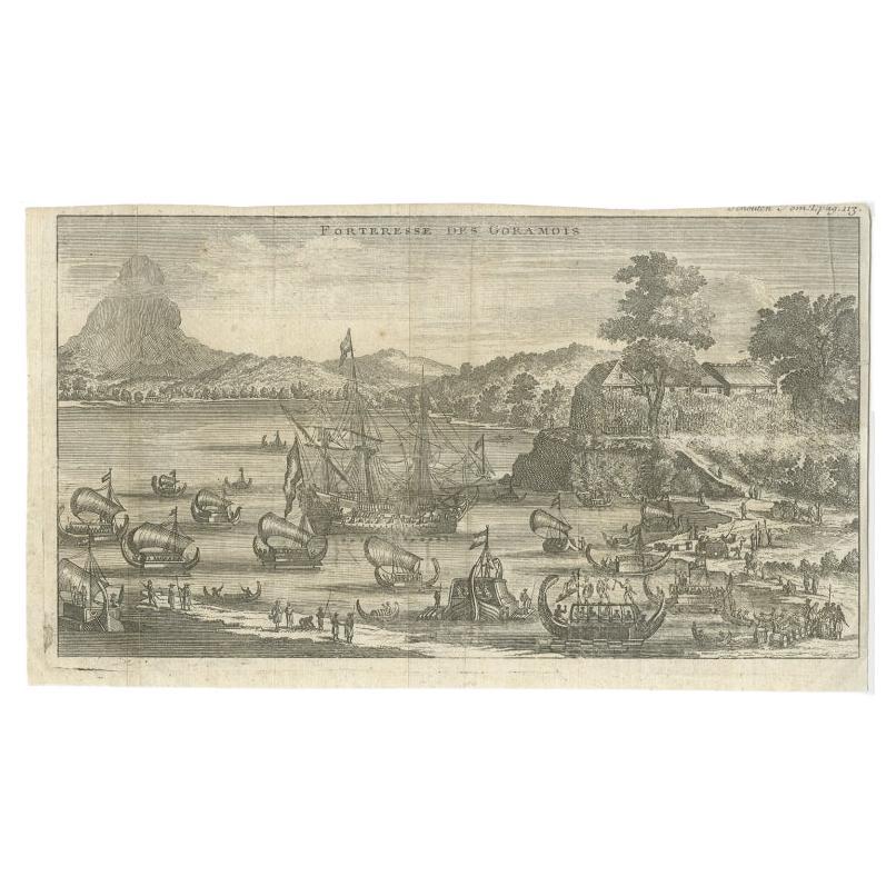
Antique Print of the Fortress of Goram by Schouten, 1725
Located in Langweer, NL
Antique print titled 'Forteresse des Goramois'. View of the fortress of Goram. Originates from 'Voyage de Gautier Schouten aux Indes Orientales (..)'.
...
Category
Antique 18th Century Prints
Materials
Paper
$124 Sale Price
20% Off
You May Also Like
Ancient View of La Valetta - Original Lithograph - Early-19th Century
Located in Roma, IT
La Valetta is an original modern artwork realized in Italy in the first half of the 19th Century.
Original Lithograph on Ivory Paper.
Inscripted in capital letters on the lower ma...
Category
1850s Modern Figurative Prints
Materials
Lithograph
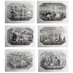
Set of 6 Original Antique Marine Prints-Famous Sea Battles. Dated 1803
Located in St Annes, Lancashire
Great set of sea battles
Copper-plate engravings.
Published by J.Stratford, London.
Dated 1803
Unframed.
Free shipping.
Category
Antique Early 1800s English Georgian Prints
Materials
Paper
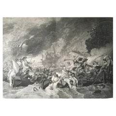
B.West Engraving "Naval Battle, Battle of the Houge" 18th Century
Located in Beuzevillette, FR
This magnificent engraving is entitled "Battle of La Hougue" by the engraver E.C Voysard after Benjamin West.
It depicts the Battle of Barfleur- La Hougue,...
Category
Antique 18th Century French Prints
Materials
Paper
Ancient View of The Strait of Gibraltar - Original Lithograph - Mid-19th Century
Located in Roma, IT
The Strait of Gibraltar is an original modern artwork realized in the mid-19th Century.
Original Colored Lithograph on Ivory Paper.
Inscripted on the lower margin in Capital Lett...
Category
Mid-19th Century Figurative Prints
Materials
Paper, Lithograph
18th Century French Map and City View of Joppe/Jaffa (Tel Aviv) by Sanson
By Nicholas Sanson d'Abbeville
Located in Alamo, CA
An original antique engraving entitled "Joppe; in ’t Hebreeusch by ouds Japho; hedendaags Japha, of Jaffa; volgens d’aftekening gedaan 1668", by Nicholas Sanson d'Abbeville (1600 - 1667). This is a view of the city of Joppe (in Hebrew Japho), now called Japha or Jaffa, the harbor portion of modern day Tel Aviv, Israel as it appeared in 1668 . It depicts a very busy harbor with numerous boats. A large ship on the left appears to be firing its canons and a small ship on the right appears to be sitting very low in the water, either heavily loaded with cargo or sinking. The town is seen on the far shore with a fortress on a hill across in the background. The map is printed from the original Sanson copperplate and was published in 1709 by his descendants.
The map is presented in an ornate brown wood frame embellished by gold-colored leaves and gold inner trim with a double mat; the outer mat is cream-colored and the inner mat is black. There is a central vertical fold, as issued. There are two small spots in the lower margin and one in the upper margin, as well as two tiny spots adjacent to the central fold. 1717 is written below the date 1668 in the inscription. The map is otherwise in very good condition.
Another map of the "Holy Land" (by Claes Visscher in 1663), with an identical style frame and mat is available. This pair of maps would make a wonderful display grouping. Please see Reference #LU117324709892.
Artist: Nicholas Sanson d'Abbeville (1600 - 1667) and his descendents were important French cartographer's active through the 17th century. Sanson started his career as a historian and initially utilized cartography to illustrate his historical treatises. His maps came to the attention of Cardinal Richelieu and then King Louis XIII of France, who became a supporter and sponsor. He subsequently appointed Sanson 'Geographe Ordinaire du Roi' the official map maker to the king. Sanson not only created maps for the king, but advised him on geographical issues and curated his map collection...
Category
Early 1700s Prints and Multiples
Materials
Engraving
