Items Similar to Antique Print of a House in Barbary, North Africa, 1773

Want more images or videos?
Request additional images or videos from the seller
1 of 7
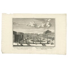
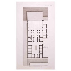
Antique Print of a House in Barbary, North Africa, 1773
$415.12
$518.9020% Off
£310.73
£388.4120% Off
€352
€44020% Off
CA$571.32
CA$714.1520% Off
A$636.79
A$795.9920% Off
CHF 334.10
CHF 417.6320% Off
MX$7,776.29
MX$9,720.3720% Off
NOK 4,230.48
NOK 5,288.1020% Off
SEK 3,998.45
SEK 4,998.0620% Off
DKK 2,679.67
DKK 3,349.5920% Off
About the Item
Antique print titled 'Gedeelte van een Huis in Barbarye (..)'. Old print depicting a view and two plans of a house in Barbary. Originates from the first Dutch editon of an interesting travel account of Northern Africa titled 'Reizen en Aanmerkingen door en over Barbaryen en het Ooste'.
Artists and Engravers: Author: T. Shaw. Translated by P. Boddaert and published by J. van Schoonhoven.
Condition: Very good, general age-related toning. Please study image carefully.
Date: 1773
Overall size: 21 x 26.5 cm.
Image size: 17 x 22 cm.
We sell original antique maps to collectors, historians, educators and interior decorators all over the world. Our collection includes a wide range of authentic antique maps from the 16th to the 20th centuries. Buying and collecting antique maps is a tradition that goes back hundreds of years. Antique maps have proved a richly rewarding investment over the past decade, thanks to a growing appreciation of their unique historical appeal. Today the decorative qualities of antique maps are widely recognized by interior designers who appreciate their beauty and design flexibility. Depending on the individual map, presentation, and context, a rare or antique map can be modern, traditional, abstract, figurative, serious or whimsical.
- Dimensions:Height: 10.44 in (26.5 cm)Width: 8.27 in (21 cm)Depth: 0 in (0.01 mm)
- Materials and Techniques:
- Period:
- Date of Manufacture:1773
- Condition:Condition: Very good, general age-related toning. Please study image carefully.
- Seller Location:Langweer, NL
- Reference Number:Seller: BG-11797-11stDibs: LU3054329296142
About the Seller
5.0
Recognized Seller
These prestigious sellers are industry leaders and represent the highest echelon for item quality and design.
Platinum Seller
Premium sellers with a 4.7+ rating and 24-hour response times
Established in 2009
1stDibs seller since 2017
2,513 sales on 1stDibs
Typical response time: <1 hour
- ShippingRetrieving quote...Shipping from: Langweer, Netherlands
- Return Policy
Authenticity Guarantee
In the unlikely event there’s an issue with an item’s authenticity, contact us within 1 year for a full refund. DetailsMoney-Back Guarantee
If your item is not as described, is damaged in transit, or does not arrive, contact us within 7 days for a full refund. Details24-Hour Cancellation
You have a 24-hour grace period in which to reconsider your purchase, with no questions asked.Vetted Professional Sellers
Our world-class sellers must adhere to strict standards for service and quality, maintaining the integrity of our listings.Price-Match Guarantee
If you find that a seller listed the same item for a lower price elsewhere, we’ll match it.Trusted Global Delivery
Our best-in-class carrier network provides specialized shipping options worldwide, including custom delivery.More From This Seller
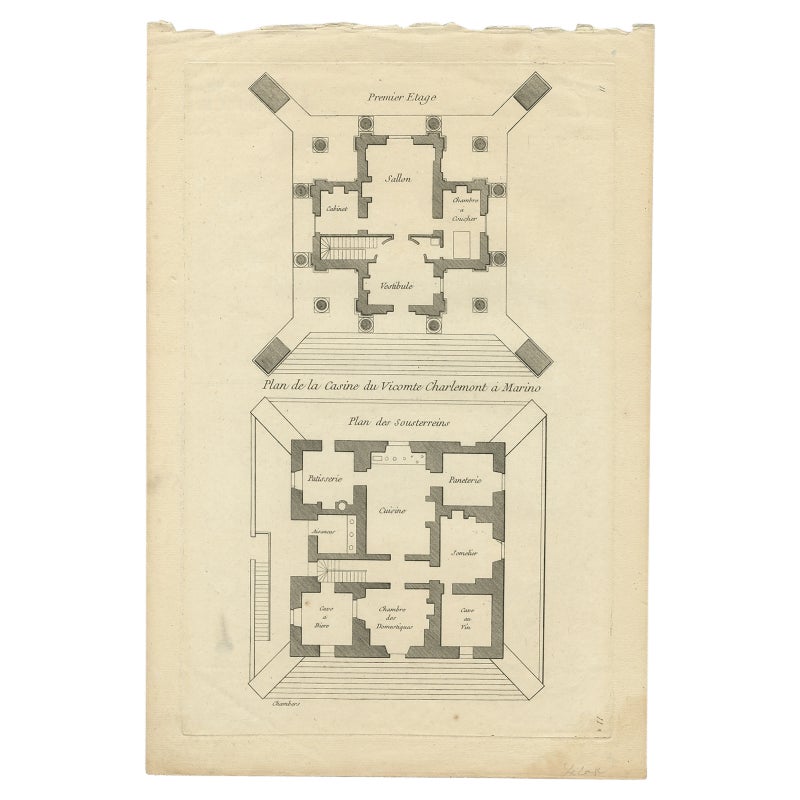
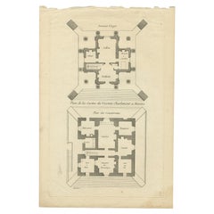
View AllPl. 11 Antique Print of the Mansion of Viscount Charlemont by Le Rouge, c.1785
Located in Langweer, NL
Antique print titled 'Plan de la Casine du Vicomte Charlemont a Marino'. Copper engraving showing the mansion of Viscount Charlemont in Marino. This print originates from 'Jardins An...
Category
Antique 18th Century Prints
Materials
Paper
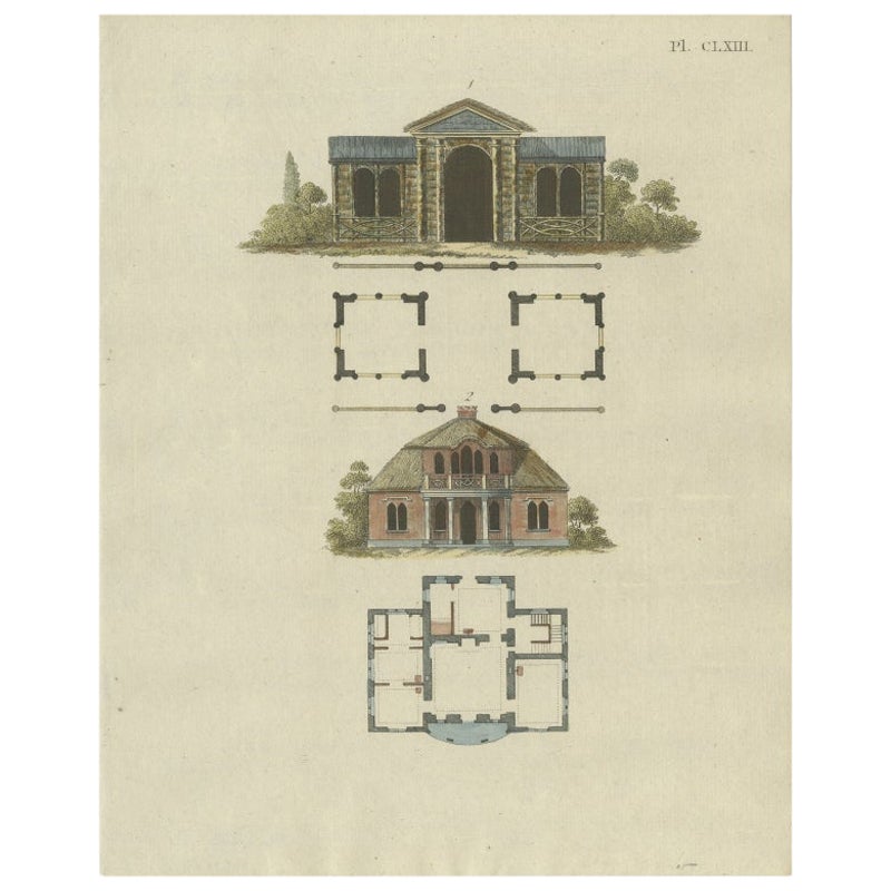
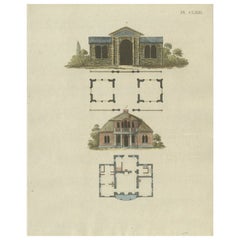
Antique Print of a House from Garden Architecture by Van Laar, 1802
Located in Langweer, NL
Untitled print of garden architecture. It shows garden buildings. This print originates from 'Magazijn van tuin-sieraden'. The book is compiled by Gijsbert van Laar, providing a surv...
Category
Antique 19th Century Prints
Materials
Paper
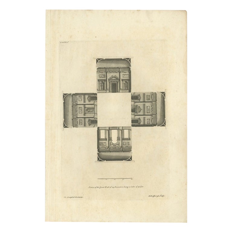
Antique Print of a Great Hall by Campbell, 1725
Located in Langweer, NL
Antique print titled 'Section of the Great Hall of my Invention being a Cube of 40 feet'.
Section of a Great Hall. This print originates from 'Vitruvius...
Category
Antique 18th Century Prints
Materials
Paper

$226 Sale Price
20% Off
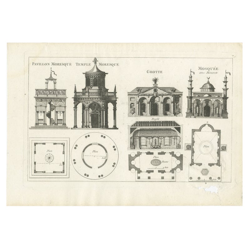
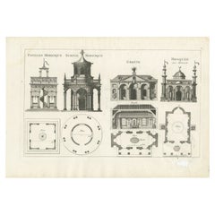
Pl. 7 Antique Print of Moorish Garden Elements by Le Rouge, 1776
Located in Langweer, NL
Antique print titled 'Pavillon Moresque Temple - Temple Moresque'. Copper engraving showing Moorish garden elements including a pavilion and temple. This print originates from 'Jardi...
Category
Antique 18th Century Prints
Materials
Paper
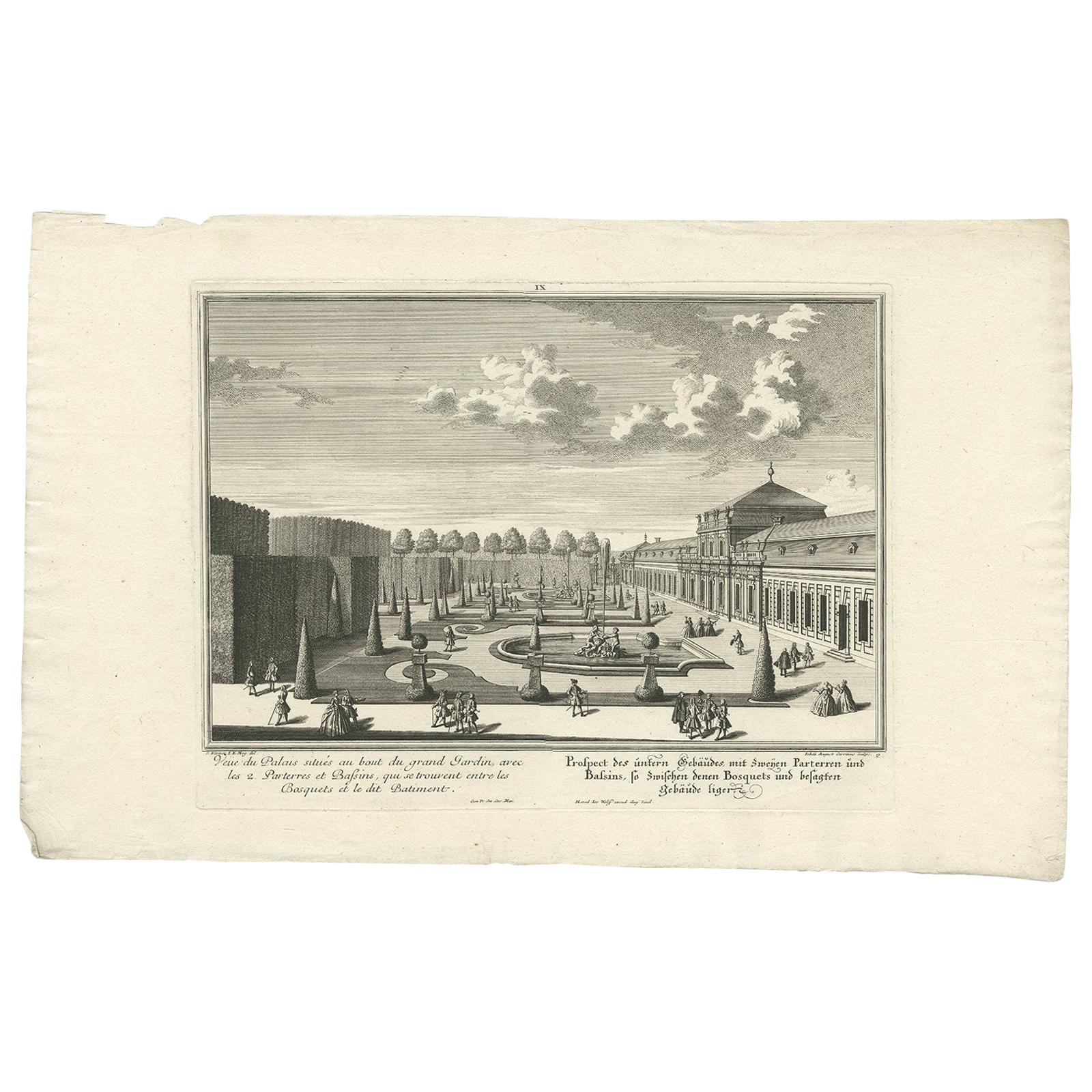
Antique Print of the Lower Building with Ground Floors by Wolff '1738'
Located in Langweer, NL
Antique print titled 'Veü du Palais situés au bout du grand Jardin (..) - Prospect des untern Gebäude mit zweijen Parterren (..)'. Prospect of the lower building with two ground floo...
Category
Antique Mid-18th Century Prints
Materials
Paper
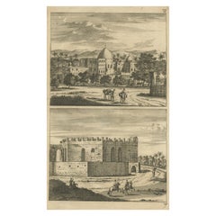
Antique Print of Cairo in Egypt, 1698
Located in Langweer, NL
Untitled antique print with two views of Cairo, Egypt. 78: Palace of Sultan Gori. 79. Tower and aqueduct. This print originates from 'Reizen van Cornelis de Bruyn, door de vermaardst...
Category
Antique 17th Century Prints
Materials
Paper
$273 Sale Price
20% Off
You May Also Like
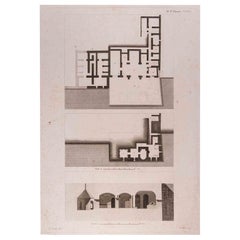
Interior Plan - Original Etching by François Mazoit - 19th century
Located in Roma, IT
Interior Plan is an original etching realized by François Mazoit in the 19th century.
Plate-signed on the lower right.
Good conditions with diffused foxing spots.
Category
19th Century Modern Interior Prints
Materials
Etching
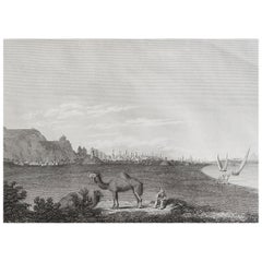
Original Antique Print of Cairo, Egypt. Dated 1809
Located in St Annes, Lancashire
Wonderful image of Cairo
Fine copper-plate engraving
Published by Sherwood & Co.
Dated 1809
Unframed.
Free shipping
Category
Antique Early 1800s English Moorish Prints
Materials
Paper
Interior Plan - Original Etching by François Mazoit - 19th century
Located in Roma, IT
Interior Plan is an original etching realized by François Mazoit in the 19th century.
Plate-signed on the lower right.
Very good conditions.
Category
19th Century Modern Interior Prints
Materials
Etching
Original Antique Print of Roman Temple of Artemis, Jerash, Jordan, C.1840
Located in St Annes, Lancashire
Wonderful image of The Temple of Artemis
Fine steel engraving
Published Circa 1840
Unframed.
.
Category
Antique 1830s English Classical Roman Prints
Materials
Paper

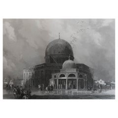
Original Antique Print of Mosque of Omar, Jerusalem, After David Roberts, C.1840
Located in St Annes, Lancashire
Wonderful image of The Mosque of Omar
Fine steel engraving after David Roberts
Published C.1840
The measurement is the paper size
Unframed.
Category
Antique 1840s German Moorish Prints
Materials
Paper
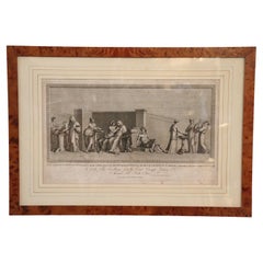
18th Century Antique Etching Print by Alessandro Mochetti
Located in Casale Monferrato, IT
Beautiful 18th century antique etching print with in walnut briar frame. Was etching by Alessandro Mochetti (1760 - 1812) was an Italian engrave...
Category
Antique 1780s Italian Prints
Materials
Paper
$1,698 Sale Price
20% Off
More Ways To Browse
Ralph Lauren Box
Secretary Bookcase 18th Century
Ship Needlepoint
Silk Batik
Silver Overlay Porcelain
Skater Chair
Slant Bookcase
Spades Hearts
Spanish Colonial Santos
Spanish Sword
Stork Sculpture
Studio Chora
Thomas Ivory
Tuscan Chest
Used Flat Files
Victorian Coach
Victorian Mahogany Clocks
Vintage Brass Hand Clip