Items Similar to Antique Print of the Region of the Hayes river, Northern Manitoba, Canada, 1759
Want more images or videos?
Request additional images or videos from the seller
1 of 5
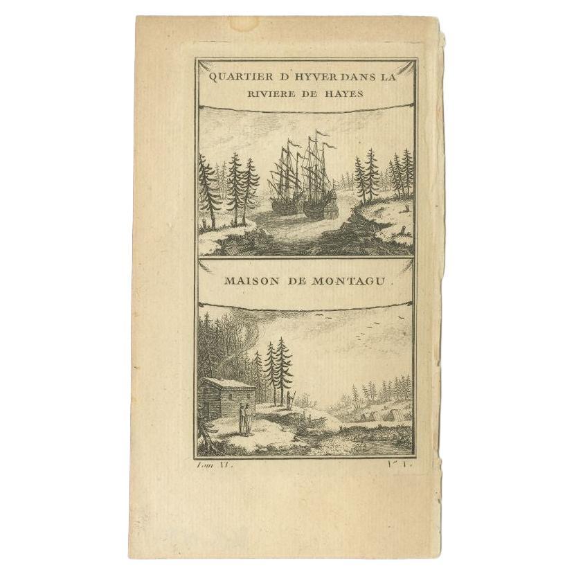
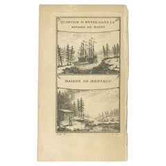
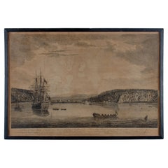
Antique Print of the Region of the Hayes river, Northern Manitoba, Canada, 1759
$153.59
£115.12
€130
CA$211
A$235.57
CHF 123.43
MX$2,883.57
NOK 1,567.61
SEK 1,478.06
DKK 989.61
Shipping
Retrieving quote...The 1stDibs Promise:
Authenticity Guarantee,
Money-Back Guarantee,
24-Hour Cancellation
About the Item
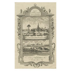
Two images on one sheet titled 'Quartier d'Hyver dans la Riviere de Hayes' and 'Maison de Montagu'. The Dobbs Galley (William Moor) and California (Francis Smith) are depicted in their winter anchorage in the Hayes river on the west coast of Hudson Bay. Below it is a depiction of Montagu House. This print originates from 'Histoire generale des Voyages (..)' by A.F. Prévost.
Artists and Engravers: Published by Didot, Paris.
Whilst cartography holds a special place in our collection, we also offer thousands of antique prints covering fields of interest as diverse as architecture, natural history, religion, ethnology and many more. Antique prints have long been appreciated for both their aesthetic and investment value. They were the product of engraved, etched or lithographed plates. These plates were handmade out of wood or metal, which required an incredible level of skill, patience and craftsmanship. Whether you have a house with Victorian furniture or more contemporary decor an old engraving can enhance your living space. We offer a wide range of authentic antique prints for any budget.
- Dimensions:Height: 10.04 in (25.5 cm)Width: 7.29 in (18.5 cm)Depth: 0 in (0.01 mm)
- Materials and Techniques:
- Period:
- Date of Manufacture:1759
- Condition:Condition: Fair, some creasing and wear. Blank verso. Please study image carefully.
- Seller Location:Langweer, NL
- Reference Number:Seller: JAK-4101stDibs: LU3054327912792
About the Seller
5.0
Recognized Seller
These prestigious sellers are industry leaders and represent the highest echelon for item quality and design.
Platinum Seller
Premium sellers with a 4.7+ rating and 24-hour response times
Established in 2009
1stDibs seller since 2017
2,511 sales on 1stDibs
Typical response time: <1 hour
- ShippingRetrieving quote...Shipping from: Langweer, Netherlands
- Return Policy
Authenticity Guarantee
In the unlikely event there’s an issue with an item’s authenticity, contact us within 1 year for a full refund. DetailsMoney-Back Guarantee
If your item is not as described, is damaged in transit, or does not arrive, contact us within 7 days for a full refund. Details24-Hour Cancellation
You have a 24-hour grace period in which to reconsider your purchase, with no questions asked.Vetted Professional Sellers
Our world-class sellers must adhere to strict standards for service and quality, maintaining the integrity of our listings.Price-Match Guarantee
If you find that a seller listed the same item for a lower price elsewhere, we’ll match it.Trusted Global Delivery
Our best-in-class carrier network provides specialized shipping options worldwide, including custom delivery.More From This Seller
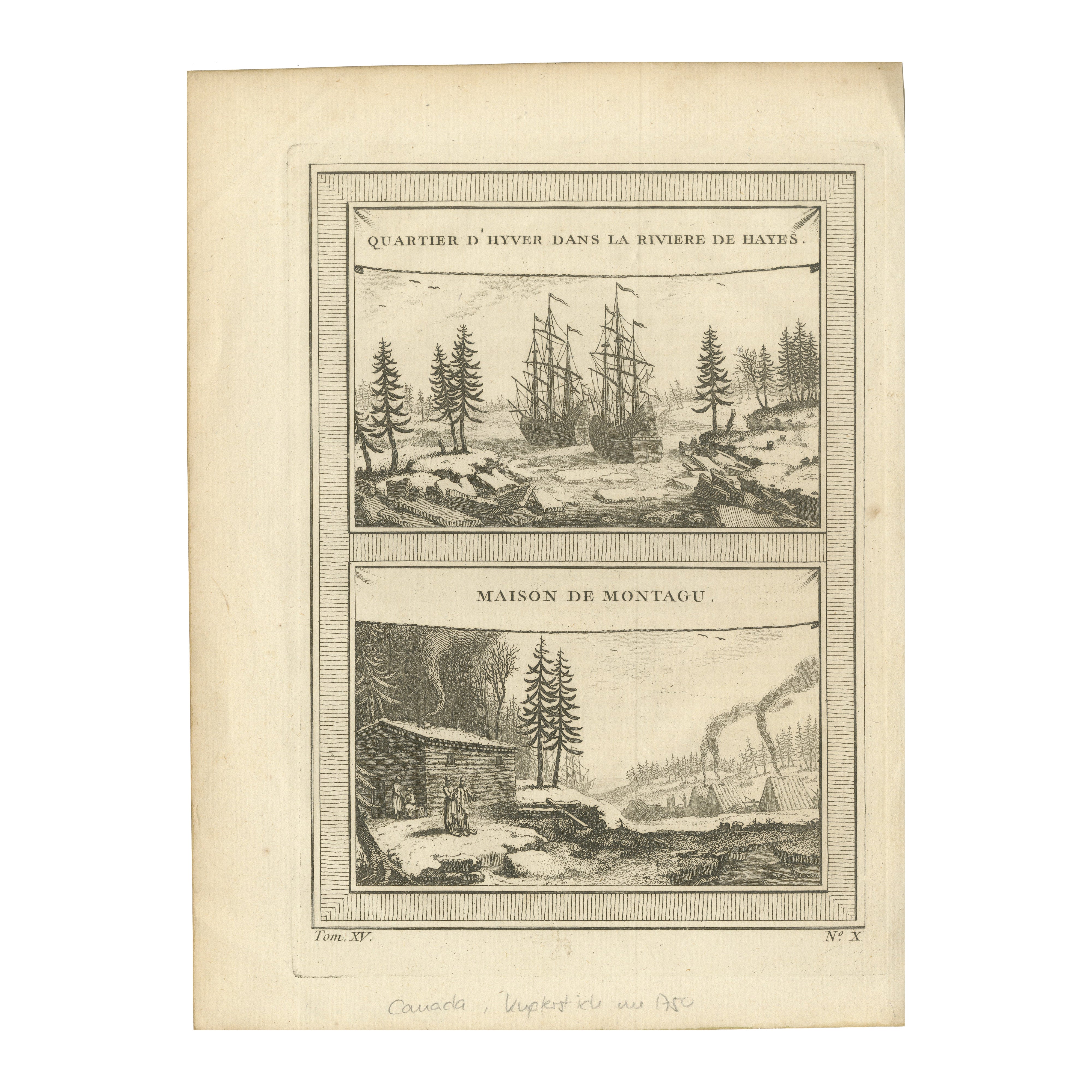
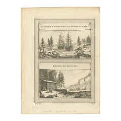
View AllAntique Print of the Region of the Hayes River, C.1780
Located in Langweer, NL
The piece is composed of two distinct illustrations on a single print. The upper artwork is titled "Winter Quarters in the Hayes River," which features two historical vessels, the Dobbs Galley under the command of William Moor and the California captained by Francis Smith...
Category
Antique 18th Century Prints
Materials
Paper
$78 Sale Price
20% Off
1757 Engraving of Hudson Bay – Winter Encampment & Early Settler Cabin
Located in Langweer, NL
Title: 1757 Engraving of Hudson Bay – Winter Encampment & Early Settler Cabin
Description:
This rare and historically significant 1757 antique copperplate engraving presents two...
Category
Antique 1750s Prints
Materials
Paper
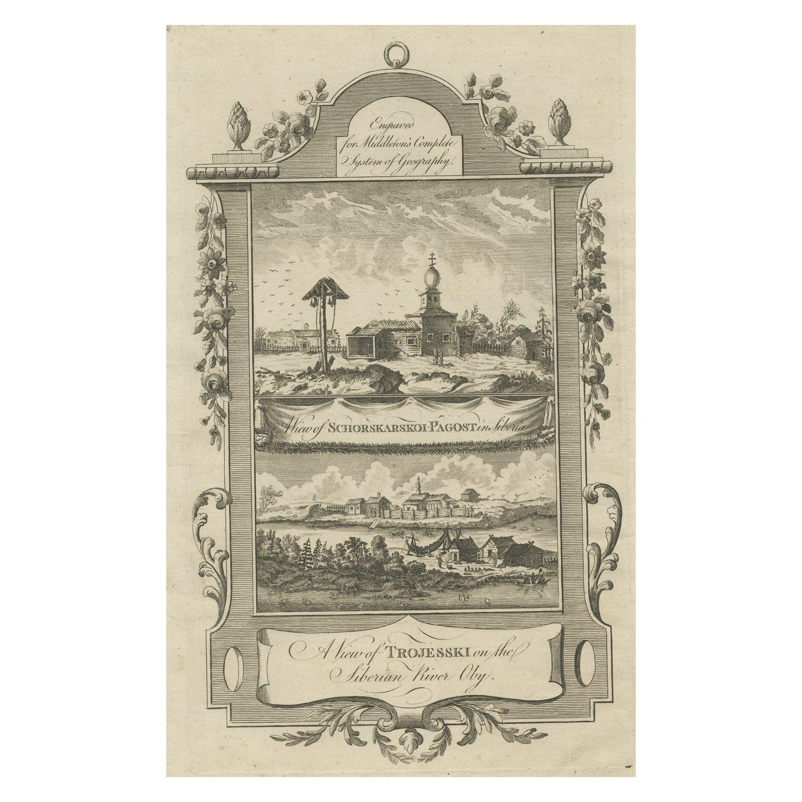
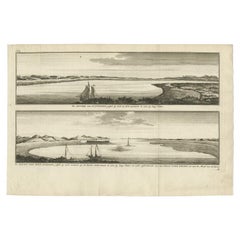
Antique Print of Villages near the Ob River, Western Siberia, Russia, c.1778
Located in Langweer, NL
Antique print titled 'A view of Trojesski on the Siberian River Oby'. The upper view is titled 'A View of Schorskarskoi-Pagost in Siberia'. Views of two towns on the Ob River. This r...
Category
Antique 18th Century Prints
Materials
Paper
$226 Sale Price
20% Off
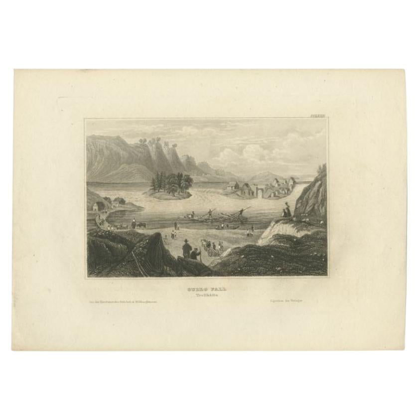
Antique Print of Trollhättan Falls in Sweden, 1839
Located in Langweer, NL
Antique print titled 'Gullo Fall Trollhatta'. View of the Trollhättan Falls, a waterfall in the Göta river (Göta älv) in Sweden. Originates from 'Meyers Universum'.
Artists and Eng...
Category
Antique 19th Century Prints
Materials
Paper
$94 Sale Price
20% Off
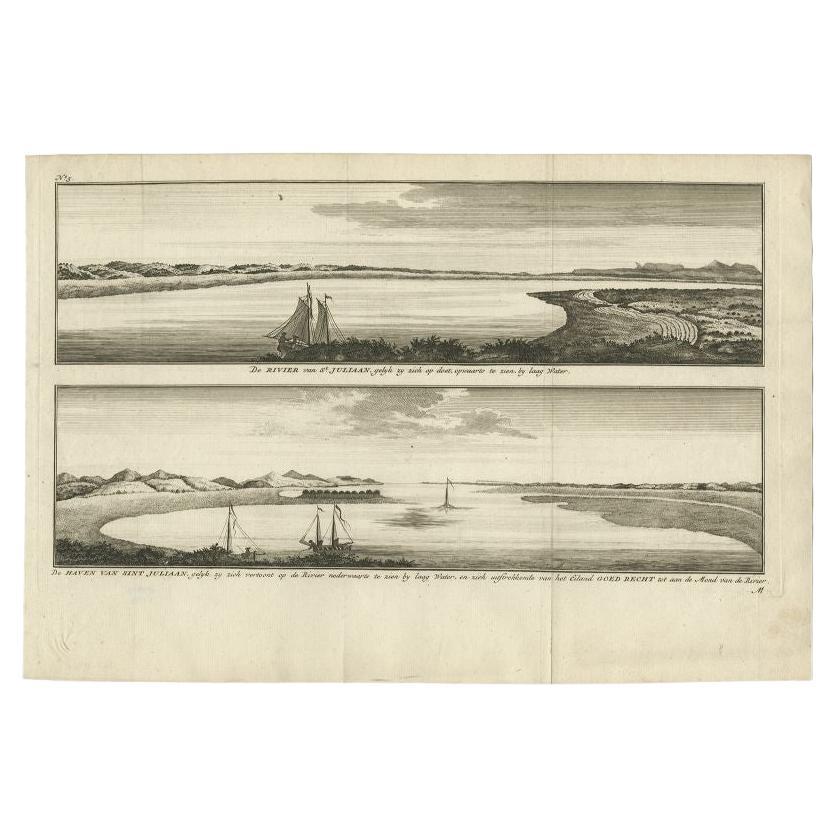
Antique Print with Views of San Julian, Patagonia, Argentina, 1765
Located in Langweer, NL
Antique print titled 'De rivier van St. Juliaan (..) - De haven van Sint Juliaan (..)'. Views of San Julian, Patagonia, Argentina. This print originates from 'Reize Rondsom De Werrel...
Category
Antique 18th Century Prints
Materials
Paper
$245 Sale Price
20% Off
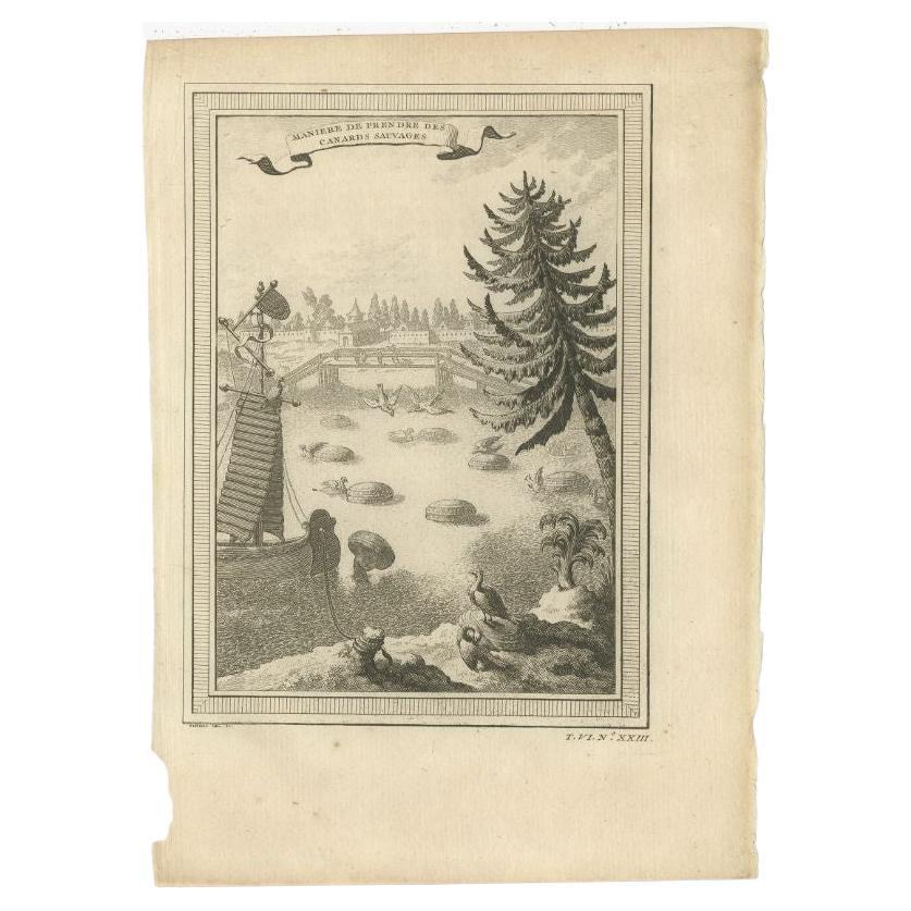
Antique Print of Catching Wild Ducks in China, 1748
Located in Langweer, NL
Antique print titled 'Maniere de prendre des Canards sauvages'. View of the catching of wild ducks in China. This print originates from Prevost's 'Histoire Generale des Voyages'.
...
Category
Antique 18th Century Prints
Materials
Paper
$132 Sale Price
20% Off
You May Also Like
A View of Cape Rouge, Quebec, Canada, Mazell after Capt. Hervey Smyth, c.1760s
Located in Savannah, GA
A View of Cape Rouge, or Carouge, on the Saint Lawrence River, north of Quebec.
Engraving by Peter Mazell after a drawing by Captian Hervey Smyth, published c.1760's, London.
T...
Category
Antique 1760s Canadian British Colonial Prints
Materials
Paper
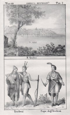
Quebec and Iroquois, Canada, North America, mid 19th century lithograph.
Located in Melbourne, Victoria
'Il Quebec / Irochesi - Capo degl' Irochesi''
Italian lithograph, c1841. Originally from 'Galleria universale di tutti i popoli del mondo' by Giuseppe Antonelli, published in Venice...
Category
Mid-19th Century Naturalistic Figurative Prints
Materials
Lithograph
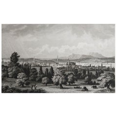
Original Antique Print of Montreal, Canada, circa 1840
Located in St Annes, Lancashire
Wonderful image of Montreal
Fine steel engraving
Published by Thomas Kelly, London circa 1840
Unframed.
Category
Antique 1840s English Prints
Materials
Paper
Landscape in Quebec - Original Lithograph - Mid-19th Century
Located in Roma, IT
Landscape in Quebec is an original modern artwork realized in the mid-19th Century.
Original Colored Lithograph on Ivory Paper.
Inscripted on the lower margin: Quebeck.
Printed ...
Category
Mid-19th Century Modern Figurative Prints
Materials
Paper, Lithograph

Original Antique Print of Albany, New York, circa 1840
Located in St Annes, Lancashire
Great print of Albany, New York
Steel engraving by Daumerlang after Wall
Published circa 1840
Unframed.
Category
Antique 1840s German Other Prints
Materials
Paper
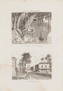
Rives du Gange and Pendichéry - Original Lithograph - 19th Century
Located in Roma, IT
Landscape is an original lithograph on paper realized by an Anonymous artist of the XIX century.
Printed in series of "France Pittoresque" at the top center.
Titled in France on t...
Category
19th Century Landscape Prints
Materials
Lithograph
More Ways To Browse
Used Furniture Anchorage
Antique Hudson Bay
Angel Plaques
Antique Bay Window
Antique Biscuit Table
Antique Brick Mold
Antique Carousel Horse
Antique Cloisonne Animals
Antique Empire Secretary Desk
Antique German Tile
Antique Glass Dome Clocks
Antique Gold Piano
Antique Ink Jar
Antique L Bracket
Antique Longcase Grandfather Clock Circa 1820
Antique Pennants
Antique Staffordshire Spaniels
Antique Terracotta Horse