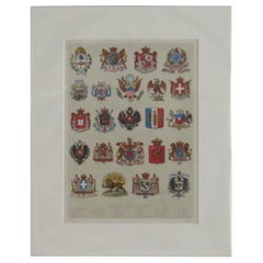
Items Similar to Coat of Arms of the Netherlands, Including Coats of Arms of the Provinces, 1864
Want more images or videos?
Request additional images or videos from the seller
1 of 5
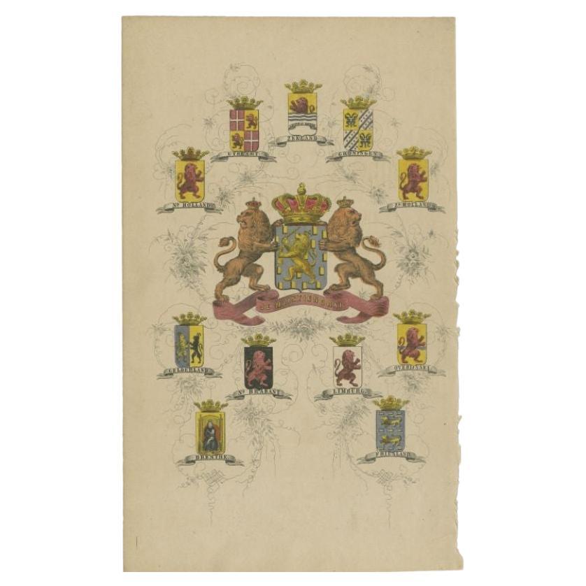
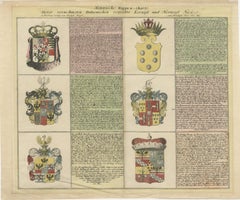
Coat of Arms of the Netherlands, Including Coats of Arms of the Provinces, 1864
$115.02
$143.7820% Off
£85.61
£107.0120% Off
€96
€12020% Off
CA$157.55
CA$196.9420% Off
A$175.23
A$219.0420% Off
CHF 91.50
CHF 114.3820% Off
MX$2,132.38
MX$2,665.4720% Off
NOK 1,168.60
NOK 1,460.7520% Off
SEK 1,095.94
SEK 1,369.9220% Off
DKK 730.81
DKK 913.5220% Off
Shipping
Retrieving quote...The 1stDibs Promise:
Authenticity Guarantee,
Money-Back Guarantee,
24-Hour Cancellation
About the Item
Antique print titled 'Je Mantiendrai'. Coat of arms of the Netherlands, also includes coats of arms of the individual Dutch provinces. This print originates from 'F. C. Brugsma's Atlas van het Koninkrijk der Nederlanden (..)'.
Artists and Engravers: Author: Frederik Carel Brugsma. Published by J.B. Wolters.
- Dimensions:Height: 10.04 in (25.5 cm)Width: 6.11 in (15.5 cm)Depth: 0 in (0.02 mm)
- Materials and Techniques:
- Period:
- Date of Manufacture:1864
- Condition:Wear consistent with age and use. Condition: Good, general age-related toning. Minor wear and soiling, blank verso. Please study image carefully.
- Seller Location:Langweer, NL
- Reference Number:Seller: BG-07606-2 1stDibs: LU3054327183282
About the Seller
5.0
Recognized Seller
These prestigious sellers are industry leaders and represent the highest echelon for item quality and design.
Platinum Seller
Premium sellers with a 4.7+ rating and 24-hour response times
Established in 2009
1stDibs seller since 2017
2,502 sales on 1stDibs
Typical response time: <1 hour
- ShippingRetrieving quote...Shipping from: Langweer, Netherlands
- Return Policy
Authenticity Guarantee
In the unlikely event there’s an issue with an item’s authenticity, contact us within 1 year for a full refund. DetailsMoney-Back Guarantee
If your item is not as described, is damaged in transit, or does not arrive, contact us within 7 days for a full refund. Details24-Hour Cancellation
You have a 24-hour grace period in which to reconsider your purchase, with no questions asked.Vetted Professional Sellers
Our world-class sellers must adhere to strict standards for service and quality, maintaining the integrity of our listings.Price-Match Guarantee
If you find that a seller listed the same item for a lower price elsewhere, we’ll match it.Trusted Global Delivery
Our best-in-class carrier network provides specialized shipping options worldwide, including custom delivery.More From This Seller
View AllAntique Print with Coats of Arms of The Netherlands, 1864
Located in Langweer, NL
Antique print titled 'Je Mantiendrai'. Coat of arms of the Netherlands, also includes coats of arms of the individual Dutch provinces. This print origi...
Category
Antique 19th Century Prints
Materials
Paper

$134 Sale Price
20% Off
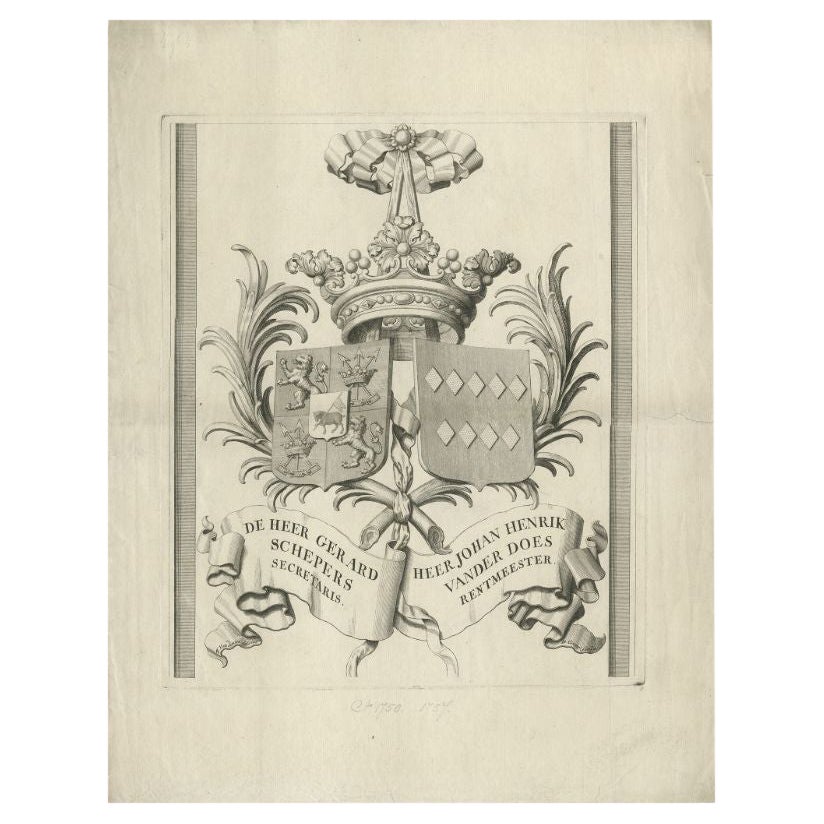
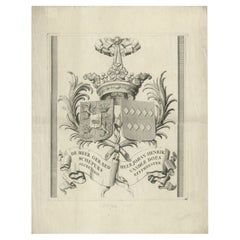
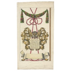
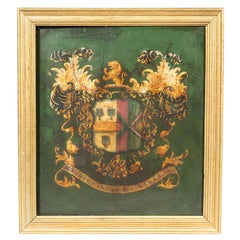
Large Antique Print of a Coat of Arms of Two Dutch Families, c.1750
Located in Langweer, NL
Antique print coat of arms titled 'De Heer Gerard Schepers Secretaris, Heer Johan Henrik van der Does Rentmeester'. Large coat of arms. Source unknown, to be determined.
Artists a...
Category
Antique 18th Century Prints
Materials
Paper
$210 Sale Price
20% Off
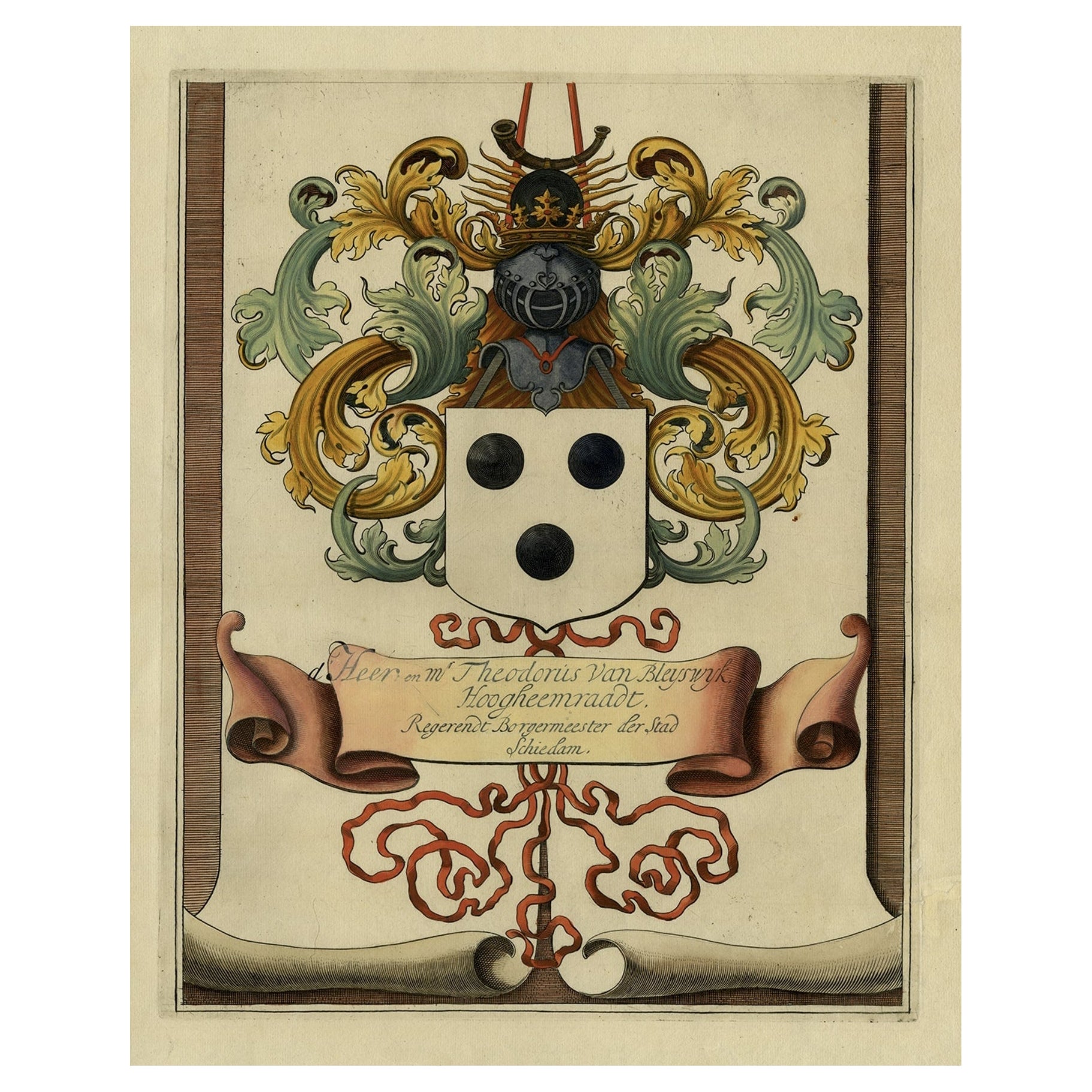
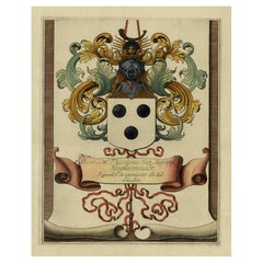
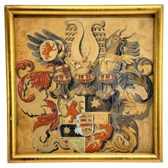
Coat of Arms of Theodorus Van Bleiswijk, Mayor of Schiedam, Netherlands, Ca.1680
Located in Langweer, NL
Antique print, titled: 'De Heer en Mr. Theodorus van Bleyswijk, Hoogheemraadt, Regerendt Borgermeester der Stad Schiedam.' -
Coat of arms of Theodorus van Bleiswijk, mayor of Sch...
Category
Antique 1680s Prints
Materials
Paper
$431 Sale Price
20% Off
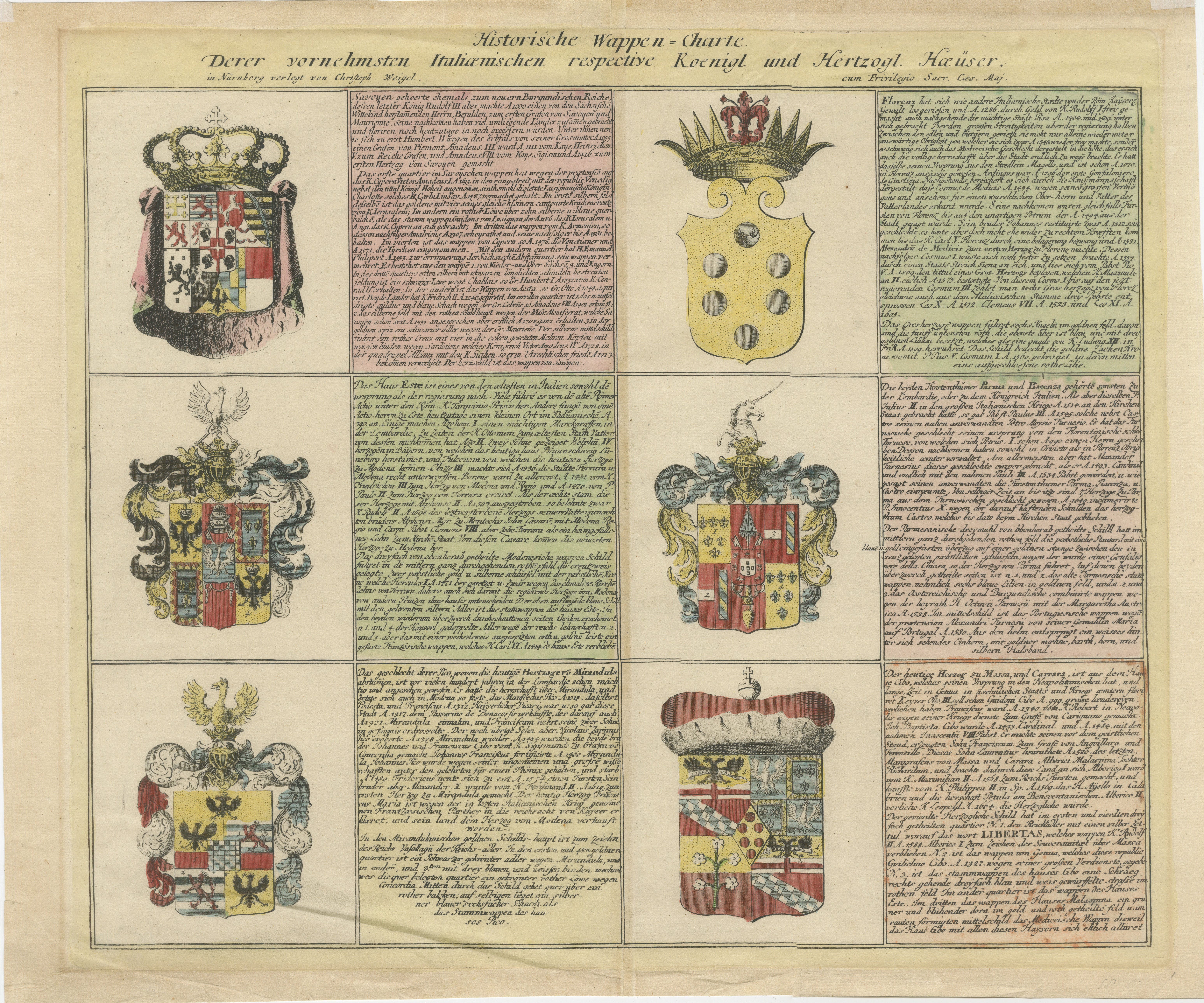
Coats of Arms of the Prominent Italian Royal and Ducal Houses, 1718
Located in Langweer, NL
Historische Wappen-Charte: Coats of Arms of the Prominent Italian Royal and Ducal Houses, 1718
This exquisite copper engraving, printed in 1718 in Nuremberg by Johann Ernst Adelbuln...
Category
Antique 1710s Prints
Materials
Paper
$421 Sale Price
20% Off
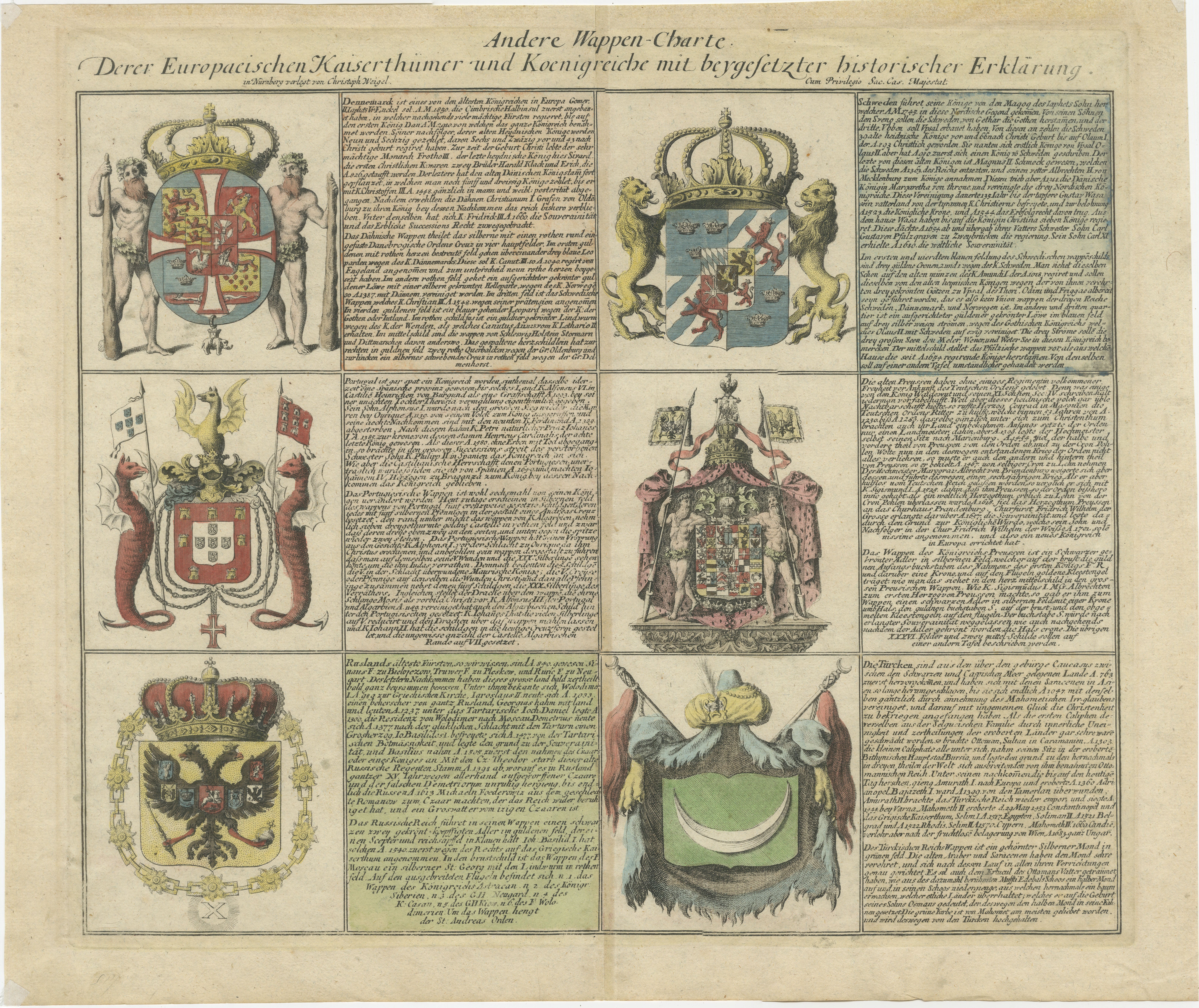
Coats of Arms of the European Empires and Kingdoms with Historical Annotations
Located in Langweer, NL
Andere Wappen-Charte: Coats of Arms of the European Empires and Kingdoms with Historical Annotations, 1718
Detailed description: This beautifully hand-colored copper engraving, pri...
Category
Antique 1710s Prints
Materials
Paper

$421 Sale Price
20% Off
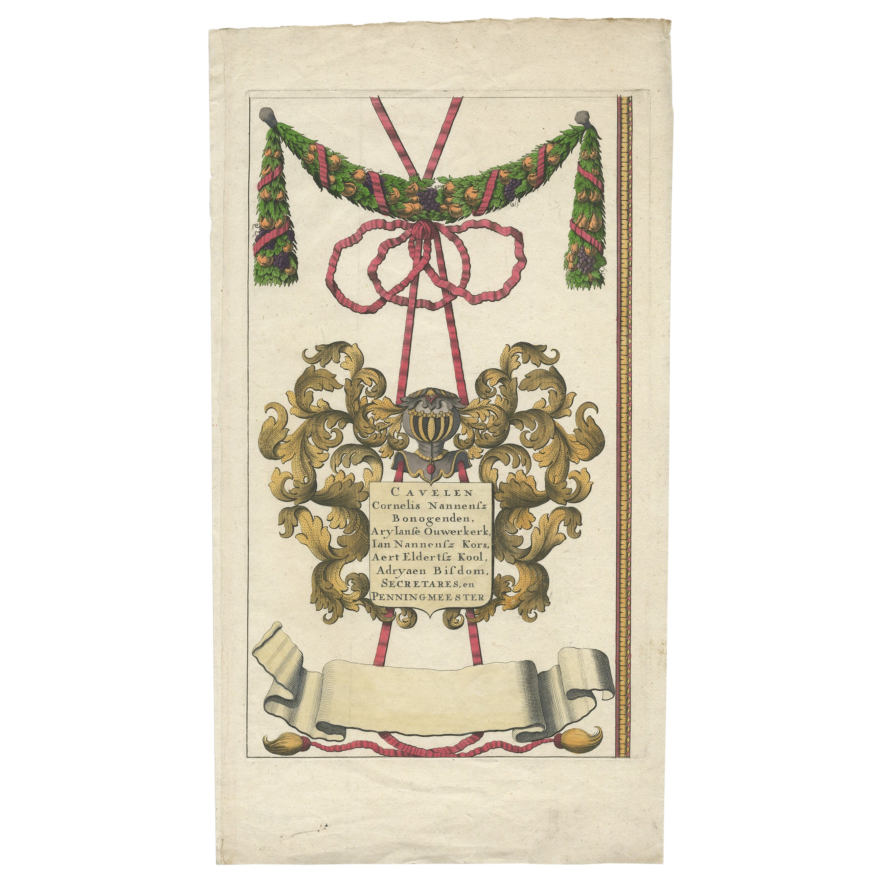
Antique Engraving of a Coat of Arms, Originally Published in 1683
Located in Langweer, NL
Antique print titled 'Cavelen Cornelis Nannensz Bonogenden, Aryianse Ouwerkerk, Ian Nannensz Kors, Aert Eldertsz Kool, Adryaen Bisdom, Secretares en Penningmeester'. One of the coats of arms from the large wall map...
Category
Antique 19th Century Prints
Materials
Paper
$239 Sale Price
20% Off
You May Also Like
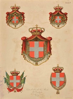
Savoy Coat of Arms - Lithograph - 19th Century
Located in Roma, IT
Savoy Coat of Arms is a lithograph print on paper, realized in the 19th Century.
Good conditions with diffused foxing.
The coat of arms, is made up of a cross surmounted by a crown...
Category
19th Century Old Masters Figurative Prints
Materials
Lithograph
18th-19th Century Watercolor Coat of Arms of Company of Merchant Taylors
Located in Chapel Hill, NC
18th to 19th century framed watercolor Coat of Arms of the Company of Merchant Taylors of the City of York. A guild of freemen since 1273, Charles II granted them a royal charter Apr...
Category
Antique 19th Century English Baroque Paintings
Materials
Maple, Paint
$295 Sale Price
34% Off
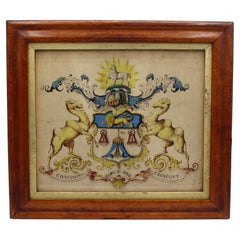
Framed British Coat Of Arms
Located in Essex, MA
With the inscription 'Virtus Incendit Vires' which translates to Virtues kindles strength. Hand painted in a frame. Michael Kittredge Collection.
Category
Antique 1830s English Arms, Armor and Weapons
Materials
Wood
An Impressive 18th Century Painted Parchment Armorial
Located in ARMADALE, VIC
An Impressive 18th Century Painted Parchment Armorial
Height: 260cm Width: 185cm
Provenance: Private Melbourne collection.
Category
Antique 18th Century Italian Medieval Paintings
Materials
Parchment Paper

19th C. Heraldic Watercolor of a Composite Noble Achievement, Signed E. Wenzel
Located in Atlanta, GA
A finely rendered heraldic watercolor on paper depicting an elaborate composite coat of arms, signed lower right “E. Wenzel” and likely executed in the late 19th century. The work pr...
Category
Antique 19th Century German Baroque Paintings
Materials
Giltwood, Paint
Mounted Print of National Coats of Arms by Tiffany & Co. from 1895 Encyclopedia
Located in Lincoln, Lincolnshire
This is a very good coloured Lithograph Print of National Coats Of Arms.
The print is mounted all ready for framing.
The external measurements of the mount are 12 W x 15 H and t...
Category
Antique Late 19th Century American Prints
Materials
Paper
$246 Sale Price
20% Off
More Ways To Browse
George Bracket Clock
Gilt Bronze Fish
Green Blanket Chest
Guangxu Period
Japanese Tea And Coffee Set Silver
Office Waste Basket
Owl Japanese
Pagoda Ring
Pair Gustavian Chests
Petit Trianon
Plaster Cast Relief
Pyramid Shelf
Queen Anne Style Chest Of Drawers
Reproduction Chest Of Drawers
Ritts Co
Rosewood Secretary Desk
Rosso Antico Marble
S S Normandie