Items Similar to Engraving of an Orang-Utan on Borneo 'Kalimantan' or Sumatra, Indonesia, 1739
Want more images or videos?
Request additional images or videos from the seller
1 of 5
Engraving of an Orang-Utan on Borneo 'Kalimantan' or Sumatra, Indonesia, 1739
$132.08
$165.1020% Off
£98.87
£123.5820% Off
€112
€14020% Off
CA$181.78
CA$227.2320% Off
A$202.62
A$253.2720% Off
CHF 106.31
CHF 132.8820% Off
MX$2,474.27
MX$3,092.8420% Off
NOK 1,346.06
NOK 1,682.5820% Off
SEK 1,272.23
SEK 1,590.2920% Off
DKK 852.62
DKK 1,065.7820% Off
About the Item
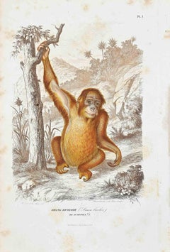
Antique print titled 'Orang-Oetang of Bosch-mensch'. This print depicts an Orang-Utan on Borneo or Sumatra, Indonesia. Originates from 'Hedendaagsche Historie, of tegenwoordige staat van alle volkeren' published by I. Tirion.
Artists and Engravers: Isaak Tirion, a Dutch publisher in Amsterdam, was born 1705. He produced serveral Atlases and Dutch town plans.
- Dimensions:Height: 7.68 in (19.5 cm)Width: 4.73 in (12 cm)Depth: 0 in (0.02 mm)
- Materials and Techniques:
- Period:1730-1739
- Date of Manufacture:1739
- Condition:Condition: Very good, please study image carefully.
- Seller Location:Langweer, NL
- Reference Number:Seller: BG-03995 1stDibs: LU3054327360732
About the Seller
5.0
Recognized Seller
These prestigious sellers are industry leaders and represent the highest echelon for item quality and design.
Platinum Seller
Premium sellers with a 4.7+ rating and 24-hour response times
Established in 2009
1stDibs seller since 2017
2,513 sales on 1stDibs
Typical response time: <1 hour
- ShippingRetrieving quote...Shipping from: Langweer, Netherlands
- Return Policy
Authenticity Guarantee
In the unlikely event there’s an issue with an item’s authenticity, contact us within 1 year for a full refund. DetailsMoney-Back Guarantee
If your item is not as described, is damaged in transit, or does not arrive, contact us within 7 days for a full refund. Details24-Hour Cancellation
You have a 24-hour grace period in which to reconsider your purchase, with no questions asked.Vetted Professional Sellers
Our world-class sellers must adhere to strict standards for service and quality, maintaining the integrity of our listings.Price-Match Guarantee
If you find that a seller listed the same item for a lower price elsewhere, we’ll match it.Trusted Global Delivery
Our best-in-class carrier network provides specialized shipping options worldwide, including custom delivery.More From This Seller
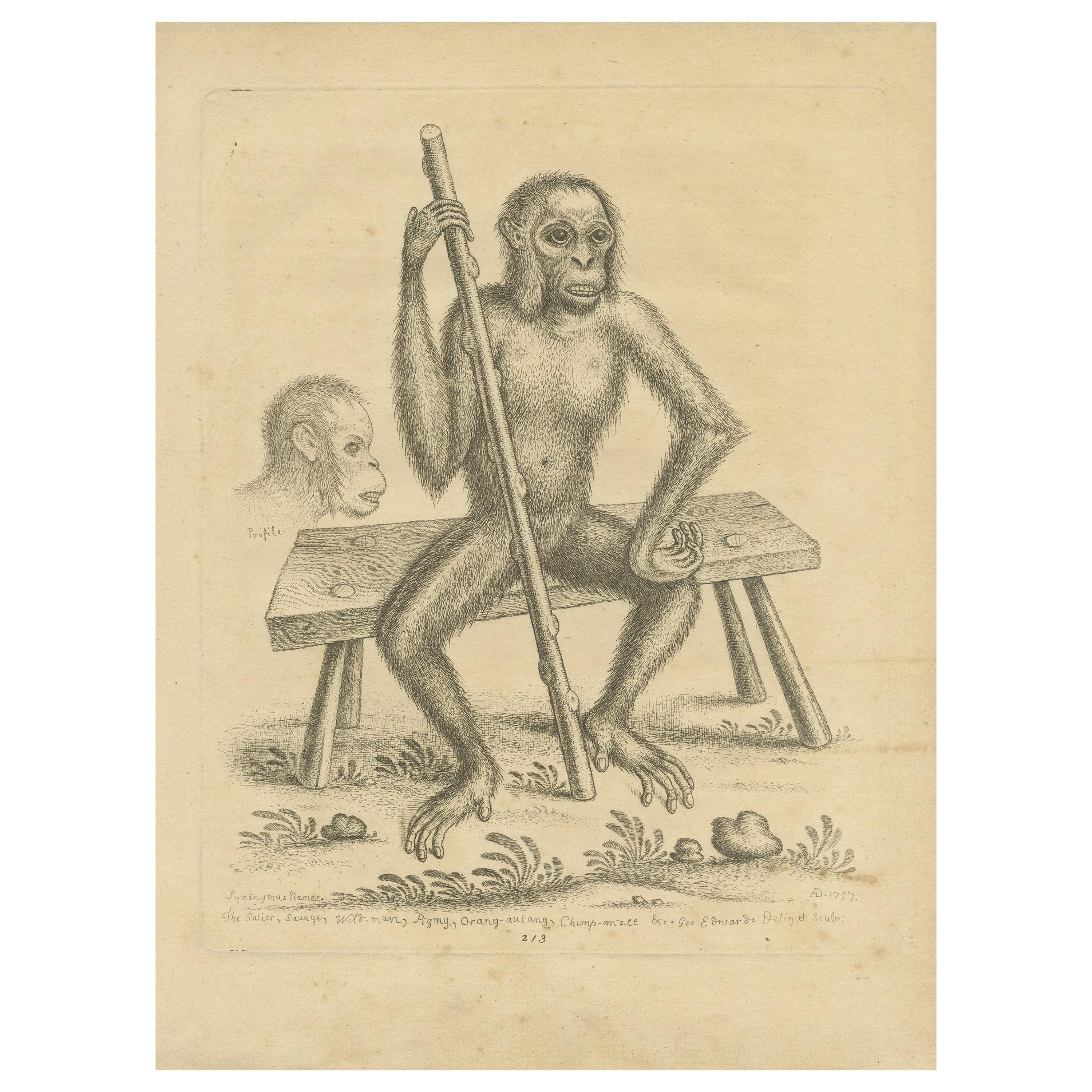
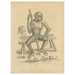
View AllAntique Print of an Orangutan Seated on a Bench by Edwards, 1757
Located in Langweer, NL
This captivating antique print, titled 'The Satier, Sauage, Wild-man, Orang-autang, Chimp-anzee', is a meticulously detailed zoological study of an orangutan from the renowned work "...
Category
Antique Mid-18th Century Prints
Materials
Paper
$471 Sale Price
20% Off
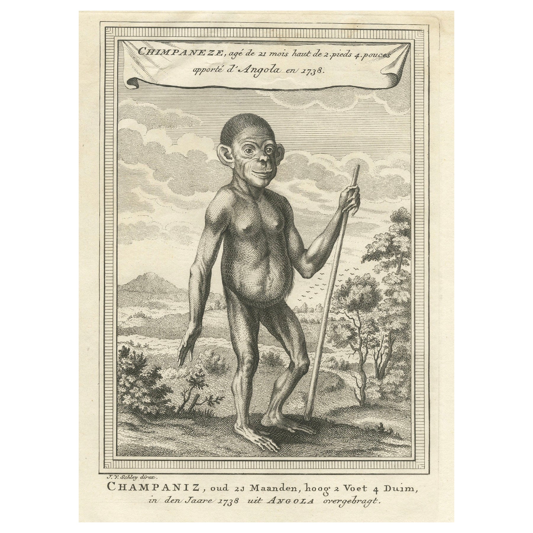
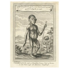
The Chimpanzee from Angola: Enlightenment Era Natural History Engraving, 1738
Located in Langweer, NL
Title: The Chimpanzee from Angola: A Catalogue of Enlightenment Era Natural History Engravings
Description: This finely detailed 18th-century engraving depicts a young chimpanzee st...
Category
Antique 1730s Prints
Materials
Paper
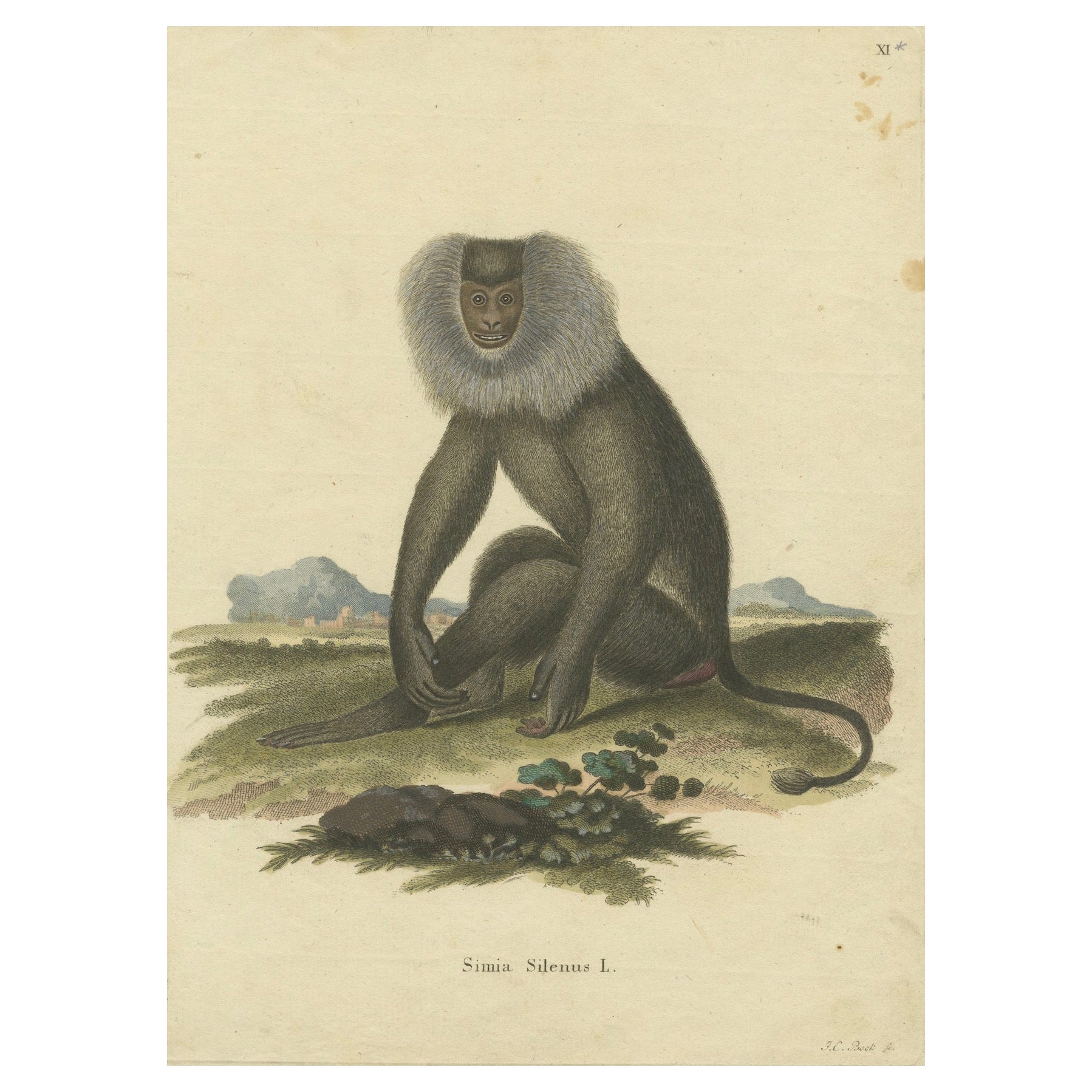
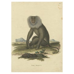
Lion-tailed Macaque - A Portrait of Wild Majesty Engraved, circa 1850
Located in Langweer, NL
Title: "Lion-tailed Macaque - A Portrait of Wild Majesty"
Description: This 19th-century coloured engraving, a creation of the German School, portrays the distinctive Lion-tailed Ma...
Category
Antique 1850s Prints
Materials
Paper
$150 Sale Price
20% Off
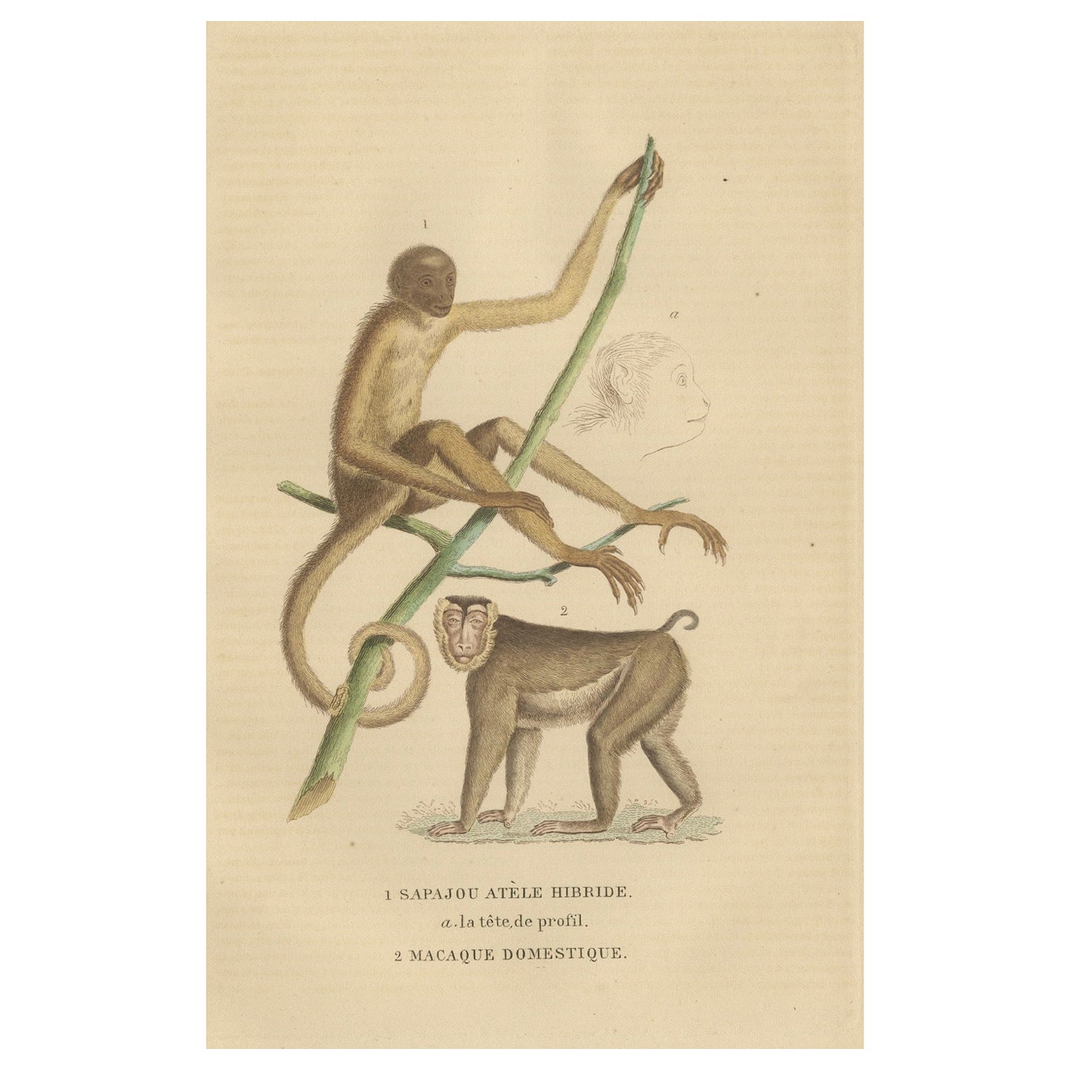
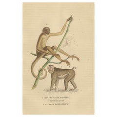
Antique Primate Engraving of a Sapajou Atèle Hybride and Macaque Domestique 1825
Located in Langweer, NL
Title: Antique Primate Engraving of a Sapajou Atèle Hybride and Macaque Domestique - 19th Century
Description:
This exquisite antique print captures two fascinating primate species,...
Category
Antique 1820s Prints
Materials
Paper
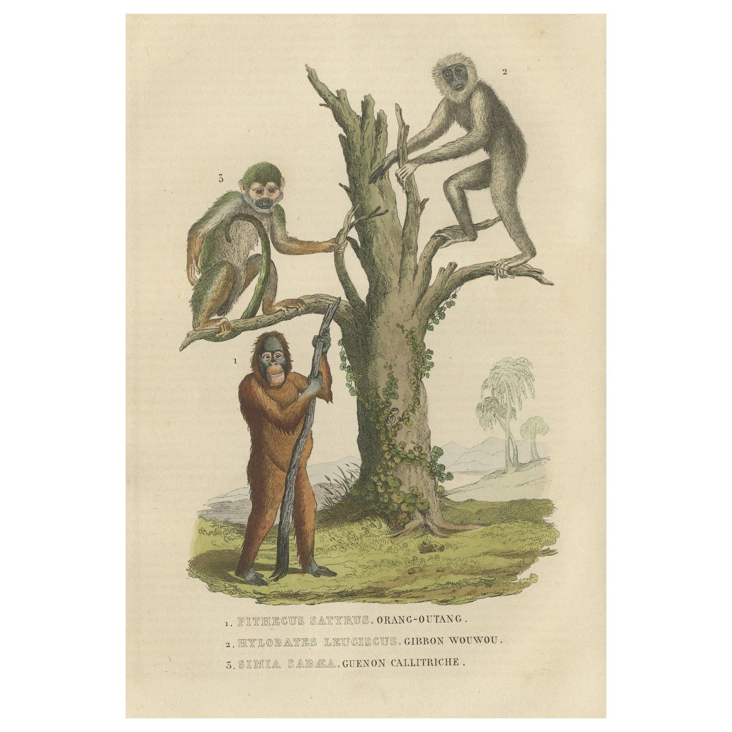
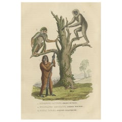
Old Print of a Red or Asiatic Orangoutan, Javan Silvery Gibbon and Green Monkey
Located in Langweer, NL
Original antique hand-colored print of three monkeys. Very decorative.
Encounter the intriguing world of primates through this collection featuring three remarkable species captured...
Category
Antique 1840s Prints
Materials
Paper
$179 Sale Price
20% Off
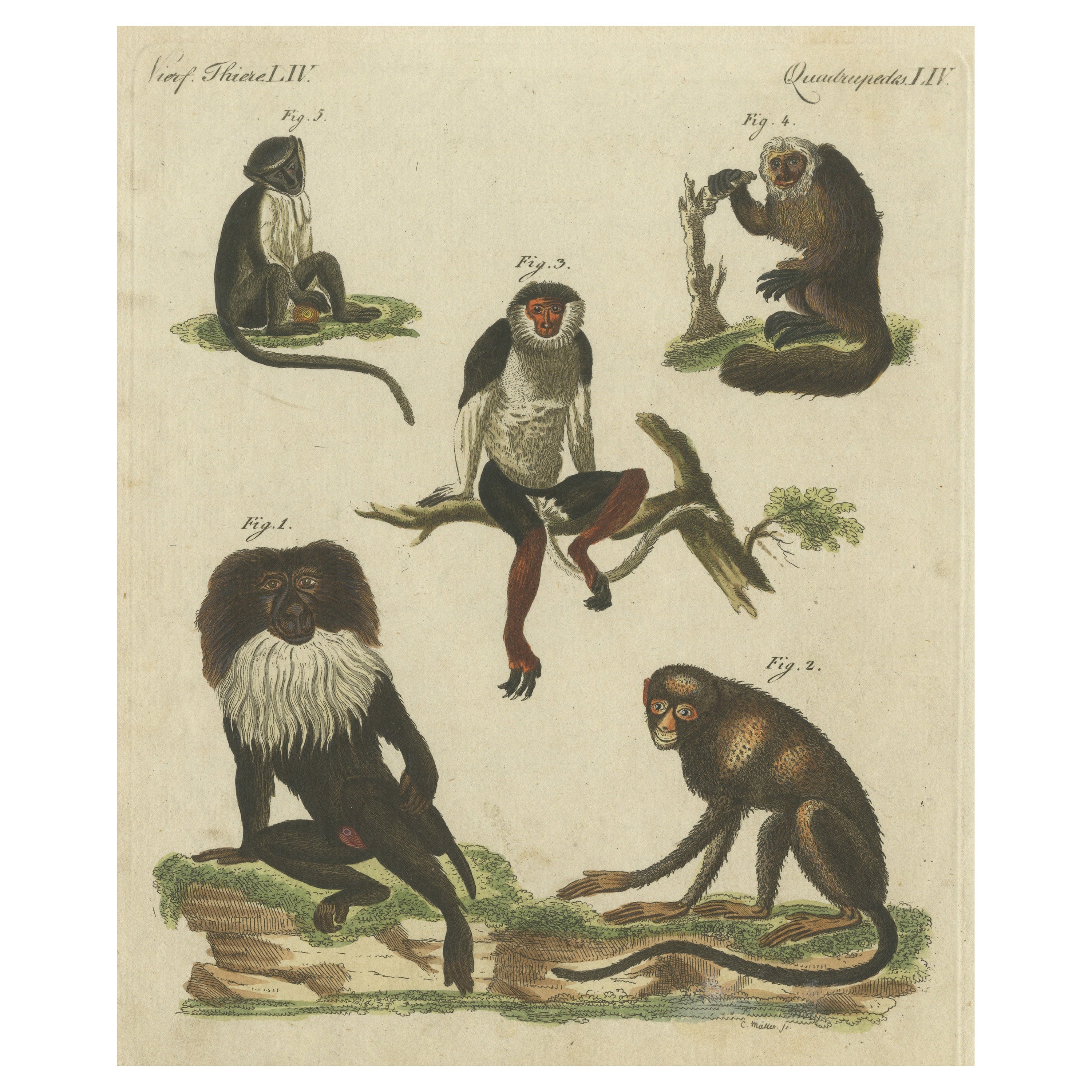
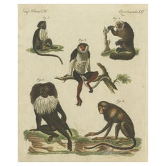
Original Antique Print of a Macaque and other Monkeys
Located in Langweer, NL
This original antique print shows the Lion-tailed macaque, Macaca silenus endangered 1, greater spot-nosed monkey, Cercopithecus nictitans 2, red-shanked douc, Pygathrix nemaeus endangered 3, white-faced saki, Pithecia pithecia 4, and roloway monkey, Cercopithecus roloway...
Category
Antique Early 19th Century Prints
Materials
Paper
$264 Sale Price
20% Off
You May Also Like
The Orangutan - Original Lithograph by Paul Gervais - 1854
By Paul Gervais
Located in Roma, IT
The Orangutan is an original lithograph on ivory-colored paper, realized by Paul Gervais (1816-1879). The artwork is from The Series of "Les Trois Règnes de la Nature", and was publi...
Category
1850s Modern Animal Prints
Materials
Lithograph, Paper
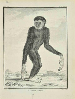
Le Grand Gibbon - Etching by Pierre Charles Baquoy - 1771
Located in Roma, IT
Le Grand Gibbon is an etching realized by Pierre Charles Baquoy in 1771.
It belongs to the suite "Histoire naturelle, générale et particulière avec la description du Cabinet du Roi"...
Category
1770s Modern Figurative Prints
Materials
Etching
The Monkey - Etching by Antonio Tempesta - 1610s
By Antonio Tempesta
Located in Roma, IT
The Monkey is a wonderful black and white etching on thick laid paper, realized by the Italian master Antonio Tempesta (1555-1630).
Not signed.
In excellent conditions, except for some stains.
Image Dimensions: 5 x 7 / 8 x 10 cm.
Including a cream-colored cardboard passepartout, 34 x 50 cm.
An exciting original print, with all the dignity of a mythological or epic story, represented with an incredible balance of black and white, light and shadow, and a typical Baroque dynamism.
Antonio Tempesta, also known as Il Tempestino (Florence, 1555 - Rome, 1630), was an Italian painter and engraver of the early Baroque period. Antonio Tempesta trained in the culture of late Mannerism, with a naturalistic but also calligraphic taste, acquired from the frequentation of Giovanni Stradano, with whom he collaborated in the decoration of Palazzo Vecchio.
Moving to Rome in 1573, he worked for Pope Gregory XIII, frescoing some maps of Rome in the Vatican, including the famous Map of Rome (1593). In the pontifical capital, he worked for many noble families and for important cardinals, such as Alessandro Farnese and Scipione Borghese. His works are in San Giovanni dei Fiorentini, at the villa in Caprarola, in Tivoli.
He returned to Florence for a brief stay, where he collaborated with Alessandro Allori...
Category
Early 17th Century Figurative Prints
Materials
Etching

Nicolas Jacob: Stipple Engravings of Monkeys, C1810, Set of 12
Located in Richmond, GB
"Storia Naturelle delle Scimie", Milan 1810.
Stipple engravings by Luigi Rados (1773-1840), after drawings by Nicolas Henri Jacob (1782-1871).
Pres...
Category
19th Century Figurative Prints
Materials
Silver
Orang Bicolore - Original Lithograph by Paul Gervais - 1854
By Paul Gervais
Located in Roma, IT
Orang Bicolore is an original lithograph on ivory-colored paper, realized by Paul Gervais (1816-1879). The artwork is from The Series of "Les Trois Règnes de la Nature", and was publ...
Category
1850s Modern Figurative Prints
Materials
Lithograph
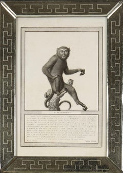
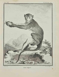
Macaque - Etching by Jacques Baron - 1771
Located in Roma, IT
Macaque is an etching realized by Jacques Baron in 1771.
It belongs to the suite "Histoire Naturelle de Buffon".
The Artist's signature is engraved lower right.
Good conditions.
Category
1770s Modern Figurative Prints
Materials
Etching
More Ways To Browse
19th Century Queen Bed Frame
1930s Mannequin
3 Drawer Commode Pair
36 Inch Chest Of Drawers
Abercrombie And Fitch Leather
Alien Table
Anglo Indian Brass Inlay
Antique Ash Trays
Antique Baby Plates
Antique Bread Cabinet
Antique Celadon Bowl
Antique Ceramic Elephants
Antique Chinese Embroidery Panel
Antique Clock Labels
Antique Glass Front Secretary
Antique Horse Tack
Antique Korean Bowl
Antique Map Case