Items Similar to Military Costume of the Gothic Nations on the Western Coasts of the Baltic, 1815
Want more images or videos?
Request additional images or videos from the seller
1 of 6
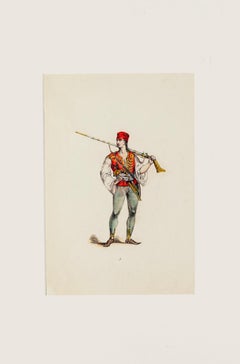
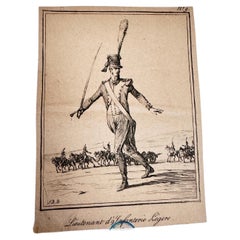
Military Costume of the Gothic Nations on the Western Coasts of the Baltic, 1815
$326.08
$543.4740% Off
£244.42
£407.3640% Off
€276
€46040% Off
CA$447.98
CA$746.6340% Off
A$500.13
A$833.5540% Off
CHF 262.06
CHF 436.7740% Off
MX$6,122.05
MX$10,203.4140% Off
NOK 3,328.15
NOK 5,546.9240% Off
SEK 3,138.03
SEK 5,230.0440% Off
DKK 2,101.01
DKK 3,501.6940% Off
About the Item
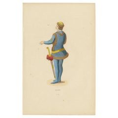
Antique print titled 'Military Costume of the Gothic Nations on the Western Coasts of the Baltic'.
Old print of Baltic military costumes. Originates from 'The costume of the original inhabitants of the British Islands' by C.H. Smith.
Artists and Engravers: Engraved by R. Havell.
Condition: Good, general age-related toning. Few marginal tears, please study image carefully.
- Dimensions:Height: 14.57 in (37 cm)Width: 10.24 in (26 cm)Depth: 0 in (0.02 mm)
- Materials and Techniques:
- Period:
- Date of Manufacture:1815
- Condition:Condition: Good, general age-related toning. Few marginal tears, please study image carefully.
- Seller Location:Langweer, NL
- Reference Number:Seller: BG-11959-10 1stDibs: LU3054326832512
About the Seller
5.0
Recognized Seller
These prestigious sellers are industry leaders and represent the highest echelon for item quality and design.
Platinum Seller
Premium sellers with a 4.7+ rating and 24-hour response times
Established in 2009
1stDibs seller since 2017
2,513 sales on 1stDibs
Typical response time: <1 hour
- ShippingRetrieving quote...Shipping from: Langweer, Netherlands
- Return Policy
Authenticity Guarantee
In the unlikely event there’s an issue with an item’s authenticity, contact us within 1 year for a full refund. DetailsMoney-Back Guarantee
If your item is not as described, is damaged in transit, or does not arrive, contact us within 7 days for a full refund. Details24-Hour Cancellation
You have a 24-hour grace period in which to reconsider your purchase, with no questions asked.Vetted Professional Sellers
Our world-class sellers must adhere to strict standards for service and quality, maintaining the integrity of our listings.Price-Match Guarantee
If you find that a seller listed the same item for a lower price elsewhere, we’ll match it.Trusted Global Delivery
Our best-in-class carrier network provides specialized shipping options worldwide, including custom delivery.More From This Seller
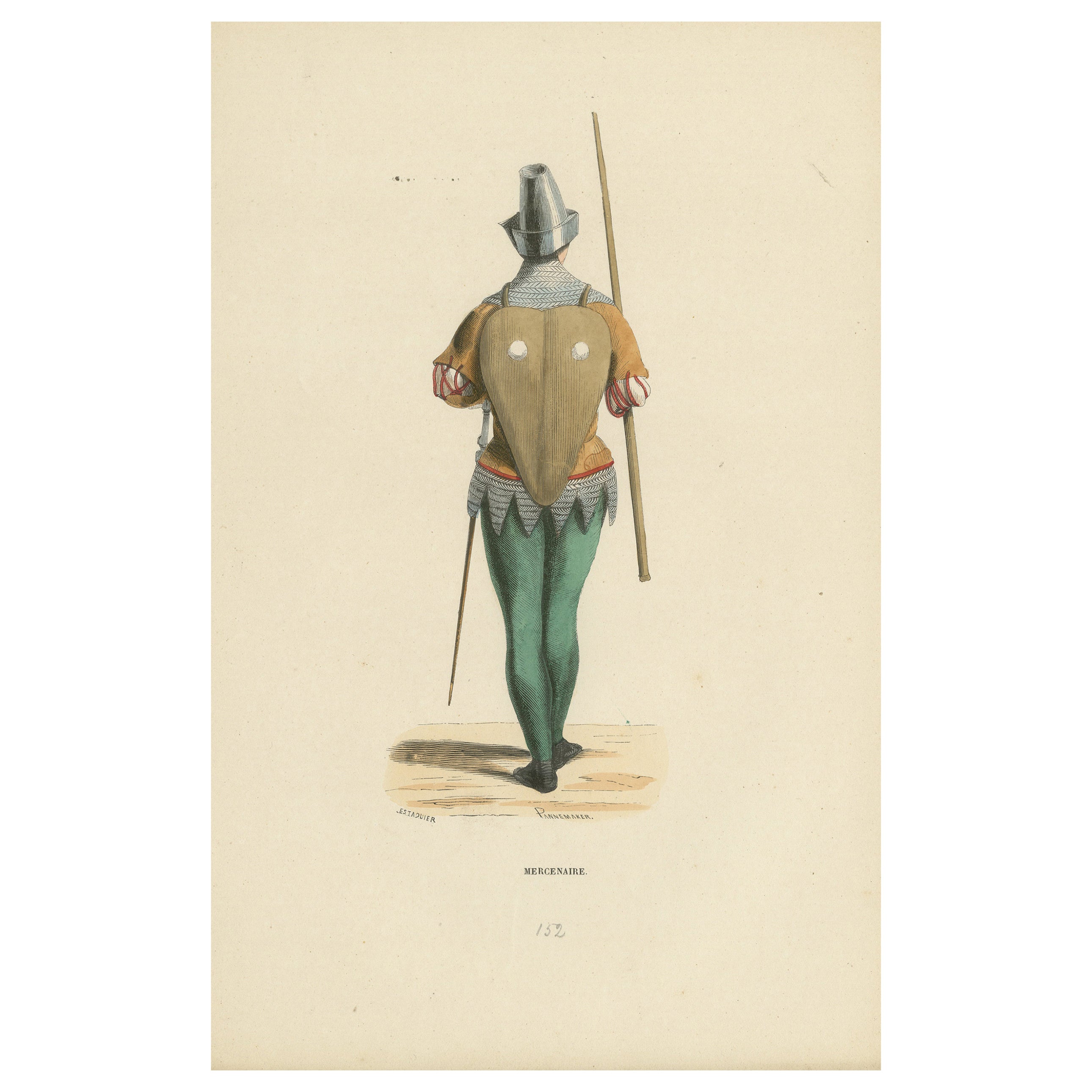
View AllThe Mercenary's Garb: Armor and Attire in 'Costume du Moyen Âge, 1847
Located in Langweer, NL
Title: "The Mercenary's Garb: Armor and Attire in 'Costume du Moyen Âge'"
Description: This lithograph from the "Costume du Moyen Âge" series, dated 1847, showcases the practical an...
Category
Antique 1840s Prints
Materials
Paper
$132 Sale Price
20% Off
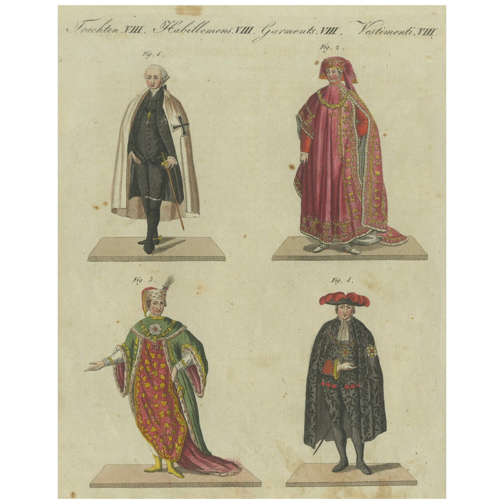
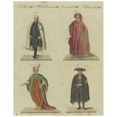
18th-Century Aristocratic and Ceremonial Attire: Handcolored Engraving of 1805
Located in Langweer, NL
This handcolored copperplate engraving, originating from Friedrich Johann Bertuch’s "Bilderbuch für Kinder" (Picture Book for Children) published in Weimar in 1805, depicts four stri...
Category
Antique Early 1800s Prints
Materials
Paper
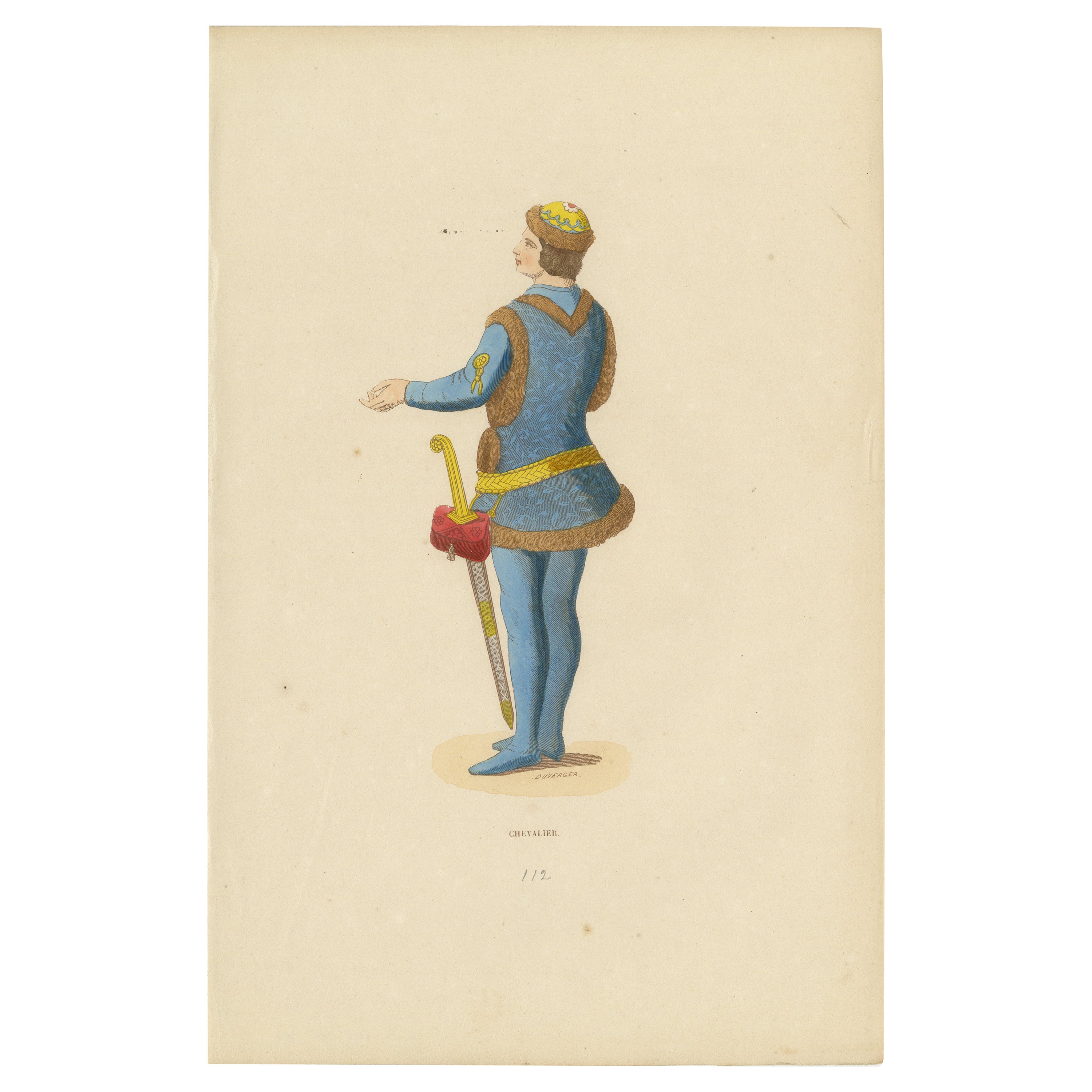
Medieval Knight: Heraldry and Valor in 15th Century Garb, 1847
Located in Langweer, NL
Title: "Chevalier" (Knight)
Description: This 1847 hand-colored engraving from the "Costume du Moyen Age" series depicts a "Chevalier," the French term for a knight. The image illus...
Category
Antique 1840s Prints
Materials
Paper
$141 Sale Price
20% Off
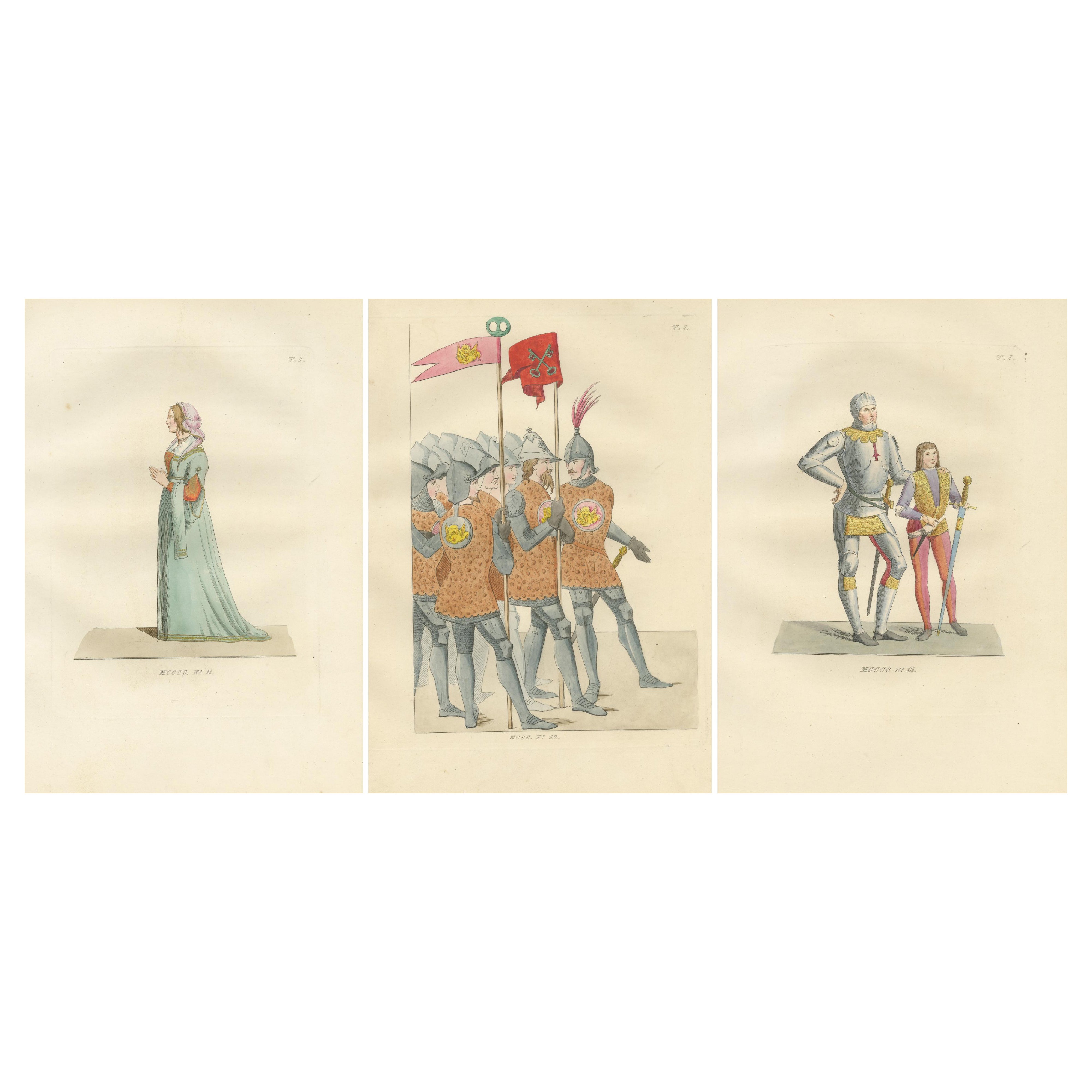
Italian Elegance and Armor in 15th Century Costume Prints, Published in 1845
Located in Langweer, NL
Italian Elegance and Armor in 15th Century Costume Prints
This captivating ensemble of three hand-colored prints showcases the visual contrast between feminine grace and martial str...
Category
Antique Mid-19th Century French Prints
Materials
Paper

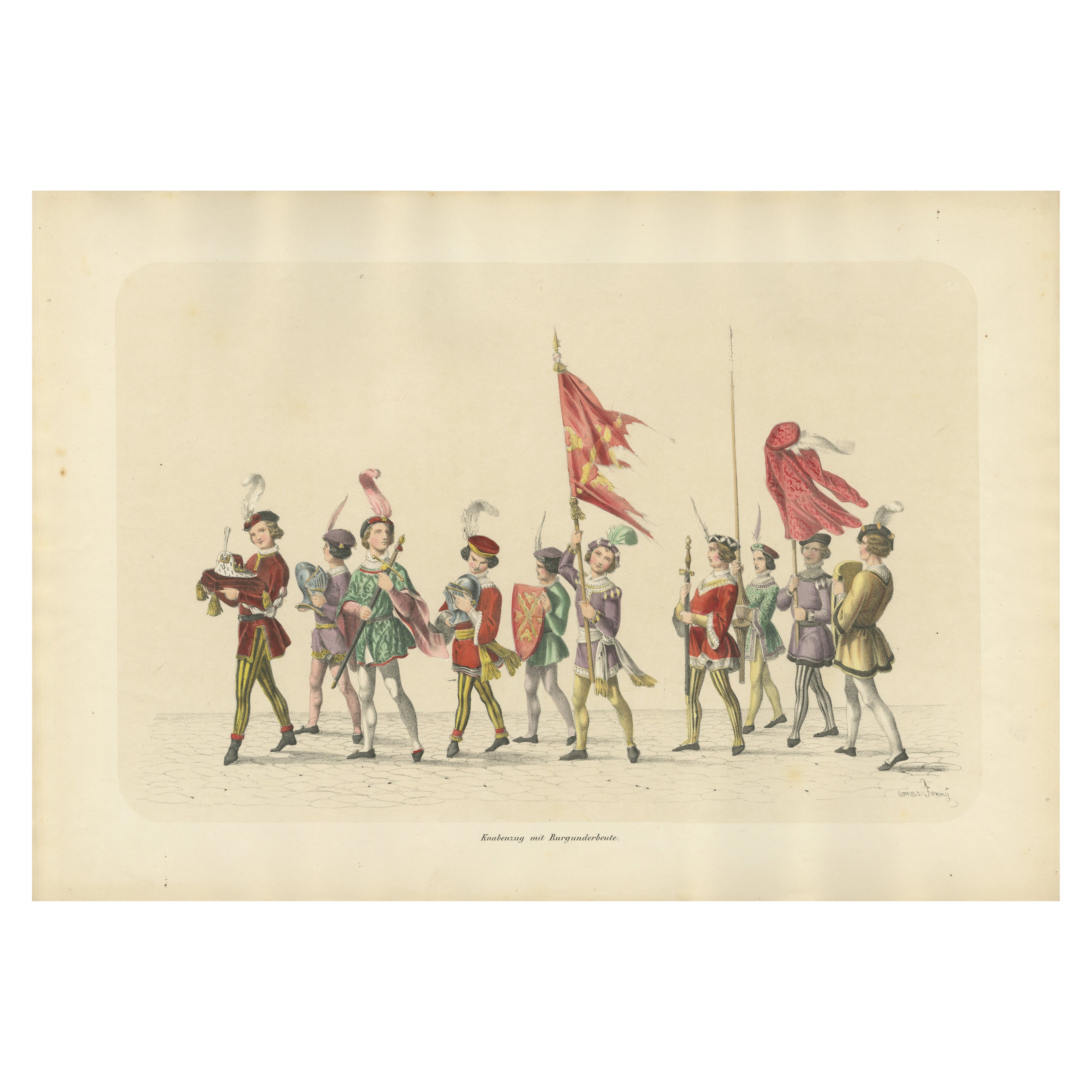
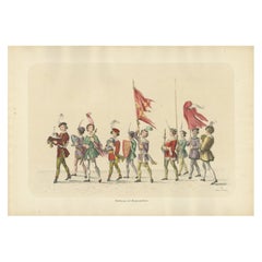
Burgundian Tribute – The Pageant of Noble Youth in Ceremonial Dress, 1855
Located in Langweer, NL
Burgundian Tribute – The Pageant of Noble Youth in Ceremonial Dress
This enchanting hand-colored lithograph, created by H. Jenny and lithographed by Kümmerly and Wittmer, is part ...
Category
Antique 1850s Prints
Materials
Paper
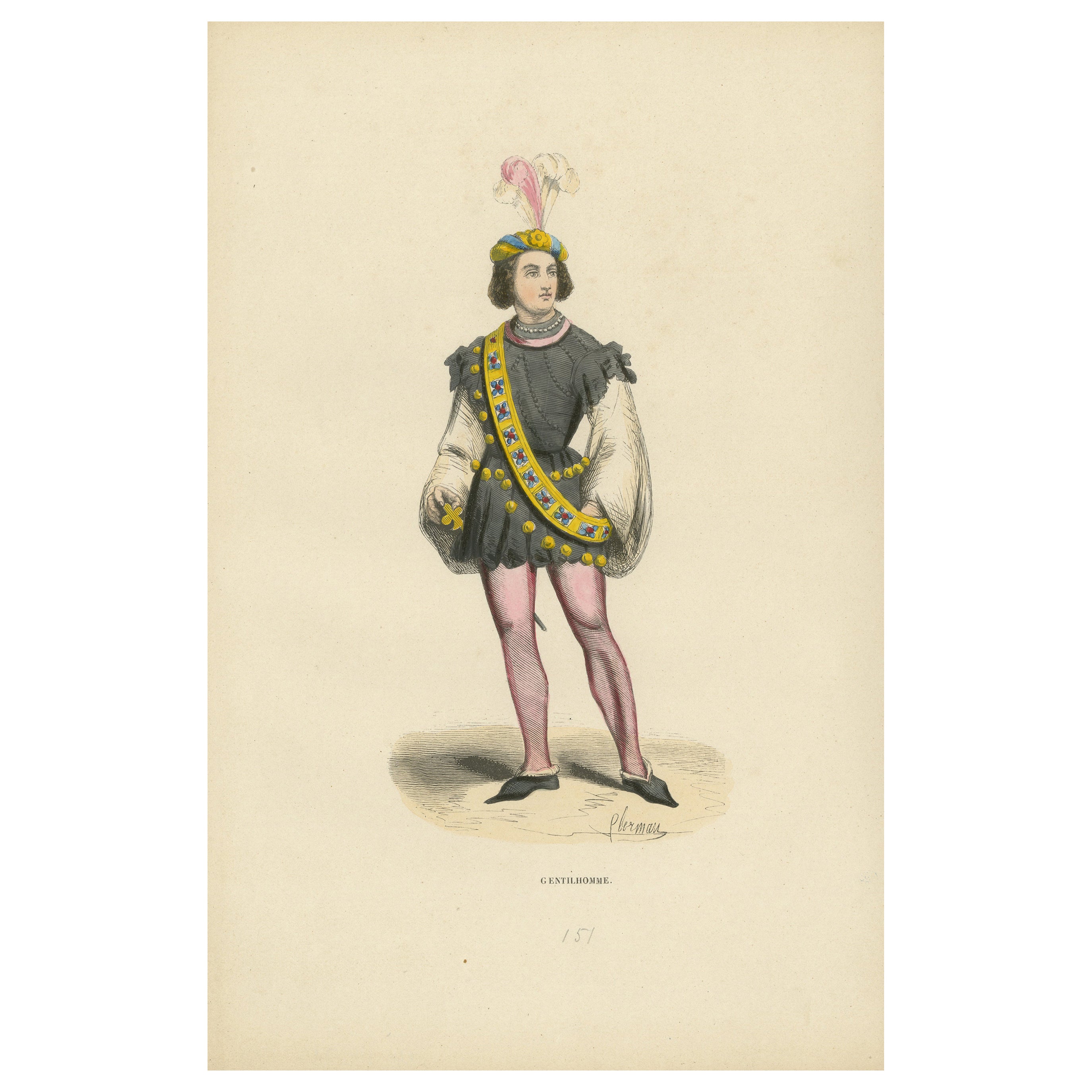
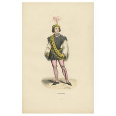
The Gallant Courtier: A Nobleman's Fashion in 'Costume du Moyen Âge, 1847
Located in Langweer, NL
Title: "The Gallant Courtier: A Nobleman's Fashion in 'Costume du Moyen Âge'"
Description: This 1847 lithograph from the "Costume du Moyen Âge" collection depicts a nobleman dressed...
Category
Antique 1840s Prints
Materials
Paper
$132 Sale Price
20% Off
You May Also Like
The Noble Pontifical Guard - Etching by Giuseppe Capparoni - 1827
Located in Roma, IT
The Noble Pontifical Guard is an Artwork realized in 1827 by the Engraver, Giuseppe Capparoni (Rome 1800- 1879).
Etching hand colored on ivory paper. Signed on plate and dated on th...
Category
1820s Modern Portrait Prints
Materials
Etching
Costume - Original Hand-colored Lithograph - 19th Century
Located in Roma, IT
Costume is original Hand-colored lithograph realized by an Anonymous artist in the late XIX century.
Included a Passepartout: 52.5 x 37cm.
Very good conditions.
The artwork represents the traditional costume by light and bright colors, skillfully depicted through soft and precise strokes, the artwork is created with congruous harmonious colors from historical costume...
Category
19th Century Modern Figurative Prints
Materials
Lithograph
Uses and Customs - Soldiers - Lithograph - 1862
Located in Roma, IT
Uses and Customs - Soldiers is a lithograph on paper realized in 1862.
The artwork belongs to the Suite Uses and customs of all the peoples of the universe: " History of the governm...
Category
1860s Modern Figurative Prints
Materials
Lithograph
Old Original Engraving with soldiers characters France 19th
Located in Auribeau sur Siagne, FR
This is an engraving,black color. Representing Soldiers. It has been made in France in the 19th Century. With the collection stamp.
Category
Antique 19th Century Italian Napoleon III Prints
Materials
Paper
$255 Sale Price / set
20% Off
Theatrical Costume - Original Lithograph - Early 20th Century
Located in Roma, IT
Theatrical Costume is a splendid hand lithograph engraved by Anonymous Artist in the Early XX Century.
The state of preservation of the artwork is exc...
Category
Early 20th Century Modern Figurative Prints
Materials
Lithograph
Old Original Engraving with soldiers characters France 19th set of 10
Located in Auribeau sur Siagne, FR
This is an engraving, with blue, Red colors. Representing Soldiers in place Vendôme, and Place du Chatelet in Paris.. It has been made in France in the 19th Century. With the collect...
Category
Antique 19th Century French Napoleon III Prints
Materials
Paper
$330 Sale Price / set
20% Off
More Ways To Browse
R Havell
Curtis Jere Chrome Sculpture
Dalmatian Dog
Danish Dog
Diamond Inlay Chest
Dollar Pattern
Drop Front Walnut Secretary
Eileen Gray Lacquer
Francois Gerard
French Bulldog Art
French Primitive Cabinet
French Rococo Bed
Furniture Polish For Birdseye Maple
Georgian Chest On Stand
Green Giraffe
Hand Painted Bed Queen
Hexagon Game Table
Naked Figurine