Items Similar to Vintage Wall Chart of Australia, 1949


Want more images or videos?
Request additional images or videos from the seller
1 of 5
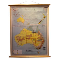
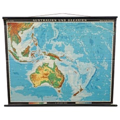
Vintage Wall Chart of Australia, 1949
$707.17
$942.9025% Off
£532.64
£710.1925% Off
€600
€80025% Off
CA$975.22
CA$1,300.3025% Off
A$1,095.62
A$1,460.8325% Off
CHF 572.46
CHF 763.2825% Off
MX$13,372.54
MX$17,830.0625% Off
NOK 7,268.60
NOK 9,691.4725% Off
SEK 6,841.86
SEK 9,122.4825% Off
DKK 4,566.97
DKK 6,089.3025% Off
About the Item
Vintage wall chart of Australia and surroundings. Published by R. Bos and K. Zeeman, 1949.
- Dimensions:Height: 34.06 in (86.5 cm)Width: 46.46 in (118 cm)Depth: 0.02 in (0.5 mm)
- Materials and Techniques:
- Period:
- Date of Manufacture:1949
- Condition:Backed with linen. Shows some wear and a few small defects. Please study images carefully.
- Seller Location:Langweer, NL
- Reference Number:1stDibs: LU3054320873402
About the Seller
5.0
Recognized Seller
These prestigious sellers are industry leaders and represent the highest echelon for item quality and design.
Platinum Seller
Premium sellers with a 4.7+ rating and 24-hour response times
Established in 2009
1stDibs seller since 2017
2,533 sales on 1stDibs
Typical response time: <1 hour
- ShippingRetrieving quote...Shipping from: Langweer, Netherlands
- Return Policy
Authenticity Guarantee
In the unlikely event there’s an issue with an item’s authenticity, contact us within 1 year for a full refund. DetailsMoney-Back Guarantee
If your item is not as described, is damaged in transit, or does not arrive, contact us within 7 days for a full refund. Details24-Hour Cancellation
You have a 24-hour grace period in which to reconsider your purchase, with no questions asked.Vetted Professional Sellers
Our world-class sellers must adhere to strict standards for service and quality, maintaining the integrity of our listings.Price-Match Guarantee
If you find that a seller listed the same item for a lower price elsewhere, we’ll match it.Trusted Global Delivery
Our best-in-class carrier network provides specialized shipping options worldwide, including custom delivery.More From This Seller
View AllDecorative Vintage Print, Dutch Chart of Australia, 1st Edition, 1952
Located in Langweer, NL
The vintage school chart of Australia titled "Australië," created by W. Bakker & H. Rush and published in 1952:
**Title**: Australië
**Creators**: W. Bakker & H. Rush
**Publication ...
Category
Mid-20th Century European Maps
Materials
Canvas
$330 Sale Price
20% Off
Vintage Wall Chart of a Landscape and Geographic Map, circa 1955
Located in Langweer, NL
Vintage wall chart titled 'Kaart en Landschap'. This wall chart shows a mountain range and geographic map. Published by J.B. Wolters, circa 1955.
Category
Mid-20th Century Prints
Materials
Paper

$565 Sale Price
20% Off
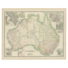
Antique Map of Australia by Johnston '1909'
Located in Langweer, NL
Antique map titled 'Australia'. Original antique map of Australia. With inset maps of Melbourne, Port Phillip, Adelaide, Perth, Sydney, Brisba...
Category
Early 20th Century Maps
Materials
Paper
$330 Sale Price
20% Off
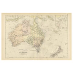
1882 Map of Australia and New Zealand with Regional and Geographical Features
Located in Langweer, NL
This 1882 map of Australia and New Zealand, published by Blackie and Son as part of the 'Comprehensive Atlas and Geography of the World,' provides a detailed and insightful look at t...
Category
Antique 1880s Maps
Materials
Paper
Mid-19th Century Map of Australasia by Carl Flemming - 1855
Located in Langweer, NL
Title: "Mid-19th Century Map of Australasia by Carl Flemming - 1855"
Description: This original 1855 antique map from the Sohr-Berghaus Atlas, created by Carl Flemming, is a detaile...
Category
Antique 1850s Maps
Materials
Paper

Large Detailed Map of Australia Wint Inset of Tasmania, 1937
Located in Langweer, NL
Antique map titled 'Australia'. Large folding map of Australia. With inset map of Tasmania. Printed by L.F. Johnston, Canberra.
Artists and Engravers: Compiled and drawn by Propert...
Category
20th Century Maps
Materials
Paper

$330 Sale Price
20% Off
You May Also Like
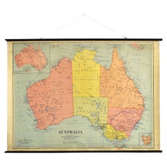
Antique Vintage Australia Wall Map By W & A K Johnston
By W. & A.K. Johnston
Located in Stockbridge, GB
Vintage Australia Wall Map By W & A K Johnston
A vintage school pull down wall map of Australia. The map has a wooden hanging pole at the top...
Category
Mid-20th Century British Schoolhouse Posters
Materials
Canvas, Wood
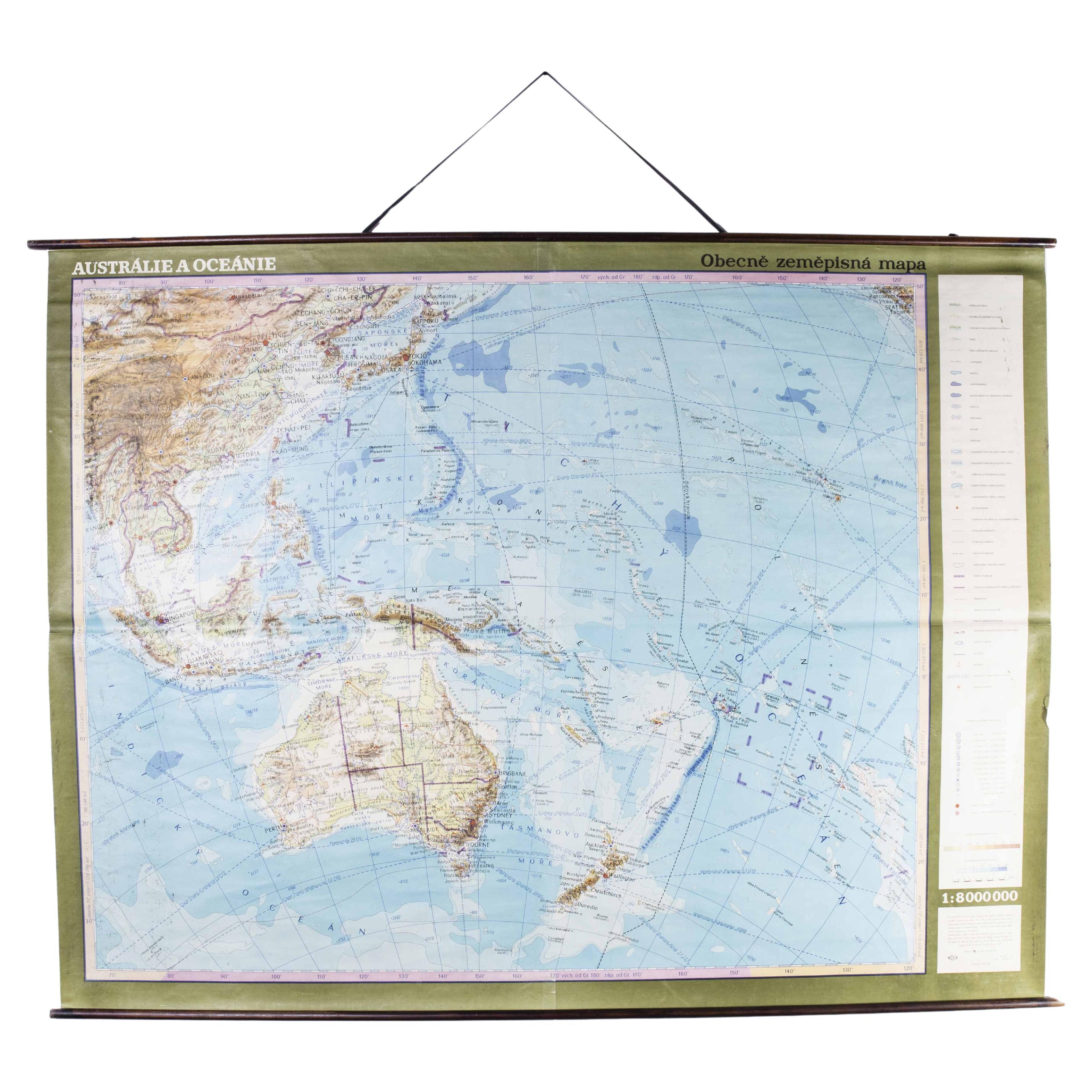
Late 20th Century Educational Geographic Map - Australasia
Located in Hook, Hampshire
Late 20th Century Educational Geographic Map – Australasia
Late 20th Century Educational Geographic Map – Australasia. Good quality roll up school educational geographic map from the...
Category
Late 20th Century Czech Posters
Materials
Cotton

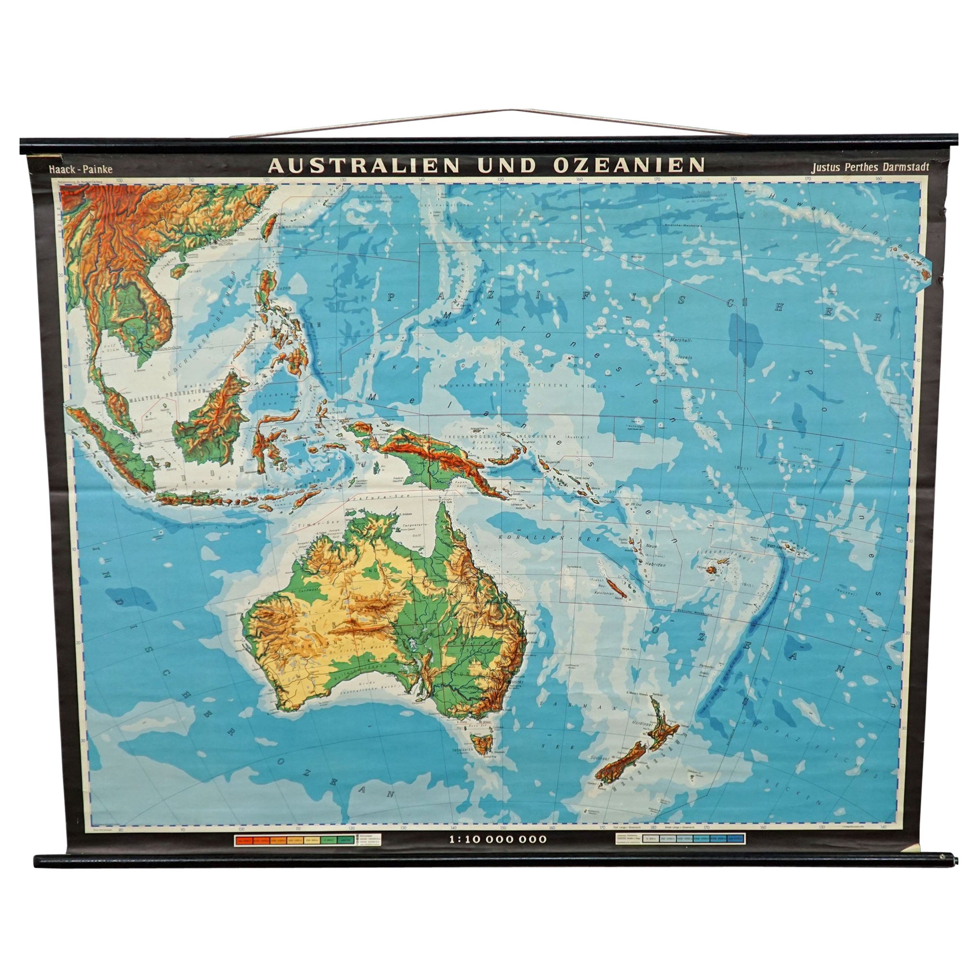
Vintage Mural Map Rollable Wall Chart Poster Australia New Zealand Indonesia
Located in Berghuelen, DE
Vintage Mural Map Rollable Wall Chart Poster Australia New Zealand Indonesia
The vintage pull-down map shows Australia and Oceania, published by Haack-Painke Justus Perthes Darmstadt. Colorful print on paper reinforced with canvas.
This wallchart is a wonderful holiday memory decoration item.
Measurements:
Width 122 cm (48.03 inch)
Height 100 cm (39.37 inch)
The measurements shown refer just to the canvas and do not include the poles.
Background information on the history of school wall charts:
The idea to upgrade every day school life by using pictures was supported in the late 18th century by Johann Bernhard Basedow. In 1774 he published a four-volume book "Elementarwerk" which combined pictures, text and information with merely hundred copperplates. Modern printing methods enabled the spread from rich private schools to rural grade schools...
Category
Vintage 1970s German Country Posters
Materials
Canvas, Wood, Paper
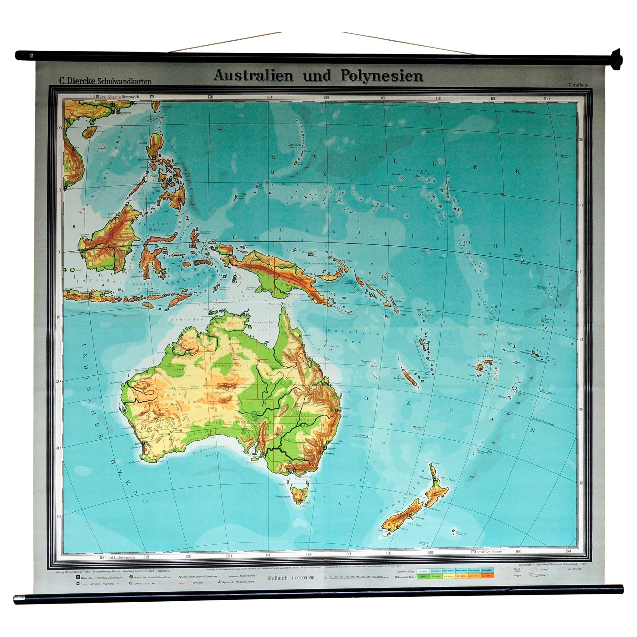
Map Mural Rollable Poster Vintage Wall Chart Australia New Zealand Polynesia
Located in Berghuelen, DE
Map Mural Rollable Poster Vintage Wall Chart Australia New Zealand Polynesia
A beautiful vintage school map illustrating the popular region of Aust...
Category
Vintage 1970s German Country Posters
Materials
Canvas, Wood, Paper

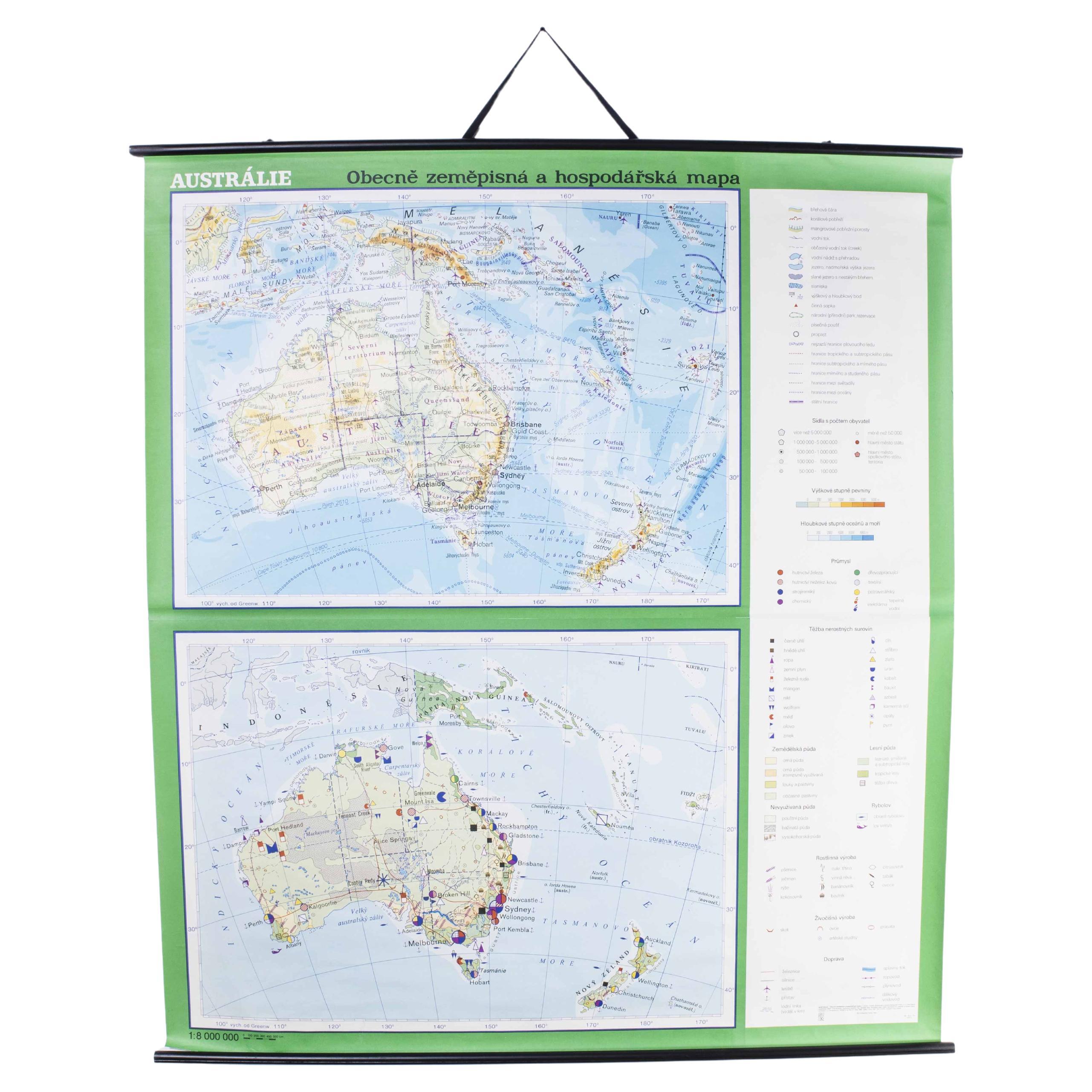
Late 20th Century Educational Geographic Map - Australia Topography And Economy
Located in Hook, Hampshire
Late 20th Century Educational Geographic Map – Australia Topography And Economy
Late 20th Century Educational Geographic Map – Australia Topography And Economy. Good quality roll up ...
Category
Late 20th Century Czech Posters
Materials
Cotton
Large Original Antique Map of Australia by Sidney Hall, 1847
Located in St Annes, Lancashire
Great map of Australia
Drawn and engraved by Sidney Hall
Steel engraving
Original colour outline
Published by A & C Black. 1847
Unframed
Free shipping.
Category
Antique 1840s Scottish Maps
Materials
Paper
