Belgium Maps
to
5,436
241
5
1
1
4
2
1
2
1
1
1
1
4
1
1
1
1
5
5
5
1
Item Ships From: Belgium
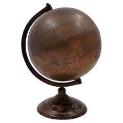
Burnished brass earth globe - Circa 1930s
Located in Linkebeek, BE
Burnished brass earth globe - Circa 1930s
Globe - World map
Measures : 20x18cm H:25cm
Wear consistent with age and use
Category
20th Century Belgium Maps
Materials
Brass
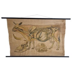
Antique Linen Anatomical School Poster from the Cow, 1950s
Located in Leuven, Vlaams Gewest
1950s didactical anatomical school poster of the cow.
Used to explain and show the anatomical aspect of a cow to the pupils.
Printed on linen.
Cool curio item to decorate a ...
Category
1950s Belgian Vintage Belgium Maps
Materials
Linen
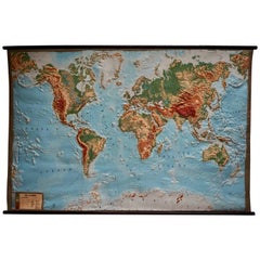
World Relief Map
Located in Antwerp, BE
Large world relief map.
Measures: Width 232 cm.
Height 158 cm.
Category
Mid-20th Century German Mid-Century Modern Belgium Maps
Materials
Acrylic
$2,097
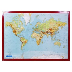
George Philip's Large Relief Map of the World 150x110cm
By George Philip & Son
Located in Linkebeek, BE
George Philip's Large Relief Map of the World 150x110cm
PHILIP, George Relief Map of the World. George Philip and Son Limited, c. 1950. Large 3D relief map of the world. Shaded relie...
Category
20th Century British Belgium Maps
Materials
Plastic, Wood
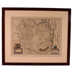
Antique Map Of Brabantia Ducantus By Bleau Circa 1640
Located in Brussels, Brussels
map of theBrabantia Ducantus (Belgium) circa 1640 by Bléau. Bléau was well known for antique atlas that he draw during the 17 century
beautiful map, double page folded in the middle,...
Category
17th Century French Renaissance Antique Belgium Maps
Materials
Paper
Related Items
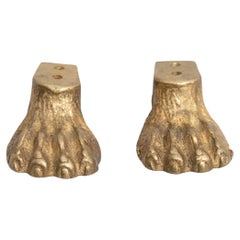
Set of 2 Brass Furniture Leg Embellisher, circa 1930
Located in Barcelona, ES
Set of two brass decorative embellishers imitating feline paws. Designed by unknown manufacturer, circa 1930. In original condition, with minor wear consistent with age and use...
Category
1930s Spanish Mid-Century Modern Vintage Belgium Maps
Materials
Brass
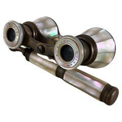
Brass Lorgnettes 'Long-Handled Opera Glasses' Mid-Century Italian Design 1930s
Located in Palermo, IT
A splendid pair of 'lorgnettes' (long-handled opera, or theatre, glasses). Lorgnettes, eye glasses held in place by long handles rather than resting on the bridge of one's nose, were...
Category
1930s Italian Vintage Belgium Maps
Materials
Brass
$447 Sale Price
20% Off
H 2.76 in W 4.34 in D 6.3 in
chinoiserie Decorated Circular Barometer, circa 1930s
By Acme Photo
Located in Dereham, GB
Chinoiserie decorated circular barometer, circa 1930s.
Black background with gold decoration,
Depicting, houses, temple, figures, trees & foliage,
Brass face,
Badge on back, re...
Category
1930s European Chinoiserie Vintage Belgium Maps
Materials
Lacquer
Moroccan Khoumya Dagger Vintage from 1950s
By Berber Tribes of Morocco
Located in North Hollywood, CA
Moroccan Tribal Khoumya Collector Dagger, vintage from the 1950s.
Handcrafted by Artisans in Morocco, very fine quality craftsmanship with a wooden grip engraved with Moroccan silver...
Category
20th Century Moroccan Moorish Belgium Maps
Materials
Metal, Nickel
Italian Parchment Map of the City of Pisa Dated, 1640
By Matthäus Merian the Elder
Located in Florence, Tuscany
An antique map of the Tuscan city of Pisa engraved for The 'Itinerarium Italiæ Nov-antiquæ' by Matthäus Merian the Elder and printed in 1640....
Category
1640s Italian Antique Belgium Maps
Materials
Paper
Brass Steering Wheel Cigar Cutter, Vintage Austria, 1930s
Located in Nuernberg, DE
A beautiful cigar cutter to stand beside your Humidor. Some wear with a nice patina, but this is old-age. Made of metal on a marble base. A beautiful nice collectible item or just a ...
Category
1930s Austrian Art Deco Vintage Belgium Maps
Materials
Marble, Metal
Antique Map of Venezuela by Montanus, 1671
By Arnoldus Montanus
Located in Langweer, NL
Antique map titled 'Venezuela cum parte Australi Novae Andalusiae'. The map extends from Coquibocoa to the Orinoque River, centered on Bariquicemento and Cape de Curiacao. Large cart...
Category
Mid-17th Century English Antique Belgium Maps
Materials
Paper
Map Exploring The World, Midi Format
Located in New York, NY
A compelling exploration of the ways that humans have mapped the world throughout history - now in a compact new edition
Map: Exploring the World brings together more than 250...
Category
21st Century and Contemporary Belgium Maps
Materials
Paper
Detailed Model of Dutch Sailing Ship Circa 1930s-1940s
Located in Opole, PL
Detailed Model of Dutch Sailing Ship Circa 1930s-1940s
A faithfully reproduced model of a vessel dating back to the Interwar Period of the 20th century. In particularly good condition.
Category
Early 20th Century Dutch Belgium Maps
Materials
Wood
$643 Sale Price
20% Off
H 37.01 in W 34.65 in D 9.45 in
Vintage Phone, 1930s/40s
Located in Roma, IT
Vintage telephone is an original design object realized in the 1930s/40s.
A brass and wood vintage telephone.
Fair conditions due to the time.
...
Category
Early 20th Century Italian Belgium Maps
Materials
Brass
1930s Austrian Horse Toy
By Craft and Folk Art Museum
Located in Sag Harbor, NY
Beautiful 1930s Austrian horse toy. Wonderful patina.
Category
1920s Austrian Folk Art Vintage Belgium Maps
Materials
Bentwood
Stylish Art Deco Velvet and Chrome Handbag Purse, circa 1930s
Located in Devon, England
For your consideration is this superbly stylish and rare 1930s black silk velvet clutch bag originating from England. Features a chrome frame and cla...
Category
Mid-20th Century English Art Deco Belgium Maps
Materials
Chrome
Previously Available Items
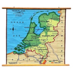
School Chart or Pull Down Map of Geography of the Netherlands, 1950s
Located in Hemiksem, VAN
A beautiful old school map of the Netherlands, painted on linen. The map shows the 3 different reliefs (low, middle, high) of the Netherlands. The beau...
Category
1950s Belgian Mid-Century Modern Vintage Belgium Maps
Materials
Linen, Paint
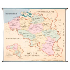
XL Old School Map of Belgium 'Printed by Procure', 1950s
Located in Oostende, BE
XL Old school map of Belgium (Printed by Procure). Presumably from around 1950-1960.
Category
1950s Belgian Mid-Century Modern Vintage Belgium Maps
Materials
Metal
Vintage Botanical West German Biology Print Chart by Hagemann, Germany, 1960s
Located in Antwerp, BE
1960s canvas wall school chart, Pull down chart with beautiful illustration of a flower. It shows the details of the flower Taraxacum on a bla...
Category
Mid-20th Century German Hollywood Regency Belgium Maps
Materials
Canvas, Paper
H 45.28 in W 33.47 in D 0.4 in
18th Century Map of the Bourgogne Region
Located in Vosselaar, BE
This large map of the French Bourgogne region was printed and mounted in the late 18th century. Since the governemental centralisation by the Sun King (Louis XIV) the succesing monar...
Category
Late 18th Century French Neoclassical Antique Belgium Maps
Materials
Canvas
1950s Tabletop Globe on Oak Base
Located in Antwerp, BE
1950s tabletop lobe on oak base.
Measures: Height 47 cm.
Category
Mid-20th Century European Mid-Century Modern Belgium Maps
Materials
Wood, Paper
Recently Viewed
View AllMore Ways To Browse
Glass Vase With Birds In Relief
Gold Leaf Statue Buddha
Gothic Tile
Greek Key Dresser
Green Glass Bud Vase Vintage
Gucci Tray
Half Moon Shelves
Handblown Glass Decanter
Heart Shaped Glass Dish
Hepplewhite Drop Leaf Table
Herend Cup
Hermes Dish
Horse Head Barware
Horse Mantel Clock
Large Limoges Platter
Michelangelo David Statue
Michelin Guide
Persian Khatam
