New Jersey Maps
to
2
5,466
195
7
3
1
1
1
2
4
1
1
1
6
5
2
1
1
7
3
3
2
2
7
7
7
1
Item Ships From: New Jersey
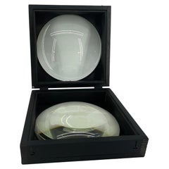
Large European 1930's Nautical Map Reader Magnifying Glass
Located in Haddonfield, NJ
This European set of two nautical magnifying glass map-readers are quite unusual and rarely found. It is fully encased in it's heavy wooden and metal enforced box. Hailing from betwe...
Category
1930s German Industrial Vintage New Jersey Maps
Materials
Metal
$2,000 Sale Price
20% Off
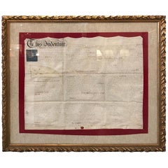
Early 19th Century Original Framed Land Indenture, England, 1810
Located in Lambertville, NJ
A large hand written land indenture document England, 1810, framed. The beautifully hand written document mounted on board with a red velvet border and ...
Category
1810s English Regency Antique New Jersey Maps
Materials
Glass, Giltwood, Parchment Paper
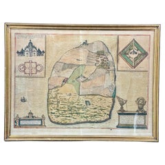
16th Century Antique Map of Ven Framed in Gold
Located in Haddonfield, NJ
Ven (older Swedish spelling Hven), is a Swedish island in the Öresund strait laying between Skåne, Sweden and Zealand and Denmark. The island was historically under Danish rule. Dani...
Category
16th Century Danish Baroque Antique New Jersey Maps
Materials
Wood, Paper
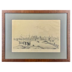
19th Century Reprint of 16th Century Harbor Map of Copenhagen
Located in Haddonfield, NJ
This reprint of 1587 antique map of Copenhagen, Denmark retains its original mid-century mat and has been recently reframed in classic wood frame. The muted sepia colored map is a wo...
Category
1880s Danish Baroque Antique New Jersey Maps
Materials
Wood, Paper
19th Century Lithograph Map of Lower Manhattan, New York
Located in Haddonfield, NJ
1859 hand colored map of Lower Manhattan or New Amsterdam by George H. Moore.
Category
19th Century English Folk Art Antique New Jersey Maps
Materials
Paper
$620 Sale Price
20% Off
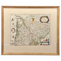
18th Century Map of French Pyrenees Region of France
Located in Haddonfield, NJ
An antique map titled "Principatus Benearnia, La Principaute De Bearn" created by the renowned Dutch cartographer Willem Janszoon Blaeu.
It depicts the Principality of Bearn, a histo...
Category
1880s Danish Baroque Antique New Jersey Maps
Materials
Wood, Paper
Four 18th Century Engraved and Hand-Colored Maps by Weigel
By Christoph Weigel
Located in Copenhagen, K
Small collection of four engraved maps of Italy, Balkan and of Central Asia.
Two are of Italy, one Corsica and Northern Italy and the other of the Southern Italian boot...
Category
18th Century German Antique New Jersey Maps
Materials
Paper
Related Items
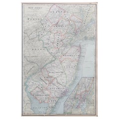
Large Original Antique Map of New Jersey, USA, circa 1900
Located in St Annes, Lancashire
Fabulous map of New Jersey
Original color
Engraved and printed by the George F. Cram Company, Indianapolis.
Published, circa 1900
Unframed
Repairs to minor edge tears
Category
1890s American Antique New Jersey Maps
Materials
Paper
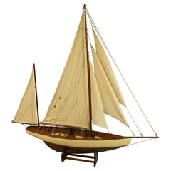
Large Scale Hand Crafted Sail Boat Model
Located in Douglas Manor, NY
3-569 Hand crafted sail boat model on base.
Category
1960s Vintage New Jersey Maps
Materials
Canvas, Hardwood
Pair Of 16th Century Italian Memento Mori
Located in Hastings, GB
A truly exceptional pair of Memento Mori 'remember you must die' painted on board, these date to the 16th century and were originally housed in an North Italian Monastery, this incre...
Category
16th Century Italian Gothic Antique New Jersey Maps
Materials
Pine
American Cast Brass Engraved Yachtsman's Speaking Trumpet, Circa 1830
Located in Charleston, SC
American hand held cast brass engraved Yachtsman's speaking trumpet with bell shaped soldered mouthpiece, coned-shaped column with original interior red paint, and terminating on a r...
Category
1830s American American Empire Antique New Jersey Maps
Materials
Brass
American Nautical Brass Yacht Binnacle Mounted in Mahogany Case, Circa 1890
Located in Charleston, SC
American nautical mahogany yacht binnacle with a hinged locking oval glass viewing port, original removable brass side light burner with font, brass carrying handle, and fitted with ...
Category
1890s American American Empire Antique New Jersey Maps
Materials
Brass
$6,500
H 10 in W 10.5 in D 8 in
Original Drawing, Circle of Giovanni Battista Tiepolo 1696-1770 Venice, Italy
By Giovanni Battista Tiepolo
Located in Vero Beach, FL
Original Drawing, Circle of Giovanni Battista Tiepolo 1696-1770 Venice, Italy
Although we offer this old master drawing as circle of Tiepolo, we are convinced, based on the composi...
Category
18th Century Italian Rococo Antique New Jersey Maps
Materials
Paper
$8,200
H 19.25 in W 20.25 in D 0.5 in
Large Danish Maple and Mahogany Pond Yacht Ship Model
Located in Kastrup, DK
Large elegant wooden pond yacht ship model in maple and mahogany.
High quality, hand-built. Deck fitted with small screws.
Denmark 1920-1930....
Category
Early 20th Century Danish Other New Jersey Maps
Materials
Brass
19th Century half mode of steam ship New York
Located in Martlesham, GB
A fabulous quality 19th Century half model of the steam ship "New York", originally called "City of New York", British built for the Inman line launched on the 15th March 1888. Cir...
Category
19th Century British Victorian Antique New Jersey Maps
Materials
Walnut
Early 19th Century Italian Altar
Located in Baton Rouge, LA
This early 19th century Italian altar is made of worn painted wood and worn fabric details. This is a highly decorative altar for the unknown Catholic saint...
Category
19th Century Italian Antique New Jersey Maps
Materials
Fabric, Wood, Paint
16th Century Map of Saudi Arabia, the Persian Gulf and Red Sea, ca. 1574
Located in Langweer, NL
Ptolemaic map of the Arabian Peninsula based on the 1548 map of Giacomo Gastaldi. It covers nearly all of the peninsula, but does not include the head of the Red Sea. The coastlines ...
Category
16th Century Antique New Jersey Maps
Materials
Paper
$440 Sale Price
20% Off
H 7.1 in W 9.8 in D 0.002 in
Russian Icon with Processional Cross 19th Century
Located in Brussels, Brussels
Very beautiful Russian icon with a processional cross in its center from the 17th century
We can see that the icon was created to accommodate the processional cross with the Chris...
Category
19th Century Belarusian Aesthetic Movement Antique New Jersey Maps
Materials
Wood
Scale Nautical Vintage Model of an English Motorboat, 1950s
Located in Milan, IT
Scale model of an English motorboat (antique motor yacht) from the 1950s, wooden planking hull. Measures: Length 57 cm, 23.44 inches, width 13.5 cm, 5.3 ...
Category
1950s British Vintage New Jersey Maps
Materials
Wood
Previously Available Items
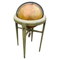
Mid-Century Illuminated Replogle World Floor Globe in Wood and Glass, Chicago
By Replogle Globes
Located in Haddonfield, NJ
American 1950's back light green painted floor globe by Replogle, Mid-Century Modern.
Remarkable and charming Chicago made world globe featur...
Category
Mid-20th Century American Mid-Century Modern New Jersey Maps
Materials
Steel
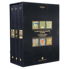
La Galleria Delle Carte Geografiche in Vaticano, Maps in the Vatican, 3 Vols
By Fra Egnazio Danti
Located in Morristown, NJ
La Galleria delle Carte geografiche in Vaticano / The Gallery of Maps in the Vatican, Mirabilia Italiae / Franco Cosimo Panini, (3) vols. in black silk cloth, slipcase with golden ti...
Category
1990s Italian Renaissance New Jersey Maps
Materials
Linen, Paper
H 13 in W 5.5 in D 10 in
Antique Framed Hand Colored Map of the Americas by Frederick De Wit, circa 1675
By Frederick de Wit
Located in Morristown, NJ
Frederick De Wit (Dutch, 1629-1706), "Novissima et Accuratissima totius Americae Descriptio", hand-colored map engraving of North and South America with California depicted as an island, decorated with images of Native Americans and indigenous flora and fauna, framed under glass, 19.5"h x 23"l (sheet), 22.5"h x 1.75"d x 26"w (frame), From the collection of an NY corporation.
A fine example of De Wit’s map of the Americas, first published ca. 1675. This map is fascinating. It was the first Dutch map to include all five Great Lakes; Lac Superieur (Lake Superior), Lac des Puans (Lake Michigan), Mare Dulce (Lake Huron...
Category
1670s Dutch Baroque Antique New Jersey Maps
Materials
Glass, Wood, Giltwood, Paint, Paper
H 22.5 in W 26 in D 1.75 in
Vintage World Globe on Mahogany Stand
Located in Lambertville, NJ
Handsome Scholarly world globe with a Regency style mahogany base. The globe is 16 inches in diameter, circa 1940, Chicago. Perfect addition to a library or study.
Category
1940s American Regency Vintage New Jersey Maps
Materials
Mahogany
English Regency Mahogany 1820s Era Map Cabinet with Antique Maps of the World
Located in Swedesboro, NJ
This is a highly unique item. This antique 1820s mahogany map cabinet comes complete with sleeves containing mounted antique maps of North America, Africa,...
Category
1820s English Regency Antique New Jersey Maps
Materials
Mahogany
H 38.25 in W 40 in D 12 in
Antique Map of Denmark by C. F. Weiland, 1829
Located in Haddonfield, NJ
Antique map of Denmark in a black wooden frame and glass screen.
Made by German C. F. Weiland, Weimar in 1829.
Category
Early 19th Century German Antique New Jersey Maps
Materials
Glass, Paper
Large Nautical Map of New York Entrance, 1870
Located in Haddonfield, NJ
Large rectangular nautical map of the New York Entrance, 1857.
Sandy Hook Bay, Coney Island, Jamaica Bay, Staten Island
Category
19th Century American Antique New Jersey Maps
Recently Viewed
View AllMore Ways To Browse
French Louis Xvi Enfilade
French Provincial Antique Dresser
French Provincial Furniture Antique Dresser
French Zinc Bar
Frog Figurine
German Folding Trolley
Glass And Brass Fireplace Screen
Glass Nude Woman Sculpture
Glass Parrots
Glass Poodle
Gothic Corbel
Granite Pagoda
Green And Gold Culver
Green Ceramic Cat
Green Porcelain Parrots
Guan Yin Statue
Gucci Display
Gustavsberg Horse
