South Coast Maps
to
3
5,436
241
4
1
1
3
2
3
2
1
1
2
2
2
1
1
4
4
4
1
Item Ships From: South Coast
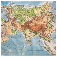
Huge Europe and Asia Vintage Wall Map
Located in San Diego, CA
A huge Europe and Asia vintage wall map, circa 1950s. The map is in fair vintage condition and measures 78"W x 73"H". #2863
Category
Mid-20th Century American South Coast Maps
Materials
Paper
$380 Sale Price
20% Off
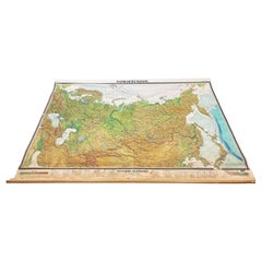
Massive Vintage Wall Map of the Soviet Union 'Sowjetunion' by Karl Wenschow
By Denoyer-Geppert
Located in San Diego, CA
A massive vintage wall map of the Soviet Union (Sowjetunion) published by Karl Wenschow in Munich, Germany, circa 1950s. The map was distributed by De...
Category
Mid-20th Century American South Coast Maps
Materials
Paper, Wood
$540 Sale Price
20% Off
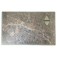
Vintage "View of the Center of Paris Taken from the Air" Lithograph Map
Located in San Diego, CA
A very stylish "View of the Center of Paris Taken from the Air" lithograph map published by the Paris Ministry of Tourism, circa early 1950s. The piece measures 27" x 43" and shows...
Category
20th Century French Mid-Century Modern South Coast Maps
Materials
Paper
$680 Sale Price
20% Off
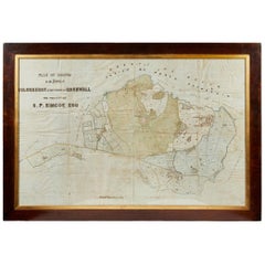
Antique Framed Pen and Ink on Fabric Map of Cornwall from Early 19th Century
Located in Los Angeles, CA
This English fabric map of Cornwall, rendered in pen-and-ink, showcases exquisite hand-drawn details and charming faded sepia tones. Encased in a classic frame, this piece elegantly ...
Category
Early 19th Century English Antique South Coast Maps
Materials
Walnut, Fabric
Related Items
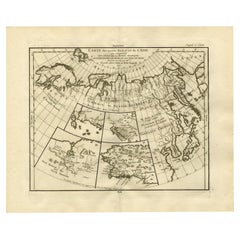
Antique Map of North and East Asia, 1751
Located in Langweer, NL
Map 2: 'Carte des parties nord et est de L'Asie'. (Map of the Northern parts and East Asia.) Five maps on one sheet, showing California, Alaska and Siberia, Korea and Japan. South to...
Category
18th Century Antique South Coast Maps
Materials
Paper
19th C, Drawing on Paper, Dated, Signed and Framed
Located in Leuven , BE
Unknown Academy Student 19th C Drawing, pencil on paper.
Category
19th Century Belgian Antique South Coast Maps
Materials
Paper
Alpine Ski Photograph, 'Panoramic View', Taken from Original 1930s Photograph
Located in Oxfordshire, GB
Vintage, antique Alpine Ski photograph.
'Panoramic View', a new mounted black and white photographic image after an original 1930s skiing photograph. Black and white alpine photos are the perfect addition to any home or ski lodge, so please do check out our other ski photos...
Category
1930s English Sporting Art Vintage South Coast Maps
Materials
Paper
$93 / item
H 14.97 in W 20.48 in D 0.04 in
Alpine Ski Photograph, 'Three Peaks' Taken from 1930s Original
Located in Oxfordshire, GB
Vintage, Alpine Ski Photograph.
'Three Peaks', a new mounted black and white photographic image after an original 1930s skiing photograph. Black and white alpine photos are the perfect addition to any home or ski lodge, so please do check out our other ski photos...
Category
1930s English Sporting Art Vintage South Coast Maps
Materials
Paper
$94 / item
H 14.97 in W 20.48 in D 0.04 in
Alpine Mountaineering Photograph, 'CLIMBER' Taken from 1930s Original
Located in Oxfordshire, GB
Vintage Alpine Mountaineering photograph.
'CLIMBER' Simelistock, Switzerland, a new mounted black and white photographic image after an original 1930s mountaineering photograph.
...
Category
1930s English Sporting Art Vintage South Coast Maps
Materials
Paper
$93 / item
H 20.5 in W 15 in D 0.1 in
Vintage Map of the Greater Antilles and Lesser Antilles
Located in Langweer, NL
Vintage map titled 'Antilles'. Original map of the Antilles. Shows the Cayman Islands, Cuba, Hispaniola (subdivided into the nations of the Dominican Republic and Haiti), Jamaica, and Puerto Rico. Also shows the Lesser Antilles...
Category
20th Century South Coast Maps
Materials
Paper
$130 Sale Price
20% Off
H 17.6 in W 22.64 in D 0.02 in
Alpine Ski Photograph, 'Happy Skiers' Taken from 1930s Original
Located in Oxfordshire, GB
Vintage, Alpine ski photograph.
'Happy Skiers', a new mounted black and white photographic image after an original 1930s skiing photograph. Black and white alpine photos are the perfect addition to any home or ski lodge. Prior to being a recreational activity skiing was purely a means of travelling from A to B through the snow, it only started to become the sport it is today in the mid-1800s. The price displayed is for the mounted photo only.
Image size 25.5cm x 40cm = 10 x 15 ½" ".
The alpine photograph...
Category
1930s English Sporting Art Vintage South Coast Maps
Materials
Paper
$93 / item
H 14.97 in W 20.48 in D 0.04 in
Vintage Soviet Book: 'Erotic of the East' and Soviet Erotic Horoscope, 1J53
Located in Bordeaux, FR
Delve into the fascinating world of human sexuality with this vintage book from the Soviet era. Titled "Erotic of the East," written by Nick Douglas and Renni Slinger, this book offe...
Category
1990s South Coast Maps
Materials
Paper
$25
H 0.12 in W 5.52 in D 8.27 in
Pair of Early Victorian English Stamped Framed & Mounted Cornwall Aquatints
Located in Vancouver, British Columbia
Fine pair of Fisher & Son London hand coloured engravings from the early Victorian Period. Beautifully framed and mounted and in good condition. Detailed scenes of Cornwall...
Category
1830s English Early Victorian Antique South Coast Maps
Materials
Paper
$1,440 Sale Price / set
20% Off
H 8.5 in W 10.5 in D 0.5 in
Alpine Ski Photograph, 'The Race' Taken from Original 1930s Photograph
Located in Oxfordshire, GB
Alpine Ski photograph.
'The Race', a new mounted black and white photographic image after an original 1930s photograph. Black & white alpine photos are the perfect addition to any home or ski lodge, so please do check out our other ski photos and winter landscapes. The photo is showing a biplane racing a car on a frozen lake. This amazing photograph was taken in Grainau, a small town in Bavaria, at the foot of Germany's highest mountain, the Zugspitze.
The pilot is General Ernst Udet - the World War I flying ace...
Category
1930s British Sporting Art Vintage South Coast Maps
Materials
Paper
$94 / item
H 20.48 in W 14.97 in D 0.04 in
A Day in the Life of the Soviet Union Book by David Elliot Cohen Hardcover Book
Located in North Hollywood, CA
A Day in the Life of the Soviet Union Book by David Elliot Cohen.
More than three hundred photographs visually survey the diversity of Russian landscapes and cityscapes and depict r...
Category
20th Century Asian Balkan South Coast Maps
Materials
Paper
$65
H 14.5 in W 10 in D 1 in
Alpine Ski Photograph, 'THE JUMP' Taken from 1930s Original
Located in Oxfordshire, GB
Vintage, Alpine Ski photograph.
'THE JUMP', a new mounted black and white photographic image after an original 1930s skiing photograph. Prior to being a recreational activity skiing was purely a means of travelling from A to B through the snow, it only started to become the sport it is today in the mid-1800s. The price displayed is for the mounted photo only.
Image size 25.5cm x 40cm = 10 X 15 ½" ".
The alpine photograph...
Category
1930s English Sporting Art Vintage South Coast Maps
Materials
Paper
$93 / item
H 14.97 in W 20.48 in D 0.04 in
Previously Available Items
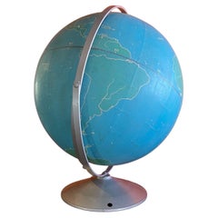
Vintage Strategy Chalk Teaching Globe on Stand by A.J. Nystrom Co
By A.J. Nystrom & Co
Located in San Diego, CA
Vintage strategy chalk teaching globe on aluminum stand by A.J. Nystrom Co., circa 1960s. The globe is in good original condition and measures 17"D x 21"H with the base of the stand ...
Category
20th Century American Mid-Century Modern South Coast Maps
Materials
Steel, Chrome
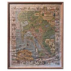
Antique Whimsical Map of San Diego, California by Jo Mora for Marston Stores
By A. Marston & Co., Jo Mora
Located in San Diego, CA
Antique whimsical map of San Diego, California by Jo Mora for Marston Stores, circa 1928. The rare map itself measures 22" x 27" and is presented in its original thin wood frame measuring 25.25" x 30.5". The map and frame are in fair to poor condition with a number of stains, blotches folds and wrinkles (please see pictures). The frame also has some damage to it. It is a very, very rare map with only 2,000 copies ever made. #1968
Jo Mora’s spectacular pictorial map of San Diego; an historical account of the city of San Diego, created by the brilliant and incomparable Jo Mora in 1928. George Marston, owner of the Marston Department Store, commissioned Mora to create one of his signature cartes, with San Diego as the subject matter, for the 50th ‘Golden’ Anniversary of The Marston Company. As a prominent philanthropist and benefactor of the city, George W. Marston eventually earned the unofficial title of “San Diego’s First Citizen”. It has been suggested that Mora and Marston probably met at the Bohemian Grove...
Category
Early 20th Century American South Coast Maps
Materials
Paper
H 30.5 in W 25.25 in D 0.5 in
Antique Map of Manhattan, New York City by Thomas Cowperthwait & Co. 1850
Located in San Diego, CA
A very nice antique map of Lower Manhattan, New York City by Thomas Cowperthwait & Co., circa 1850. The map itself measures 13" x 16" and is professionally presented in a nice black ...
Category
Mid-19th Century American Antique South Coast Maps
Materials
Paper
Celestial Maps, Set of Four, Ignace Gaston Pardies
By Ignace Gaston Pardies
Located in Pasadena, CA
This is a rare set of four of a complete set of six 17th century Gaston Ignace Pardies*** (1636-1673) Celestial Maps. The folios were colored contemporan...
Category
17th Century French Baroque Antique South Coast Maps
Materials
Paper
Vintage School House Classroom United States Map
Located in Santa Monica, CA
Graphic vintage United States classroom map that has been heavy map material mounted on solid board for display.
Category
Mid-20th Century American Steampunk South Coast Maps
Materials
Wood, Paper
Large English Map of Europe, Circa 1920
Located in Los Angeles, CA
A Large Framed Map of Europe from the London Geographical Institute. Displaying a curvilinear design with wonderful earth and sea tones, it is framed...
Category
Early 20th Century English South Coast Maps
Map
Located in Los Angeles, CA
A Large Map of Gent in Frame
Category
Early 20th Century French South Coast Maps
Recently Viewed
View AllMore Ways To Browse
Burmese Nat
Burr Ash
Canton Enamel Vases
Captains Chest
Carved Falcon
Casa Gusto
Cast Iron Fireplace Tool Holder
Castor And Pollux
Ceramic Penguin
Ceramic Squirrel
Ceramic Vase Primavera Blue
Chandler Mclellan
Chariot Mantel Clocks
Charles X Commode France
Cherry Tilt Top Table
Chinese Enameled Copper Box
Chinese Export Armorial Porcelain Plate
Chinese Green Parrots
