New Arrivals: Maps
Vintage, New and Antique Maps
Shop New Arrivals
New day. New (outstanding) designs. Be the first to shop pieces — from furniture to fine jewelry — arriving daily.

to
62
5
67
1
1
8
55
4
3
1
2
1
1
67
1
61
53
4
4
3
67
67
67
1857 Map of Southern South America – Argentina, Chile, Rio de Janeiro
Located in Langweer, NL
1857 Map of Southern South America – Argentina, Chile, Rio de Janeiro
Original antique map titled “Der Südliche Theil von Süd-America” (The Southern Part of South America), publishe...
Category
Antique Mid-19th Century German Maps
Materials
Paper
1857 Map of Northern South America – Brazil, Colombia, Peru by Stülpnagel
Located in Langweer, NL
1857 Map of Northern South America – Brazil, Colombia, Peru by Stülpnagel
Antique map titled “Süd-America in zwei Blättern” (South America in Two Sheets), newly edited by V. v. Stül...
Category
Antique Mid-19th Century German Maps
Materials
Paper
1858 Map of the Baltic States & Inner Russia to Moscow – Justus Perthes
Located in Langweer, NL
1858 Map of the Baltic States & Inner Russia to Moscow – Justus Perthes
Description:
Antique map titled "Ostsee-Länder und das Innere Russland bis Moskau," published by Justus Perth...
Category
Antique Mid-19th Century German Maps
Materials
Paper
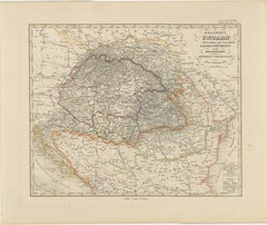
1858 Map of Hungary, Galicia & the Balkans – Justus Perthes Engraving
Located in Langweer, NL
1858 Map of Hungary, Galicia & the Balkans – Justus Perthes Engraving
Antique map titled "Galizien, Ungarn, Slavonien und Croatien, Siebenbürgen und Dalmatien," published by Justus ...
Category
Antique Mid-19th Century German Maps
Materials
Paper
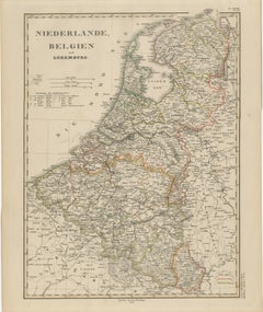
Benelux Antique Map – Netherlands, Belgium & Luxembourg by Perthes, 1857
Located in Langweer, NL
1857 Map of Netherlands, Belgium & Luxembourg – Justus Perthes Engraving
Antique map titled "Niederlande, Belgien und Luxemburg," published by Justus Perthes in Gotha in 1857. This...
Category
Antique Mid-19th Century German Maps
Materials
Paper
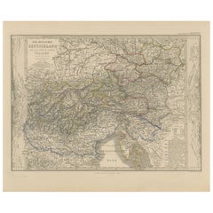
Antique Habsburg Empire Map – Southeastern Germany to Venice, 1858
Located in Langweer, NL
Map of Southeastern Germany & Northern Italy – Antique Engraving, 1858
Antique map titled "Süd-Östliches Deutschland nebst einem Theil des nördlichen Italien," published by Justus P...
Category
Antique Mid-19th Century German Maps
Materials
Paper
1858 Map of Southwestern Germany & Switzerland – Bavaria, Württemberg, Baden
Located in Langweer, NL
Antique Map of Southwestern Germany & Switzerland – Bavaria, Württemberg, Baden, 1858
Detailed antique map titled "Südwestliches Deutschland mit Bayern, Würtemberg, Baden, Hohenzoll...
Category
Antique Mid-19th Century German Maps
Materials
Paper
Antique Map of Eastern Germany, Bohemia, Moravia & Silesia – 1858
Located in Langweer, NL
Antique Map of Eastern Germany, Bohemia, Moravia & Silesia – 1858
Detailed 19th-century engraved map titled "Östliches Deutschland mit Böhmen, Mähren und Schlesien" (Eastern German...
Category
Antique Mid-19th Century German Maps
Materials
Paper
Antique Map of Prussia & Posen – Insets of Berlin, Königsberg & Danzig, 1858
Located in Langweer, NL
Antique Map of Prussia & Posen – With Insets of Berlin, Königsberg & Danzig, 1858
Highly detailed and information-rich map titled "Die Preuss: Provinzen Preussen und Posen", publish...
Category
Antique Mid-19th Century German Maps
Materials
Paper
Antique Map of Northeastern Germany – Saxon & Prussian States, 1858
Located in Langweer, NL
Antique Map of Northeastern Germany – Saxon & Prussian States, 1858
Detailed and finely engraved map titled "Nord-Östliches Deutschland enthaltend die Sächsischen Länder und die Pre...
Category
Antique Mid-19th Century German Maps
Materials
Paper
Antique Map of Prussia, Hanover, Netherlands & Belgium – 1858
Located in Langweer, NL
Antique Map of Northwestern Germany, Netherlands & Belgium – 1858
Detailed 19th-century engraved map titled "Nordwestliches Deutschland, Kgr. der Niederlande, Kgr. Belgien" (Northwe...
Category
Antique Mid-19th Century German Maps
Materials
Paper
Antique Map of Germany & Railways – Transport Network Overview, 1857
Located in Langweer, NL
Antique Map of Germany & Railways – Transport Network Overview, 1857
Striking 19th-century map titled "Deutschland und angränzende Länder zur Übersicht der Eisenbahnen und Hauptstra...
Category
Antique Mid-19th Century German Maps
Materials
Paper
18th Century Map of French Pyrenees Region of France
Located in Haddonfield, NJ
An antique map titled "Principatus Benearnia, La Principaute De Bearn" created by the renowned Dutch cartographer Willem Janszoon Blaeu.
It depicts the Principality of Bearn, a histo...
Category
Antique 1880s Danish Baroque Maps
Materials
Wood, Paper
1856 Engraved Map of Switzerland with Cantonal Borders by Stülpnagel
Located in Langweer, NL
1856 Engraved Map of Switzerland with Cantonal Borders by Stülpnagel
This finely detailed antique map of Switzerland, titled "Die Schweiz," was published in 1856 by the renowned Ger...
Category
Antique Mid-19th Century German Maps
Materials
Paper
England & Wales in 1857 – Decorative Antique Map with Rail Routes
Located in Langweer, NL
Antique Map of England & Wales – Hand-Colored Engraving by Stülpnagel, 1857
Fine 19th-century map titled "England und Wales", drawn and engraved by Friedrich von Stülpnagel and publ...
Category
Antique Mid-19th Century German Maps
Materials
Paper
1858 Map of South France with Corsica – Marseille to Italian Border
Located in Langweer, NL
Antique Map of Southeastern France & Corsica – Stülpnagel Engraving, 1858
Highly detailed 19th-century map titled "Südöstliches Frankreich"(Southeastern France), engraved by Friedri...
Category
Antique Mid-19th Century German Maps
Materials
Paper
Antique Map of Southwestern France – With Insets of Paris & Lyon, 1858
Located in Langweer, NL
Antique Map of Southwestern France – With Insets of Paris & Lyon, 1858
Detailed copperplate map of "Südwestliches Frankreich" (Southwestern France), created by Friedrich von Stülpna...
Category
Antique Mid-19th Century German Maps
Materials
Paper
Antique Map of Northeastern France – Alsace, Lorraine & Champagne, 1858
Located in Langweer, NL
Antique Map of Northeastern France – Alsace, Lorraine & Champagne, 1858
Detailed 19th-century engraved map titled "Nordöstliches Frankreich", drawn by Friedrich von Stülpnagel and p...
Category
Antique Mid-19th Century German Maps
Materials
Paper
Hand-Colored Map of Northwest France – Brittany to Loire, 1858
Located in Langweer, NL
Antique Map of Northwestern France – Stülpnagel Engraving, Justus Perthes 1858
Impressively detailed mid-19th-century map of northwestern France titled "Frankreich in IV Blättern – ...
Category
Antique Mid-19th Century German Maps
Materials
Paper
Antique Map of Spain and Portugal – Hand-Colored Engraving by Stülpnagel, 1857
Located in Langweer, NL
Antique Map of Spain and Portugal – Hand-Colored Engraving by Stülpnagel, 1857
Fine 19th-century engraved map of the Iberian Peninsula titled "Spanien und Portugal", designed by F. ...
Category
Antique Mid-19th Century German Maps
Materials
Paper
Historic 1858 Map of South America – Pre-Border Consolidation
Located in Langweer, NL
Antique Map of South America – Stülpnagel Engraving Published by Perthes, 1858
Detailed 19th-century engraved map titled "Süd-America", designed and drawn by F. von Stülpnagel and p...
Category
Antique Mid-19th Century German Maps
Materials
Paper
Antique Map of Germany, Netherlands, Belgium & Switzerland – Stülpnagel, 1857
Located in Langweer, NL
Antique Map of Germany, Netherlands, Belgium & Switzerland – Stülpnagel, 1857
Fine mid-19th century map of Central Europe titled "Deutschland, Niederlande, Belgien, Schweiz", drawn ...
Category
Antique Mid-19th Century German Maps
Materials
Paper
1855 Relief Map of Germany and the Alps Showing Rivers and Terrain
Located in Langweer, NL
1855 Engraved Map of Switzerland with Cantonal Borders by Stülpnagel
This finely detailed antique map of Switzerland, titled "Die Schweiz," was published in 1855 by the renowned Ger...
Category
Antique Mid-19th Century German Maps
Materials
Paper
1856 France and Switzerland Map with Mountain Profiles
Located in Langweer, NL
1856 Map of France and Switzerland with Paris Inset by Stülpnagel
This finely detailed antique map of France and Switzerland was published in 1856 by the esteemed German cartographe...
Category
Antique Mid-19th Century German Maps
Materials
Paper
Antique Map of Britain & Ireland with North Sea Detail – 1856 Stülpnagel
Located in Langweer, NL
Antique Map of the British Isles & North Sea by Stülpnagel, 1856
This beautifully detailed 1856 map titled *"Die Britischen Inseln und die Nord-See"* was drawn by F. von Stülpnagel ...
Category
Antique Mid-19th Century German Maps
Materials
Paper
Antique Map of Australia, New Zealand & Polynesia – Stülpnagel, 1857
Located in Langweer, NL
Antique Map of Australia, New Zealand & Polynesia – Stülpnagel, 1857
Description:
This finely engraved and delicately hand-colored map titled "Australien und Polynesien in Mercator'...
Category
Antique Mid-19th Century German Maps
Materials
Paper
Antique Map of the Caribbean & Central America – West Indies, 1857
Located in Langweer, NL
Antique Map of the Caribbean & Central America – West Indies, 1857
This finely engraved and hand-colored map titled "West-Indien und Centro-America" was published in 1857 by Justus ...
Category
Antique Mid-19th Century German Maps
Materials
Paper
1917 "New Hudson River Map" by Wallace Bruce, Later Edition, Folding Map
Located in Colorado Springs, CO
Presented is a 1917 printing of “New Hudson Map” by Wallace Bruce. The map was published by Bryant Union Publishing Co., in New York City. The map is a later edition, issued in a distinct strip-chart format that is over 100 inches long. The map includes amazing detail, compiled mostly from U.S. Coast Survey data. It is drawn on a scale of 1.5 miles per inch, allowing ample space for it to show historical landmarks, landings, islands, list prominent residents, and more. The verso is filled with related text and illustrations about the Hudson River valley. The map folds into cream paper wrappers, titled "Hudson River Map...
Category
Vintage 1910s American Beaux Arts Maps
Materials
Paper
1857 Engraved Map of Russia, Finland & Scandinavia – Historic Print
Located in Langweer, NL
Antique Map of European Russia Including Scandinavia – Stieler Atlas 1857
This antique map titled "Europäisches Russland nebst Schweden und Norwegen" (European Russia together with ...
Category
Antique Mid-19th Century German Maps
Materials
Paper
Antique Map of West and Central Africa – Stieler Atlas, Justus Perthes 1857
Located in Langweer, NL
Antique Map of West and Central Africa – Stieler Atlas, Justus Perthes 1857
This finely engraved map titled "Mittel- und Nord-Africa. Westl. Theil." was published in 1857 by Justus ...
Category
Antique Mid-19th Century German Maps
Materials
Paper
Colorfull Antique Map of Africa with Algeria Inset – Stieler Atlas 1858
Located in Langweer, NL
Antique Map of Africa with Algeria Inset – Stieler Atlas 1858
This antique map of Africa, engraved by F. von Stülpnagel and published by Justus Perthes in 1858, is a finely detailed...
Category
Antique Mid-19th Century German Maps
Materials
Paper
Antique Map of Denmark 1858 – Includes Iceland & Copenhagen Plan
Located in Langweer, NL
Antique Map of Denmark 1858 – Includes Iceland & Copenhagen Plan
This finely detailed antique map of Denmark was published in 1858 by Justus Perthes in Gotha, as part of the renowne...
Category
Antique Mid-19th Century German Maps
Materials
Paper
Antique Map of Scandinavia 1857 – Sweden & Norway in Detail
Located in Langweer, NL
Sweden and Norway Map – Stieler Atlas Engraving, 1858
This fine antique map titled Schweden und Norwegen (Sweden and Norway) was published in 1858 by Justus Perthes of Gotha and dra...
Category
Antique Mid-19th Century German Maps
Materials
Paper
1987 "The Ian Fleming Thriller Map" by Aaron Silverman and Molly Maguire
Located in Colorado Springs, CO
Presented is an original “Ian Fleming Thriller Map,” which features the travels of MI6 Agent 007, James Bond, from author Ian Fleming’s series of fourteen spy novels. The pictorial m...
Category
Vintage 1980s American Modern Maps
Materials
Paper
1927 "Texas" Map by C.S. Hammond
Located in Colorado Springs, CO
Presented is a very detailed map of Texas, printed in 1927. The map was featured in The Literary Digest Atlas of the World and Gazetteer, published by Funk & Wagnalls. The map is sma...
Category
Vintage 1920s American Maps
Materials
Paper
Large Antique Map of Texas with Panhandle & Bay Inset Maps, Colton, 1873
Located in Langweer, NL
Large Antique Map of Texas with Panhandle & Bay Inset Maps, Colton, 1873
This richly detailed and visually striking antique map of Texas was pub...
Category
Antique 1870s Maps
Materials
Paper
Colorful 1915 Road Map of Oregon with Portland Inset & Index – Geographical Pub.
Located in Langweer, NL
Colorful 1915 Road Map of Oregon with Portland Inset & Index – Geographical Pub.
Description:
This vibrant and information-rich folding map of Oregon, titled "Premier Series Oregon"...
Category
Vintage 1910s Maps
Materials
Paper
Antique Map of Alexander the Great's Empire & Campaigns, de Vaugondy, 1753
Located in Langweer, NL
Antique Map of Alexander the Great's Empire & Campaigns, de Vaugondy, 1753
This rare and elegantly engraved map, titled "Antiquor Imperiorum Tabula, in qua Prae Caeteris, Macedonicu...
Category
Antique Mid-18th Century European Maps
Materials
Paper
Hand-Colored Map of the Holy Land Divided Among the Twelve Tribes, c.1720
Located in Langweer, NL
Hand-Colored Map of the Holy Land Divided Among the Twelve Tribes, c.1720
This striking antique map, titled "Iudaea seu Palaestina ob Sacratissima Redemtoris Vestigia Hodie Dicta Te...
Category
Antique Early 18th Century European Maps
Materials
Paper
Topographic Map of Mount Sinai Summit – Antique Engraving by Pococke, 1776
Located in Langweer, NL
Topographic Map of Mount Sinai Summit – Antique Engraving by Pococke, 1776
This antique engraving offers a rare and detailed view of the summit plateau of Mount Sinai, titled "Grond...
Category
Antique Late 18th Century Dutch Maps
Materials
Paper
Mount Sinai & St. Catherine's – Antique Map of the Sinai Monasteries, 1776
Located in Langweer, NL
Mount Sinai & St. Catherine's – Antique Map of the Sinai Monasteries, 1776
Description:
This finely engraved antique map depicts the mountainous region of the Sinai Peninsula, focus...
Category
Antique Late 18th Century Dutch Maps
Materials
Paper
Cairo, Babylon & Heliopolis – Antique Map of Ancient Memphis Region, 1776
Located in Langweer, NL
Cairo, Babylon & Heliopolis – Antique Map of Ancient Memphis Region, 1776
This antique map is an 18th-century Dutch engraving showing the region around ancient Memphis, Egypt, inclu...
Category
Antique Late 18th Century Dutch Maps
Materials
Paper
Bordeaux City View – Braun & Hogenberg Original Woodcut, ca. 1575
Located in Langweer, NL
Bordeaux City View – Braun & Hogenberg Original Woodcut, ca. 1575
Description:
This detailed and highly decorative bird’s-eye view of Bordeaux, titled Bovrdeavx, originates from the...
Category
Antique 16th Century German Maps
Materials
Paper
Historic 1857 Map of North-East Africa & Arabia – Fine Engraving
Located in Langweer, NL
North-East Africa and Arabia Map 1857
This detailed antique print shows “Mittel- und Nord-Afrika (östl. Theil) und Arabien” meaning “Central and North Africa (eastern part) and Arab...
Category
Antique Mid-19th Century German Maps
Materials
Paper
United States, Canada & Mexico – 1857 North America Map
Located in Langweer, NL
North America Map – United States, Canada, Mexico 1857
This impressive antique print shows “Nord-America” meaning “North America,” published in 1857 by Justus Perthes in Gotha as pa...
Category
Antique Mid-19th Century German Maps
Materials
Paper
Southern Africa & Madagascar Antique Map – Beautiful 1857 Edition
Located in Langweer, NL
Southern Africa and Madagascar Map 1857
This detailed antique print shows “Süd-Africa mit Madagascar” meaning “Southern Africa with Madagascar,” published in 1857 by Justus Perthes ...
Category
Antique Mid-19th Century German Maps
Materials
Paper
Iran and Turan Map – Persia, Afghanistan, Baluchistan, Turkestan 1858
Located in Langweer, NL
Iran and Turan Map – Persia, Afghanistan, Baluchistan, Turkestan 1858
This impressive antique print shows “Iran und Turan (Persien, Afghanistan, Beludschistan, Turkestan),” meaning ...
Category
Antique Mid-19th Century German Maps
Materials
Paper
Australia, New Zealand, and Neighbouring Islands Map 1858
Located in Langweer, NL
Australia and Neighbouring Islands Map 1858
This attractive antique print shows “Festland von Australien und benachbarte Inseln” meaning “Mainland Australia and neighbouring islands...
Category
Antique Mid-19th Century German Maps
Materials
Paper
Mediterranean, Black Sea & Ottoman Empire Map 1853
Located in Langweer, NL
Mediterranean, Black Sea & Ottoman Empire Map 1853
This impressive antique print shows the Mediterranean and Black Sea regions with a focus on the Ottoman Empire, titled “Das Mittel...
Category
Antique Mid-19th Century German Maps
Materials
Paper
Ireland Map – Provincial and County Divisions 1851
Located in Langweer, NL
Ireland Map – Provincial and County Divisions 1851
This fine antique print shows Ireland titled simply “Ireland,” published in 1851 by Justus Perthes in Gotha as part of Adolf Stiel...
Category
Antique Mid-19th Century German Maps
Materials
Paper
Scotland Map – Highlands, Islands, and Northern England 1858
Located in Langweer, NL
Scotland Map – Highlands, Islands, and Northern England 1858
This attractive antique print shows Scotland and its surroundings titled “Schotland mit der ...
Category
Antique Mid-19th Century German Maps
Materials
Paper
Antique Map of California as an Island "The 5 Californias" by Robert de Vaugondy
Located in San Diego, CA
A very nice and rare antique map entitled "Carte de la Californie Suivant" (The 5 Californias), by Didier Robert de Vaugondy of Paris, circa 1772. The map itself measures 15.5" x 13...
Category
Antique Mid-19th Century American Maps
Materials
Paper
Arctic Polar Map – North Pole and Russian Empire Regions 1857
Located in Langweer, NL
Arctic Polar Map – North Pole and Russian Empire Regions 1857
This remarkable antique print shows the Arctic titled “Polar-Karte enthaltend die Länder und Meere am Nord-Pol” meaning...
Category
Antique Mid-19th Century German Maps
Materials
Paper
Western & Eastern Hemisphere Maps – World Double Hemisphere Engravings 1857
Located in Langweer, NL
Western & Eastern Hemisphere Maps – World Double Hemisphere Engravings 1857
These beautiful antique prints show two complementary hemispheric maps titled “Westliche Halbkugel” (West...
Category
Antique Mid-19th Century German Maps
Materials
Paper
Northern Hemisphere Star Map – Constellations & Astronomical Chart, c.1858
Located in Langweer, NL
Northern Hemisphere Star Map – Constellations & Astronomical Chart c.1858
This attractive antique print shows the northern starry sky titled “Der nördliche gestirnte Himmel”, meanin...
Category
Antique Mid-19th Century German Maps
Materials
Paper
European Turkey and Greece Map – Balkans and Ionian Islands 1857
Located in Langweer, NL
European Turkey and Greece Map – Balkans and Ionian Islands 1857
This detailed antique print shows “Die Europäische Türkei, Griechenland und die Ionische...
Category
Antique Mid-19th Century German Maps
Materials
Paper
Greece Map – Kingdom of Greece and Ionian Islands 1847
Located in Langweer, NL
Greece Map – Kingdom of Greece and Ionian Islands 1847
This elegant antique print shows the Kingdom of Greece titled “Königreich Griechenland und die Ionischen Inseln” meaning “King...
Category
Antique Mid-19th Century German Maps
Materials
Paper
Europe Map – Political Divisions and Borders, Published in 1858
Located in Langweer, NL
Europe Map – Political Divisions and Borders 1858
This fine antique print shows Europe with its political divisions titled “Europa zur Übersicht der politischen Verhältnisse” meanin...
Category
Antique Mid-19th Century German Maps
Materials
Paper
Europe Map – Rivers, Watersheds and Elevation, Published in 1857
Located in Langweer, NL
Europe Map – Rivers, Watersheds and Elevation 1857
This beautiful antique print shows Europe with its river systems and watershed regions, titled “Europa zur Übersicht der Flussgebi...
Category
Antique Mid-19th Century German Maps
Materials
Paper
World Map – Mercator Projection with Global Sea Routes, Published in 1857
Located in Langweer, NL
World Map – Mercator Projection with Global Sea Routes 1857
This attractive antique print shows a world map titled “Planiglob in Mercators Projection zur Übersicht der Erdfläche und...
Category
Antique Mid-19th Century German Maps
Materials
Paper


