Antique Map Of Malta

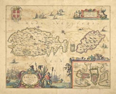
Mare Mediterra - Neum (Map of Malta) - Etching by Johannes Janssonius - 1650s
By Johannes Janssonius
Located in Roma, IT
Mare Mediterra - Neum is an ancient map realized in 1650 by Johannes Janssonius (1588-1664). Good
Category

1650s Modern Antique Map Of Malta

Materials

Etching

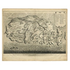
Rare Antique Bird's-eye View Map of The Island of Malta, 1729
Located in Langweer, NL
Aenlandde.' This is an uncommon bird's-eye view map of the island of Malta. The map presents a
Category

18th Century Antique Map Of Malta

Materials

Paper

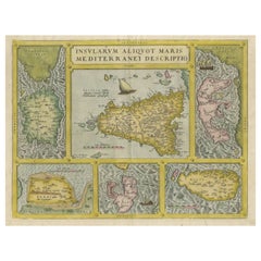
Coloured Antique Map of Sicily, Sardinia, Corfu, Elba, Malta and Zerbi (Jerba)
By Abraham Ortelius
Located in Langweer, NL
Ortelius' map combining, on one page, maps of the islands of Sicily, Sardinia, Corfu, Elba, Malta and Zerbi
Category

16th Century Antique Map Of Malta

Materials

Paper

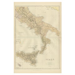
Original Antique Map of the South Part of Italy with an Inset of Malta, 1882
Located in Langweer, NL
cartographic expertise. Adding to its allure, a small inset featuring the Maltese Islands enhances this map
Category

1880s Antique Map Of Malta

Materials

Paper

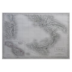
Large Original Antique Map of South Italy and Malta by Sidney Hall, 1847
Located in St Annes, Lancashire
Great map of South Italy and Malta Drawn by Sidney Hall Steel engraving by G.Aikman
Category

1840s Scottish Antique Map Of Malta

Materials

Paper

Antique Map of Italy, Showing Corsica, Sardinia, Croatia, Malta and More, C.1740
Located in Langweer, NL
bit of Provence, Malta and the northern coast of Africa. The map is centered on a simple compass rose
Category

18th Century Antique Map Of Malta

Materials

Paper

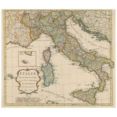
Detailed Antique Map of Italy and surrounding Islands
Located in Langweer, NL
Antique map titled 'Italie volgens de allernieuwste Uitgave van den Heere d'Anville'. Very detailed
Category

Mid-18th Century Antique Map Of Malta

Materials

Paper

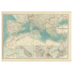
Antique Map of the Basin of the Mediterranean by Johnston '1909'
Located in Langweer, NL
Mediterranean. With inset maps of the Strait of Gibraltar, Morocco, Maltese Islands, Valetta, Venice and
Category

Early 20th Century Antique Map Of Malta

Materials

Paper

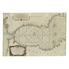
Large Decorative Antique Map of the Mediterranean, ca.1770
Located in Langweer, NL
Antique map titled 'Carte de la Mer Mediterranee en Douze Feuilles'. First map out of twelve
Category

1770s Antique Map Of Malta

Materials

Paper

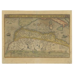
Antique Map of North Africa by Ortelius, c.1580
Located in Langweer, NL
Antique map titled 'Barbariae et Biledulgerid Nova Descriptio'. Original antique map of North
Category

16th Century Antique Map Of Malta

Materials

Paper

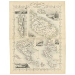
Old Map of British Mediterranean Territories with Images of Historic Sites, 1851
Located in Langweer, NL
John Tallis & Company was a British map-making firm that gained widespread acclaim in the 19th
Category

1850s Antique Map Of Malta

Materials

Paper

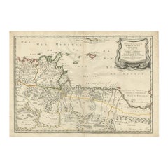
Rare Antique Map of 'Barbarie' or Northern Africa, 1655
Located in Langweer, NL
Tripoli et Pays Circomvoisins'. This map depicts North Africa with Malta and originates from 'Cartes
Category

17th Century Antique Map Of Malta

Materials

Paper

Antique Map of Islands in the Mediterranean by Bowen, 'c.1760'
Located in Langweer, NL
maps on one sheet including 'Islands of Malta Goze & Cuming, An Accurate Chart of Cape de Verde Islands
Category

Mid-18th Century Antique Map Of Malta

Materials

Paper

Antique Map of Western and Eastern Barbary in Africa, c.1744
Located in Langweer, NL
Antique map titled 'A New & Accurate Map of the Western Parts of Barbary' and 'A New & Accurate Map
Category

18th Century Antique Map Of Malta

Materials

Paper

Antique Map of 'African' Islands in the Mediterranean Sea and The Atlantic, 1747
Located in Langweer, NL
(..)'. Detailed set of eight maps, including a large and detailed Malta, the Bay of Agoa de Saldanha, Tenerife
Category

18th Century Antique Map Of Malta

Materials

Paper

Antique Map of Eastern Mediterranean and Asia Minor by a Benedictine, c.1725
Located in Langweer, NL
gospel. This map shows the east Mediterranean countries and Asia Minor; Turkey, Greece, Cyprus, Malta
Category

18th Century Antique Map Of Malta

Materials

Paper

Dartmouth, England: A Hand-Colored 17th Century Sea Chart by Captain Collins
By Captain Greenvile Collins
Located in Alamo, CA
most technologically advanced sailing yacht in the world, the Maltese Falcon. I have 16 of his sea
Category

Late 17th Century English Antique Map Of Malta

Materials

Paper

Edinburgh, Scotland Coast: A 17th Century Hand-Colored Sea Chart by Collins
By Captain Greenvile Collins
Located in Alamo, CA
Maltese Falcon.
Category

Late 17th Century English Antique Map Of Malta

Materials

Paper

Plymouth, England: A Hand-Colored 17th Century Sea Chart by Captain Collins
By Captain Greenvile Collins
Located in Alamo, CA
most technologically advanced sailing yacht in the world, the Maltese Falcon. I have 16 of his sea
Category

Late 17th Century English Antique Map Of Malta

Materials

Paper

Flanders, Holland & Norfolk: Hand-Colored 17th Century Sea Chart by Collins
By Captain Greenvile Collins
Located in Alamo, CA
most technologically advanced sailing yacht in the world, the Maltese Falcon. I have 16 of his sea
Category

Late 17th Century English Antique Map Of Malta

Materials

Paper

Siege of Szigetvár, 1566: Lafreri's Rare Handcolored Engraving Published in 1585
Located in Langweer, NL
references for this rare map: Bifolco/Ronca (2018), plate 551; Ganado, Malta NL Coll. pp. 201/42; see Meurer
Category

16th Century Antique Map Of Malta

Materials

Paper

People Also Browsed

Ancient Malta Cross Marble Various Colors 19th Century Carrara Marble
By Europa Antiques
Located in Madrid, ES
Ancient malta cross marble various colors 19th Century Carrara marble. Measures: height 30cm width 30cm Weight 8Kg Very good condition The price is for which one The price of...
Category

19th Century Italian Baroque Antique Map Of Malta

Materials

Terracotta

Imperial Splendor: Antique Map of the Ottoman Empire by Blaeu, circa 1640
Located in Langweer, NL
The antique map titled 'Turcicum Imperium' is an original old map of the Ottoman Empire, historically and colloquially known as the Turkish Empire. Here are the key features and deta...
Category

Mid-17th Century Antique Map Of Malta

Materials

Paper

Five Greek Poets and a Philosopher
By Cy Twombly
Located in London, GB
Complete set of seven lithographs with embossment, 1978, on Richard de Bas mould-made paper, initialed and numbered in pencil from the edition of 40 verso, printed by Matthieu Studio...
Category

1970s Abstract Antique Map Of Malta

Materials

Lithograph

Hand Colored Bird Engravings, circa 1890s(6individual pieces available)
Located in Douglas Manor, NY
#5- 3023 Hand Colored Bird Engraving . Original engraving matted in a celidone green, glass and white wood frame. 6 available choice by photo below Hand colored Priced individually
Category

Late 19th Century Antique Map Of Malta

Materials

Glass, Wood, Paper

Audubon's "Little Owl, "1834 Havell Edition in Gilt 19th Century Frame
By John James Audubon
Located in Brooklyn, NY
Created as part of John James Audubon's "The Birds of North America," the single greatest work on ornithology ever produced, this fabulous print of "The Little Owl, Strix Acadica" is...
Category

1830s English American Classical Antique Map Of Malta

Materials

Gesso, Giltwood, Paper

Serene Vista of Messina and its Strait: An Engraved Jewel, circa 1800
Located in Langweer, NL
Title: "Vue de Messine & de Son Détroit" This evocative print titled "Vue de Messine & de Son Détroit" presents a picturesque view of Messina and its strait, a vital waterway separa...
Category

Early 19th Century Antique Map Of Malta

Materials

Paper

Prideaux John Selby, England, Set of 4 Hand Colored Restrike Prints of Waterfowl
By John Selby
Located in Morristown, NJ
Selby's Illustrations of British Ornithology (London: 1841-1846). Likely a later restrike printing (20th c.,) hand-colored prints, embossed with plate marks, includes: "Eider Duck, M...
Category

Early 20th Century English George IV Antique Map Of Malta

Materials

Glass, Wood, Paint, Paper

ANCIENT ROMAN MARBLE RELIEF OF A MALE TORSO, ROME, 2ND/3RD CENTURY AD
Located in Milan, IT
This muscular male torso probably comes from a larger relief, which would have decorated the front part of a sarcophagus. It likely represents the figure of a satyr, standing, with t...
Category

15th Century and Earlier Antique Map Of Malta

Materials

Marble

Antique George II White Statuary and Sicilian Jasper Marble Fireplace Mantle
Located in London, GB
A mid-18th century, George II, white statuary and Sicilian Jasper marble chimneypiece by Thomas Carter I, (1702-1756.) The jambs in the form of full rounded Jasper columns, the friez...
Category

18th Century George II Antique Map Of Malta

Materials

Marble, Statuary Marble

Paysage du Berri - Etching and Aquatint After Théodore Rousseau - Late 1800
By Lucien Gautier
Located in Roma, IT
Original print by Lucien Gautier after the original painting by T. Rousseau. Etching and aquatint. Perfect conditions. Collect the magician landscapes by the French Barbizon school ...
Category

Late 19th Century Barbizon School Antique Map Of Malta

Materials

Etching, Aquatint

18th Century Maltese Four Drawer Serpentine Front Commode
Located in Los Angeles, CA
18th c. Italian 4 Drawer Serpentine Front Commode. The Commode is made of Burlwood with Fruitwood Inlays.
Category

18th Century and Earlier Maltese Antique Map Of Malta

Materials

Burl, Fruitwood

Trireme Greek Model Ship, Museum Quality
Located in Bafra, 55
This historical ancient Greek trireme ship model is made of high-quality wood and handcrafted with great care and effort. At 26.3 inches in length, 5.1 inches in width, and 11.8 inch...
Category

15th Century and Earlier Turkish Arts and Crafts Antique Map Of Malta

Materials

Wood

Trireme Greek Model Ship, Museum Quality
Free Shipping
H 12 in W 5 in D 26 in
Greek head
Located in EL CAMPELLO, ES
ITEM: Head MATERIAL: Marble CULTURE: Greek, Hellenistic period PERIOD: 3rd – 1st Century B.C DIMENSIONS: 55 mm x 38 mm x 44 mm CONDITION: Good condition. Includes stand PROVENANCE: E...
Category

15th Century and Earlier Greek Classical Greek Antique Map Of Malta

Materials

Marble

Greek head
Greek head
H 2.17 in W 1.5 in D 1.74 in
Greek head
Located in EL CAMPELLO, ES
ITEM: Head MATERIAL: Marble CULTURE: Greek, Hellenistic period PERIOD: 3rd – 1st Century B.C DIMENSIONS: 55 mm x 47 mm x 47 mm CONDITION: Good condition. Includes stand PROVENANCE: E...
Category

15th Century and Earlier Greek Classical Greek Antique Map Of Malta

Materials

Marble

Greek head
Greek head
H 2.17 in W 1.86 in D 1.86 in
Classic Bronze Sculpture by Luigi de Luca - Maiden of Ancient Greece
Located in Madrid, ES
This elegant bronze sculpture captures the beauty and grace of ancient Greece, depicting a maiden in all her splendor. Created by the renowned Italian sculptor Luigi de Luca (1857-19...
Category

Late 19th Century Antique Map Of Malta

Materials

Bronze

Mediterranean and Adriatic Seas: Original 18th Century Hand-colored Map by Bowen
Located in Alamo, CA
This is an original 18th century hand-colored map entitled "An Accurate Chart of The Mediterranean and Adriatic Sea's; with the Archipelago & Part of the Black Sea. Exhibiting all th...
Category

Mid-18th Century Old Masters Antique Map Of Malta

Materials

Engraving

Recent Sales

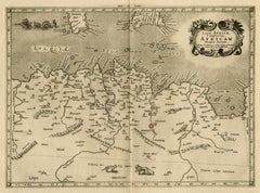
Ptolemaic map of ancient Tunesia, Malta, Lybia by Mercator - Engraving - 17th c.
By Gerard Mercator
Located in Zeeland, Noord-Brabant
Ptolemaic map covering ancient Tunesia with Malta and parts of Lybia. Embellished with sea monsters, wild
Category

1690s Old Masters Antique Map Of Malta

Materials

Engraving

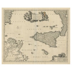
Decorative Map of Sicily, Malta and a Bit of Naples and Sardinia 'Italy', c.1680
Located in Langweer, NL
Antique map titled 'Regnum Siciliae cum circumjacentribus Regnis et Insulis'. Decorative map of
Category

1680s Antique Map Of Malta

Materials

Paper

Interesting Detailed Antique Map of Region Around The Mediterranean Sea, 1882
Located in Langweer, NL
Sea. Included are inset maps of Marseille, Genova, Gibraltar, Maltese Islands, Trieste, Valetta
Category

1880s Antique Map Of Malta

Materials

Paper

Bellin 18th Century Hand Colored Map of St. Christophe (St. Kitts)
By Jacques-Nicolas Bellin
Located in Alamo, CA
Jacques Bellin's hand colored copper plate map of the Caribbean island of Saint Kitts entitled
Category

Mid-18th Century French Antique Map Of Malta

Materials

Paper

Bellin 18th Century Hand Colored Map of "L'isle de Sainte Lucie" 'St. Lucia'
By Jacques-Nicolas Bellin
Located in Alamo, CA
Jacques Bellin's map of the Caribbean island of Saint Lucia entitled "Carte de L'isle de Sainte
Category

Mid-18th Century French Antique Map Of Malta

Materials

Paper

Antique Print of a Knight of the Knights Hospitaller in Cape, 1845
Located in Langweer, NL
Hospitaller in cape, Order of Malta, Order of Knights of the Hospital of Saint John of Jerusalem. This print
Category

19th Century Antique Map Of Malta

Materials

Paper

Antique Print of a Grand Cross of the Knights Hospitaller by Tiron, 1845
Located in Langweer, NL
Knights Hospitaller, Order of Malta, Order of Knights of the Hospital of Saint John of Jerusalem. This
Category

19th Century Antique Map Of Malta

Materials

Paper

THE BATHS OF CARACALLA, ROME
Located in London, GB
accompany them on a four-month voyage to the Kingdom of the Two Sicilies and Malta where he created close to
Category

Late 18th Century Antique Map Of Malta

Materials

Watercolor

Antique Map of Italy, South Part, by W. G. Blackie, 1859
Located in Langweer, NL
Malta and Island west of Sicily. This map originates from ‘The Imperial Atlas of Modern Geography
Category

Mid-19th Century Antique Map Of Malta

Materials

Paper

Large Antique Map of Italy with Corsica, Sardinia, Sicily & Malta, 1854
Located in Langweer, NL
Antique map titled 'The States of Italy, with their islands, Corsica, Sardinia, Sicily & Malta
Category

19th Century Antique Map Of Malta

Materials

Paper

Antique Map of Italy, with Sardinia and Corsica
Located in Langweer, NL
Antique map titled 'Italie par A. Vuillemin'. Attractive map of Italy, covers the pre-Garibaldi
Category

Mid-19th Century Antique Map Of Malta

Materials

Paper

Antique Map of North Africa by Ortelius 'circa 1580'
Located in Langweer, NL
nearby Mediterranean including Sicily and Malta.This map is oriented northward and shows the northern
Category

16th Century Antique Map Of Malta

Materials

Paper

Antique Wall Map of the Empire of Charlemagne by Bertius 'circa 1620'
Located in Langweer, NL
Antique map titled 'Imperii Caroli Magni et vicinarum regionum descriptio'. Rare, large four-sheet
Category

Early 17th Century Antique Map Of Malta

Materials

Paper

Antique Map of the Mediterranean by A.K. Johnston, 1865
Located in Langweer, NL
, Maltese Islands, Valetta, Venice and Alexandria. This map originates from the ‘Royal Atlas of Modern
Category

Mid-19th Century Antique Map Of Malta

Materials

Paper

Antique Map of British Possessions in the Mediterranean by J. Tallis, circa 1851
Located in Langweer, NL
A highly decorative and detailed mid-19th century map of the British possessions in the
Category

Mid-19th Century Antique Map Of Malta

Hand-Colored 18th Century Sea Chart of Cork, Ireland by Reverend J. Lindsay
By Reverend J. Lindsay
Located in Alamo, CA
Maltese Falcon.
Category

Mid-18th Century English Antique Map Of Malta

Materials

Paper

Antique Map of the Island of Malta by A. de Putter, 1729
Located in Langweer, NL
Aenlandde.' - This is an uncommon bird's-eye view map of the island of Malta. The map presents a
Category

Early 18th Century Antique Map Of Malta

Materials

Paper

Malta, Antique Map from "Civitates Orbis Terrarum" - 1572-1617
By Franz Hogenberg
Located in Roma, IT
Braun G., Hogenberg F., Malta, from Civitates Orbis Terrarum, Cologne, T. Graminaeus 1572-1617
Category

16th Century Antique Map Of Malta

Materials

Etching

Bellin 18th Century Hand Colored Map of St. Christophe (St. Kitts)
Located in Alamo, CA
Jacques Bellin's hand colored copper plate map of the Caribbean island of Saint Kitts entitled
Category

Late 18th Century Other Art Style Antique Map Of Malta

Materials

Engraving

Bellin 18th Century Hand Colored Map of "L'isle de Sainte Lucie" (St. Lucia)
Located in Alamo, CA
Jacques Bellin's map of the Caribbean island of Saint Lucia entitled "Carte de L'isle de Sainte
Category

Mid-18th Century Other Art Style Antique Map Of Malta

Materials

Engraving

Get Updated with New Arrivals
Save "Antique Map Of Malta", and we’ll notify you when there are new listings in this category.

Antique Map Of Malta For Sale on 1stDibs

Choose from an assortment of styles, material and more with respect to the antique map of malta you’re looking for at 1stDibs. Each antique map of malta for sale was constructed with extraordinary care, often using paper, fabric and wool. Whether you’re looking for an older or newer antique map of malta, there are earlier versions available from the 18th Century and newer variations made as recently as the 20th Century. Each antique map of malta bearing Victorian hallmarks is very popular. Captain Greenvile Collins and Abraham Ortelius each produced at least one beautiful antique map of malta that is worth considering.

Finding the Right collectibles-curiosities for You

Antique and vintage collectibles and curiosities can bring whimsy and wonder to any interior. 

Decorating with old scientific instruments, historical memorabilia and vintage musical instruments, as well as other authentic collectibles and curiosities that can be found on 1stDibs, presents an opportunity to create a unique, natural history museum-like atmosphere in your home that can provoke conversation as often as it pays tribute to how far we’ve come in understanding our world. 

And bringing collectibles and curiosities into your space is actually on trend — Wunderkammern, or curiosity cabinets, were all the rage in Europe during the 1500s and continued to have adherents there and in the U.S. in the following centuries. Today, however, they’re experiencing a real surge in popularity and influencing how many interior designers are furnishing and decorating homes — combining contemporary with antique, scientific with tribal, earthly with extraterrestrial, Les Lalanne tables with Flemish tapestries.

The original Wunderkammern were entire rooms filled with objects demonstrating their owners’ worldly knowledge: A proper one included artificiala or preciosa (objets d’art); naturalia (such as skeletons, shells, minerals); exotica (taxidermy or dried plants); and scientifica (scientific instruments), frequently alongside religious relics and ancient artifacts.

Pay tribute to a history of rich and diverse musical traditions that have taken shape all over the world by decorating your home with a collection of antique and vintage musical instruments — with a little help from strong hanging wire or some wall hooks, vintage brass instruments such as a gong, French horn or trumpet can help elevate a home office or complement the efforts you’ve made to ensure a welcoming vibe in your home’s entryway. Bells or antique wind instruments can add provocative metallic contrasts to dark woods as tabletop decorative objects.  

Create an intriguing focal point with Georgian scientific instruments, such as stick barometers with mahogany cases or lacquered brass telescopes. These items stem from an era named for the monarchies of the four King Georges, who ruled England in succession starting in 1714 (plus King William’s reign, which lasted until 1837). Just as there was beautiful jewelry produced during the period that today is coveted by collectors, there is much to be found in the collectibles and curiosities realm too.

Wanderlust, nostalgia and a shared love of good design are contributing factors to certain trends in decorating — just as vintage trunks and luggage have reappeared as furniture or home accents in a bedroom or foyer, decorating with globes, maps or nautical objects is similarly rooted in the allure of travel and a penchant for the stylish finishing touch that collectibles bring to our homes.

Find a wide range of antique and vintage collectibles and curiosities on 1stDibs.

Read More

Pamela Shamshiri Shares the Secrets behind Her First-Ever Book and Its Effortlessly Cool Interiors

The sought-after designer worked with the team at Hoffman Creative to produce a monograph that beautifully showcases some of Studio Shamshiri's most inspiring projects.

Moroccan Artworks and Objects Take Center Stage in an Extraordinary Villa in Tangier

Italian writer and collector Umberto Pasti opens the doors to his remarkable cave of wonders in North Africa.

Montecito Has Drawn Royalty and Celebrities, and These Homes Are Proof of Its Allure

Hollywood A-listers, ex-pat aristocrats and art collectors and style setters of all stripes appreciate the allure of the coastal California hamlet — much on our minds after recent winter floods.

Whaam! Blam! Pow! — a New Book on Pop Art Packs a Punch

Publishing house Assouline and writer Julie Belcove have teamed up to trace the history of the genre, from Roy Lichtenstein, Andy Warhol and Yayoi Kusama to Mickalene Thomas and Jeff Koons.

The Sparkling Legacy of Tiffany & Co. Explained, One Jewel at a Time

A gorgeous new book celebrates — and memorializes — the iconic jeweler’s rich heritage.
What Makes a Gem-Encrusted Chess Set Worth $4 Million?

The world’s most opulent chess set, weighing in at 513 carats, is literally fit for a king and queen.

Tauba Auerbach’s Geometric Pop-Up Book Is Mighty Rare, Thanks to a Hurricane

This sculptural art book has an epic backstory of its own.

Step inside the Storied Mansions of Palm Beach’s Most Effervescent Architect

From Spanish-style courtyards to fanciful fountains, these acclaimed structures abound in surprising and elegant details.