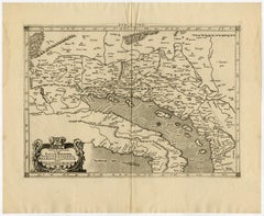
Map Dalmatia

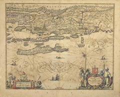
Ancient Map - Dalmatia - Etching by Johannes Janssonius - 1650s
By Johannes Janssonius
Located in Roma, IT
Dalmatia is an ancient map realized in 1650 by Johannes Janssonius (1588-1664). The Map is Hand
Category

1650s Modern Figurative Prints

Materials

Etching

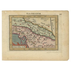
Antique Miniature Map of the Roman Province of Illyricum 'Dalmatia'
By Abraham Ortelius
Located in Langweer, NL
Antique miniature map titled 'Illyricum'. Original small map of Illyricum. The Roman province of
Category

Antique Early 17th Century Maps

Materials

Paper

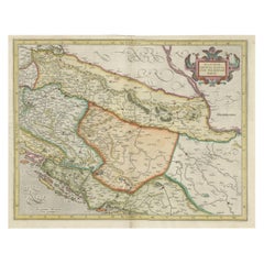
Old Eastern Balkans Map, with Dalmatia, Croatia, Slavonia, Bosnia, Serbia, 1633
Located in Langweer, NL
Antique map titled 'Sclavonia, Croatia, Bosnia cum Dalmatiae Parte'. Old map of the Eastern Balkans
Category

Antique 1630s Maps

Materials

Paper

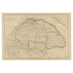
Antique Map of Hungary, Transylvania and Dalmatia by W. G. Blackie, 1859
Located in Langweer, NL
Antique map titled 'Hungary, Transylvania, Dalmatia'. Original antique map of Hungary, Transylvania
Category

Antique Mid-19th Century Maps

Materials

Paper

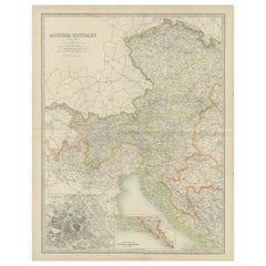
Antique Map of Austria- Hungary by Johnston '1909'
Located in Langweer, NL
Vienna, Dalmatia and Herzegovina. This map originates from the ‘Royal Atlas of Modern Geography
Category

Early 20th Century Maps

Materials

Paper

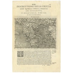
Rare Original 16th Century Antique Map of Greece, 1598
Located in Langweer, NL
Beautiful and rare antique map of Greece with Albania, Mecedonia, Romania, Dalmatia and the
Category

Antique 16th Century Maps

Materials

Paper

Antique Map of Italy, Showing Corsica, Sardinia, Croatia, Malta and More, C.1740
Located in Langweer, NL
.' Attractive detailed map showing Italy as well as Corsica, Sardinia, Minorca, Croatia, Albania, Dalmatia, a
Category

Antique 18th Century Maps

Materials

Paper

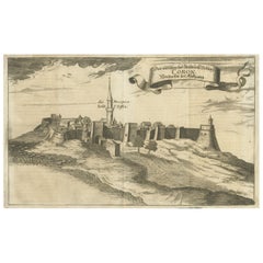
Original Copper Engraving of Koroni 'or Corone', Greece, 1688
Located in Langweer, NL
contemporary eyewitness accounts of the Balkans (Hungary, Dalmatia, Greece) during 1683-88. Artists and
Category

Antique 1680s Maps

Materials

Paper

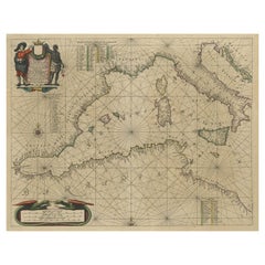
Original Antique Engraving of a Sea Chart of the Western Mediterranean, ca.1650
Located in Langweer, NL
Antique map titled 'Pascaerte van 't westlyckste deel vande Middelandsche-Zee (..)'. Sea chart of
Category

Antique 1650s Maps

Materials

Paper

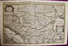
Hungary & Eastern Europe: A Large 17th C. Hand-colored Map by Sanson & Jaillot
By Nicholas Sanson d'Abbeville
Located in Alamo, CA
This large hand-colored map entitled "Le Royaume De Hongrie et les Estats qui en ont este sujets et
Category

1690s Landscape Prints

Materials

Engraving

People Also Browsed

French 19th Century Napoleon III Period Japanese Black Lacquer Side Table
Located in West Palm Beach, FL
An exquisite French 19th century Louis XV st. Napoleon III period Ebony, ormolu, and Japanese black lacquer side table. The table is raised by three most elegant cabriole legs retain...
Category

Antique 19th Century French Louis XV Side Tables

Materials

Ormolu

Rare Art Deco Bronze Rondel by Studin, Croatia
By Marin Studin
Located in Philadelphia, PA
Sculptor Marin Studin was born in Kastel Novi in Croatia and later studied under Ivan Metrovic. He sculpted a statue of St. Roko which decorates a little 16th century church of the s...
Category

Early 20th Century Croatian Sculptures

Materials

Bronze

French Papier Mâché Black, Gilt and Mother-of-Pearl Frame
Located in New York, NY
A French Napoleon III (Second Empire) papier mâché black painted, gilded and mother-of-pearl inlaid frame, France, circa 1880 Size: 17 1/2" high x 16" wide x 1 1/2" ...
Category

Antique 1880s French Napoleon III Picture Frames

Materials

Mother-of-Pearl, Giltwood

Antique Map of Eastern Europe by Stieler, 1890
Located in Langweer, NL
Antique map titled 'Osterreich-Ungarn in 4 Blattern, Blatt 4.' Map of Eastern Europe, with Montenegro in the lower left corner, the southern edge of Hungary (area Baja and Szeged) an...
Category

Antique 19th Century Maps

Materials

Paper

Historical American Civil War Era Wire Frame Magnifying Eye Glass Spectacles
Located in Philadelphia, PA
A delicate pair of handmade magnifying wire rim eye glasses from the American Civil War era, circa 1860. A great looking historical conversation piece or decor item. Use this pair ...
Category

Antique Mid-19th Century American American Classical Historical Memorabilia

Materials

Metal

Dasha & Mari - English Tea
By Dasha & Mari
Located in London, GB
Dasha & Mari - English Tea 40x30" inches paper size oversize C print - numbered and stamped limited to 100 only. Sumptuous, sensual with erotic undertones, this is a beautiful fin...
Category

2010s Modern Nude Photography

Materials

C Print

Framed Sketch, Drawing ‘L’aumône’ 'Almsgiving' 19th French School
Located in Beuzevillette, FR
Adorable drawing from the middle of the 19th century representing an alms giving scene in a church. In the background of the drawing, there is a painting representing Saint Martin cu...
Category

Antique 19th Century French Drawings

Materials

Paper, Crayon

1950 Dubois - France Skiing Original Vintage Poster
By Jacques Dubois
Located in Winchester, GB
A wonderful treasure of mid-century advertising, displaying the Alps, this beautiful original tourism poster was created by the Ministere Des Travaux Publics Des Transports Et Du Tou...
Category

Vintage 1950s French Posters

Materials

Paper

1950 Dubois - France Skiing Original Vintage Poster
Free Shipping
H 39.2 in W 24 in D 0.1 in
Le Croates - Original Drawing By Herbert Knotel - 1940s
Located in Roma, IT
Le Croates is an original drawing in ink and watercolor realized by Herbert Knotel in 1930/40s. Good condition except for being aged. The artwork is depicted through strong lines i...
Category

1940s Modern Figurative Drawings and Watercolors

Materials

Watercolor, Ink

Epirus Albania - Etching by Johannes Janssonius - 1650s
By Johannes Janssonius
Located in Roma, IT
Epirus Albania is an ancient map realized in 1650 by Johannes Janssonius (1588-1664). Good conditions. From Atlantis majoris quinta pars, Orbem maritimum [Novus Atlas, volume V: ca...
Category

1650s Modern Figurative Prints

Materials

Etching

Antique Kittinger 8-inch Terrestrial World Globe on a Mahogany Wooden Stand
By Kittinger Furniture Company
Located in Philadelphia, PA
A fine, antique 8 inch terrestrial globe. Manufactured by Kittinger Company, Inc. (in collaboration with the publishers W. & A.K. Johnston, Ltd. of Edinburgh, Scotland). On a turne...
Category

Early 20th Century Maps

Materials

Mahogany, Gesso, Wood, Paper

Antique Map of Northern Africa "Barbary Coast" by R. Bonne, circa 1780
Located in Langweer, NL
A fine example of Rigobert Bonne and Guilleme Raynal’s 1780 map of northwestern Africa or the Barbary Coast. Includes the modern day countries of Morocco, Algeria, Tunisia, Libya, an...
Category

Antique Late 18th Century Maps

Materials

Paper

Old Map of the Balkans Incl Greece, Turkey, Serbia, Montenegro, Bulgaria, C.1900
Located in Langweer, NL
Antique map titled 'Carte de la presqu-île du Balcan - Karte der Balkan Halbinsel'. Original antique map of the Balkans including Greece, Turkey, Serbia, Montenegro, Bulgaria and...
Category

Antique Early 1900s Maps

Materials

Paper

18th Century Map of the Southern Balkans by Giovanni Maria Cassini
By Giovanni Maria Cassini
Located in Hamilton, Ontario
18th century map by Italian engraver Giovanni Maria Cassini (Italy 1745-1824). Map of the Southern Balkans: Rome. Hand colored and copper engraved print done in the year 1788. It in...
Category

Antique 18th Century Italian Maps

Materials

Paper

Masterly Crafted w. Edelweiss Flowers Swiss Black Forest Barometer & Thermometer
Located in Lisse, NL
Top museum quality carved Swiss barometer / weather station This antique barometer is not only about the actuality of the weather, it is also a true work of art and a real pleasure ...
Category

Antique Late 19th Century Swiss Black Forest Wall-mounted Sculptures

Materials

Wood

1989 Roger Broders - Marseille Original Vintage Poster
By Roger Broders
Located in Winchester, GB
Originally created in 1930, this beautiful art deco poster advertises the "Port De L'Afrique Du Nord", or "Port to North Africa" Marseille. Depicting the busy port filled with large ...
Category

Vintage 1980s Posters

Materials

Paper

1989 Roger Broders - Marseille Original Vintage Poster
Free Shipping
H 39.3 in W 25.5 in D 0.1 in

Recent Sales

Rare 1710 Hand-Colored Map of Europe
By Frederick de Wit
Located in La Jolla, CA
chart that shows an area from Morocco to the Scandinavian island of Spitsbergen and Iceland. The map
Category

Antique 1710s Dutch Northern Renaissance Prints

Materials

Paper

Ptolemaic map of Balkan coast extending north by Mercator - Engraving - 17th c.
By Gerard Mercator
Located in Zeeland, Noord-Brabant
, Dalmatia, cum Italiae parte. (…).' - A beautiful Ptolemaic map of the Balkan coast and northern Italy along
Category

1690s Old Masters More Prints

Materials

Engraving

Old Map of the Austro-Hungarian Empire with an Inset Map Dalmatia, 1882
Located in Langweer, NL
inset map of the continuation of Dalmatia. This map originates from 'The Royal Atlas of Modern Geography
Category

Antique 1880s Maps

Materials

Paper

Antique Map of the Austrian Empire by A.K. Johnston, 1865
Located in Langweer, NL
more. With an inset map of Dalmatia. This map originates from the ‘Royal Atlas of Modern Geography’ by
Category

Antique Mid-19th Century Maps

Materials

Paper

Antique Map of the Austrian Empire ‘West’ by A.K. Johnston, 1865
Located in Langweer, NL
Antique map titled 'Austrian Empire (Western Sheet)'. Depicting Dalmatia, Istria, Croatia, Bohemia
Category

Antique Mid-19th Century Maps

Materials

Paper

Large Engraving of Diocletian's Palace in Split, Croatia, 1764
Located in Langweer, NL
originates from 'Ruins of the Palace of the Emperor Diocletian at Spalatro in Dalmatia' by Robert Adam
Category

Antique 1760s Maps

Materials

Paper

Set of 2 Old Maps of the Austro-Hungarian Empire , 1882
Located in Langweer, NL
inset map of the continuation of Dalmatia. This map originates from 'The Royal Atlas of Modern Geography
Category

Antique 1880s Maps

Materials

Paper

Set of 2 Old Maps of the Austro-Hungarian Empire , 1882
Free Shipping
H 24.1 in W 19.49 in D 0 in
Get Updated with New Arrivals
Save "Map Dalmatia", and we’ll notify you when there are new listings in this category.

Map Dalmatia For Sale on 1stDibs

At 1stDibs, there are many versions of the ideal map dalmatia for your home. Frequently made of paper, every map dalmatia was constructed with great care. Your living room may not be complete without a map dalmatia — find older editions for sale from the 18th Century and newer versions made as recently as the 20th Century. You’ll likely find more than one map dalmatia that is appealing in its simplicity, but Abraham Ortelius produced versions that are worth a look.

How Much is a Map Dalmatia?

A map dalmatia can differ in price owing to various characteristics — the average selling price 1stDibs is $496, while the lowest priced sells for $223 and the highest can go for as much as $2,175.

Read More

Pamela Shamshiri Shares the Secrets behind Her First-Ever Book and Its Effortlessly Cool Interiors

The sought-after designer worked with the team at Hoffman Creative to produce a monograph that beautifully showcases some of Studio Shamshiri's most inspiring projects.

Moroccan Artworks and Objects Take Center Stage in an Extraordinary Villa in Tangier

Italian writer and collector Umberto Pasti opens the doors to his remarkable cave of wonders in North Africa.

Montecito Has Drawn Royalty and Celebrities, and These Homes Are Proof of Its Allure

Hollywood A-listers, ex-pat aristocrats and art collectors and style setters of all stripes appreciate the allure of the coastal California hamlet — much on our minds after recent winter floods.

Whaam! Blam! Pow! — a New Book on Pop Art Packs a Punch

Publishing house Assouline and writer Julie Belcove have teamed up to trace the history of the genre, from Roy Lichtenstein, Andy Warhol and Yayoi Kusama to Mickalene Thomas and Jeff Koons.

The Sparkling Legacy of Tiffany & Co. Explained, One Jewel at a Time

A gorgeous new book celebrates — and memorializes — the iconic jeweler’s rich heritage.

What Makes a Gem-Encrusted Chess Set Worth $4 Million?

The world’s most opulent chess set, weighing in at 513 carats, is literally fit for a king and queen.

Tauba Auerbach’s Geometric Pop-Up Book Is Mighty Rare, Thanks to a Hurricane

This sculptural art book has an epic backstory of its own.

Step inside the Storied Mansions of Palm Beach’s Most Effervescent Architect

From Spanish-style courtyards to fanciful fountains, these acclaimed structures abound in surprising and elegant details.