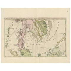
Southeast Asia Map

4
79
to
33
76
3
79
79
79
2
59
15
5
1
1
2
1
78
2
1
1
1
6
3
2
1
2
2
2
2
1
Sort By
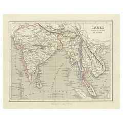
Antique Map of India to Southeast Asia
Located in Langweer, NL
Antique map titled 'Indes en-decà et au-delà du Gange'. Original old map of India to Southeast Asia
Category

Antique Mid-19th Century Maps

Materials

Paper

Antique Map of India to Southeast Asia
H 10.01 in W 12.05 in D 0.02 in
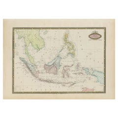
Antique Map of Southeast Asia by Garnier, 1860
Located in Langweer, NL
Southeast Asia, from Birma and Sumatra to the Philippines and Nouveau Guinea. Artists and Engravers: Author
Category

Antique 19th Century Maps

Materials

Paper

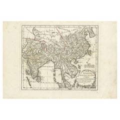
Antique Map of Southeast Asia by Dussy, 1778
Located in Langweer, NL
Asia: Hindustan, India and China. This map originates from 'Nouvel Atlas Portatif destine
Category

Antique 18th Century Maps

Materials

Paper

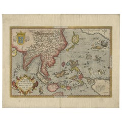
Antique Map of Southeast Asia by Ortelius '1587'
By Abraham Ortelius
Located in Langweer, NL
Antique map titled 'Indiae Orientalis Insularumque Adiacientium Typus'. Ortelius includes early
Category

Antique 16th Century Maps

Materials

Paper

Antique Map of Southeast Asia by Ortelius '1587'
Free Shipping
H 13.78 in W 19.3 in D 0.02 in
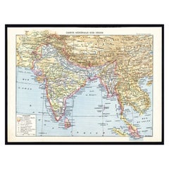
Antique Map of Southeast Asia by Larousse, 1897
Located in Langweer, NL
"Front: 'Carte Generale des Indes.' (General map of India / The Indies / Thailand / Malaysia). Rear
Category

Antique 19th Century Maps

Materials

Paper

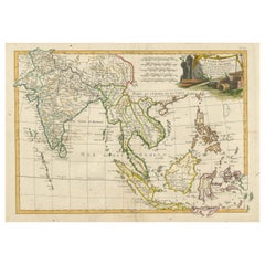
Antique Map of Southeast Asia with Decorative Allegorical Cartouche
Located in Langweer, NL
Antique map titled 'Les Indes Orientales et leur Archipel'. Old map of Southeast Asia, the Straits
Category

Antique Mid-18th Century Maps

Materials

Paper

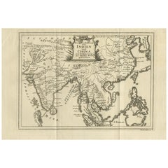
Antique Map of Southeast Asia by Van Dùren, 1752
Located in Langweer, NL
Antique map titled 'Neue Vorstellung von Indien und China'. Original antique map of Southeast Asia
Category

Antique Mid-18th Century Maps

Materials

Paper

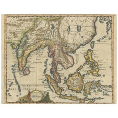
Antique Map of Southeast Asia, China, Philippines and India
Located in Langweer, NL
Antique map titled 'Indiae Orientalis et Insularum Adiacentium'. Decorative map of Southeast Asia
Category

Antique Early 18th Century Maps

Materials

Paper

Antique Map of Southeast Asia by J. Ottens, 1710
Located in Langweer, NL
of Southeast Asia. Ottens incorporated information provided by the French Jesuits and charts the
Category

Antique Early 18th Century Maps

Materials

Paper

Antique Map of Southeast Asia by Blaeu, c.1640
Located in Langweer, NL
"Antique map titled 'India quae Orientalis dicitur et Insulae adiacentes'. Map of Southeast Asia
Category

Antique 17th Century Maps

Materials

Paper

Antique Map of Southeast Asia by Walker, c.1845
Located in Langweer, NL
"Untitled map of southeast Asia. This map depicts India, Indonesia, Australia and surrounding
Category

Antique 19th Century Maps

Materials

Paper

Antique Map of Southeast Asia by Chatelain, c.1732
Located in Langweer, NL
Sumatra Andemaon'. It shows: Southeast Asia; Borneo, Java, Siam (Thailand), Malacca (Malaysia) and
Category

Antique 18th Century Maps

Materials

Paper

Antique Map of Southeast Asia by Chatelain, c.1732
Located in Langweer, NL
Sumatra Andemaon'. It shows: Southeast Asia; Borneo, Java, Siam (Thailand), Malacca (Malaysia) and
Category

Antique 18th Century Maps

Materials

Paper

Large Antique Map of Asia including All of Southeast Asia, c.1792
Located in Langweer, NL
Asia including all of Southeast Asia. The cartography is archaic for the period with the continental
Category

Antique 18th Century Maps

Materials

Paper

Antique Map of India and Southeast Asia by Sanson '1654'
Located in Langweer, NL
Antique map titled 'Partie Meridionale de l'Inde'. Early map of India and Southeast Asia. The map
Category

Antique Mid-17th Century Maps

Materials

Paper

Antique Map of Southeast Asia by H. Chatelain, circa 1720
By Henri-Abraham Chatelain
Located in Langweer, NL
Sumatra Andemaon'. Influential map of Southeast Asia, including modern day Thailand, southern Vietnam
Category

Antique Early 18th Century Maps

Materials

Paper

Antique Map of Southeast Asia by H. Chatelain, circa 1720
No Reserve
H 17.72 in W 19.69 in D 0.02 in
Antique Map of India and Southeast Asia by Balbi '1847'
Located in Langweer, NL
Asia. This map originates from 'Abrégé de Géographie (..)' by Adrien Balbi. Published 1847.
Category

Antique Mid-19th Century Maps

Materials

Paper

1797 Tardieu Map of Southeast Asia: The Malay Archipelago and Beyond
Located in Langweer, NL
- 18th-century cartography - Atlas Universel - Southeast Asia historical map - Maritime Southeast Asia
Category

Antique 1790s Maps

Materials

Paper

Authentic Old Map of Southeast Asia with Original Border Coloring, 1745
Located in Langweer, NL
Indies, including present-day Indonesia, Malaysia, the Philippines, and parts of Southeast Asia. This
Category

Antique 1740s Maps

Materials

Paper

Antique Map of Southeast Asia and China by Kiepert, c.1870
By Thomas Kitchin
Located in Langweer, NL
Antique map titled 'Ostindien und China'. Old map of Southeast Asia and China. This map originates
Category

Antique 19th Century Maps

Materials

Paper

Old Antique Map of the East Indies and Southeast Asia, ca.1644
Located in Langweer, NL
Indies and Southeast Asia showing the area between India in the West and parts of Japan, the Marianas and
Category

Antique 1640s Maps

Materials

Paper

Antique Map of Southeast Asia from Persia to the Timor Island, 1712
Located in Langweer, NL
Antique map titled 'A New Map of the East Indies'. Old map covering all of Southeast Asia from
Category

Antique 1710s Maps

Materials

Paper

Antique Map of Southeast Asia and the Indian Ocean by Valentijn, 1726
By Thomas Kitchin
Located in Langweer, NL
Antique map titled 'Tabula Indiae Orientalis'. Beautiful detailed map of Australia, Southeast Asia
Category

Antique 18th Century Maps

Materials

Paper

Antique Map of Southeast Asia 'India, Indonesia' by N. Visscher, circa 1670
Located in Langweer, NL
Antique map titled 'Indiae Orientalis, nec non Insularum Adiacentium Nova Descriptio.' The map
Category

Antique Mid-17th Century Maps

Materials

Paper

Detailed Original Antique Map of India, Southeast Asia and the Far East, 1719
Located in Langweer, NL
of India, Southeast Asia and the Far East, extending from Gujerat to the supposed "Terre De Yeco
Category

Antique 1710s Maps

Materials

Paper

Detailed Map of Southeast Asia From the Tip of Cambodia to Java, 1739
Located in Langweer, NL
'. Detailed map of Southeast Asia, extending from the tip of Cambodia to Java. This map originates from
Category

Antique 1730s Maps

Materials

Paper

Map of Australia, New Zealand, Part of China, Japan and Southeast Asia, 1857
Located in Langweer, NL
Southeast Asia. In the upper right is a bit of the California coast by San Francisco. At the bottom of the
Category

Antique 19th Century Maps

Materials

Paper

Map of Southeast Asia, Extending from India to Tibet & Japan to New Guinea, 1640
Located in Langweer, NL
Antique map titled 'India quae Orientalis dicitur et Insulae adiacentes'. Map of Southeast Asia
Category

Antique 1640s Maps

Materials

Paper

Original Antique Hand-Colored Map of The East Indies and Southeast Asia, c.1644
Located in Langweer, NL
Indies and Southeast Asia showing the area between India in the West and parts of Japan, the Marianas and
Category

Antique 1640s Maps

Materials

Paper

Old Map Covering All of Southeast Asia from Persia to the Timor Island, 1712
Located in Langweer, NL
Description: Antique map titled 'A New Map of the East Indies'. Old map covering all of Southeast
Category

Antique 1710s Maps

Materials

Paper

Original Blaeu Map of Southeast Asia from India to Tibet and Japan to New Guinea
Located in Langweer, NL
Southeast Asia, extending from India to Tibet to Japan to New Guinea. It was the first popular map to depict
Category

Antique 1640s Maps

Materials

Paper

Historical Map Depicting the Continent of Asia, 1882
Located in Langweer, NL
This 1882 map presents a meticulously detailed representation of the continent of Asia, a testament
Category

Antique 1880s Maps

Materials

Paper

Antique Map of South East Asia, Australia and the Indian Ocean, 1726
By F. Valentijn
Located in Langweer, NL
Antique map titled 'Tabula Indiae Orientalis'. Beautiful detailed map of Australia, Southeast
Category

Antique Mid-18th Century Dutch Maps

Materials

Paper

Early Original Antique Map of South East Asia with Large Parts Still Unknown
Located in Langweer, NL
Antique map titled 'Insulae Indiae Orientalis'. Original antique map of Southeast Asia. Shows towns
Category

Antique Late 17th Century Maps

Materials

Paper

Original 1859 Map of Asia from W.G. Blackie's Imperial Atlas of Modern Geography
Located in Langweer, NL
Antique map titled 'Asia'. Original antique map of Asia. This map originates from ‘The Imperial
Category

Antique Mid-19th Century Maps

Materials

Paper

Antique Map of the East Indies by Moll '1745'
Located in Langweer, NL
, Moluca and Sunda Islands'. Detailed map of the Indian Ocean, Southeast Asia, China, Formosa, the
Category

Antique Mid-18th Century Maps

Materials

Paper

Antique Map of the East Indies by Moll '1745'
H 13.98 in W 16.93 in D 0.02 in
Antique Map of the East Indies by Rossi, 1683
Located in Langweer, NL
nuova scoperta e l'Isole de Ladri ne Mare del Zud (..)'. Decorative map of Southeast Asia, northern
Category

Antique 17th Century Maps

Materials

Paper

Antique Map of the Sunda Islands by Tirion 'c.1760'
Located in Langweer, NL
map of the Sunda Islands, Southeast Asia, extending from the tip of Cambodia to Java. Published by I
Category

Antique Mid-18th Century Maps

Materials

Paper

Antique Map of the East Indies by Mariette, circa 1650
Located in Langweer, NL
map of Southeast Asia from the Maldives to the South of Japan with parts of the northern Australian
Category

Antique Mid-17th Century Maps

Materials

Paper

Antique Map Depicting Burma, Siam, Annam (Vietnam) and Japan, 1882
Located in Langweer, NL
:** This map depicts the regions of Southeast Asia that are today known as Myanmar (Burma), Thailand (Siam
Category

Antique 1880s Maps

Materials

Paper

Antique Map of Java, Indonesia (circa 1770) - Dutch Cartography
By Jakob van der Schley
Located in Langweer, NL
expanding their influence in Southeast Asia. - Java was a crucial part of the Dutch East Indies, and maps
Category

Antique Mid-18th Century Maps

Materials

Paper

Antique Map of the East Indies by Janssonius, c.1644
By Johannes Janssonius
Located in Langweer, NL
Indies and Southeast Asia showing the area between India in the West and parts of Japan, the Marianas and
Category

Antique 17th Century Maps

Materials

Paper

Antique Map of the Philippines, Taiwan and Surroundings by Bonne '1780'
Located in Langweer, NL
extending from Formosa to Borneo and from the Philippines to Pegu, and showing all of Southeast Asia. Inset
Category

Antique Late 18th Century Maps

Materials

Paper

Antique Map of the Netherlands and Belgium by Homann, circa 1710
By Johann Baptist Homann
Located in Langweer, NL
Mercury and a globe with Southeast Asia (marked Ostindien) and the Pacific Ocean.
Category

Antique Early 18th Century German Maps

Materials

Paper

Antique Map of the Netherlands and Belgium by Homann, circa 1710
Free Shipping
H 20.87 in W 24.02 in D 0.02 in
Large Antique Map of the East Indies, with Inset of the Philippines
Located in Langweer, NL
Antique map titled 'A Map of the East Indies (..)'. Large antique map of Southeast Asia, India, and
Category

Antique Late 18th Century Maps

Materials

Paper

Antique Map of Singapore, Malaysia, Borneo, Sumatra and Java (Indonesia), 1739
Located in Langweer, NL
'. Detailed map of Southeast Asia, extending from the tip of Cambodia to Java. This map originates from
Category

Antique 18th Century Maps

Materials

Paper

Antique Map of the Tonkin River ‘Vietnam’ by J.N. Bellin, 1764
Located in Langweer, NL
Generale des Voyages’. This map depicts part of Southeast Asia, most likely northern Vietnam around the
Category

Antique Mid-18th Century Maps

Materials

Paper

Antique Map of the Malay Archipelago with Images of Indigenous People, 1851
Located in Langweer, NL
South and Southeast Asia. It is not a bear but gets its name from its bear-like appearance and its
Category

Antique 1850s Maps

Materials

Paper

Original Antique Map of the East Indies (Indonesia) by Janssonius, c.1644
By Johannes Janssonius
Located in Langweer, NL
Indies and Southeast Asia showing the area between India in the West and parts of Japan, the Marianas and
Category

Antique 17th Century Maps

Materials

Paper

Antique Map of the Sunda Islands Sumatra, Java, Malay Peninsula & Borneo (1739)
By Isaak Tirion
Located in Langweer, NL
'. Detailed map of the Sunda Islands, Southeast Asia, extending from the tip of Cambodia to Java. This map
Category

Antique Mid-18th Century Maps

Materials

Paper

Charting the Course of Empire: Bonne's 1770 Masterpiece Maps of the Indian Ocean
Located in Langweer, NL
of Southeast Asia. Expertly crafted by the distinguished Royal Hydrographer, these maps boast an
Category

Antique 1770s Maps

Materials

Paper

Cartographic Elegance of the Mughal Dominion in a Hand-Colored Antique Map, 1705
Located in Langweer, NL
thought to be the source of important Southeast Asian rivers, is particularly notable for illustrating the
Category

Antique Early 1700s Maps

Materials

Paper

Antique Map of the Strait of Malacca, Malay Peninsula & Dutch Indies, c.1670
Located in Langweer, NL
Southeast Asia. The map centers on the Strait of Malacca and Malay Peninsula. It extends from India and the
Category

Antique 1670s Maps

Materials

Paper

Old Map of Ancient Times covering Egypt Towards Arabia and India to Java, c.1660
Located in Langweer, NL
Parergon. Covers from Egypt and the Nile valley eastward past Arabia and India, to Southeast Asia and Java
Category

Antique 1660s Maps

Materials

Paper

Vintage Rollable Map Southeast Asia China Japan Wall Chart
Located in Berghuelen, DE
A classical pull-down school map showing the popular region of Southeast Asia with China and Japan
Category

Late 20th Century German Country Prints

Materials

Canvas, Wood, Paper

Ancient Cartography of the Indian Subcontinent, Published in 1880
Located in Langweer, NL
the Silk Road and maritime paths used by traders to reach Southeast Asia, the Middle East, and East
Category

Antique 1880s Maps

Materials

Paper

Colored Antique Print of various Water Plants including Coral in Southeast Asia
By F. Valentijn
Located in Langweer, NL
various water plants including coral native to South East Asia/Indonesia. On the left five whale teeth. In
Category

Antique Mid-18th Century Prints

Materials

Paper

Vintage Wall Chart of Balikpapan 'Indonesia'
Located in Langweer, NL
cultural and colonial history of Southeast Asia. In summary, the 'Balikpapan' wall chart is a fascinating
Category

Early 20th Century Prints

Materials

Paper

Vintage Wall Chart of Balikpapan 'Indonesia'
H 33.47 in W 45.28 in D 0.02 in
1730 Hand-Colored Antique Map of the Americas
Located in La Jolla, CA
also shows the trade route from Europe to Southeast Asia, via Mexico and the west coast of North
Category

Antique 1730s Dutch Baroque Prints

Materials

Paper

Oost Indien Wassende-Graade Paskaart
By Johannes van Keulen
Located in La Jolla, CA
A hugely desirable map for Western Australia, Southeast Asia and the Indian Ocean generally. This
Category

Antique 1690s Dutch Baroque Prints

Materials

Paper

Oost Indien Wassende-Graade Paskaart
H 24 in W 31.5 in D 1 in
  • 1
Get Updated with New Arrivals
Save "Southeast Asia Map", and we’ll notify you when there are new listings in this category.

Southeast Asia Map For Sale on 1stDibs

Find many varieties of an authentic southeast asia map available at 1stDibs. Each southeast asia map for sale was constructed with extraordinary care, often using paper, canvas and fabric. Whether you’re looking for an older or newer southeast asia map, there are earlier versions available from the 18th Century and newer variations made as recently as the 20th Century. Each southeast asia map bearing hallmarks is very popular. You’ll likely find more than one southeast asia map that is appealing in its simplicity, but Abraham Ortelius and Henri-Abraham Chatelain produced versions that are worth a look.

Finding the Right collectibles-curiosities for You

Antique and vintage collectibles and curiosities can bring whimsy and wonder to any interior. 

Decorating with old scientific instruments, historical memorabilia and vintage musical instruments, as well as other authentic collectibles and curiosities that can be found on 1stDibs, presents an opportunity to create a unique, natural history museum-like atmosphere in your home that can provoke conversation as often as it pays tribute to how far we’ve come in understanding our world. 

And bringing collectibles and curiosities into your space is actually on trend — Wunderkammern, or curiosity cabinets, were all the rage in Europe during the 1500s and continued to have adherents there and in the U.S. in the following centuries. Today, however, they’re experiencing a real surge in popularity and influencing how many interior designers are furnishing and decorating homes — combining contemporary with antique, scientific with tribal, earthly with extraterrestrial, Les Lalanne tables with Flemish tapestries.

The original Wunderkammern were entire rooms filled with objects demonstrating their owners’ worldly knowledge: A proper one included artificiala or preciosa (objets d’art); naturalia (such as skeletons, shells, minerals); exotica (taxidermy or dried plants); and scientifica (scientific instruments), frequently alongside religious relics and ancient artifacts.

Pay tribute to a history of rich and diverse musical traditions that have taken shape all over the world by decorating your home with a collection of antique and vintage musical instruments — with a little help from strong hanging wire or some wall hooks, vintage brass instruments such as a gong, French horn or trumpet can help elevate a home office or complement the efforts you’ve made to ensure a welcoming vibe in your home’s entryway. Bells or antique wind instruments can add provocative metallic contrasts to dark woods as tabletop decorative objects.  

Create an intriguing focal point with Georgian scientific instruments, such as stick barometers with mahogany cases or lacquered brass telescopes. These items stem from an era named for the monarchies of the four King Georges, who ruled England in succession starting in 1714 (plus King William’s reign, which lasted until 1837). Just as there was beautiful jewelry produced during the period that today is coveted by collectors, there is much to be found in the collectibles and curiosities realm too.

Wanderlust, nostalgia and a shared love of good design are contributing factors to certain trends in decorating — just as vintage trunks and luggage have reappeared as furniture or home accents in a bedroom or foyer, decorating with globes, maps or nautical objects is similarly rooted in the allure of travel and a penchant for the stylish finishing touch that collectibles bring to our homes.

Find a wide range of antique and vintage collectibles and curiosities on 1stDibs.

Read More

Pamela Shamshiri Shares the Secrets behind Her First-Ever Book and Its Effortlessly Cool Interiors

The sought-after designer worked with the team at Hoffman Creative to produce a monograph that beautifully showcases some of Studio Shamshiri's most inspiring projects.

Moroccan Artworks and Objects Take Center Stage in an Extraordinary Villa in Tangier

Italian writer and collector Umberto Pasti opens the doors to his remarkable cave of wonders in North Africa.

Montecito Has Drawn Royalty and Celebrities, and These Homes Are Proof of Its Allure

Hollywood A-listers, ex-pat aristocrats and art collectors and style setters of all stripes appreciate the allure of the coastal California hamlet — much on our minds after recent winter floods.

Whaam! Blam! Pow! — a New Book on Pop Art Packs a Punch

Publishing house Assouline and writer Julie Belcove have teamed up to trace the history of the genre, from Roy Lichtenstein, Andy Warhol and Yayoi Kusama to Mickalene Thomas and Jeff Koons.

The Sparkling Legacy of Tiffany & Co. Explained, One Jewel at a Time

A gorgeous new book celebrates — and memorializes — the iconic jeweler’s rich heritage.

What Makes a Gem-Encrusted Chess Set Worth $4 Million?

The world’s most opulent chess set, weighing in at 513 carats, is literally fit for a king and queen.

Tauba Auerbach’s Geometric Pop-Up Book Is Mighty Rare, Thanks to a Hurricane

This sculptural art book has an epic backstory of its own.

Step inside the Storied Mansions of Palm Beach’s Most Effervescent Architect

From Spanish-style courtyards to fanciful fountains, these acclaimed structures abound in surprising and elegant details.