French House & Garden Prints
to
1
1
Height
to
Width
to
1
1
1
1
1
1
1
1
1
1
1
1
1
6
110
104
93
80
Creator: French House & Garden
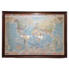
Map of France, globe / Planisphere “Le Monde Politique”, National Geographic Ins
By French House & Garden
Located in Valladolid, ES
Outstanding 19th-century French map designed and published by the French National Geographic Institute following the Aïtoff Wagner cartographic projection, a type of projection used...
Category
1960s French Mid-Century Modern Vintage French House & Garden Prints
Materials
Crystal
Related Items
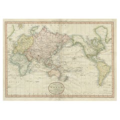
Very Attractive Antique Map of the World as Planisphere, Shows Cook's Voyages
Located in Langweer, NL
Antique map titled 'Chart of the World, according to Mercators Projection'. This world map shows the various discoveries of Captain James Cook during his 3 voyages between 1768 and 1780, and the English and French Explorers who followed immediately thereafter, including Vancouver and La Perouse. This edition of the map is significantly revised from the editions issued immediately after the official report of Cook's Voyages were integrated into the map, showing better detail in New Zealand, Australia, the Northwest Coast of America and North East coast of Asia, along with Greenland. A new large lake also appears for the first time in the Western part of North America, shortly before the commencement of the Lewis...
Category
Late 18th Century Antique French House & Garden Prints
Materials
Paper
$1,310 Sale Price
25% Off
H 16.15 in W 20.08 in D 0.02 in
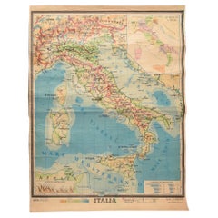
Geographical Map of Italy
Located in Alessandria, Piemonte
BOLIS Publishing House - Bergamo.
A beautiful large map of Italy, on paper but suitably reinforced to preserve it correctly. The maps were usually p...
Category
Mid-20th Century Italian Other French House & Garden Prints
Materials
Paper
Original Antique Map of Normandy, France
Located in Langweer, NL
Antique map titled 'Carte de Normandie (..)'. Attractive map of Normandy, France. it depicts the former French Duchy of Normandy, covers the region fro...
Category
Mid-18th Century Antique French House & Garden Prints
Materials
Paper
Vintage Wall Chart of a Landscape and Geographic Map, circa 1955
Located in Langweer, NL
Vintage wall chart titled 'Kaart en Landschap'. This wall chart shows a mountain range and geographic map. Published by J.B. Wolters, circa 1955.
Category
Mid-20th Century French House & Garden Prints
Materials
Paper
$559 Sale Price
20% Off
H 32.68 in W 45.67 in D 0.02 in
Old Map of the French Department of Nièvre, France
By Victor Levasseur
Located in Langweer, NL
Antique map titled 'Dept. de la Nièvre'. Map of the French department of Nievre, France. Part of the prestiegous Burgundy or Bourgogne wine region this area is known for its producti...
Category
Mid-19th Century Antique French House & Garden Prints
Materials
Paper
$316 Sale Price
20% Off
H 14.38 in W 20.36 in D 0.02 in
Planisphere map by Antonio Vallardi Editore, Italy
Located in Cuneo, Italy (CN)
Vintage map, planisphere by Antonio Vallardi Editore, was placed in the Municipality of Milan, late 19th century, origin Italy.
With wooden sticks.
Measurements cm w 300 x H 170
Category
20th Century Italian French House & Garden Prints
Materials
Paper
Antique Map of the Region of Le Mans 'France' by Blaeu, circa 1640
By Willem Blaeu
Located in Langweer, NL
Antique Map: Cenomanorum Galliae regionis typus vulgo le Mans – Blaeu, circa 1640
This beautifully engraved and hand-colored map depicts the historical province of Maine in northw...
Category
Mid-17th Century Antique French House & Garden Prints
Materials
Paper
$465 Sale Price
20% Off
H 20.08 in W 23.23 in D 0.02 in
Map of Scandinavia – Antique Atlas Map by A. Levasseur, France, 1875
Located in Langweer, NL
Map of Scandinavia – Antique Atlas Map by A. Levasseur, France, 1875
This elegant 19th-century map titled Carte des Royaumes de Suède, de Norvège et de Danem...
Category
Late 19th Century French Antique French House & Garden Prints
Materials
Paper
$378 Sale Price
35% Off
H 24.02 in W 18.71 in D 0.02 in
Original Copper Engraved Map of France
Located in Langweer, NL
Antique map titled 'New and Accurate Map of France from the latest improvements'. Original copper engraved map of France. Engraved by T. Bowen, published circa 1771.
Category
Late 18th Century Antique French House & Garden Prints
Materials
Paper
Antique Map of the British Isles According to the Geography of the Roman Empire
Located in Langweer, NL
Antique map titled 'Insulae Britannicae'. Interesting map of Britain, Scotland, and Ireland. It shows a rudimentary outline of the islands according to the geography of the Roman Emp...
Category
Late 18th Century Antique French House & Garden Prints
Materials
Paper
$167 Sale Price
20% Off
H 8.08 in W 10.24 in D 0.02 in
Former Air France planisphere published by Permalux during 70's
Located in LYON, FR
This vintage travel agency planisphere published by Permalux dates from the 70s and shows the destinations covered at the time by the national co...
Category
1970s French Vintage French House & Garden Prints
Materials
Plywood
1859 Classic Map of France: Blackie's Imperial Geographic Masterpiece
Located in Langweer, NL
The "Antique Map of France" from 'The Imperial Atlas of Modern Geography', published in 1859 by W. G. Blackie, is a historically valuable cartographic work that offers a comprehensiv...
Category
Mid-19th Century Antique French House & Garden Prints
Materials
Paper
$218 Sale Price
25% Off
H 21.26 in W 14.57 in D 0.02 in
French House & Garden prints for sale on 1stDibs.
French House & Garden prints are available for sale on 1stDibs. These distinctive items are frequently made of wood and are designed with extraordinary care. There are many options to choose from in our collection of French House & Garden prints, although brown editions of this piece are particularly popular. Many of the original prints by French House & Garden were created in the mid-century modern style in france during the 1960s. If you’re looking for additional options, many customers also consider prints by Alberto Giacometti, Jean Lurcat, and Françoise Gilot. Prices for French House & Garden prints can differ depending upon size, time period and other attributes — on 1stDibs, these items begin at $1,349 and can go as high as $1,349, while a piece like these, on average, fetch $1,349.
Creators Similar to French House & Garden
Questions About French House & Garden Prints
- What is a French garden called?1 Answer1stDibs ExpertOctober 12, 2021A French formal garden is called the jardin à la française. It's an asymmetrical style of garden based on the notion of imposing order on nature. The French garden became popular on a monumental scale in 17th century France. On 1stDibs, find a variety of antique and vintage garden furniture.


