Giovanni Maria Cassini More Furniture and Collectibles
to
2
2
2
2
2
2
2
2
2
2
1,026
215
205
174
Creator: Giovanni Maria Cassini
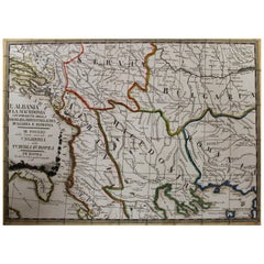
18th Century Map of the Southern Balkans by Giovanni Maria Cassini
By Giovanni Maria Cassini
Located in Hamilton, Ontario
18th century map by Italian engraver Giovanni Maria Cassini (Italy 1745-1824).
Map of the Southern Balkans: Rome. Hand colored and copper engraved print done in the year 1788. It in...
Category
18th Century Italian Antique Giovanni Maria Cassini More Furniture and Collectibles
Materials
Paper
$795 Sale Price
36% Off
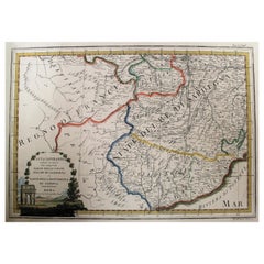
Map of the Kingdom of Sardinia and Part of the Kingdom of Genoa, Rome
By Giovanni Maria Cassini
Located in Hamilton, Ontario
18th century map by Italian engraver Giovanni Maria Cassini (Italy 1745-1824). Map of Part of the Kingdom of Sardinia and Part of the Kingdom of Genoa: Rome. This is a hand colored a...
Category
18th Century Italian Antique Giovanni Maria Cassini More Furniture and Collectibles
Materials
Paper
$795 Sale Price
36% Off
Related Items
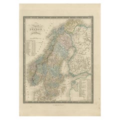
Antique Map of the Kingdoms of Sweden and Norway by Wyld '1845'
Located in Langweer, NL
Antique map titled 'Kingdoms of Sweden and Norway'. Original antique map of the Kingdoms of Sweden and Norway. This map originates from 'An Atlas of the World, Comprehending Separate...
Category
Mid-19th Century Antique Giovanni Maria Cassini More Furniture and Collectibles
Materials
Paper
$143 Sale Price
40% Off
H 14.18 in W 10.24 in D 0.02 in
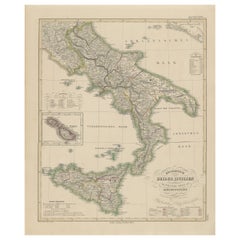
Kingdom of the Two Sicilies Map – Southern Italy and Sicily 1857
Located in Langweer, NL
Kingdom of the Two Sicilies Map – Southern Italy and Sicily 1857
This detailed antique print shows the “Königreich Beider Sicilien nebst dem südlichen Theile des Kirchenstaats” mean...
Category
Mid-19th Century German Antique Giovanni Maria Cassini More Furniture and Collectibles
Materials
Paper
Antique Map of North Carolina, with inset map of the western part
Located in Langweer, NL
Antique map titled 'North Carolina'. Original antique map of North Carolina, United States. With inset map of the western part of North Carolina....
Category
Late 19th Century Antique Giovanni Maria Cassini More Furniture and Collectibles
Materials
Paper
$277 Sale Price
20% Off
H 8.27 in W 10.63 in D 0.02 in
French 18th Century Map of Paris by Turgot
By Michel Etienne Turgot
Located in Los Angeles, CA
Complete Paris map set of etchings by Turgot. This printing is from the 1960s and have warm natural color to the paper. Frame each individually to your liking. The overall dimension ...
Category
1960s French French Provincial Vintage Giovanni Maria Cassini More Furniture and Collectibles
Materials
Paper
Map of the Ottoman Empire in Europe, incl. the Balkans, Greece & Turkey, c.1760
Located in Langweer, NL
Antique map Turkey titled 'An Accurate Map of Turky in Europe drawn from the best Authorities'.
Map of the Ottoman Empire in Europe, the Balkans, Greece, and Turkey in Europe. Engr...
Category
1760s Antique Giovanni Maria Cassini More Furniture and Collectibles
Materials
Paper
$440 Sale Price
20% Off
H 8.67 in W 13.59 in D 0 in
Map of The Italian Peninsula with the islands of Sicily, Sardinia, Corsica, 1880
Located in Langweer, NL
This map, titled "ITALIA, Sicilia, Sardinia, Corsica," represents the Italian Peninsula along with the islands of Sicily, Sardinia, and Corsica. Inset maps offer detailed views of "R...
Category
1880s Antique Giovanni Maria Cassini More Furniture and Collectibles
Materials
Paper
$354 Sale Price
20% Off
H 15.56 in W 18.51 in D 0 in
Antique Map of the Coast of Southern France, 1793
Located in Langweer, NL
Antique map titled '14th Chart of the Coast of France, from Port Vendres to the Petit Rhône'. Original map with later hand coroling of the coast of Southern France.
The "14th Chart of the Coast of France, from Port Vendres to the Petit Rhône" is an antique map that offers a detailed depiction of the southern coast of France, specifically highlighting the Mediterranean coastline. This map, which dates back to 1793, was originally part of "Le Petit Neptune Français; Or, French Coasting Pilot," a publication designed for maritime navigation along the French coastlines.
Key Features of the Map:
1. **Geographic Coverage**:
- The map covers the southern French coastline from Port Vendres in the west to the Petit Rhône in the east.
- It includes notable regions such as Languedoc, the Gulf of Lyon, and parts of Catalonia (Spain).
2. **Notable Places**:
- **Montpellier**: A major city in the Diocese of Montpellier, an important cultural and economic center.
- **Narbonne**: Located in the Diocese of Narbonne, a historical city with Roman heritage.
- **Agde**: Situated in the Diocese of Agde, known for its ancient Greek colony origins.
- **Béziers**: Part of the Diocese of Béziers, another city with deep historical roots dating back to Roman times.
- **Port Vendres**: A critical port near the Spanish border.
- **Catalonia**: Including parts of northeastern Spain, emphasizing the coastal connection between France and Spain.
3. **Dioceses and Regions**:
- The map is marked with various dioceses such as Montpellier, Agde, Narbonne, and Béziers, indicating ecclesiastical boundaries.
- It highlights the broader region of Languedoc, a historical province known for its wine production and medieval history.
4. **Navigational Aids**:
- The map features a compass rose with radiating lines, a common navigational aid in maritime maps...
Category
Late 18th Century Antique Giovanni Maria Cassini More Furniture and Collectibles
Materials
Paper
$229 Sale Price
20% Off
H 10.71 in W 9.18 in D 0.02 in
18th Century Antique Engraving of the Southern Hemisphere by G. de L'Isle
By Guillaume De L'Isle
Located in Langweer, NL
Antique map titled 'Hemisphere Meridional pour voir plus distinctement Les Terres Australes'. Hemispherical map of the southern hemisphere centered on ...
Category
Late 18th Century Antique Giovanni Maria Cassini More Furniture and Collectibles
Materials
Paper
$953 Sale Price
20% Off
H 21.58 in W 29.93 in D 0.02 in
Hand-Colored 18th Century Homann Map of the Danube, Italy, Greece, Croatia
By Johann Baptist Homann
Located in Alamo, CA
"Fluviorum in Europa principis Danubii" is a hand colored map of the region about the Danube river created by Johann Baptist Homann (1663-1724) in his 'Atlas Novus Terrarum', publish...
Category
Early 18th Century German Antique Giovanni Maria Cassini More Furniture and Collectibles
Materials
Paper
$875
H 20 in W 23.88 in D 0.07 in
Antique Map of The United States Southern Section by A & C. Black, 1870
Located in Langweer, NL
Antique map titled 'United States Southern Section'. Original antique map of Map of The United States Southern Section. This map originates from ‘Black's General Atlas of The World’....
Category
Late 19th Century Antique Giovanni Maria Cassini More Furniture and Collectibles
Materials
Paper
$239 Sale Price
20% Off
H 17.52 in W 23.63 in D 0.02 in
Map of the Republic of Genoa
Located in New York, NY
Framed antique hand-coloured map of the Republic of Genoa including the duchies of Mantua, Modena, and Parma.
Europe, late 18th century.
Dimension: 25...
Category
Late 18th Century European Antique Giovanni Maria Cassini More Furniture and Collectibles
Detailed Antique Map of the Black Sea, Balkans and Asia Minor
Located in Langweer, NL
Antique map titled 'Nuova Carta del Europa Turchesca (..)'. This is an Italian version of Tirion's detailed map of the Black Sea, Balkans, and Asia Minor. It is embellished with a si...
Category
Mid-18th Century Antique Giovanni Maria Cassini More Furniture and Collectibles
Materials
Paper
$555 Sale Price
20% Off
H 14.3 in W 17.33 in D 0.02 in
Previously Available Items
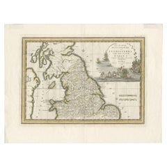
Antique Map of Northern England and Wales by Cassini, 'circa 1795'
By Giovanni Maria Cassini
Located in Langweer, NL
Antique map titled 'La Parte Settentrionale dell' Inghilterra e del Principato di Galles'.
Engraved map of Northern England and Wales. Shows Northum...
Category
Late 18th Century Antique Giovanni Maria Cassini More Furniture and Collectibles
Materials
Paper
Giovanni Maria Cassini more furniture and collectibles for sale on 1stDibs.
Giovanni Maria Cassini more furniture and collectibles are available for sale on 1stDibs. These distinctive items are frequently made of paper and are designed with extraordinary care. There are many options to choose from in our collection of Giovanni Maria Cassini more furniture and collectibles, although beige editions of this piece are particularly popular. If you’re looking for additional options, many customers also consider more furniture and collectibles by Vincenzo Coronelli, Dolce & Gabbana, and Gabriella Crespi. Prices for Giovanni Maria Cassini more furniture and collectibles can differ depending upon size, time period and other attributes — on 1stDibs, these items begin at $302 and can go as high as $795, while a piece like these, on average, fetch $795.
Creators Similar to Giovanni Maria Cassini
Antico Setificio Fiorentino Srl.
