Items Similar to Antique Map of the Coast of Southern France, 1793


Want more images or videos?
Request additional images or videos from the seller
1 of 6
Antique Map of the Coast of Southern France, 1793
About the Item
Antique map titled '14th Chart of the Coast of France, from Port Vendres to the Petit Rhône'. Original map with later hand coroling of the coast of Southern France. This map originates from 'Le Petit Neptune Français; Or, French Coasting Pilot, for the Coast of Flanders, Channel, Bay of Biscay and Mediterranean (..)' printed for W. Faden, 1793.
- Dimensions:Height: 10.71 in (27.2 cm)Width: 9.18 in (23.3 cm)Depth: 0.02 in (0.5 mm)
- Materials and Techniques:
- Period:
- Date of Manufacture:1793
- Condition:Repaired: new backing. Age-related toning. Some wear. Closed tear lower right, also affecting image. Blank verso. Please study image carefully.
- Seller Location:Langweer, NL
- Reference Number:
About the Seller
5.0
Platinum Seller
These expertly vetted sellers are 1stDibs' most experienced sellers and are rated highest by our customers.
Established in 2009
1stDibs seller since 2017
1,977 sales on 1stDibs
Typical response time: <1 hour
- ShippingRetrieving quote...Ships From: Langweer, Netherlands
- Return PolicyA return for this item may be initiated within 14 days of delivery.
More From This SellerView All
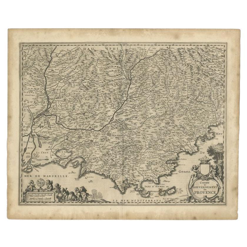
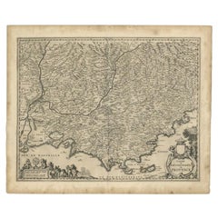
- Original Antique Map of the Southern Coast of France by Janssonius, 1657By Johannes JanssoniusLocated in Langweer, NLAntique map of France titled 'Comté et Gouvernement de Provence'. Decorative map of the southern coast of France. This map originates from 'Atlas Novus,...Category
Antique 17th Century Maps
MaterialsPaper
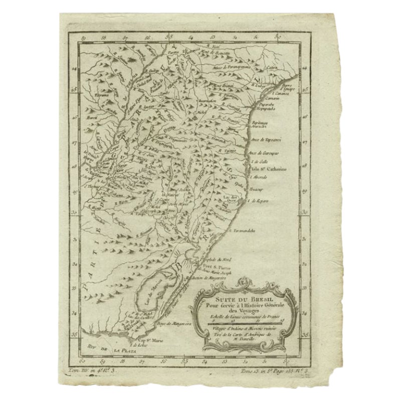
- Antique Map of the Coast of Southern Brazil by Bellin, c.1755By Jacques-Nicolas BellinLocated in Langweer, NLAntique map titled ‘Suite de Bresil’. Map of the coast of southern Brazil, with Lagoa Mirim, and Uruguay (here named as Paraguay). This print originates from 'Histoire générale des V...Category
Antique 18th Century Maps
MaterialsPaper
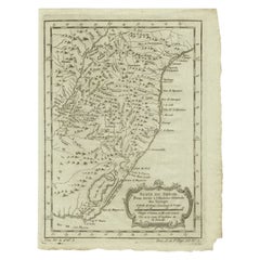
- Antique Map of the Coast of France, 1710By Jacobus HarrewijnLocated in Langweer, NLAntique map titled 'Les Embouchures de la Somme et de Bresle'. Map of the coast of Northern France showing the estuaries of the Somme and the Bresle. This map is part of a serie of...Category
Antique Early 18th Century Maps
MaterialsPaper

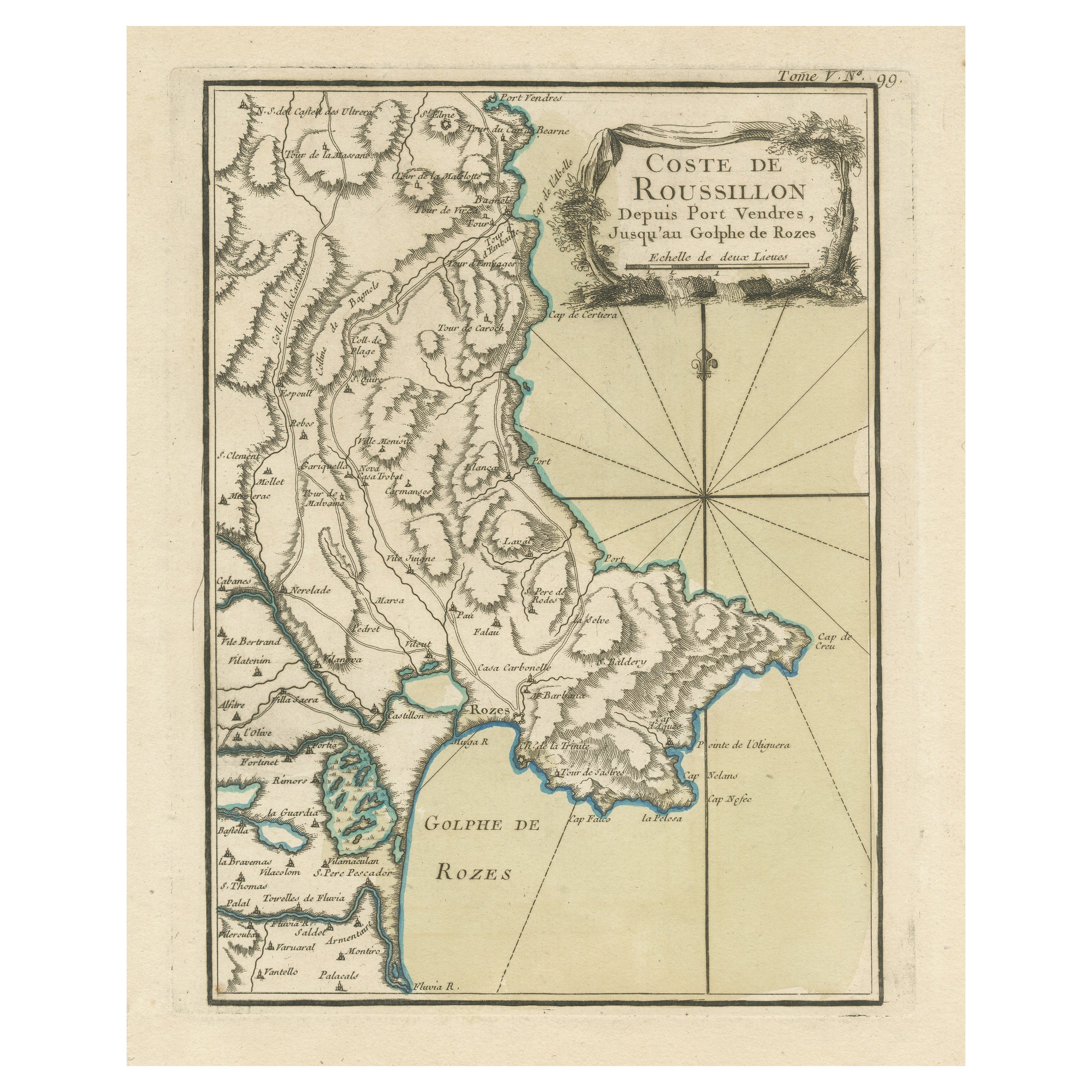
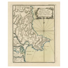
- Antique Map of the Coast of Roussillon, FranceLocated in Langweer, NLAntique map titled 'Coste de Roussillon depuis Port Vendres, jusqu'au golphe de Rozes'. Original map of the coast of Roussillon, France. This map originates from 'Le Petit Atlas Mari...Category
Antique Mid-18th Century Maps
MaterialsPaper
- Antique Map of the Northern Coast of Africa and Southern Europe, circa 1745By Covens & MortierLocated in Langweer, NLAntique map titled 'In Notitiam Ecclesiasticam Africae Tabula Geographica'. Very decorative hand-colored map of the northern coast of Africa, Spain, Italy and the Mediterranean with the islands of Sardinia, Corsica, Majorca, Minorca etc. Sicily features a smoking Mount Aetna. Embellished with three architectural cartouches...Category
Antique Mid-18th Century Maps
MaterialsPaper
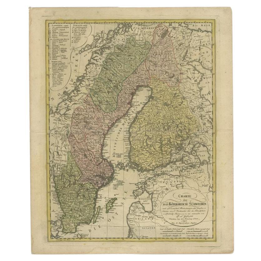
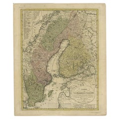
- Antique Map of the Kingdom of Sweden by Güssefeld, 1793Located in Langweer, NLAntique map titled 'Charte über das Konigreich Schweden (..)'. Original antique map of the Kingdom of Sweden. Source unknown, to be determined. Artists and Engravers: Franz Ludwig...Category
Antique 18th Century Maps
MaterialsPaper

You May Also Like
- Large Original Antique Folding Map of Manchester, England, Dated 1793Located in St Annes, LancashireSuperb map of Manchester and Salford Folding map. Printed on paper laid on to the original canvas Unframed. Published by C. Laurent, 1793. ...Category
Antique 1790s English Georgian Maps
MaterialsCanvas, Paper
- Northwest Coast and Isle of Man MapLocated in Cheshire, GBGreenville Collins Northwest Coast and Isle of Man. hand coloured chart, encased in an ebonised frame. Dimensions Height 26.5 Inches Width 30 Inches Depth 1 InchesCategory
Early 20th Century British Maps
MaterialsPaper
- Original Antique Decorative Map of South America-West Coast, Fullarton, C.1870Located in St Annes, LancashireGreat map of Chili, Peru and part of Bolivia Wonderful figural border From the celebrated Royal Illustrated Atlas Lithograph. Original color. Published by Fullarton, Edi...Category
Antique 1870s Scottish Maps
MaterialsPaper
- 18th Century Map of the Southern Balkans by Giovanni Maria CassiniBy Giovanni Maria CassiniLocated in Hamilton, Ontario18th century map by Italian engraver Giovanni Maria Cassini (Italy 1745-1824). Map of the Southern Balkans: Rome. Hand colored and copper engraved print done in the year 1788. It in...Category
Antique 18th Century Italian Maps
MaterialsPaper
- 1976 The Log of H.M.S. Providence 1791-1793By William BlighLocated in Bath, GBA scarce and fine limited edition of William Bligh's log of his second breadfruit voyage of 1791, on board the H.M.S. Providence. A scarce work, this is number sixty-three of five-h...Category
Vintage 1970s British Books
MaterialsPaper
- 1861 Topographical Map of the District of Columbia, by Boschke, Antique MapLocated in Colorado Springs, COPresented is an original map of Albert Boschke's extremely sought-after "Topographical Map of the District of Columbia Surveyed in the Years 1856 ...Category
Antique 1860s American Historical Memorabilia
MaterialsPaper