Anthony Rosa Maps
to
1
1
1
1
1
1
1
1
1
1
1
1
1
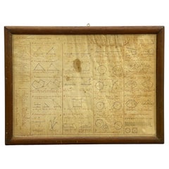
1852 Geometrical Constructions Chart by C. W. Knudsen
Located in Garnerville, NY
Twenty two (22) meticulously rendered hand written and drawn geometrical constructions by C. W. Knudsen, circa 1952. The piece is inscribed in red lower left, C. W. Knudsen, August 1...
Category
Antique 1850s American Schoolhouse Maps
Materials
Glass, Wood, Paper, Parchment Paper
$708 Sale Price
20% Off
Related Items
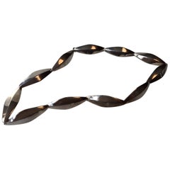
Danish Modernist Sterling Leaf Necklace by Bent Knudsen, 1960s
By Bent Knudsen
Located in Esbjerg, DK
This Mid-Century Modern necklace sometimes referred to as peak or leaf was made by the Danish silversmith Bent Knudsen. Bent Knudsen designed for the Hans Hanse...
Category
Vintage 1960s Danish Mid-Century Modern Collectible Jewelry
Materials
Sterling Silver
$658 Sale Price
25% Off
H 15.36 in Dm 0.52 in
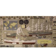
Mariner's Chart Poster
Located in Hamilton, Ontario
Mariner's chart poster (nautical).
Category
20th Century Posters
Antique Map of North America by Lowry '1852'
Located in Langweer, NL
Antique map titled 'North America'. Original map of North America. This map originates from 'Lowry's Table Atlas constructed and engraved from the...
Category
Antique Mid-19th Century Maps
Materials
Paper
Antique Map of South Africa by Lowry, 1852
Located in Langweer, NL
Antique map titled 'South Africa'. Two individual sheets of South Africa. This map originates from 'Lowry's table Atlas constructed and engraved from the most recent authorities' by ...
Category
Antique Mid-19th Century Maps
Materials
Paper
$141 Sale Price / set
20% Off
H 12.21 in W 9.65 in D 0.02 in
Antique Map of the Northern Hemisphere by Lowry, '1852'
Located in Langweer, NL
Antique map titled 'Perspective Projection of the World on the horizon of London'. Original map of the northern hemisphere. This map originates fro...
Category
Antique Mid-19th Century Maps
Materials
Paper
$141 Sale Price
20% Off
H 12.21 in W 9.65 in D 0.02 in
Sterling Silver and Amethyst Bracelet by Bent Knudsen
By Bent Knudsen
Located in Pawtucket, RI
Interesting Scandinavian cuff from Danish jewelry designer Bent Knudsen in sterling with amethyst. Signed with impressed manufacturer's mark to interior: [Sterl...
Category
Vintage 1960s Danish Scandinavian Modern Collectible Jewelry
Materials
Amethyst, Sterling Silver
Antique Map of the Netherlands by Petri, 1852
Located in Langweer, NL
Antique map titled 'Het Koninkrijk der Nederlanden'. Map of the Netherlands, with coats of arms of all Dutch provinces. Also includes a small inset map of Luxembourg...
Category
Antique 19th Century Maps
Materials
Paper
Antique Map of Persia and Tartary by Lowry, '1852'
Located in Langweer, NL
Antique map titled 'Persia and Tartary'. Original map of Persia and Tartary. This map originates from 'Lowry's Table Atlas constructed and engraved from the most recent Authorities' ...
Category
Antique Mid-19th Century Maps
Materials
Paper
$94 Sale Price
20% Off
H 12.21 in W 9.65 in D 0.02 in
Antique Map of Austria by Lowry, 1852
Located in Langweer, NL
Antique map titled 'Austria'. Original map of Austria. This map originates from 'Lowry's Table Atlas constructed and engraved from the most recent Autho...
Category
Antique Mid-19th Century Maps
Materials
Paper
Antique Map of Denmark by Lowry, 1852
Located in Langweer, NL
Antique map titled 'Denmark'. Original map of Denmark. This map originates from 'Lowry's Table Atlas constructed and engraved from the most recent Authorities' by J.W. Lowry. Publish...
Category
Antique Mid-19th Century Maps
Materials
Paper
Antique Map of South America by Lowry, 1852
Located in Langweer, NL
Antique map titled 'South America'. Original map of South America. This map originates from 'Lowry's Table Atlas constructed and engraved from the most recent authorities' by J.W. Lo...
Category
Antique Mid-19th Century Maps
Materials
Paper
Antique Map of Australasia by Lowry, 1852
Located in Langweer, NL
Antique map titled 'Australasia'. Original map of Australasia. This map originates from 'Lowry's Table Atlas constructed and engraved from the most recent Authorities' by J.W. Lowry....
Category
Antique Mid-19th Century Maps
Materials
Paper


