Antique Avenue Maps
to
6
6
1
3
3
5
1
6
2
2
2
1
6
6
6
2
1
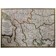
18th Century Map of the Southern Balkans by Giovanni Maria Cassini
By Giovanni Maria Cassini
Located in Hamilton, Ontario
18th century map by Italian engraver Giovanni Maria Cassini (Italy 1745-1824).
Map of the Southern Balkans: Rome. Hand colored and copper engraved print done in the year 1788. It in...
Category
Antique 18th Century Italian Maps
Materials
Paper
$795 Sale Price
36% Off
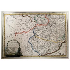
Map of the Kingdom of Sardinia and Part of the Kingdom of Genoa, Rome
By Giovanni Maria Cassini
Located in Hamilton, Ontario
18th century map by Italian engraver Giovanni Maria Cassini (Italy 1745-1824). Map of Part of the Kingdom of Sardinia and Part of the Kingdom of Genoa: Rome. This is a hand colored a...
Category
Antique 18th Century Italian Maps
Materials
Paper
$795 Sale Price
36% Off
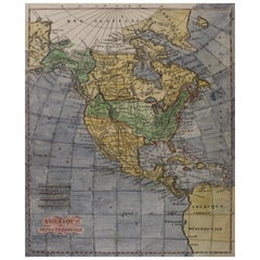
Early 19th Century Hand Coloured Map of North America by Aaron Arrowsmith
By Aaron Arrowsmith
Located in Hamilton, Ontario
Hand coloured map in French by English cartographer Aaron Arrowsmith (1750–1823) titled "Amerique Septentionale" (North America).
Map size: 9.5" x 8"
Mat size: 20.5" x 14.25".
Category
Antique Early 19th Century English Maps
Materials
Paper
$795 Sale Price
36% Off
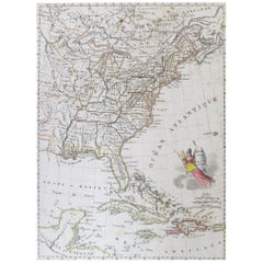
Early 19th Century Hand Colored Map of the United States and Caribbean Islands
Located in Hamilton, Ontario
Hand coloured early 19th century map by Giraldon of France titled "Etats Unis et Grandes Antilles" (United States and Greater Antilles).
Category
Antique Early 19th Century French Maps
Materials
Paper
$595 Sale Price
40% Off
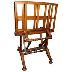
English Mahogany Wooden Folio Stand, Map and Document Holder, circa 1820
Located in Hamilton, Ontario
Regency era mahogany wood folio stand rack, map, poster, document holder used in a library, office or den, circa 1820. Folds out to six positions ...
Category
Antique Early 19th Century English Regency Magazine Racks and Stands
Materials
Wood
$5,200 Sale Price
20% Off
17th Century Nicolas Visscher Map of Southeastern Europe
Located in Hamilton, Ontario
A beautiful, highly detailed map of southeastern Europe by Nicolas Visscher. Includes regions of Northern Italy (showing the cities Bologna, Padua, and Venice), Bohemia, Austria (sho...
Category
Antique 17th Century Dutch Maps
Materials
Paper
$1,350 Sale Price
38% Off
Related Items
Small Map of the United States
Located in Langweer, NL
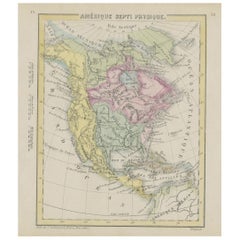
Antique map titled 'Amérique septe. Physique'. Small map of the United States. lithographed by C. Callewaert brothers in Brussels circa 1870.
Category
Antique Mid-19th Century Maps
Materials
Paper
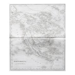
Original Antique Map of North America by Dower, circa 1835
Located in St Annes, Lancashire
Nice map of North America
Drawn and engraved by J.Dower
Published by Orr & Smith. C.1835
Unframed.
Free shipping
Category
Antique 1830s English Maps
Materials
Paper
1846 "North America" Map, Engraved by I. Dower
Located in Colorado Springs, CO
Presented is an original 1846 map of “North America.” The map was drawn and engraved by I. Dower and published in London by Orr & Company. The map depicts North America, to include G...
Category
Antique 1840s English Victorian Maps
Materials
Paper
Antique Map of The United States of North America, Pacific States, 1882
Located in Langweer, NL
The map is from the same 1882 Blackie Atlas and focuses on the Pacific States of the United States of America during that period. Here are some details and historical context about t...
Category
Antique 1880s Maps
Materials
Paper
$237 Sale Price
20% Off
H 14.97 in W 11.03 in D 0 in
Antique Map of North America, 1821
Located in Langweer, NL
Antique map of America titled 'Carte de l'Amerique septentrionale'. Scarce map of North America, shortly after the Louisiana Purchase and the first ...
Category
Antique 19th Century Maps
Materials
Paper
America "Amérique Septentrionale": A 19th Century French Map by Delamarche
By Maison Delamarche 1
Located in Alamo, CA
This framed mid 19th century map of North America entitled "Amérique Septentrionale" by Felix Delamarche was published in Paris in 1854 by Quay de l'Horloge du Palais, avec les Carte...
Category
Antique Mid-19th Century American Other Maps
Materials
Paper
$975
H 20 in W 22.63 in D 0.88 in
Antique Map of the United States by Balbi '1847'
Located in Langweer, NL
Antique map titled 'Etats-Unis'. Original antique map of the United States. This map originates from 'Abrégé de Géographie (..)' by Ad...
Category
Antique Mid-19th Century Maps
Materials
Paper
$190 Sale Price
20% Off
H 9.06 in W 11.23 in D 0.02 in
Antique Map of North America by Johnston, 1882
By Alexander Keith Johnston
Located in Langweer, NL
Antique map titled 'North America'.
Old map of North America. This map originates from 'The Royal Atlas of Modern Geography, Exhibiting, in a Series of Entirely Original and Authen...
Category
Antique 19th Century Maps
Materials
Paper
Antique Map of North America by Lapie '1842'
Located in Langweer, NL
Antique map titled 'Carte de l'Amérique septentrionale'. Map of North America, with an inset map of the Aleutian Islands. This map originates from 'Atlas universel de géographie anci...
Category
Antique Mid-19th Century Maps
Materials
Paper
French 18th Century Map of Paris by Turgot
By Michel Etienne Turgot
Located in Los Angeles, CA
Complete Paris map set of etchings by Turgot. This printing is from the 1960s and have warm natural color to the paper. Frame each individually to your liking. The overall dimension ...
Category
Vintage 1960s French French Provincial Maps
Materials
Paper
18th Century Antique Engraving of the Southern Hemisphere by G. de L'Isle
By Guillaume De L'Isle
Located in Langweer, NL
Antique map titled 'Hemisphere Meridional pour voir plus distinctement Les Terres Australes'. Hemispherical map of the southern hemisphere centered on ...
Category
Antique Late 18th Century Maps
Materials
Paper
$1,183
H 21.58 in W 29.93 in D 0.02 in
1847 Ornamental Map of the United States & Mexico by H. Phelps
Located in Colorado Springs, CO
Offered is an original 1847 ornamental map of the U.S. entitled "Ornamental Map of the United States & Mexico" by Humphrey Phelps. The map was issued as an act of Congress by Phelps on Fulton Street, New York. The broadside is elaborately hand-colored.
This is a very detailed and graphic propaganda map of the United States expressing U.S. dominance of the North American continent. The hand-colored map proclaims the Manifest Destiny, with the recent acquisition of Upper California and Texas at the conclusion of the Mexican-American War. The newly acquired land is boldly colored, standing in stark contrast to the rest of the U.S. The map details a potential route for a railroad running from New York City, to Buffalo, to Chicago, then west along the Oregon Trail to Oregon City. This route anticipates the construction of the transcontinental railroad by nearly 20 years.
The map includes elaborately detailed renderings of George Washington, Hernan Cortez, and Montezuma at top to represent European expansion to the Americas. At bottom are four inset designs with text showing the following: a chronological history of the U.S. beginning from settlement to the U.S. victory in the Mexican-American war; an illustration of General Zachary Taylor with details on the Oregon Territory; an illustration of the Aztec Temple of the Sun in Tenochtitlan and a chronology of the Conquest of the Aztec Empire under Cortez; a portrait of General Antonio Lopez de Santa Anna...
Category
Antique 1840s American Maps
Materials
Paper
