Items Similar to Antique Map of the United States by Balbi '1847'


Want more images or videos?
Request additional images or videos from the seller
1 of 6
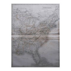
Antique Map of the United States by Balbi '1847'
About the Item
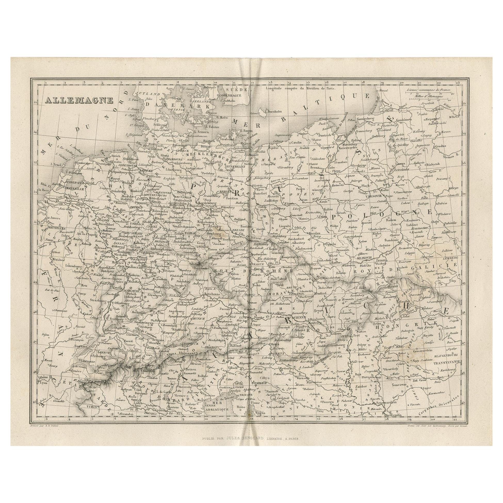
Antique map titled 'Etats-Unis'. Original antique map of the United States. This map originates from 'Abrégé de Géographie (..)' by Adrien Balbi. Published 1847.
- Dimensions:Height: 9.06 in (23 cm)Width: 11.23 in (28.5 cm)Depth: 0.02 in (0.5 mm)
- Materials and Techniques:
- Period:
- Date of Manufacture:1847
- Condition:General age-related toning, original folding line. Minor wear, blank verso. Please study image carefully.
- Seller Location:Langweer, NL
- Reference Number:
About the Seller
5.0
Platinum Seller
These expertly vetted sellers are 1stDibs' most experienced sellers and are rated highest by our customers.
Established in 2009
1stDibs seller since 2017
1,916 sales on 1stDibs
Typical response time: <1 hour
- ShippingRetrieving quote...Ships From: Langweer, Netherlands
- Return PolicyA return for this item may be initiated within 14 days of delivery.
More From This SellerView All
- Antique Map of the World by Balbi '1847'Located in Langweer, NLAntique map titled 'Planisphère'. Original antique map of the world. This map originates from 'Abrégé de Géographie (..)' by Adrien Balbi. Pub...Category
Antique Mid-19th Century Maps
MaterialsPaper
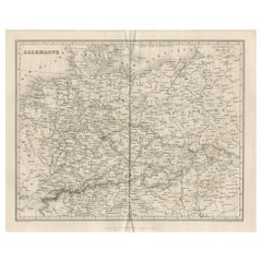
- Antique Map of Germany by Balbi '1847'Located in Langweer, NLAntique map titled 'Allemagne'. Original antique map of Germany. This map originates from 'Abrégé de Géographie (..)' by Adrien Balbi. Published...Category
Antique Mid-19th Century Maps
MaterialsPaper
- Antique Map of Oceania by Balbi '1847'Located in Langweer, NLAntique map titled 'Océanie'. Original antique map of Oceania. This map originates from 'Abrégé de Géographie (..)' by Adrien Balbi. Published 1847.Category
Antique Mid-19th Century Maps
MaterialsPaper
- Antique Map of France by Balbi '1847'Located in Langweer, NLAntique map titled 'France'. Original antique map of France. This map originates from 'Abrégé de Géographie (..)' by Adrien Balbi. Published 1847.Category
Antique Mid-19th Century Maps
MaterialsPaper
- Antique Map of Europe by Balbi '1847'Located in Langweer, NLAntique map titled 'Europe'. Original antique map of Europe. This map originates from 'Abrégé de Géographie (..)' by Adrien Balbi. Published 1847.Category
Antique Mid-19th Century Maps
MaterialsPaper
- Antique Map of Asia by Balbi '1847'Located in Langweer, NLAntique map titled 'Asie'. Original antique map of Asia. This map originates from 'Abrégé de Géographie (..)' by Adrien Balbi. Published 1847.Category
Antique Mid-19th Century Maps
MaterialsPaper


You May Also Like
- Original Antique Map of United States, Grattan and Gilbert, 1843Located in St Annes, LancashireGreat map of United States Drawn and engraved by Archer Published by Grattan and Gilbert. 1843 Original colour Unframed.Category
Antique 1840s English Maps
MaterialsPaper
- 1847 Ornamental Map of the United States & Mexico by H. PhelpsLocated in Colorado Springs, COOffered is an original 1847 ornamental map of the U.S. entitled "Ornamental Map of the United States & Mexico" by Humphrey Phelps. The map was issued as an act of Congress by Phelps on Fulton Street, New York. The broadside is elaborately hand-colored. This is a very detailed and graphic propaganda map of the United States expressing U.S. dominance of the North American continent. The hand-colored map proclaims the Manifest Destiny, with the recent acquisition of Upper California and Texas at the conclusion of the Mexican-American War. The newly acquired land is boldly colored, standing in stark contrast to the rest of the U.S. The map details a potential route for a railroad running from New York City, to Buffalo, to Chicago, then west along the Oregon Trail to Oregon City. This route anticipates the construction of the transcontinental railroad by nearly 20 years. The map includes elaborately detailed renderings of George Washington, Hernan Cortez, and Montezuma at top to represent European expansion to the Americas. At bottom are four inset designs with text showing the following: a chronological history of the U.S. beginning from settlement to the U.S. victory in the Mexican-American war; an illustration of General Zachary Taylor with details on the Oregon Territory; an illustration of the Aztec Temple of the Sun in Tenochtitlan and a chronology of the Conquest of the Aztec Empire under Cortez; a portrait of General Antonio Lopez de Santa Anna...Category
Antique 1840s American Maps
MaterialsPaper
- Large Original Antique Map of United States by Sidney Hall, 1847Located in St Annes, LancashireGreat map of United States Drawn and engraved by Sidney Hall Steel engraving Original colour outline Published by A & C Black. 1847 ...Category
Antique 1840s Scottish Maps
MaterialsPaper
- N.E. View of the United States Capitol, Washington, DC Antique Proof Print 1858Located in Colorado Springs, COThis engraved print shows a view of the United States Capitol Building, in Washington, D.C. The print depicts the neoclassical building from the northeast orientation, with a bustling street scene in front. The steel engraving is a proof printing, drawn and engraved by Henry Sartain and published in 1858. Plans began in May 1854 to build a new cast-iron dome for the United States Capitol. The then-architect of the Capitol Thomas Walter and his team were sold on the aesthetics of a new dome, as well as the utility of a fire-proof one. A year later, on March 3, 1855, President Franklin Pierce...Category
Antique 1850s American Prints
MaterialsPaper
- 1859 "Map of the United States of America..." by J. H. ColtonBy J.H. ColtonLocated in Colorado Springs, COPresented is an 1859 “Map of the United States of America, the British Provinces, Mexico, the West Indies and Central America with Part of...Category
Antique 1850s American Maps
MaterialsPaper
- Original Antique Map of The United States of America, circa 1890Located in St Annes, LancashireGreat map of the USA By The Stanford's Geographical Establishment Original colour Unframed.Category
Antique 1890s English Victorian Maps
MaterialsPaper


Recently Viewed
View AllMore Ways To Browse
Antique Furniture United States
Antique United States
Antique United States Maps
Antique Map United States
Antique United States Map
United States Map Antique
Antique Maps Of United States
Antique Maps Of States
Antique Map Of The United States
Antique Maps Of The United States
Vans Authentics
Antique Island Map
Antique Furniture South East
Ocean Antiques
Map Netherlands
Old Map World
Old World Maps
Framed Maps