COOCOOU27 Maps
to
2
2
1
2
2
2
2
1
1
2
2
2
2
2
1
1
1
1
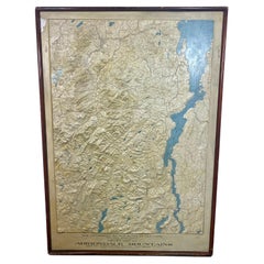
Rare and Early Plaster Relief Map of Adirondack Mountains by F J H Merrill
By P.F. Howells, E. W. Merrill
Located in Buffalo, NY
Rare and Early Monumental Plaster Relief Map of Adirondack Mountains by The University of the State of New York, New York State Museum..F J H Merrill director,,,modeled by Howell's ...
Category
Vintage 1910s American Industrial Maps
Materials
Plaster, Wood
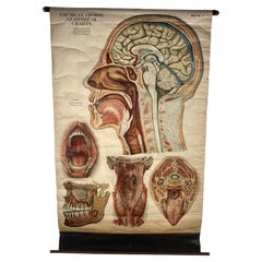
1918 American Frohse Anatomical Chart, A. J. Nystrom, Max Brodel Illustrator
By Max Brödel, A.J. Nystrom & Co
Located in Buffalo, NY
Antique American Frohse Anatomical pull down chart, by A. J. Nystrom, ,revised and augmented by Max Brodel illustrator... Amazing color, patina, age appropriate wear. dated 1918..
Max (Paul Heinrich) Brödel
1870-1941
Brödel, an illustrator and the first director of the Art as Applied to Medicine program at Johns Hopkins...
Category
Vintage 1910s American Steampunk Prints
Materials
Wood, Paper
Related Items
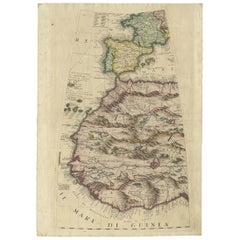
Rare Antique Map of Southwestern Europe and West Africa by V.M. Coronelli, 1692
By Vincenzo Coronelli
Located in Langweer, NL
Antique Globe Gore: Southwestern Europe and West Africa by Vincenzo Coronelli
This exquisite, hand-colored globe gore by Vincenzo Coronelli, one of the most renowned 17th-century cartographers, represents Southwestern Europe and West Africa. A segment of Coronelli's monumental 42-inch terrestrial globe, this gore is a remarkable example of the artistry and geographical knowledge of the late 1600s. Covering France, the Iberian Peninsula, and all of Africa west of a line extending from Algeria to the Bight of Benin, it also includes the Canary Islands and Madeira.
Coronelli’s globe gores are celebrated for their exceptional engraving and accuracy, and this piece is no exception. The coastline of Africa is depicted with remarkable precision for its time, reflecting the latest geographical knowledge of European explorers. In contrast, the interior of Africa—still a mystery to European mapmakers—features mythical elements such as fantastical mountain ranges and exotic fauna. Giraffes, elephants, lions, and mysterious giant birds populate the landscape, offering a glimpse into the imagination and curiosity of the era. One notable detail is the Gambia...
Category
Antique Late 17th Century Maps
Materials
Paper
$2,331 Sale Price
20% Off
H 19.3 in W 13.59 in D 0.02 in
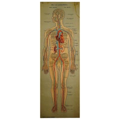
Anatomical Wall Chart Depicting the Human Lymphatic and Blood Vessels
Located in Berghuelen, DE
Anatomical Wall Chart Depicting the Human Lymphatic and Blood Vessels
A rare 19-carat anatomical wall chart depicting the human lymphatic and blood ve...
Category
Early 20th Century German Victorian Prints
Materials
Paper
$680
H 62.21 in W 21.46 in D 0.79 in
Antique Foldable Anatomical Wall Chart Depicting Human Musculature
Located in Berghuelen, DE
Antique Foldable Anatomical Wall Chart Depicting Human Musculature
The rare 19th century anatomical wall chart depicts the human musculature and inter...
Category
Early 20th Century German Victorian Prints
Materials
Wood, Paper
$1,245
H 61.03 in W 21.46 in D 1.19 in
Rare Set of 3 Map Samplers by A Charles. Italy, Spain & France
Located in Chelmsford, Essex
Set of 3 Map Samplers by A Charles. All depict countries, cities, seas and landmarks of the respective countries. The first entitled, 'SPAIN and PORTUGAL'. The second, 'MAP OF FRANCE...
Category
Antique Early 19th Century English Tapestries
Materials
Linen
$3,386 / set
H 6.3 in W 8.3 in D 1.6 in
Rare Antique Bible Map of Southern Europe by A. Schut, 1743
Located in Langweer, NL
Antique map of the Mediterranean and a large part of Europe, illustrating the voyage of St. Paul to Rome. This map originates from ‘Biblia Sacra, dat is, de H. Schriftuer van het Oud...
Category
Antique Mid-18th Century Maps
Materials
Paper
$519 Sale Price
32% Off
H 15.44 in W 21.26 in D 0.02 in
Antique Anatomical Wall Chart Depicting the Human Skeleton
Located in Berghuelen, DE
Antique Anatomical Wall Chart Depicting the Human Skeleton
A rare 19th century anatomical wall chart depicting the human skeleton. On the sides On the...
Category
Early 20th Century German Victorian Prints
Materials
Paper
19th Century French Émile Deyrolle Anatomical Lithograph Poster
Located in London, GB
Émile Deyrolle Anatomical poster
A wonderfully rare and decorative curio medical French (Paris) original lithograph on board anatomical poster in ...
Category
Antique 1880s French Early Victorian Scientific Instruments
Materials
Paper
Foldable Anatomical Wall Chart Depicting Human Musculature
Located in Berghuelen, DE
Foldable Anatomical Wall Chart Depicting Human Musculature
A rare 19th century anatomical wall chart depicting human musculature and internal organs. ...
Category
Early 20th Century German Victorian Prints
Materials
Paper
Antique Sea Chart of North America by Ottens, circa 1745
Located in Langweer, NL
Antique map titled 'Septemtrionaliora Americae a Groenlandia (..)'. Sea chart of the northern waters of North America, including the coast of Labrador and pa...
Category
Antique Mid-18th Century Maps
Materials
Paper
$3,123 Sale Price
25% Off
H 21.46 in W 25.99 in D 0.02 in
World Relief Map
Located in Antwerp, BE
Large world relief map.
Measures: Width 232 cm.
Height 158 cm.
Category
Mid-20th Century German Mid-Century Modern Maps
Materials
Acrylic
1889 Map of Italy in 3D Relief
Located in Weesp, NL
Introducing a true gem for collectors and history enthusiasts alike: this rare 1889 *"Italia in Rilievo"* map by L. Roux & Co. from Torino, a masterpiece of craftsmanship and cartogr...
Category
Antique 1880s European Maps
Materials
Paper
Antique Chart of the US Predominating Sex, 1874
Located in Langweer, NL
Antique chart titled 'Map of predominating sex showing the local excess of males or of females in the distribution of population over the territory of th...
Category
Antique Late 19th Century Maps
Materials
Paper
$475 Sale Price
20% Off
H 21.66 in W 16.15 in D 0.02 in


