Gottschalch Antiques Maps
to
1
1
2
2
2
2
1
1
2
2
2
1
1
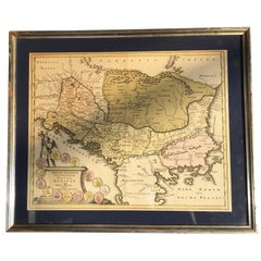
Four 18th Century Engraved and Hand-Colored Maps by Weigel
By Christoph Weigel
Located in Copenhagen, K
Small collection of four engraved maps of Italy, Balkan and of Central Asia.
Two are of Italy, one Corsica and Northern Italy and the other of the Southern Italian boot...
Category
Antique 18th Century German Maps
Materials
Paper
17th Century Map of Denmark by French Cartographer Sanson, Dated 1658
By Nicolas Sanson
Located in Copenhagen, K
17th century map of Denmark by French cartographer Sanson.
Nicolas Sanson (20 December 1600-7 July 1667) was a French cartographer, termed by some the creator of French geography an...
Category
Antique 17th Century French Maps
Materials
Paper
Related Items
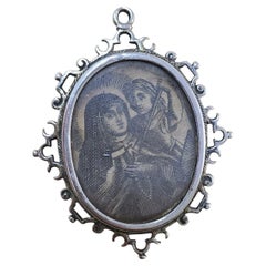
18th-century reliquary in solid silver, finely hand-engraved
Located in Madrid, ES
Elegant 18th-century reliquary in solid silver, finely hand-engraved, with ornamental decoration typical of Baroque religious art. Its oval shape features floral and symbolic details...
Category
Antique 18th Century European Baroque Religious Items
Materials
Silver
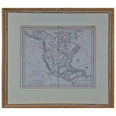
America "Amérique Septentrionale": A 19th Century French Map by Delamarche
By Maison Delamarche 1
Located in Alamo, CA
This framed mid 19th century map of North America entitled "Amérique Septentrionale" by Felix Delamarche was published in Paris in 1854 by Quay de l'Horloge du Palais, avec les Carte...
Category
Antique Mid-19th Century American Other Maps
Materials
Paper
$975
H 20 in W 22.63 in D 0.88 in
Four 18th Century Vellum Covered Latin Books
Located in Hudson, NY
These four books printed in Latin are covered in beautiful old vellum covers and spines. Each book contains text, margin commentary and pictorial illustration to the fronts pages. All but one is from the same library with like beautifully embossed bindings and like blue colored paper borders. These three had at one point clasp binders now gone or in a damaged state. The final book is vellum bound but not in embossed covers and spines.
Condition Disclosure:
While we do our best to carefully inspect and give a full report on the condition
of any item we sell, pointing out any repairs or alterations that may have been
done to the best of our knowledge, as is the case with any antique and vintage item,
there is a possibility that at some point in the life of the piece that there
may have been damaged which has been professionally repaired and
as such a repair undetectable, it is therefore impossible for us to disclose...
we recommend that you also read and agree to the 1st dibs user agreement...
Category
Antique 18th Century Books
Materials
Paper
French 18th Century Map of Paris by Turgot
By Michel Etienne Turgot
Located in Los Angeles, CA
Complete Paris map set of etchings by Turgot. This printing is from the 1960s and have warm natural color to the paper. Frame each individually to your liking. The overall dimension ...
Category
Vintage 1960s French French Provincial Maps
Materials
Paper
Antique Albertus Seba Pair 18th Century Hand-Colored Engravings Butterfly
By Albertus Seba 1
Located in Washington, DC
Rare pair of original hand-colored prints from Sir Albertus Seba's cabinet of natural curiosities. Prints come from published volumes in Amste...
Category
Antique Mid-18th Century Dutch Prints
Materials
Paper
$700 / set
H 26 in W 12.5 in D 0.3 in
Antique Map of Turkey with Cyprus and Greece Islands by N. Sanson, circa 1652
Located in Langweer, NL
Antique map of Turkey, Anatolie with Cyprus and the Greece islands. Attractive scrolled title cartouche to top right corner. Blank verso.
Category
Antique Mid-17th Century Maps
Materials
Paper
$323
H 8.08 in W 10.56 in D 0.02 in
Antique Map of North and South America by Schneider and Weigel, 1818
Located in Langweer, NL
Antique map titled 'America nach Arrowsmiths Weltcharte und dessen Globular Projection (..)'. Map of North and South America. Published by Schneider and Weigel, 1818.
Category
Antique Early 19th Century Maps
Materials
Paper
$1,248 Sale Price
30% Off
H 22.25 in W 26.78 in D 0.02 in
Engraved Silver Reliquary – 18th Century
Located in Madrid, ES
Antique religious reliquary in engraved silver, dating from the 18th century. This devotional piece features engraved letters or inscriptions on one side and, on the other, a very de...
Category
Antique 18th Century European Baroque Religious Items
Materials
Silver
Original Antique Map of Egypt in Frame by C. Weigel, circa 1720
Located in Langweer, NL
The map is an antique depiction of ancient Egypt, divided into its regions and nomes, also including areas like Troglodytica, Marmarica, and Ethiopia above Egypt. Christophorus Weige...
Category
Antique Early 18th Century Maps
Materials
Paper
$927 Sale Price
20% Off
H 27.56 in W 24.41 in D 0.99 in
Engraved Copper Plate – 18th Century
Located in Madrid, ES
Interesting and rare original 18th-century copper plate used for printing religious engravings. The plate is finely engraved with a burin, depicting sacred scenes typical of the devo...
Category
Antique 18th Century European Baroque Religious Items
Materials
Copper
California, Alaska and Mexico: 18th Century Hand-Colored Map by de Vaugondy
By Didier Robert de Vaugondy
Located in Alamo, CA
This is an 18th century hand-colored map of the western portions of North America entitled "Carte de la Californie et des Pays Nord-Ouest separés de l'Asie par le détroit d'Anian, ex...
Category
Antique 1770s French Maps
Materials
Paper
$975
H 13.75 in W 16.63 in D 0.13 in
Early 19th Century Hand Colored Map of the United States and Caribbean Islands
Located in Hamilton, Ontario
Hand coloured early 19th century map by Giraldon of France titled "Etats Unis et Grandes Antilles" (United States and Greater Antilles).
Category
Antique Early 19th Century French Maps
Materials
Paper
$595 Sale Price
40% Off
H 13.5 in W 10 in D 0.975 in


