Items Similar to Rare Chromolithograph of An Estate with Garden in the 18th Century, ca.1900
Want more images or videos?
Request additional images or videos from the seller
1 of 5
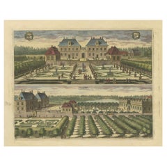
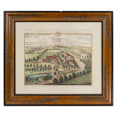
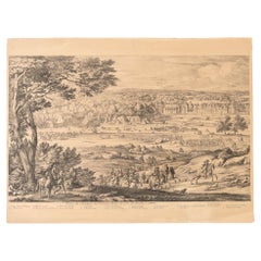
Rare Chromolithograph of An Estate with Garden in the 18th Century, ca.1900
$431.70
$539.6320% Off
£321.14
£401.4320% Off
€360
€45020% Off
CA$591.15
CA$738.9420% Off
A$657.28
A$821.6020% Off
CHF 343.20
CHF 428.9920% Off
MX$8,000.69
MX$10,000.8620% Off
NOK 4,379.02
NOK 5,473.7720% Off
SEK 4,102.93
SEK 5,128.6720% Off
DKK 2,740.48
DKK 3,425.6020% Off
Shipping
Retrieving quote...The 1stDibs Promise:
Authenticity Guarantee,
Money-Back Guarantee,
24-Hour Cancellation
About the Item
The antique garden print you've described, titled 'Buitenplaats met tuin uit de 18e eeuw,' features a rare chromolithographic plate created by G.A. Sijthoff (1867-1949). This illustration showcases an estate with a garden dating back to the 18th century. The detailed depiction of this historical garden provides a glimpse into the aesthetics and landscaping of the era, preserved in this rare and collectible print. Published by N. Veenstra's Gravenhage, this chromolithograph holds historical significance and visual appeal, capturing the essence of a bygone era's gardening and architectural styles.
- Dimensions:Height: 24.22 in (61.5 cm)Width: 18.51 in (47 cm)Depth: 0 in (0.02 mm)
- Materials and Techniques:
- Period:1900-1909
- Date of Manufacture:circa 1900
- Condition:Very good, some marginal tears. Please study image carefully.
- Seller Location:Langweer, NL
- Reference Number:Seller: BG-11220 1stDibs: LU3054326716252
About the Seller
5.0
Recognized Seller
These prestigious sellers are industry leaders and represent the highest echelon for item quality and design.
Platinum Seller
Premium sellers with a 4.7+ rating and 24-hour response times
Established in 2009
1stDibs seller since 2017
2,510 sales on 1stDibs
Typical response time: <1 hour
- ShippingRetrieving quote...Shipping from: Langweer, Netherlands
- Return Policy
Authenticity Guarantee
In the unlikely event there’s an issue with an item’s authenticity, contact us within 1 year for a full refund. DetailsMoney-Back Guarantee
If your item is not as described, is damaged in transit, or does not arrive, contact us within 7 days for a full refund. Details24-Hour Cancellation
You have a 24-hour grace period in which to reconsider your purchase, with no questions asked.Vetted Professional Sellers
Our world-class sellers must adhere to strict standards for service and quality, maintaining the integrity of our listings.Price-Match Guarantee
If you find that a seller listed the same item for a lower price elsewhere, we’ll match it.Trusted Global Delivery
Our best-in-class carrier network provides specialized shipping options worldwide, including custom delivery.More From This Seller
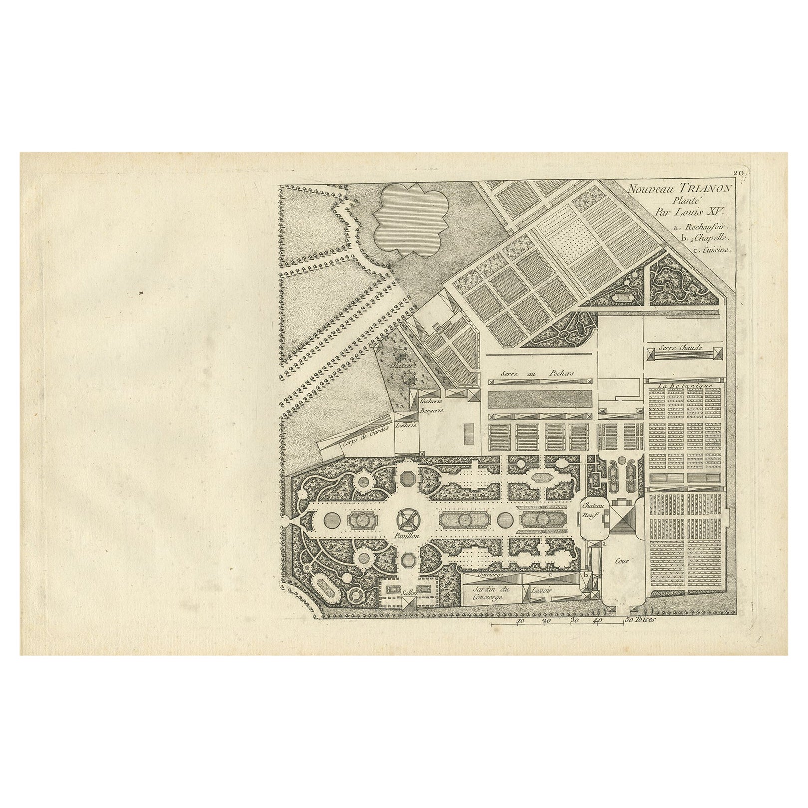
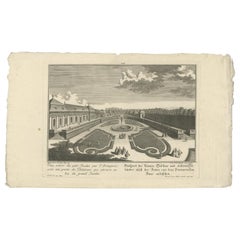
View AllPl. 20 Antique Print of a Garden Planted by Louis XV by Le Rouge, c.1785
Located in Langweer, NL
Antique print titled 'Nouveau Trianon planté par Louis XV'. Copper engraving showing a garden planted by Louis XV. This print originates from 'Jardins Anglo-Chinois à la Mode' by Geo...
Category
Antique 18th Century Prints
Materials
Paper
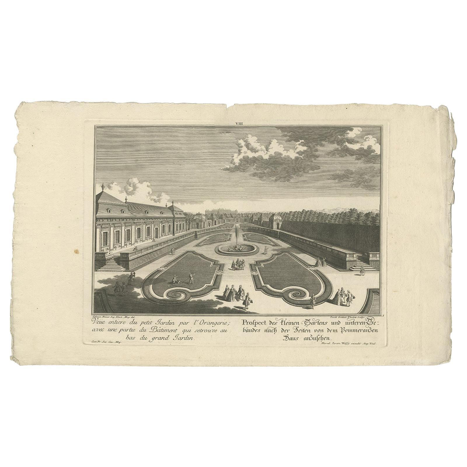
Antique Print of a Small Garden and Building by Wolff, 1737
Located in Langweer, NL
Antique print titled 'Veüe entiere du petit Jardin (..) - Prospect de skleinen Gartens (..)'. Prospect of the small garden and building. This print originates from 'Wunder würdigen K...
Category
Antique Mid-18th Century Prints
Materials
Paper
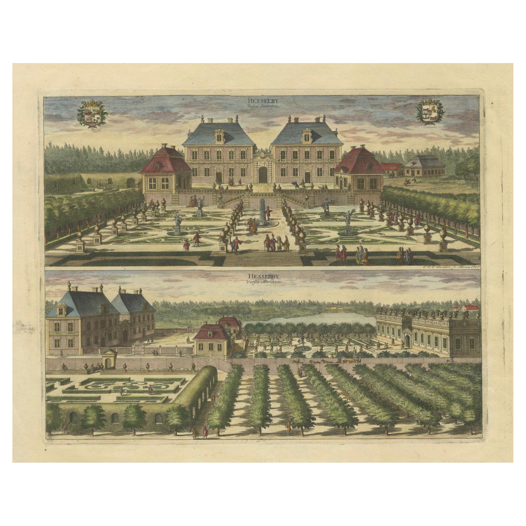
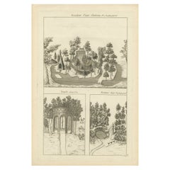
Engraved Hand-colored Views of Hesselby Castle in Stockholm, Sweden, 1707
Located in Langweer, NL
This print is from "Suecia Antiqua et Hodierna," which is a significant work depicting Sweden during its era as a great power. The collection of engravings...
Category
Antique Early 1700s Prints
Materials
Paper
$460 Sale Price
20% Off
Free Shipping
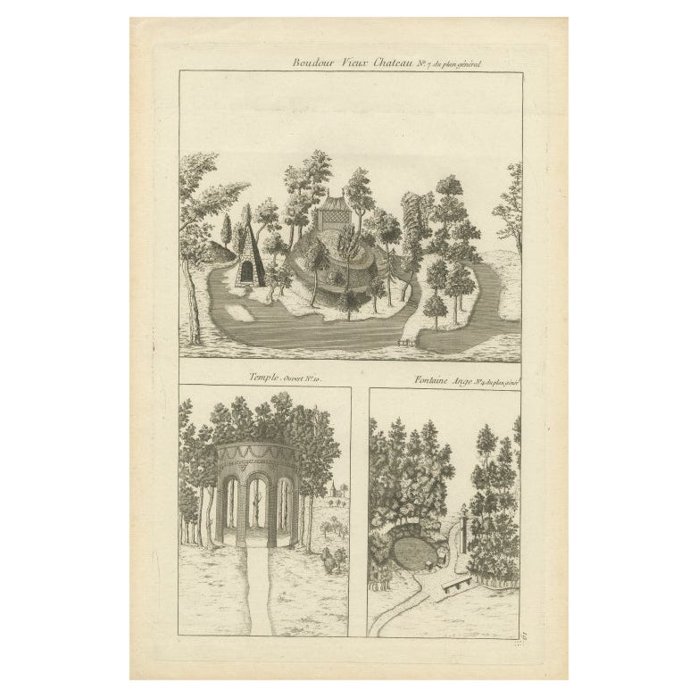
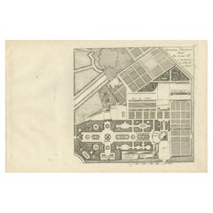
Pl. 19 Antique Print of the Garden of a Castle by Le Rouge, c.1785
Located in Langweer, NL
Antique print titled 'Boudour Vieux Chateau'. Copper engraving showing the garden, temple and fountain of a castle. This print originates from 'Jardins Anglo-Chinois à la Mode' by Ge...
Category
Antique 18th Century Prints
Materials
Paper
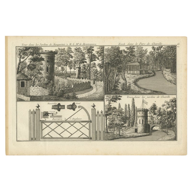
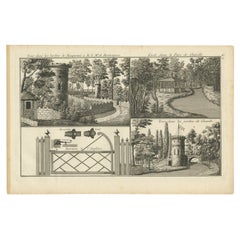
Pl. 15 Antique Print of the Garden of Maupertuis and Chaville by Le Rouge
Located in Langweer, NL
Antique print titled 'Tour dans les Jardins de Maupertuis (..)'. Copper engraving with a view of the garden of Maupertuis and Chaville. This print originates from 'Jardins Anglo-Chin...
Category
Antique 18th Century Prints
Materials
Paper
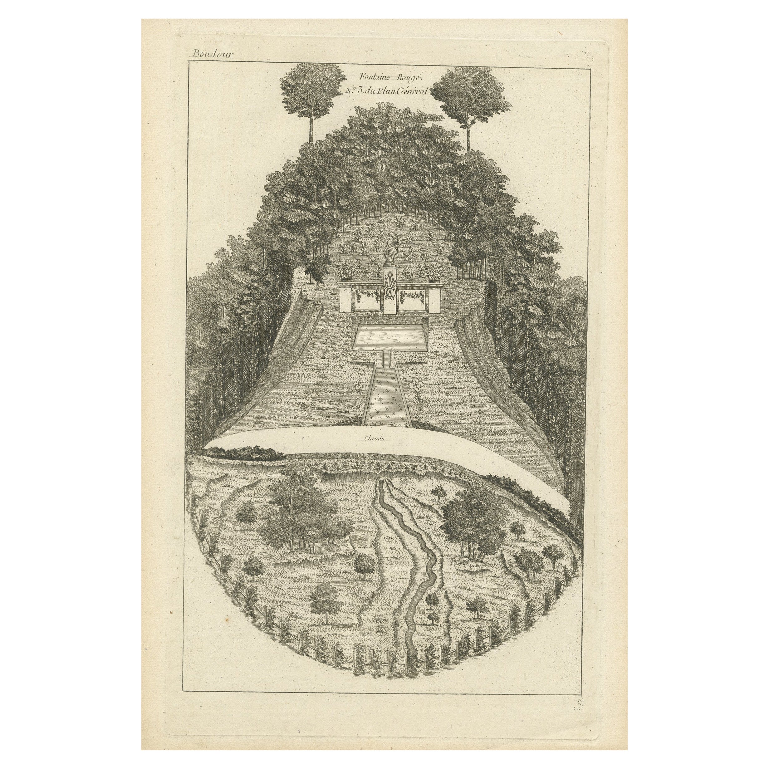
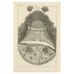
Pl. 21 Antique Print of a Garden Fountain by Le Rouge, c.1785
Located in Langweer, NL
Antique print titled 'Fontaine Rouge No. 3 du Plan Général'. Copper engraving of a garden fountain. This print originates from 'Jardins Anglo-Chinois à la Mode' by Georg Louis le Rou...
Category
Antique 18th Century Prints
Materials
Paper
You May Also Like
Gardens of the Chateau Rueil, Paris, France, mid 17th century engraving
By Matthaeus Merian
Located in Melbourne, Victoria
'Prosp. horti Auraicorum Pomorum a Ruel'
Copper-line engraving by Matthaeus Merian.
From 'Topographia Galliae', a fine series of engravings of 17th-century French landscapes, gard...
Category
Mid-18th Century Rococo Landscape Prints
Materials
Engraving

Color Print of an English Estate in a Wooden Frame
Located in Queens, NY
English Victorian color lithograph of the aerial view of an English estate in white matting and a rectangular wood & black trimmed frame (Companion piece: 062454).
Category
Antique Late 19th Century British Victorian Prints
Italian Garden - Original Etching 19th Century
Located in Roma, IT
Italian Garden is an original etching on paper realized by an
Anonymous artist of the XIX century, singed and titled on the plate with inscription bel...
Category
19th Century Figurative Prints
Materials
Etching
Three 18th Century Engravings of Versailles Garden by Antoine Aveline
By Antoine Aveline
Located in Vancouver, British Columbia
A set of three original copperplate engravings by the renowned Parisian 18th century Engraver Antione Aveline ( b 1718 - d 1762 ). The three engravings are numbered 62, 64 and 45 and were commissioned with the permission of the Louis XV the King of France at the time.
All three engravings show views and perspectives of features in the gardens of Versailles...
Category
Antique Mid-18th Century French Louis XV Prints
Materials
Paper
$720 Sale Price / set
20% Off
Painting Of Garden House, France, 19th Century
Located in Lisbon, PT
A beautiful garden painting from the Romantic era featuring a graceful lady wandering through meticulously maintained gardens, complete with a charming fountain and lush trees. The h...
Category
Antique Late 19th Century French Romantic Paintings
Materials
Canvas
$3,246 Sale Price
23% Off
Antique View of the Castle of Fontainbleau from the Garden
Located in Alessandria, Piemonte
View of the castle of FONTAINEBLEAU from the garden.
A rare engraving from the early nineteenth century.
ref. ST/777.
Category
Antique Early 19th Century French Other Prints
Materials
Paper
More Ways To Browse
Antique Architectural Models
Antique Architectural Models
Architectural Souvenirs
Souvenir Building
Grand Tour Temple
Colonne Antique
Metal Souvenir Buildings
Architectural Plaster Model
Giallo Antico
Staircase Model
Tower Of Pisa
Temple Vesta
Antique Industrial Wood Molds
Grand Tour Temple Model
Temple Marble Grand Tour
Architectural Model Staircases
Grand Tour Model Marble Column
Antique Wood Foundry Mold