Items Similar to Antique Sheet Music 'Drums & Trumpets or a Parade in Broadway', circa 1865


Want more images or videos?
Request additional images or videos from the seller
1 of 5
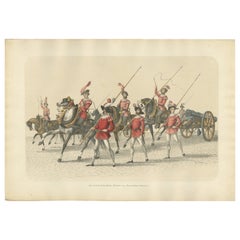
Antique Sheet Music 'Drums & Trumpets or a Parade in Broadway', circa 1865
$143.90
$179.8820% Off
£107.05
£133.8120% Off
€120
€15020% Off
CA$197.05
CA$246.3120% Off
A$219.09
A$273.8720% Off
CHF 114.40
CHF 14320% Off
MX$2,666.90
MX$3,333.6220% Off
NOK 1,459.67
NOK 1,824.5920% Off
SEK 1,367.64
SEK 1,709.5620% Off
DKK 913.49
DKK 1,141.8720% Off
Shipping
Retrieving quote...The 1stDibs Promise:
Authenticity Guarantee,
Money-Back Guarantee,
24-Hour Cancellation
About the Item
Antique sheet music 'Drums & Trumpets or a Parade in Broadway' by F.B. Helmsmüller. Color front cover illustration of band instruments arrayed on ground with a sword in front of a military encampment, with a U.S. flag in the background. This composition by F.B. Helmsmüller portrays three military bands parading up Broadway in New York City: Graffulla's 7th Regiment Band [Claudio S. Grafulla], Dodworth's 71st Regiment Band [Allen Dodworth], and Helmsmüller's 22nd Regiment Band. Published circa 1865.
- Dimensions:Height: 13.98 in (35.5 cm)Width: 10.83 in (27.5 cm)Depth: 0.08 in (2 mm)
- Materials and Techniques:
- Period:
- Date of Manufacture:circa 1865
- Condition:Loose pages. Shows some wear and foxing, mainly along edges. Few small defects, general age-related toning. Please study images carefully.
- Seller Location:Langweer, NL
- Reference Number:Seller: BG-11842-41stDibs: LU3054322087892
About the Seller
5.0
Recognized Seller
These prestigious sellers are industry leaders and represent the highest echelon for item quality and design.
Platinum Seller
Premium sellers with a 4.7+ rating and 24-hour response times
Established in 2009
1stDibs seller since 2017
2,511 sales on 1stDibs
Typical response time: <1 hour
- ShippingRetrieving quote...Shipping from: Langweer, Netherlands
- Return Policy
Authenticity Guarantee
In the unlikely event there’s an issue with an item’s authenticity, contact us within 1 year for a full refund. DetailsMoney-Back Guarantee
If your item is not as described, is damaged in transit, or does not arrive, contact us within 7 days for a full refund. Details24-Hour Cancellation
You have a 24-hour grace period in which to reconsider your purchase, with no questions asked.Vetted Professional Sellers
Our world-class sellers must adhere to strict standards for service and quality, maintaining the integrity of our listings.Price-Match Guarantee
If you find that a seller listed the same item for a lower price elsewhere, we’ll match it.Trusted Global Delivery
Our best-in-class carrier network provides specialized shipping options worldwide, including custom delivery.More From This Seller
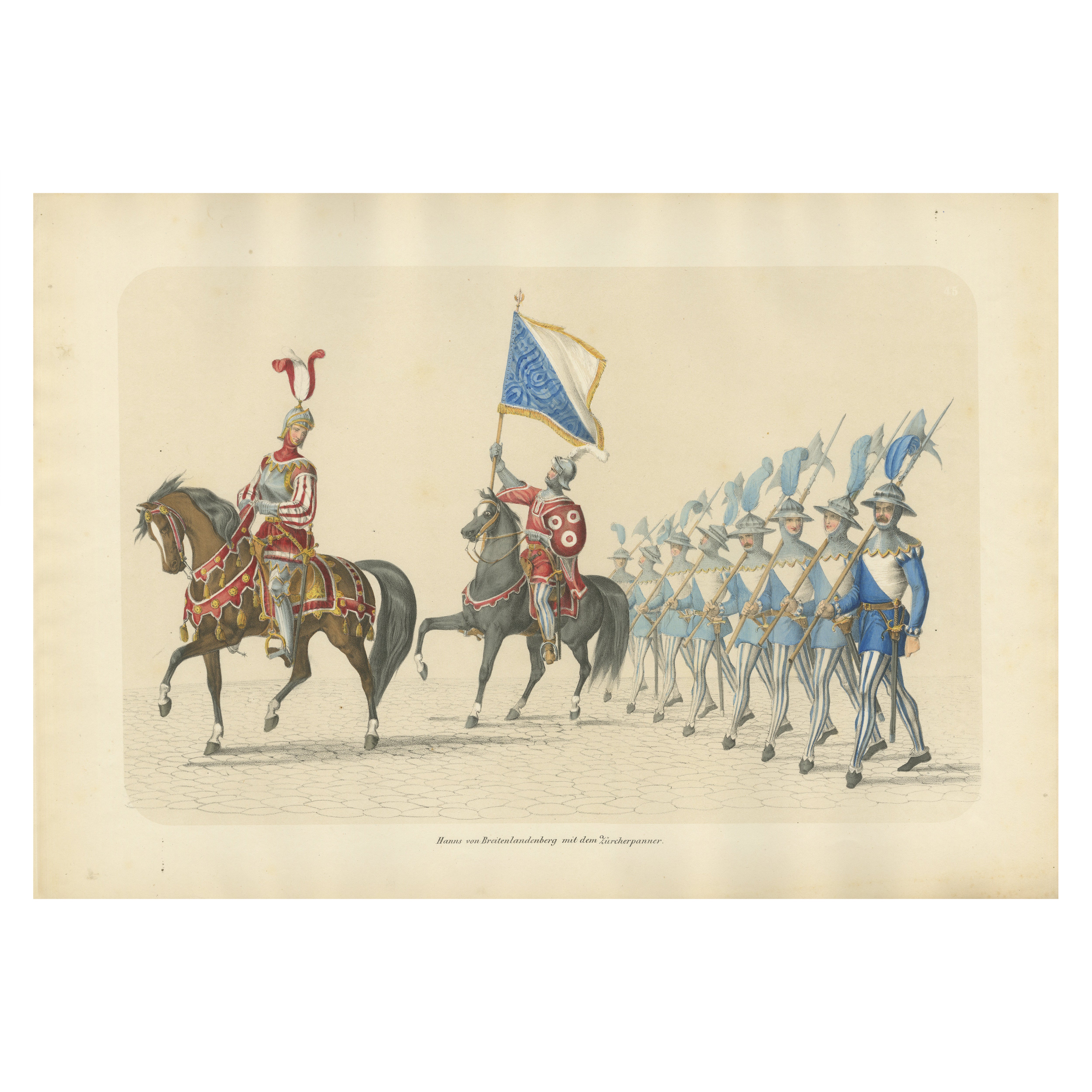
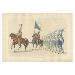
View All1855 Swiss Procession – Hans von Breitenlandenberg and the Zurich Banner
Located in Langweer, NL
Title: 1855 Swiss Procession – Hans von Breitenlandenberg and the Zurich Banner
Description: This impressive hand-colored lithograph, created by H. Jenny and lithographed by Kümm...
Category
Antique 1850s Prints
Materials
Paper
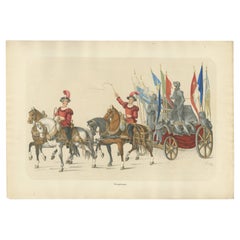
Triumphal Chariot – A Grand Display of Conquered Armor and Banners, 1855
Located in Langweer, NL
Triumphal Chariot – A Grand Display of Conquered Armor and Banners
This remarkable hand-colored lithograph, created by H. Jenny and lithographed by Kümmerly and Wittmer, is part o...
Category
Antique 1850s Prints
Materials
Paper
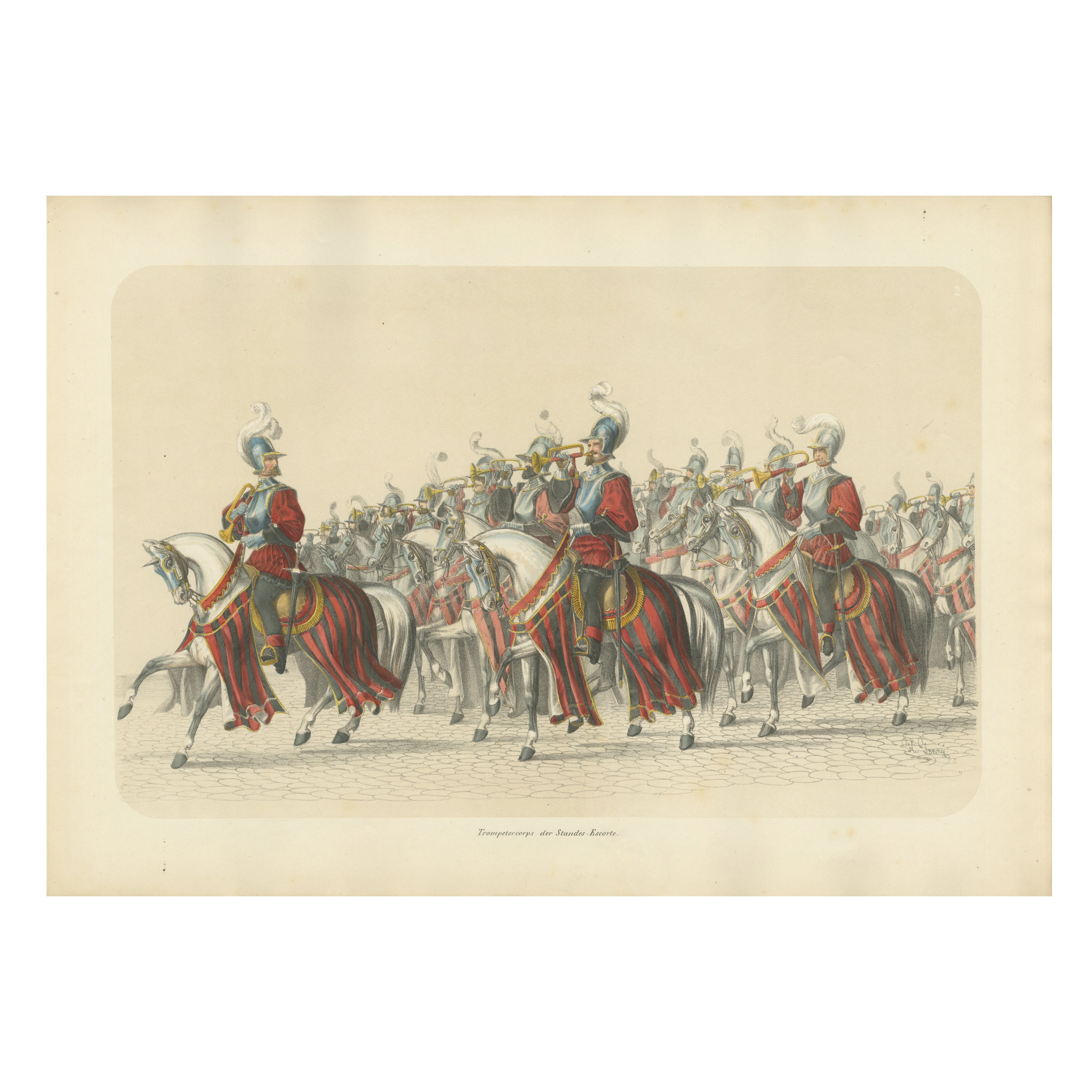
Resplendent Cavalry Fanfare – Trumpet Corps of the Swiss States’ Escort in 1853
Located in Langweer, NL
Title: Resplendent Cavalry Fanfare – Trumpet Corps of the Swiss States’ Escort in 1853
Description: This stunning hand-colored lithograph is part of the *Fest Album Celebrating Be...
Category
Antique 1850s Prints
Materials
Paper

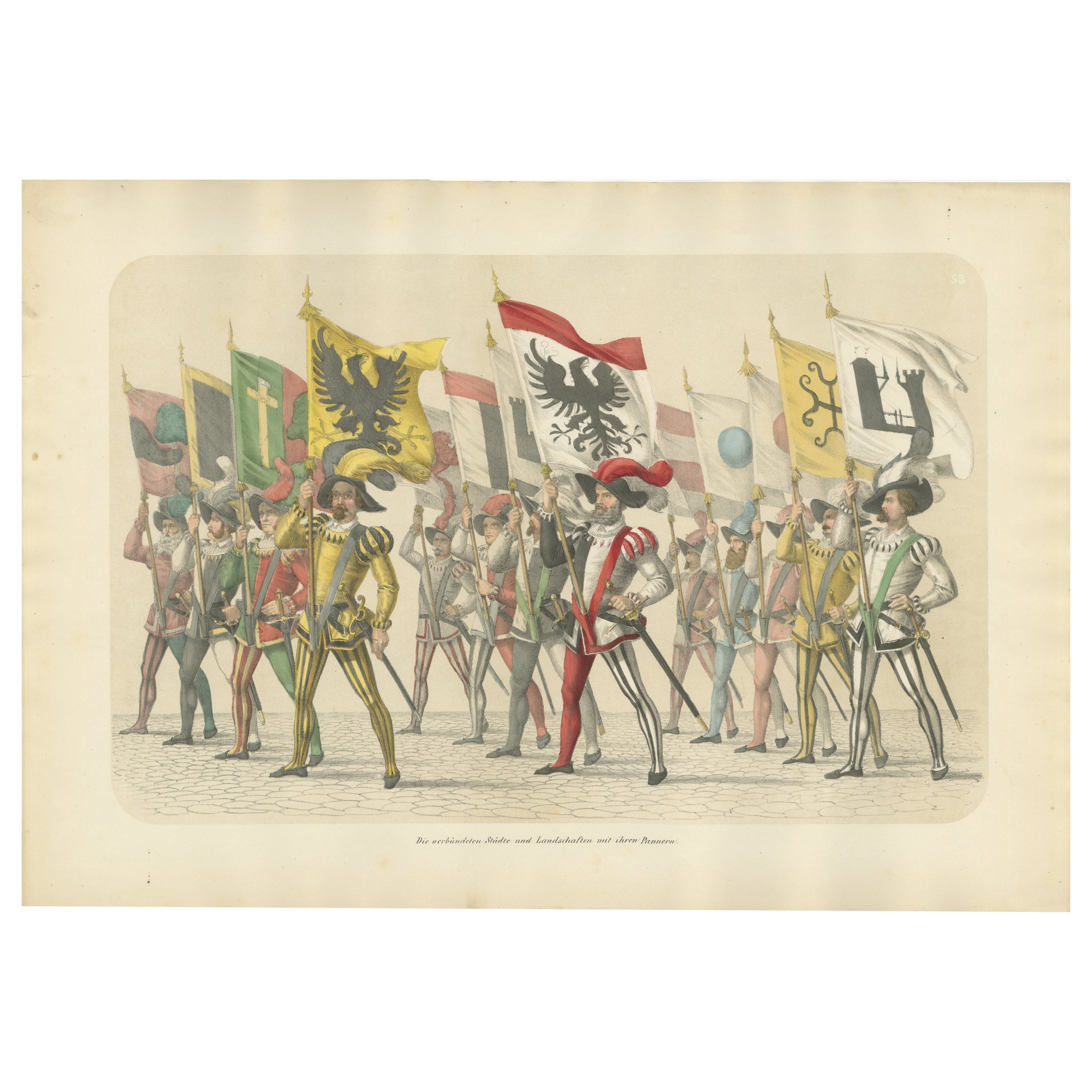
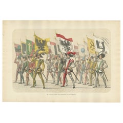
Parade of Unity – The Allied Cities and Territories with Their Banners, 1855
Located in Langweer, NL
1855 Parade of Unity – The Allied Cities and Territories with Their Banners
This magnificent hand-colored lithograph, created by H. Jenny and lithographed by Kümmerly and Wittmer,...
Category
Antique 1850s Prints
Materials
Paper
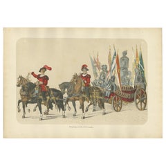
A Triumphal Procession – Captured Banners and Armor of Swiss Victories, 1855
Located in Langweer, NL
Title: The 1855 Triumphal Procession – Captured Banners and Armor of Swiss Victories
Description: This remarkable hand-colored lithograph, created by H. Jenny and lithographed by ...
Category
Antique 1850s Prints
Materials
Paper
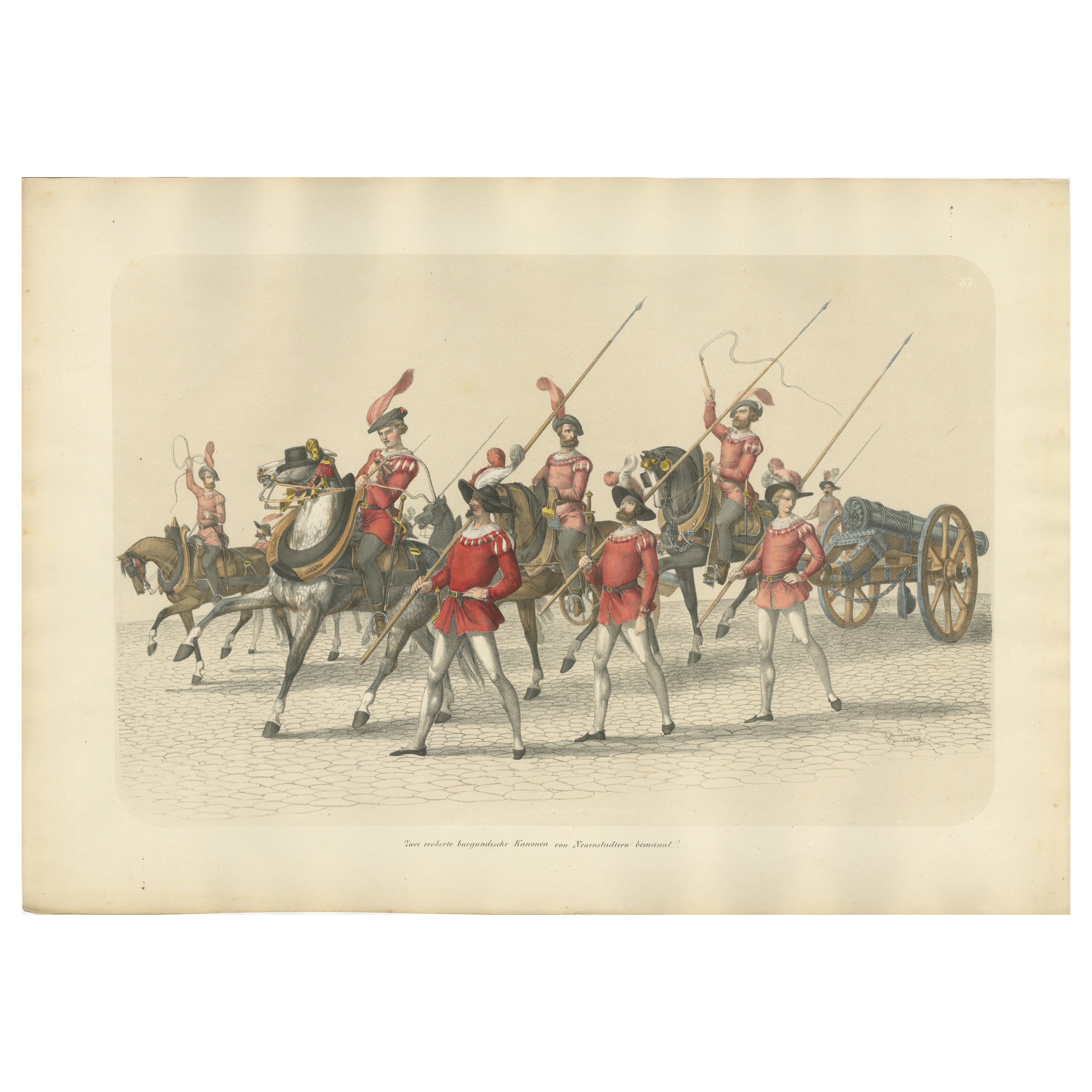
1855 Swiss Victory Parade – Captured Burgundian Cannons in Triumphal Procession
Located in Langweer, NL
Title: 1855 Swiss Victory Parade – Captured Burgundian Cannons in Triumphal Procession
Description:
This exquisite hand-colored lithograph, created by H. Jenny and lithographed ...
Category
Antique 1850s Prints
Materials
Paper
You May Also Like
A Pictorial Description of Broadway – The Mail & Express 1899
Located in Middletown, NY
What did Broadway look like at the turn of the 20th Century ? Here is a scarce and important block-by-block view.
New York: The Mail and Express, 1899. FIRST EDITION
Oblong folio, 6...
Category
Antique Late 19th Century American Books
Materials
Paper
Musical Instrument - Lithograph - 1862
Located in Roma, IT
Musical Instrument is a lithograph on paper realized in 1862.
Titled on the lower.
The artwork belongs to the Suite Uses and customs of all the peoples of the universe: " History o...
Category
1860s Modern Figurative Prints
Materials
Lithograph
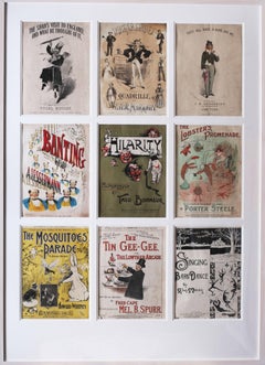
Original British sheet music covers from the early 19th Century
Located in Petworth, West Sussex
Set of 9 sheet music covers from the early part of the 20th Century, London, by various artists.
Altogether they portray a real feeling of the fun of the age and what people were...
Category
Early 20th Century Victorian Figurative Prints
Materials
Lithograph
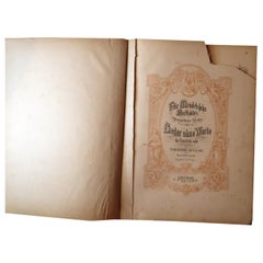
Melodic Elegance: Antique German Sheet Music Book - Early 20th Century, 2C06
Located in Bordeaux, FR
Immerse yourself in the rich musical legacy with our Antique German Sheet Music Book from the beginning of the 20th century. Published in Leipzig by C.F. Peters, this edition feature...
Category
20th Century Toys and Dolls
Materials
Porcelain
$153 Sale Price
20% Off
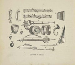
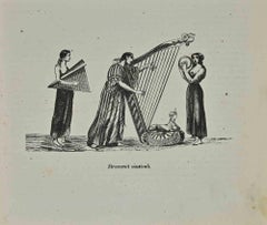
Musical Instruments - Ancient Costumes - Lithograph - 1862
Located in Roma, IT
Musical Instruments - Ancient Costumes is a lithograph on paper realized in 1862.
The artwork belongs to the Suite Uses and customs of all the peoples of the universe: " History of ...
Category
1860s Modern Figurative Prints
Materials
Lithograph
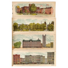
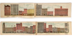
A Pictorial View of Broadway, 1899 - 74 Chromolithograph plates
Located in Middletown, NY
What did Broadway look like at the turn of the 20th Century? Here is a scarce and important block-by-block view published in 1899 by The Mail and Express
New York: The Mail and Expr...
Category
Late 19th Century American Realist Figurative Prints
Materials
Lithograph
More Ways To Browse
Antique Sheet Music
Used Band Instruments
19th Century Sheet Music
Military Drum
Military Antique Drum
Sex Book
Washington Irving
Winston Leathers
Antique Leather Bible
Michael S Smith
Rock N Roll Collectibles
Silver Book Binding
The Works Of William Shakespeare
David Hicks In Color
Antique Miniature Books
Disney Books
Leather Bound Bible
Napoleon Bonaparte Books