Items Similar to Histoire De Russie Published 1797 with 36 Engraved Plates by E.A. David
Want more images or videos?
Request additional images or videos from the seller
1 of 16
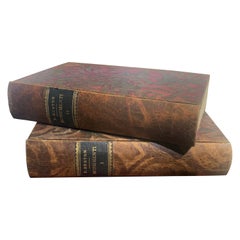
Histoire De Russie Published 1797 with 36 Engraved Plates by E.A. David
$975
£753.36
€870.95
CA$1,377.75
A$1,545.23
CHF 809.21
MX$18,776.09
NOK 10,275.67
SEK 9,742.06
DKK 6,501.20
About the Item
The History of Russia in 2 volumes published 1797, in French.
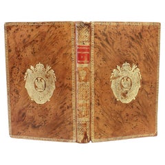
A lovely 2 volume first edition titled "Histoire de Russie" by Blin de Sainmore, French poet, playwright and historian ( full name: Adrien-Michel-Hyacinthe Blin de Sainmore 1733-1807) with 18 dramatic historical engravings in each volume engraved by F.A. David (1741-1824) a well-known artist and engraver. Bound in boards with gilt tooled leather spines and front corners. The 36 superb engravings depict various imagined rendering of historical moments in the long and sad history of the Russian empire. Contents are bright and fresh.
- Dimensions:Height: 9.75 in (24.77 cm)Width: 8 in (20.32 cm)Depth: 2 in (5.08 cm)
- Materials and Techniques:
- Place of Origin:
- Period:
- Date of Manufacture:1797
- Condition:Wear consistent with age and use. Minor losses. Edges bumped, some wear to covers appropriate to age. Internally clean with minor foxing. Plates in very good condition with tissue guards.
- Seller Location:San Francisco, CA
- Reference Number:Seller: C1021-481stDibs: LU855245114642
About the Seller
5.0
Recognized Seller
These prestigious sellers are industry leaders and represent the highest echelon for item quality and design.
Platinum Seller
Premium sellers with a 4.7+ rating and 24-hour response times
Established in 1982
1stDibs seller since 2008
359 sales on 1stDibs
Typical response time: 1 hour
Associations
The Art and Antique Dealers League of AmericaAntiques Associations Members
- ShippingRetrieving quote...Shipping from: San Francisco, CA
- Return Policy
Authenticity Guarantee
In the unlikely event there’s an issue with an item’s authenticity, contact us within 1 year for a full refund. DetailsMoney-Back Guarantee
If your item is not as described, is damaged in transit, or does not arrive, contact us within 7 days for a full refund. Details24-Hour Cancellation
You have a 24-hour grace period in which to reconsider your purchase, with no questions asked.Vetted Professional Sellers
Our world-class sellers must adhere to strict standards for service and quality, maintaining the integrity of our listings.Price-Match Guarantee
If you find that a seller listed the same item for a lower price elsewhere, we’ll match it.Trusted Global Delivery
Our best-in-class carrier network provides specialized shipping options worldwide, including custom delivery.More From This Seller
View AllWorks of Robert Burns 1834
Located in San Francisco, CA
The works of Robert Burns in 8 volumes bound in full blue calf and printed in Waterloo, 1834. One volume as is. Spines sun faded to green
Category
Antique 1830s English Books
Materials
Leather, Paper

$475 / set
O. Henry 'William Sydney Porter' Complete Works in 13 Leatherbound Volumes
Located in San Francisco, CA
Henry, O. (William Sydney Porter). Published by Doubleday, Doran & Company, Inc. Thirteen volumes, small octavo, blue three-quarter morocco and cloth boards, raised bands, gilt toole...
Category
Vintage 1920s American Books
Materials
Paper, Leather
Pompeiana; The Topography, Edifices, and Ornaments of Pompeii Sir Wm. Gell 1837
Located in San Francisco, CA
Pompeiana The Topography, Edifices and Ornaments of Pompeii by Sir William Gell, complete in two 1/4 leather tall octavo volumes with marbleized boards. 82 full page engraved plates ...
Category
Antique 1830s English Books
Materials
Leather, Paper

California and Its Gold Regions by Fayette Robinson
Located in San Francisco, CA
California and Its Gold Regions
by Fayette Robinson
137 pages, small octavo
Published New York: Stringer & Townsend 222 Broadway. 1849. First Edition
Beautifully rebound in gilt-tool...
Category
Antique Mid-19th Century American Books
Materials
Leather, Paper

Europe During the Middle Ages by Henry Hallam 3 Volumes Leatherbound
Located in San Francisco, CA
Hallam's View of the State of Europe During the Middle Ages, complete in 3 leather bound octavo volumes with marbleized boards. The volumes contain the bookplate of former owner, Cha...
Category
Antique 1830s English Books
Materials
Leather, Paper

California Illustrated by J. M. Letts
Located in San Francisco, CA
California Illustrated
by J. M. Letts
Published New York: R. T. Young, 140 Fulton Street. Later edition, published 1853.
Rebound in 3/4 blue calf with marbleized boards and end paper...
Category
Antique Mid-19th Century American Books
Materials
Leather, Paper

You May Also Like
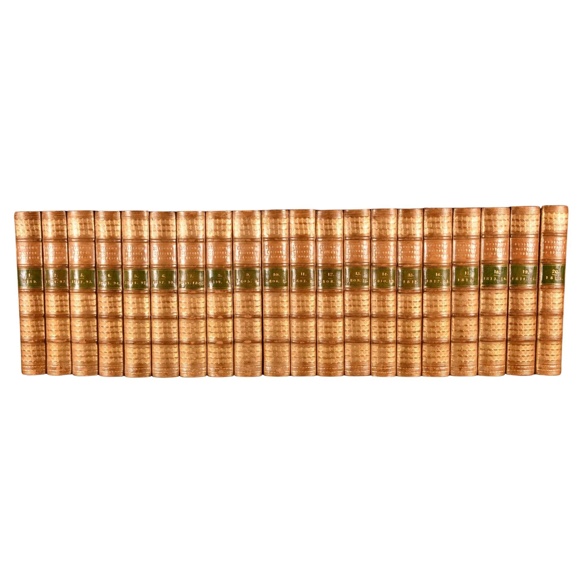
1848 History of Europe from the Commencement of the French Revolution
By Archibald Alison
Located in Bath, GB
A wonderful copy of the seventh edition of Alison's exhaustive study of the French Revolution, from 1789 to 1815. In lovely half calf bindings.
A complete twenty volume 1848 seventh...
Category
Antique 1840s British Books
Materials
Paper
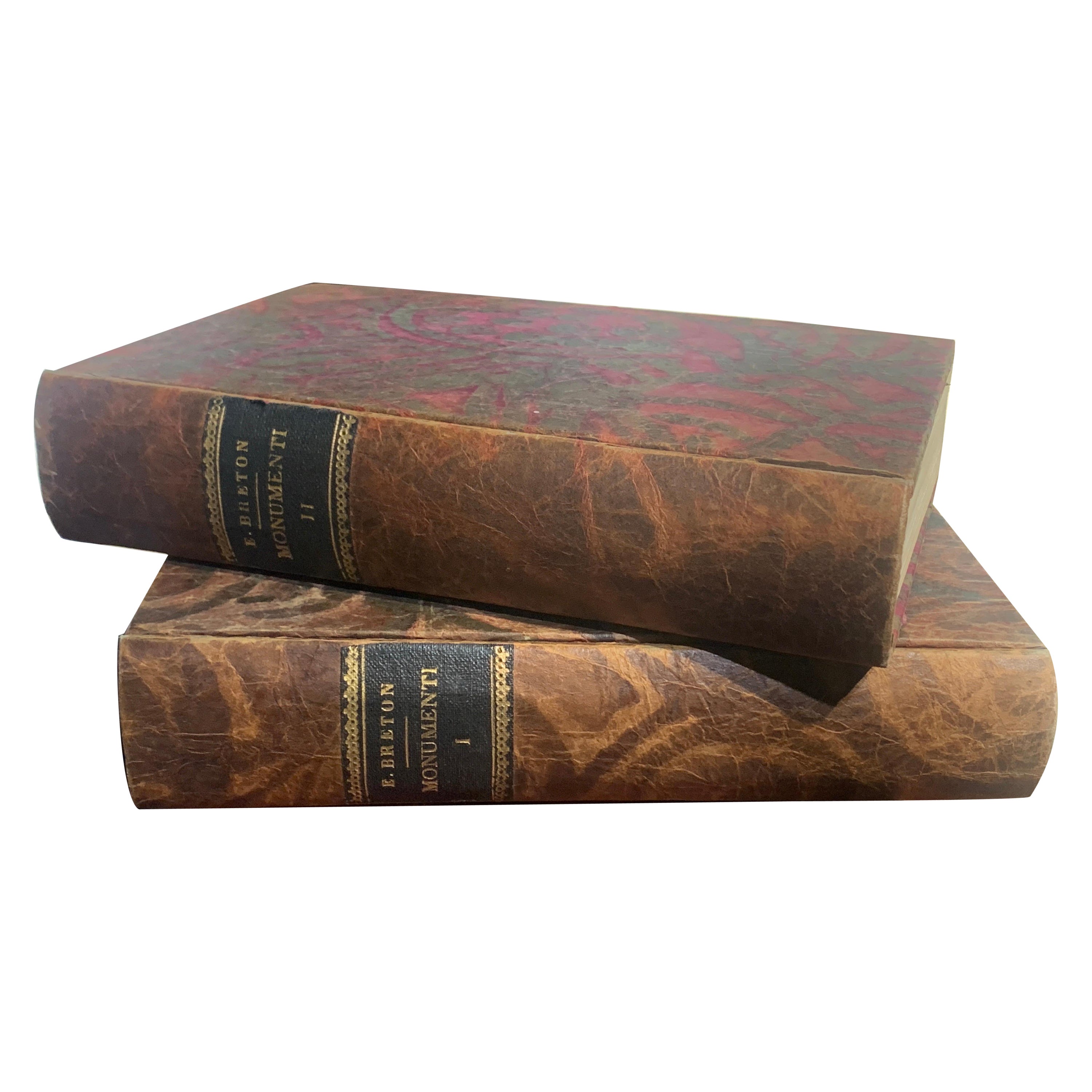
19th Century Two Italian Volumes Monumenti Di Tutti I Popoli by Ernest Breton
Located in Sofia, BG
Two volumes 'Monumenti di tutti i popoli" written by Breton in Italian language. Quite good condition with some light traces of moisture between pages.
Published in 1844 and 1846.
Category
Antique Mid-19th Century Italian Books
Materials
Paper
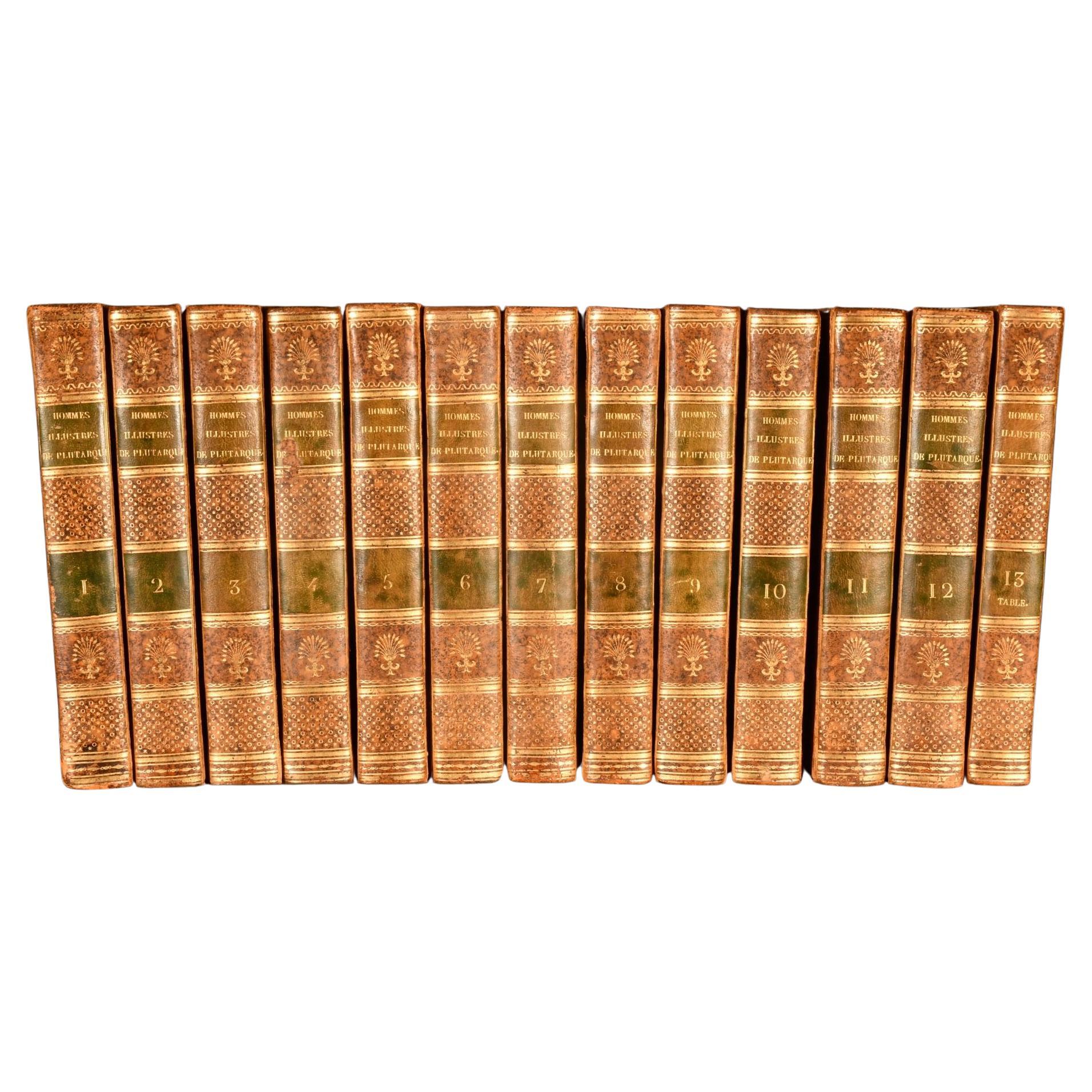
1818-1820 Les Vies de Hommes Illustres de Plutarque
By Plutarch
Located in Bath, GB
A new and revised edition of this translation of Plutarch's Parallel Lives, or Lives of Illustrious Men, in French.
French. Complete in thirteen volumes. Part of a larger set of twe...
Category
Antique 1810s French Books
Materials
Paper

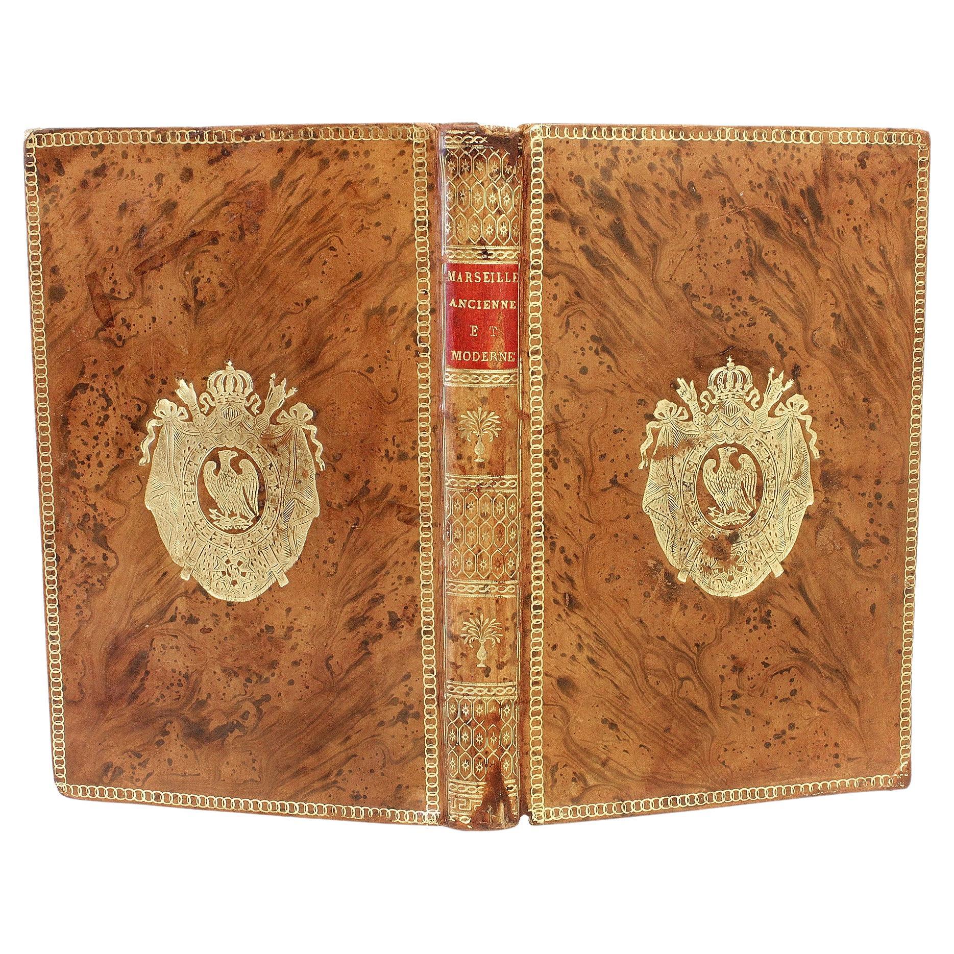
Marseille Ancienne et Moderne - FIRST ED WITH THE GILT ARMS OF NAPOLEON - 1786
Located in Hillsborough, NJ
AUTHOR: M. Guys [Pierre-Augustin].
TITLE: Marseille Ancienne et Moderne.
PUBLISHER: Paris: Veuve Duchesne, 1786.
DESCRIPTION: FIRST EDITION WITH THE GILT ARMS OF NAPOLEON. 1 vol....
Category
Antique 1780s French Books
Materials
Leather
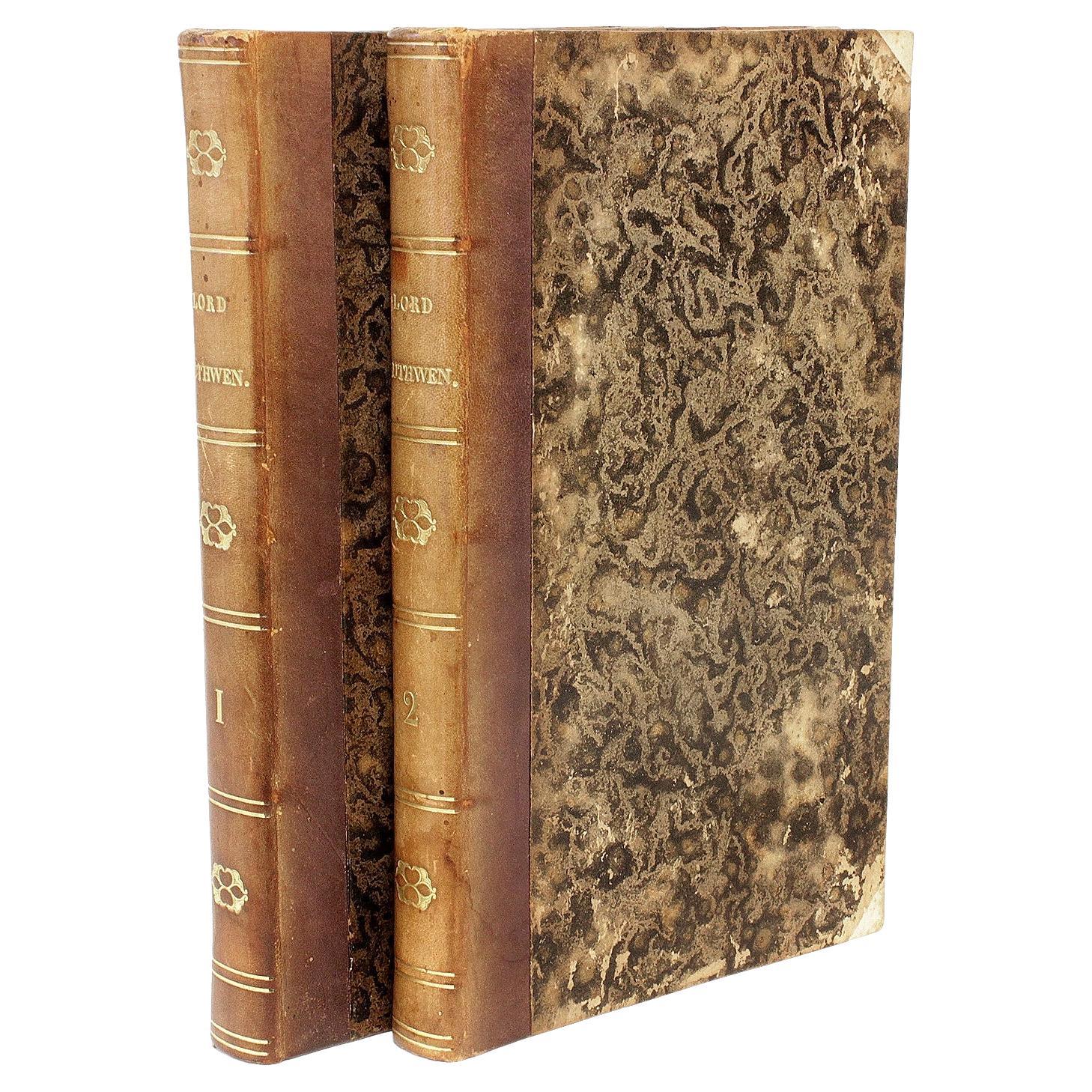
Cyprien Berard - Lord Ruthwen, ou Les Vampires - 1820 - FIRST FRENCH EDITION
Located in Hillsborough, NJ
AUTHOR: Cyprien Berard and Charles Nodier.
TITLE: Lord Ruthwen, ou Les Vampires.
PUBLISHER: Paris: Chez Ladvocat, Libraire, 1820.
DESCRIPTION: FIRST FRENCH EDITION. 2 vols., 6-3/...
Category
Antique 1820s French Books
Materials
Leather

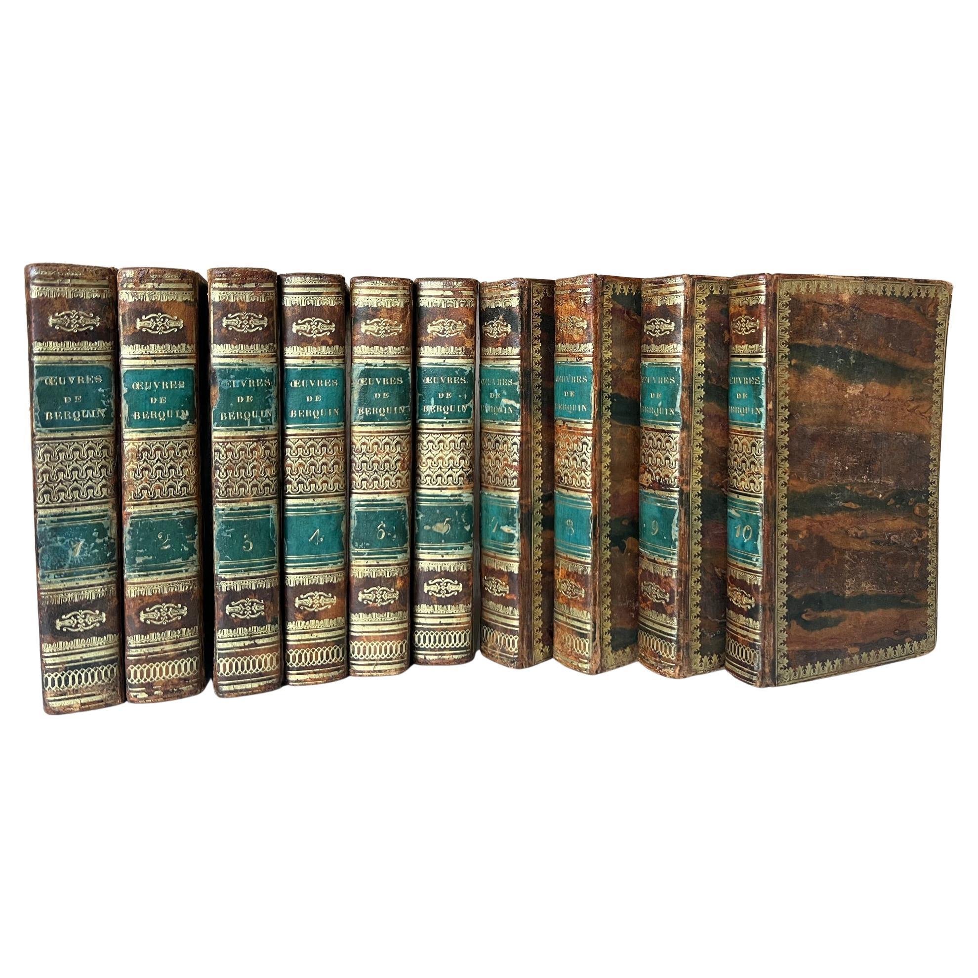
French Series of Childrens Books by Arnaud Berquin-Set of 10, c. 1829
Located in Ross, CA
Ten book series of The works of Arnaud Berquin. The set was put together by hand, has leather spines and covers with gilded lettering, decoration, and a lacework design with a hand p...
Category
Antique Early 19th Century French French Provincial Books
Materials
Leather

$1,200 Sale Price / set
57% Off
More Ways To Browse
Russian Leather
Antique Engraving Tools
Century Furniture Down Chair
Antique Carved Walnut Table
Brazilian Chair 1970
Vintage 2000S
Italian Hand Painted Table
Afghanistan Kilim
Green Carpet 1960
English Furniture Library
Medieval Antique
1904 Chair
Antique Furniture Castors
Carlo Bellini
Glass Brass Coffee Table Vintage
Italian Office Chair Mid Century
Louis Style Side Table
Large French Carpet