Items Similar to 16th Century Antique Map of Ven Framed in Gold

Want more images or videos?
Request additional images or videos from the seller
1 of 18
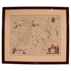
16th Century Antique Map of Ven Framed in Gold
$580
£440.09
€503.20
CA$810.10
A$900.72
CHF 470.31
MX$10,964
NOK 6,000.93
SEK 5,622.58
DKK 3,755.51
Shipping
Retrieving quote...The 1stDibs Promise:
Authenticity Guarantee,
Money-Back Guarantee,
24-Hour Cancellation
About the Item
Ven (older Swedish spelling Hven), is a Swedish island in the Öresund strait laying between Skåne, Sweden and Zealand and Denmark. The island was historically under Danish rule. Danish astronomer Tycho Brahe (1546–1601) built two observatories there, Uraniborg and Stjerneborg, during 1576–1596. The observatories were built by the inhabitants of the island with Tycho Brahe as their Lord.
The Swedish took over control in 1658, as the rest of Scania was ceded to Sweden by the Treaty of Roskilde. The island was not specifically mentioned in the treaty, and according to the Danes it was not part of Scania, but part of Zealand and therefore still under Danish rule. The Swedes did not agree with that interpretation, and sent troops to occupy the island on 6 May 1658. The transfer to Sweden was confirmed in 1660 by the Treaty of Copenhagen. The 350th anniversary of this transfer was commemorated on the island in 2010.
This framed map would make a wonderful addition standing alone or on a gallery wall.
- Dimensions:Height: 16.6 in (42.17 cm)Width: 21.8 in (55.38 cm)Depth: 1.1 in (2.8 cm)
- Style:Baroque (Of the Period)
- Materials and Techniques:
- Place of Origin:
- Period:
- Date of Manufacture:16th Century
- Condition:Wear consistent with age and use.
- Seller Location:Haddonfield, NJ
- Reference Number:Seller: 123451stDibs: LU943441198462
About the Seller
5.0
Platinum Seller
Premium sellers with a 4.7+ rating and 24-hour response times
Established in 2010
1stDibs seller since 2012
1,981 sales on 1stDibs
Typical response time: <1 hour
- ShippingRetrieving quote...Shipping from: Haddonfield, NJ
- Return Policy
Authenticity Guarantee
In the unlikely event there’s an issue with an item’s authenticity, contact us within 1 year for a full refund. DetailsMoney-Back Guarantee
If your item is not as described, is damaged in transit, or does not arrive, contact us within 7 days for a full refund. Details24-Hour Cancellation
You have a 24-hour grace period in which to reconsider your purchase, with no questions asked.Vetted Professional Sellers
Our world-class sellers must adhere to strict standards for service and quality, maintaining the integrity of our listings.Price-Match Guarantee
If you find that a seller listed the same item for a lower price elsewhere, we’ll match it.Trusted Global Delivery
Our best-in-class carrier network provides specialized shipping options worldwide, including custom delivery.More From This Seller
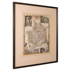
View All19th Century Lithograph Map of Lower Manhattan, New York
Located in Haddonfield, NJ
1859 hand colored map of Lower Manhattan or New Amsterdam by George H. Moore.
Category
Antique 19th Century English Folk Art Maps
Materials
Paper

$620 Sale Price
20% Off
19th Century Reprint of 16th Century Harbor Map of Copenhagen
Located in Haddonfield, NJ
This reprint of 1587 antique map of Copenhagen, Denmark retains its original mid-century mat and has been recently reframed in classic wood frame. The muted sepia colored map is a wo...
Category
Antique 1880s Danish Baroque Maps
Materials
Wood, Paper

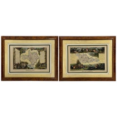
Set of Two 19th Century French Hand-Colored Regional Maps
Located in Haddonfield, NJ
These historical regional maps depict the “Dépt de la Moselle" (Department of Moselle) and the Departement de Gard in France. Both pieces date back to the 19th Century, given their s...
Category
Antique 19th Century French Empire Drawings
Materials
Wood, Paper
Early 19th Century French Rectangular Gold Gilt Wood Art Frame
Located in Haddonfield, NJ
As found in the Provence region this wooden rectangular frame has fantastic gilt and patina. Add some vintage charm to your favorite water color, print or oil painting with this attr...
Category
Antique Early 19th Century French French Provincial Picture Frames
Materials
Wood, Paint
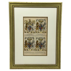
English Coat of Arms Art Print by Joseph Edmondson Gold Leaf Frame
Located in Haddonfield, NJ
The image shows a page from "Baronagium Genealogicum" by Joseph Edmondson, published in 1764. It features the coats of arms for Prince Frederick, Princess Anne, Princess Amalia Sophi...
Category
Antique Late 19th Century English Prints
Materials
Wood, Paper
Antique Raffaello Hand Colored Lithograph Etching in Gilt Frame
Located in Haddonfield, NJ
Impressive Italian hand-colored classic motif print depicting lions, birds, griffins, swans, ruins, putti and strongmen.
Raffaello Sanzio d'Urbino, also known as Raphael, designed t...
Category
Mid-20th Century Italian Neoclassical Drawings
Materials
Wood, Giltwood, Paper

You May Also Like
Antique Map of Asia 'in Frame, circa 1739'
Located in Langweer, NL
Antique map titled 'Asia Dividida em suas Regioens & Principaes Estados'. Rare and uncommon map of Asia. Signed '1739'. Source unknown, to be determined.
...
Category
Antique Mid-18th Century Maps
Materials
Paper

$623 Sale Price
35% Off
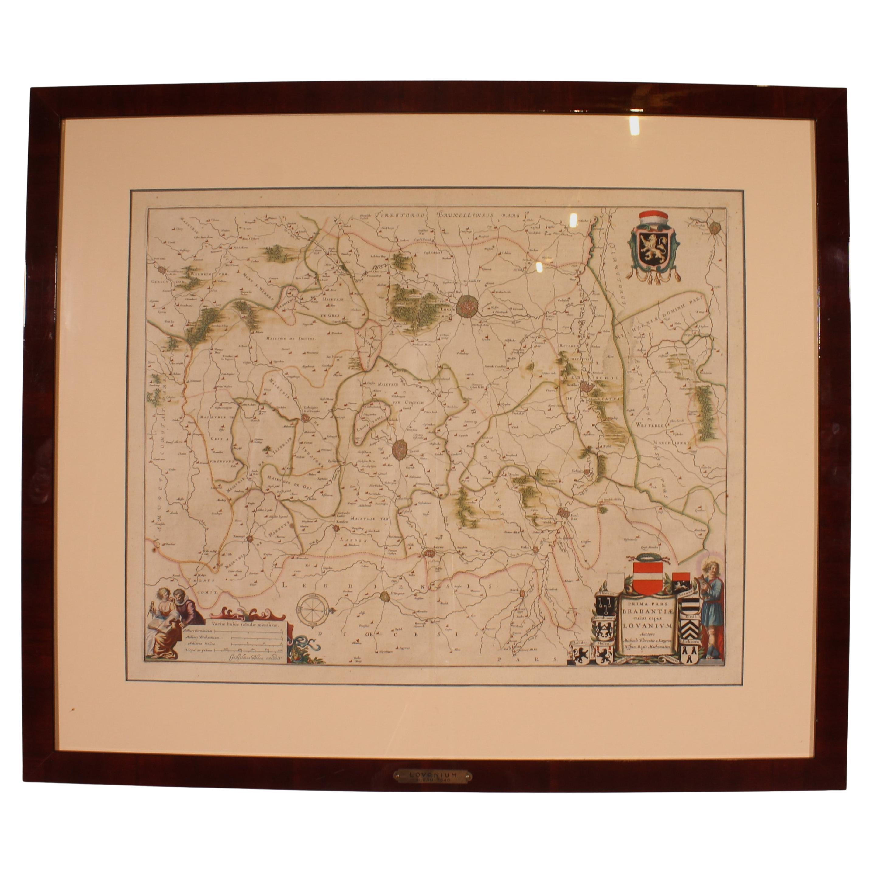
Antique Map Of Lovanium By Bleau Circa 1640
Located in Brussels, Brussels
map of the brabent of leuven (Belgium) circa 1640 by Bléau. Bléau was well known for antique atlas that he draw during the 17 century
beautiful map, double page folded in the middle,...
Category
Antique 17th Century French Renaissance Prints
Materials
Paper
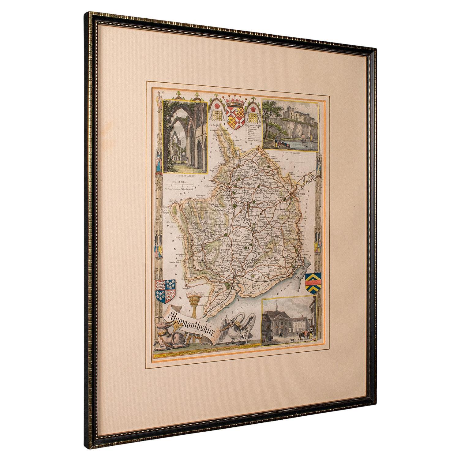
Antique Lithography Map, Monmouthshire, Framed, Welsh Cartography, Victorian
Located in Hele, Devon, GB
This is an antique lithography map of Monmouthshire. An English, framed atlas engraving of cartographic interest, dating to the mid 19th century and later.
Superb lithography of Mo...
Category
Antique Mid-19th Century British Victorian Maps
Materials
Glass, Wood, Paper
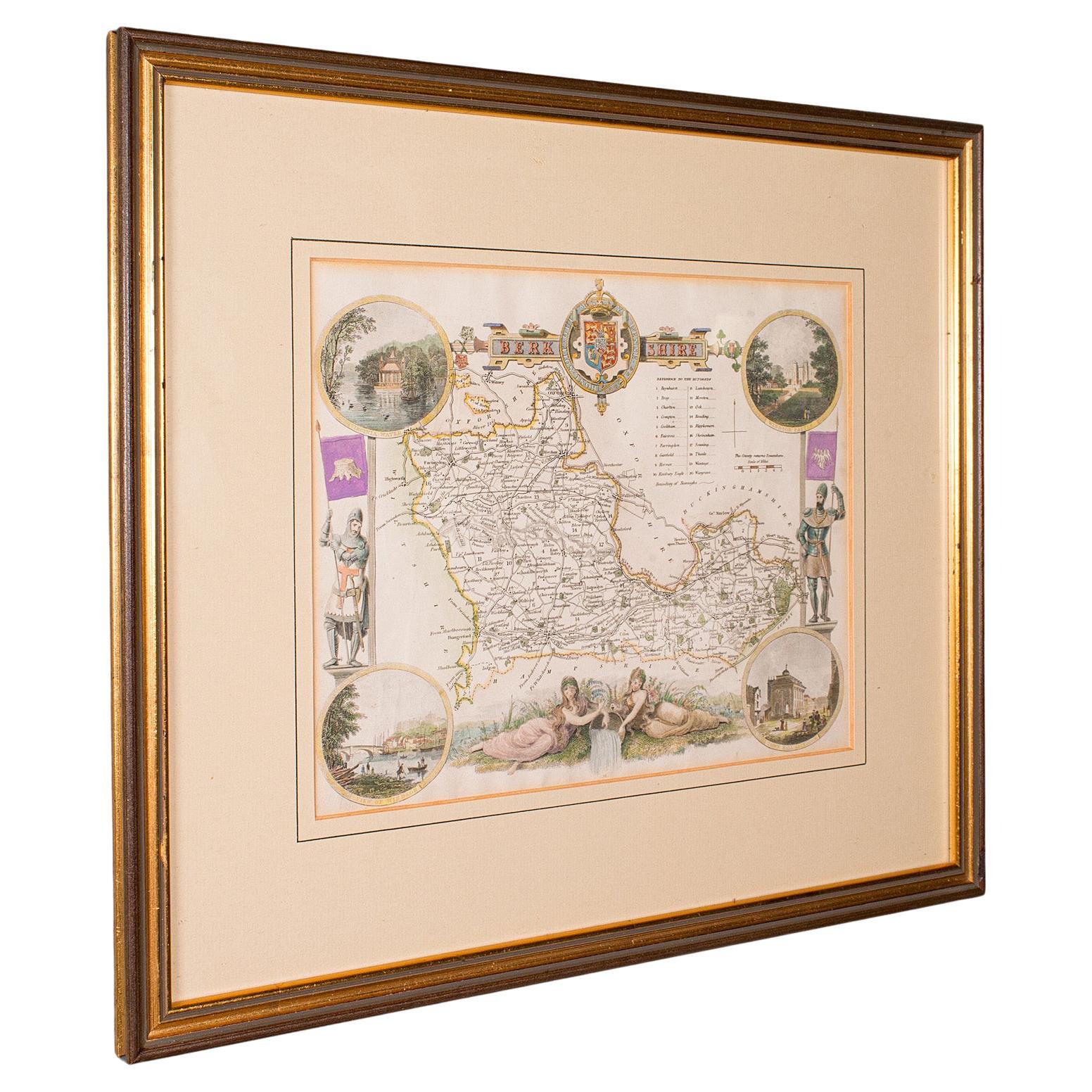
Antique Berkshire Map, English County, Framed Engraving, Cartography, Lithograph
Located in Hele, Devon, GB
This is an antique county map of Berkshire. An English, framed atlas engraving of cartographic interest, dating to the mid 19th century and later.
Superb lithography of Berkshire a...
Category
Antique Mid-19th Century British Victorian Maps
Materials
Glass, Wood, Paper

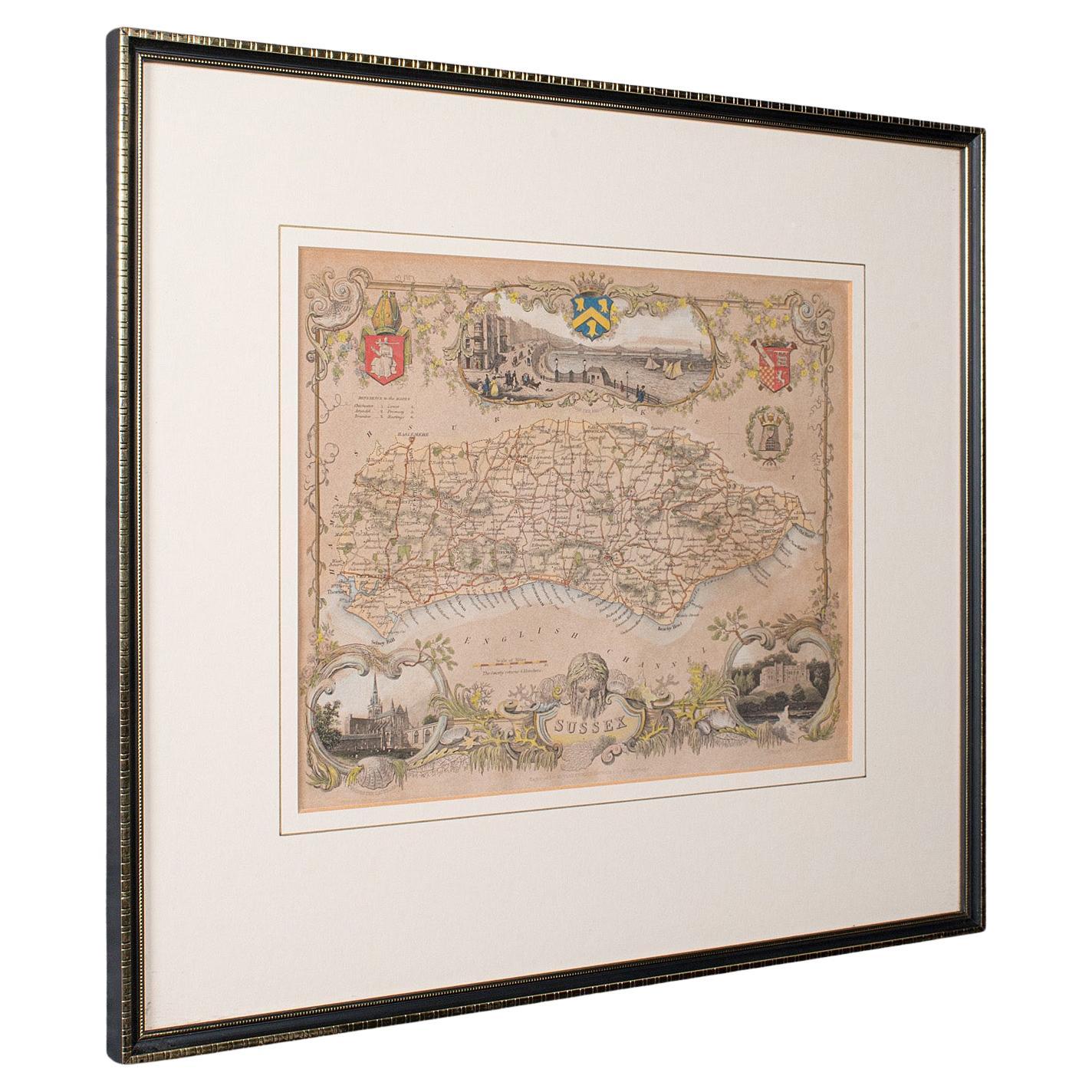
Antique County Map, Sussex, English, Framed Lithography, Cartography, Victorian
Located in Hele, Devon, GB
This is an antique lithography map of Sussex. An English, framed atlas engraving of cartographic interest, dating to the mid 19th century and later.
Superb lithography of Sussex an...
Category
Antique Mid-19th Century British Victorian Maps
Materials
Paper

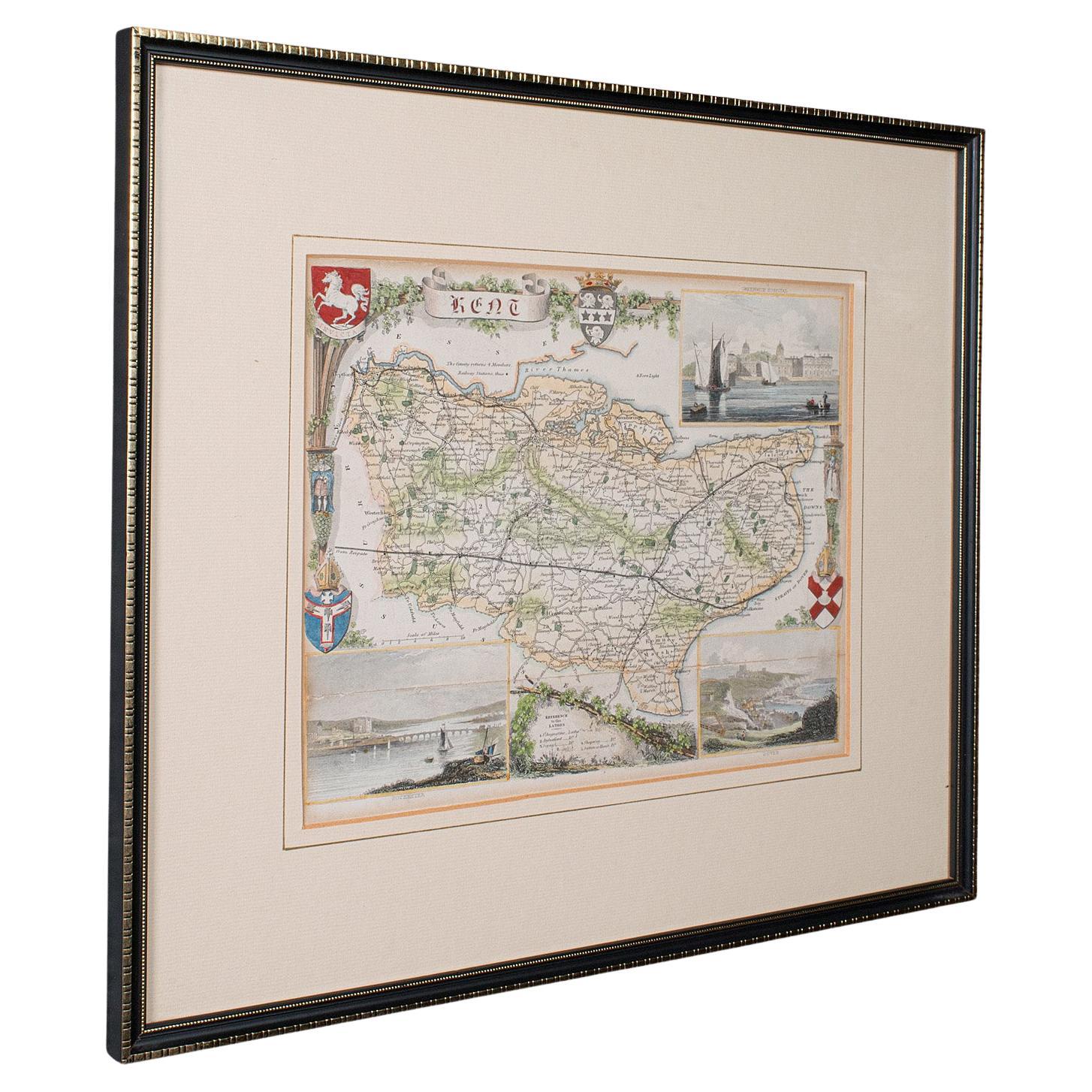
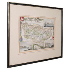
Antique County Map, Kent, English, Framed, Lithography, Cartography, Victorian
Located in Hele, Devon, GB
This is an antique lithography map of Kent. An English, framed atlas engraving of cartographic interest, dating to the mid 19th century and later.
Superb lithography of Kent and it...
Category
Antique Mid-19th Century British Victorian Maps
Materials
Paper
More Ways To Browse
Gold Frame 16th Century
Coffee Table Black Italian Modern
Christofle America
Iranian Silk Rug Carpet
Poul Moller
Tables With Inlaid Wood
World War Table
Antonio Jacobsen
Ariston Chairs
Coffee Tables Europe
Marble Top Dining Tables
Nordiska Argentina
Pink And Black Rug
Black Wooden Chair
Orrefors Embassy
Black Ebonized
Elios Chair
Panache Designs